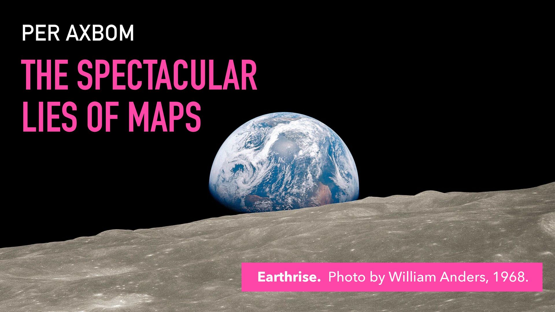
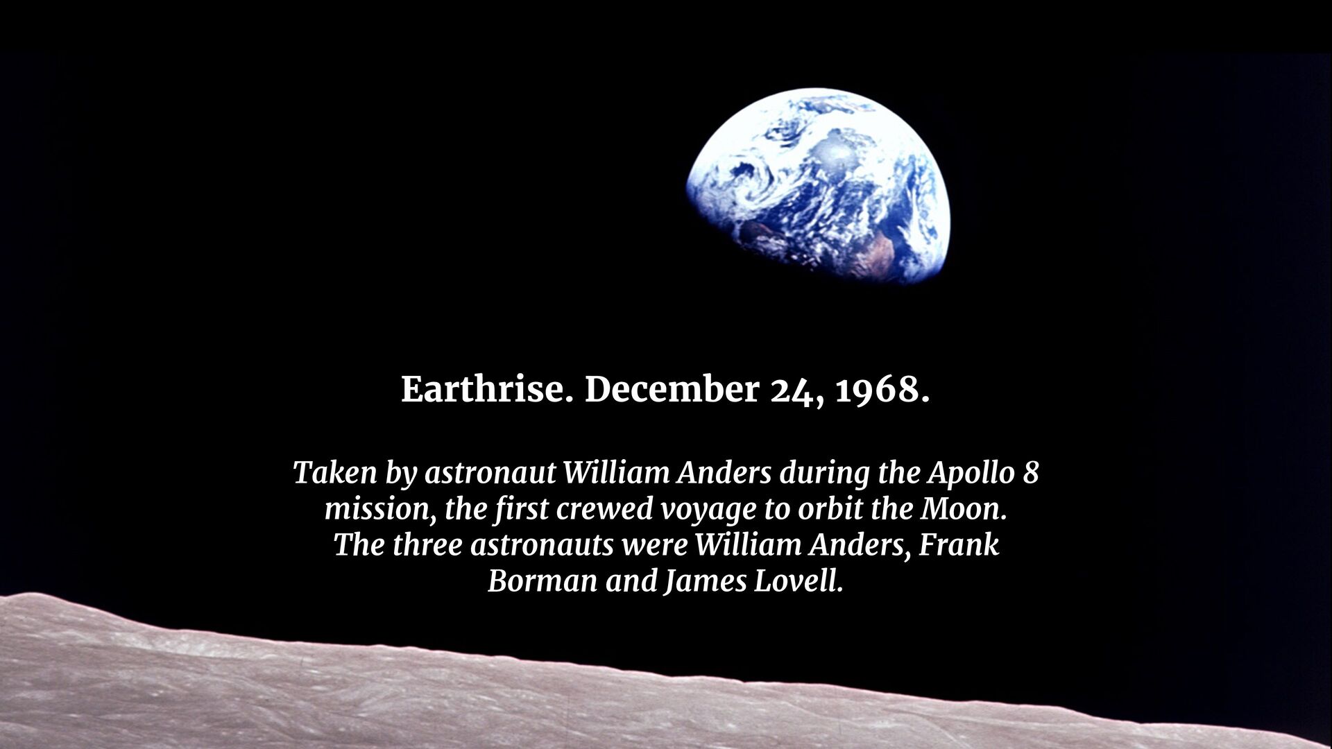
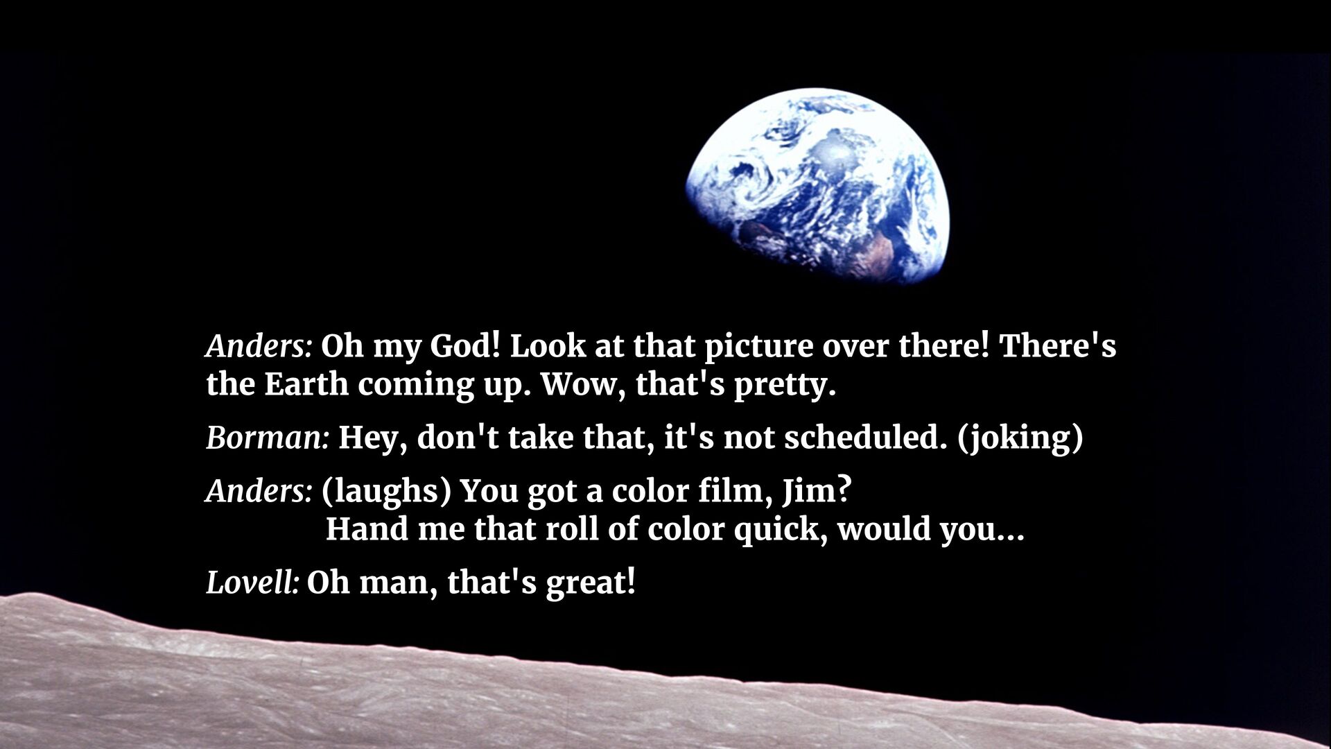
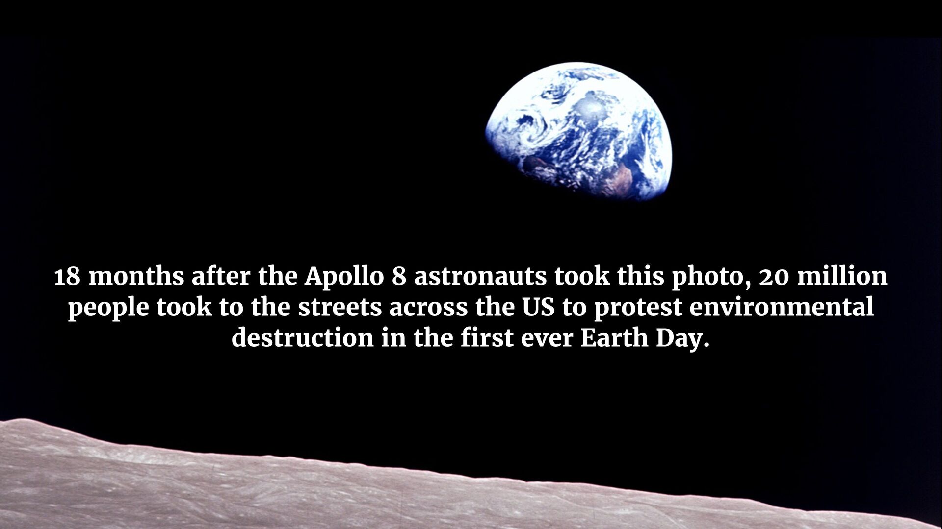
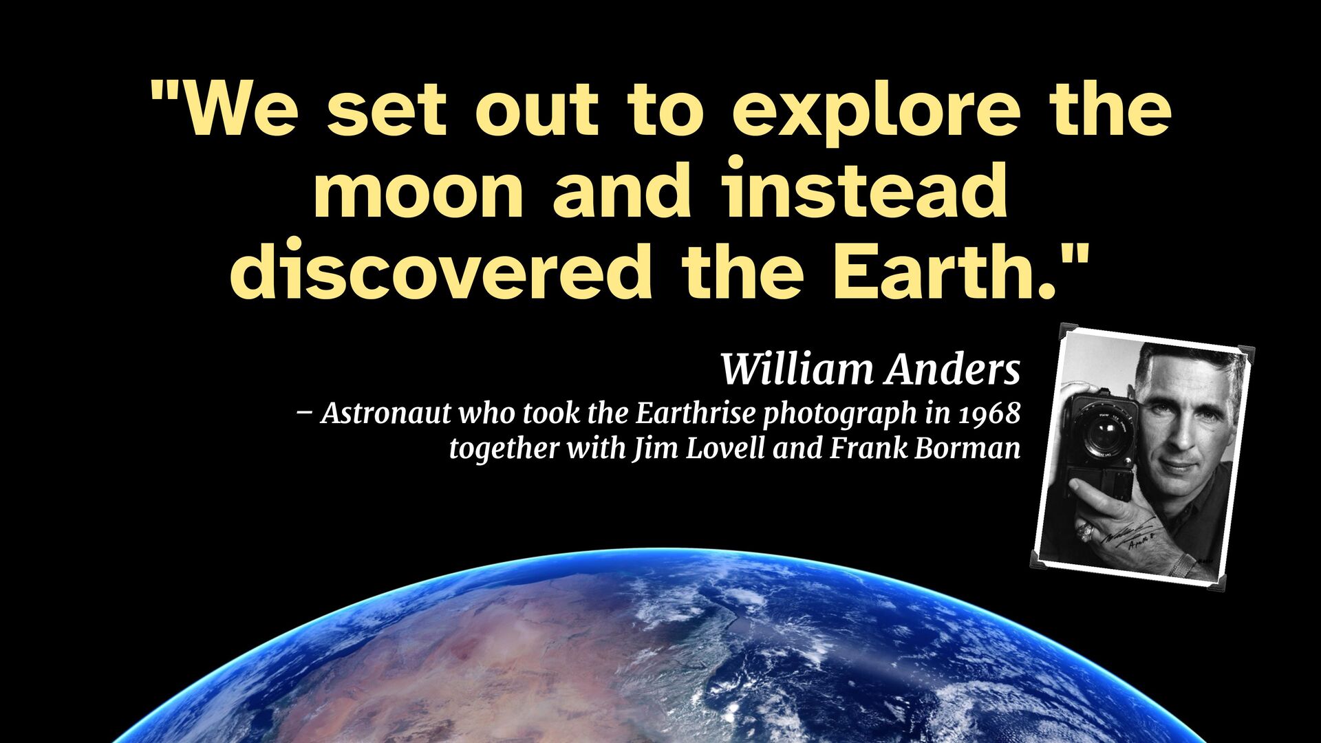
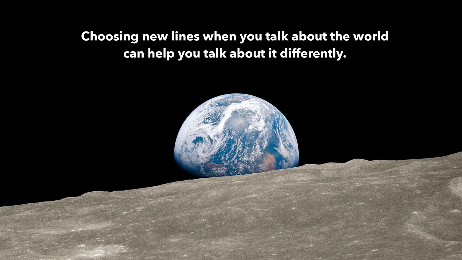
There's the Earth coming up. Wow, that's pretty. Borman: Hey, don't take that, it's not scheduled. (joking) Anders: (laughs) You got a color film, Jim? Hand me that roll of color quick, would you… Lovell: Oh man, that's great!
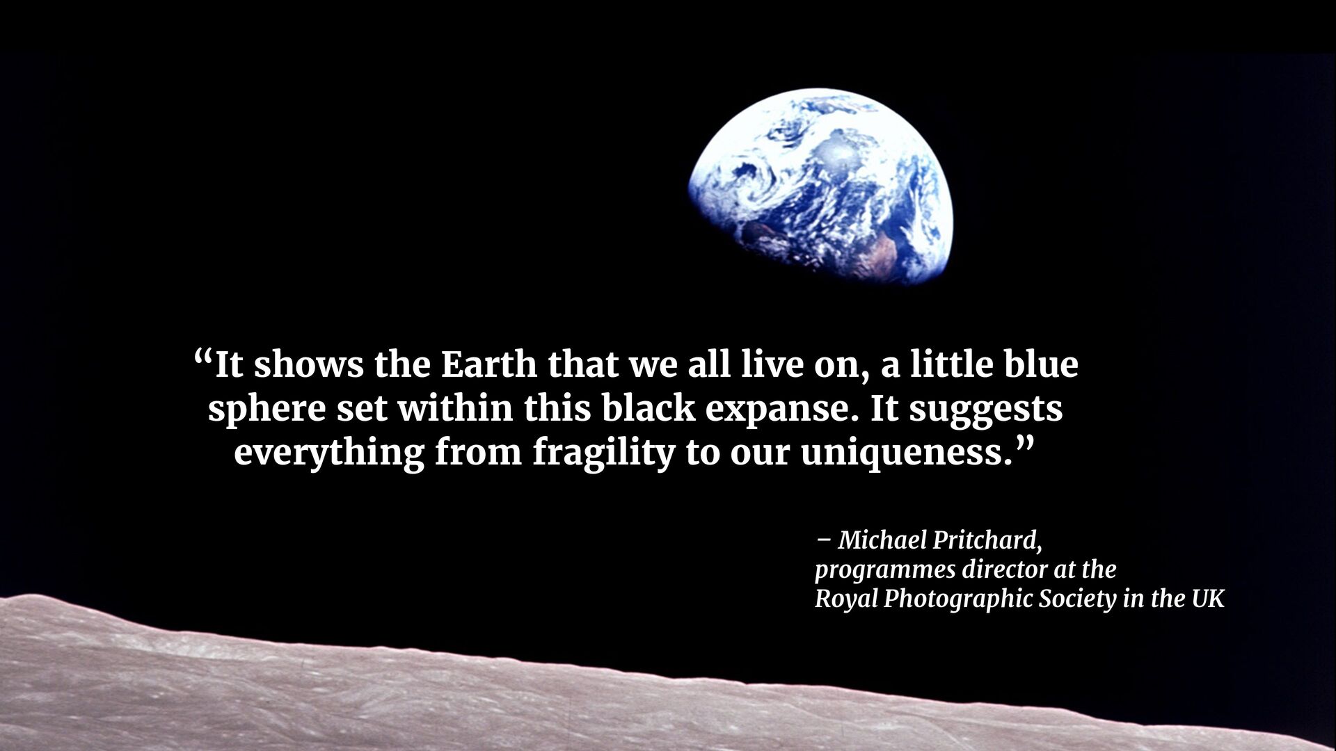
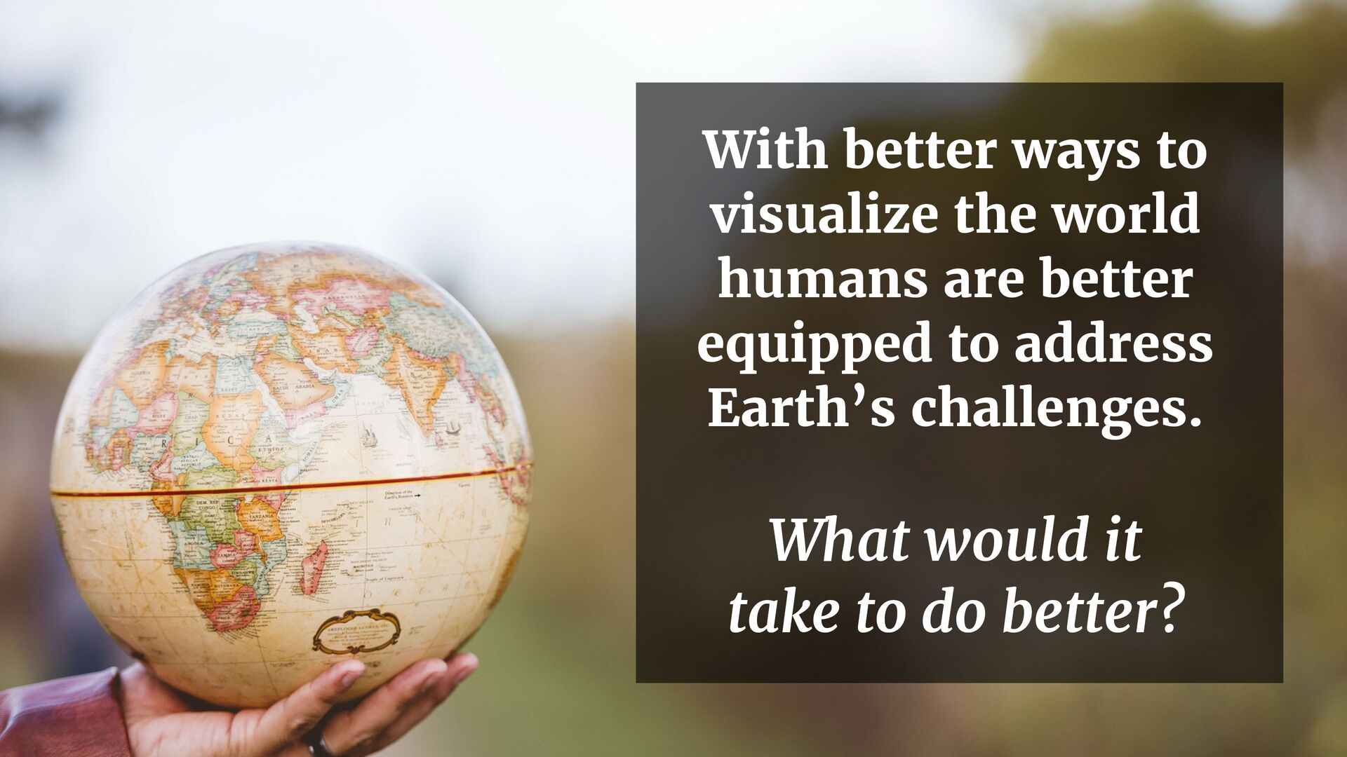
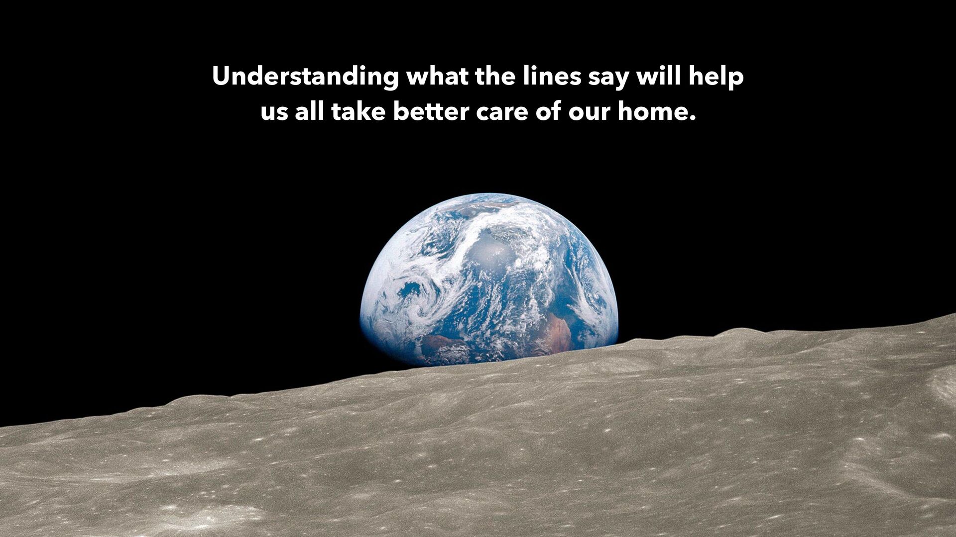
little blue sphere set within this black expanse. It suggests everything from fragility to our uniqueness.” – Michael Pritchard, programmes director at the Royal Photographic Society in the UK
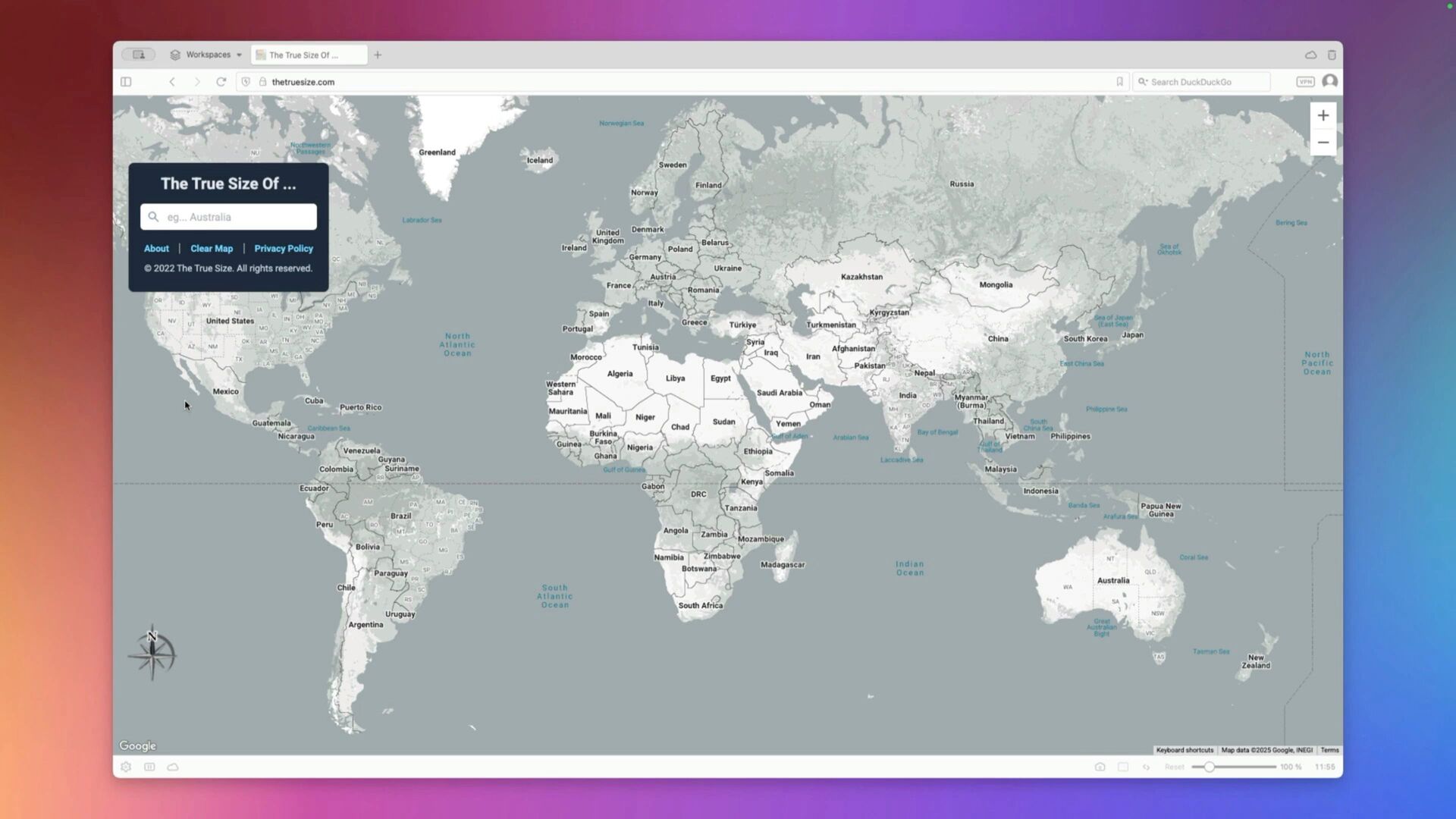
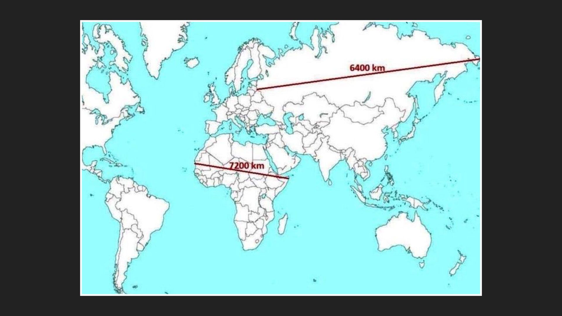
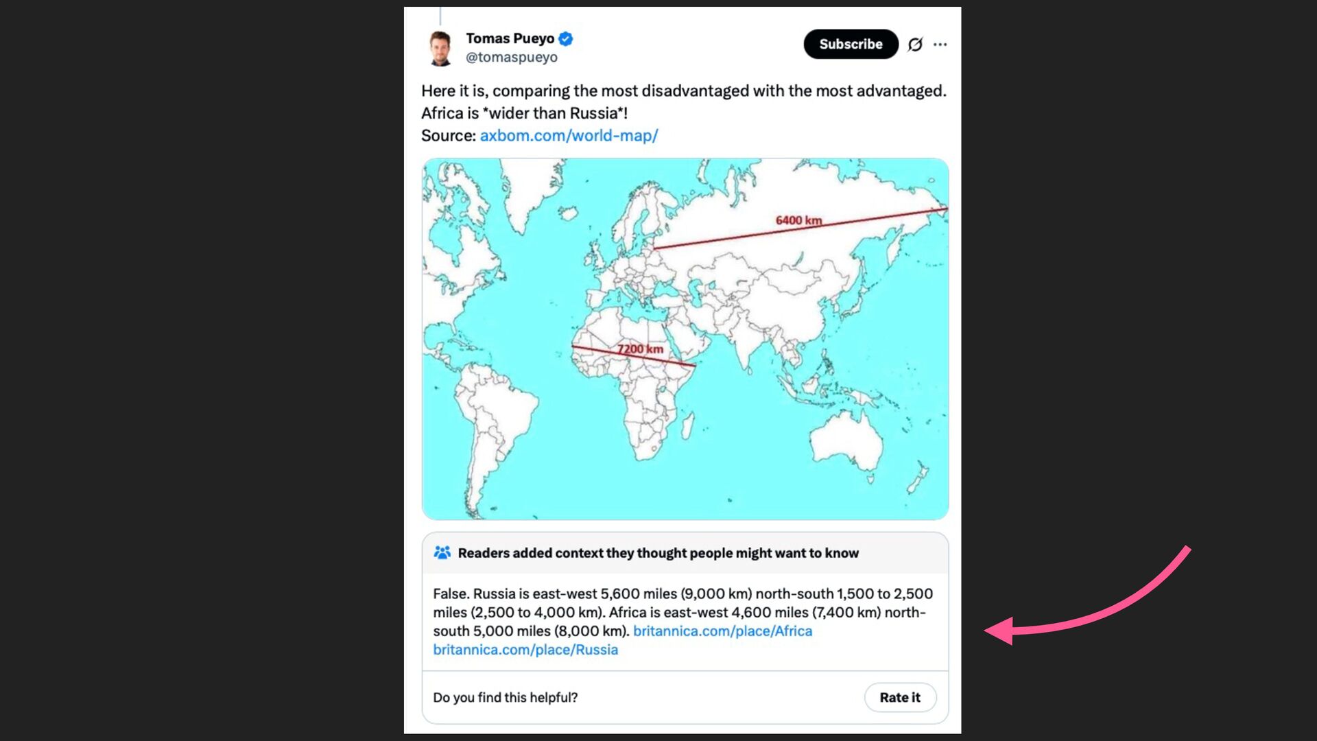
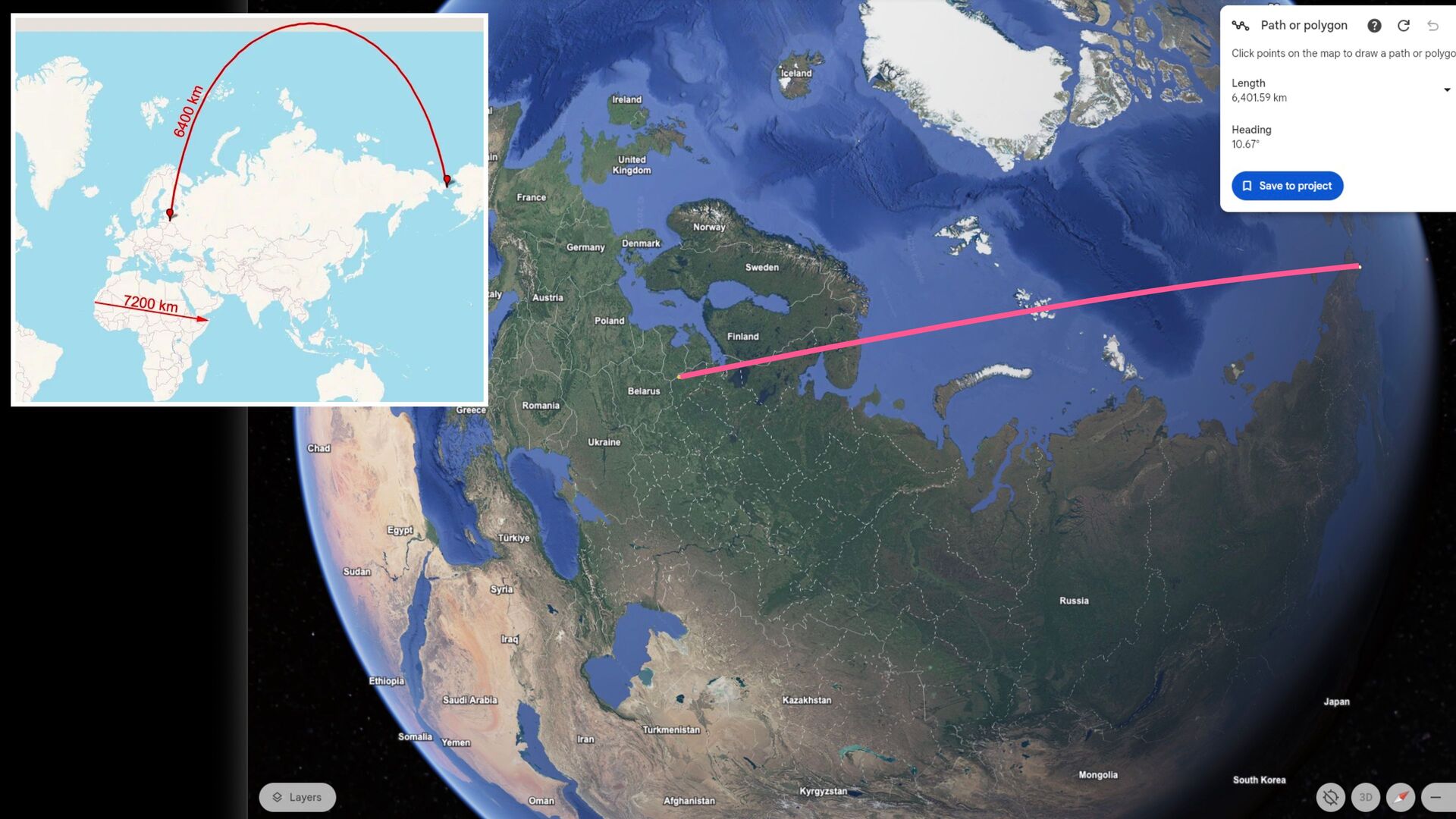
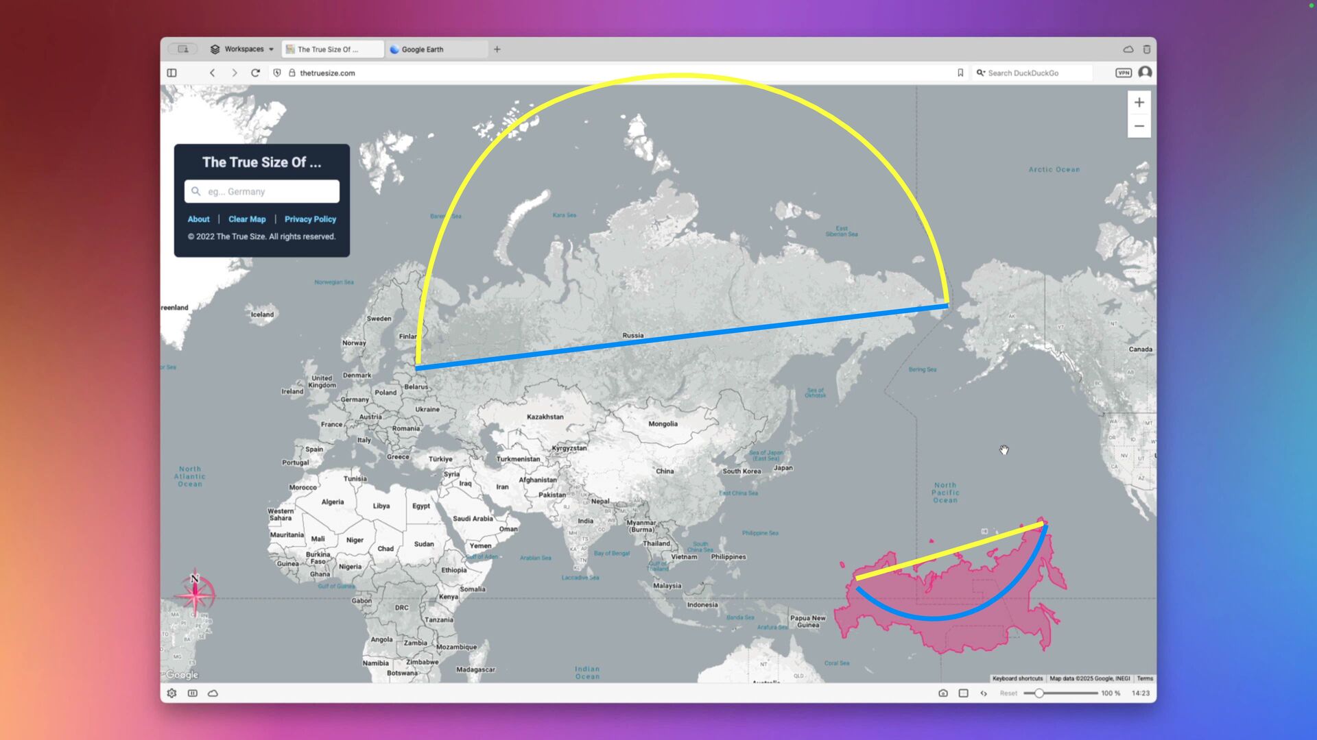
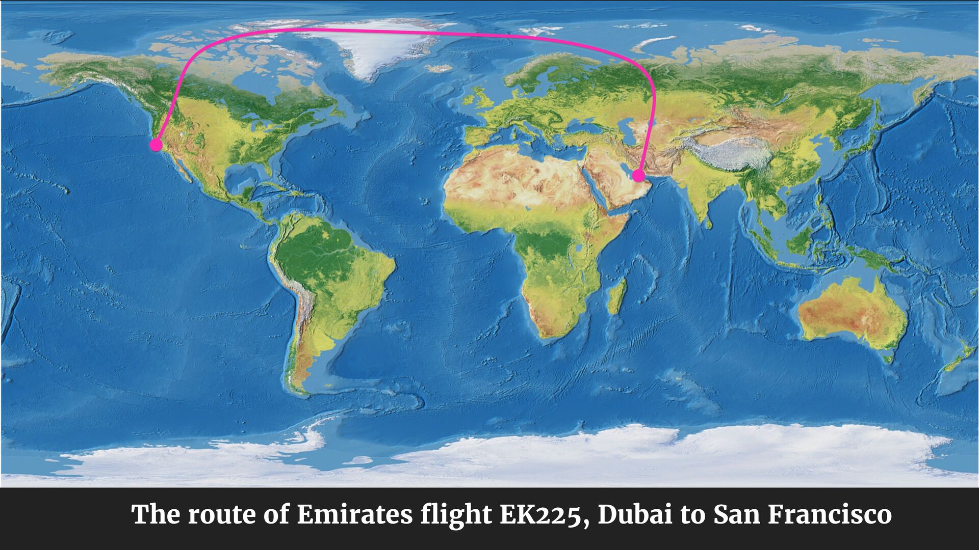
Austria B e l a r u s U k r a i n e Egypt Türklye Sudan Syra trag R u s s i a Ethiopia Saudi Arabia SomaliaYemen Turkmenistan Iran Oman Afghanistan Kyrgyzstan 89. Path or polygon u Click points o n the map to draw a path or polygo Length 6,401.59 k m Heading 10.67° ⼜Save to project J a p a n South Korea
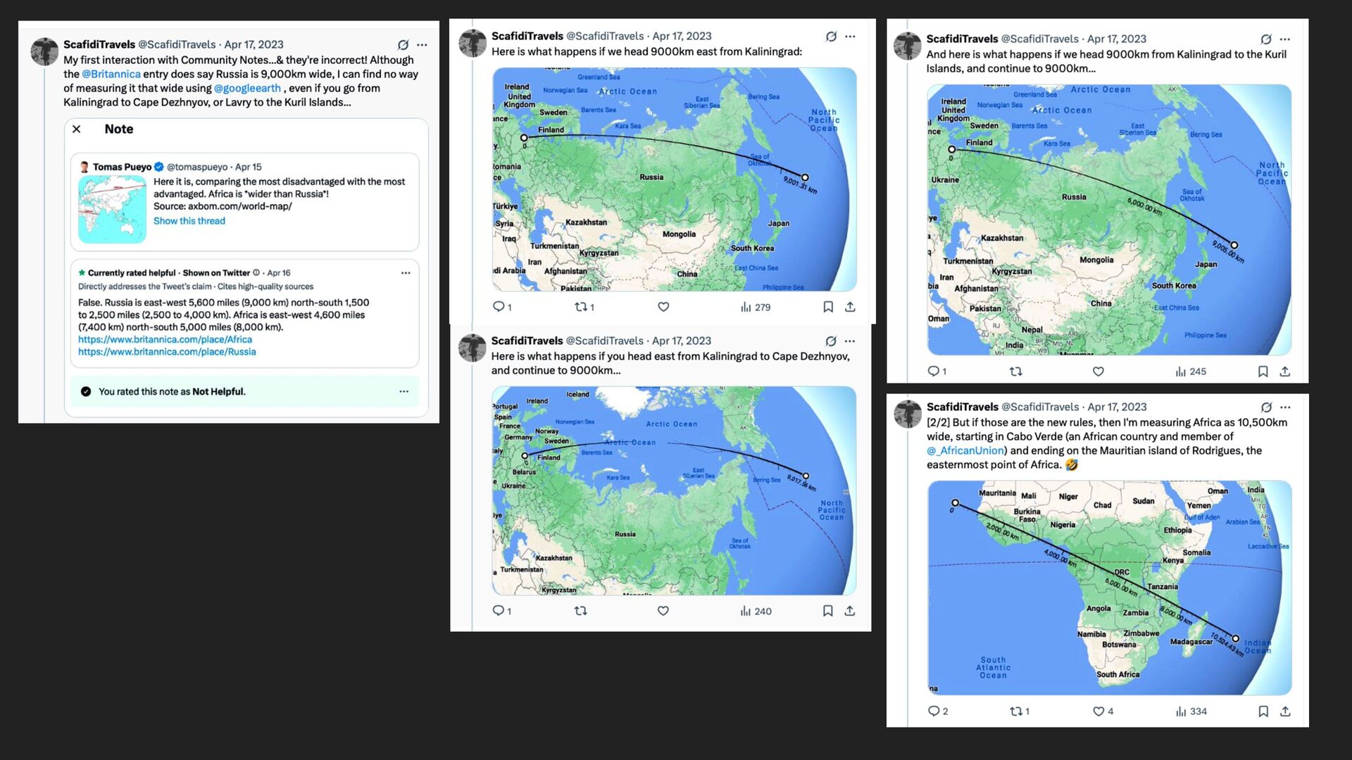
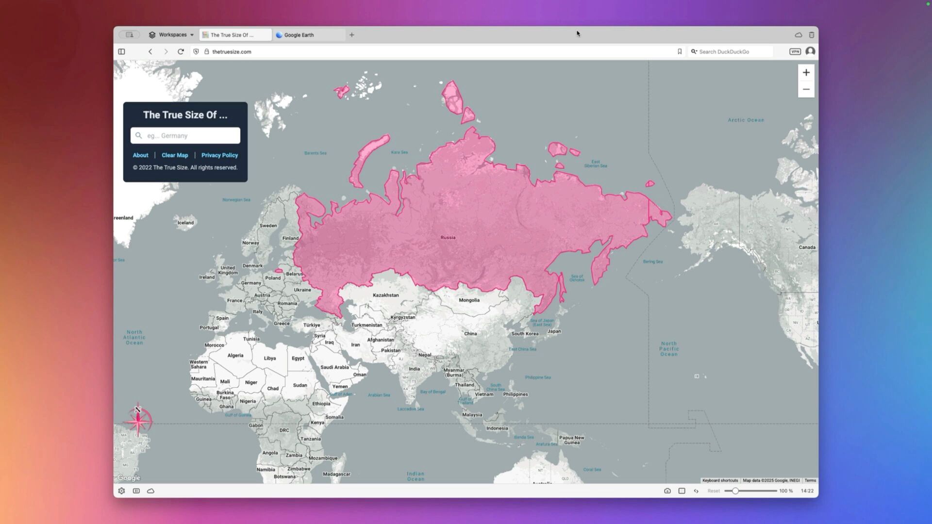
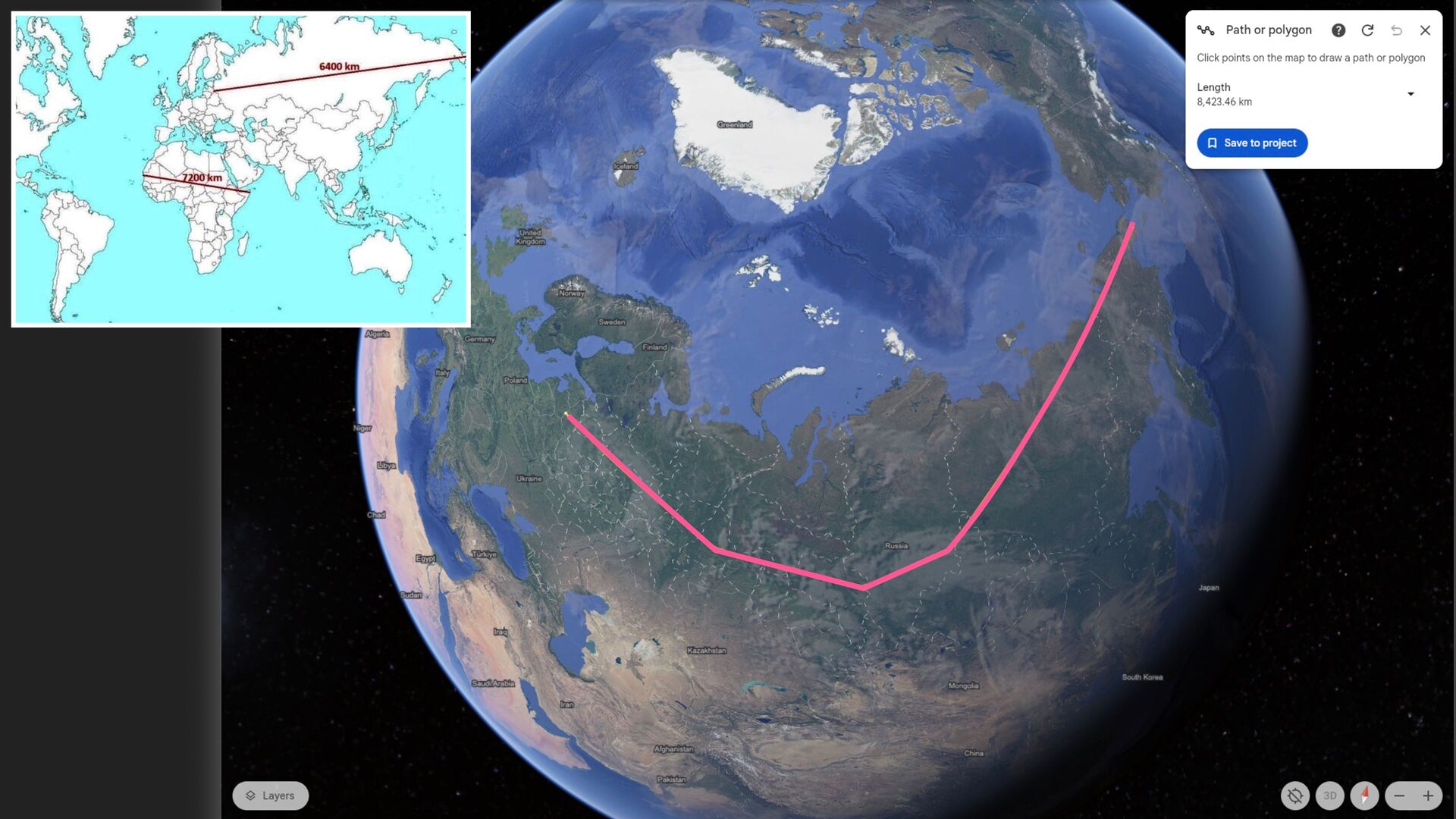
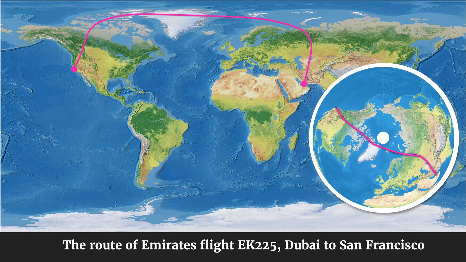
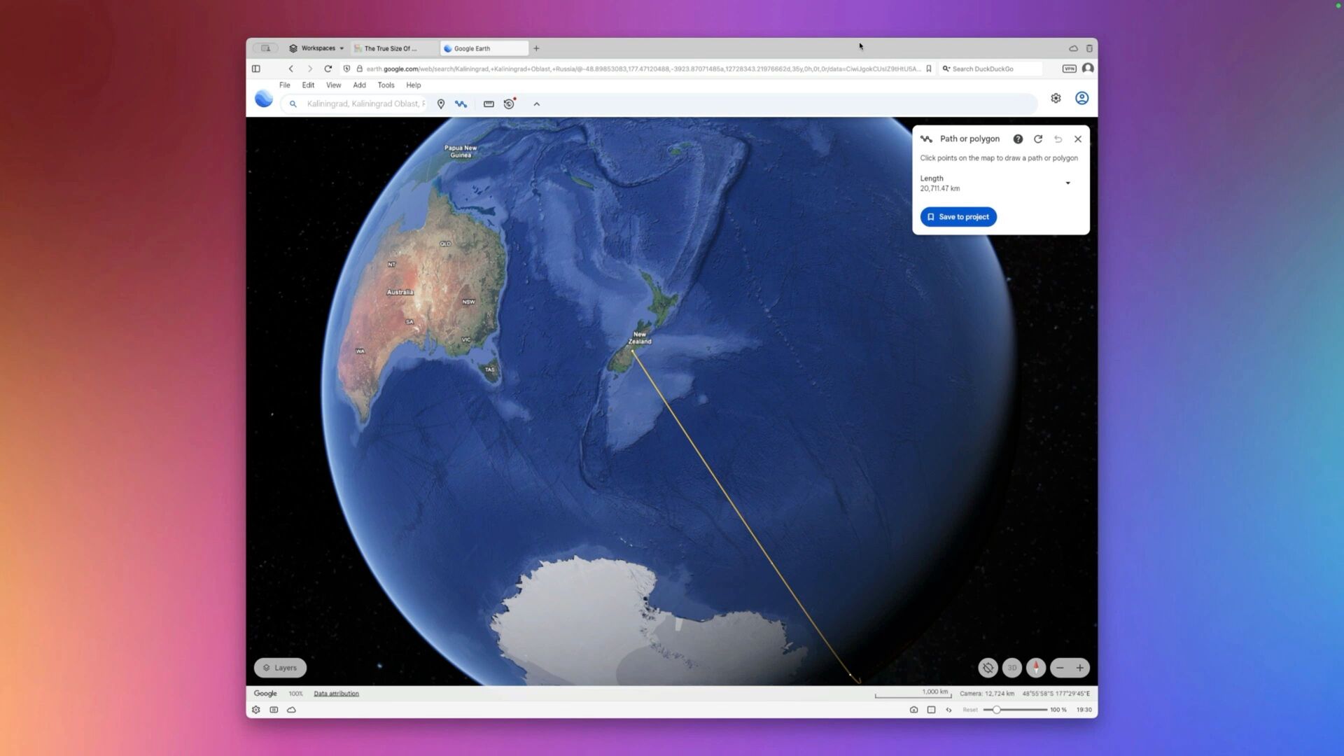
l e z a r t h earth.google.com/web/search/Kaliningrad,«Kaliningrad+Oblast,+Russia/@-48.89853083,177.47120488,-3923.87071485a,12728343.21976662 Q * S e a r c h DuckDuckGo V P N Tools I H e l o K a l i n i n g r a d , K a l i n i n a r a d O b l a s t , F ⽬ " P a t h o r p o l y g o n P a p u a N e c l i c k points o n the map to draw a path o r polygon L e n g t h 20.711.47 km s a v e t o p r o j e c t " L a v e r ' s G o o g l e . D a t a a t t r i b u t i o n
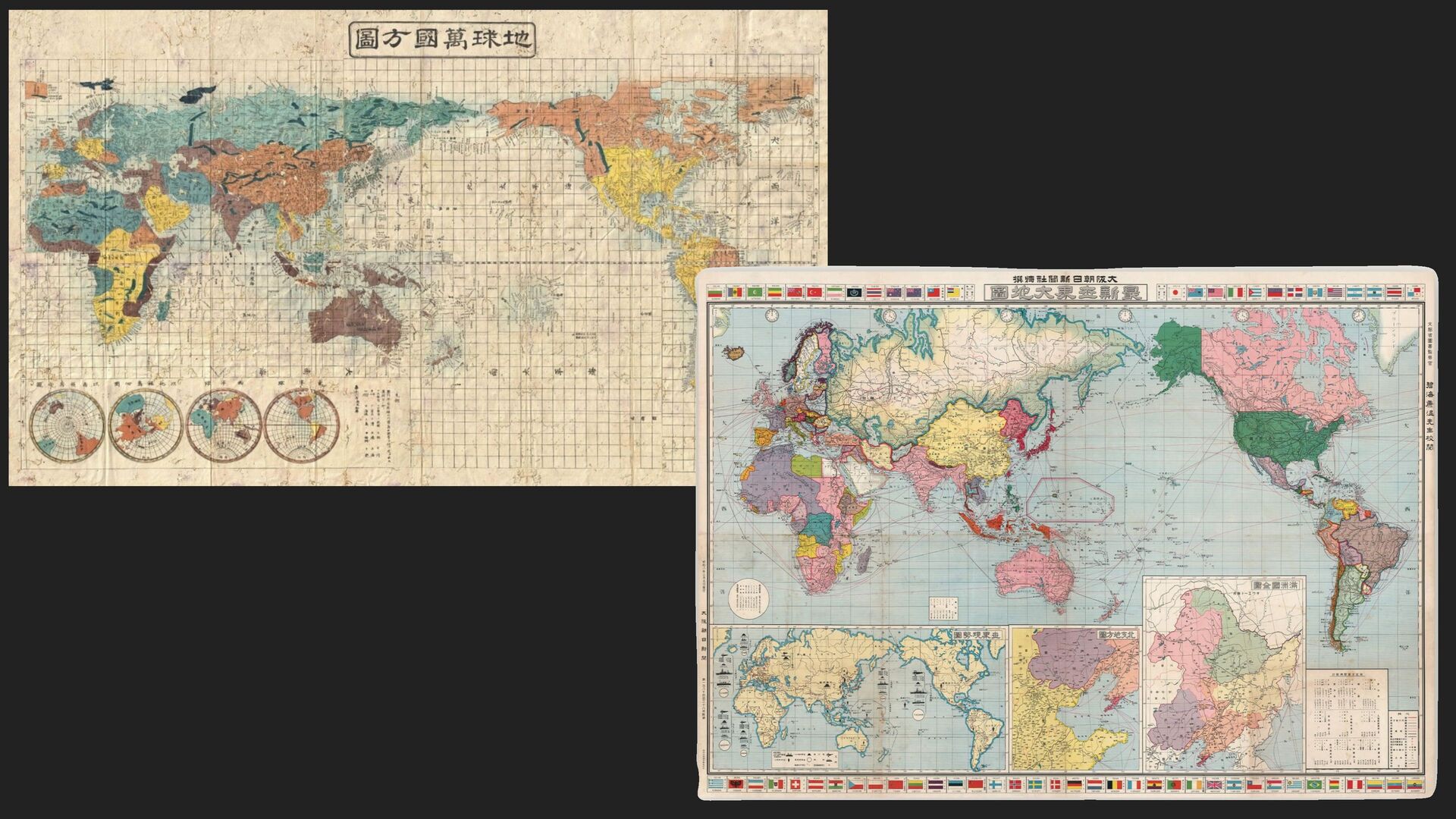
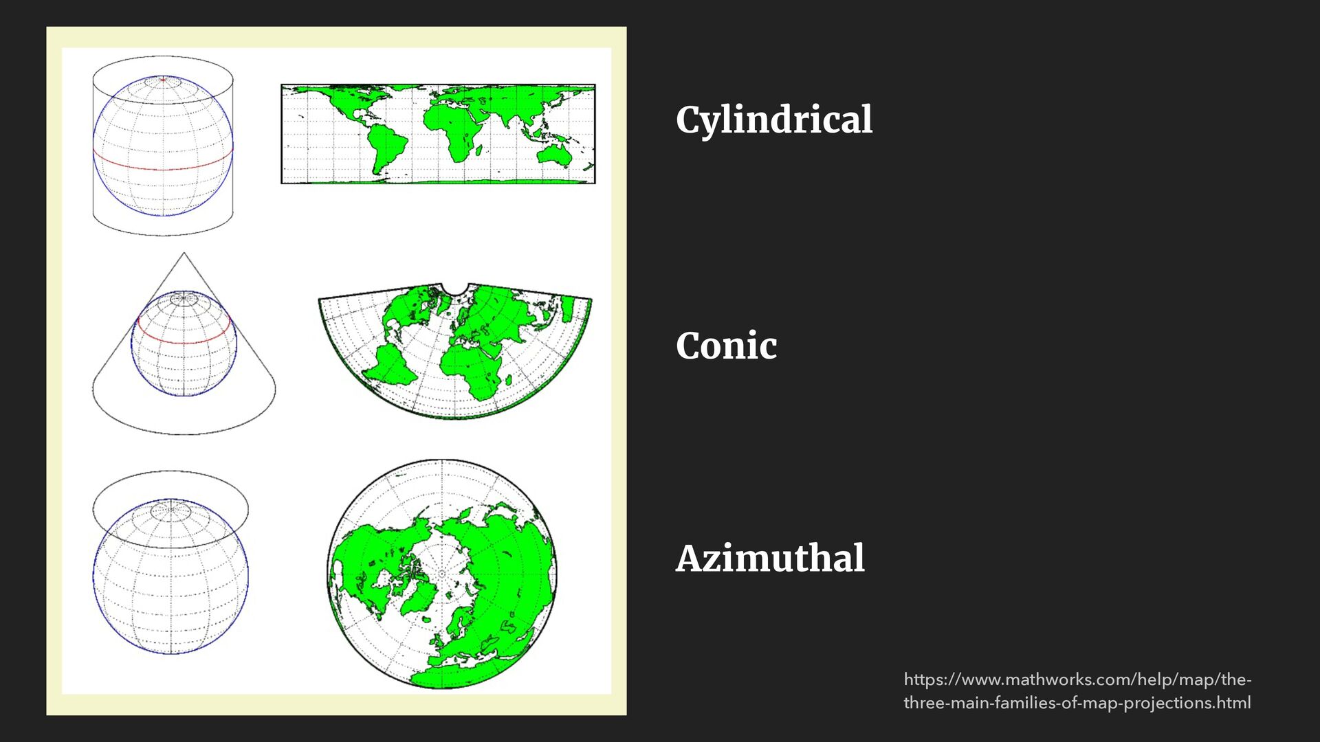
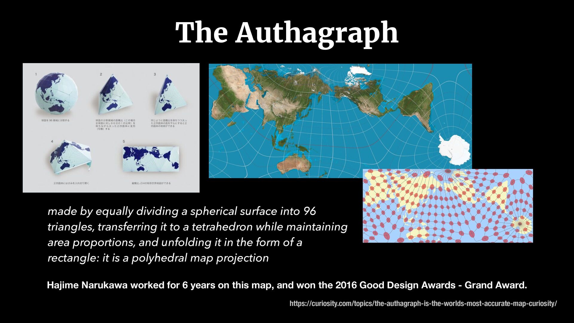
map, and won the 2016 Good Design Awards - Grand Award. https://curiosity.com/topics/the-authagraph-is-the-worlds-most-accurate-map-curiosity/ made by equally dividing a spherical surface into 96 triangles, transferring it to a tetrahedron while maintaining area proportions, and unfolding it in the form of a rectangle: it is a polyhedral map projection
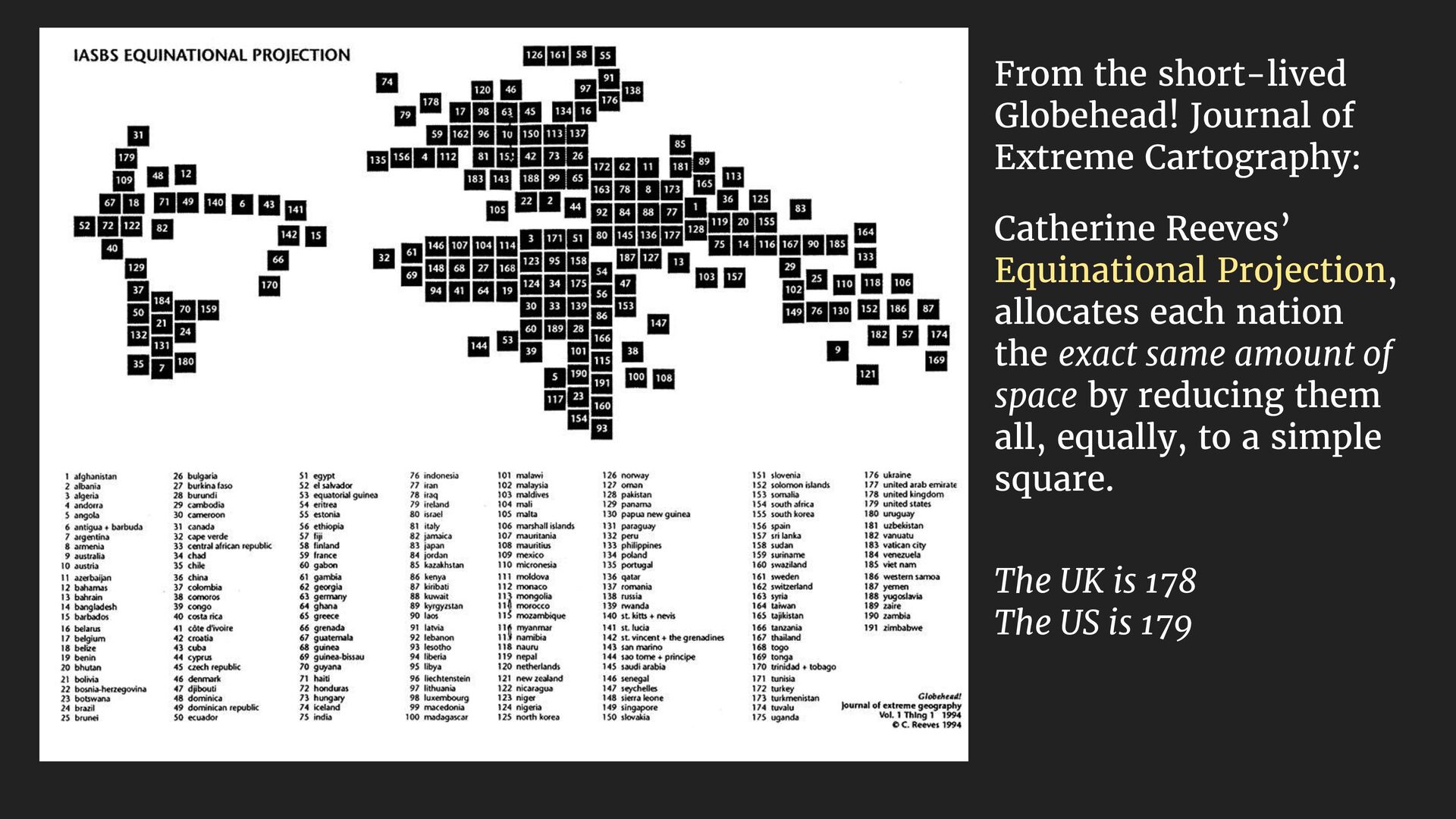
Equinational Projection, allocates each nation the exact same amount of space by reducing them all, equally, to a simple square. The UK is 178 The US is 179
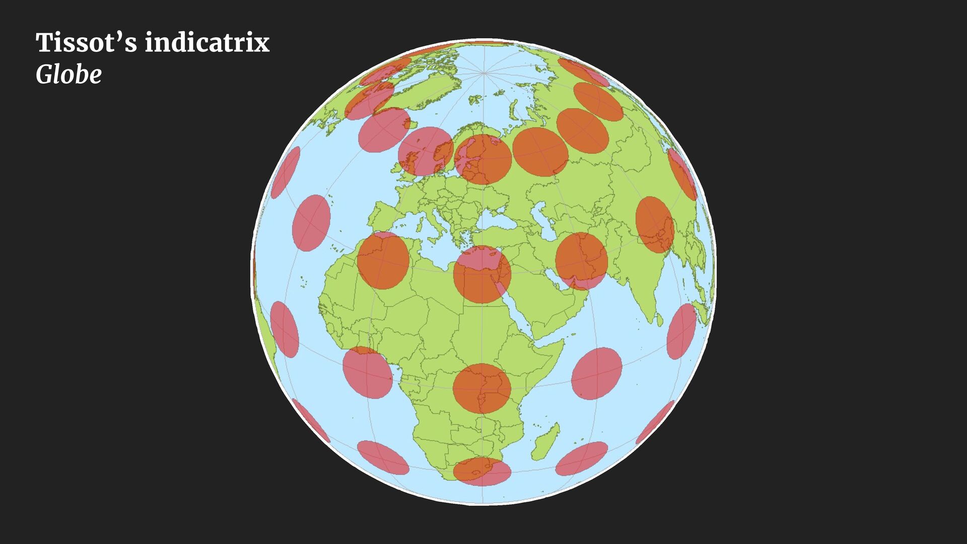
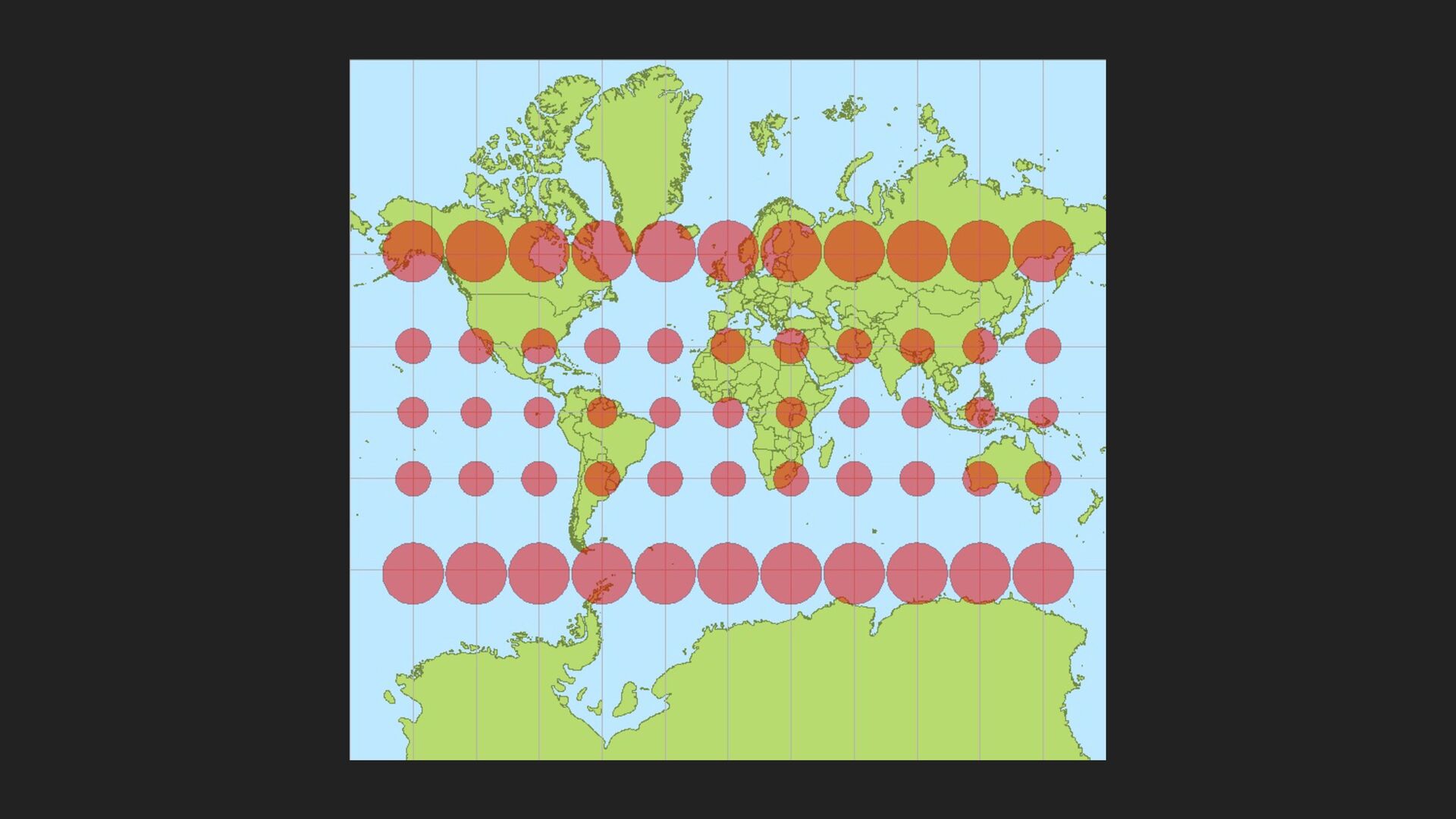
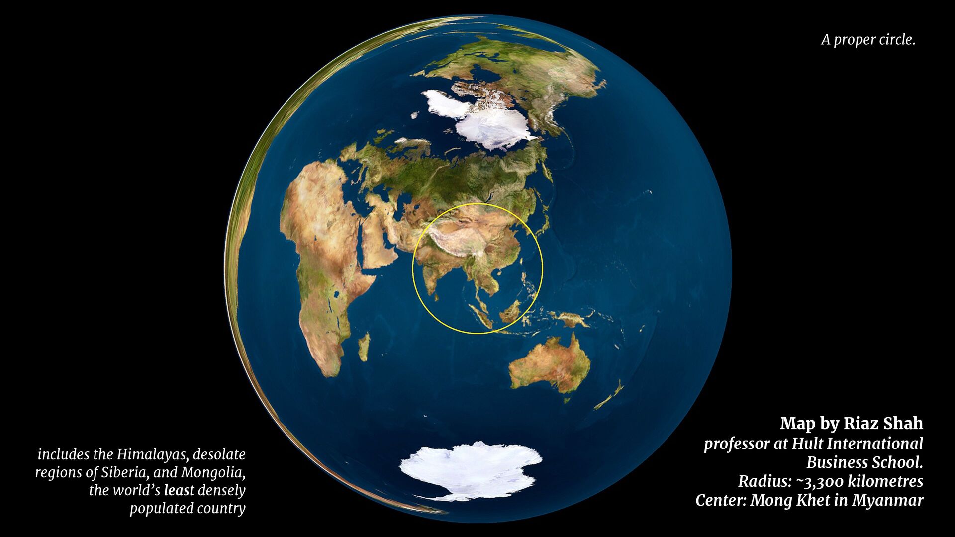
Radius: ~3,300 kilometres Center: Mong Khet in Myanmar includes the Himalayas, desolate regions of Siberia, and Mongolia, the world’s least densely populated country A proper circle.
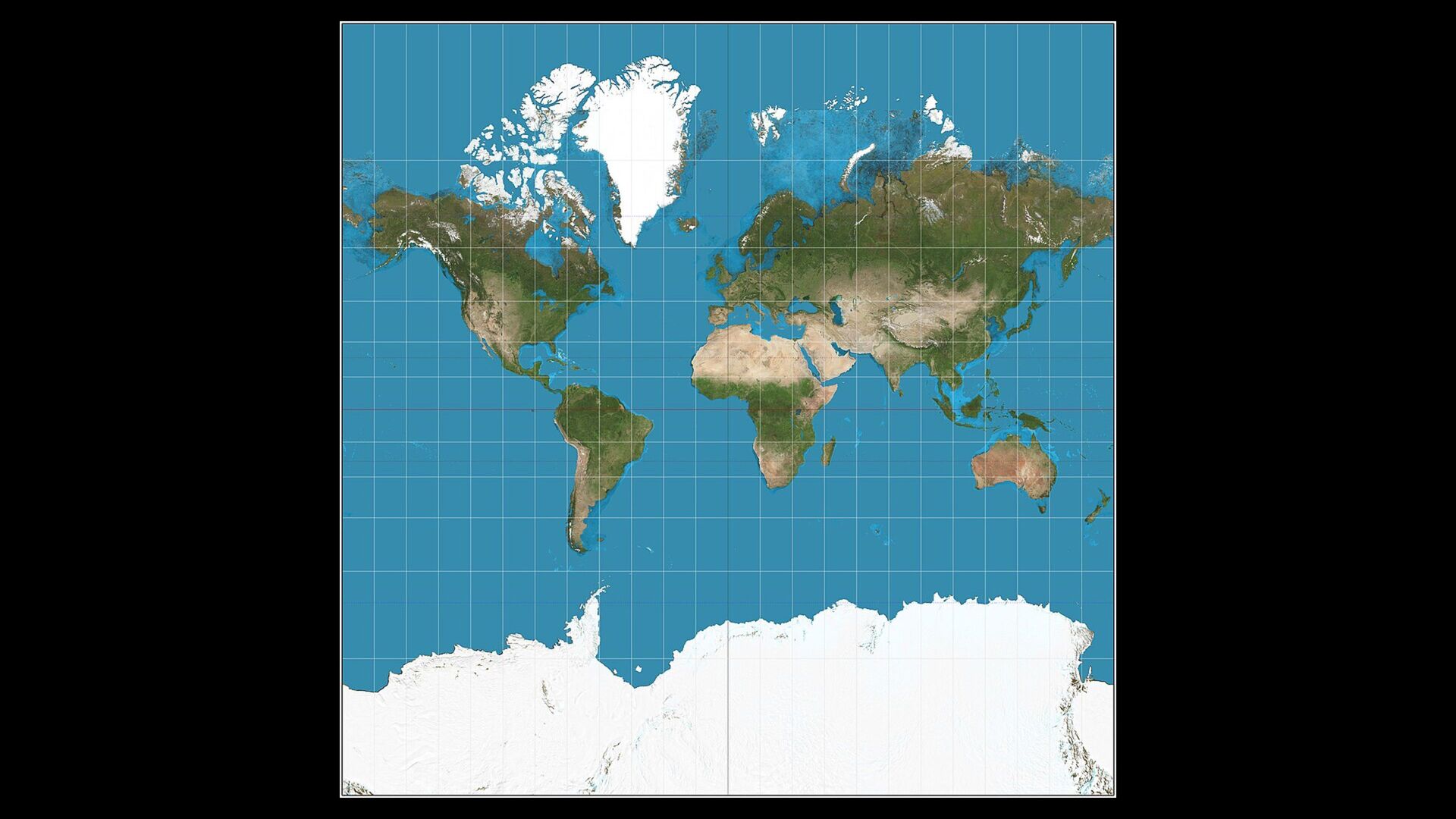
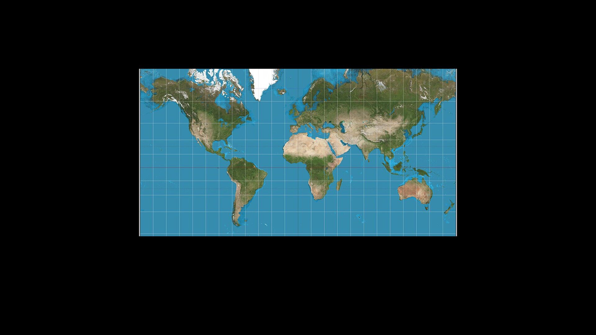
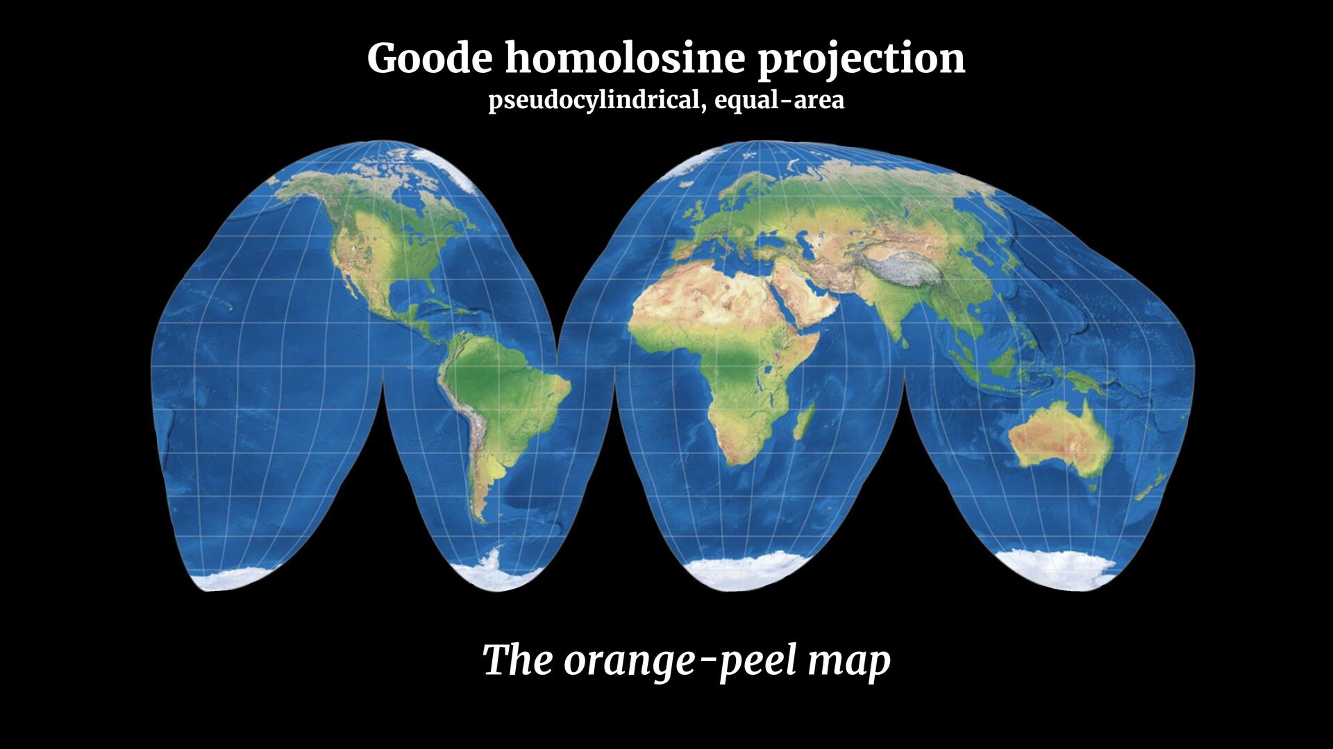
government agencies to cease using rectangular world maps for general purposes or artistic displays. Such maps promote serious, erroneous conceptions by severely distorting large sections of the world […]” Resolution adopted by seven North American cartographic societies in 1989:
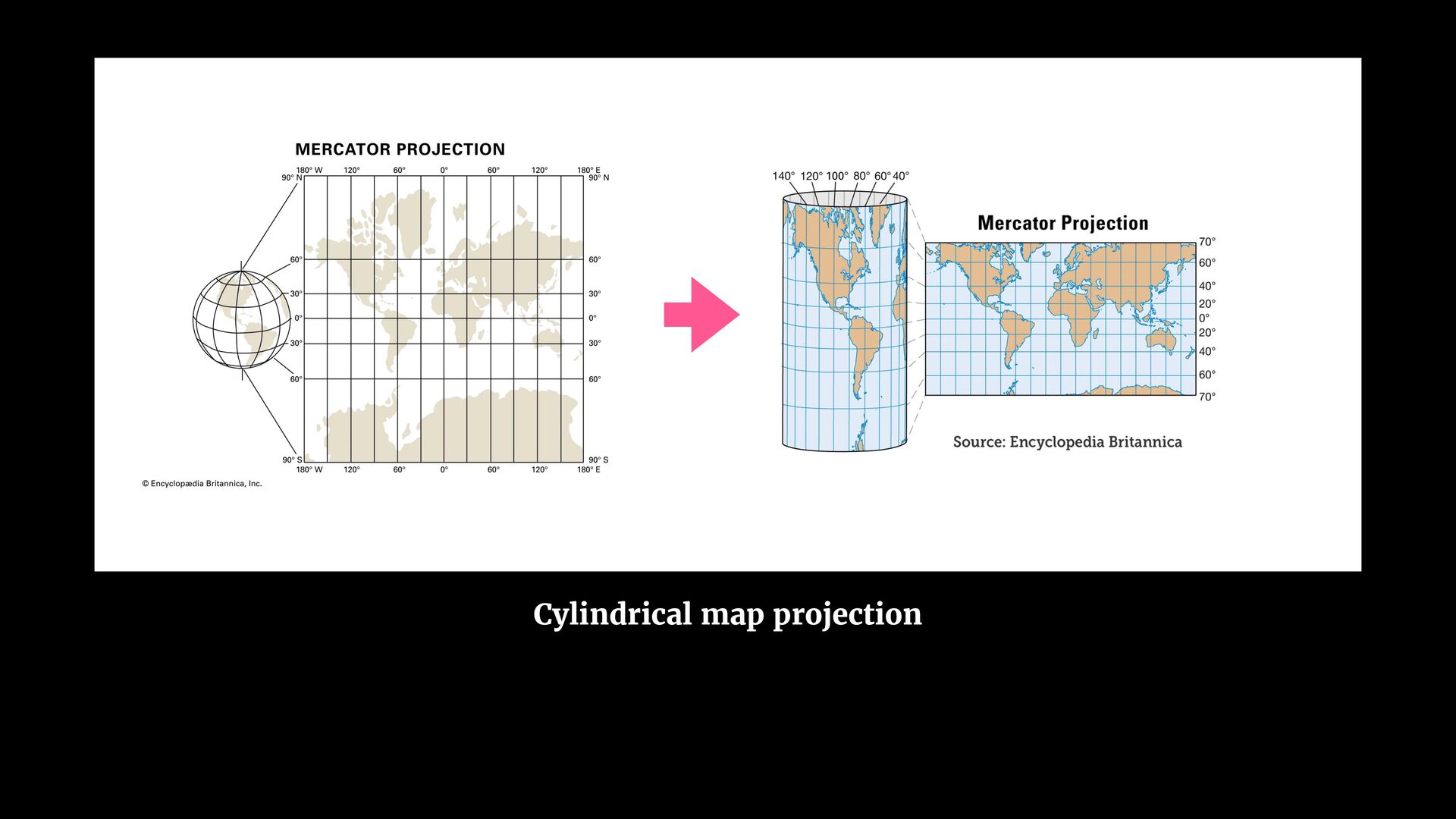
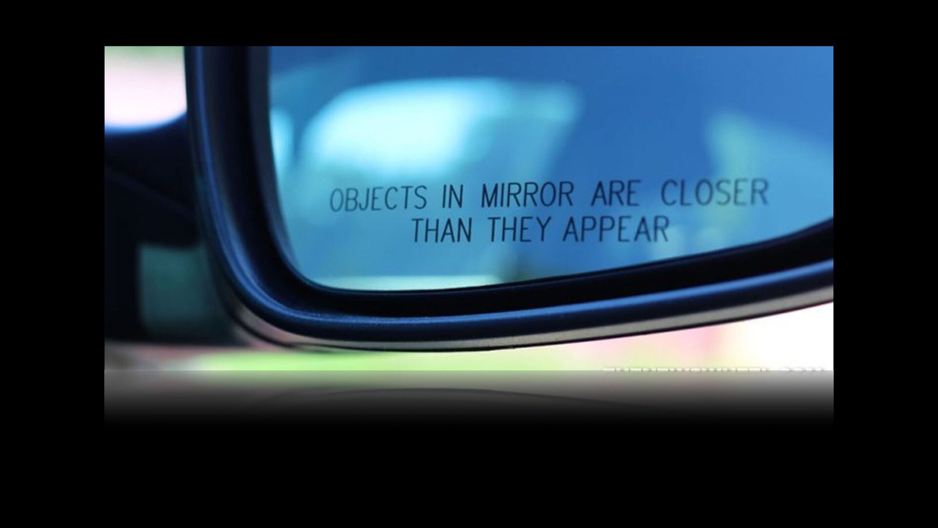
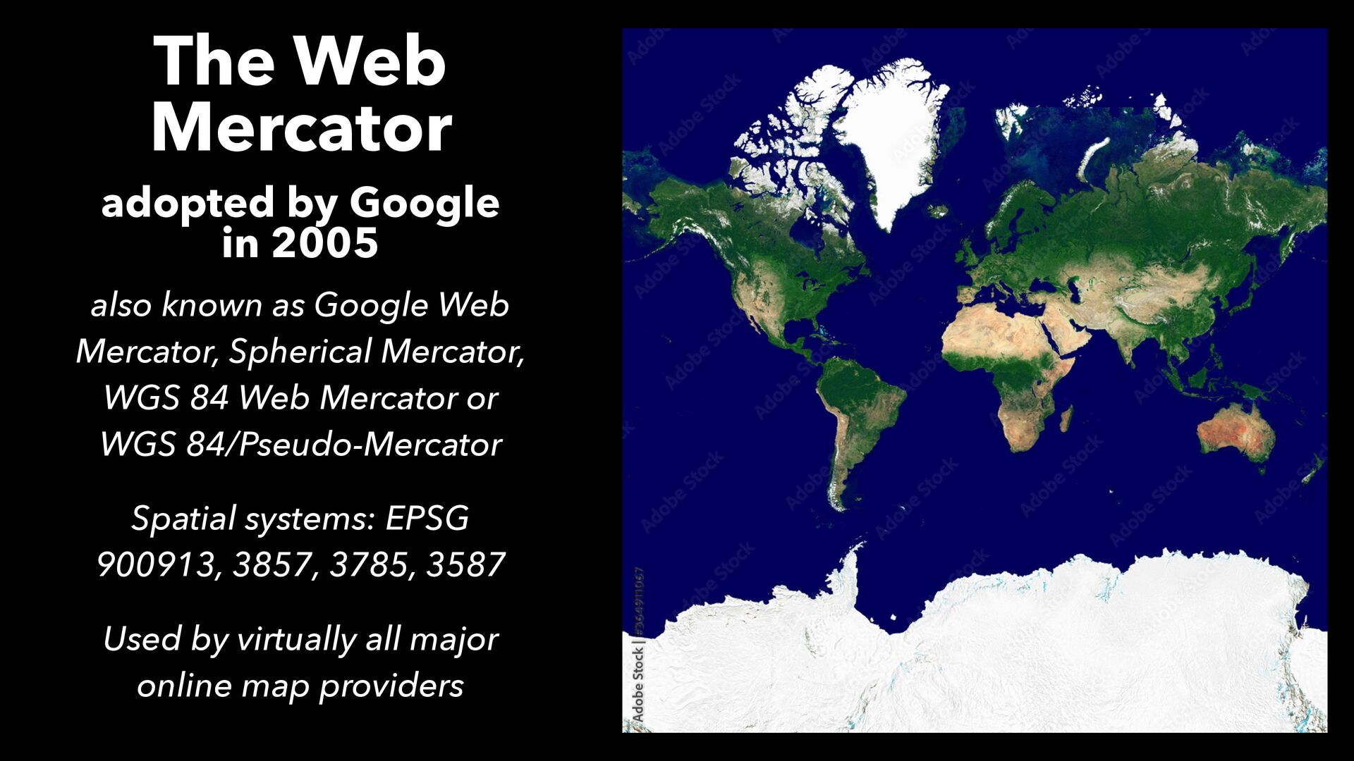
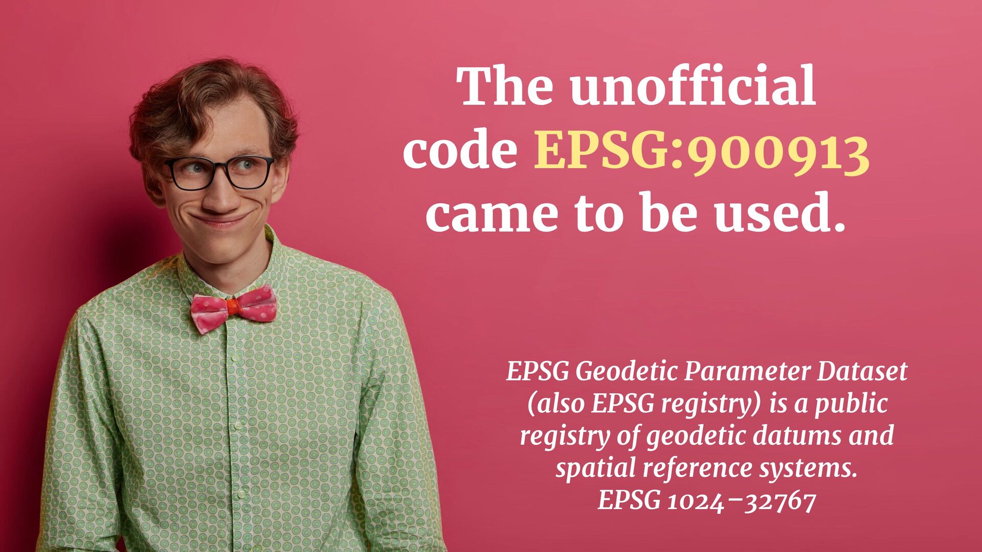
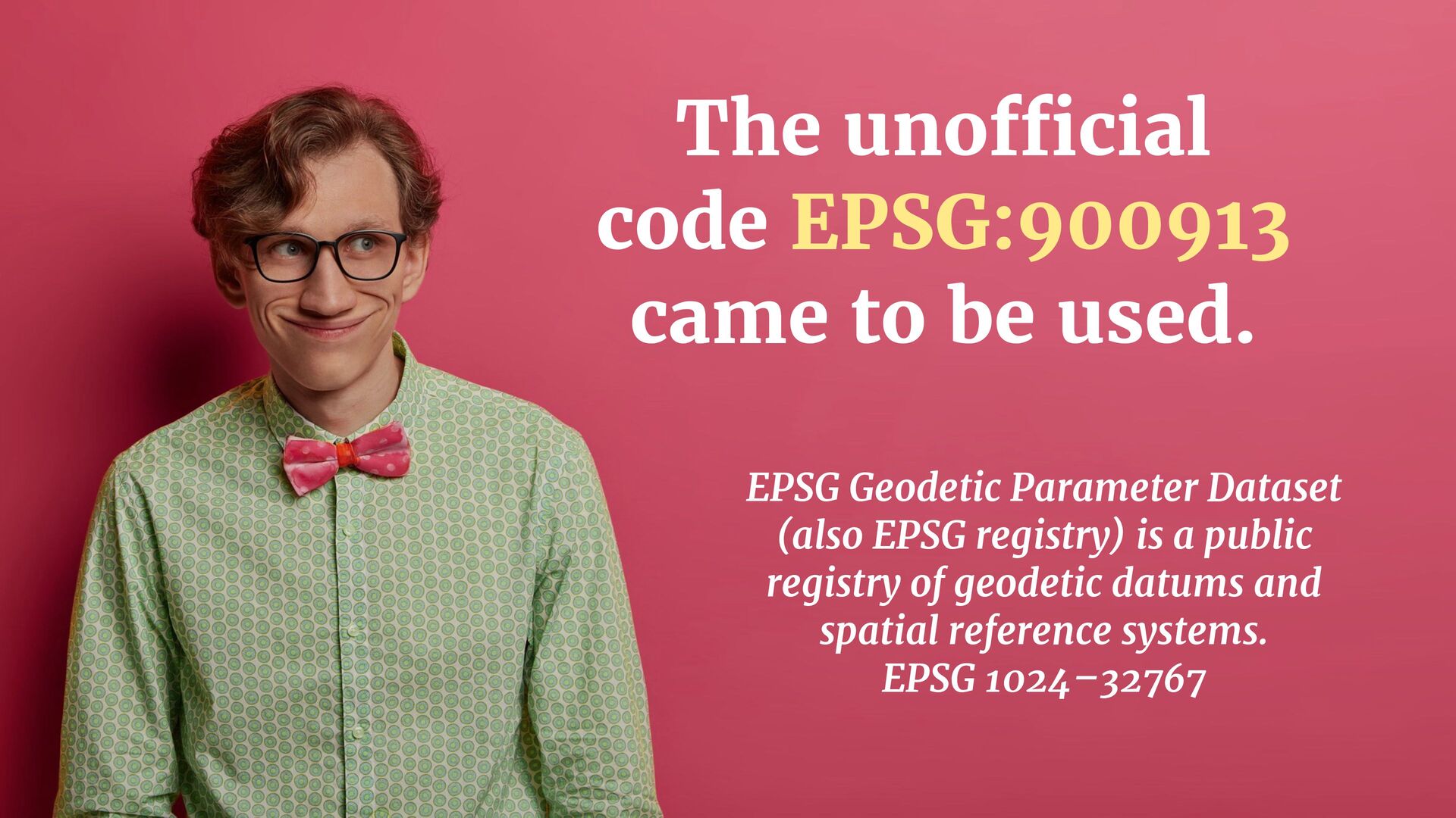
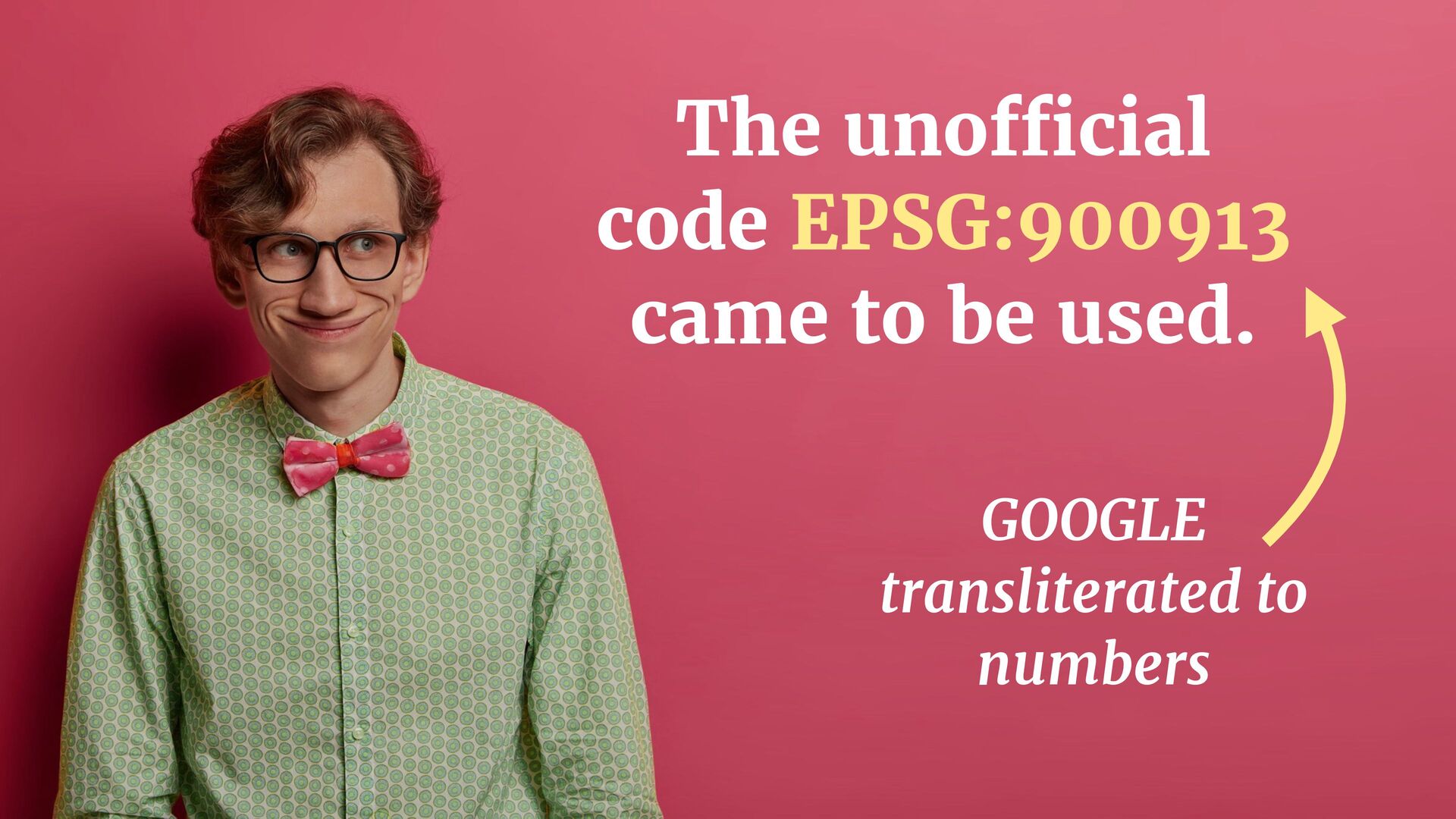
as Google Web Mercator, Spherical Mercator, WGS 84 Web Mercator or WGS 84/Pseudo-Mercator Spatial systems: EPSG 900913, 3857, 3785, 3587 Used by virtually all major online map providers
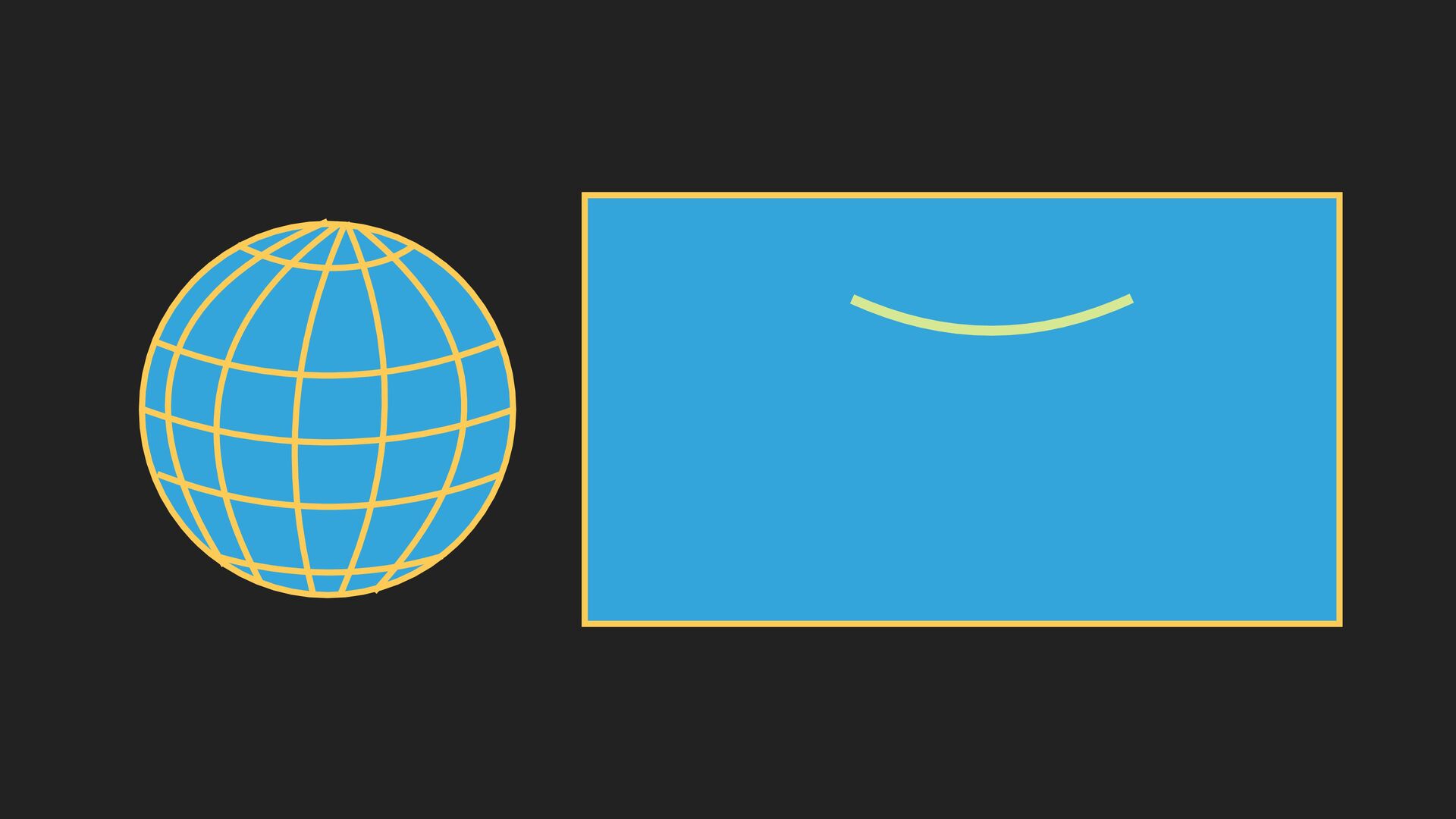
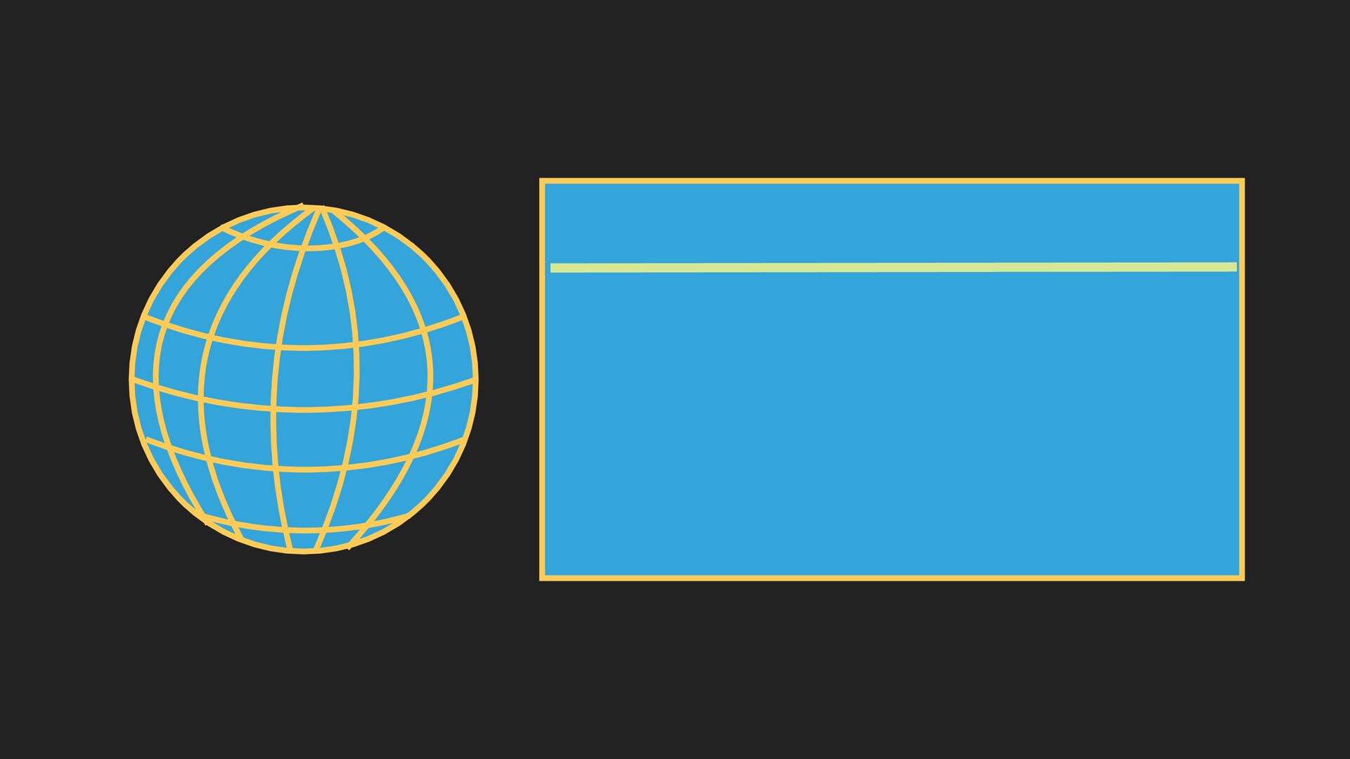
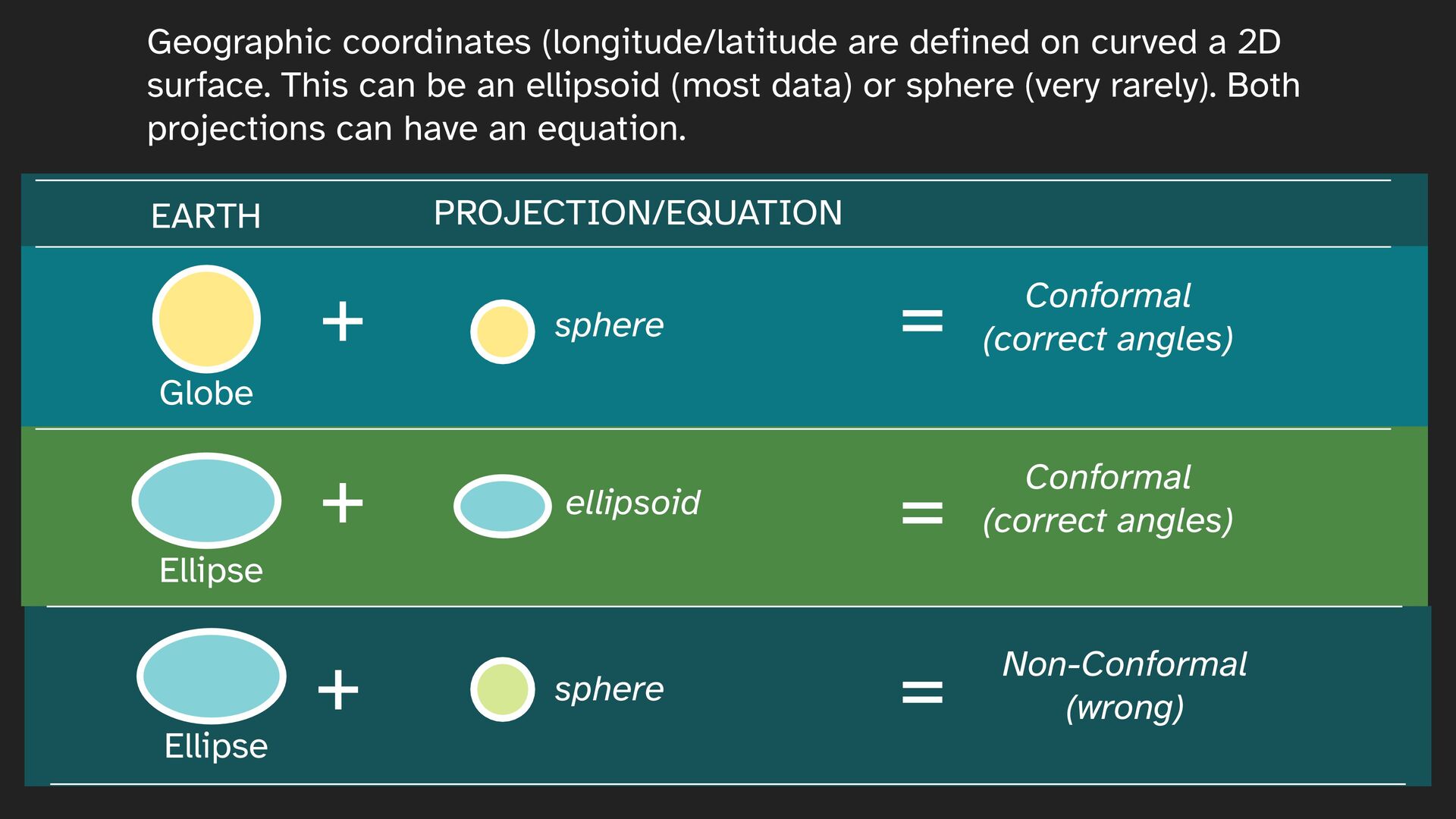
curved a 2D surface. This can be an ellipsoid (most data) or sphere (very rarely). Both projections can have an equation. + ellipsoid + + sphere sphere = Conformal (correct angles) = Conformal (correct angles) = Non-Conformal (wrong) PROJECTION/EQUATION
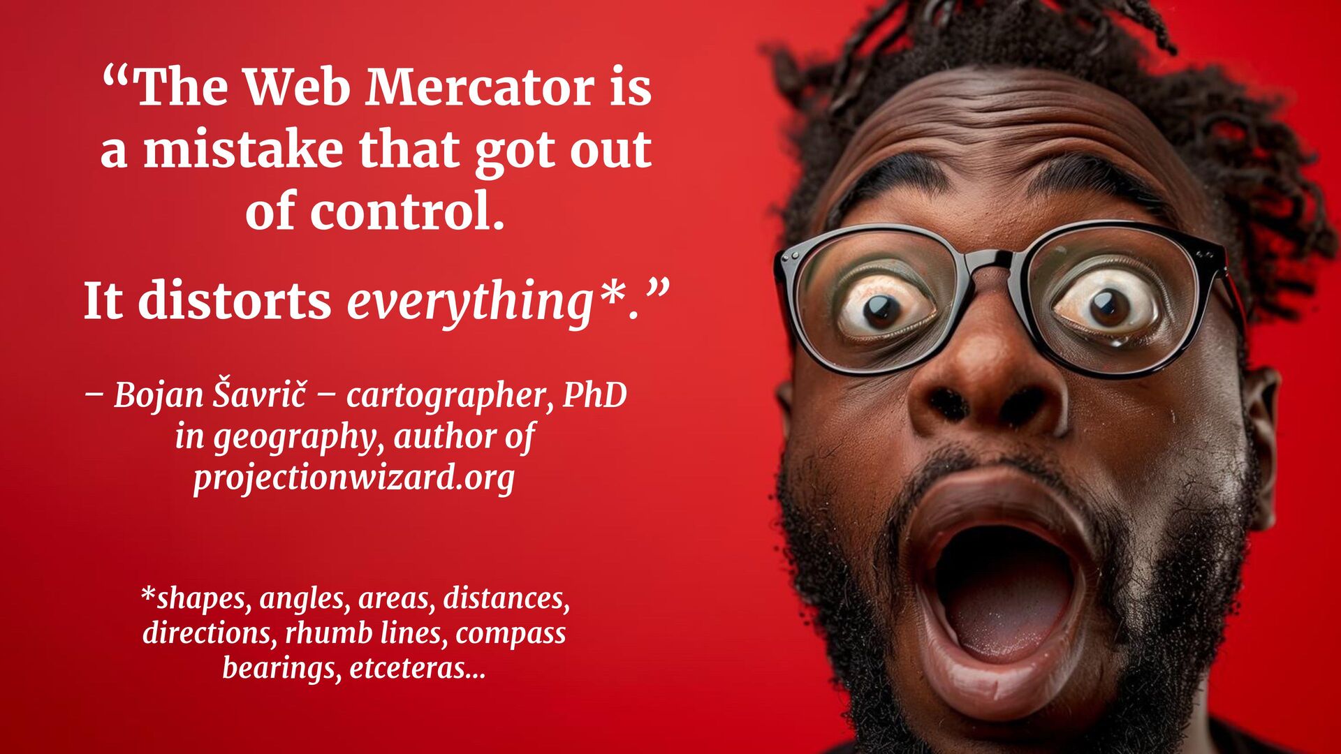
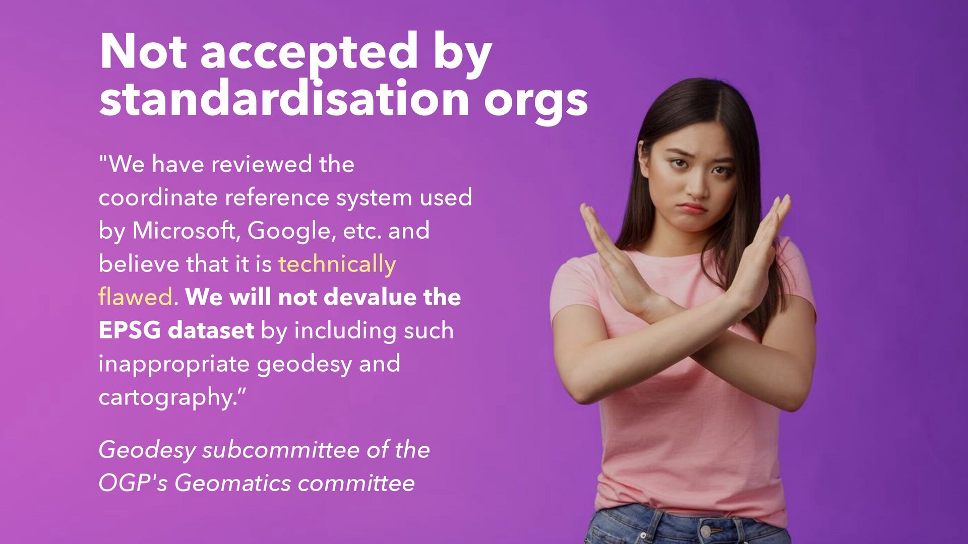
reference system used by Microsoft, Google, etc. and believe that it is technically flawed. We will not devalue the EPSG dataset by including such inappropriate geodesy and cartography.” Geodesy subcommittee of the OGP's Geomatics committee
suddenly in the hands of a Namibian agriculturalist, a Sahelian nomad or a Senegalese fisherwoman – the maps they would conjure up would be completely different. They might well prioritise soil types over Starbucks, wells over Walmarts and the state of land degradation over panoramic street views of American towns.” – James Wan, The Guardian
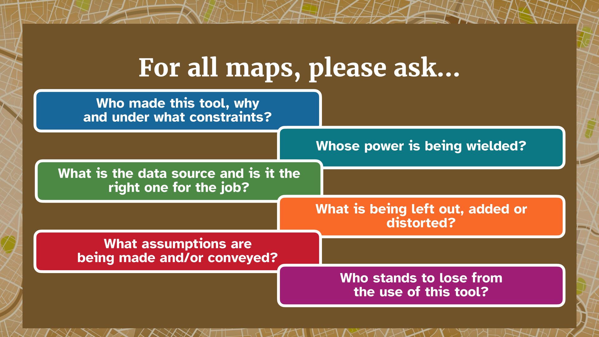
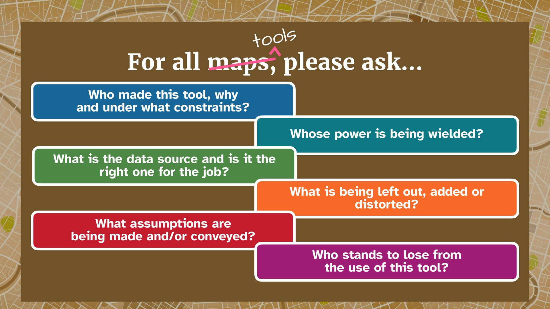
power is being wielded? What is the data source and is it the right one for the job? What is being left out, added or distorted? For all maps, please ask… What assumptions are being made and/or conveyed? Who stands to lose from the use of this tool?
power is being wielded? What is the data source and is it the right one for the job? What is being left out, added or distorted? For all maps, please ask… tools What assumptions are being made and/or conveyed? Who stands to lose from the use of this tool?
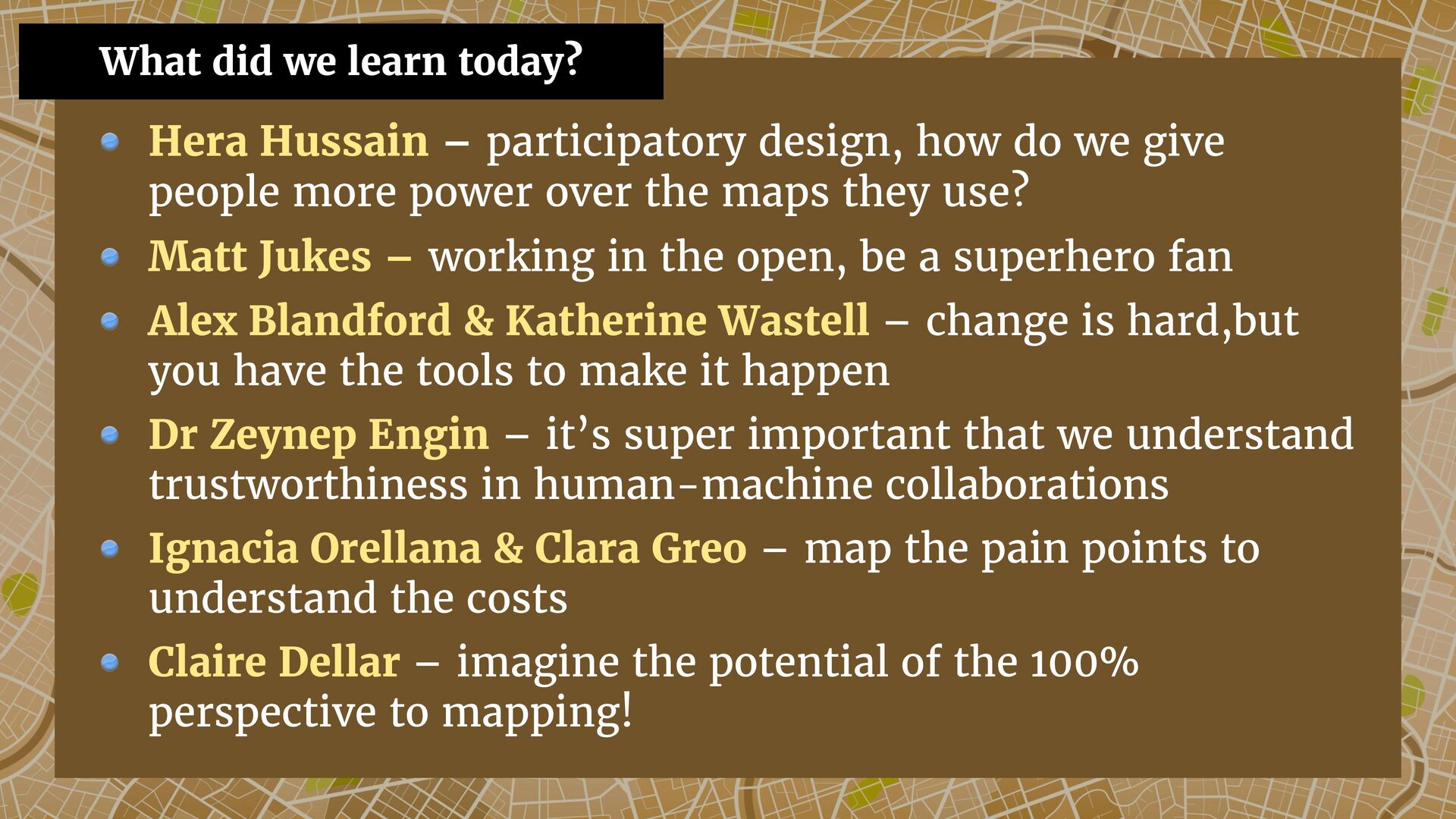
more power over the maps they use? Matt Jukes – working in the open, be a superhero fan Alex Blandford & Katherine Wastell – change is hard,but you have the tools to make it happen Dr Zeynep Engin – it’s super important that we understand trustworthiness in human-machine collaborations Ignacia Orellana & Clara Greo – map the pain points to understand the costs Claire Dellar – imagine the potential of the 100% perspective to mapping! What did we learn today?
![[W]e strongly urge book and map publishers, the media and](https://files.speakerdeck.com/presentations/49b11b4d4dc04e96b5f447fdbae50668/slide_85.jpg)
![Use Literally Anything but Web Mercator [YouTube]](https://files.speakerdeck.com/presentations/49b11b4d4dc04e96b5f447fdbae50668/slide_90.jpg)
![“[I]magine if all of Google's data and programming ability was](https://files.speakerdeck.com/presentations/49b11b4d4dc04e96b5f447fdbae50668/slide_95.jpg)