Upgrade to Pro — share decks privately, control downloads, hide ads and more …

Software Defined Radio: See the Waves, Sniff Th...

Software Defined Radio: See the Waves, Sniff The Air

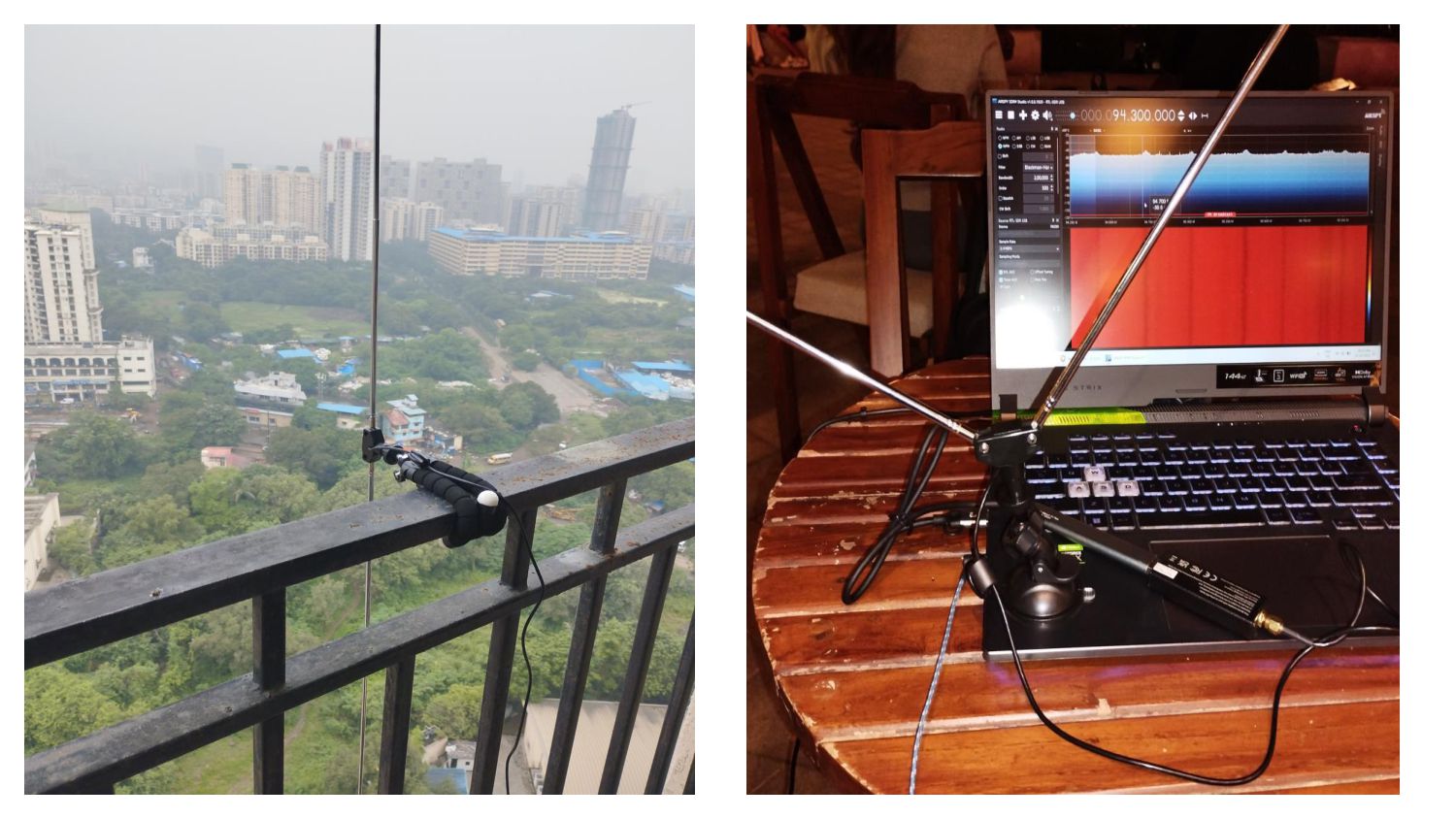
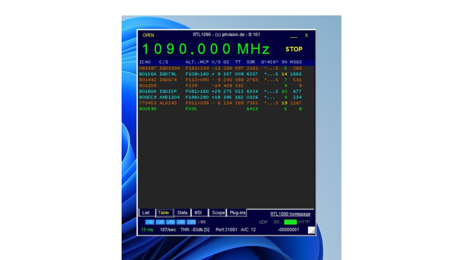
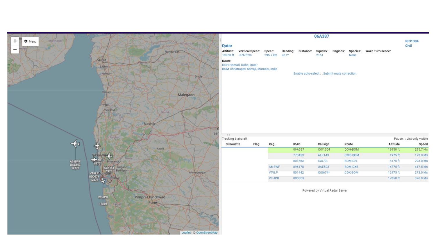
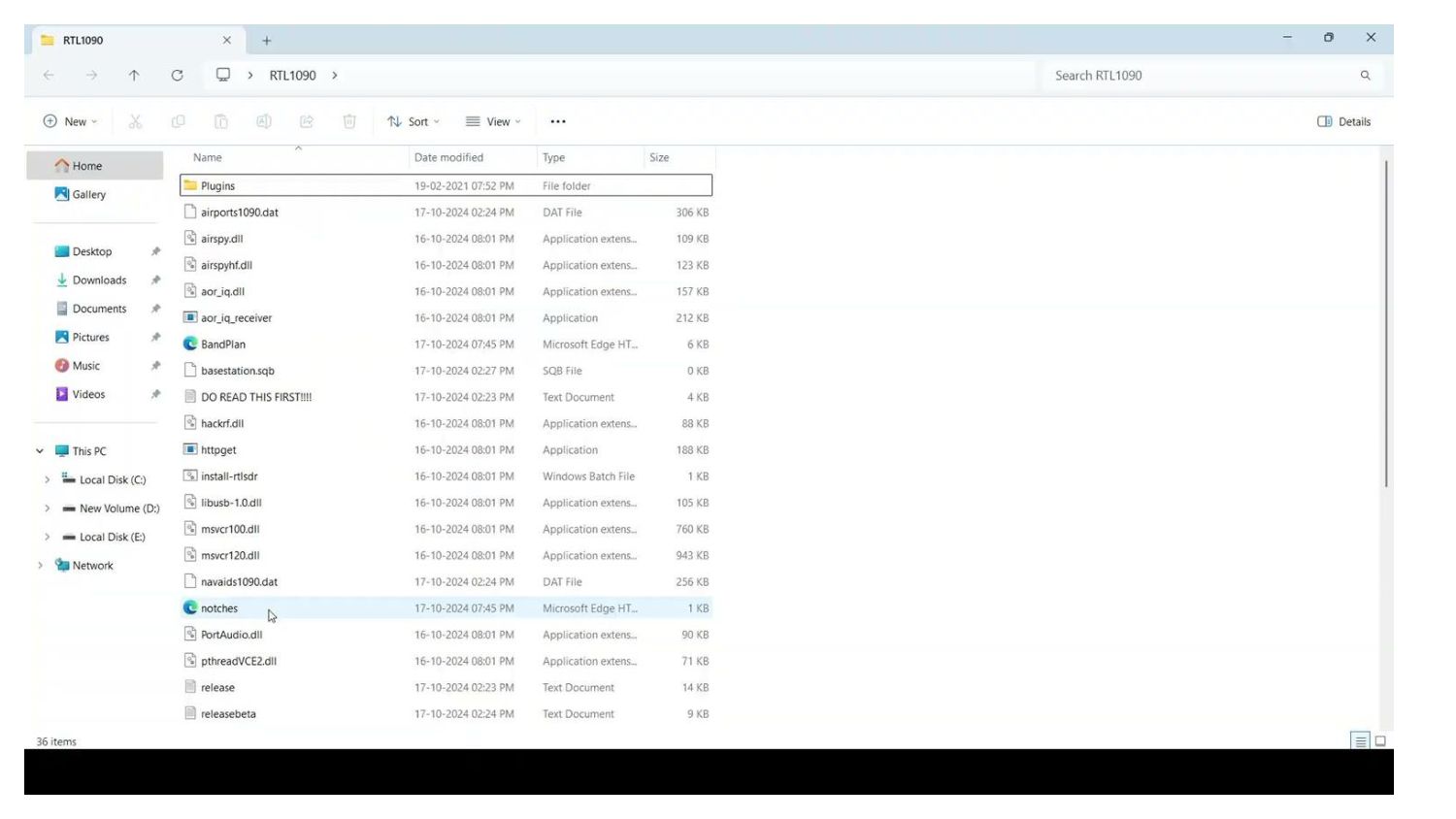
Title: Software Defined Radio: See the Waves, Sniff The Air
Presenter: ​Arun Mathai
Event: BreachForce CyberSecurity Cohort
Talk Date: 24th-November-2024

Key Takeaways: Discover how software-defined radio technology can be leveraged to explore and analyze wireless communications, providing a new perspective on network security.

BreachForce

November 24, 2024
Tweet

More Decks by BreachForce

Other Decks in Technology

Transcript

  1. Who am I ? • I am Arun Mathai S.K

    • I work @Frappe Cloud as a SDE • I do all kinds of tinkering and hacking • FOSS & digital rights advocate • Checkout my website https://arunmathaisk.in • I go by @arunmathaisk on the internets
  2. The RTL-SDR devices are based on the Realtek RTL2832U chip,

    a highly integrated USB demodulator chip designed for DVB-T (Digital Video Broadcasting - Terrestrial) and DAB (Digital Audio Broadcasting) applications.
  3. 1. Wireless Planning and Coordination (WPC) Wing: The WPC Wing,

    under the Ministry of Communications, regulates wireless communication in India. 2. License requirements: For receiver-only devices like RTL-SDR, no license is required for: - FM radio (88-108 MHz) - AM radio (535-1705 kHz) - Shortwave radio (2-30 MHz) - Amateur radio frequencies (allocated by WPC) 3. Restricted frequencies: Licenses are required for: - Cellular frequencies (GSM, LTE, etc.) - Satellite communication - Aviation and maritime frequencies - Military and government frequencies
  4. Dipole Length (L) = 468 / Frequency (f) in MHz

    Where: - L is the length of the dipole in feet - f is the frequency in MHz For example: - 144 MHz (2m amateur band): L = 468 / 144 ≈ 3.25 feet (98.4 cm) - 433 MHz (70cm amateur band): L = 468 / 433 ≈ 1.08 feet (33 cm)
  5. ATIS (Automatic Terminal Information Service) is a pre- recorded audio

    broadcast provided by airports to inform pilots about: (118.0-135.975 MHz) 1. Weather conditions 2. Airfield conditions 3. NOTAMs (Notices to Airmen) 4. Airport advisories 5. Other essential information Weather: - Wind direction and speed - Visibility - Clouds - Temperature - Dew point
  6. AIS (Automatic Identification System) is a maritime safety and tracking

    system that uses VHF radio communication to: 1. Identify vessels 2. Share location and speed information 3. Enhance collision avoidance 4. Improve maritime domain awareness AIS operates on two VHF channels: 1. Channel 87B (161.975 MHz) 2. Channel 88B (162.025 MHz) 1. Channel 87B: Used for: - Position reports - Navigation status - Safety-related messages 2. Channel 88B: Used for: - Ship static data (e.g., vessel name, type) - Voyage-related information (e.g., destination, ETA) - Other non-safety messages
  7. ADS-B (Automatic Dependent Surveillance-Broadcast) is a surveillance technology used in

    aviation to: 1. Broadcast aircraft location and altitude 2. Enhance air traffic control (ATC) visibility 3. Improve safety and efficiency How ADS-B works: 1. Aircraft equipped with ADS-B transponders broadcast their: - Location (latitude/longitude) - Altitude - Velocity (speed and direction) - Identification (aircraft ID and call sign) 2. Broadcasts are transmitted on 1090 MHz (Mode S) or 978 MHz (UAT) 3. Ground stations and nearby aircraft receive ADS-B broadcasts 4. Received data is used for: - Air traffic control - Collision avoidance - Flight tracking