Upgrade to Pro
— share decks privately, control downloads, hide ads and more …
Speaker Deck
Features
Speaker Deck
PRO
Sign in
Sign up for free
Search
Search
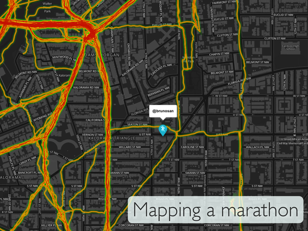
Geo_DC Meetup talk: Mapping a marathon
Search
Sponsored
·
SiteGround - Reliable hosting with speed, security, and support you can count on.
→
Bruno Sánchez-Andrade Nuño
December 05, 2012
Technology
1.9k
1
Share
Embed
Copy iframe code
Copy JS code
Copy link
Start on current slide
Geo_DC Meetup talk: Mapping a marathon
Details available here:
http://brunosan.eu/2012/10/29/Running-a-marathon/
Bruno Sánchez-Andrade Nuño
December 05, 2012
More Decks by Bruno Sánchez-Andrade Nuño
See All by Bruno Sánchez-Andrade Nuño
Intro to Gain and Data Mining
brunosan
1
65
Other Decks in Technology
See All in Technology
GitHub Copilot 最新アップデート – 「一歩先」の実践活用術
moulongzhang
5
1.6k
いまさら聞けない「仕様駆動開発入門」 〜AI活用時代の開発プロセスを考える〜
findy_eventslides
2
190
Claude Codeをどのように キャッチアップしているか
oikon48
13
8.8k
SONiCのNETCONFサーバ機能を試してみた
sonic
0
110
不要なレビューをAIにまかせて AIコーディングの環境改善を加速した
shoota
1
260
あなたの知らないPDFのアクセシビリティ
lycorptech_jp
PRO
0
240
Flow 不死:AI 時代 DevOps 的不變本質
cheng_wei_chen
2
480
アジャイルな経理と Claude Code と 経営の未来
kawaguti
PRO
3
190
FPGAの開発コンペでZephyrを使ってみた
iotengineer22
0
190
40代で“やっとエンジニアになれた”――閉じた学びを開き、空の青さを知る / 20260628 Naoki Takahashi
shift_evolve
PRO
4
740
20260619 私の日常業務での生成 AI 活用
masaruogura
1
250
GitHub Copilot app最速の発信の裏側
tomokusaba
1
250
Featured
See All Featured
Speed Design
sergeychernyshev
33
1.9k
Responsive Adventures: Dirty Tricks From The Dark Corners of Front-End
smashingmag
254
22k
Sam Torres - BigQuery for SEOs
techseoconnect
PRO
0
290
The Pragmatic Product Professional
lauravandoore
37
7.3k
Between Models and Reality
mayunak
4
350
Thoughts on Productivity
jonyablonski
76
5.2k
Measuring Dark Social's Impact On Conversion and Attribution
stephenakadiri
2
220
The Cost Of JavaScript in 2023
addyosmani
55
10k
Statistics for Hackers
jakevdp
799
230k
HTML-Aware ERB: The Path to Reactive Rendering @ RubyCon 2026, Rimini, Italy
marcoroth
1
220
Lightning talk: Run Django tests with GitHub Actions
sabderemane
0
200
Into the Great Unknown - MozCon
thekraken
41
2.6k
Transcript
Mapping a marathon
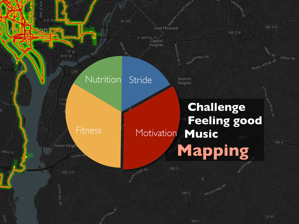
Challenge Feeling good Music Mapping Nutrition Fitness Motivation Stride
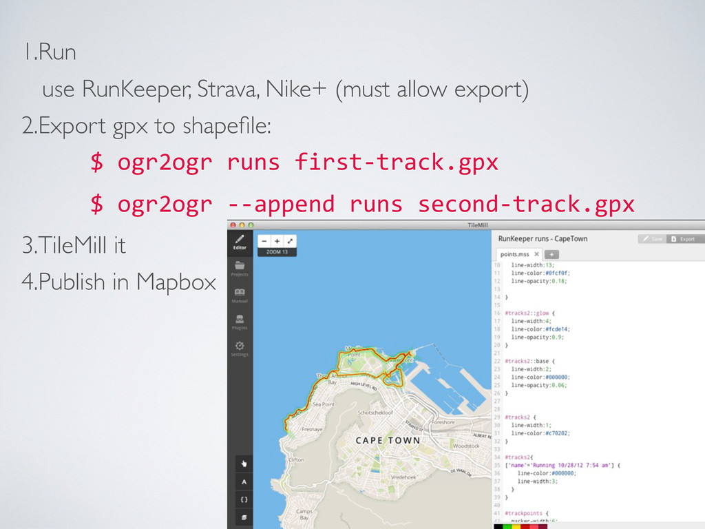
1.Run use RunKeeper, Strava, Nike+ (must allow export) 2.Export gpx
to shapefile: $ ogr2ogr runs first-‐track.gpx $ ogr2ogr -‐-‐append runs second-‐track.gpx 3.TileMill it 4.Publish in Mapbox
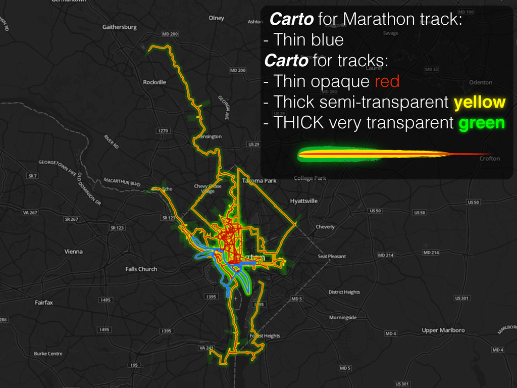
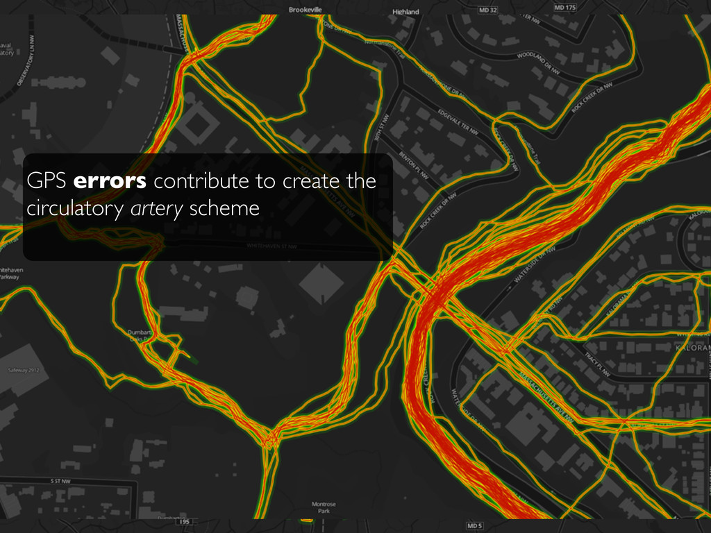
Carto for Marathon track: - Thin blue Carto for tracks:
- Thin opaque red - Thick semi-transparent yellow - THICK very transparent green
GPS errors contribute to create the circulatory artery scheme
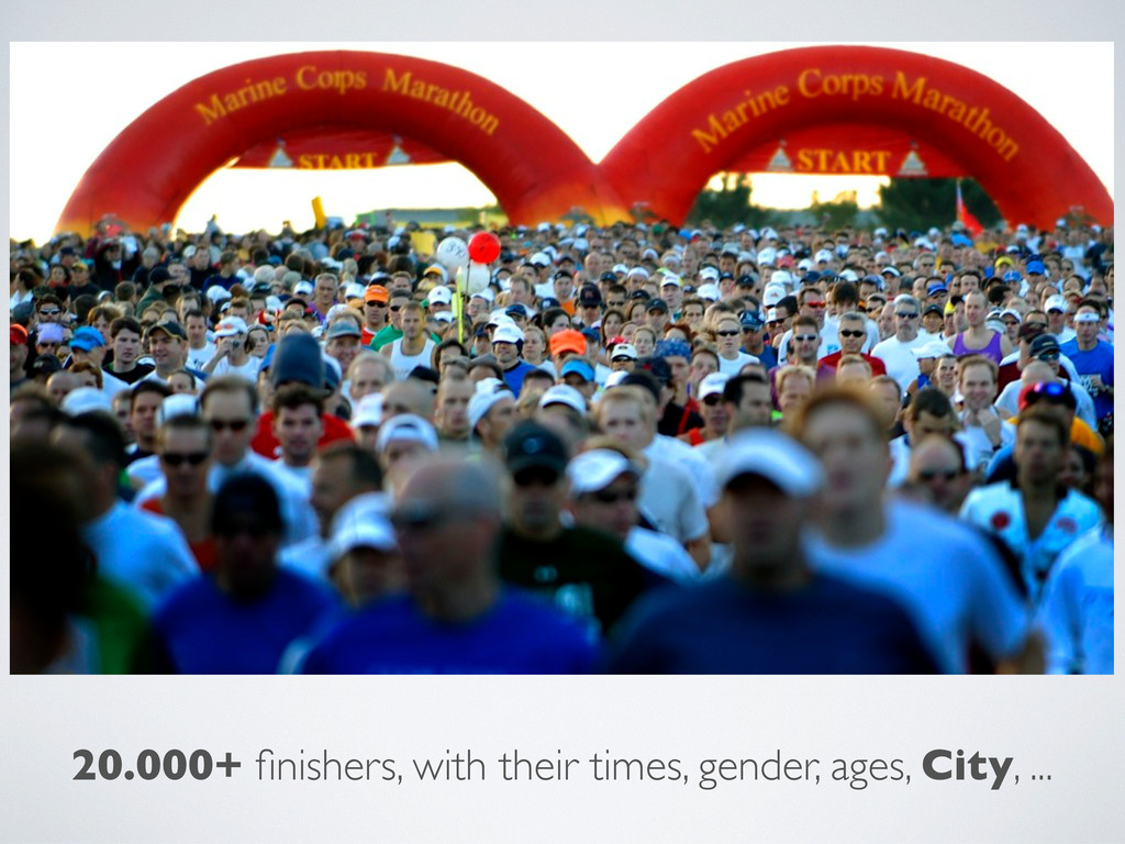
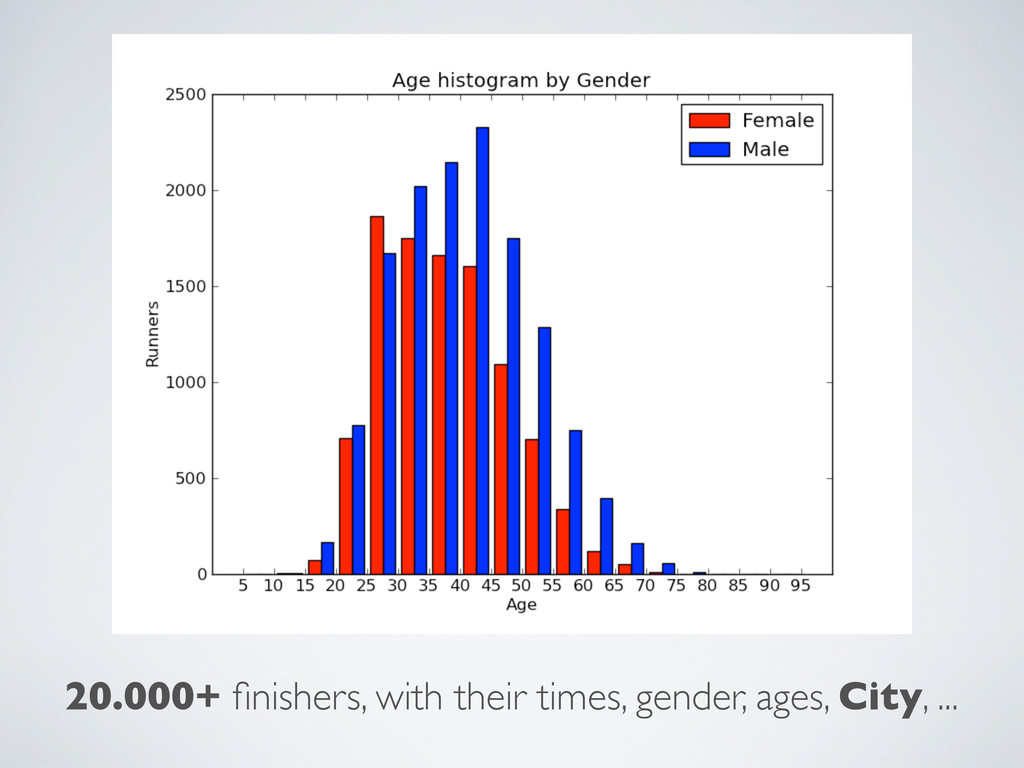
20.000+ finishers, with their times, gender, ages, City, ...
20.000+ finishers, with their times, gender, ages, City, ...
1.Run the Marine Corps Marathon [optional] 2.Import to Google Refine
to fix names and geocode (via Yahoo): 3.Aggregate data by city with python [Input]: Places=[r['Location'] for r in runner if 'Location' in r] ... 4.TileMill it 5.Publish in Mapbox
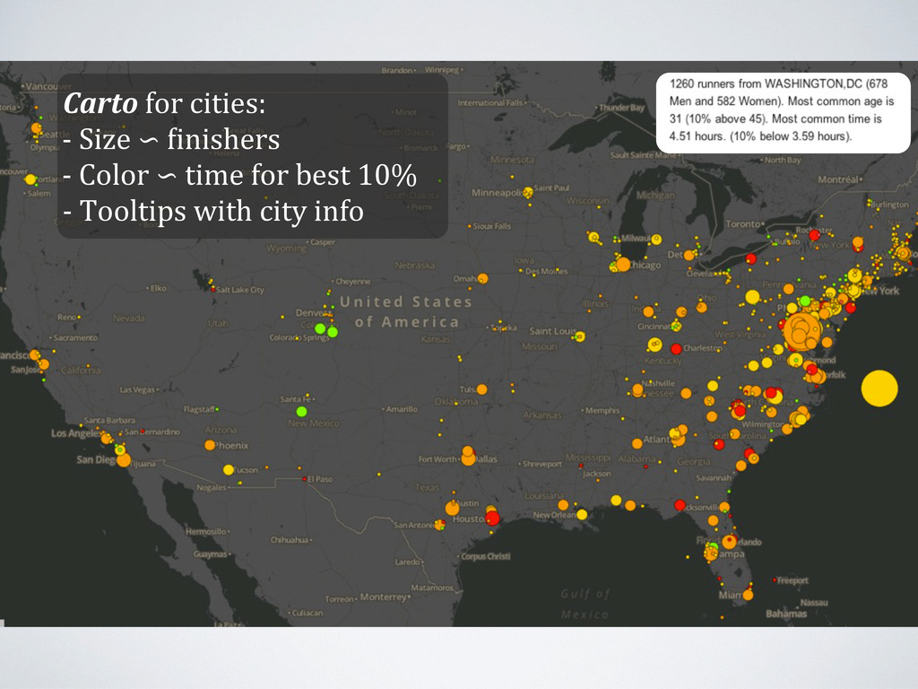
Carto for cities: -‐ Size ∽ /inishers -‐ Color ∽
time for best 10% -‐ Tooltips with city info
~40.000 steps (1 million steps in training) logging app with
export GPS Customize geo data Hosting + map layers Prepare (geo) data geolocation of city names analyze data
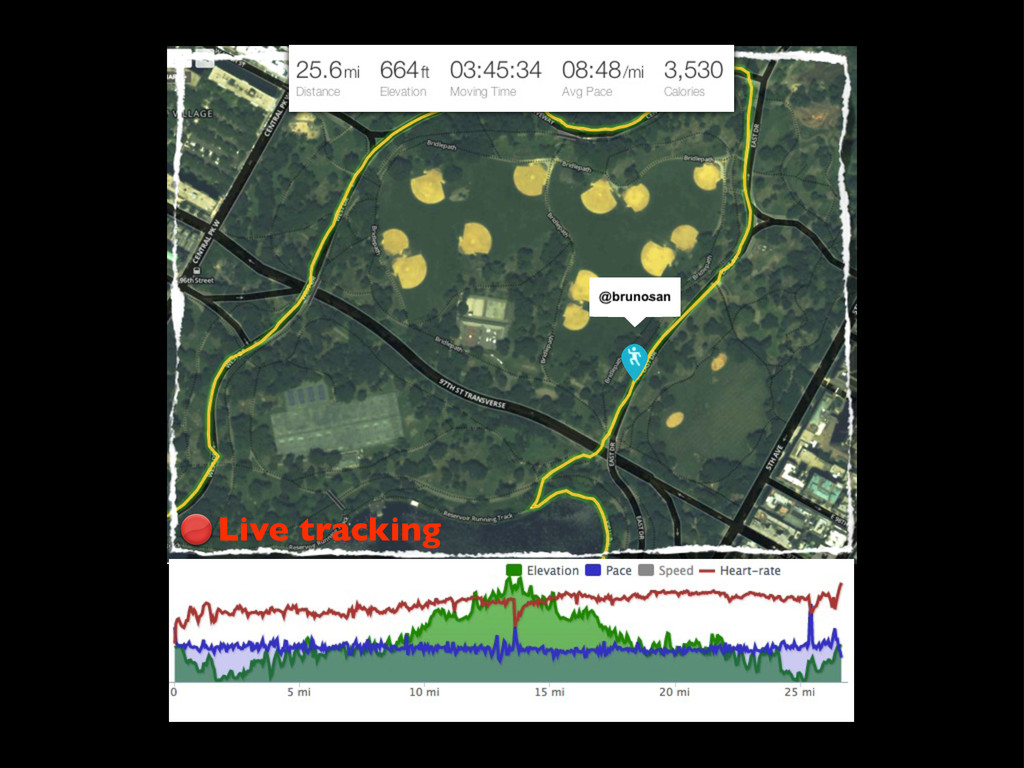
Live tracking
None
![1.Run the Marine Corps Marathon [optional] 2.Import to Google Refine](https://files.speakerdeck.com/presentations/c339498021ea01300e441231381b2534/slide_7.jpg)