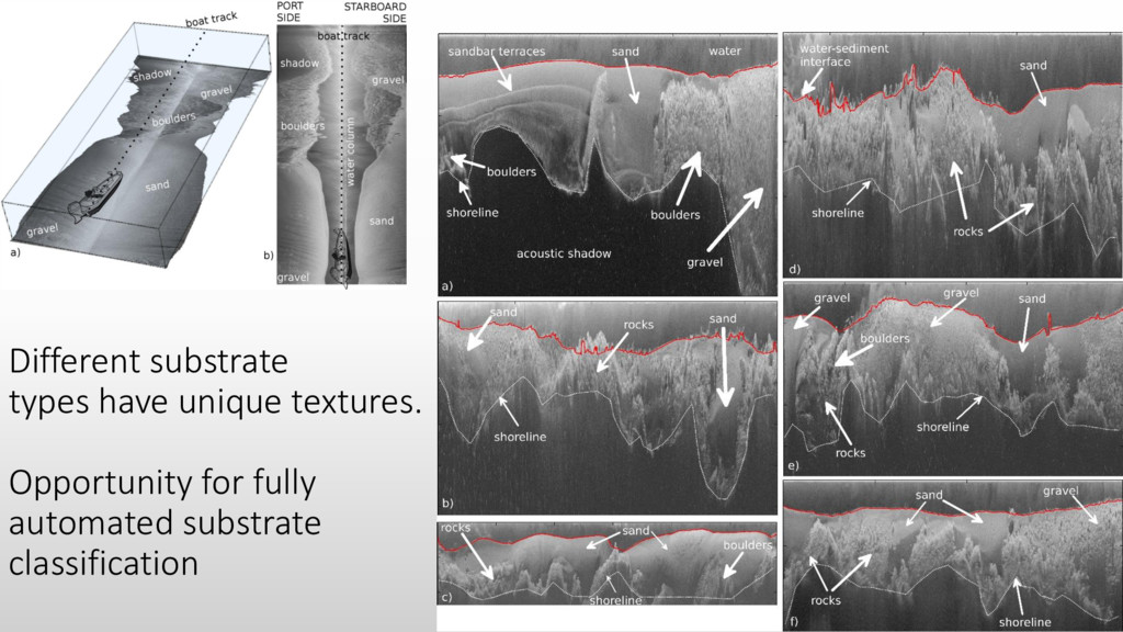
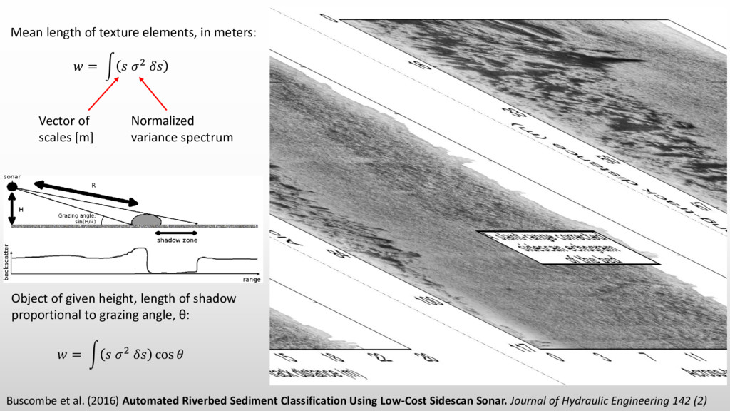
Sidescan Sonar. Journal of Hydraulic Engineering 142 (2) = න 2 Mean length of texture elements, in meters: = න 2 cos Normalized variance spectrum Vector of scales [m] Object of given height, length of shadow proportional to grazing angle, θ:
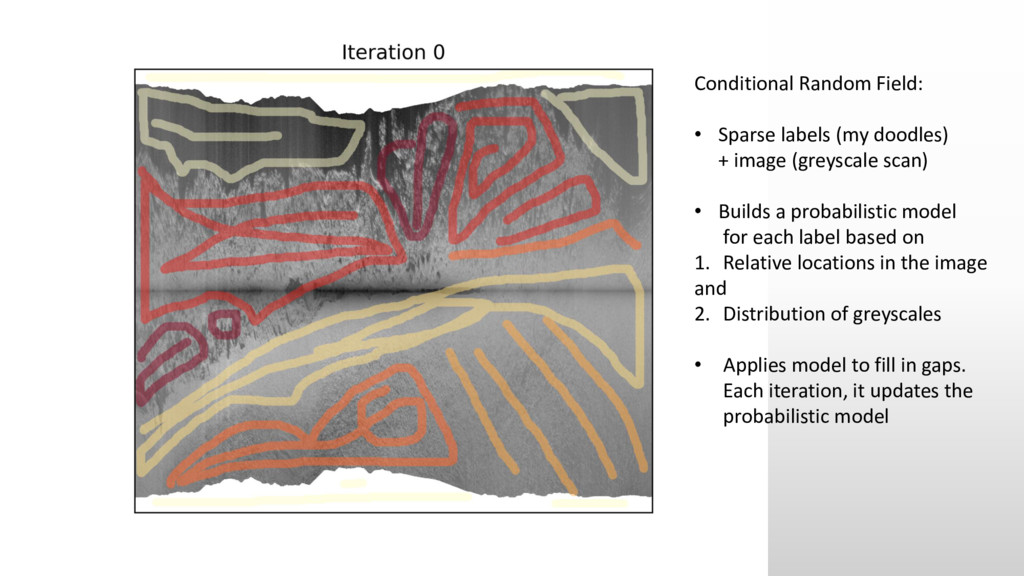
(greyscale scan) • Builds a probabilistic model for each label based on 1. Relative locations in the image and 2. Distribution of greyscales • Applies model to fill in gaps. Each iteration, it updates the probabilistic model
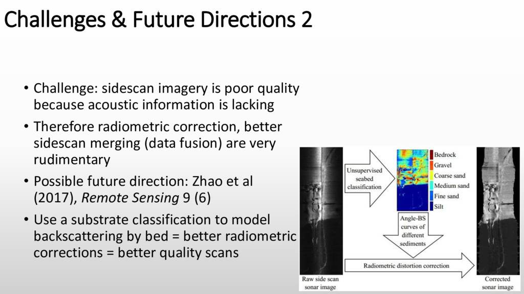
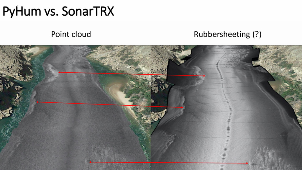
poor quality because acoustic information is lacking • Therefore radiometric correction, better sidescan merging (data fusion) are very rudimentary • Possible future direction: Zhao et al (2017), Remote Sensing 9 (6) • Use a substrate classification to model backscattering by bed = better radiometric corrections = better quality scans
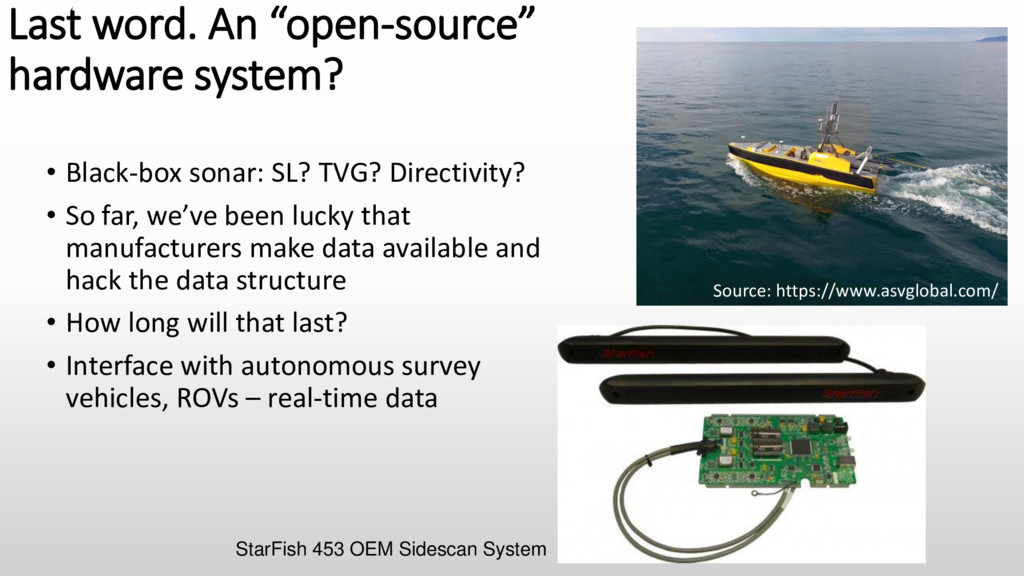
TVG? Directivity? • So far, we’ve been lucky that manufacturers make data available and hack the data structure • How long will that last? • Interface with autonomous survey vehicles, ROVs – real-time data Source: https://www.asvglobal.com/ StarFish 453 OEM Sidescan System
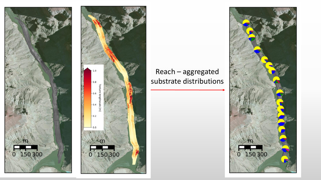
![Texture Lengthscale [m] Unsupervised substrate classification](https://files.speakerdeck.com/presentations/361b222326b7458c89428c7e556d6c13/slide_14.jpg)
![Unsupervised substrate classification Texture Lengthscale [m]](https://files.speakerdeck.com/presentations/361b222326b7458c89428c7e556d6c13/slide_17.jpg)