Upgrade to Pro
— share decks privately, control downloads, hide ads and more …
Speaker Deck
Features
Speaker Deck
PRO
Sign in
Sign up for free
Search
Search
FOSS4G 2015 Tokyo Vector Tiles Pt. 4
Search
Hidenori FUJIMURA
October 09, 2015
110
0
Share
Embed
Copy iframe code
Copy JS code
Copy link
Start on current slide
FOSS4G 2015 Tokyo Vector Tiles Pt. 4
Hidenori FUJIMURA
October 09, 2015
More Decks by Hidenori FUJIMURA
See All by Hidenori FUJIMURA
みんなに伝わる防災マップ
hfu
0
170
未来の繁栄のためのスマート地図
hfu
0
190
Smart Maps for the prosperity in the future
hfu
0
280
Smart Maps and Bazaar
hfu
0
210
Sensemaking with Smart Maps
hfu
0
140
Smart Maps for the United Nations, with the United Nations
hfu
0
190
UN Smart Maps
hfu
0
230
スマート地図バザールによる地図XMLのタイル配信
hfu
0
140
国土地理院におけるベース・レジストリの整備とDX推進への取り組み
hfu
0
330
Featured
See All Featured
The B2B funnel & how to create a winning content strategy
katarinadahlin
PRO
1
420
Leo the Paperboy
mayatellez
8
1.9k
Building an army of robots
kneath
306
46k
Organizational Design Perspectives: An Ontology of Organizational Design Elements
kimpetersen
PRO
1
760
StorybookのUI Testing Handbookを読んだ
zakiyama
31
6.8k
Testing 201, or: Great Expectations
jmmastey
46
8.2k
Refactoring Trust on Your Teams (GOTO; Chicago 2020)
rmw
35
3.5k
Ruling the World: When Life Gets Gamed
codingconduct
0
280
Building Experiences: Design Systems, User Experience, and Full Site Editing
marktimemedia
0
550
How to Align SEO within the Product Triangle To Get Buy-In & Support - #RIMC
aleyda
2
1.6k
Building the Perfect Custom Keyboard
takai
2
810
Visual Storytelling: How to be a Superhuman Communicator
reverentgeek
2
590
Transcript
Ministry of Land, Infrastructure, Transport and Tourism Geospatial Information Authority
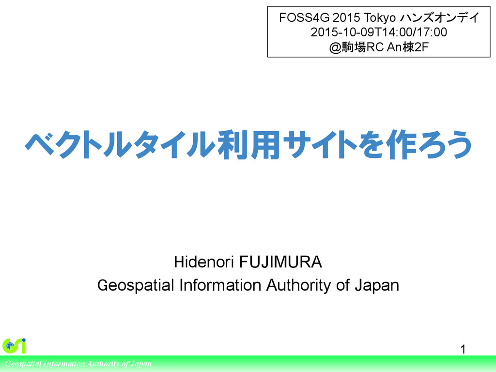
of Japan ベクトルタイル利用サイトを作ろう Hidenori FUJIMURA Geospatial Information Authority of Japan 1 FOSS4G 2015 Tokyo ハンズオンデイ 2015-10-09T14:00/17:00 @駒場RC An棟2F
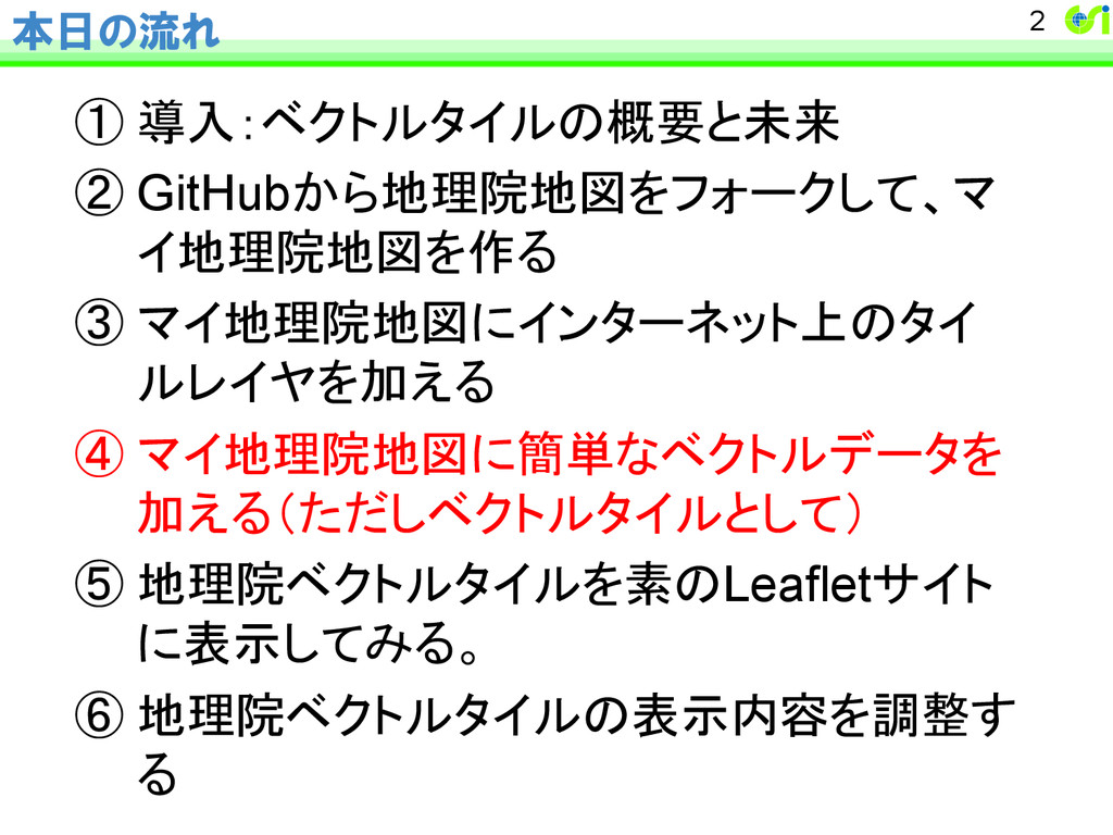
本日の流れ ① 導入:ベクトルタイルの概要と未来 ② GitHubから地理院地図をフォークして、マ イ地理院地図を作る ③ マイ地理院地図にインターネット上のタイ ルレイヤを加える ④ マイ地理院地図に簡単なベクトルデータを 加える(ただしベクトルタイルとして) ⑤ 地理院ベクトルタイルを素のLeafletサイト に表示してみる。
⑥ 地理院ベクトルタイルの表示内容を調整す る 2
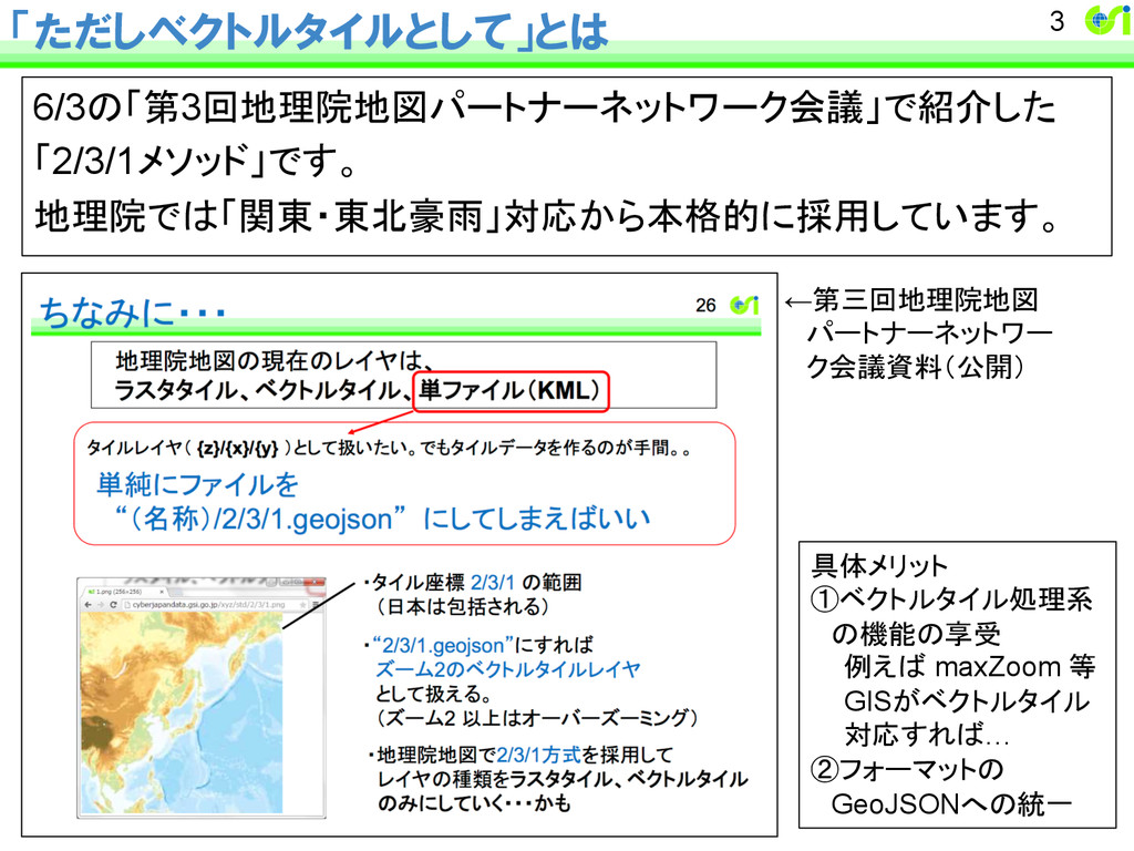
「ただしベクトルタイルとして」とは 6/3の「第3回地理院地図パートナーネットワーク会議」で紹介した 「2/3/1メソッド」です。 地理院では「関東・東北豪雨」対応から本格的に採用しています。 3 具体メリット ①ベクトルタイル処理系 の機能の享受 例えば maxZoom
等 GISがベクトルタイル 対応すれば… ②フォーマットの GeoJSONへの統一 ←第三回地理院地図 パートナーネットワー ク会議資料(公開)
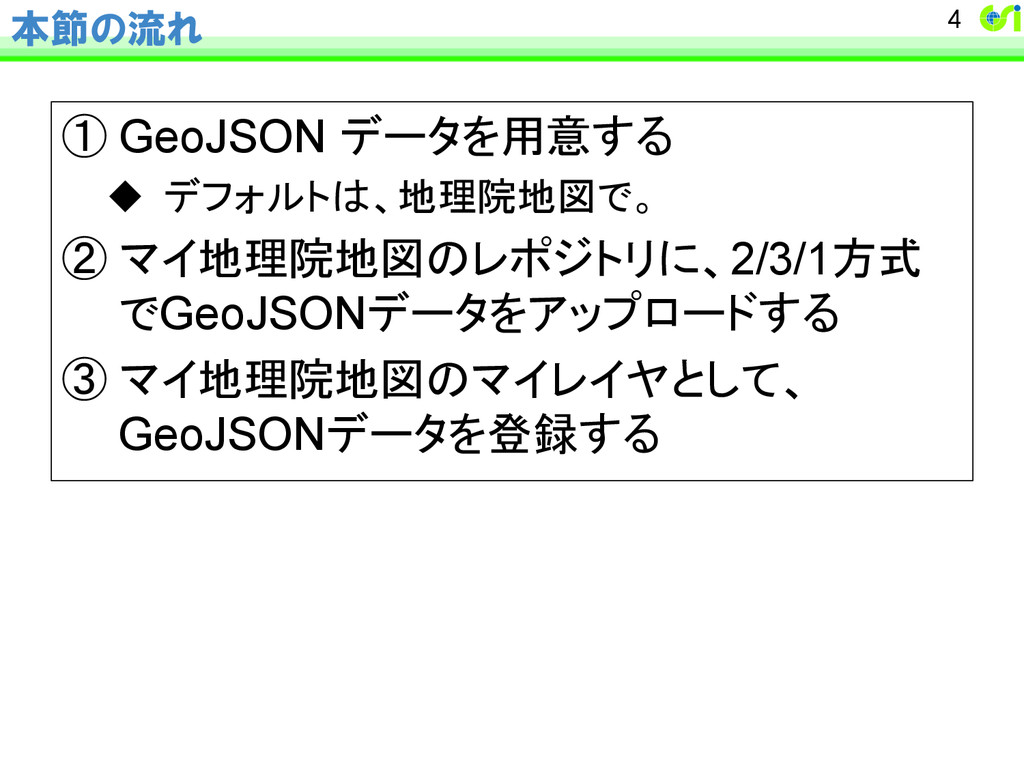
本節の流れ ① GeoJSON データを用意する u デフォルトは、地理院地図で。 ② マイ地理院地図のレポジトリに、2/3/1方式 でGeoJSONデータをアップロードする ③ マイ地理院地図のマイレイヤとして、 GeoJSONデータを登録する 4
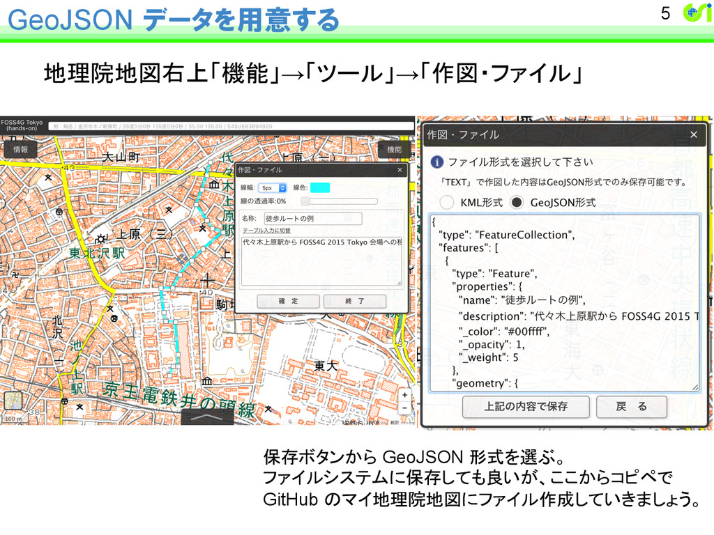
GeoJSON データを用意する 地理院地図右上「機能」→「ツール」→「作図・ファイル」 5 保存ボタンから GeoJSON 形式を選ぶ。 ファイルシステムに保存しても良いが、ここからコピペで GitHub のマイ地理院地図にファイル作成していきましょう。
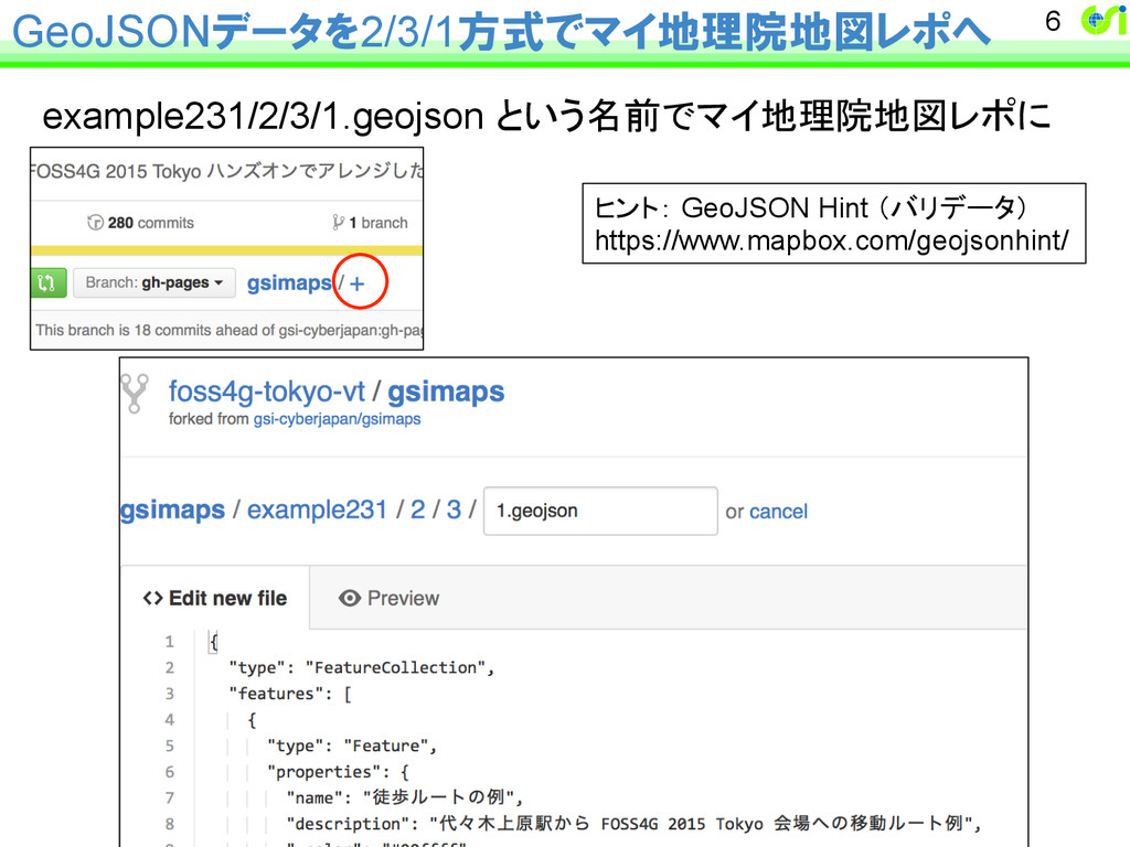
GeoJSONデータを2/3/1方式でマイ地理院地図レポへ example231/2/3/1.geojson という名前でマイ地理院地図レポに 6 ヒント: GeoJSON Hint (バリデータ) https://www.mapbox.com/geojsonhint/
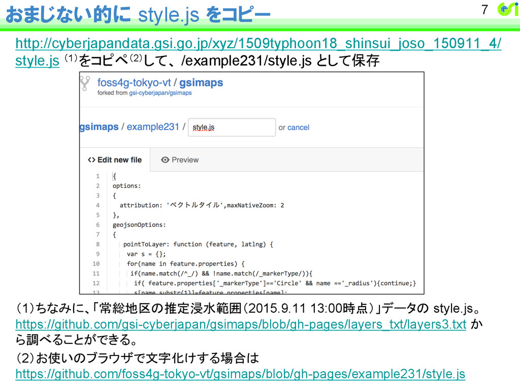
おまじない的に style.js をコピー http://cyberjapandata.gsi.go.jp/xyz/1509typhoon18_shinsui_joso_150911_4/ style.js (1)をコピペ(2)して、 /example231/style.js として保存 (1)ちなみに、「常総地区の推定浸水範囲(2015.9.11 13:00時点)」データの
style.js。 https://github.com/gsi-cyberjapan/gsimaps/blob/gh-pages/layers_txt/layers3.txt か ら調べることができる。 (2)お使いのブラウザで文字化けする場合は https://github.com/foss4g-tokyo-vt/gsimaps/blob/gh-pages/example231/style.js 7
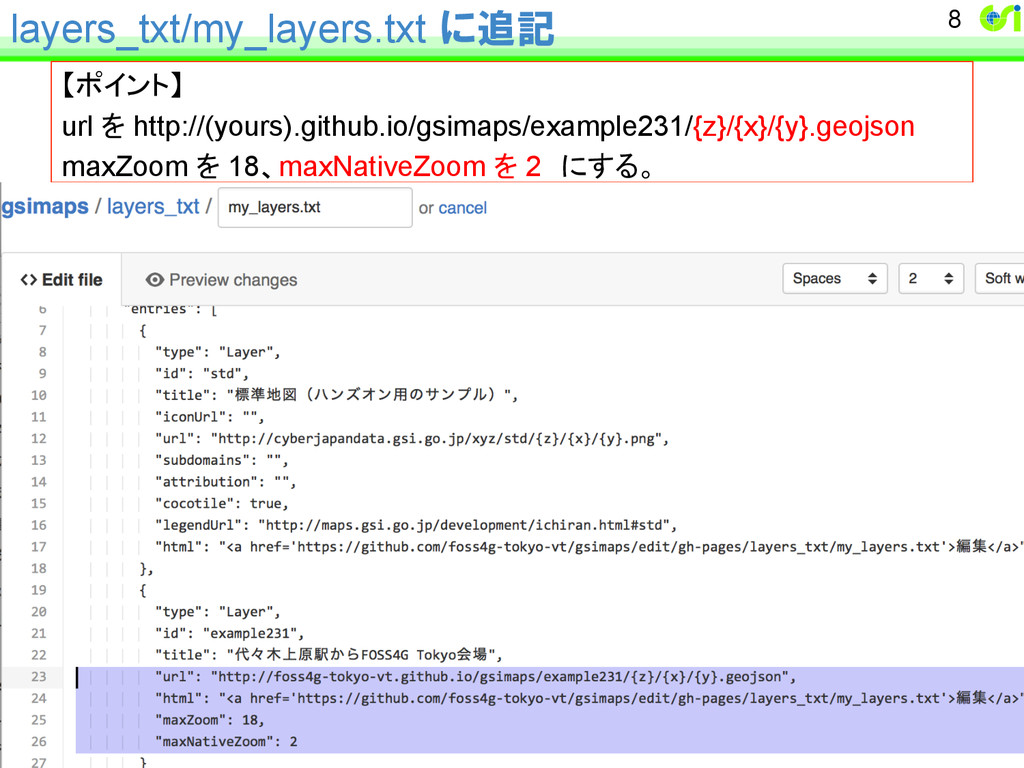
layers_txt/my_layers.txt に追記 【ポイント】 url を http://(yours).github.io/gsimaps/example231/{z}/{x}/{y}.geojson maxZoom を 18、maxNativeZoom を
2 にする。 8
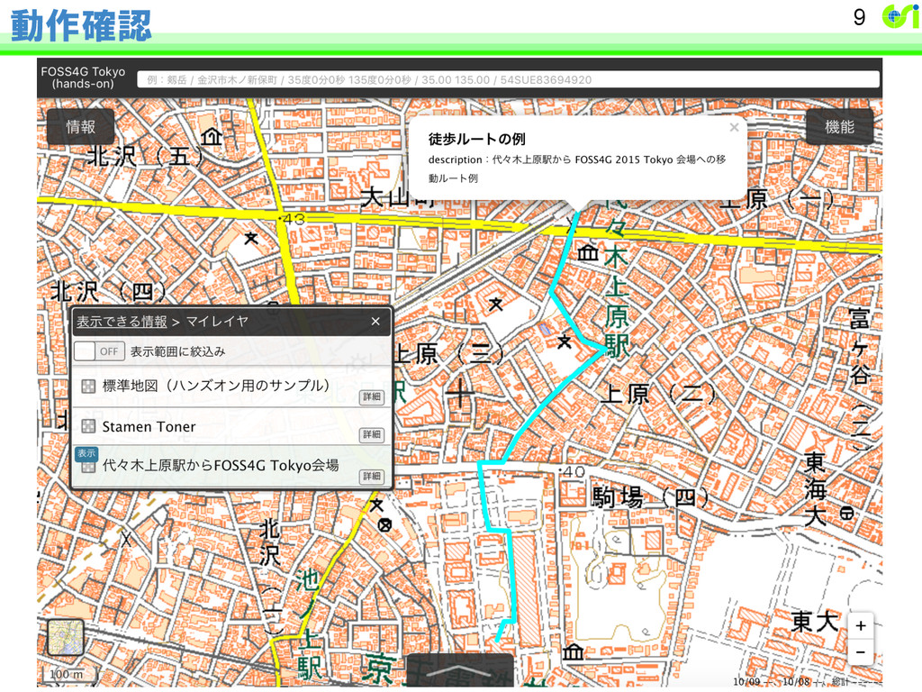
動作確認 9