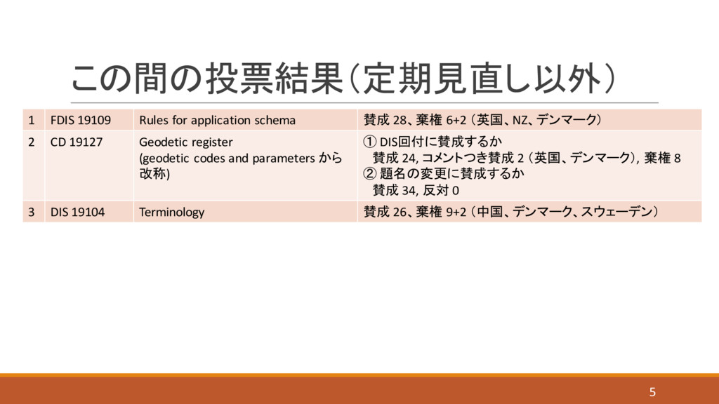
registration -- Part 2: XML schema implementation 1 英 15 8 11 2 19133 Location-based services -- Tracking and navigation 0 14 Harmonize with 19148 (Linear referencing) 9 12 3 19129 Imagery, gridded and coverage data framework 1 独 2 21 11 4 19128 Web map server interface 0 1 デンマーク 24 10 5 19123 Schema for coverage geometry and functions 0 15 9 11 6 19112 Spatial referencing by geographic identifiers 0 15 9 11 7 19108 Temporal schema 0 1 デンマーク 23 11 The standard was developed in preparation for other Imagery standards, like ISO/TS 19130. Today, it has no meaning anymore. 19115, 19117, 19119 が更新 6
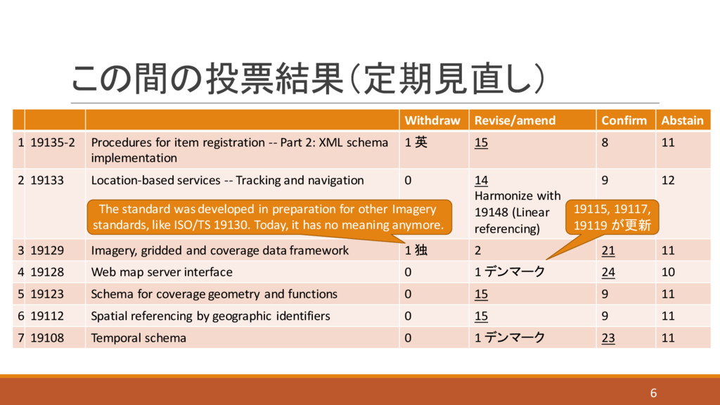
at the 41st ISO/TC 211 plenary meeting in Sydney 2015-12-10/11, regarding possible adoption as an ISO/TC 211 Technical Report → ISO/TC 211 で採択されても、具体的な影響力が発生するような技術報告書ではない。 (対処方針案) このタイミングで採択をしたい理由について、できるだけ聴取する。 1 CEN/TR 15449-1 reference model 2 CEN/TR 15449-2 best practices 3 CEN/TR 15449-3 data centric view 4 CEN/TR 15449-4 service centric view 5 CEN/TR 15449-5 validation and testing 7 ※次頁参照
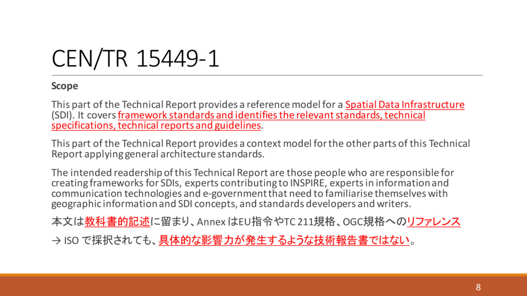
a reference model for a Spatial Data Infrastructure (SDI). It covers framework standards and identifies the relevant standards, technical specifications, technical reports and guidelines. This part of the Technical Report provides a context model for the other parts of this Technical Report applying general architecture standards. The intended readership of this Technical Report are those people who are responsible for creating frameworks for SDIs, experts contributing to INSPIRE, experts in information and communication technologies and e-government that need to familiarise themselves with geographic information and SDI concepts, and standards developers and writers. 本文は教科書的記述に留まり、Annex はEU指令やTC 211規格、OGC規格へのリファレンス → ISO で採択されても、具体的な影響力が発生するような技術報告書ではない。 8
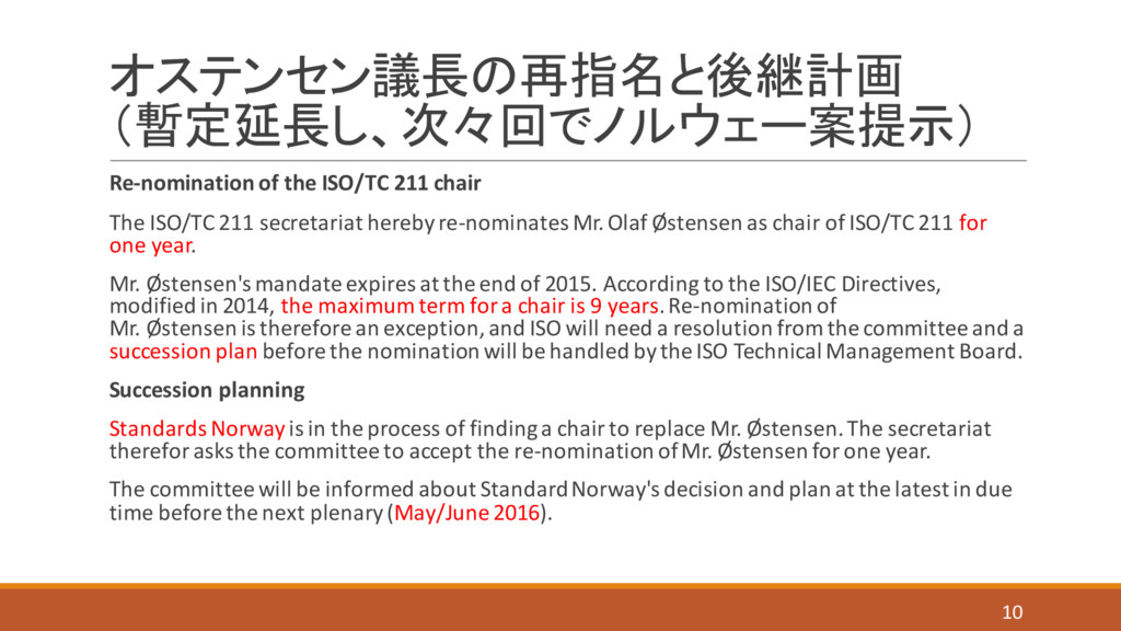
211 secretariat hereby re-nominates Mr. Olaf Østensen as chair of ISO/TC 211 for one year. Mr. Østensen's mandate expires at the end of 2015. According to the ISO/IEC Directives, modified in 2014, the maximum term for a chair is 9 years. Re-nomination of Mr. Østensen is therefore an exception, and ISO will need a resolution from the committee and a succession plan before the nomination will be handled by the ISO Technical Management Board. Succession planning Standards Norway is in the process of finding a chair to replace Mr. Østensen. The secretariat therefor asks the committee to accept the re-nomination of Mr. Østensen for one year. The committee will be informed about Standard Norway's decision and plan at the latest in due time before the next plenary (May/June 2016). 10
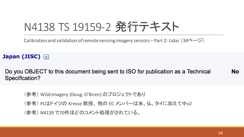
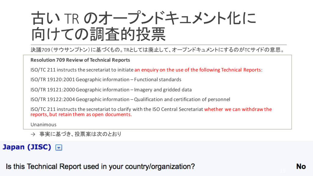
Reports ISO/TC 211 instructs the secretariat to initiate an enquiry on the use of the following Technical Reports: ISO/TR 19120:2001 Geographic information –Functional standards ISO/TR 19121:2000 Geographic information –Imagery and gridded data ISO/TR 19122:2004 Geographic information –Qualification and certification of personnel ISO/TC 211 instructs the secretariat to clarify with the ISO Central Secretariat whether we can withdraw the reports, but retain them as open documents. Unanimous → 事実に基づき、投票案は次のとおり 15
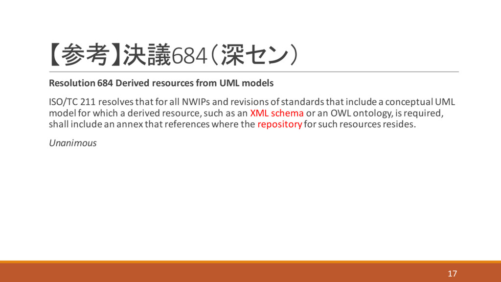
resolves that for all NWIPs and revisions of standards that include a conceptual UML model for which a derived resource, such as an XML schema or an OWL ontology, is required, shall include an annex that references where the repositoryfor such resources resides. Unanimous 17