Upgrade to Pro — share decks privately, control downloads, hide ads and more …

Bringing Old Maps & Illustrated Maps to the Web...

Bringing Old Maps & Illustrated Maps to the Web: 10 Years of Maplat and Turning Misalignment into Innovation /maplat-foss4g-hiroshima-2026-talk

FOSS4G Hiroshima 2026 General Talk session, Sep. 2nd 2026, Room: Dahlia 2

Maplat is an open-source platform enabling bidirectional coordinate transformation between historical or illustrated maps and modern maps. Celebrating its 10th anniversary, this talk covers the project's technology, real-world applications, and philosophy — including ongoing developments and open challenges we would love to explore together with the community.

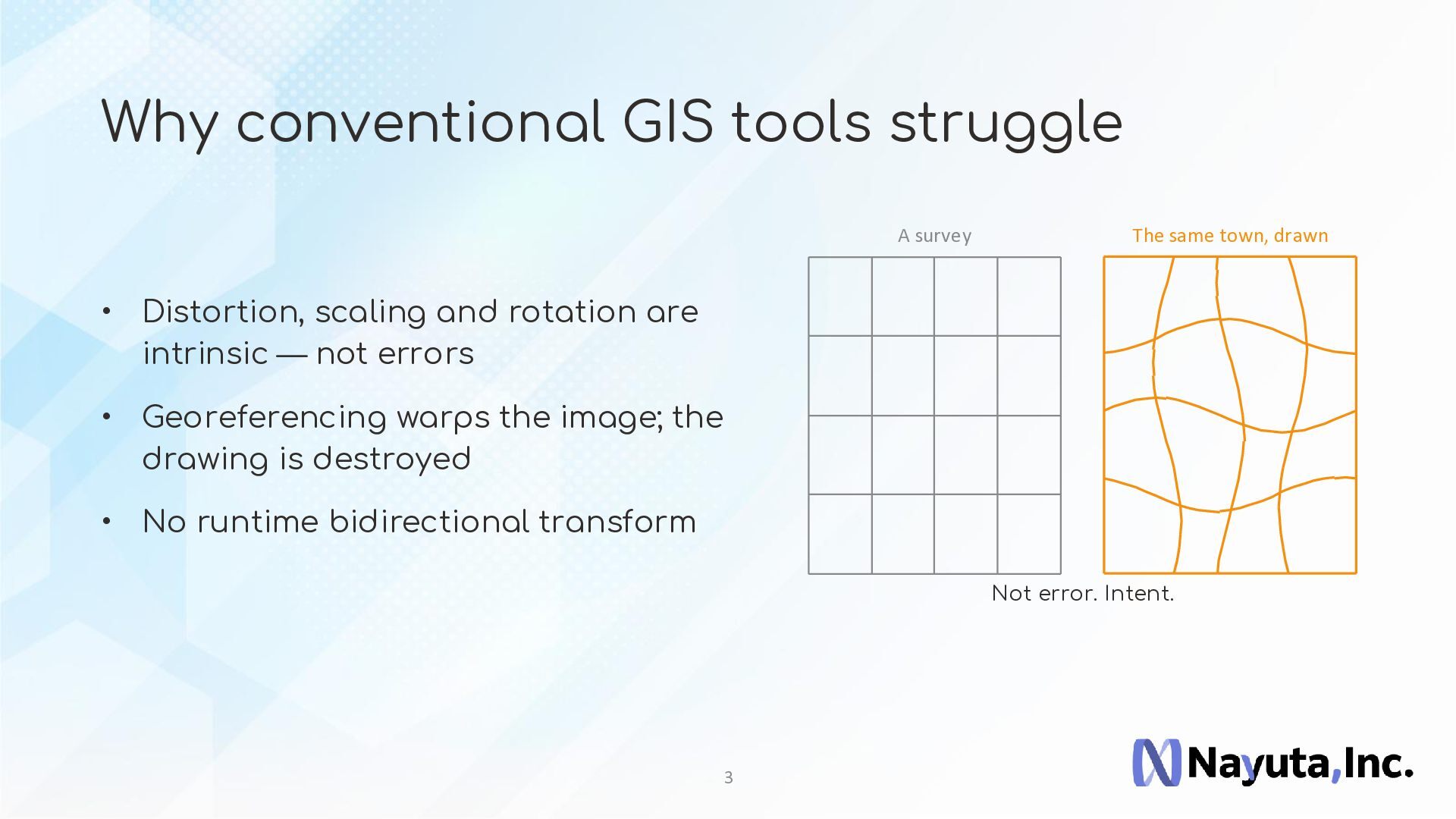
Historical maps and hand-drawn tourist illustrated maps are difficult to handle with conventional GIS tools due to their distortion, scaling, and rotation. Maplat addresses this through a proprietary coordinate transformation engine built on Japanese-patented technology, achieving high-accuracy bidirectional coordinate transformation between any such map image and modern maps — within 2D space.

10 Years of Maplat: Where We Came From and Where We Stand
Why conventional GIS tools struggle with historical and illustrated maps
Real-world use cases (Niigata Kagai Project and others (NOTE: Example was changed to Yamagata archive in actual presentation))
Current state of development and commercialization by Nayuta Inc.
Turning "Misalignment" into a Positive Force
Historical and illustrated maps never align perfectly with modern maps. Rather than treating this as a defect, Maplat embraces it as meaningful information — a reflection of the era, purpose, and culture in which each map was created. By transforming this misalignment into a bidirectional coordinate transformation system within 2D space, Maplat has delivered a practical solution for historical GIS, cultural heritage, and tourism applications. This philosophy is at the heart of Maplat's innovation.

Future Directions and Open Challenges
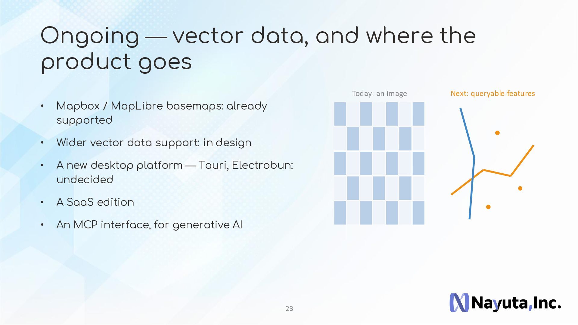
Ongoing development including expanded support for vector data
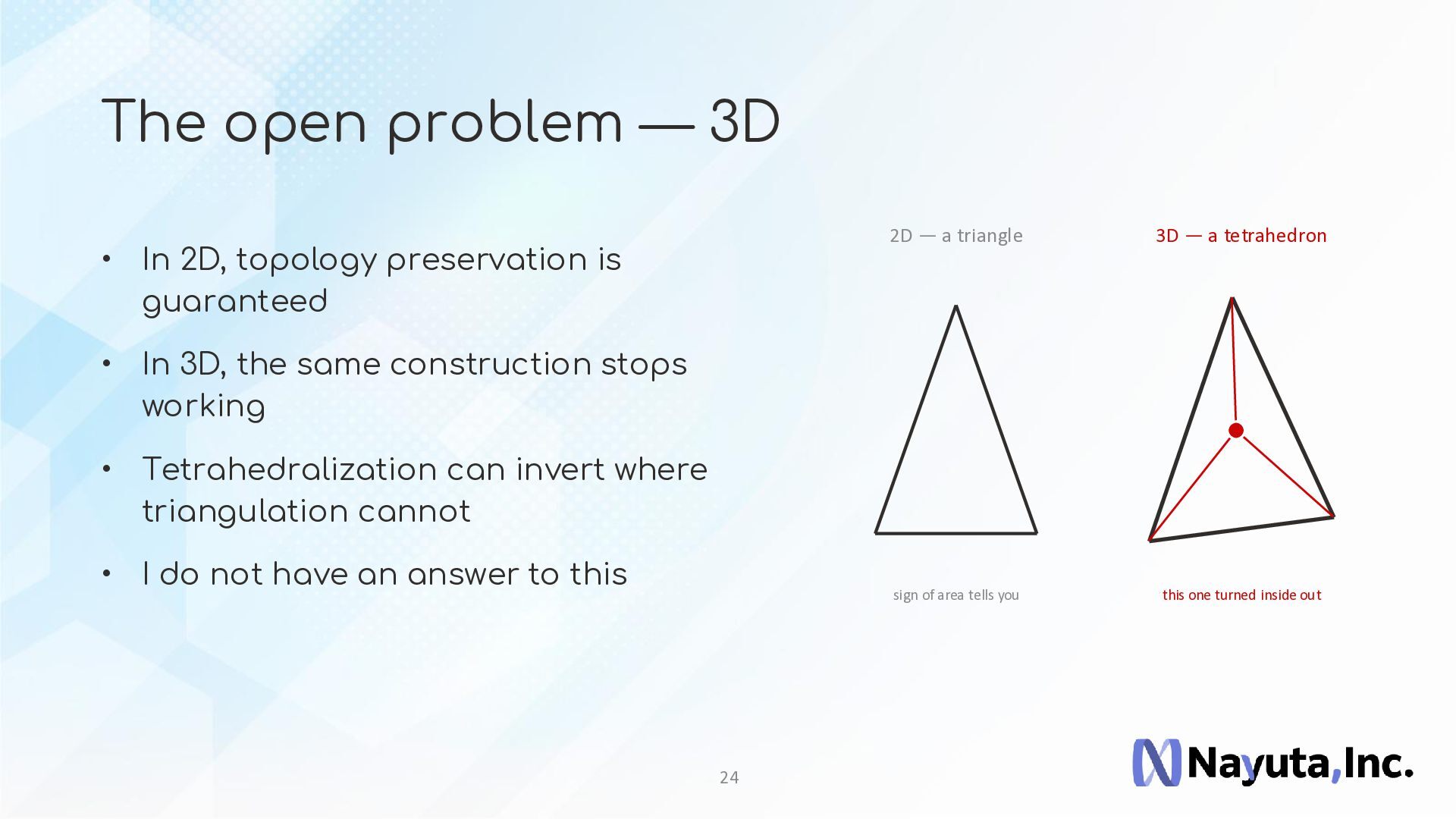
The exciting yet unsolved challenge of 3D extension — the "misalignment as a feature" approach that works elegantly in 2D breaks down when carried into 3D space, and this remains a fundamental open question
We would love to hear ideas and insights from the audience on how to move forward
Maplat is still a relatively unknown project, but for those interested in humanities-oriented GIS — history, culture, and tourism — and for anyone who sees potential in embracing the "imperfection" of maps, we hope this talk sparks an inspiring discussion.

Avatar for Code for History

Code for History

September 02, 2026

More Decks by Code for History

Other Decks in Technology

Transcript

  1. Bringing Old Maps & Illustrated Maps to the Web: 10

    Years of M and Turning Misalignment into Innovation KOHEI OTSUKA — CTO, Nayuta, Inc. FOSS4G HIROSHIMA 2026 | 2 Sep 2026, 11:00 | Dahlia2
  2. P ar t 1 M — ten years Where we

    came from, and where we stand 2
  3. Why conventional GIS tools struggle A survey The same town,

    drawn • Distortion, scaling and rotation are intrinsic — not errors • Georeferencing warps the image; the drawing is destroyed • No runtime bidirectional transform Not error. Intent. 3
  4. Yamagata Archive — a public archive of old maps •

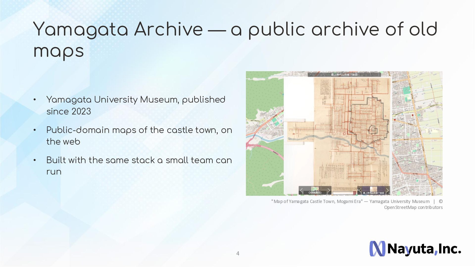
    Yamagata University Museum, published since 2023 • Public-domain maps of the castle town, on the web • Built with the same stack a small team can run "Map of Yamagata Castle Town, Mogami Era" — Yamagata University Museum | © OpenStreetMap contributors 4
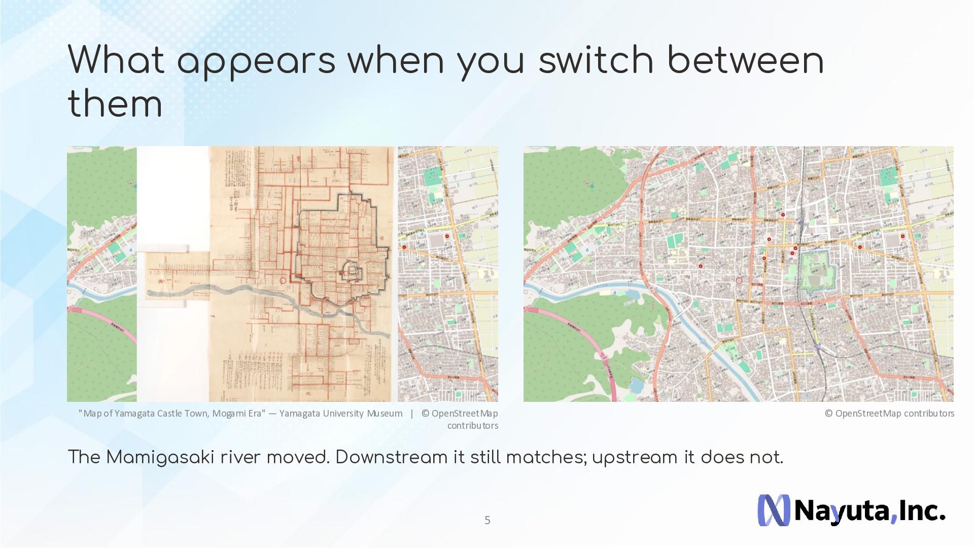
  5. What appears when you switch between them "Map of Yamagata

    Castle Town, Mogami Era" — Yamagata University Museum | © OpenStreetMap contributors The Mamigasaki river moved. Downstream it still matches; upstream it does not. 5 © OpenStreetMap contributors
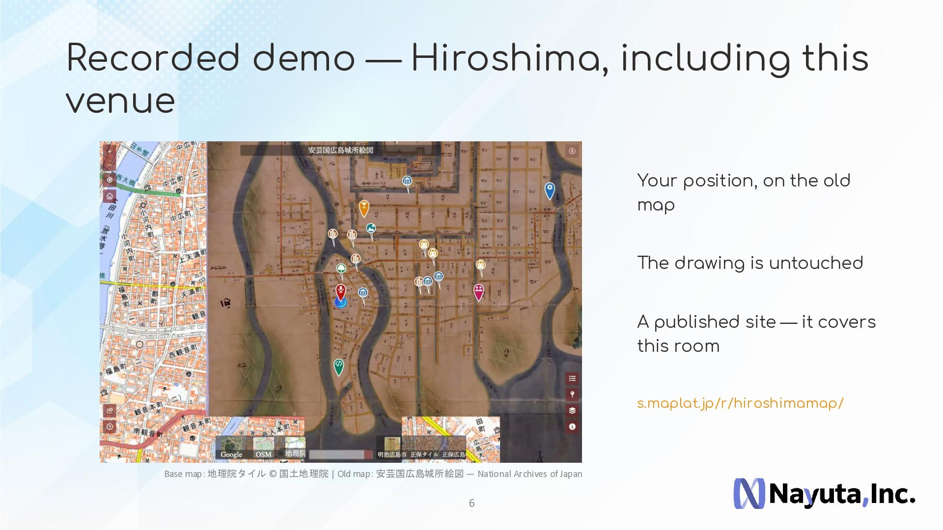
  6. Recorded demo — Hiroshima, including this venue Your position, on

    the old map The drawing is untouched A published site — it covers this room s.maplat.jp/r/hiroshimamap/ Base map: 地理院タイル © 国土地理院 | Old map: 安芸国広島城所絵図 — National Archives of Japan 6
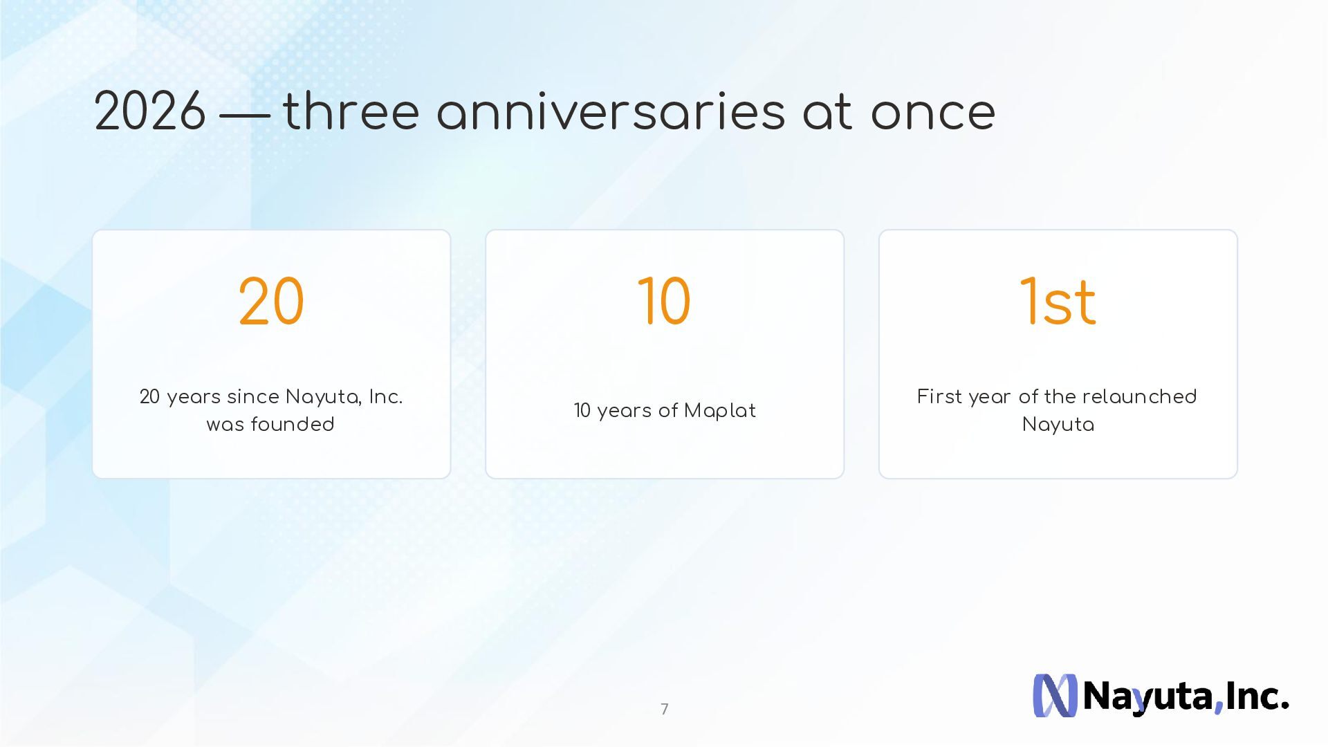
  7. 2026 — three anniversaries at once 20 10 1st 20

    years since Nayuta, Inc. was founded 10 years of Maplat First year of the relaunched Nayuta 7
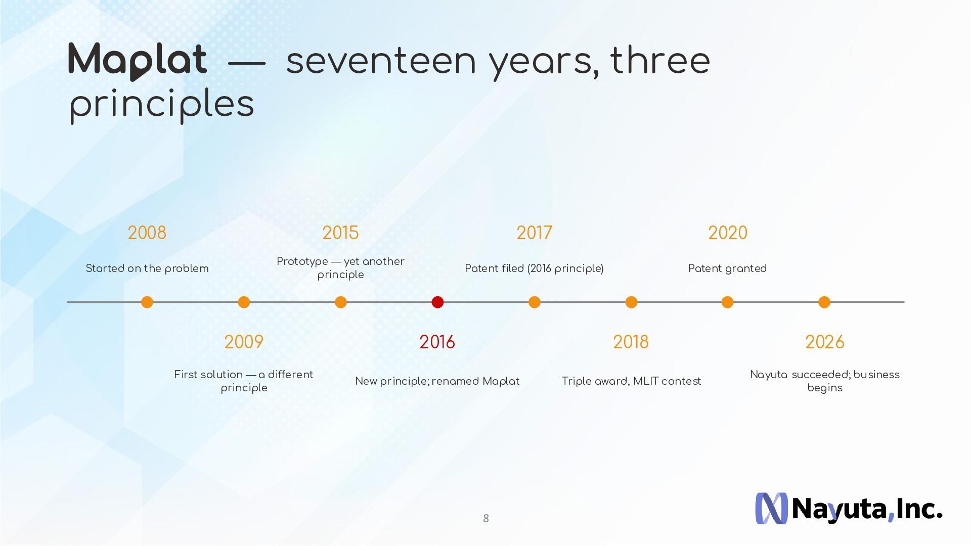
  8. M — seventeen years, three principles 2008 2015 2017 2020

    Started on the problem Prototype — yet another principle Patent filed (2016 principle) Patent granted 2009 2016 2018 2026 First solution — a different principle New principle; renamed Maplat Triple award, MLIT contest Nayuta succeeded; business begins 8
  9. Patent and open source, together • Japanese patent 6684776 —

    held by the inventor, personally • Nayuta, Inc. develops and delivers it as a business • Shipped under the Apache License 2.0 • Five repositories — Version 1.0 (release candidate) Earlier patent 5810411 — filed 2011, granted 2015. Sole inventor; rights not held (work for hire) 9
  10. P ar t 2 Turning misalignment into innovation The philosophy

    at the heart of Maplat: every map has its own rationality 10
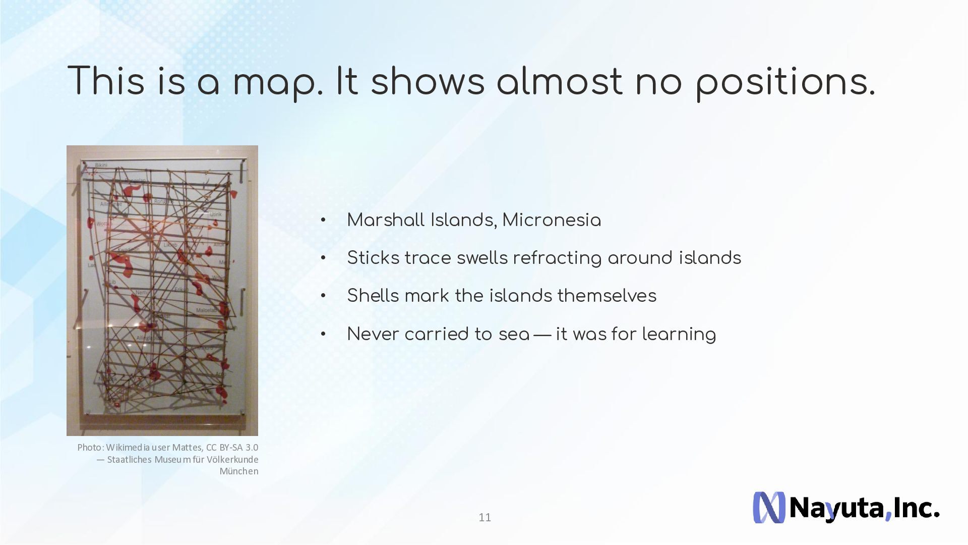
  11. This is a map. It shows almost no positions. •

    Marshall Islands, Micronesia • Sticks trace swells refracting around islands • Shells mark the islands themselves • Never carried to sea — it was for learning Photo: Wikimedia user Mattes, CC BY-SA 3.0 — Staatliches Museum für Völkerkunde München 11
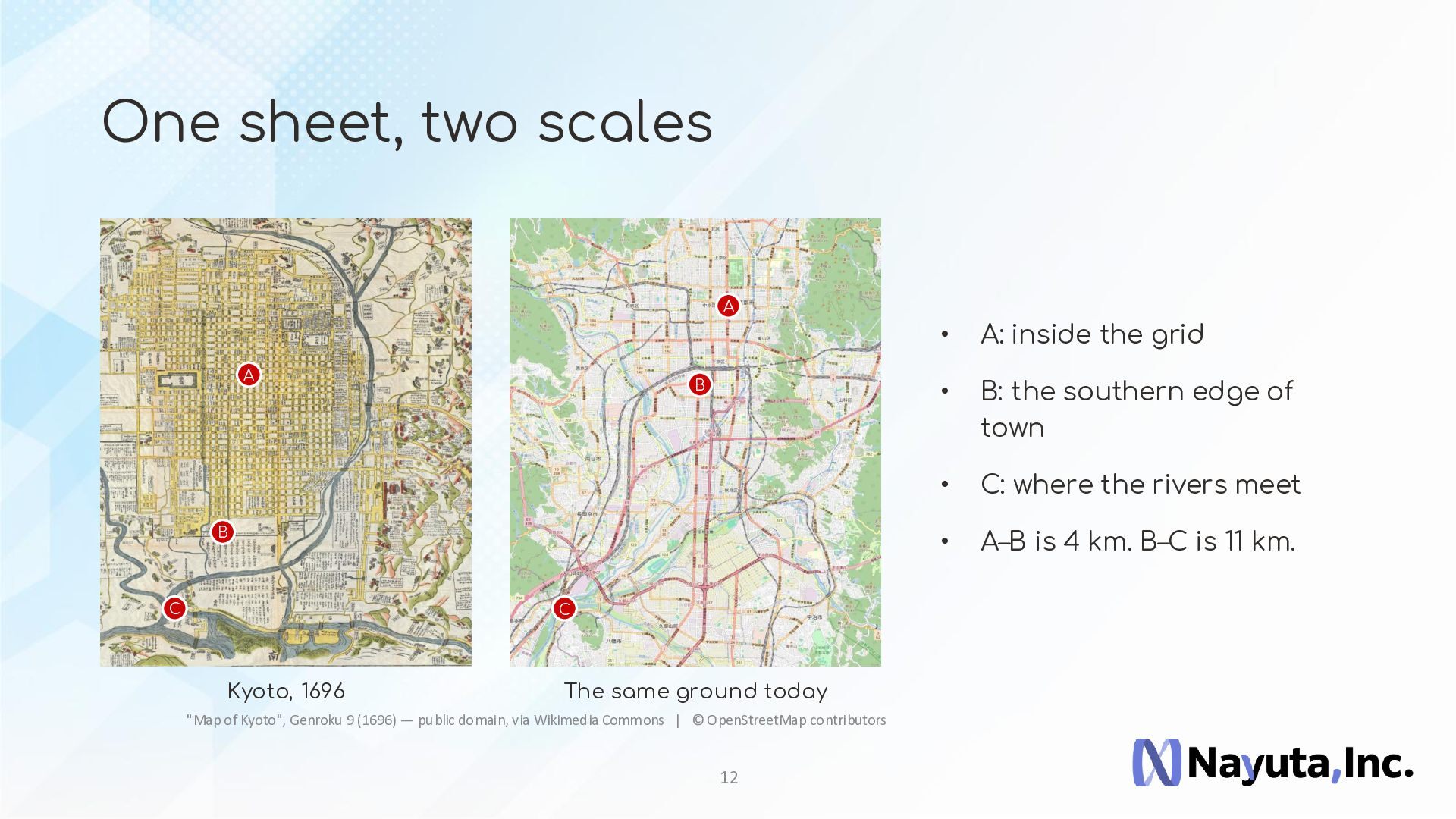
  12. One sheet, two scales A A B B C C

    Kyoto, 1696 The same ground today "Map of Kyoto", Genroku 9 (1696) — public domain, via Wikimedia Commons | © OpenStreetMap contributors 12 • A: inside the grid • B: the southern edge of town • C: where the rivers meet • A–B is 4 km. B–C is 11 km.
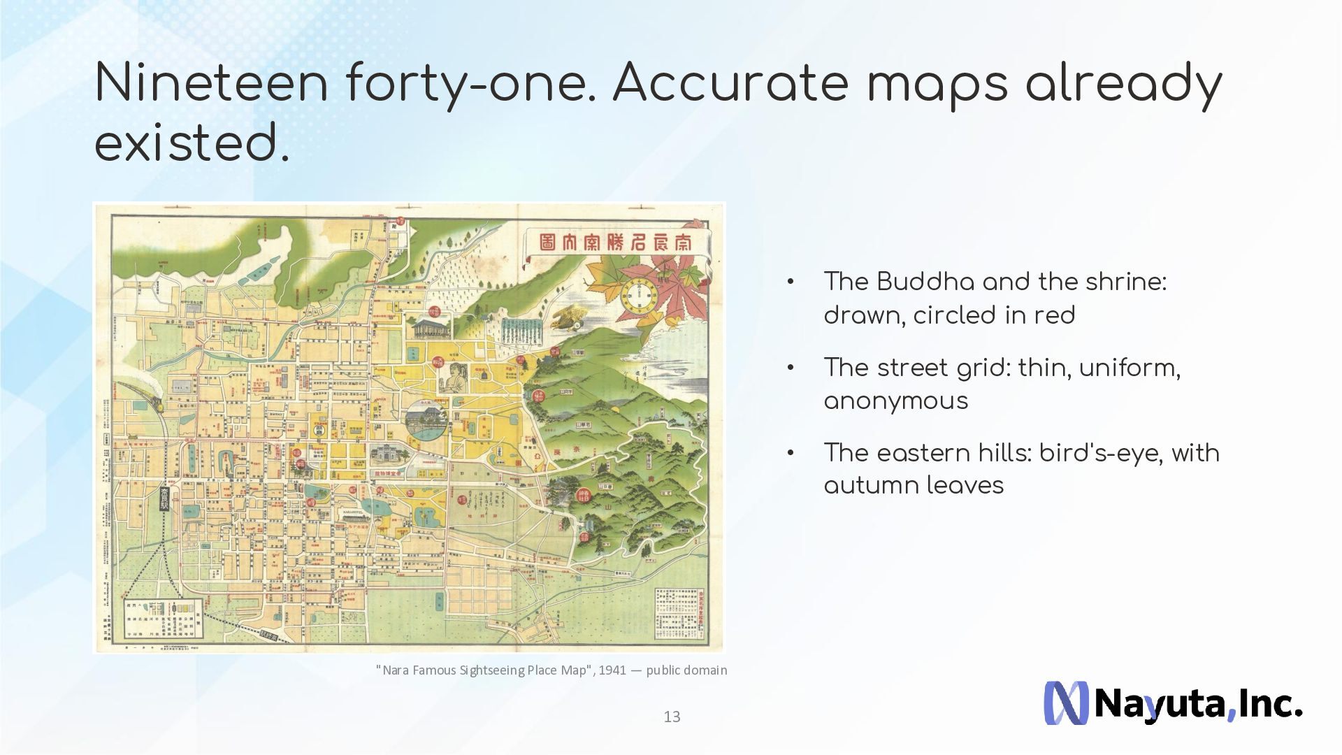
  13. Nineteen forty-one. Accurate maps already existed. "Nara Famous Sightseeing Place

    Map", 1941 — public domain 13 • The Buddha and the shrine: drawn, circled in red • The street grid: thin, uniform, anonymous • The eastern hills: bird's-eye, with autumn leaves
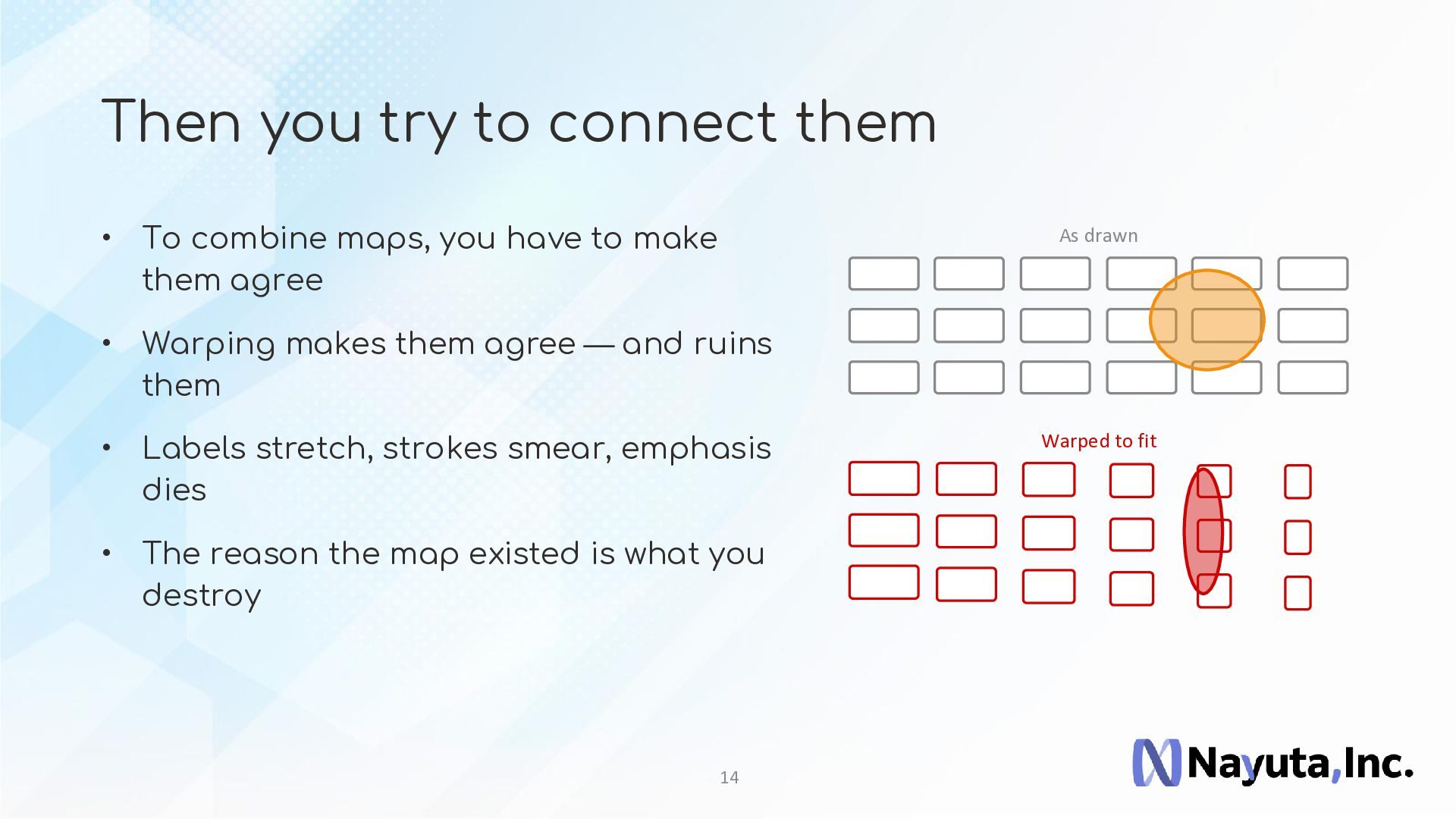
  14. Then you try to connect them • To combine maps,

    you have to make them agree As drawn • Warping makes them agree — and ruins them • Labels stretch, strokes smear, emphasis dies • The reason the map existed is what you destroy 14 Warped to fit
  15. Keep the drawing. Connect it anyway. Then inaccuracy stops being

    a weakness. The gap records the era, the purpose and the culture the map was drawn for. 15
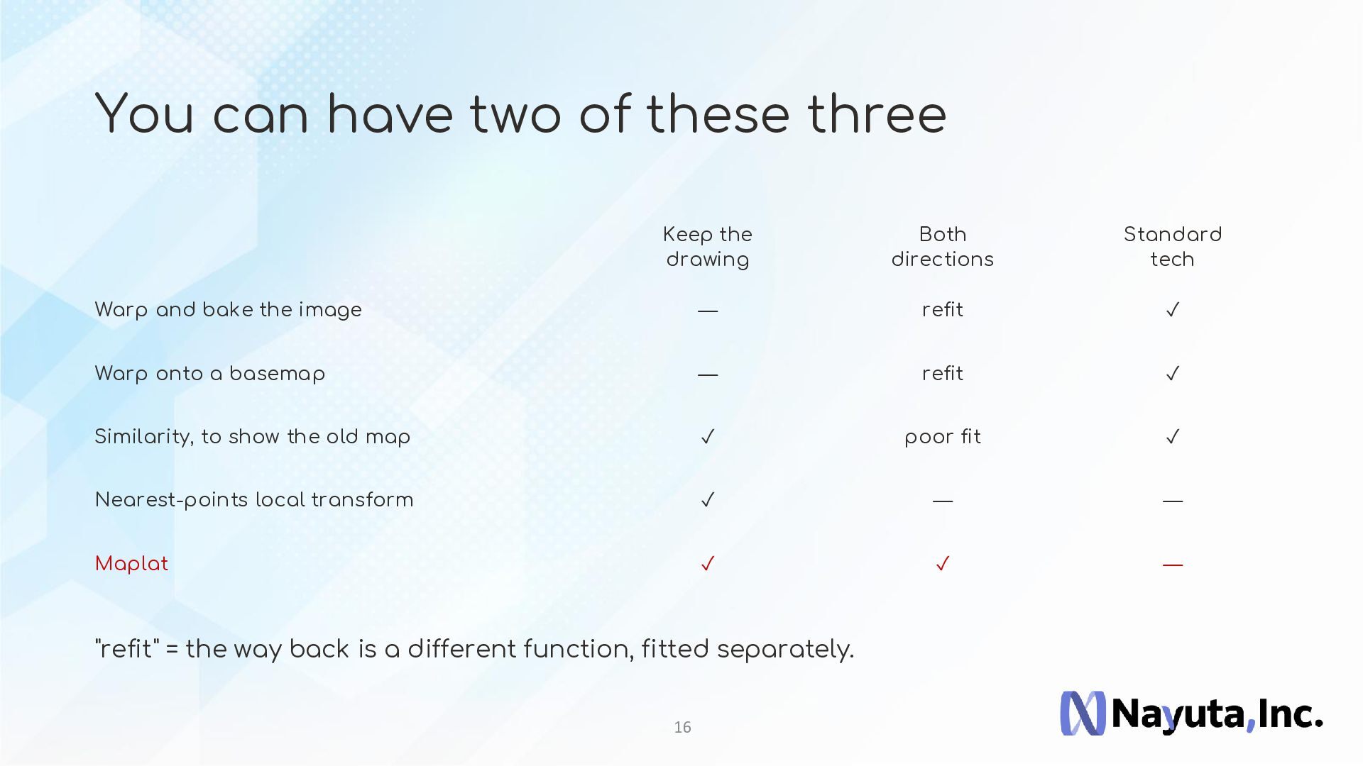
  16. You can have two of these three Keep the drawing

    Both directions Standard tech Warp and bake the image — refit ✓ Warp onto a basemap — refit ✓ Similarity, to show the old map ✓ poor fit ✓ Nearest-points local transform ✓ — — Maplat ✓ ✓ — "refit" = the way back is a different function, fitted separately. 16
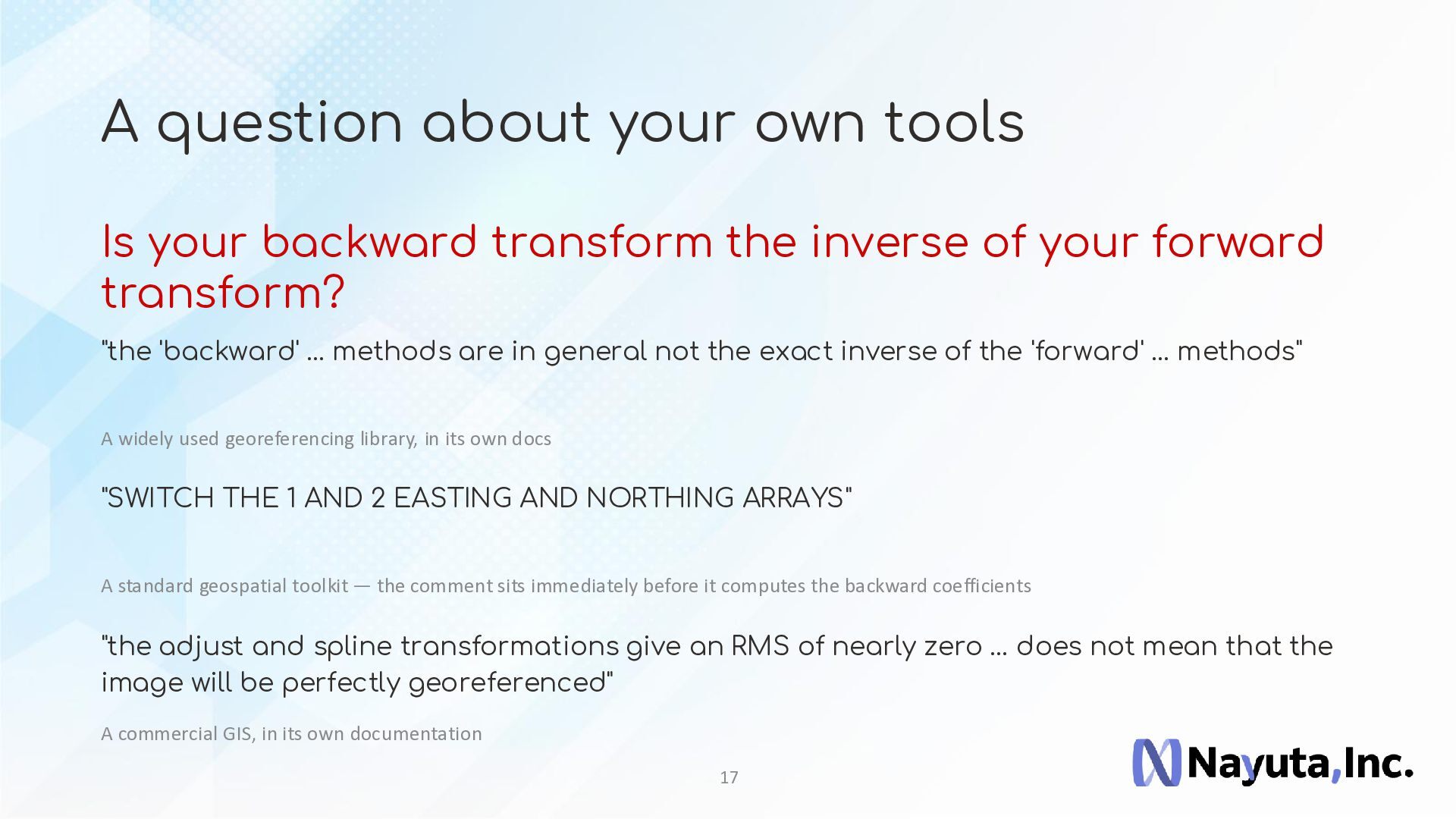
  17. A question about your own tools Is your backward transform

    the inverse of your forward transform? "the 'backward' … methods are in general not the exact inverse of the 'forward' … methods" A widely used georeferencing library, in its own docs "SWITCH THE 1 AND 2 EASTING AND NORTHING ARRAYS" A standard geospatial toolkit — the comment sits immediately before it computes the backward coefficients "the adjust and spline transformations give an RMS of nearly zero … does not mean that the image will be perfectly georeferenced" A commercial GIS, in its own documentation 17
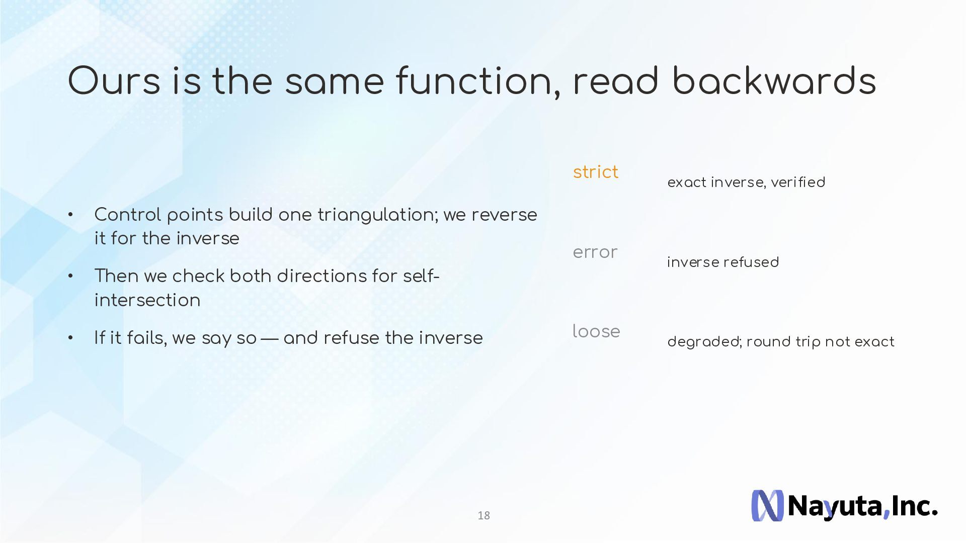
  18. Ours is the same function, read backwards strict • Control

    points build one triangulation; we reverse it for the inverse • Then we check both directions for selfintersection • If it fails, we say so — and refuse the inverse 18 error loose exact inverse, verified inverse refused degraded; round trip not exact
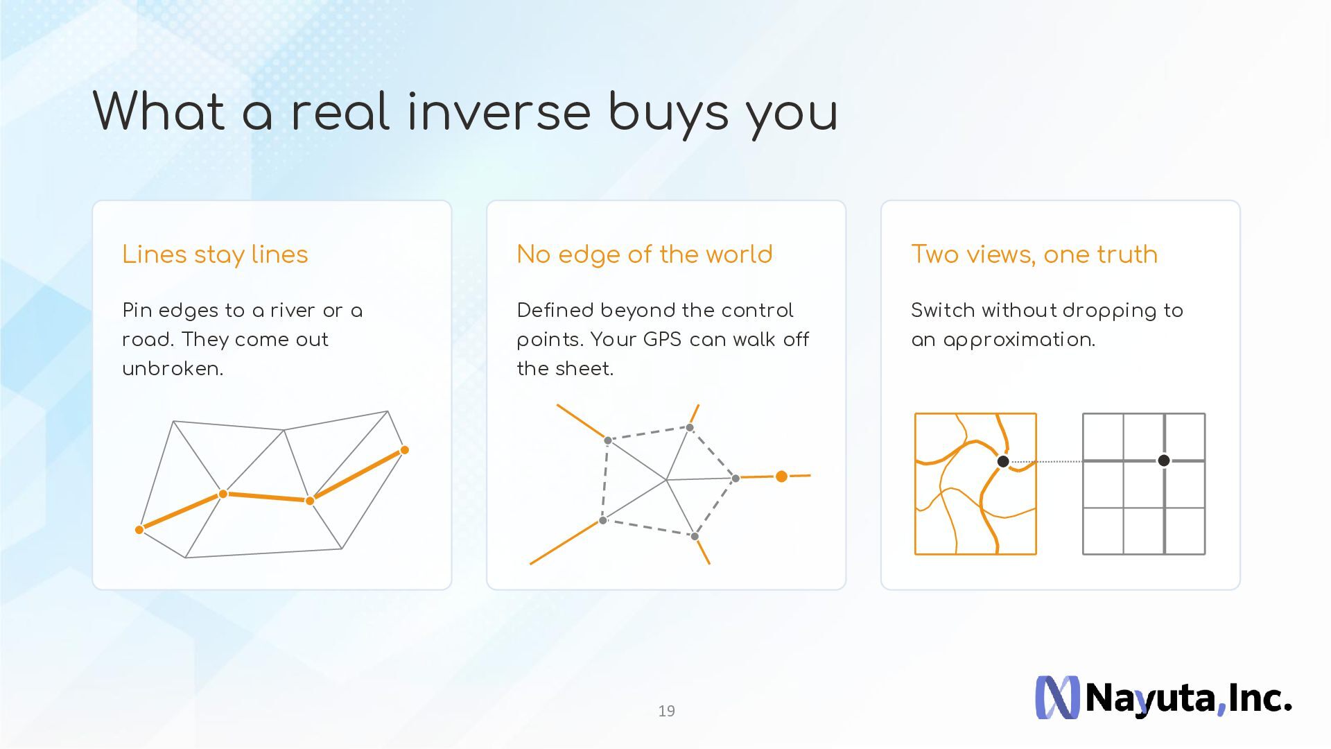
  19. What a real inverse buys you Lines stay lines No

    edge of the world Two views, one truth Pin edges to a river or a Defined beyond the control Switch without dropping to road. They come out points. Your GPS can walk off an approximation. unbroken. the sheet. 19
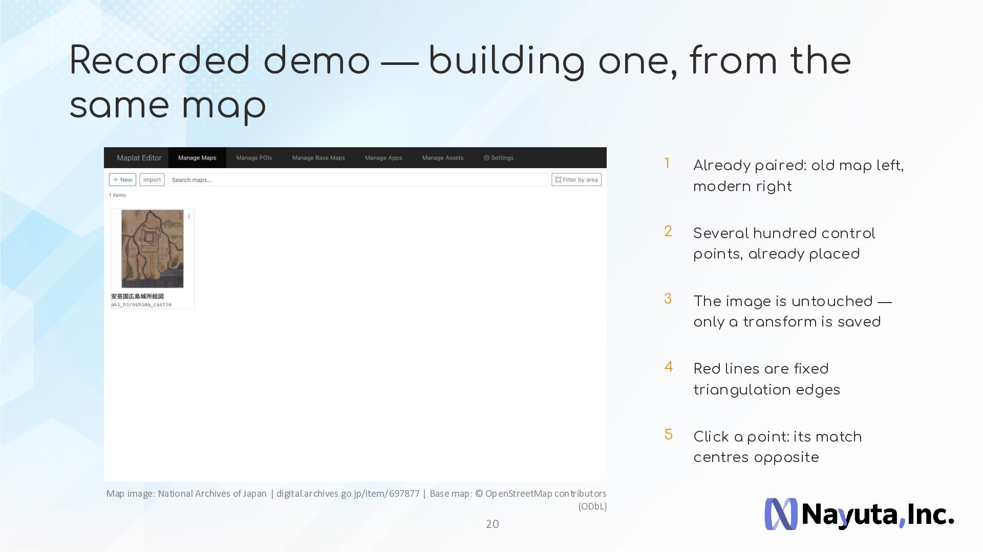
  20. Recorded demo — building one, from the same map Map

    image: National Archives of Japan | digital.archives.go.jp/item/697877 | Base map: © OpenStreetMap contributors (ODbL) 20 1 Already paired: old map left, modern right 2 Several hundred control points, already placed 3 The image is untouched — only a transform is saved 4 Red lines are fixed triangulation edges 5 Click a point: its match centres opposite
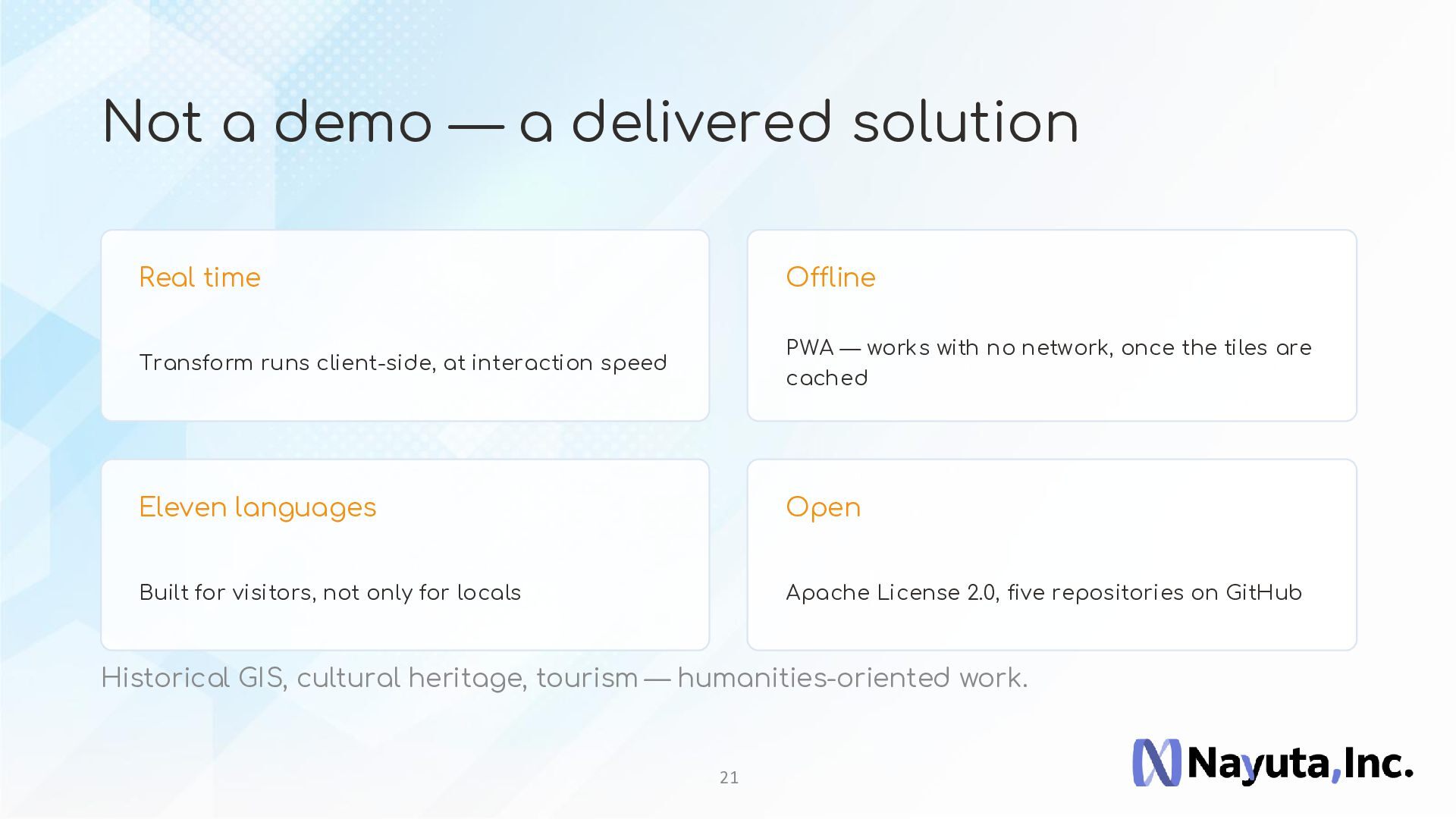
  21. Not a demo — a delivered solution Real time Offline

    Transform runs client-side, at interaction speed PWA — works with no network, once the tiles are cached Eleven languages Open Built for visitors, not only for locals Apache License 2.0, five repositories on GitHub Historical GIS, cultural heritage, tourism — humanities-oriented work. 21
  22. P ar t 3 Where this goes next Ongoing work,

    and one problem I have not solved 22
  23. Ongoing — vector data, and where the product goes Today:

    an image • Mapbox / MapLibre basemaps: already supported • Wider vector data support: in design • A new desktop platform — Tauri, Electrobun: undecided • A SaaS edition • An MCP interface, for generative AI 23 Next: queryable features
  24. The open problem — 3D • In 2D, topology preservation

    is guaranteed 2D — a triangle 3D — a tetrahedron sign of area tells you this one turned inside out • In 3D, the same construction stops working • Tetrahedralization can invert where triangulation cannot • I do not have an answer to this 24
  25. — We would love to hear ideas from this community

    — github.com/code4history/Maplat | www.maplat.jp/en/ s.maplat.jp/r/hiroshimamap/