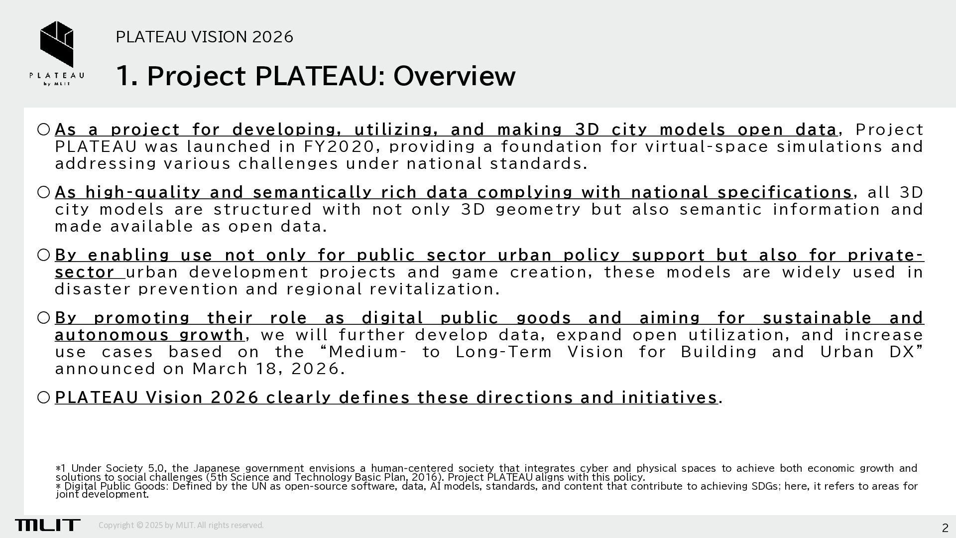
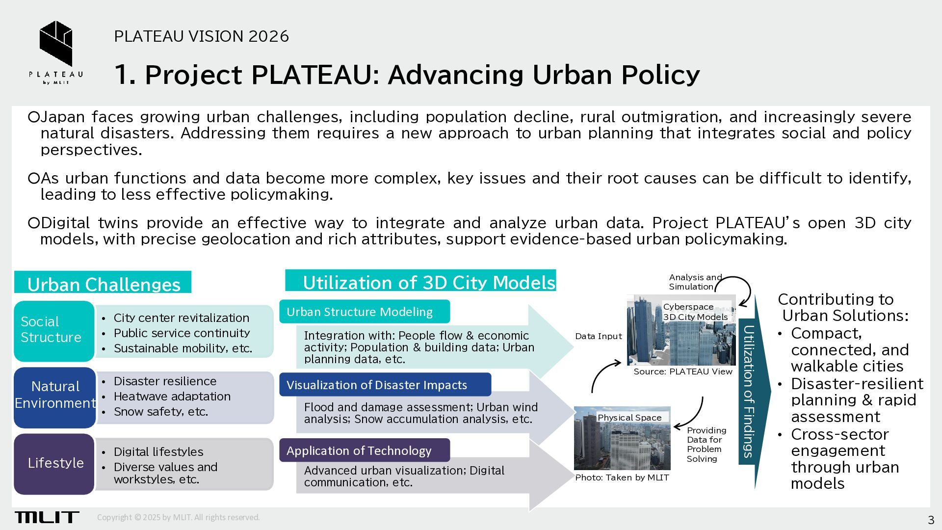
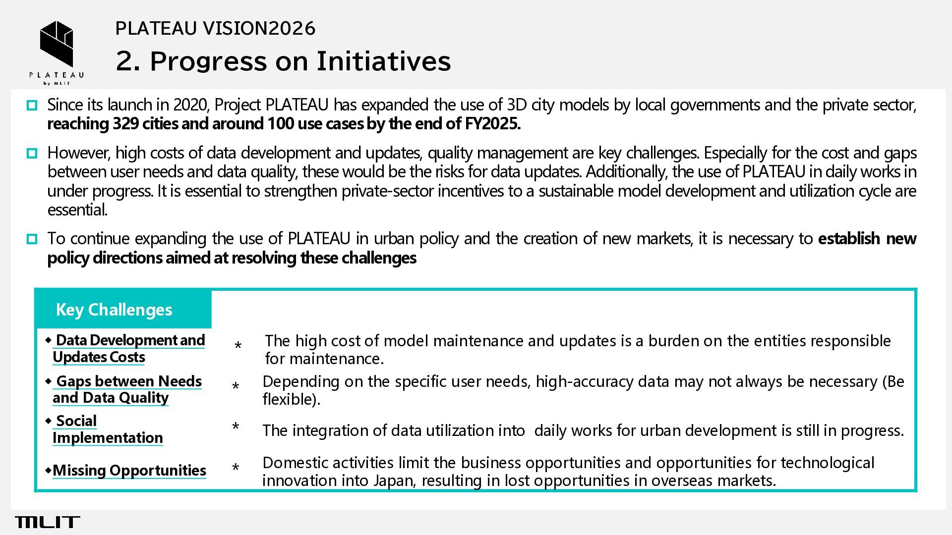
in 2020, Project PLATEAU has expanded the use of 3D city models by local governments and the private sector, reaching 329 cities and around 100 use cases by the end of FY2025. However, high costs of data development and updates, quality management are key challenges. Especially for the cost and gaps between user needs and data quality, these would be the risks for data updates. Additionally, the use of PLATEAU in daily works in under progress. It is essential to strengthen private-sector incentives to a sustainable model development and utilization cycle are essential. To continue expanding the use of PLATEAU in urban policy and the creation of new markets, it is necessary to establish new policy directions aimed at resolving these challenges Key Challenges ◆ Data Development and Updates Costs * The high cost of model maintenance and updates is a burden on the entities responsible for maintenance. ◆ Gaps between Needs and Data Quality * Depending on the specific user needs, high-accuracy data may not always be necessary (Be flexible). ◆ Social Implementation * The integration of data utilization into daily works for urban development is still in progress. ◆Missing Opportunities * Domestic activities limit the business opportunities and opportunities for technological innovation into Japan, resulting in lost opportunities in overseas markets.
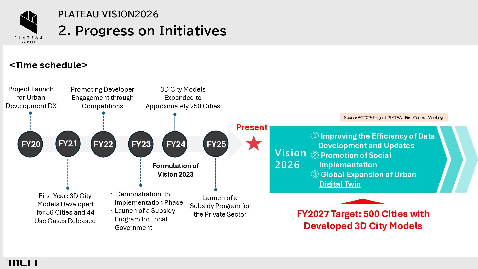
for Urban Development DX Promoting Developer Engagement through Competitions 3D City Models Expanded to Approximately 250 Cities Source:FY2026 Project PLATEAUFirst General Meeting Present FY20 FY21 FY22 FY23 FY24 FY25 Formulation of Vision 2023 First Year: 3D City Models Developed for 56 Cities and 44 Use Cases Released ・ Demonstration to Launch of a Implementation Phase Subsidy Program for ・Launch of a Subsidy the Private Sector Program for Local Government ① Improving the Efficiency of Data Development and Updates Vision ② Promotion of Social Implementation 2026 ③ Global Expansion of Urban Digital Twin FY2027 Target: 500 Cities with Developed 3D City Models
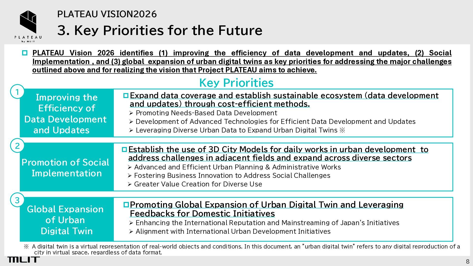
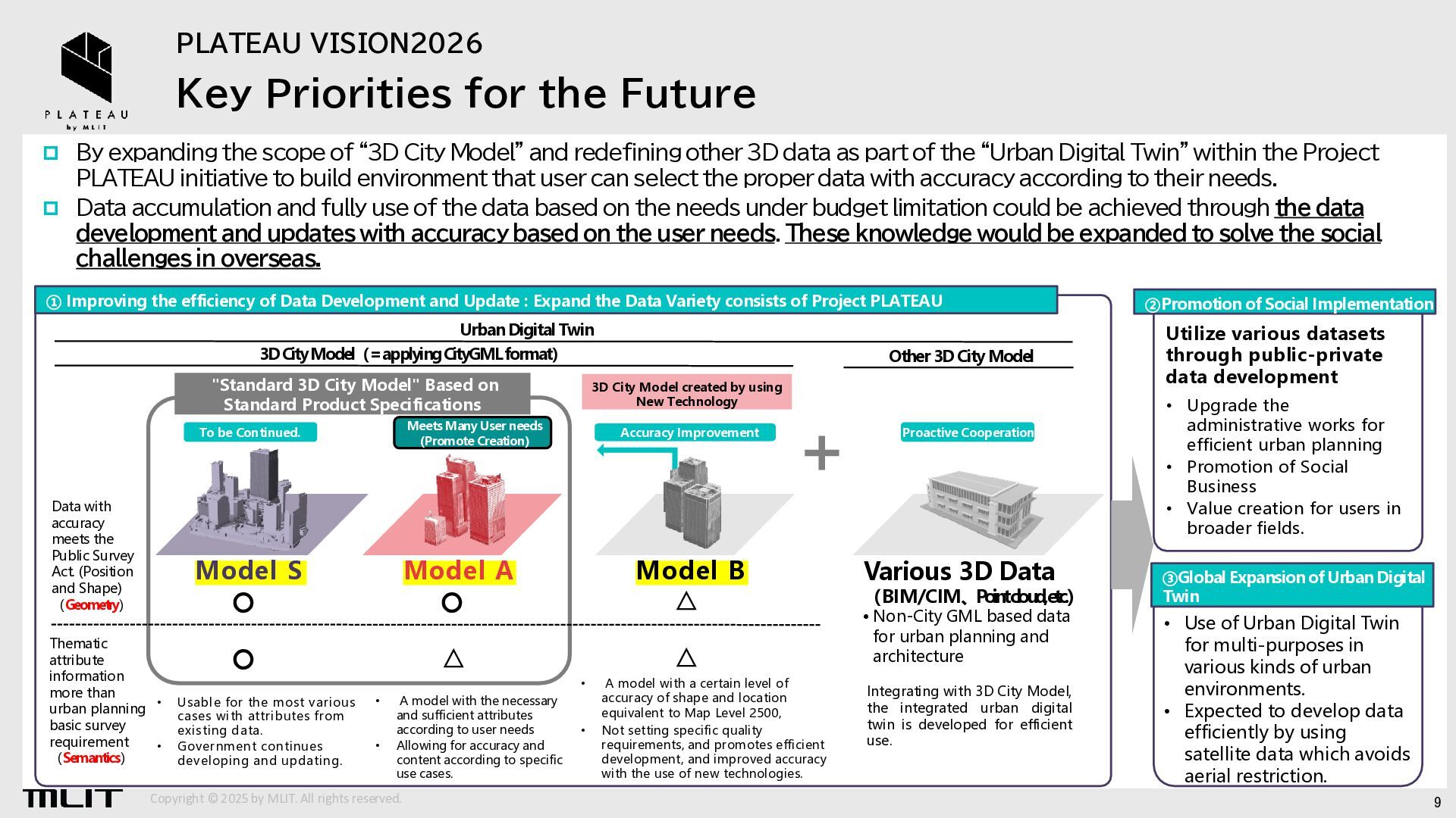
Vision 2026 identifies (1) improving the efficiency of data development and updates, (2) Social Implementation , and (3) global expansion of urban digital twins as key priorities for addressing the major challenges outlined above and for realizing the vision that Project PLATEAU aims to achieve. Key Priorities 1 Improving the Efficiency of Data Development and Updates 2 Promotion of Social Implementation 3 Global Expansion of Urban Digital Twin Expand data coverage and establish sustainable ecosystem (data development and updates) through cost-efficient methods. ➢ Promoting Needs-Based Data Development ➢ Development of Advanced Technologies for Efficient Data Development and Updates ➢ Leveraging Diverse Urban Data to Expand Urban Digital Twins ※ Establish the use of 3D City Models for daily works in urban development to address challenges in adjacent fields and expand across diverse sectors ➢ Advanced and Efficient Urban Planning & Administrative Works ➢ Fostering Business Innovation to Address Social Challenges ➢ Greater Value Creation for Diverse Use Promoting Global Expansion of Urban Digital Twin and Leveraging Feedbacks for Domestic Initiatives ➢ Enhancing the International Reputation and Mainstreaming of Japan's Initiatives ➢ Alignment with International Urban Development Initiatives ※ A digital twin is a virtual representation of real-world objects and conditions. In this document, an "urban digital twin" refers to any digital reproduction of a city in virtual space, regardless of data format. 8
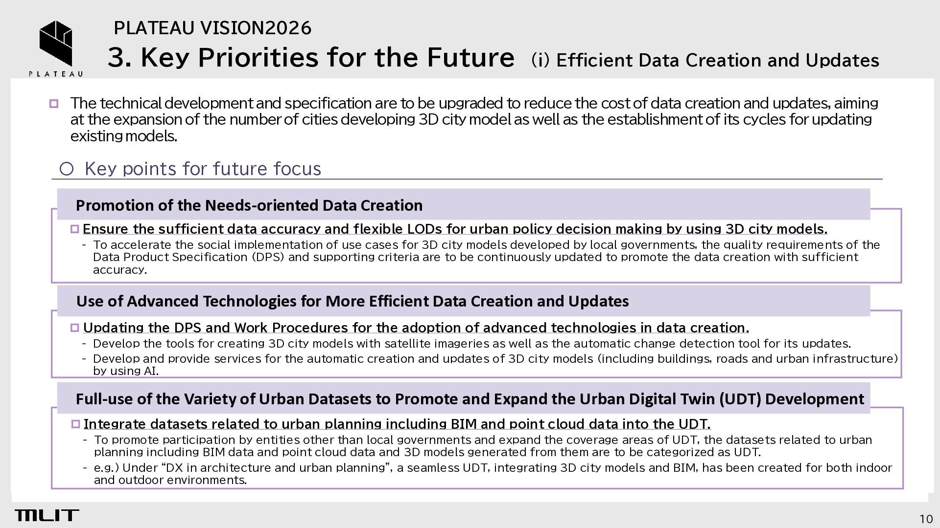
Data Creation and Updates The technical development and specification are to be upgraded to reduce the cost of data creation and updates, aiming at the expansion of the number of cities developing 3D city model as well as the establishment of its cycles for updating existing models. 〇 Key points for future focus Promotion of the Needs-oriented Data Creation Ensure the sufficient data accuracy and flexible LODs for urban policy decision making by using 3D city models. - To accelerate the social implementation of use cases for 3D city models developed by local governments, the quality requirements of the Data Product Specification (DPS) and supporting criteria are to be continuously updated to promote the data creation with sufficient accuracy. Use of Advanced Technologies for More Efficient Data Creation and Updates Updating the DPS and Work Procedures for the adoption of advanced technologies in data creation. - Develop the tools for creating 3D city models with satellite imageries as well as the automatic change detection tool for its updates. - Develop and provide services for the automatic creation and updates of 3D city models (including buildings, roads and urban infrastructure) by using AI. Full-use of the Variety of Urban Datasets to Promote and Expand the Urban Digital Twin (UDT) Development Integrate datasets related to urban planning including BIM and point cloud data into the UDT. - To promote participation by entities other than local governments and expand the coverage areas of UDT, the datasets related to urban planning including BIM data and point cloud data and 3D models generated from them are to be categorized as UDT. - e.g.) Under “DX in architecture and urban planning”, a seamless UDT, integrating 3D city models and BIM, has been created for both indoor and outdoor environments. 10
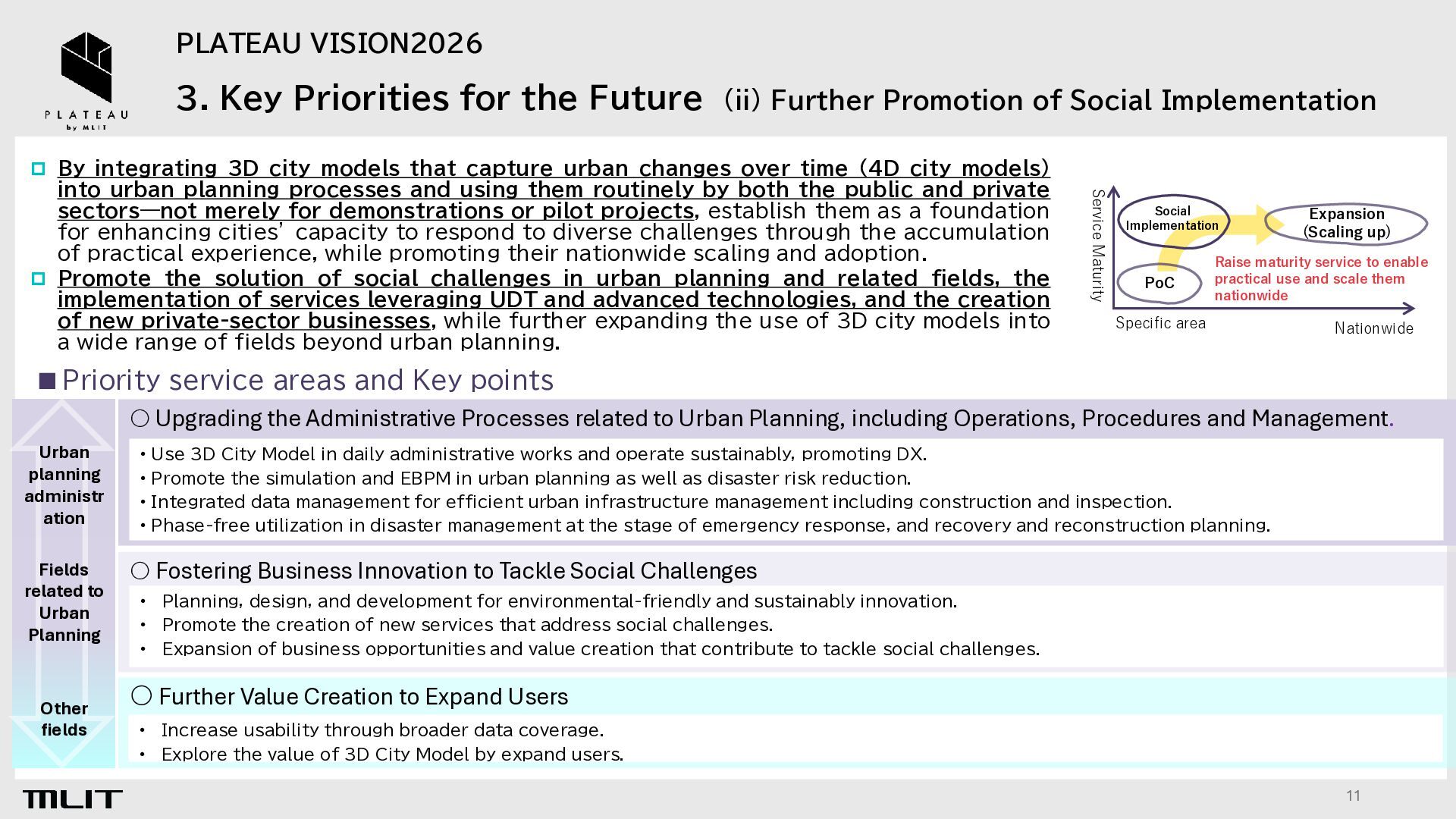
Promotion of Social Implementation By integrating 3D city models that capture urban changes over time (4D city models) Service Maturity into urban planning processes and using them routinely by both the public and private sectors—not merely for demonstrations or pilot projects, establish them as a foundation for enhancing cities’ capacity to respond to diverse challenges through the accumulation of practical experience, while promoting their nationwide scaling and adoption. Promote the solution of social challenges in urban planning and related fields, the implementation of services leveraging UDT and advanced technologies, and the creation of new private-sector businesses, while further expanding the use of 3D city models into a wide range of fields beyond urban planning. Social Implementation PoC Expansion (Scaling up) Raise maturity service to enable practical use and scale them nationwide Specific area Nationwide ▪ Priority service areas and Key points 〇 Upgrading the Administrative Processes related to Urban Planning, including Operations, Procedures and Management. Urban planning administr ation • Use 3D City Model in daily administrative works and operate sustainably, promoting DX. • Promote the simulation and EBPM in urban planning as well as disaster risk reduction. • Integrated data management for efficient urban infrastructure management including construction and inspection. • Phase-free utilization in disaster management at the stage of emergency response, and recovery and reconstruction planning. Fields related to Urban Planning 〇 Fostering Business Innovation to Tackle Social Challenges Other fields • • • Planning, design, and development for environmental-friendly and sustainably innovation. Promote the creation of new services that address social challenges. Expansion of business opportunities and value creation that contribute to tackle social challenges. 〇 Further Value Creation to Expand Users • • Increase usability through broader data coverage. Explore the value of 3D City Model by expand users. 11
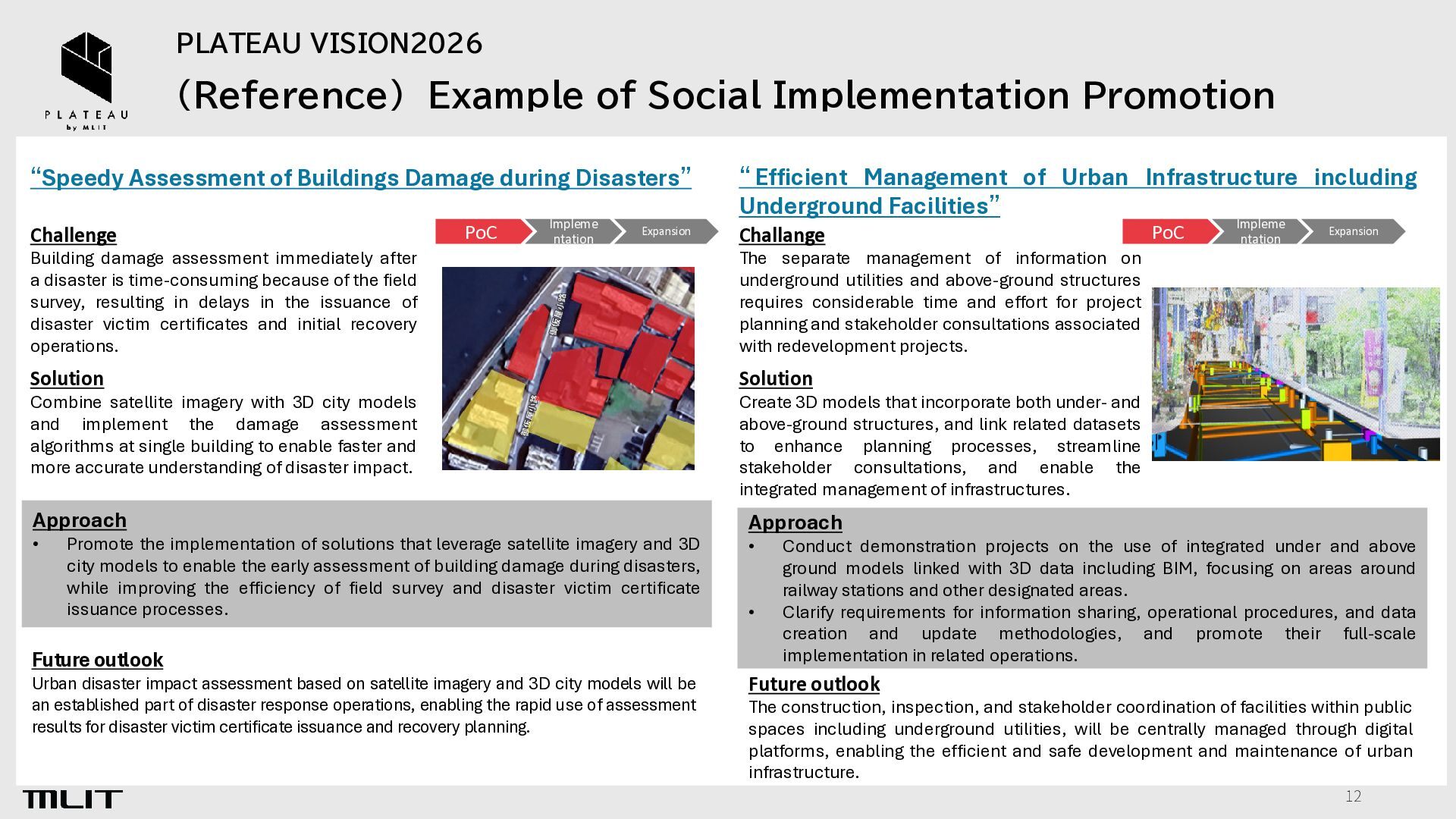
of Buildings Damage during Disasters” Challenge PoC Impleme ntation Expansion Building damage assessment immediately after a disaster is time-consuming because of the field survey, resulting in delays in the issuance of disaster victim certificates and initial recovery operations. “ Efficient Management of Urban Infrastructure including Underground Facilities” Challange Solution Approach Approach • Promote the implementation of solutions that leverage satellite imagery and 3D city models to enable the early assessment of building damage during disasters, while improving the efficiency of field survey and disaster victim certificate issuance processes. Future outlook Urban disaster impact assessment based on satellite imagery and 3D city models will be an established part of disaster response operations, enabling the rapid use of assessment results for disaster victim certificate issuance and recovery planning. Impleme ntation Expansion The separate management of information on underground utilities and above-ground structures requires considerable time and effort for project planning and stakeholder consultations associated with redevelopment projects. Solution Combine satellite imagery with 3D city models and implement the damage assessment algorithms at single building to enable faster and more accurate understanding of disaster impact. PoC Create 3D models that incorporate both under- and above-ground structures, and link related datasets to enhance planning processes, streamline stakeholder consultations, and enable the integrated management of infrastructures. • • Conduct demonstration projects on the use of integrated under and above ground models linked with 3D data including BIM, focusing on areas around railway stations and other designated areas. Clarify requirements for information sharing, operational procedures, and data creation and update methodologies, and promote their full-scale implementation in related operations. Future outlook The construction, inspection, and stakeholder coordination of facilities within public spaces including underground utilities, will be centrally managed through digital platforms, enabling the efficient and safe development and maintenance of urban infrastructure. 12
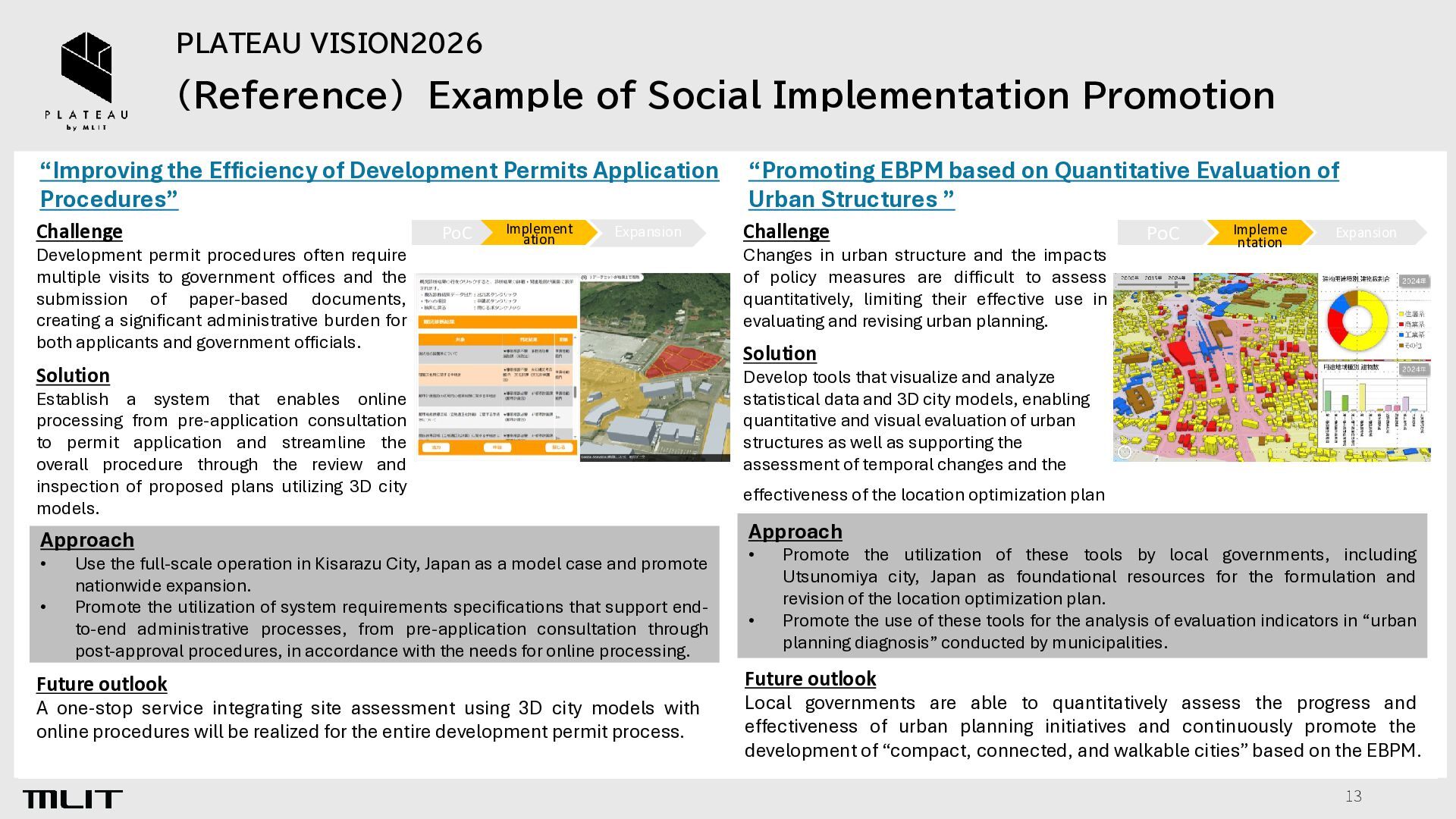
Efficiency of Development Permits Application Procedures” Challenge Development permit procedures often require multiple visits to government offices and the submission of paper-based documents, creating a significant administrative burden for both applicants and government officials. PoC Implement ation Expansion Solution Establish a system that enables online processing from pre-application consultation to permit application and streamline the overall procedure through the review and inspection of proposed plans utilizing 3D city models. Approach • • Use the full-scale operation in Kisarazu City, Japan as a model case and promote nationwide expansion. Promote the utilization of system requirements specifications that support endto-end administrative processes, from pre-application consultation through post-approval procedures, in accordance with the needs for online processing. Future outlook A one-stop service integrating site assessment using 3D city models with online procedures will be realized for the entire development permit process. “Promoting EBPM based on Quantitative Evaluation of Urban Structures ” Challenge Changes in urban structure and the impacts of policy measures are difficult to assess quantitatively, limiting their effective use in evaluating and revising urban planning. PoC Impleme ntation Expansion Solution Develop tools that visualize and analyze statistical data and 3D city models, enabling quantitative and visual evaluation of urban structures as well as supporting the assessment of temporal changes and the effectiveness of the location optimization plan. Approach • • Promote the utilization of these tools by local governments, including Utsunomiya city, Japan as foundational resources for the formulation and revision of the location optimization plan. Promote the use of these tools for the analysis of evaluation indicators in “urban planning diagnosis” conducted by municipalities. Future outlook Local governments are able to quantitatively assess the progress and effectiveness of urban planning initiatives and continuously promote the development of “compact, connected, and walkable cities” based on the EBPM. 13
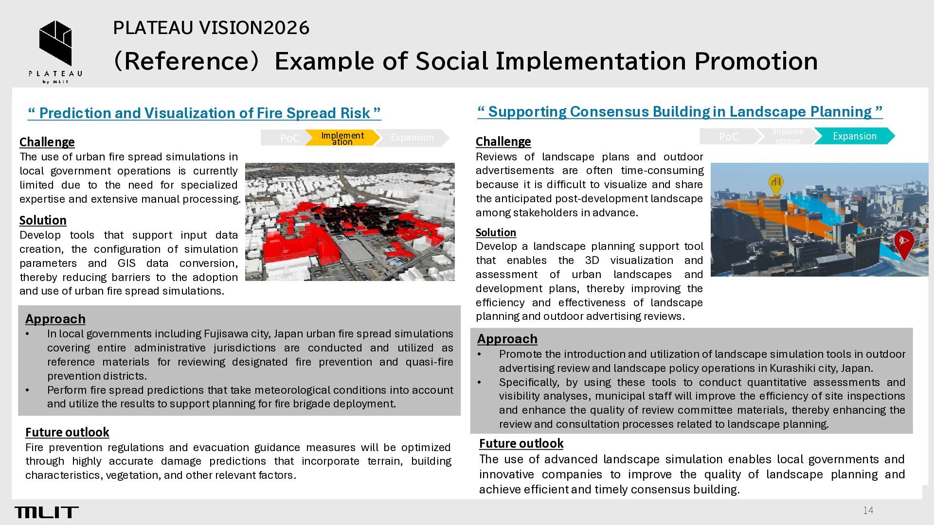
Consensus Building in Landscape Planning ” “ Prediction and Visualization of Fire Spread Risk ” Challenge PoC Implement ation Expansion The use of urban fire spread simulations in local government operations is currently limited due to the need for specialized expertise and extensive manual processing. Solution Develop tools that support input data creation, the configuration of simulation parameters and GIS data conversion, thereby reducing barriers to the adoption and use of urban fire spread simulations. Approach • • In local governments including Fujisawa city, Japan urban fire spread simulations covering entire administrative jurisdictions are conducted and utilized as reference materials for reviewing designated fire prevention and quasi-fire prevention districts. Perform fire spread predictions that take meteorological conditions into account and utilize the results to support planning for fire brigade deployment. Future outlook Fire prevention regulations and evacuation guidance measures will be optimized through highly accurate damage predictions that incorporate terrain, building characteristics, vegetation, and other relevant factors. Challenge PoC Impleme ntation Expansion Reviews of landscape plans and outdoor advertisements are often time-consuming because it is difficult to visualize and share the anticipated post-development landscape among stakeholders in advance. Solution Develop a landscape planning support tool that enables the 3D visualization and assessment of urban landscapes and development plans, thereby improving the efficiency and effectiveness of landscape planning and outdoor advertising reviews. Approach • • Promote the introduction and utilization of landscape simulation tools in outdoor advertising review and landscape policy operations in Kurashiki city, Japan. Specifically, by using these tools to conduct quantitative assessments and visibility analyses, municipal staff will improve the efficiency of site inspections and enhance the quality of review committee materials, thereby enhancing the review and consultation processes related to landscape planning. Future outlook The use of advanced landscape simulation enables local governments and innovative companies to improve the quality of landscape planning and achieve efficient and timely consensus building. 14
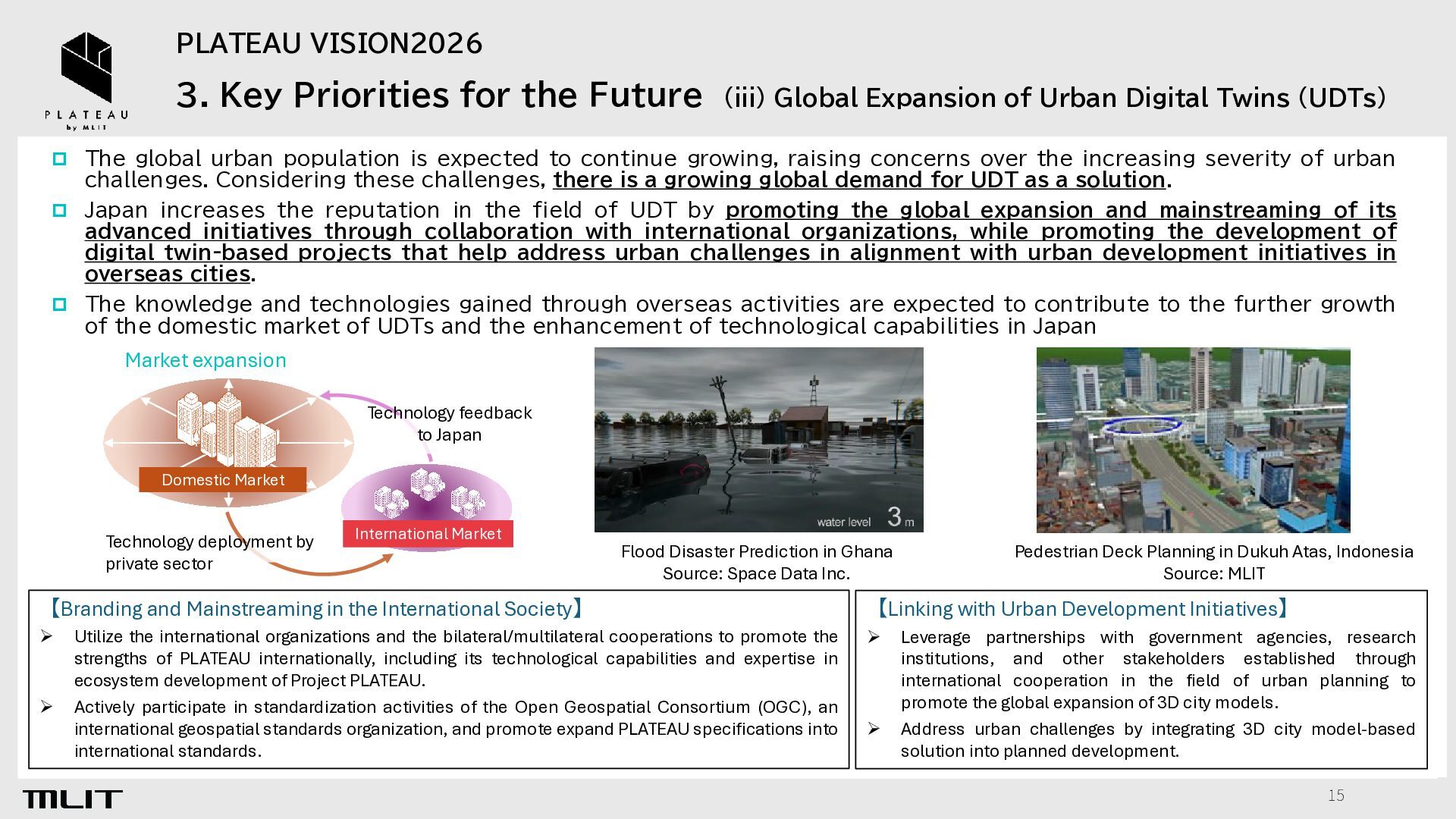
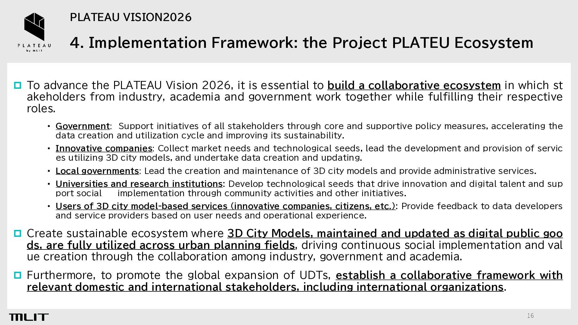
Expansion of Urban Digital Twins (UDTs) The global urban population is expected to continue growing, raising concerns over the increasing severity of urban challenges. Considering these challenges, there is a growing global demand for UDT as a solution. Japan increases the reputation in the field of UDT by promoting the global expansion and mainstreaming of its advanced initiatives through collaboration with international organizations, while promoting the development of digital twin-based projects that help address urban challenges in alignment with urban development initiatives in overseas cities. The knowledge and technologies gained through overseas activities are expected to contribute to the further growth of the domestic market of UDTs and the enhancement of technological capabilities in Japan Market expansion Technology feedback to Japan Domestic Market Technology deployment by private sector International Market Flood Disaster Prediction in Ghana Source: Space Data Inc. 【Branding and Mainstreaming in the International Society】 ➢ ➢ Utilize the international organizations and the bilateral/multilateral cooperations to promote the strengths of PLATEAU internationally, including its technological capabilities and expertise in ecosystem development of Project PLATEAU. Actively participate in standardization activities of the Open Geospatial Consortium (OGC), an international geospatial standards organization, and promote expand PLATEAU specifications into international standards. Pedestrian Deck Planning in Dukuh Atas, Indonesia Source: MLIT 【Linking with Urban Development Initiatives】 ➢ ➢ Leverage partnerships with government agencies, research institutions, and other stakeholders established through international cooperation in the field of urban planning to promote the global expansion of 3D city models. Address urban challenges by integrating 3D city model-based solution into planned development. 15
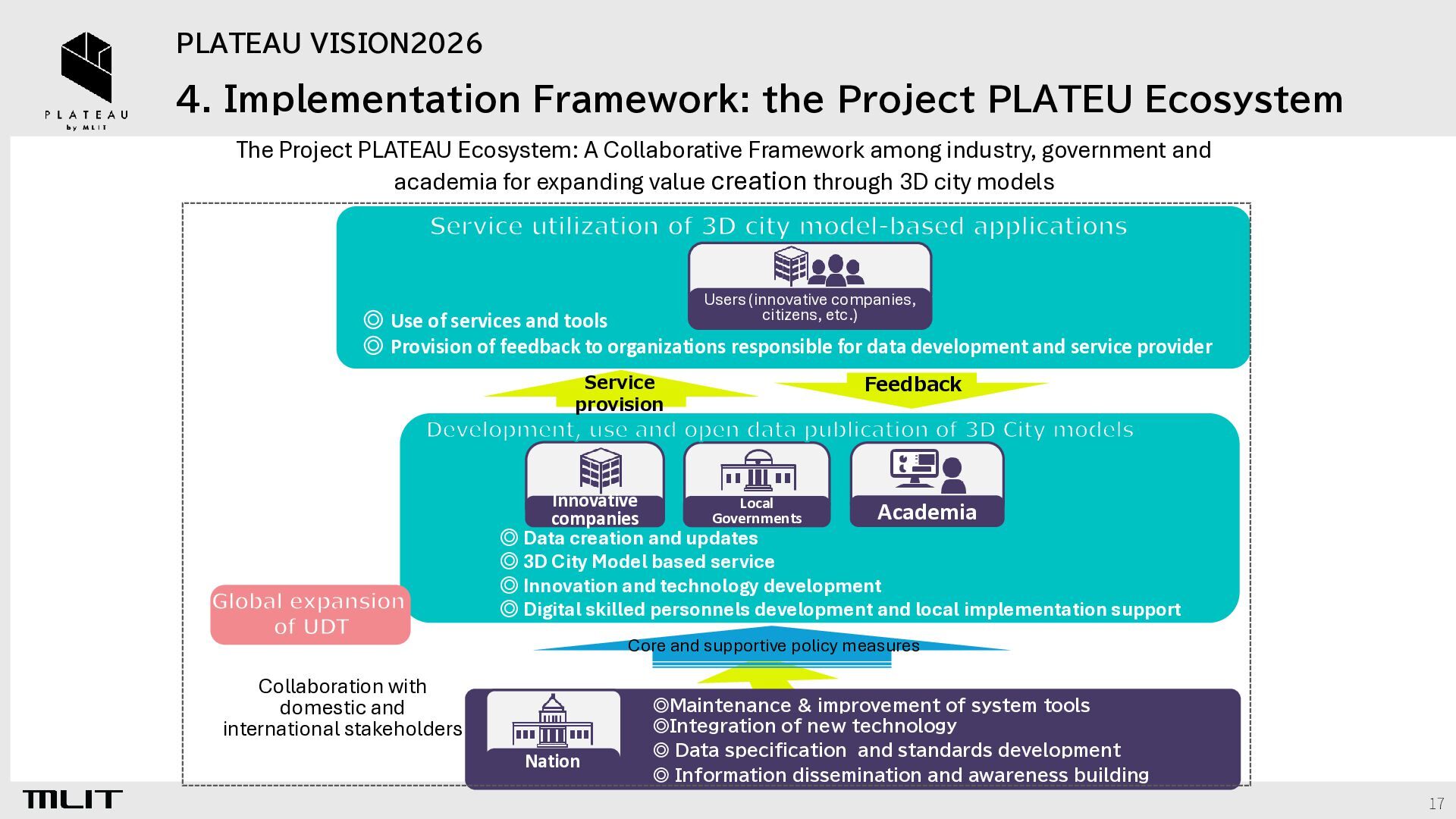
To advance the PLATEAU Vision 2026, it is essential to build a collaborative ecosystem in which st akeholders from industry, academia and government work together while fulfilling their respective roles. • Government: Support initiatives of all stakeholders through core and supportive policy measures, accelerating the data creation and utilization cycle and improving its sustainability. • Innovative companies: Collect market needs and technological seeds, lead the development and provision of servic es utilizing 3D city models, and undertake data creation and updating. • Local governments: Lead the creation and maintenance of 3D city models and provide administrative services. • Universities and research institutions: Develop technological seeds that drive innovation and digital talent and sup port social implementation through community activities and other initiatives. • Users of 3D city model-based services (innovative companies, citizens, etc.): Provide feedback to data developers and service providers based on user needs and operational experience. Create sustainable ecosystem where 3D City Models, maintained and updated as digital public goo ds, are fully utilized across urban planning fields, driving continuous social implementation and val ue creation through the collaboration among industry, government and academia. Furthermore, to promote the global expansion of UDTs, establish a collaborative framework with relevant domestic and international stakeholders, including international organizations. 16
Project PLATEAU Ecosystem: A Collaborative Framework among industry, government and academia for expanding value creation through 3D city models Service utilization of 3D city model-based applications Users (innovative companies, citizens, etc.) ◎ Use of services and tools ◎ Provision of feedback to organizations responsible for data development and service provider Service provision Feedback Development, use and open data publication of 3D City models Global expansion of UDT Innovative Local Academia Governments companies ◎ Data creation and updates ◎ 3D City Model based service ◎ Innovation and technology development ◎ Digital skilled personnels development and local implementation support Core and supportive policy measures Collaboration with domestic and international stakeholders Nation ◎Maintenance & improvement of system tools ◎Integration of new technology ◎ Data specification and standards development ◎ Information dissemination and awareness building 17


 kokusaidigital
 seathinner
 honnibal
 auna
auna
 greggifford
 michaelherold
 joshbly
 apolaine
 csswizardry
 akademiya2063
 marktimemedia
 427marketing
 morganepeng