importance assessment for geospatial machine learning Patrick Schratz, Tobias Herrmann, Alexander Brenning, GIScience group, University of Jena EGU Vienna, April 2017
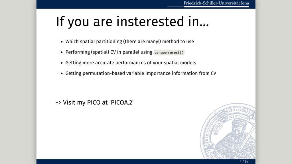
many!) method to use Performing (spatial) CV in parallel using parsperrorest() Getting more accurate performances of your spatial models Getting permutation-based variable importance information from CV 4 / 24
many!) method to use Performing (spatial) CV in parallel using parsperrorest() Getting more accurate performances of your spatial models Getting permutation-based variable importance information from CV -> Visit my PICO at 'PICOA.2' 4 / 24
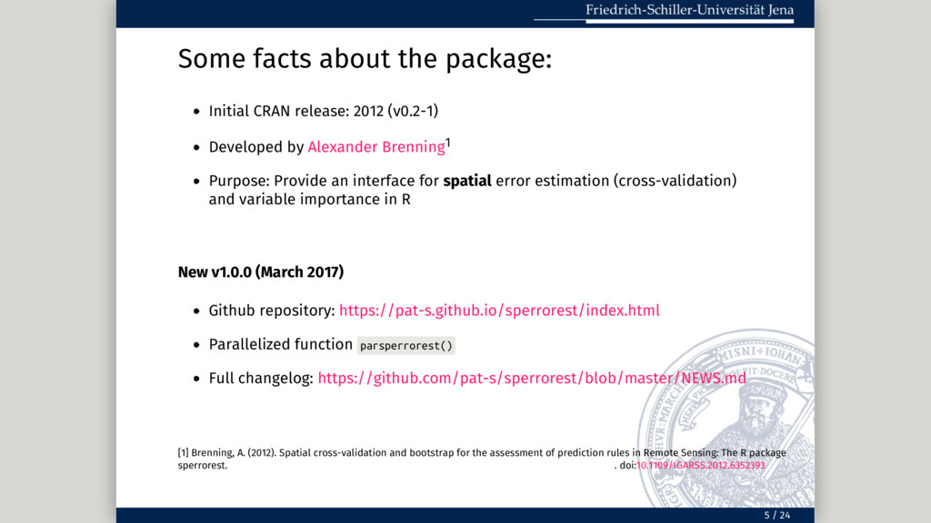
Developed by Alexander Brenning1 Purpose: Provide an interface for spatial error estimation (cross-validation) and variable importance in R New v1.0.0 (March 2017) Github repository: https://pat-s.github.io/sperrorest/index.html Parallelized function parsperrorest() Full changelog: https://github.com/pat-s/sperrorest/blob/master/NEWS.md [1] Brenning, A. (2012). Spatial cross-validation and bootstrap for the assessment of prediction rules in Remote Sensing: The R package sperrorest. . doi:10.1109/IGARSS.2012.6352393 5 / 24
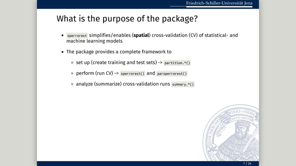
cross-validation (CV) of statistical- and machine learning models The package provides a complete framework to set up (create training and test sets) -> partition.*() perform (run CV) -> sperrorest() and parsperrorest() analyze (summarize) cross-validation runs summary.*() 7 / 24
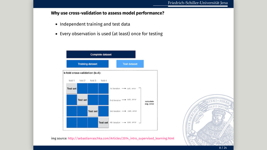
test data Every observation is used (at least) once for testing img source: http://sebastianraschka.com/Articles/2014_intro_supervised_learning.html 8 / 24
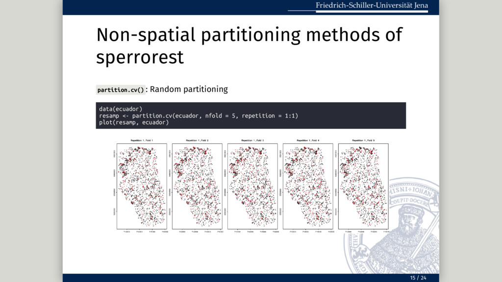
kind of spatial data, spatial autocorrelation is present (with a varying magnitude) When doing a non-spatial cross-validation, usually a random resampling is applied. This resampling method assumes that the observations are independent. This is not the case for spatial data! The predicted model performances will be overoptimistic if spatial autocorrelation between the training and test data exists.2 [2] Brenning, A. (2012). Spatial cross-validation and bootstrap for the assessment of prediction rules in Remote Sensing: The R package sperrorest. In 2012 IEEE International Geoscience and Remote Sensing Symposium (pp. 5372–5375). doi:10.1109/IGARSS.2012.6352393 9 / 24
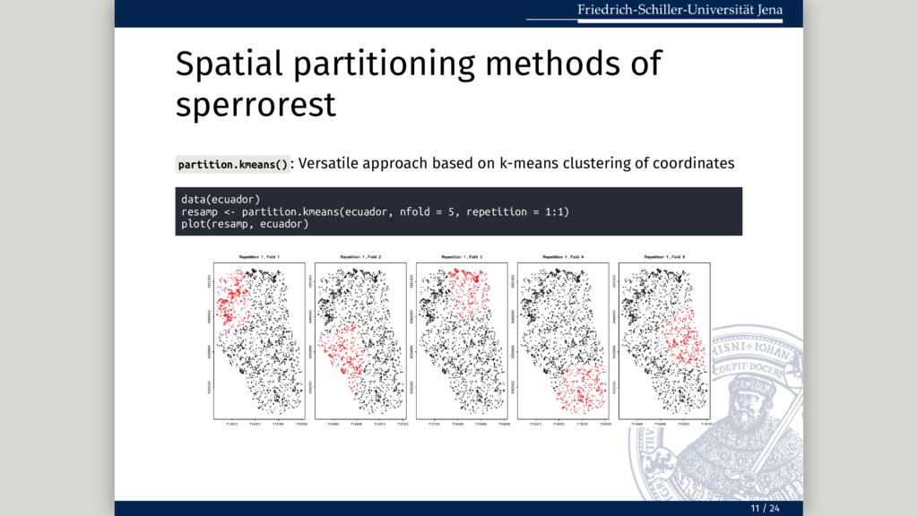
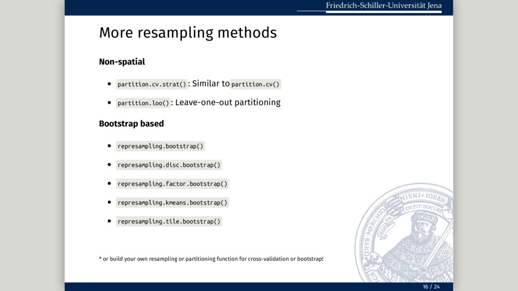
: Leave-one-out partitioning Bootstrap based represampling.bootstrap() represampling.disc.bootstrap() represampling.factor.bootstrap() represampling.kmeans.bootstrap() represampling.tile.bootstrap() * or build your own resampling or partitioning function for cross-validation or bootstrap! 16 / 24
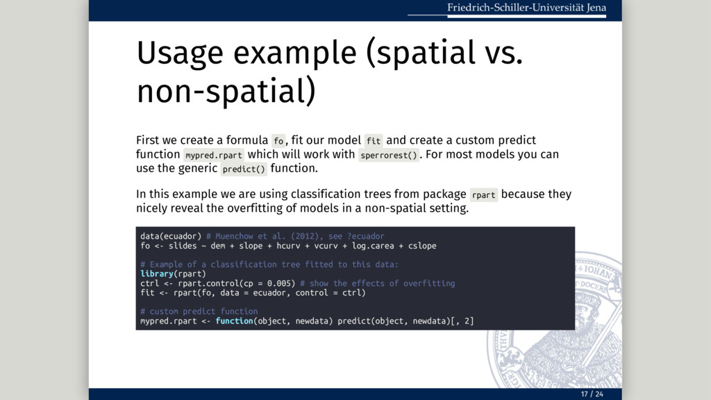
fo , fit our model fit and create a custom predict function mypred.rpart which will work with sperrorest() . For most models you can use the generic predict() function. In this example we are using classification trees from package rpart because they nicely reveal the overfitting of models in a non-spatial setting. data(ecuador) # Muenchow et al. (2012), see ?ecuador fo <- slides ~ dem + slope + hcurv + vcurv + log.carea + cslope # Example of a classification tree fitted to this data: library(rpart) ctrl <- rpart.control(cp = 0.005) # show the effects of overfitting fit <- rpart(fo, data = ecuador, control = ctrl) # custom predict function mypred.rpart <- function(object, newdata) predict(object, newdata)[, 2] 17 / 24
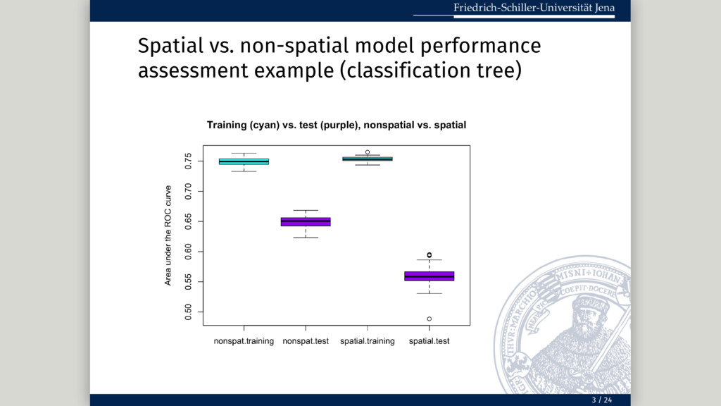
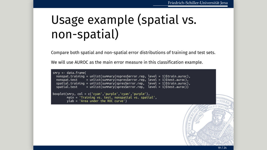
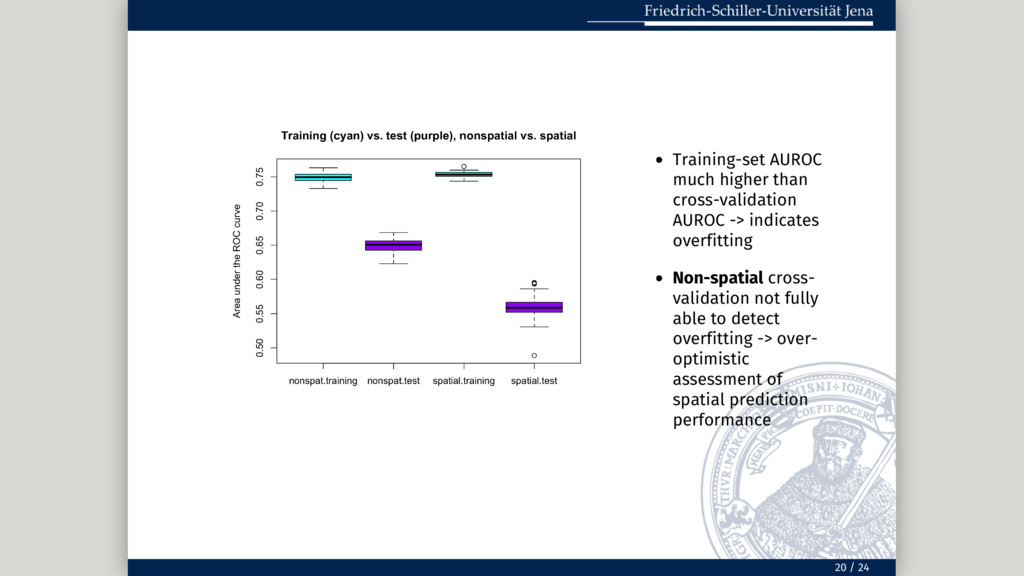
error distributions of training and test sets. We will use AUROC as the main error measure in this classification example. smry <- data.frame( nonspat.training = unlist(summary(nspres$error.rep, level = 1)$train.auroc), nonspat.test = unlist(summary(nspres$error.rep, level = 1)$test.auroc), spatial.training = unlist(summary(spres$error.rep, level = 1)$train.auroc), spatial.test = unlist(summary(spres$error.rep, level = 1)$test.auroc)) boxplot(smry, col = c('cyan','purple','cyan','purple'), main = 'Training vs. test, nonspatial vs. spatial', ylab = 'Area under the ROC curve') 19 / 24


 pat_s
pat_s
 guaca
guaca
 sorah
sorah
 oniak3ibm
 tanahiro2010
 koic
koic
 akit37
 ryu1013
 gam0022
 drumath2237
 gonta
gonta
 kishida
 econanringo
 danielanewman
 62gerente
 chriscoyier
 rkendrick25
 smashingmag
 samtorres
 coloredviolet
 gurzu
gurzu
 geshan
 akosma
 marketingsoph
 mza
mza
![Non-spatial summary(nspres$importance)[1:10] ## mean.auroc mean.error mean.accuracy mean.sensitivity ## dem 0.125296481](https://files.speakerdeck.com/presentations/c62c4c60e6974640970e9caaed954bf1/slide_25.jpg)