$30 off During Our Annual Pro Sale. View Details »

Survey of Unique IDs in NYC Open Data: Joins, S...

Survey of Unique IDs in NYC Open Data: Joins, Sorrows, and Surprises

An overview of unique identifiers in NYC open data relating to the built environment.

Presentation: https://www.youtube.com/watch?v=Dhuc4fdIBqc

Avatar for Jonathan Pichot

Jonathan Pichot

March 02, 2019
Tweet

More Decks by Jonathan Pichot

Other Decks in Technology

Transcript

  1. What we’ll cover Borough/Block/Lot (BBL) Building ID Number (BIN) Address

    Street Segment IDs ⚙ With some data and tool demos along the way
  2. The BBL Borough Block Lot - Assigned to Tax Lots

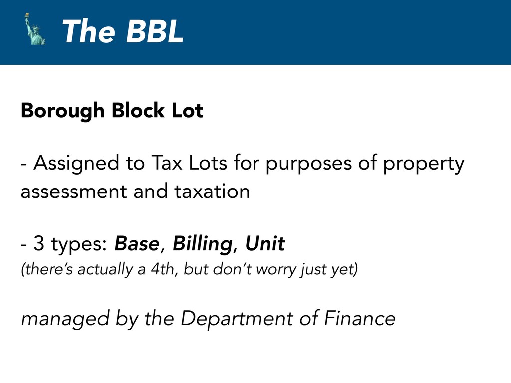
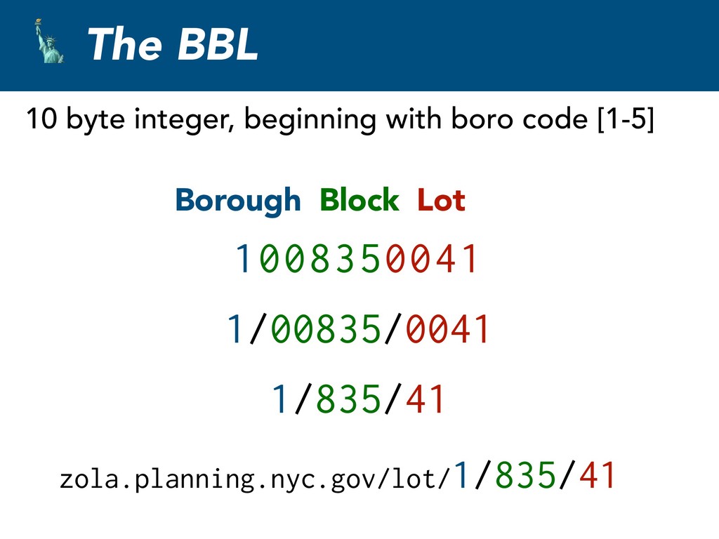
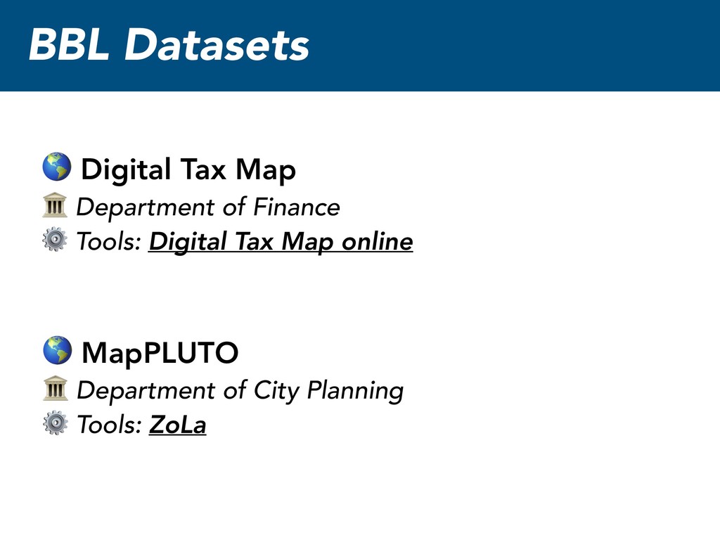
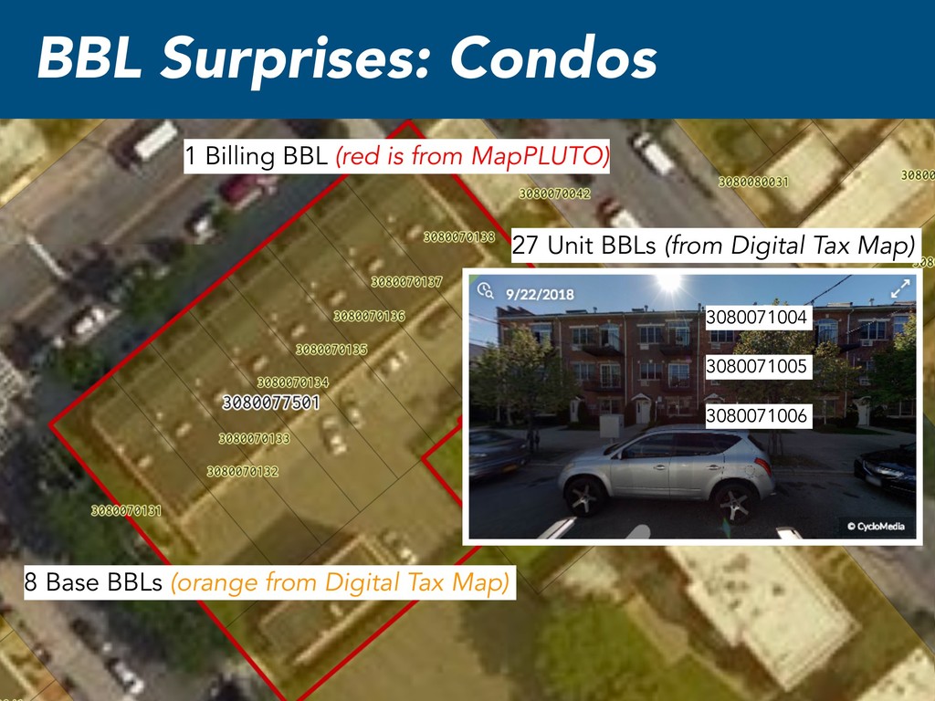
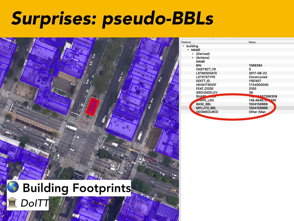
    for purposes of property assessment and taxation - 3 types: Base, Billing, Unit
 (there’s actually a 4th, but don’t worry just yet) managed by the Department of Finance
  3. BBL Datasets MapPLUTO
 Department of City Planning
 ⚙ Tools: ZoLa

    Digital Tax Map
 Department of Finance
 ⚙ Tools: Digital Tax Map online
  4. BBL Surprises: Condos 1 Billing BBL (red is from MapPLUTO)

    8 Base BBLs (orange from Digital Tax Map)
  5. BBL Surprises: Condos 1 Billing BBL (red is from MapPLUTO)

    8 Base BBLs (orange from Digital Tax Map) 27 Unit BBLs (from Digital Tax Map) 3080071004 3080071005 3080071006
  6. BBL Surprises: Condos Base BBL - covers most cases, single

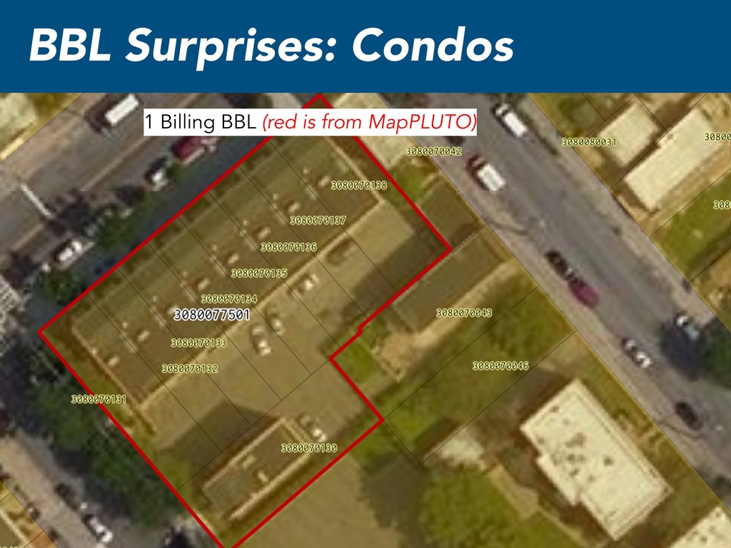
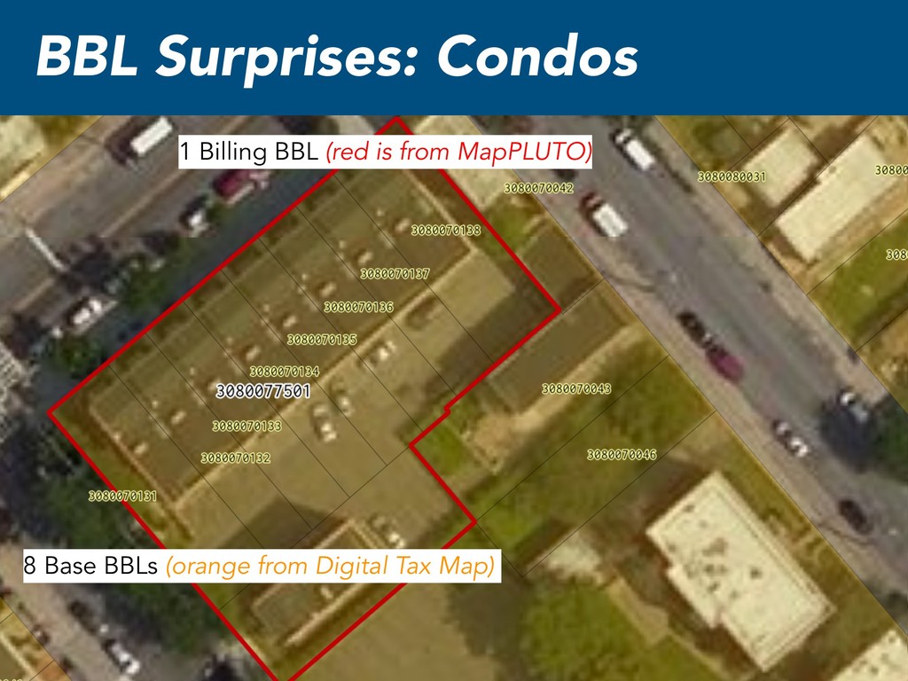
    standing building with one owner Billing BBL - Represents a legal entity, like a condo association, or co-op Unit BBL - represents a unit for tax liability managed by the Department of Finance
  7. The BIN Building Identifier Number - Created in the 1990s,

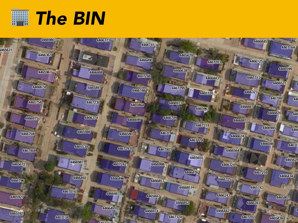
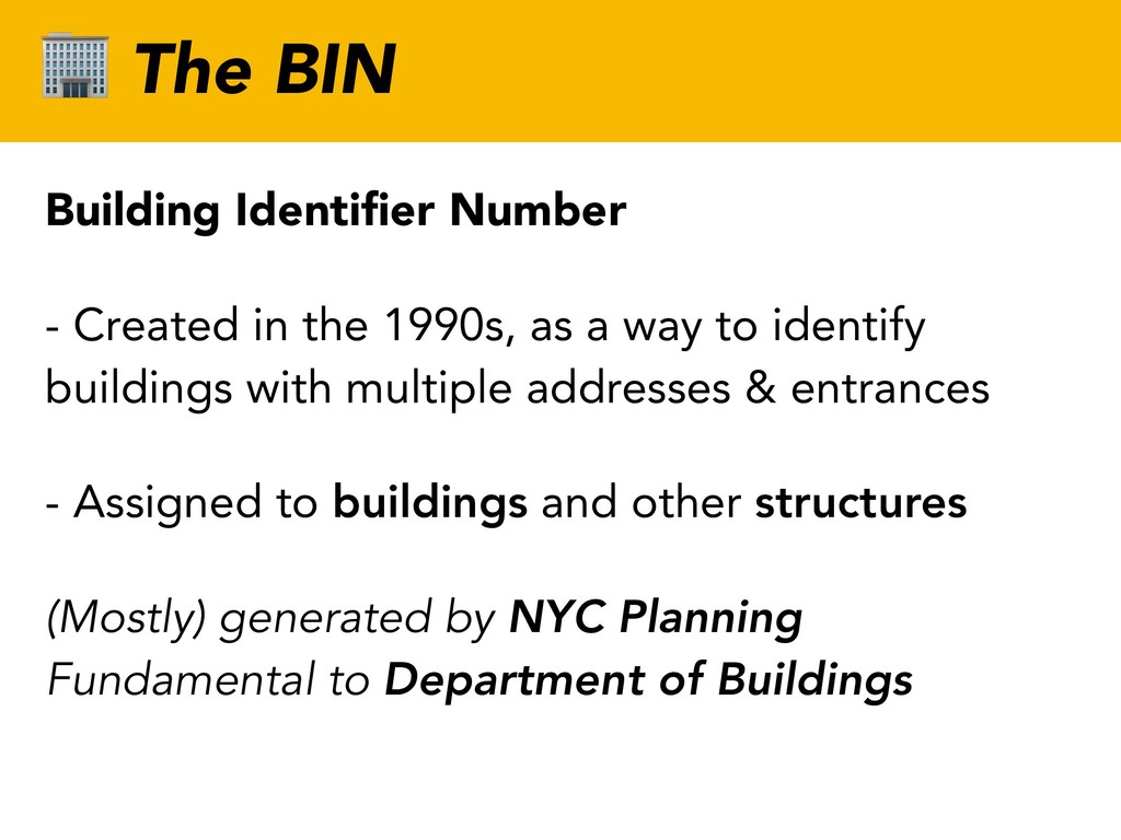
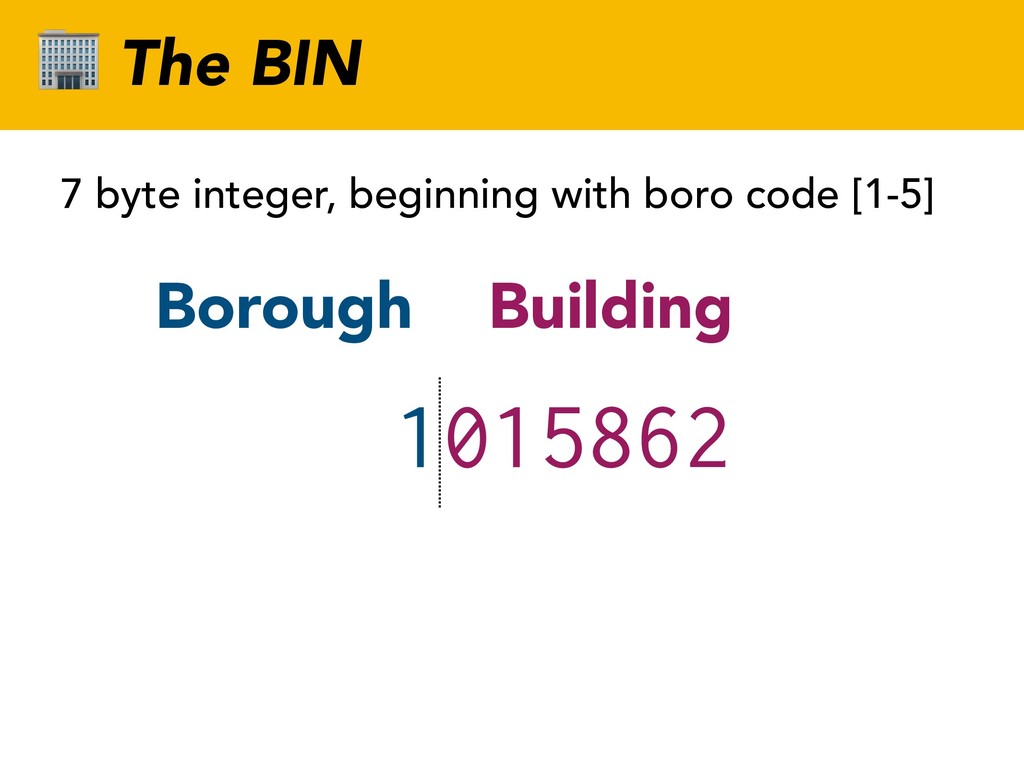
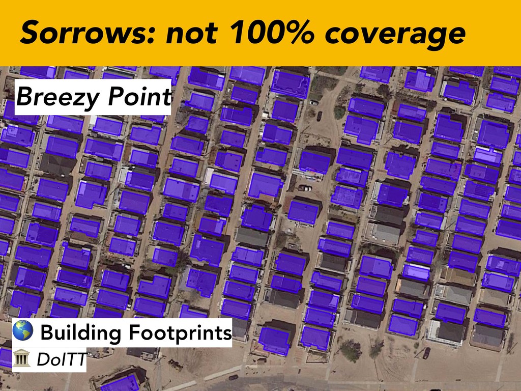
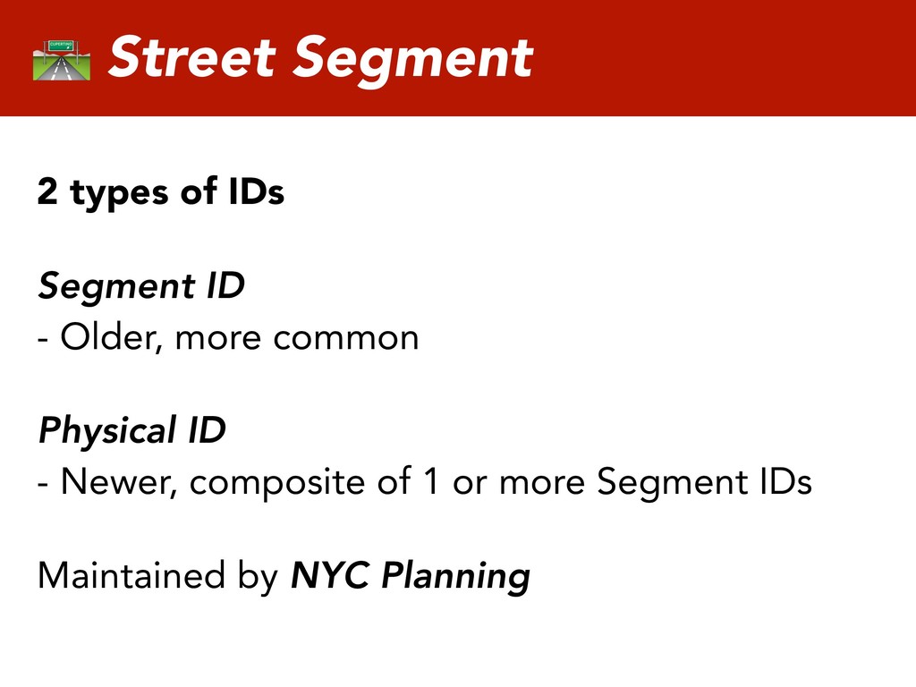
    as a way to identify buildings with multiple addresses & entrances - Assigned to buildings and other structures (Mostly) generated by NYC Planning
 Fundamental to Department of Buildings
  8. BIN Datasets Building Footprints
 DoITT DOB Job Application Filings
 Department

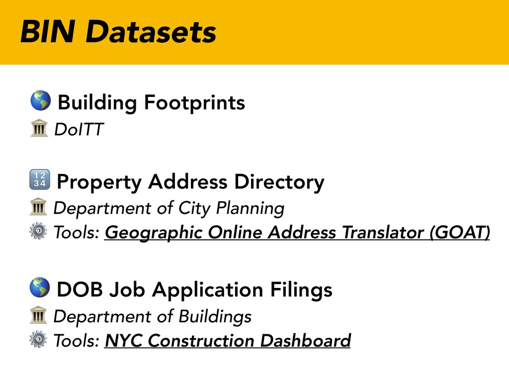
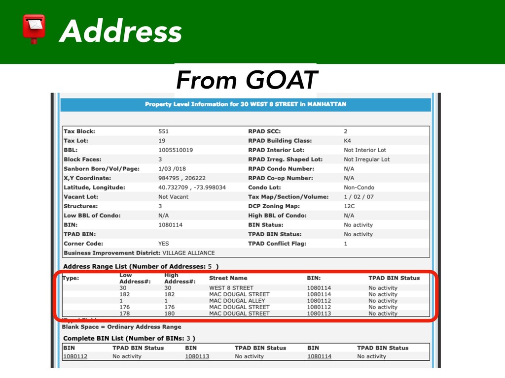
    of Buildings
 ⚙ Tools: NYC Construction Dashboard Property Address Directory
 Department of City Planning
 ⚙ Tools: Geographic Online Address Translator (GOAT)
  9. A BIN is born: construction Building permit filed with DOB

    DOB creates temporary BIN (TBIN) ✅ DOB issues a Certificate of Occupancy DCP adds BIN to address database (PAD) DoITT adds building footprints
  10. A BIN is retired: demolition Demolition permit filed with DOB

    DOB confirms demolition completion DCP removes BIN from address database DoITT removes building footprint
  11. NYC Address Points
 DoITT
 Metadata Address Datasets Property Address Directory


    Department of City Planning
 ⚙ Tools: Geographic Online Address Translator (GOAT)
  12. Address - Collection of information used to give the location

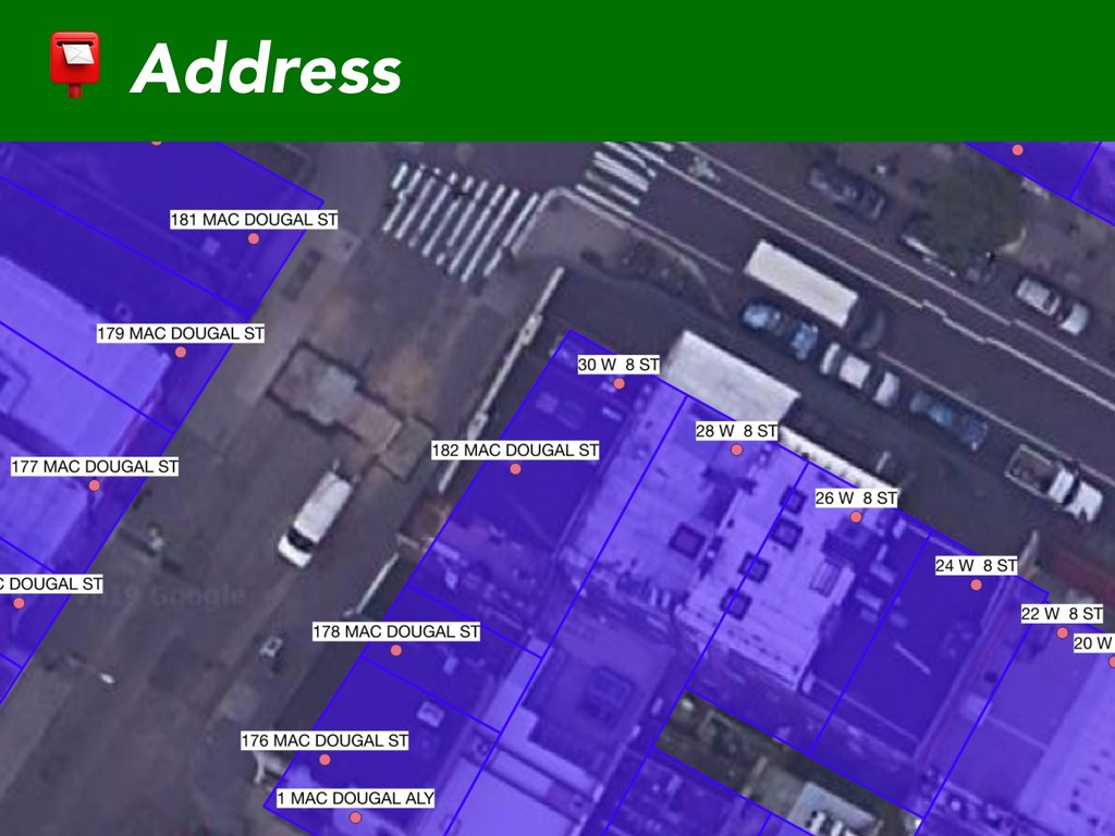
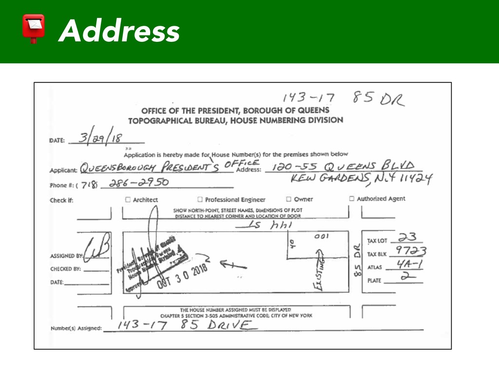
    of a building, apartment, or other structure or a plot of land - Generated by each Borough President’s office, integrated into data by NYC Planning Address
  13. Street Segment 2 types of IDs Segment ID
 - Older,

    more common Physical ID
 - Newer, composite of 1 or more Segment IDs Maintained by NYC Planning
  14. Street Segment Datasets Citywide Street Centerline (CSCL)
 DoITT
 Metadata
 Physical

    ID
 Linear Integrated Ordered Network (LION)
 Department of City Planning
 Segment ID + Physical ID
  15. Street Segment Joins Street Pavement Rating
 Department of Transportation
 Segment

    ID (with version year)
 ⚙ NYC Streets
 Street Construction Permits
 Department of Transportation
 Segment ID
 ⚙ NYC Streets
  16. Street Segment Joins PlowNYC
 Department of Sanitation
 Physical ID
 ⚙

    Plow NYC
 Traffic Counts
 Department of Transportation
 Segment ID (no version )
  17. Data and its limits Data will only ever approximate physical

    reality NYC an always changing reality Modeling such a complex reality, and maintaining that model over decades, let alone centuries, is extraordinary work
  18. Resources NYC Public Data: A primer on property data by

    David Elner NYC GIS Metadata by DoITT
 github.com/CityOfNewYork/nyc-geo-metadata NYCityMap & Beyond by DoITT GIS
 nycitymap.wordpress.com