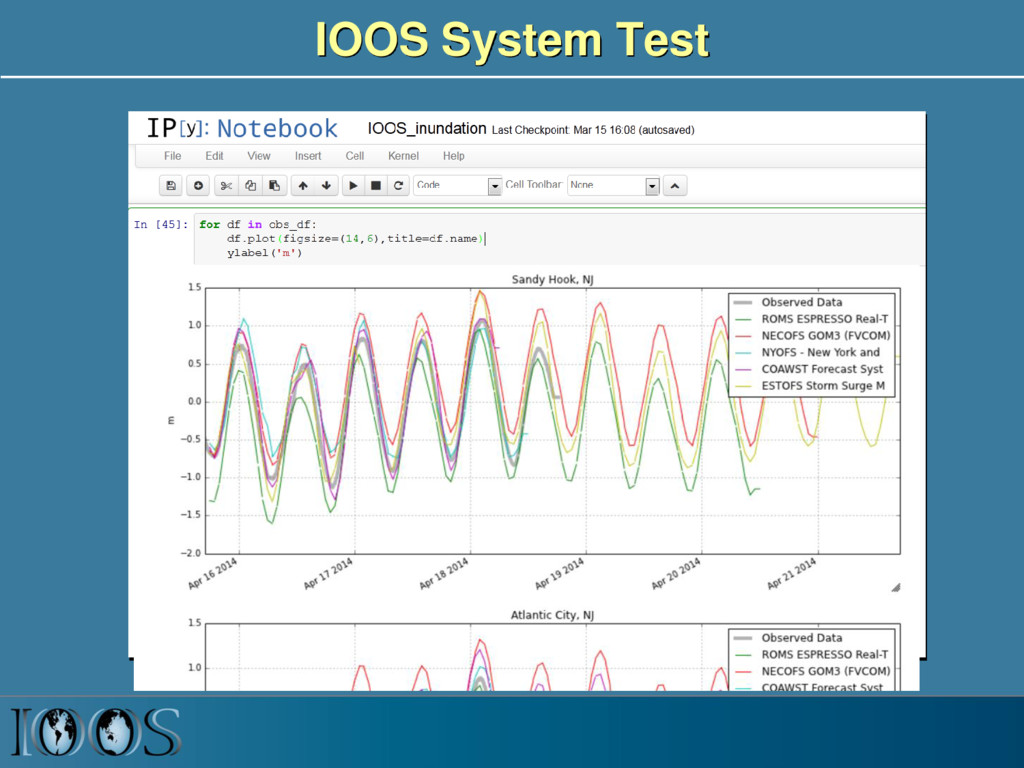
Rich Signell , USGS, Woods Hole, MA, USA Filipe Fernandes, SECOORA, Brazil Kyle Wilcox, Axiom Data Science, Wickford, RI, USA NOAA EDM Meeting, Washington, DC 2016-01-04
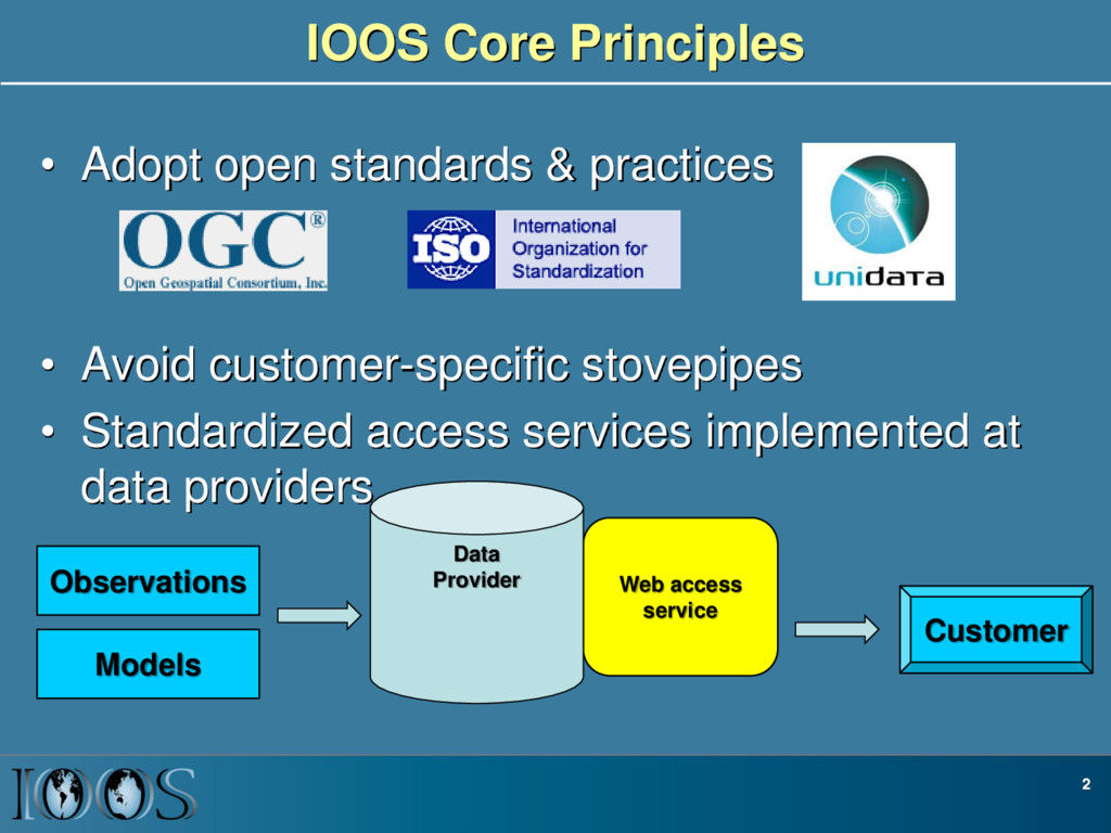
Avoid customer-specific stovepipes • Standardized access services implemented at data providers 2 Customer Web access service Data Provider Observations Models
Global Organization for Earth System Science Portal IOOS: Integrated Ocean Observing System ESMF: Earth System Modeling Framework OGC: Open Geospatial Consortium (GALEON: WCS profile)
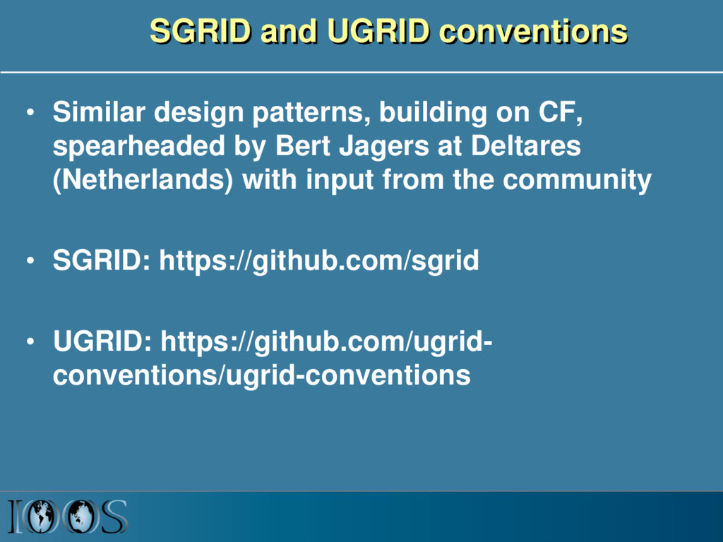
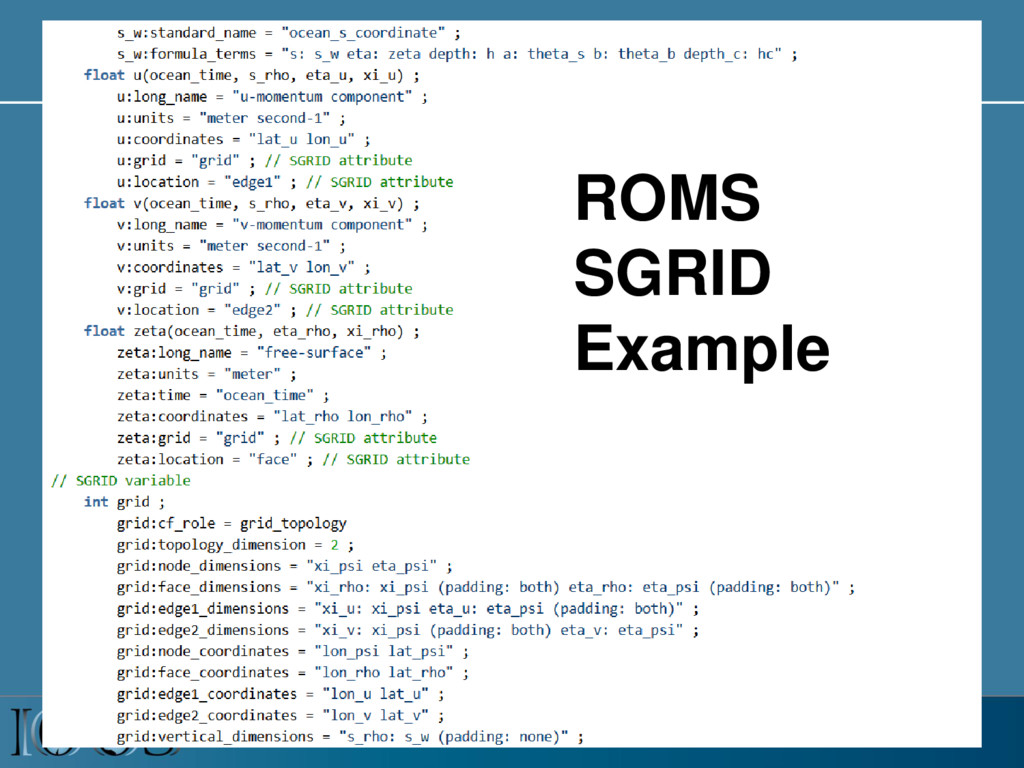
CF, spearheaded by Bert Jagers at Deltares (Netherlands) with input from the community • SGRID: https://github.com/sgrid • UGRID: https://github.com/ugrid- conventions/ugrid-conventions
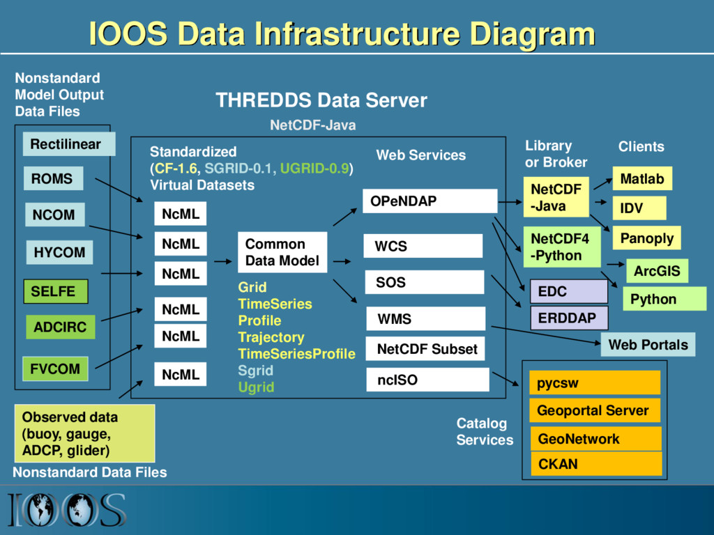
NcML NcML NcML NcML Common Data Model OPeNDAP NetCDF Subset THREDDS Data Server Standardized (CF-1.6, SGRID-0.1, UGRID-0.9) Virtual Datasets Nonstandard Model Output Data Files Web Services Matlab Panoply IDV Clients NetCDF -Java Library or Broker WMS ncISO ArcGIS NetCDF4 -Python FVCOM Python EDC NetCDF-Java SOS Geoportal Server GeoNetwork CKAN Observed data (buoy, gauge, ADCP, glider) Web Portals pycsw NcML Grid TimeSeries Profile Trajectory TimeSeriesProfile Sgrid Ugrid Nonstandard Data Files Catalog Services Rectilinear ERDDAP WCS
independent access to UGRID-compliant data in python (https://github.com/pyugrid) • pysgrid: allows model independent access to SGRID-compliant data in python (https://github.com/sgrid/pysgrid)
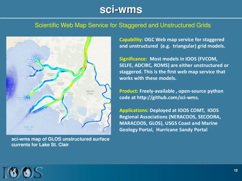
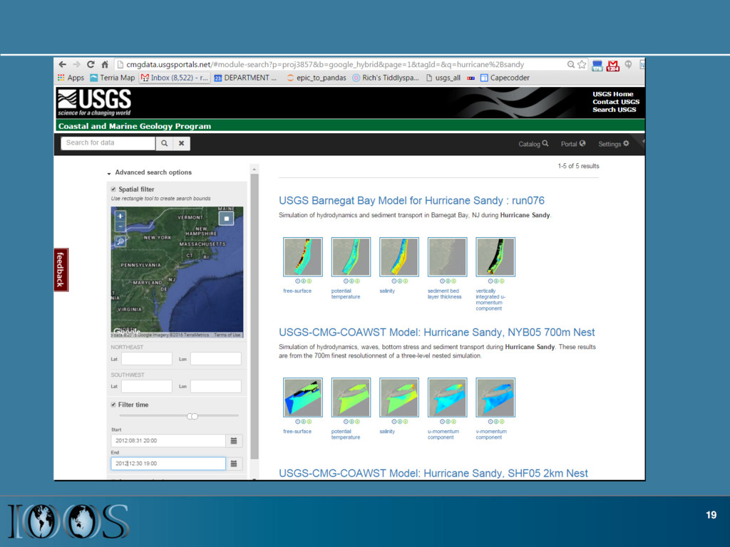
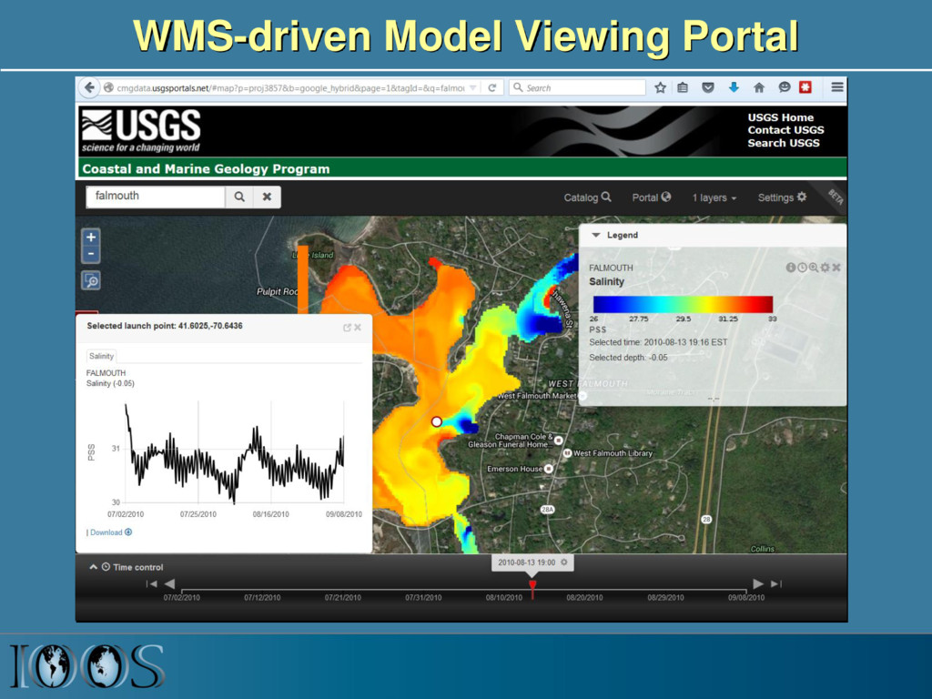
Grids Capability: OGC Web map service for staggered and unstructured (e.g. triangular) grid models. Significance: Most models in IOOS (FVCOM, SELFE, ADCIRC, ROMS) are either unstructured or staggered. This is the first web map service that works with these models. Product: Freely-available , open-source python code at http://github.com/sci-wms. Applications: Deployed at IOOS COMT, IOOS Regional Associations (NERACOOS, SECOORA, MARACOOS, GLOS), USGS Coast and Marine Geology Portal, Hurricane Sandy Portal sci-wms map of GLOS unstructured surface currents for Lake St. Clair
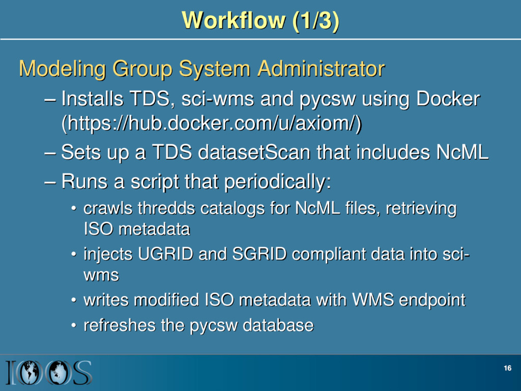
using Docker (https://hub.docker.com/u/axiom/) – Sets up a TDS datasetScan that includes NcML – Runs a script that periodically: • crawls thredds catalogs for NcML files, retrieving ISO metadata • injects UGRID and SGRID compliant data into sci- wms • writes modified ISO metadata with WMS endpoint • refreshes the pycsw database 16 Workflow (1/3)
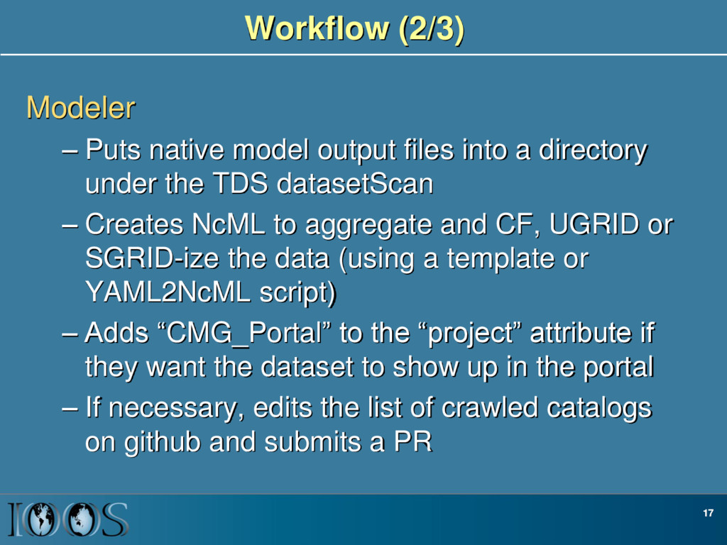
a directory under the TDS datasetScan – Creates NcML to aggregate and CF, UGRID or SGRID-ize the data (using a template or YAML2NcML script) – Adds “CMG_Portal” to the “project” attribute if they want the dataset to show up in the portal – If necessary, edits the list of crawled catalogs on github and submits a PR 17
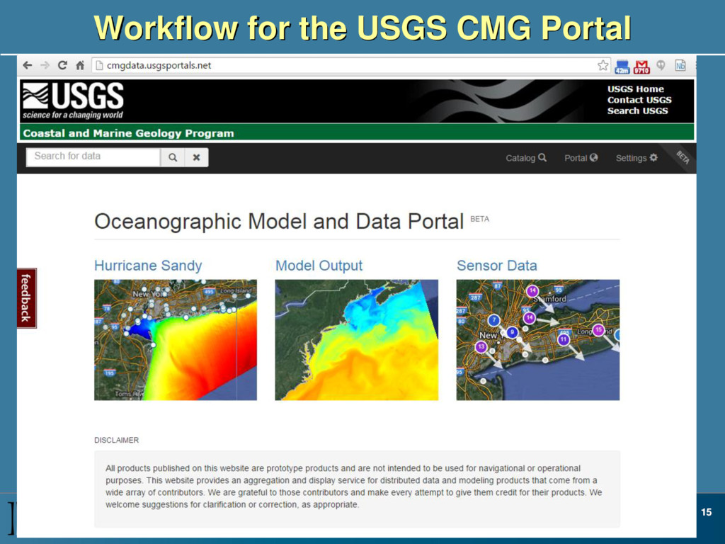
(in a cron job) on the modeling groups pycsw services, filtering on datasets that contain a project called “CMG_Portal” – Datasets that have valid WMS services are added to the portal See <https://github.com/USGS-CMG/usgs-cmg- portal/wiki> for details of the workflow 18
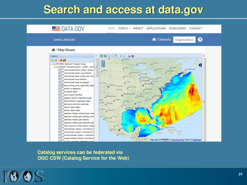
accessing data, and displaying map images from all common ocean models (including all NOAA ocean forecast models) • Modeling groups can enable these services using free software: TDS, sci-wms, pycsw and automate management with some simple scripts
UGRID and SGRID • Make the framework more robust: improve testing, documentation, training • Improve performance of WMS services for SGRID and UGRID data • Investigate TerriaJS as a common infrastructure for model product browsing via standard services • Add UGRID and SGRID support to netcdf-java