Woods Hole, MA, USA Filipe Fernandes, SECOORA, Salvador, Brazil Kyle Wilcox, Axiom Data Science, Wickford, RI Hazards-SEES Kick-off Meeting, MIT 2016-01-14
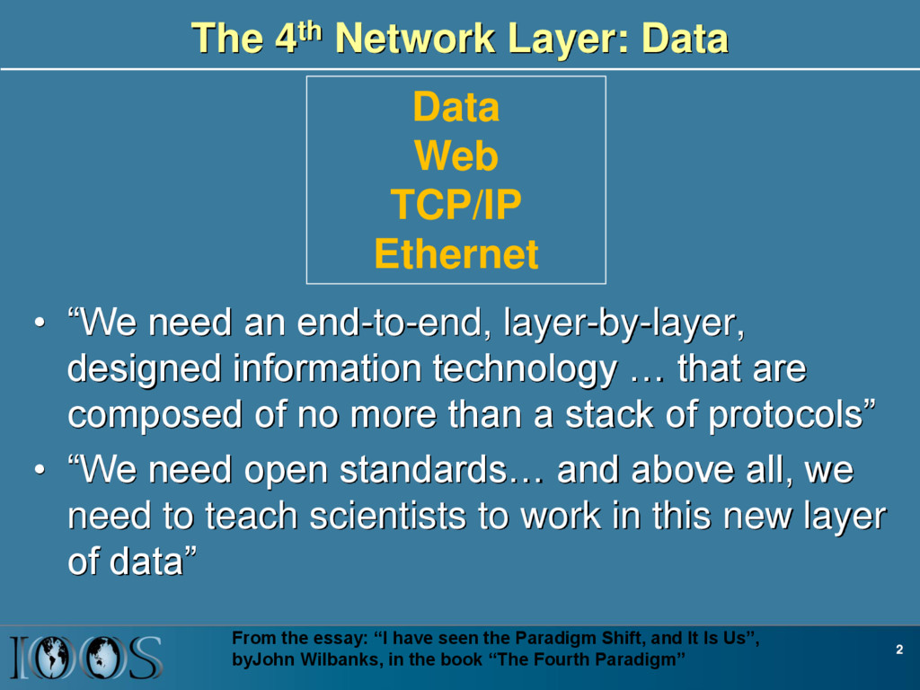
layer-by-layer, designed information technology … that are composed of no more than a stack of protocols” • “We need open standards… and above all, we need to teach scientists to work in this new layer of data” 2 From the essay: “I have seen the Paradigm Shift, and It Is Us”, byJohn Wilbanks, in the book “The Fourth Paradigm” Data Web TCP/IP Ethernet
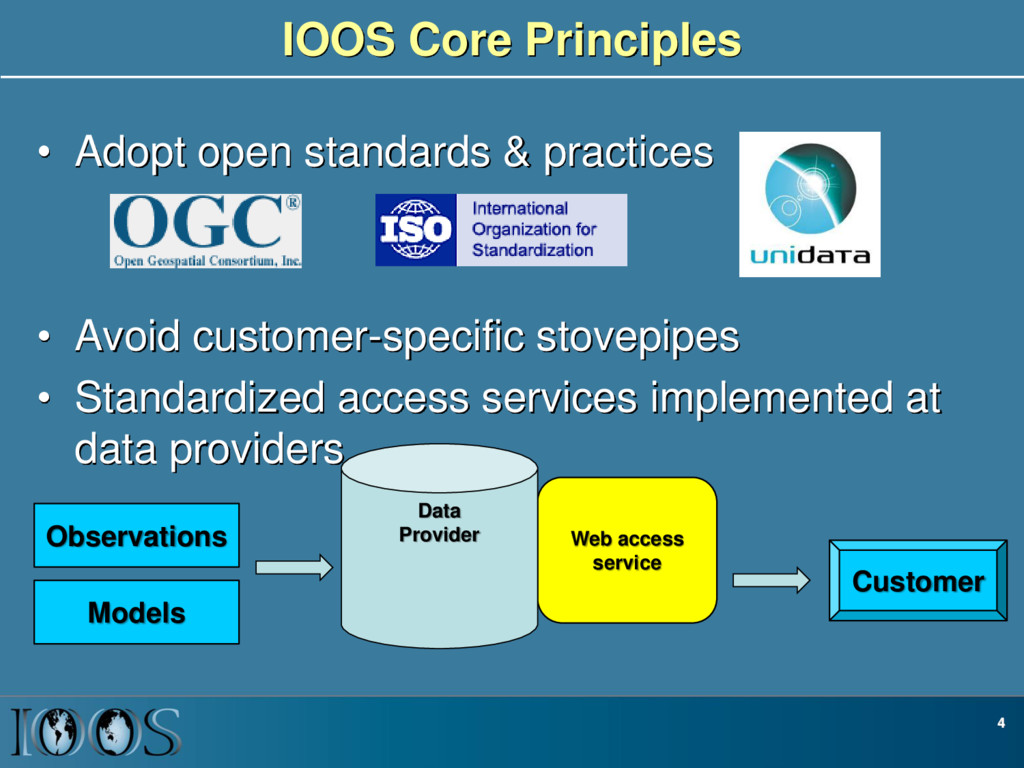
Avoid customer-specific stovepipes • Standardized access services implemented at data providers 4 Customer Web access service Data Provider Observations Models
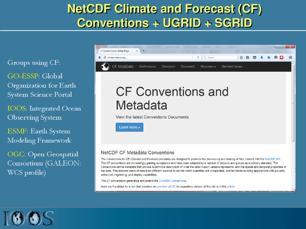
Groups using CF: GO-ESSP: Global Organization for Earth System Science Portal IOOS: Integrated Ocean Observing System ESMF: Earth System Modeling Framework OGC: Open Geospatial Consortium (GALEON: WCS profile)
NcML NcML NcML NcML Common Data Model OPeNDAP+CF WCS NetCDF Subset THREDDS Data Server Standardized (CF-1.6, UGRID-0.9) Virtual Datasets Nonstandard Model Output Data Files Web Services Matlab Panoply IDV Clients NetCDF -Java Library or Broker WMS ncISO ArcGIS NetCDF4 -Python FVCOM Python ERDDAP NetCDF-Java SOS Geoportal Server GeoNetwork GI-CAT Observed data (buoy, gauge, ADCP, glider) Web Portals CKAN-pyCSW NcML Grid Ugrid TimeSeries Profile Trajectory TimeSeriesProfile Nonstandard Data Files Catalog Services
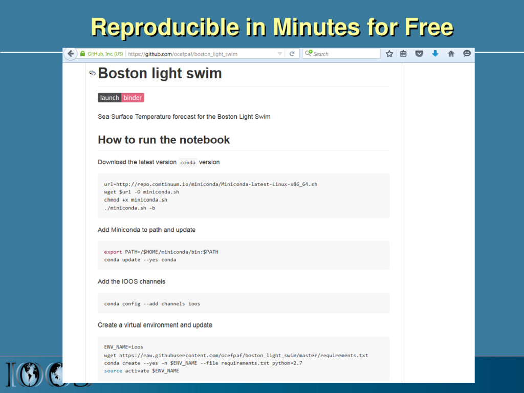
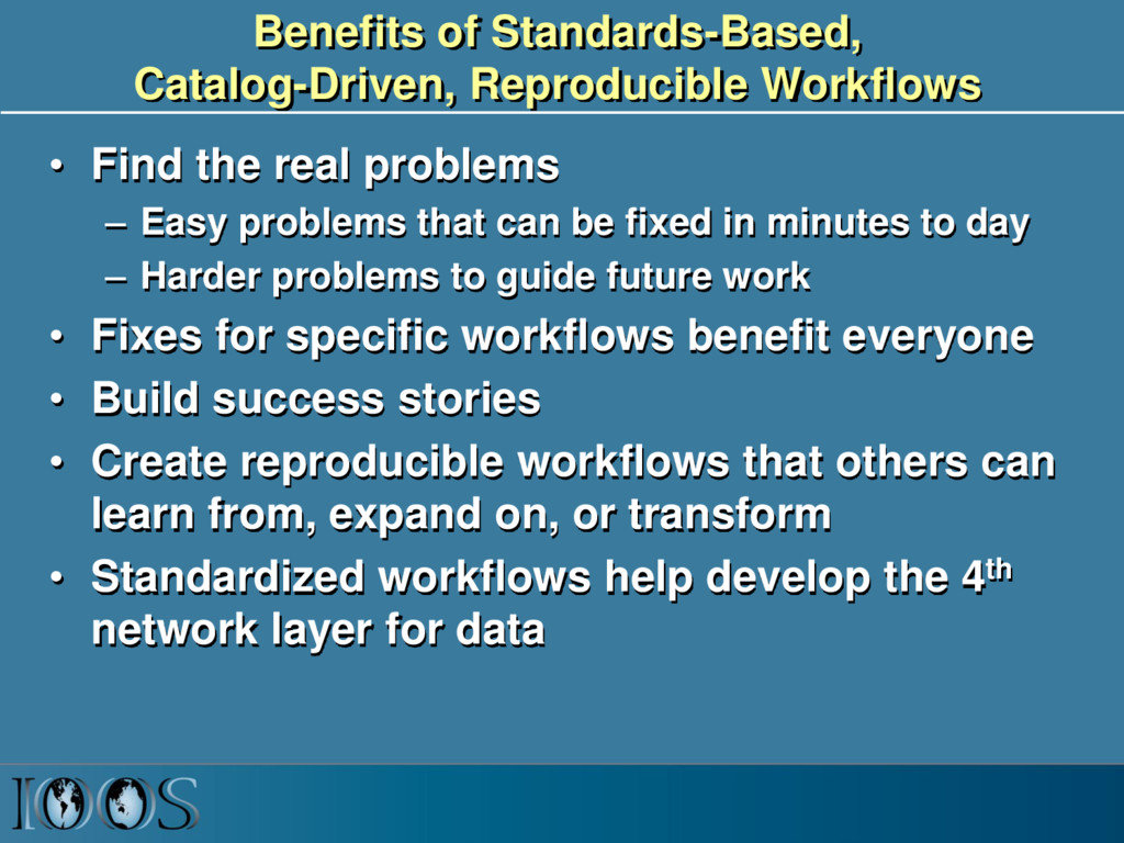
problems – Easy problems that can be fixed in minutes to day – Harder problems to guide future work • Fixes for specific workflows benefit everyone • Build success stories • Create reproducible workflows that others can learn from, expand on, or transform • Standardized workflows help develop the 4th network layer for data
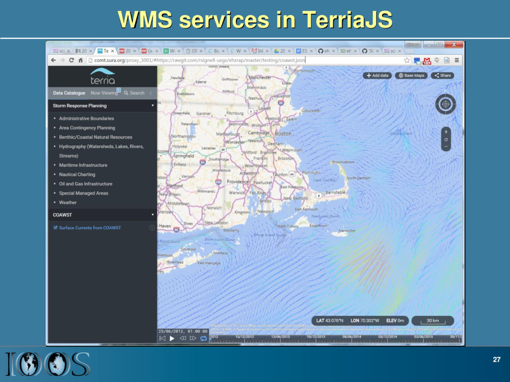
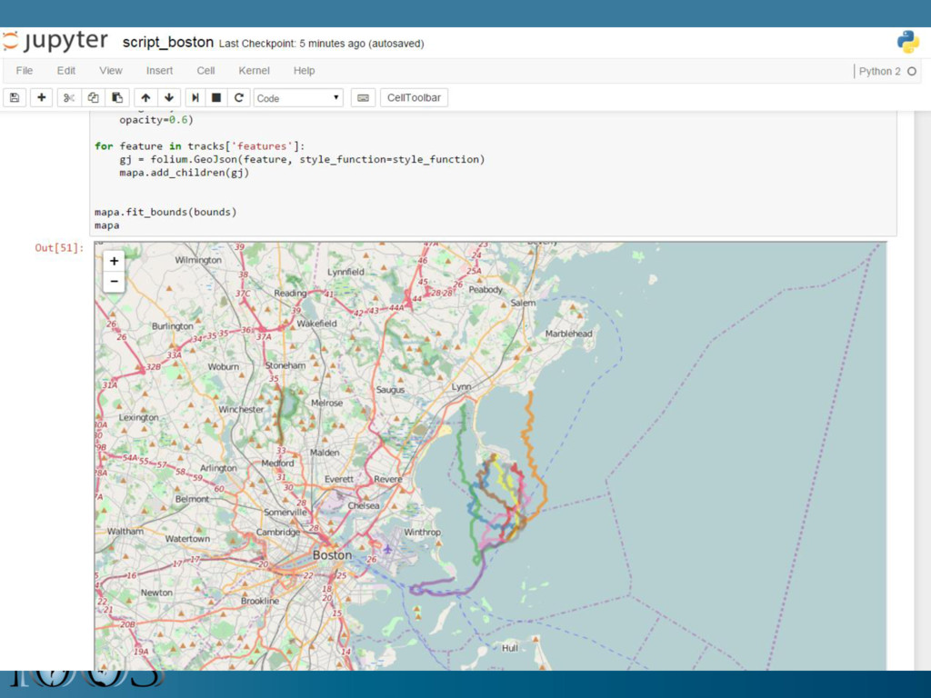
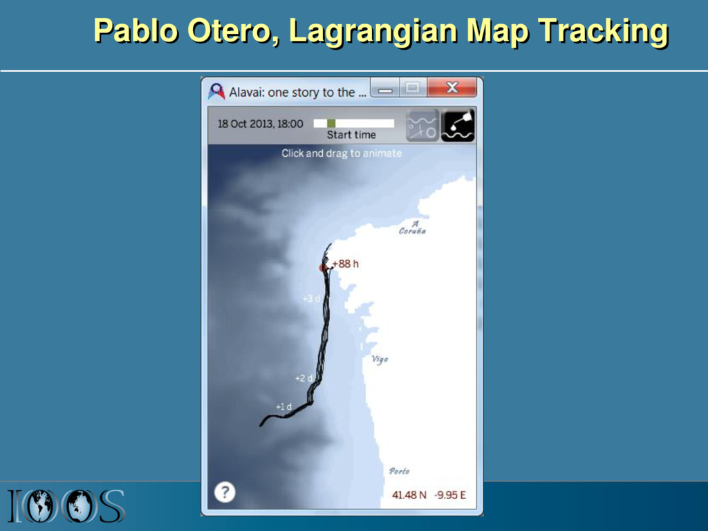
most important items for a successful Hazards project? 2. What are you most looking forward to achieve personally and as a team? 3. What are the main things that you need from other team members? 4. What are the biggest challenges for your role in the Hazards project? • Work with team members to achieve standardized data, services and use community tools. Standards for Lagrangian scientific feature types, CZML, TerriaJS
![[ rsignell-usgs | ocefpaf ] & github](https://files.speakerdeck.com/presentations/409859d131c4463391a5a7700e83e761/slide_31.jpg)