Upgrade to Pro — share decks privately, control downloads, hide ads and more …

Toward OGC Support for the Next Generation of Climate and Forecast Models

Toward OGC Support for the Next Generation of Climate and Forecast Models

Presentation to the Open Geospatial Consortium (OGC) Coverage Domain Working Group

Rich Signell

March 07, 2016
Tweet

More Decks by Rich Signell

Other Decks in Science

Transcript

  1. Toward OGC Support for the Next Generation of Climate and

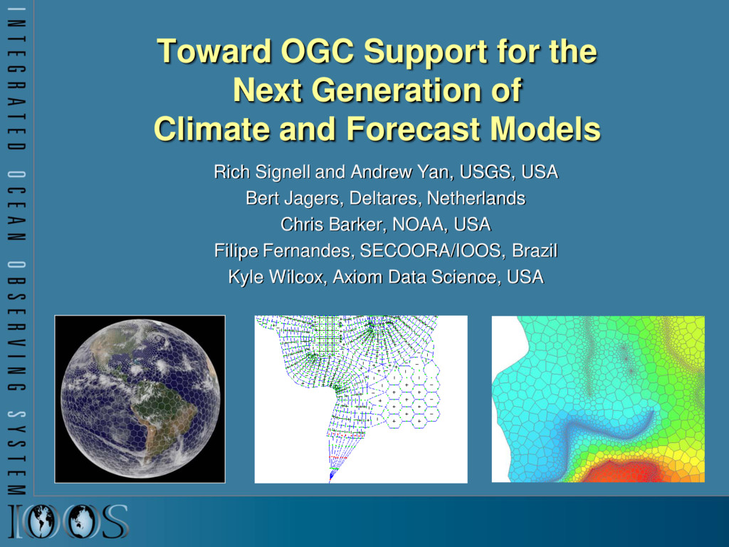
    Forecast Models Rich Signell and Andrew Yan, USGS, USA Bert Jagers, Deltares, Netherlands Chris Barker, NOAA, USA Filipe Fernandes, SECOORA/IOOS, Brazil Kyle Wilcox, Axiom Data Science, USA
  2. Ocean grids are often not regularly spaced! Stretched surface and

    terrain following vertical coordinates Curvilinear orthogonal horizontal coordinates
  3. CF Conventions for met/ocean models Groups using CF: OGC: Open

    Geospatial Consortium GO-ESSP: Global Organization for Earth System Science Portal IOOS: Integrated Ocean Observing System float temp(ocean_time, s_rho, eta_rho, xi_rho) ; temp: standard_name = “sea_water_potential_temperature" ; temp: units = "Celsius" ; temp: coordinates = "lon_rho lat_rho s_rho ocean_time" ; double s_rho(s_rho) ; s_rho: long_name = "S-coordinate at RHO-points" ; s_rho: positive = "up" ; s_rho: standard_name = "ocean_s_coordinate_g1" ; s_rho: formula_terms = "s: s_rho C: Cs_r eta: zeta depth: h depth_c: hc "
  4. IOOS Recommended Web Services and Data Encodings In-situ data (buoys,

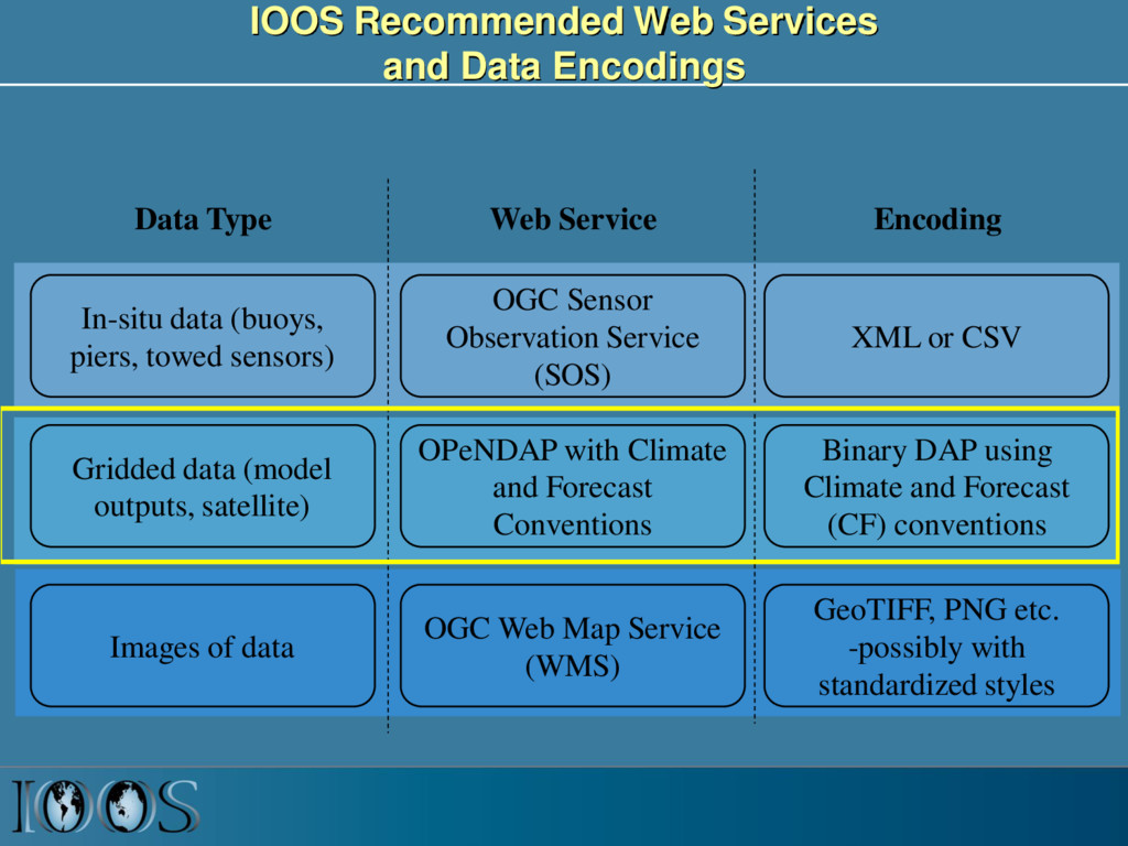
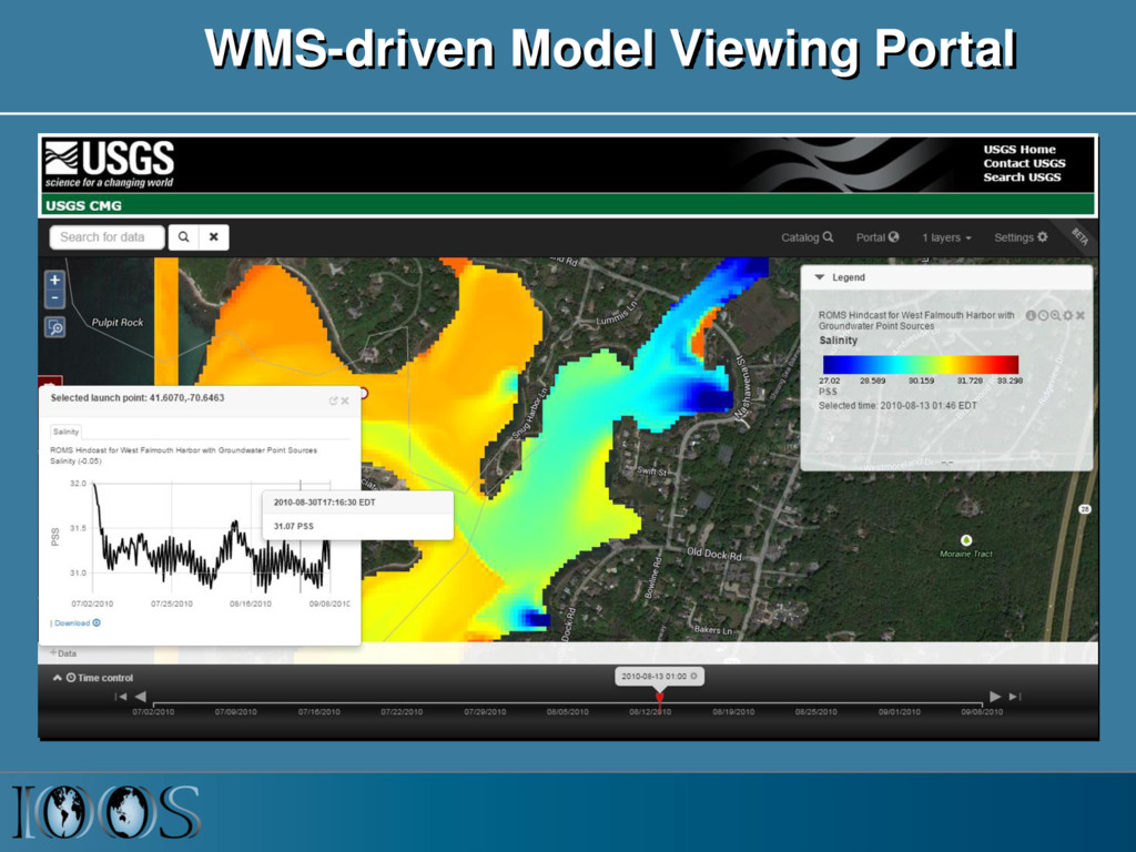
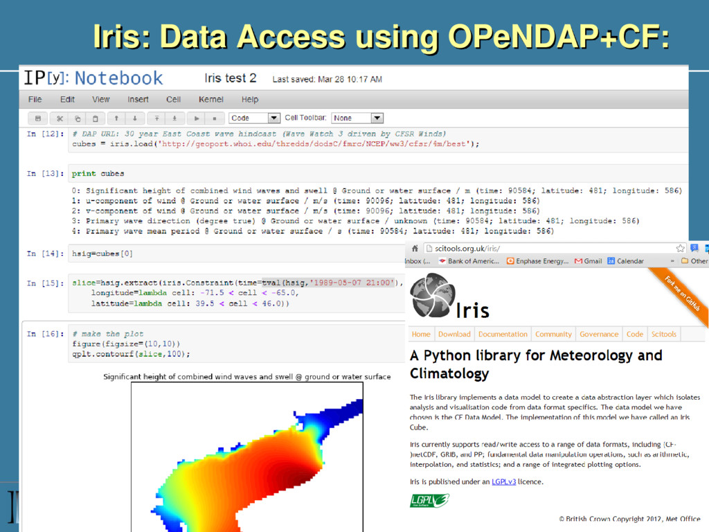
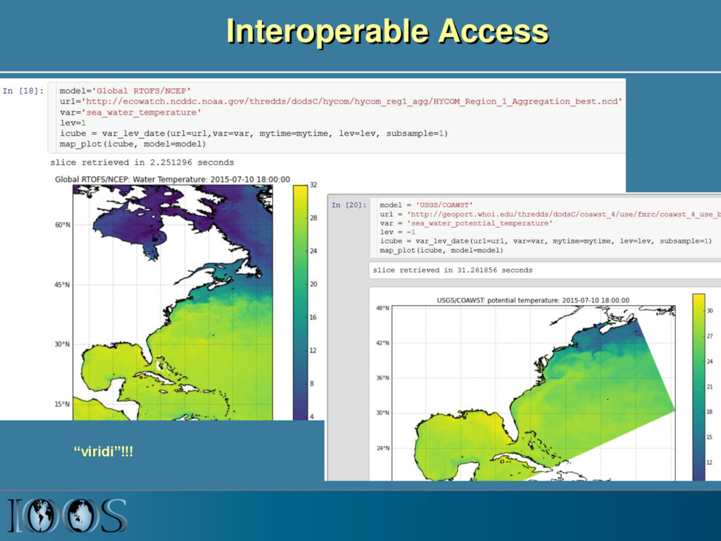
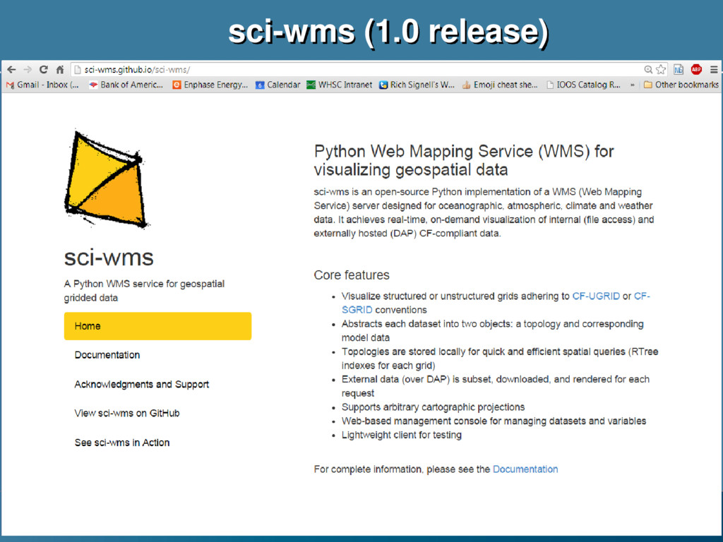
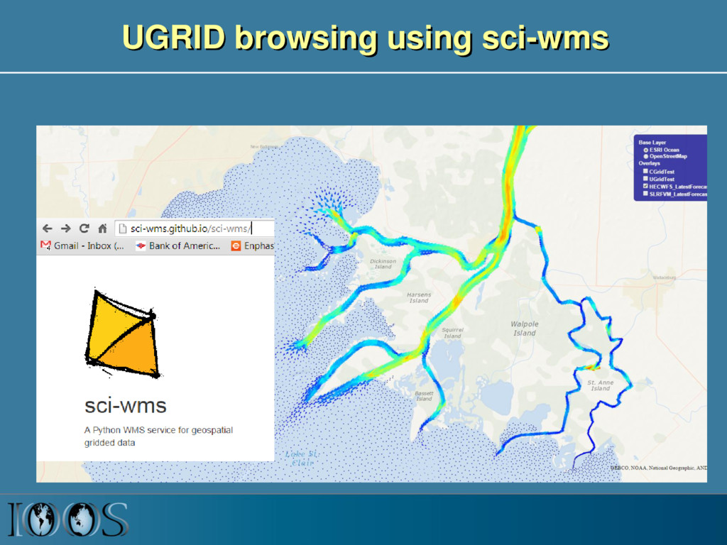
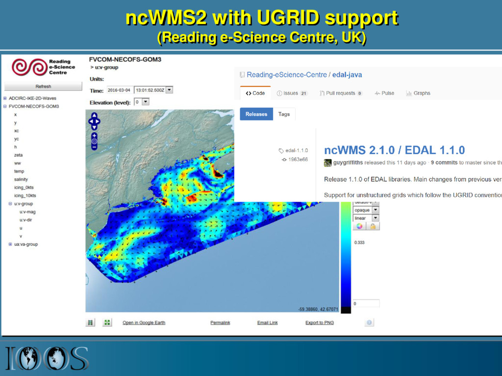
    piers, towed sensors) Gridded data (model outputs, satellite) OGC Sensor Observation Service (SOS) OPeNDAP with Climate and Forecast Conventions XML or CSV Binary DAP using Climate and Forecast (CF) conventions Images of data OGC Web Map Service (WMS) GeoTIFF, PNG etc. -possibly with standardized styles Data Type Web Service Encoding
  5. IOOS Data Infrastructure Diagram ROMS ADCIRC HYCOM SELFE NCOM NcML

    NcML NcML NcML NcML Common Data Model OPeNDAP+CF WCS NetCDF Subset THREDDS Data Server Standardized (CF-1.6, UGRID-0.9) Virtual Datasets Nonstandard Model Output Data Files Web Services Matlab Panoply IDV Clients NetCDF -Java Library or Broker WMS ncISO ArcGIS NetCDF4 -Python FVCOM Python ERDDAP NetCDF-Java SOS Geoportal Server GeoNetwork GI-CAT Observed data (buoy, gauge, ADCP, glider) Godiva2 pycsw - CKAN NcML Grid Ugrid TimeSeries Profile Trajectory TimeSeriesProfile Nonstandard Data Files Catalog Services
  6. Next-Generation Models MPAS Global Forecast Model, NCAR/LANL, USA MODFLOW-USG Groundwater

    Model, USGS, USA Delft-Unstructured Ocean/Estuary/River Model (Deltares, Netherlands)
  7. Summary • Want OGC-compliant data models, services and tools that

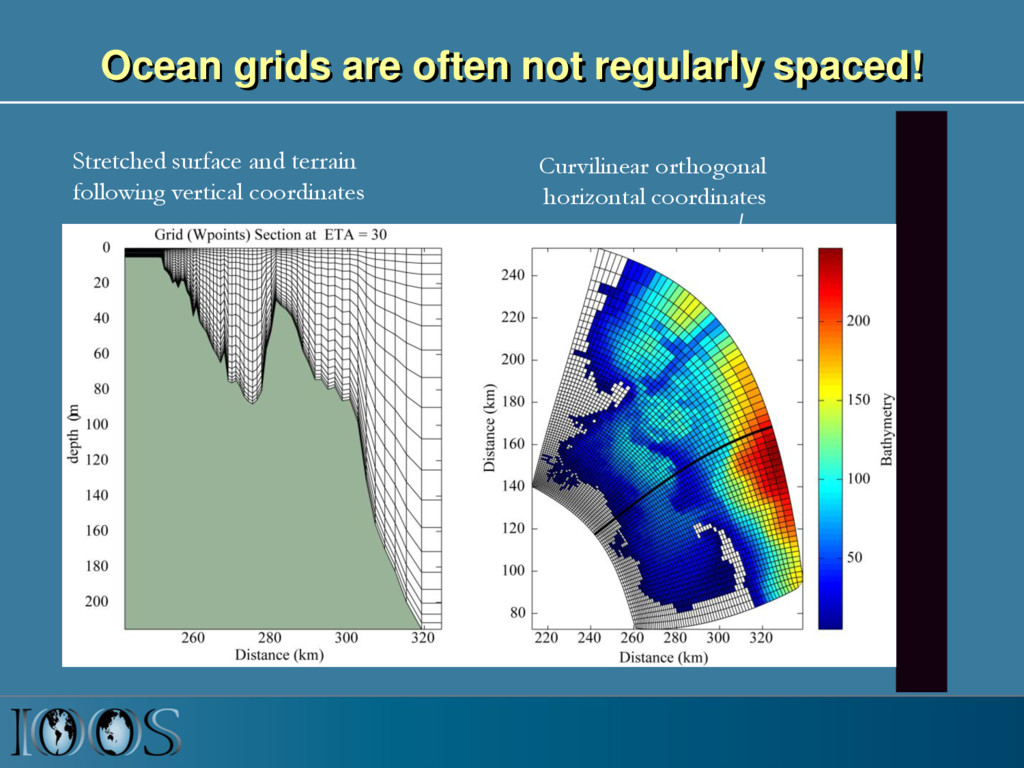
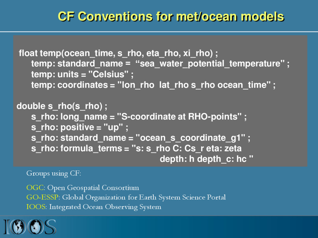
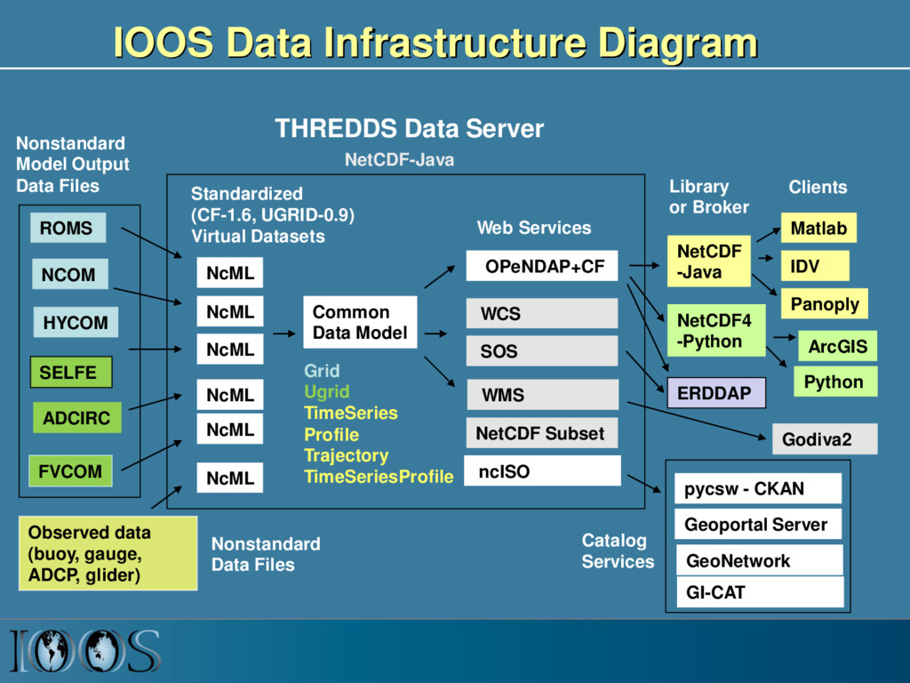
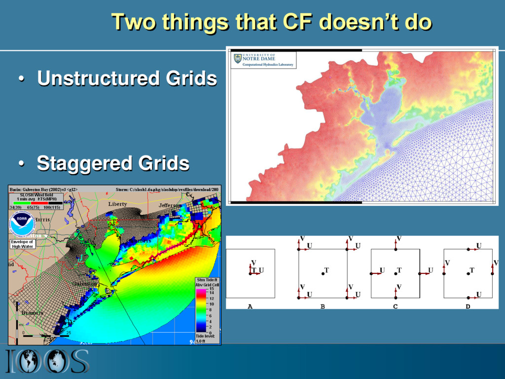
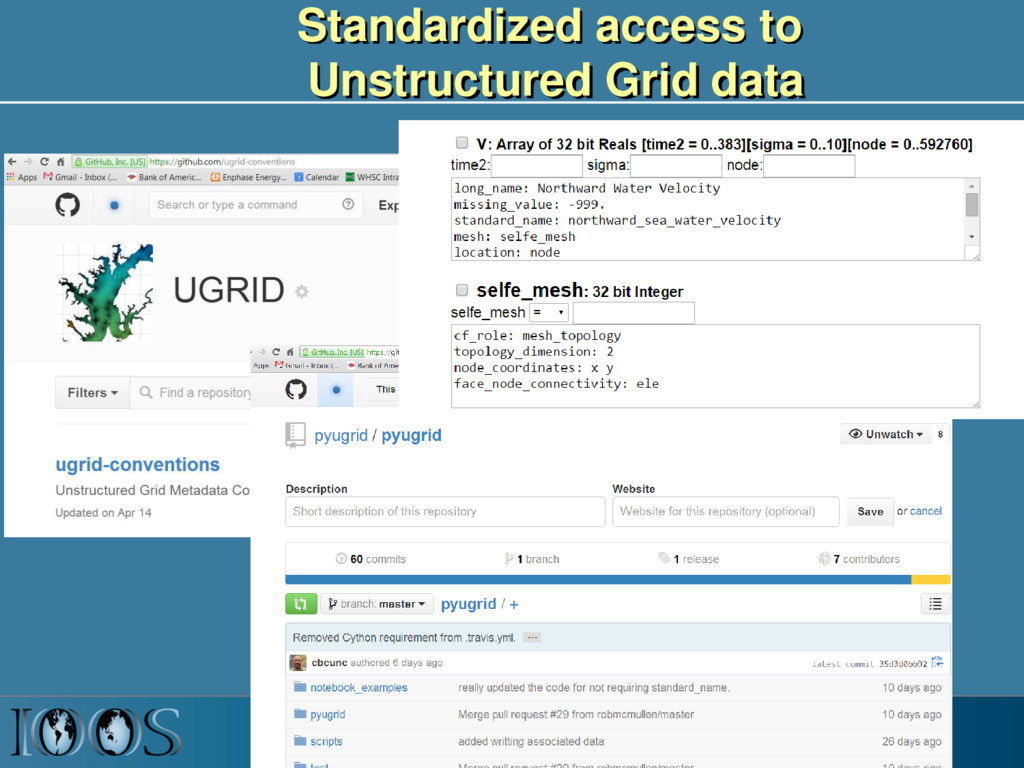
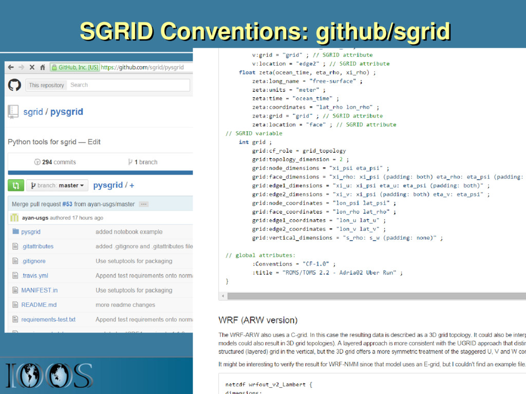
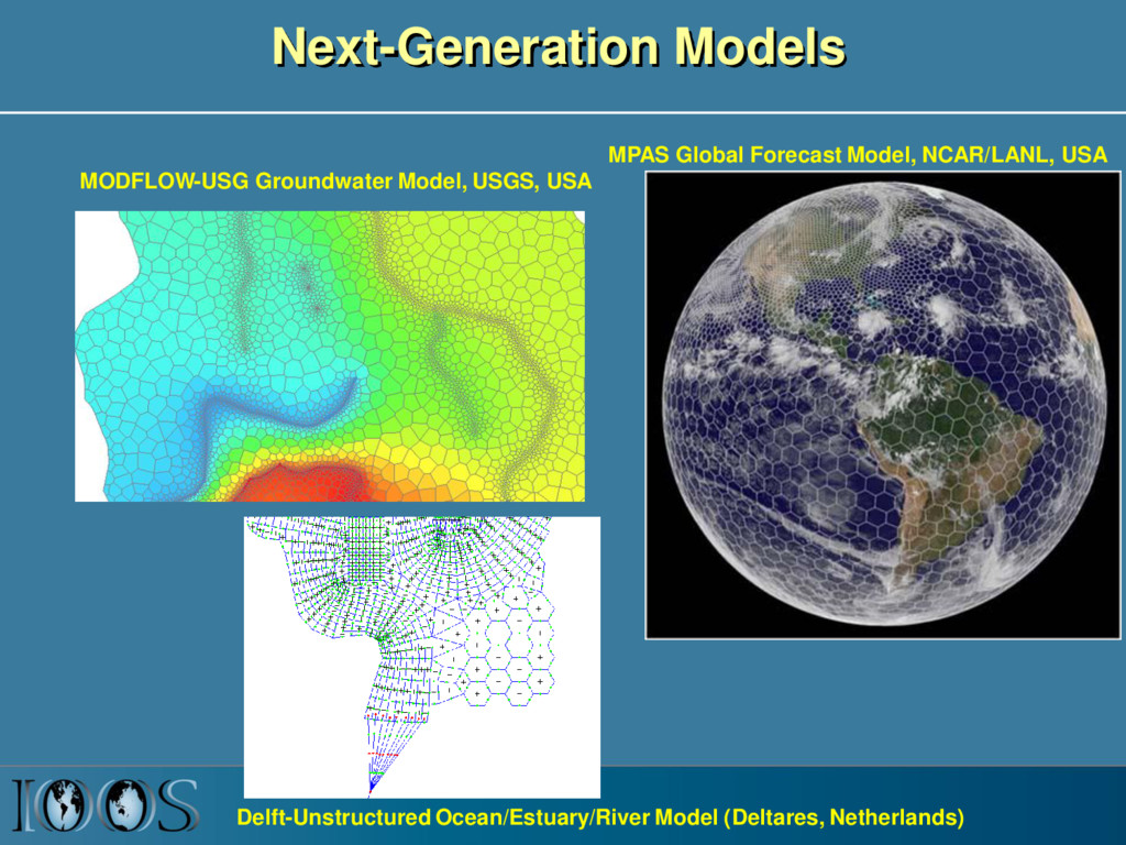
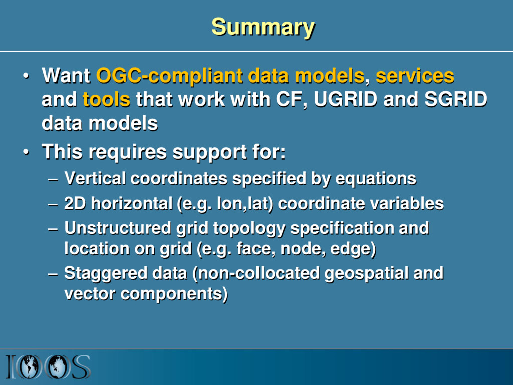
    work with CF, UGRID and SGRID data models • This requires support for: – Vertical coordinates specified by equations – 2D horizontal (e.g. lon,lat) coordinate variables – Unstructured grid topology specification and location on grid (e.g. face, node, edge) – Staggered data (non-collocated geospatial and vector components)