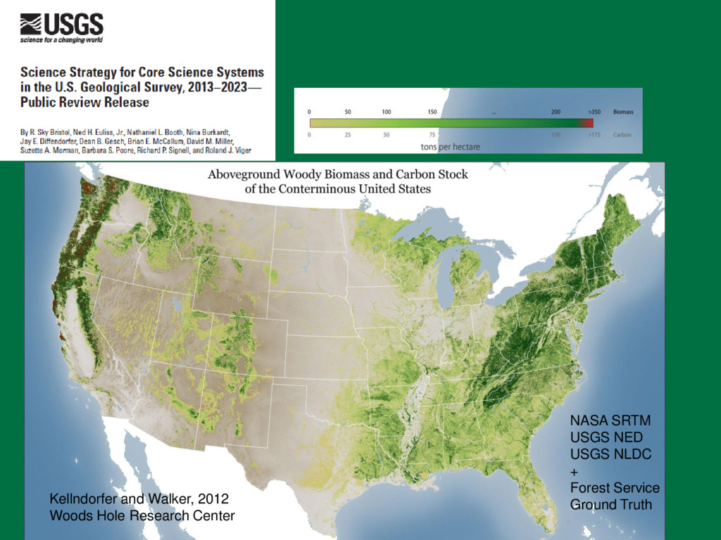
that contributes to the wise management of the Nation's natural resources and that promotes the health, safety, and well- being of the people Slogan: “Science for a Changing World”
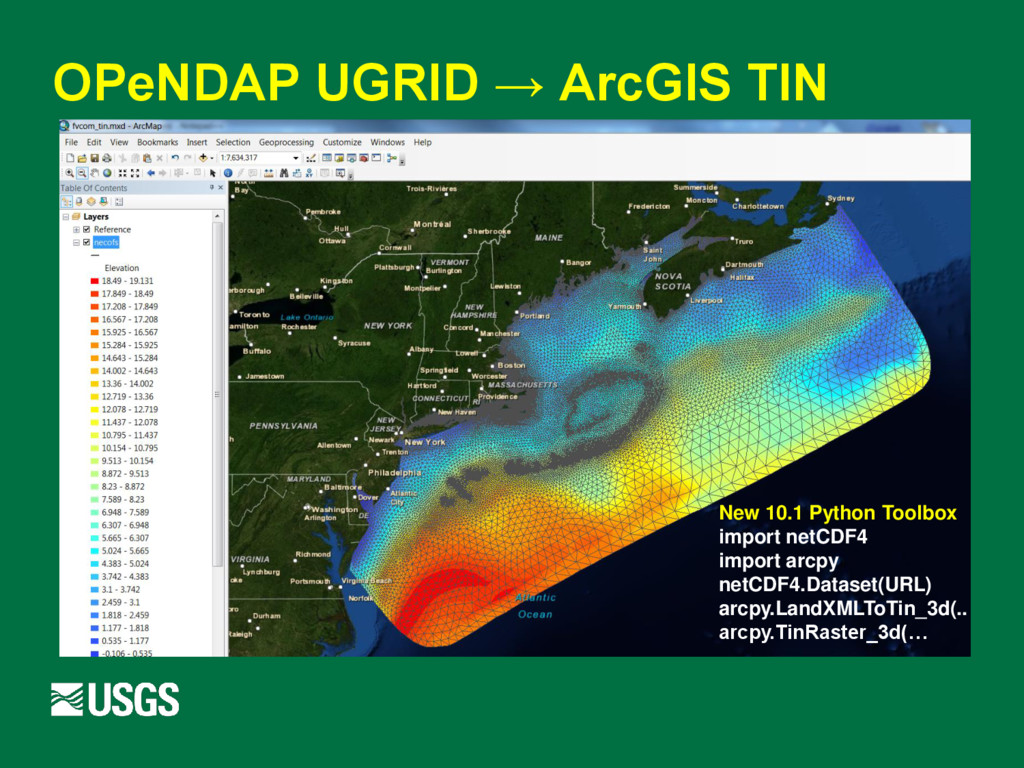
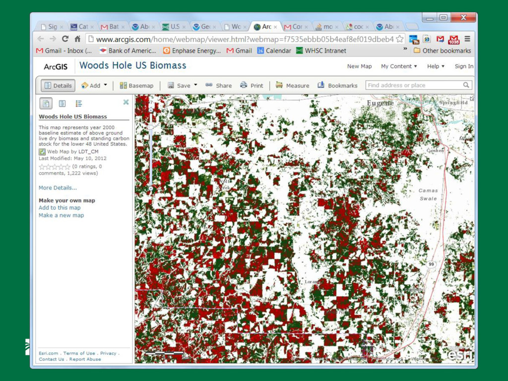
ArcGIS as their primary scientific analysis and visualation tool ArcGIS 10 uses Python as it’s scripting and interface language Use of Python allows ArcGIS users to utilize 100s of community packages In 2012, USGS bought an Enthought Python Distribution (EPD) site license to facilitate interoperability of science workflows
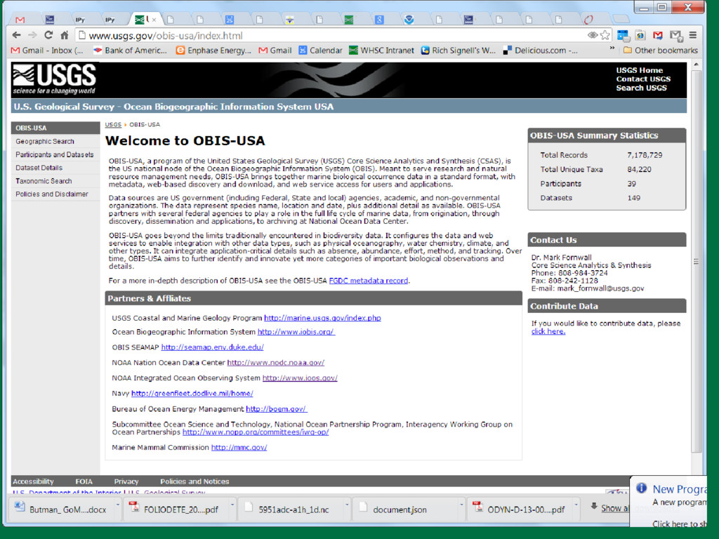
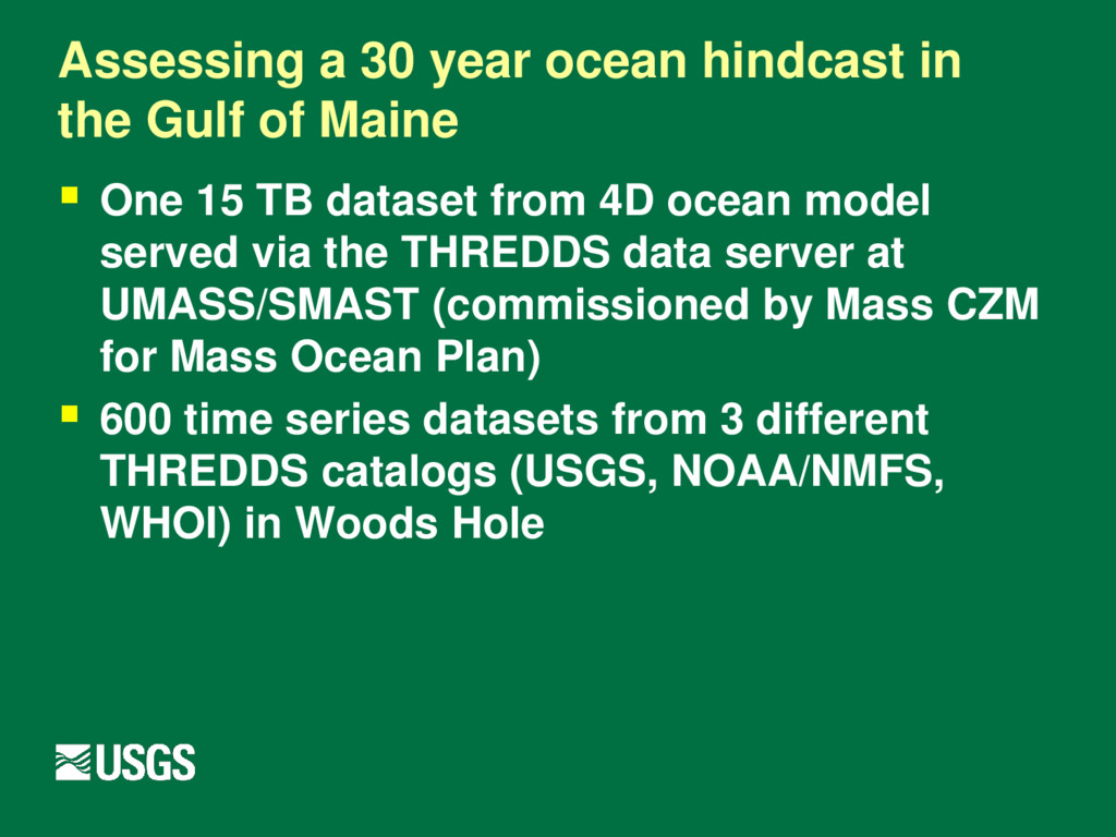
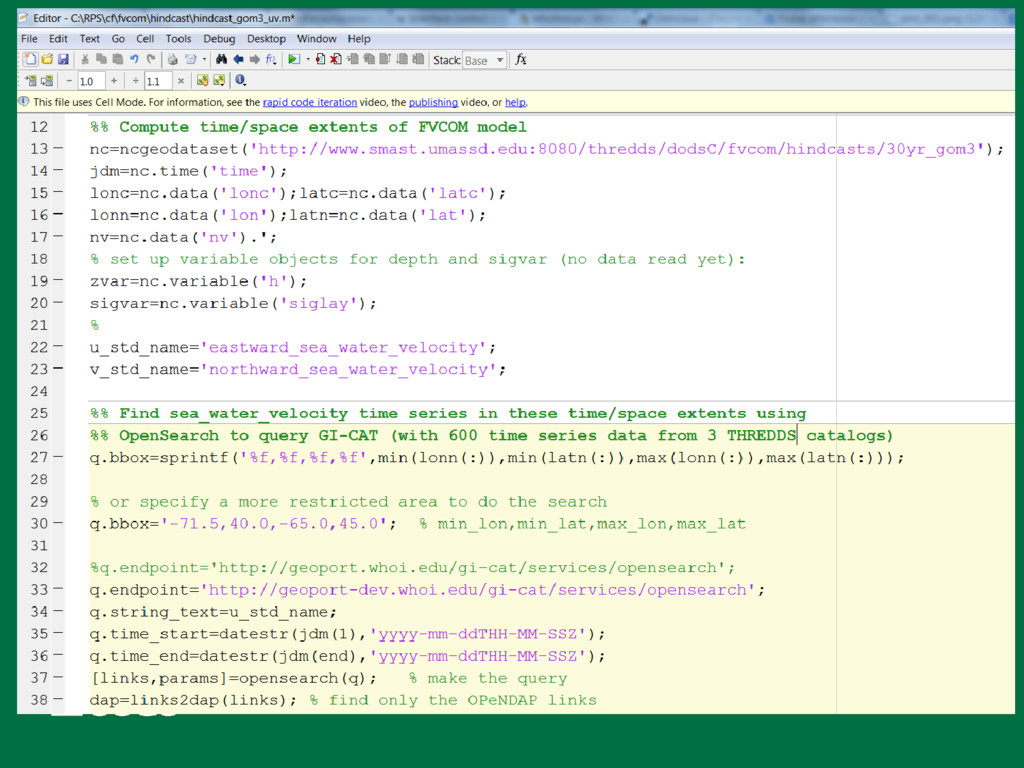
Maine One 15 TB dataset from 4D ocean model served via the THREDDS data server at UMASS/SMAST (commissioned by Mass CZM for Mass Ocean Plan) 600 time series datasets from 3 different THREDDS catalogs (USGS, NOAA/NMFS, WHOI) in Woods Hole
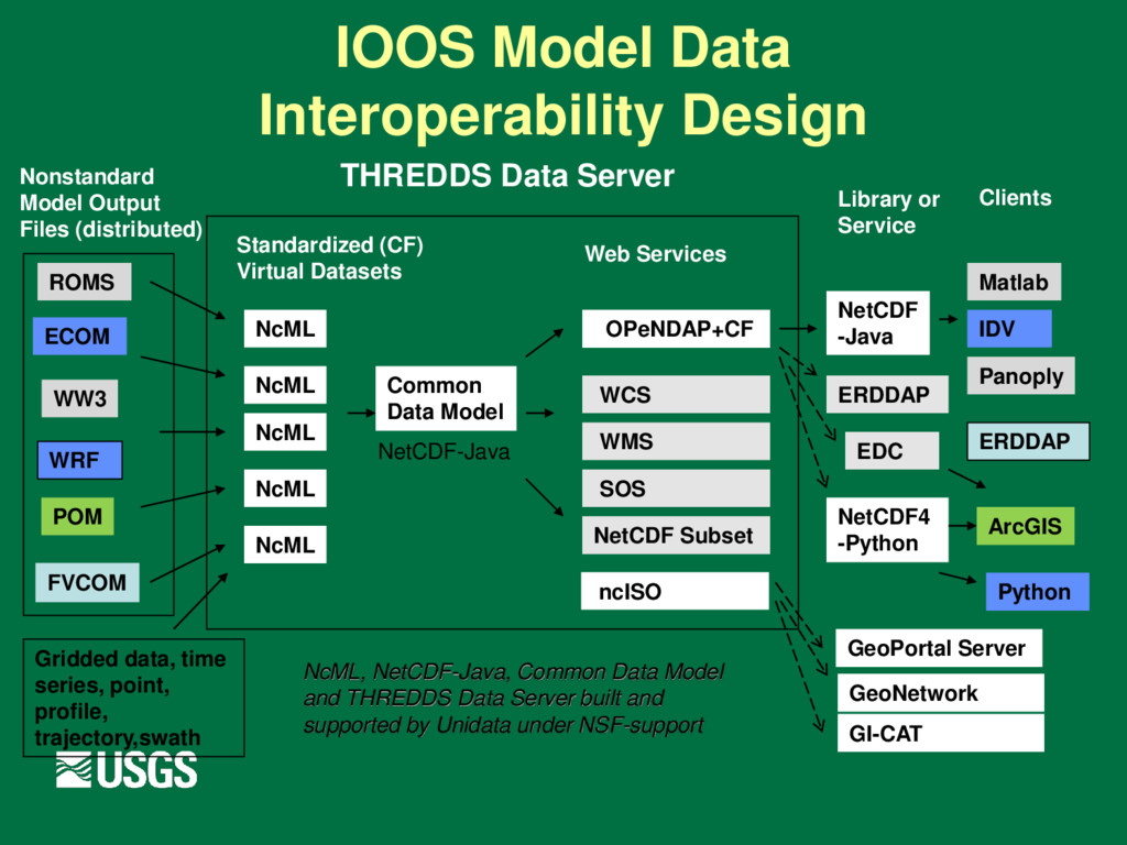
NcML NcML NcML NcML NcML Common Data Model OPeNDAP+CF WCS NetCDF Subset THREDDS Data Server Standardized (CF) Virtual Datasets Nonstandard Model Output Files (distributed) Web Services Matlab Panoply IDV ERDDAP Clients NetCDF -Java Library or Service NcML, NetCDF-Java, Common Data Model and THREDDS Data Server built and supported by Unidata under NSF-support WMS ncISO ArcGIS NetCDF4 -Python FVCOM Python EDC ERDDAP NetCDF-Java SOS GeoPortal Server GeoNetwork GI-CAT Gridded data, time series, point, profile, trajectory,swath
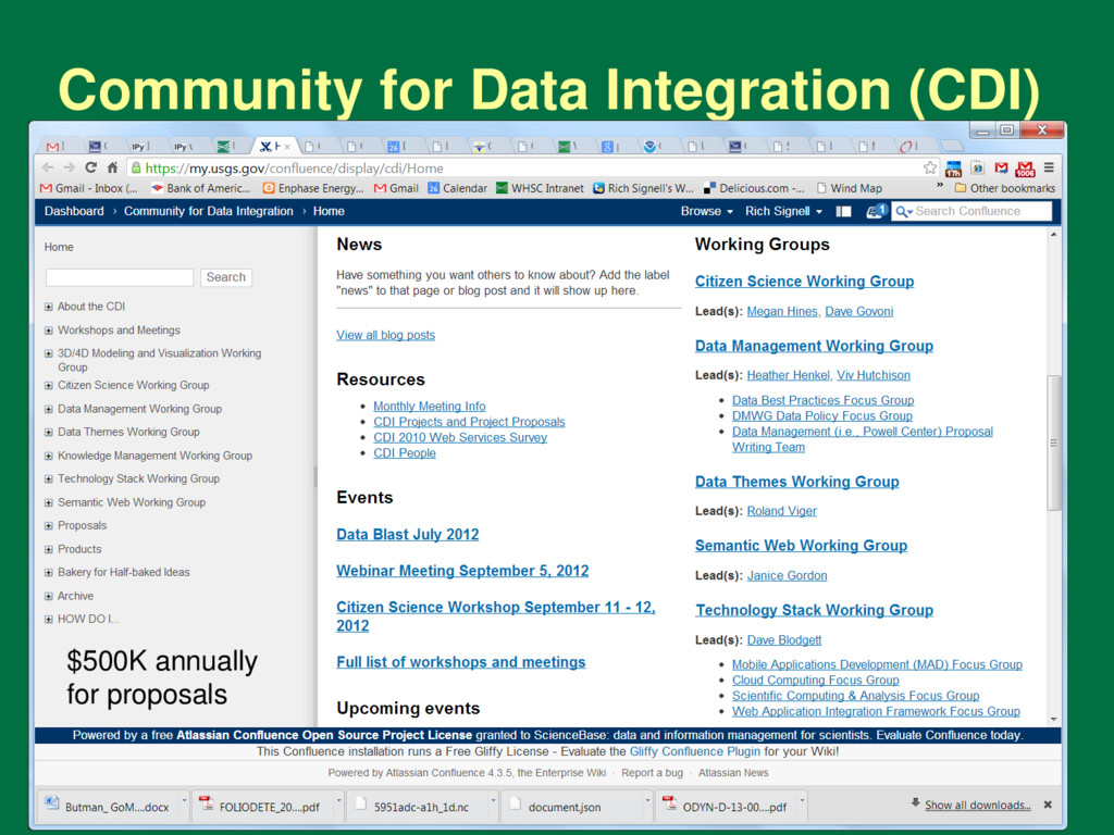
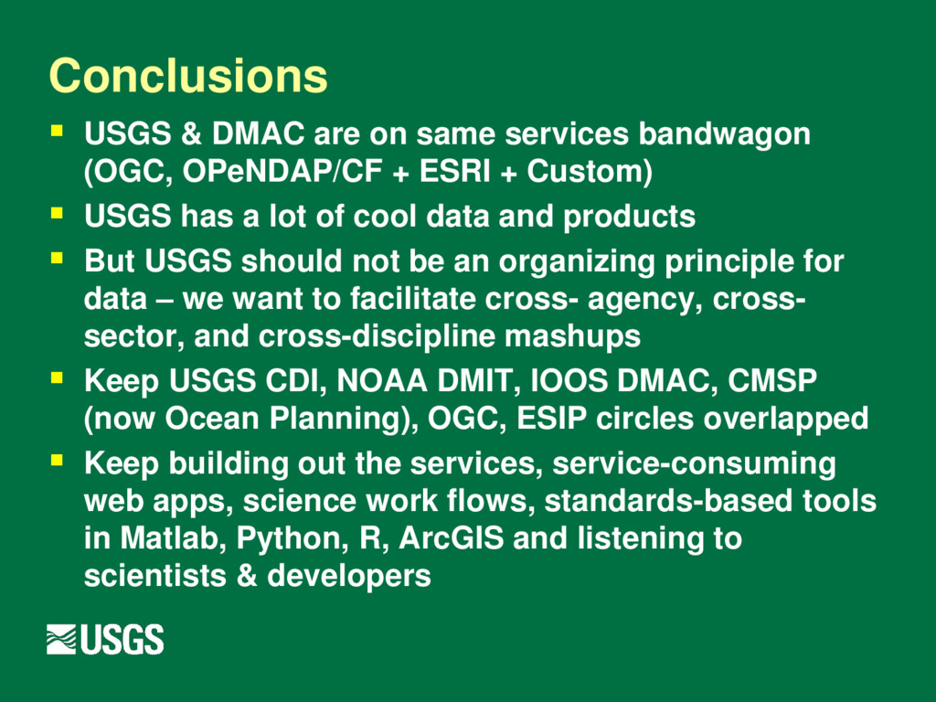
(OGC, OPeNDAP/CF + ESRI + Custom) USGS has a lot of cool data and products But USGS should not be an organizing principle for data – we want to facilitate cross- agency, cross- sector, and cross-discipline mashups Keep USGS CDI, NOAA DMIT, IOOS DMAC, CMSP (now Ocean Planning), OGC, ESIP circles overlapped Keep building out the services, service-consuming web apps, science work flows, standards-based tools in Matlab, Python, R, ArcGIS and listening to scientists & developers
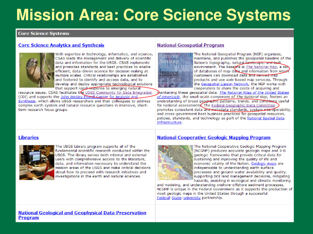