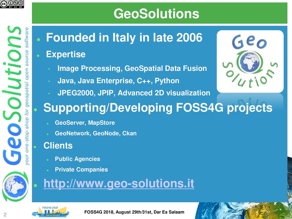
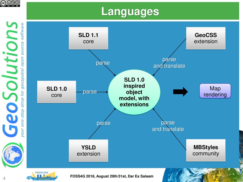
Various software can style maps and generate a proper SLD document for OGC compliant WMS like GeoServer to use. However, in most occasions, the styling allowed by the graphical tools is pretty limited and not good enough to achieve good looking, readable and efficient cartographic output. For those that like to write their own styles CSS also represents a nice alternatives thanks to its compactness and expressiveness.
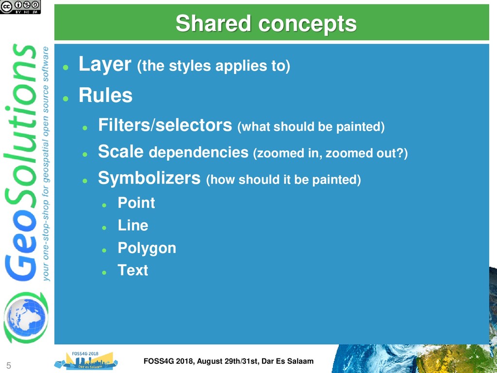
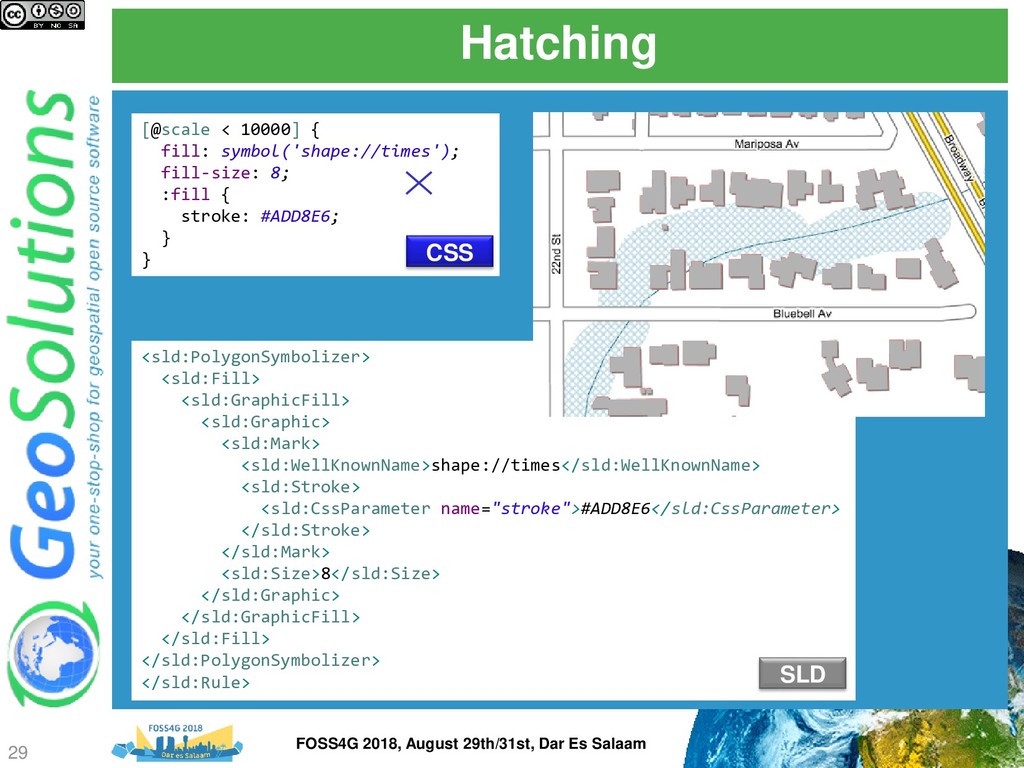
Several topics will be covered, providing examples in both SLD and CSS for each, including: mastering multi-scale styling, using GeoServer extensions to build common hatch patterns, line styling beyond the basics, such as cased lines, controlling symbols along a line and the way they repeat, leveraging TTF symbol fonts and SVGs to generate good looking point thematic maps, using the full power of GeoServer label lay-outing tools to build pleasant, informative maps on both point, polygon and line layers, including adding road plates around labels, leverage the labeling subsystem conflict resolution engine to avoid overlaps in stand alone point symbology, blending charts into a map, dynamically transform data during rendering to get more explicative maps without the need to pre-process a large amount of views.
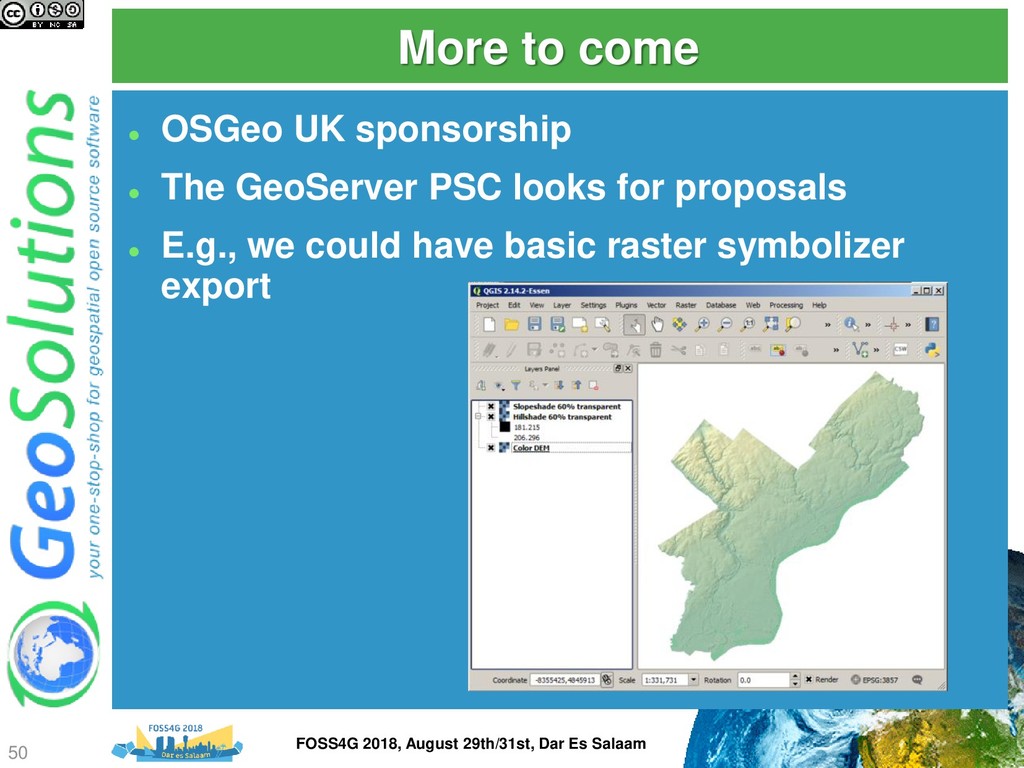
The presentation aims to provide the attendees with enough information to master SLD/CSS documents and most of GeoServer extensions to generate appealing, informative, readable maps that can be quickly rendered on screen.
![Simple image [type = 'alpine_hut'][@sd < 100k] { mark: url('symbols/alpinehut.p.16.png');](https://files.speakerdeck.com/presentations/66c4a4dcf60348a8a4baf2796ea04928/slide_19.jpg)
![Marks (SVG in this case) [type = 'bank'][@sd < 6k]](https://files.speakerdeck.com/presentations/66c4a4dcf60348a8a4baf2796ea04928/slide_20.jpg)
![Marks composition and override [type = 'fountain’] { [@sd <](https://files.speakerdeck.com/presentations/66c4a4dcf60348a8a4baf2796ea04928/slide_21.jpg)
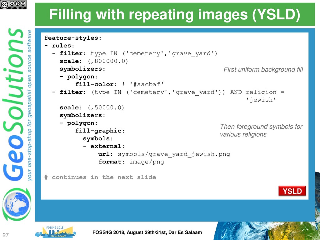
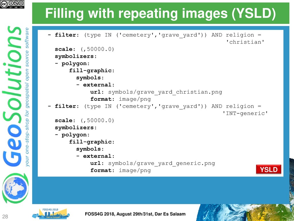
![Filling with repeating images fill [@sd < 800k][type in ('cemetery',](https://files.speakerdeck.com/presentations/66c4a4dcf60348a8a4baf2796ea04928/slide_25.jpg)
![Solid lines (OSM admin borders) [type = 'administrative'] { [admin_level](https://files.speakerdeck.com/presentations/66c4a4dcf60348a8a4baf2796ea04928/slide_30.jpg)
![Point labels and obstacles [@sd < 200k] { label: [FULLNAME];](https://files.speakerdeck.com/presentations/66c4a4dcf60348a8a4baf2796ea04928/slide_35.jpg)
![Line labels [@sd < 200k] { label: [LABEL_NAME]; font-fill: #000000;](https://files.speakerdeck.com/presentations/66c4a4dcf60348a8a4baf2796ea04928/slide_36.jpg)
![Z ordering http://docs.geoserver.org/latest/en/user/styling/sld- extensions/z-order/example.html [class = 'motorways'] { stroke: #990000,](https://files.speakerdeck.com/presentations/66c4a4dcf60348a8a4baf2796ea04928/slide_43.jpg)
![Geometry transformations [@scale < 10000] { fill-geometry: [offset(the_geom, 6, -6)];](https://files.speakerdeck.com/presentations/66c4a4dcf60348a8a4baf2796ea04928/slide_44.jpg)
![That’s all folks! Questions? [email protected] 51 FOSS4G 2018, August 29th/31st,](https://files.speakerdeck.com/presentations/66c4a4dcf60348a8a4baf2796ea04928/slide_50.jpg)