Hidenori Fujimura, Diego Gonzalez Ferreiro, Paolo Frizzera, Oliva Martin Sanchez, Takayuki Miyauchi, Shinichi Nishikawa, Naoki Ohashi, Jin Igarashi, Taichi Furuhashi FOSS4G 2022 General Tracks 2022-08-25, 14:15-14:45 (Europe/Rome), General Online
Geospatial Expert UN Geospatial Information Section, United Nations Secretariat I joined UN Vector Tile Toolkit in 2019, and working for its deployment in UN since 2020. The UN Open GIS Initiative aims to identify and develop an Open Source GIS bundle that meets the requirements of UN operations for both peace-building and peace-keeping. Geospatial Strategy for the United Nations The effective, efficient and universal use of geospatial information in support of all mandates and operations of the United Nations for a better world Our strategy and Initiative
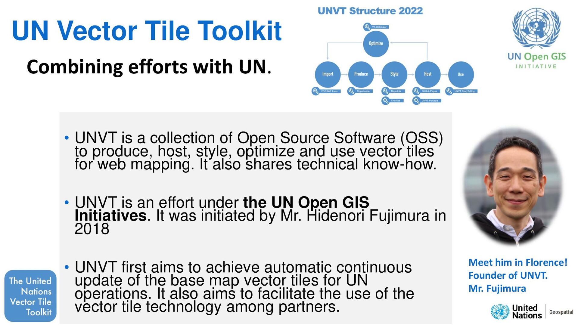
Open Source Software (OSS) to produce, host, style, optimize and use vector tiles for web mapping. It also shares technical know-how. • UNVT is an effort under the UN Open GIS Initiatives. It was initiated by Mr. Hidenori Fujimura in 2018 • UNVT first aims to achieve automatic continuous update of the base map vector tiles for UN operations. It also aims to facilitate the use of the vector tile technology among partners. Combining efforts with UN. Meet him in Florence! Founder of UNVT. Mr. Fujimura
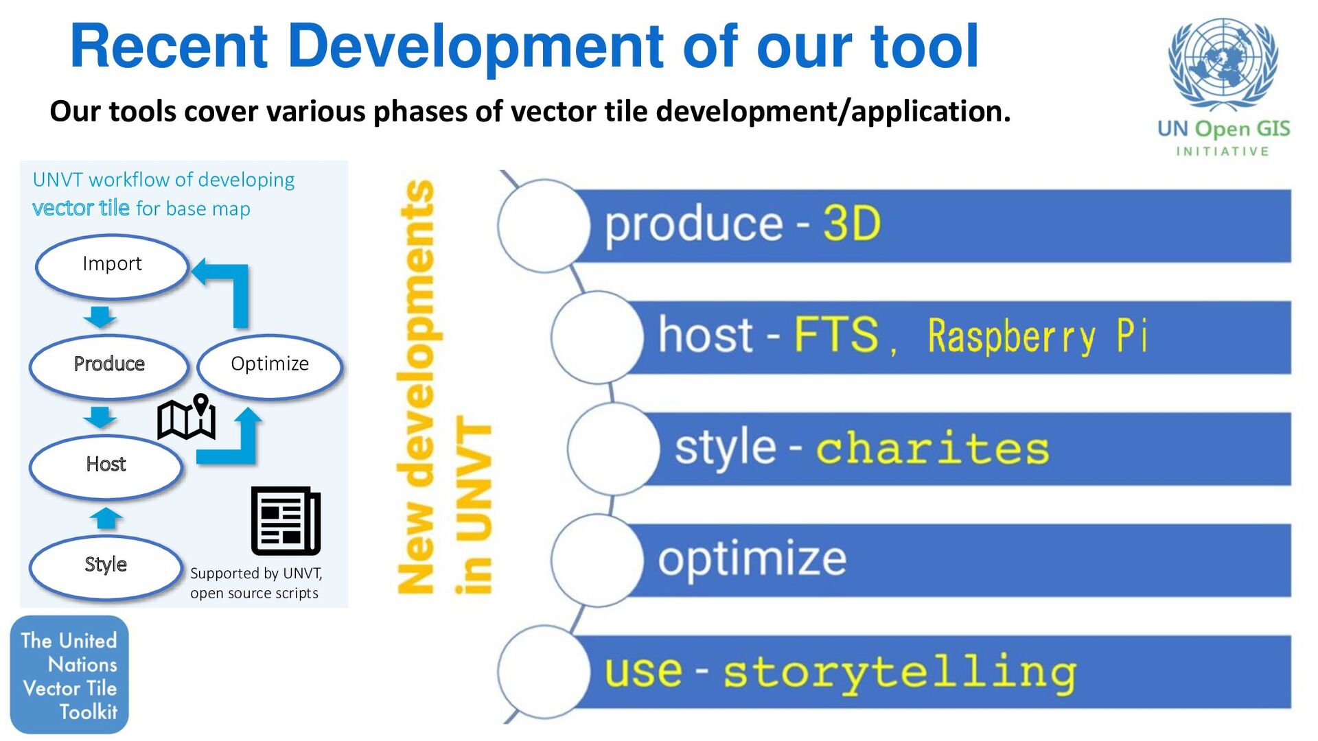
UNVT workflow of developing vector tile for base map Supported by UNVT, open source scripts Our tools cover various phases of vector tile development/application.
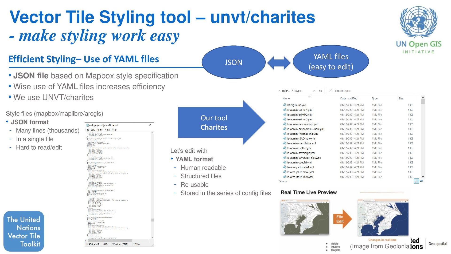
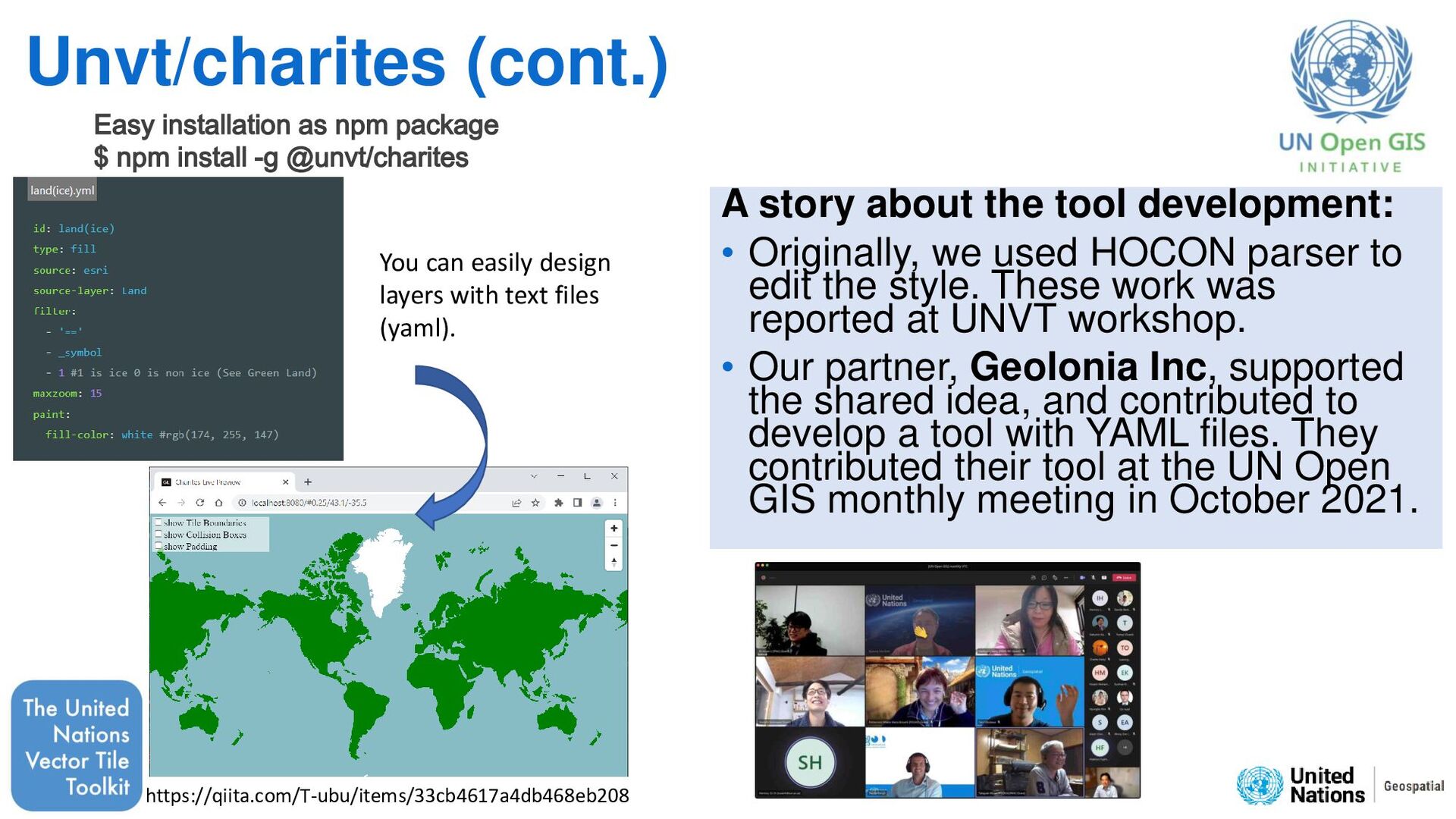
easy • JSON file based on Mapbox style specification • Wise use of YAML files increases efficiency • We use UNVT/charites Style files (mapbox/maplibre/arcgis) • JSON format - Many lines (thousands) - In a single file - Hard to read/edit Efficient Styling– Use of YAML files Our tool Charites Let’s edit with • YAML format - Human readable - Structured files - Re-usable - Stored in the series of config files (Image from Geolonia) JSON YAML files (easy to edit)
we used HOCON parser to edit the style. These work was reported at UNVT workshop. • Our partner, Geolonia Inc, supported the shared idea, and contributed to develop a tool with YAML files. They contributed their tool at the UN Open GIS monthly meeting in October 2021. You can easily design layers with text files (yaml). https://qiita.com/T-ubu/items/33cb4617a4db468eb208 Easy installation as npm package $ npm install -g @unvt/charites
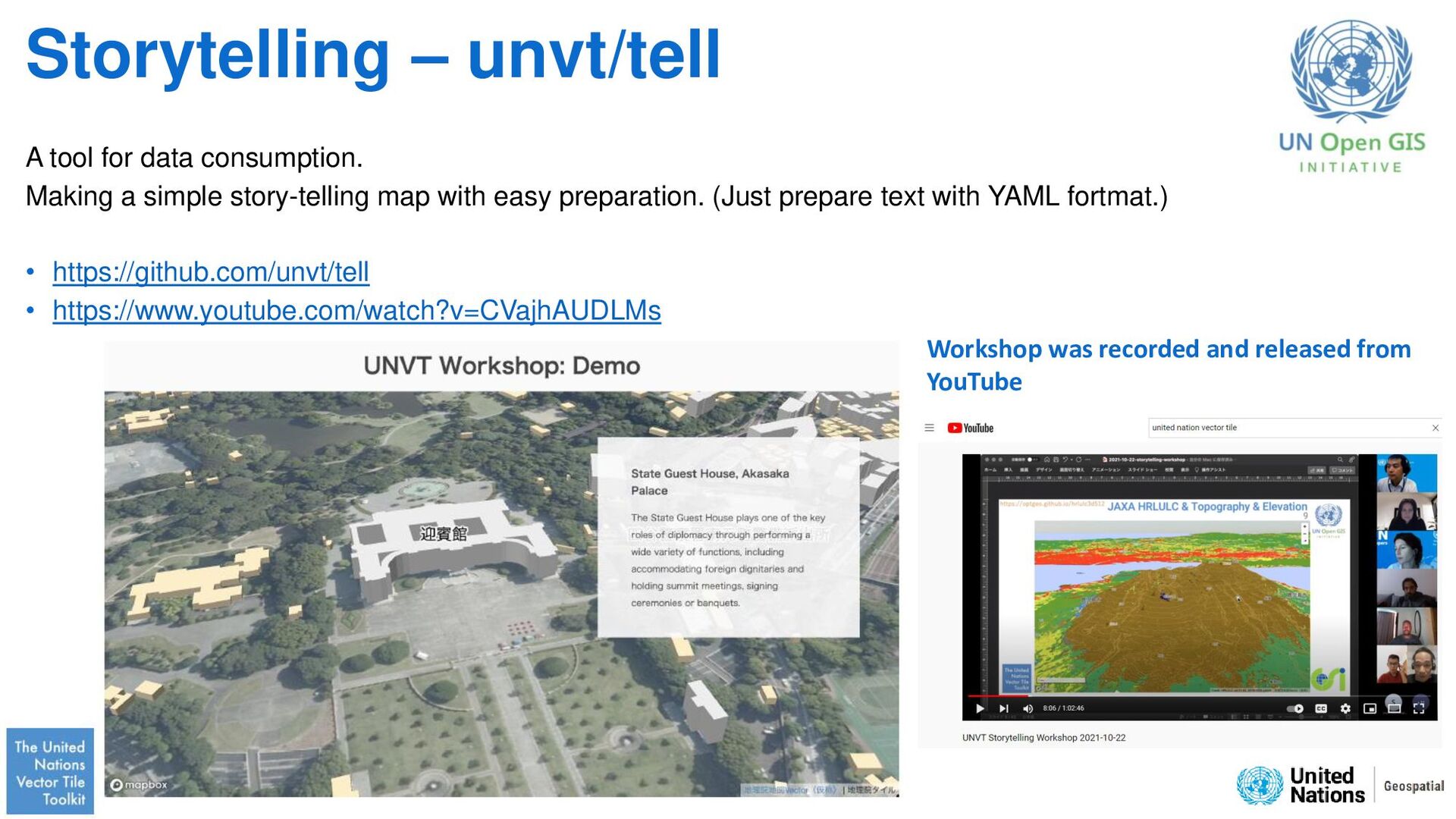
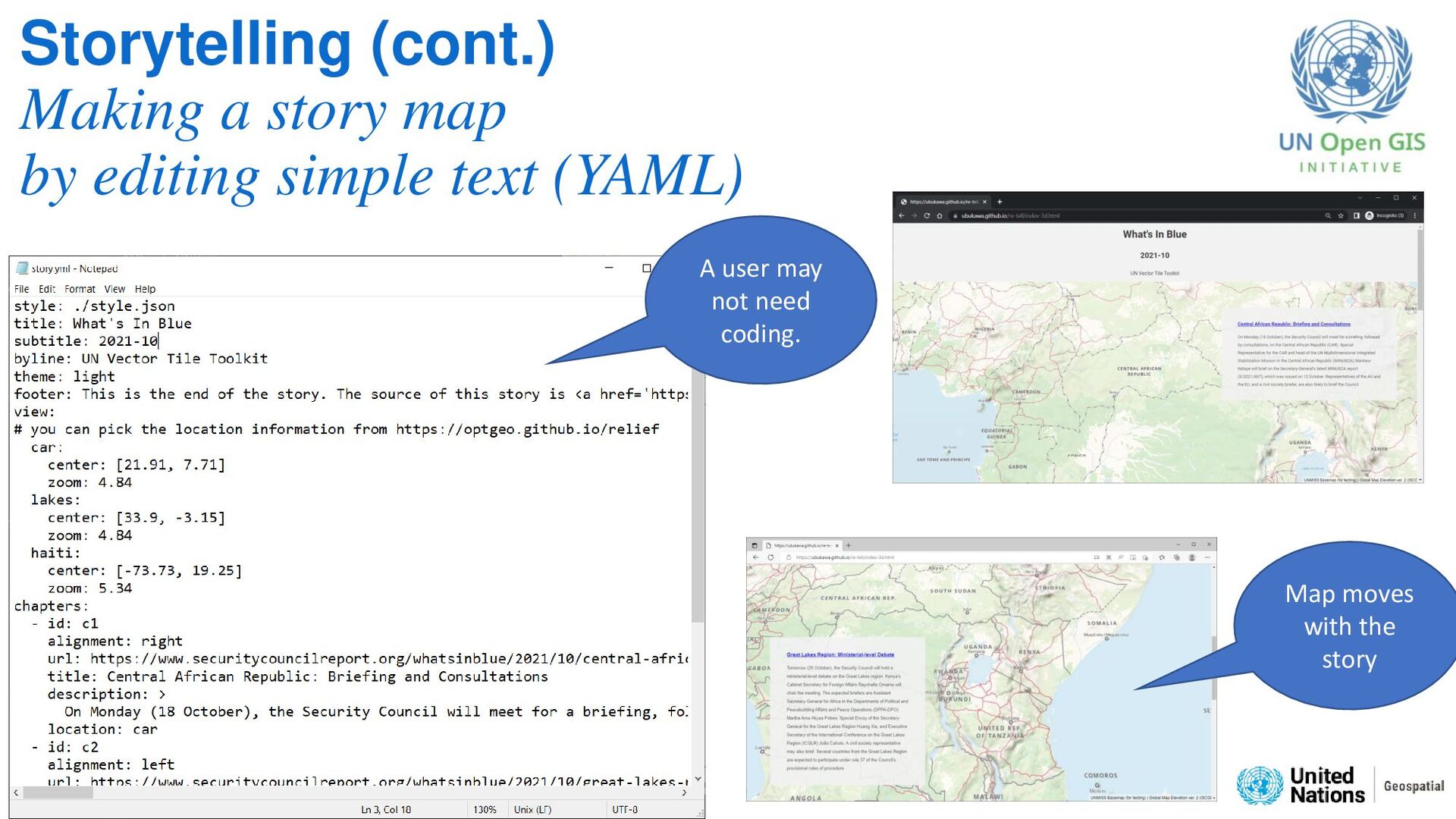
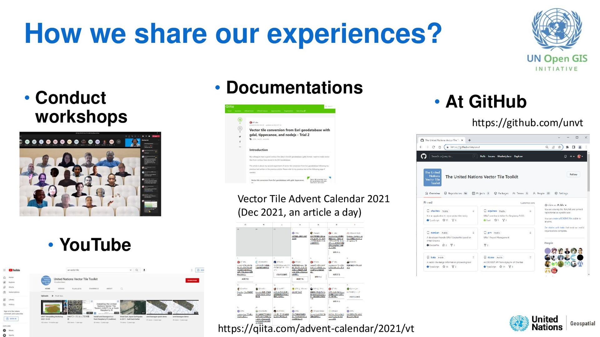
simple story-telling map with easy preparation. (Just prepare text with YAML fortmat.) • https://github.com/unvt/tell • https://www.youtube.com/watch?v=CVajhAUDLMs Workshop was recorded and released from YouTube
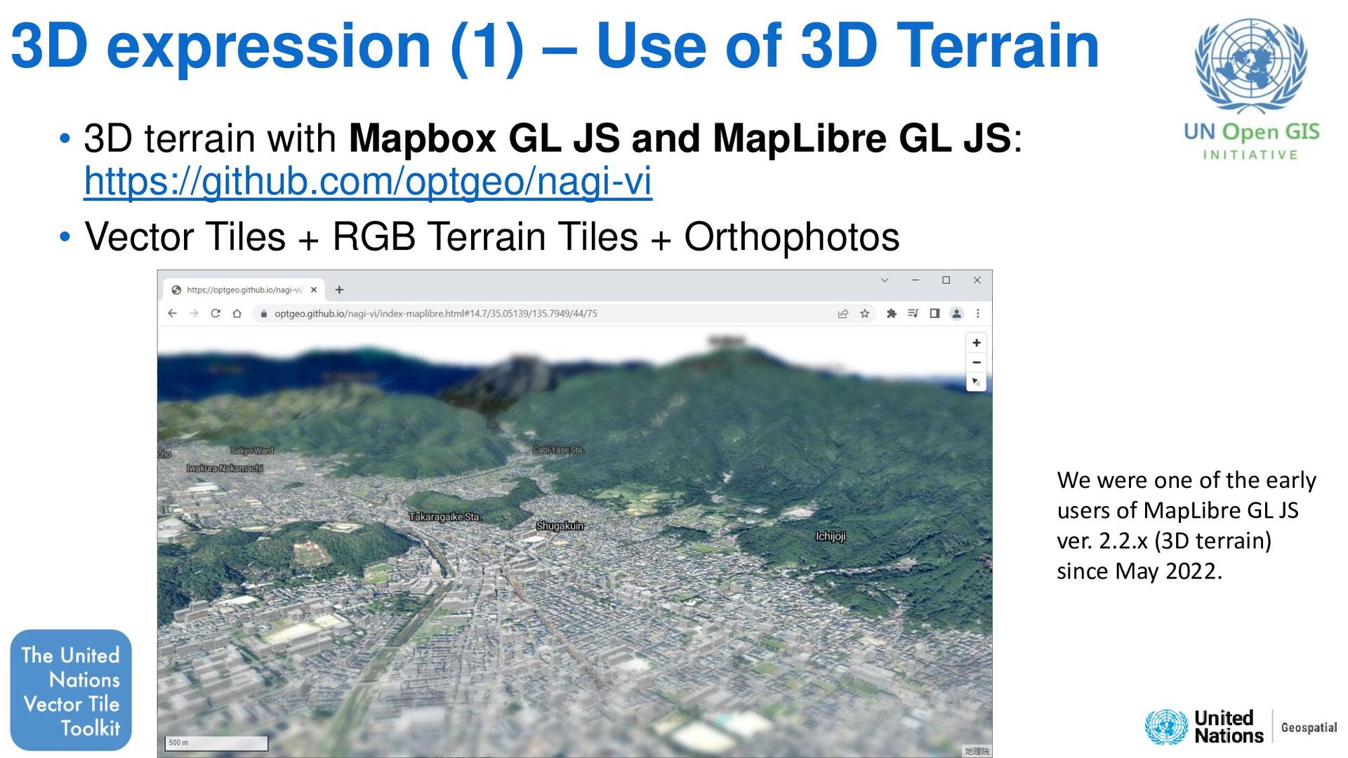
terrain with Mapbox GL JS and MapLibre GL JS: https://github.com/optgeo/nagi-vi • Vector Tiles + RGB Terrain Tiles + Orthophotos We were one of the early users of MapLibre GL JS ver. 2.2.x (3D terrain) since May 2022.
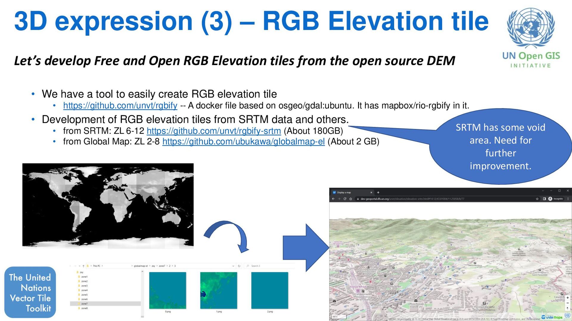
a tool to easily create RGB elevation tile • https://github.com/unvt/rgbify -- A docker file based on osgeo/gdal:ubuntu. It has mapbox/rio-rgbify in it. • Development of RGB elevation tiles from SRTM data and others. • from SRTM: ZL 6-12 https://github.com/unvt/rgbify-srtm (About 180GB) • from Global Map: ZL 2-8 https://github.com/ubukawa/globalmap-el (About 2 GB) Let’s develop Free and Open RGB Elevation tiles from the open source DEM SRTM has some void area. Need for further improvement.
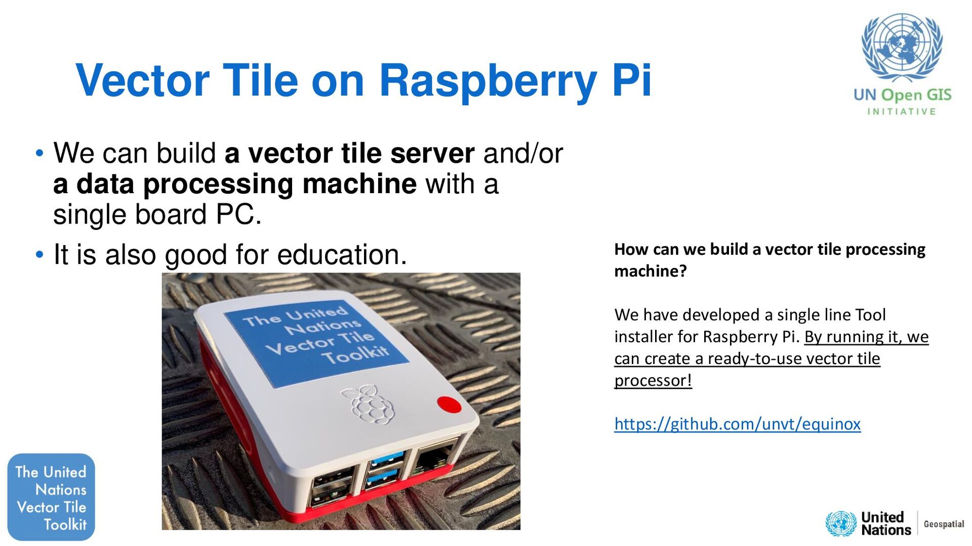
vector tile server and/or a data processing machine with a single board PC. • It is also good for education. How can we build a vector tile processing machine? We have developed a single line Tool installer for Raspberry Pi. By running it, we can create a ready-to-use vector tile processor! https://github.com/unvt/equinox
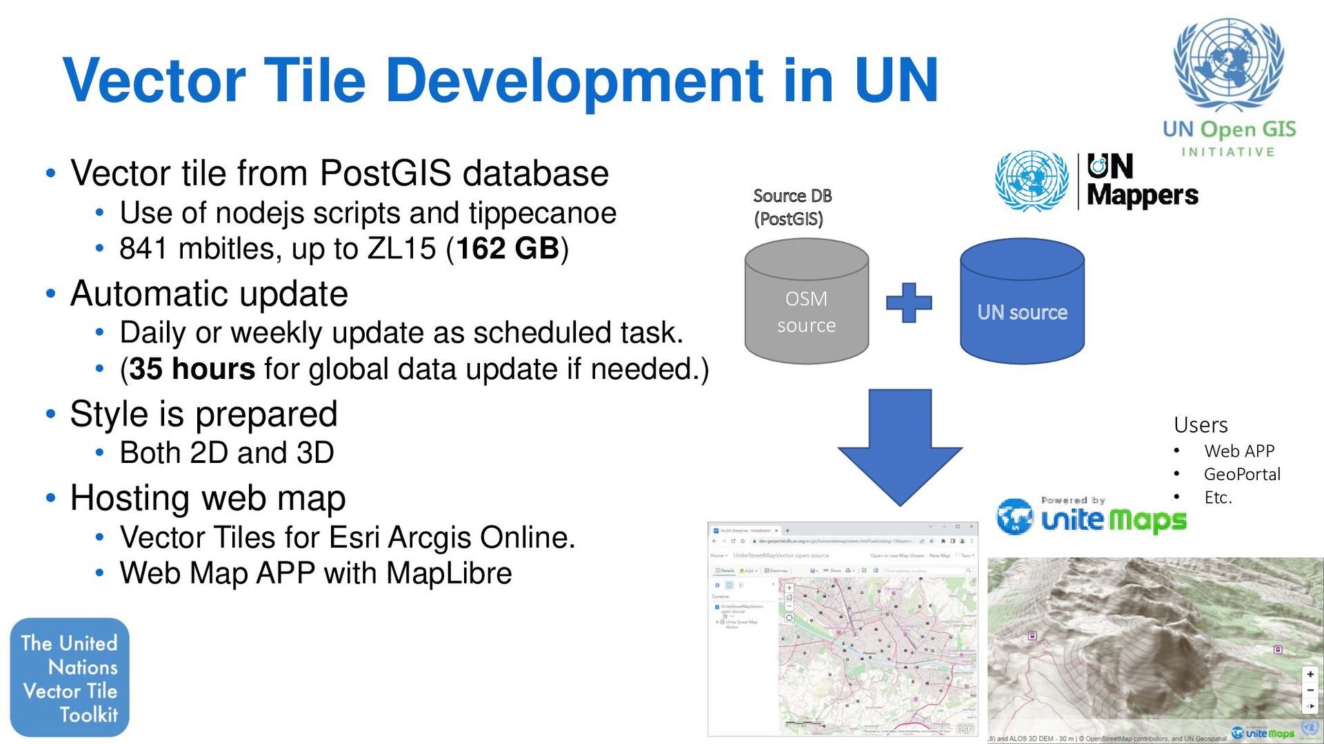
database • Use of nodejs scripts and tippecanoe • 841 mbitles, up to ZL15 (162 GB) • Automatic update • Daily or weekly update as scheduled task. • (35 hours for global data update if needed.) • Style is prepared • Both 2D and 3D • Hosting web map • Vector Tiles for Esri Arcgis Online. • Web Map APP with MapLibre OSM source UN source Source DB (PostGIS) Users • Web APP • GeoPortal • Etc.
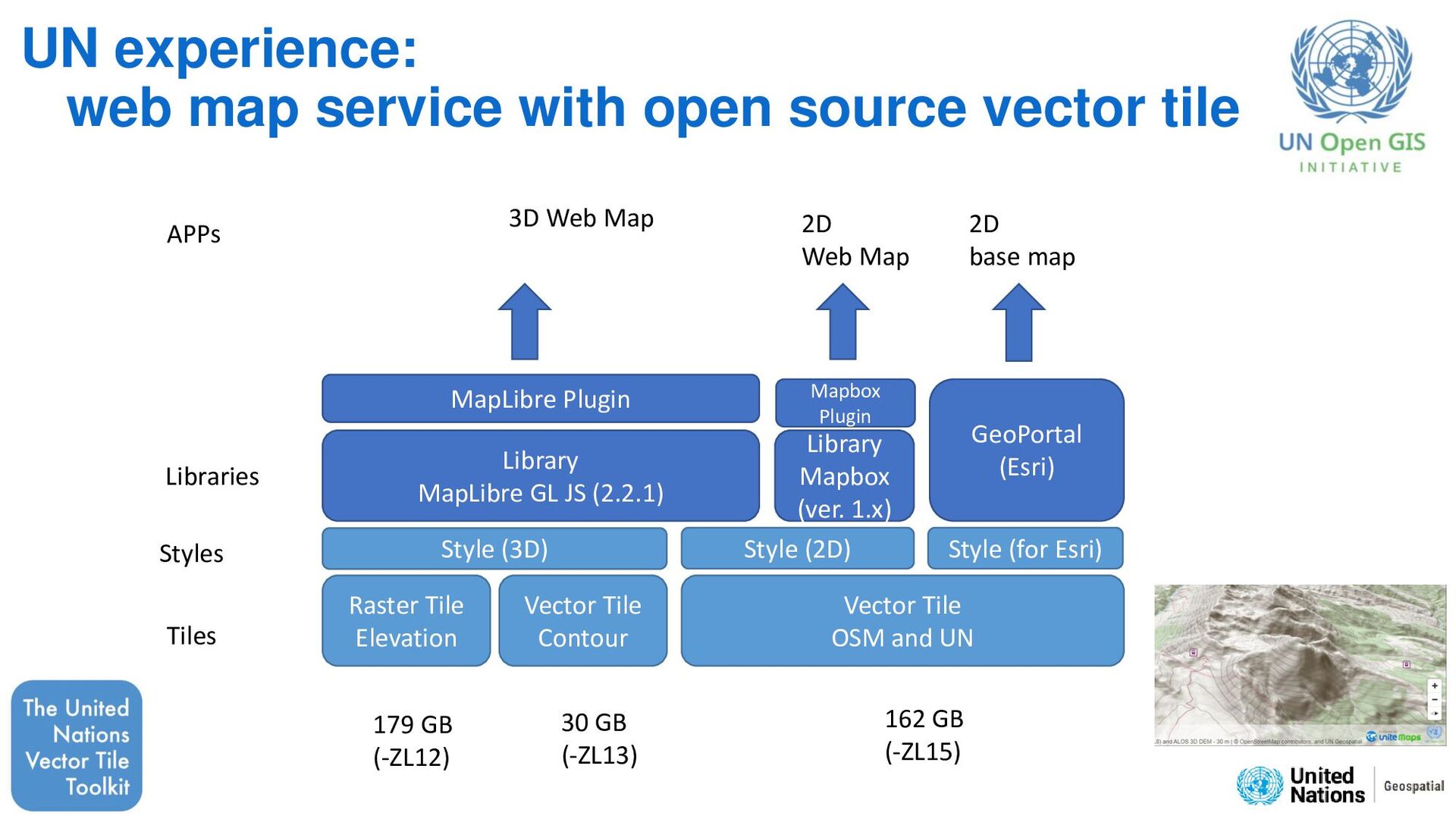
and UN Vector Tile Contour Raster Tile Elevation MapLibre Plugin GeoPortal (Esri) Library Mapbox (ver. 1.x) 3D Web Map 2D Web Map 2D base map Style (3D) Mapbox Plugin Tiles Styles Libraries APPs Style (for Esri) 30 GB (-ZL13) 179 GB (-ZL12) 162 GB (-ZL15) UN experience: web map service with open source vector tile
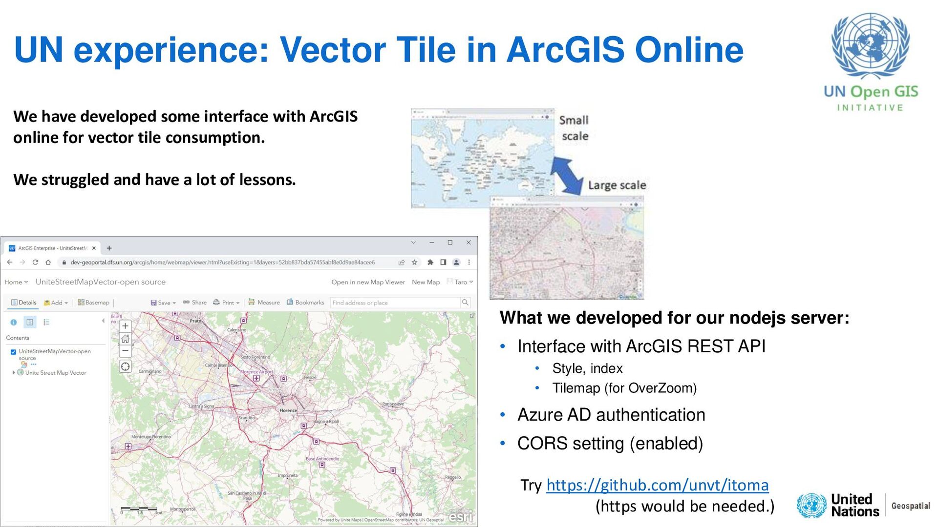
for our nodejs server: • Interface with ArcGIS REST API • Style, index • Tilemap (for OverZoom) • Azure AD authentication • CORS setting (enabled) We have developed some interface with ArcGIS online for vector tile consumption. We struggled and have a lot of lessons. Try https://github.com/unvt/itoma (https would be needed.)
a joint effort to support various vector tile operations (produce, style, host, optimize, use). • Everyone can feely use our tool to operate web map, and we will continue our vector tile operations/developments. • We see the great value in sharing technical experiences through the initiative. • I showed some examples today. Feel free to join us to explore/learn vector tile and other web map techniques together! Join us at https://github.com/unvt
![About me Taro Ubukawa (Mr.) Email: [email protected] GitHub: @ubukawa Senior](https://files.speakerdeck.com/presentations/91f0d6f8e94c41d0a34b9d5e2b4c2b0a/slide_1.jpg)