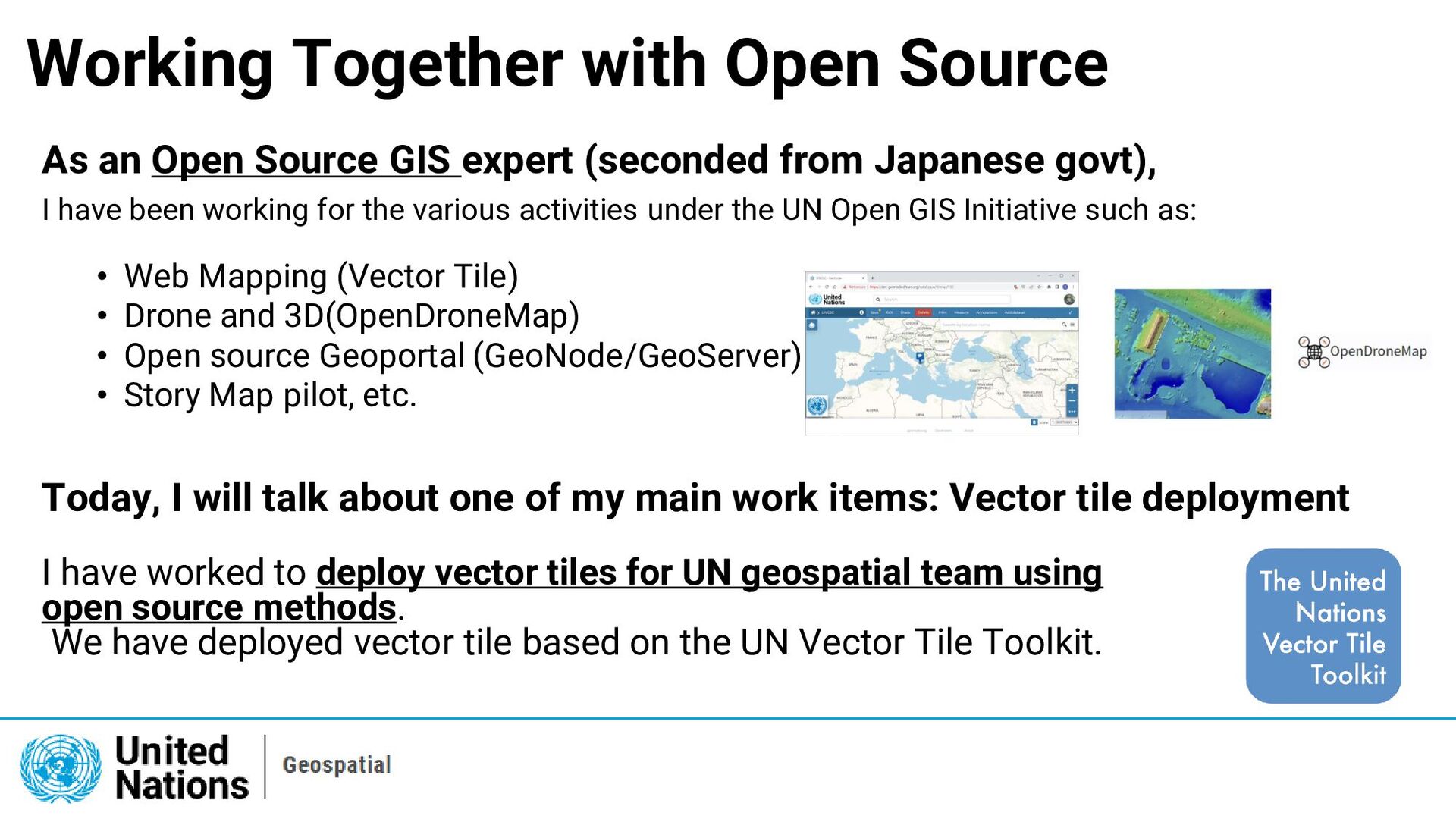
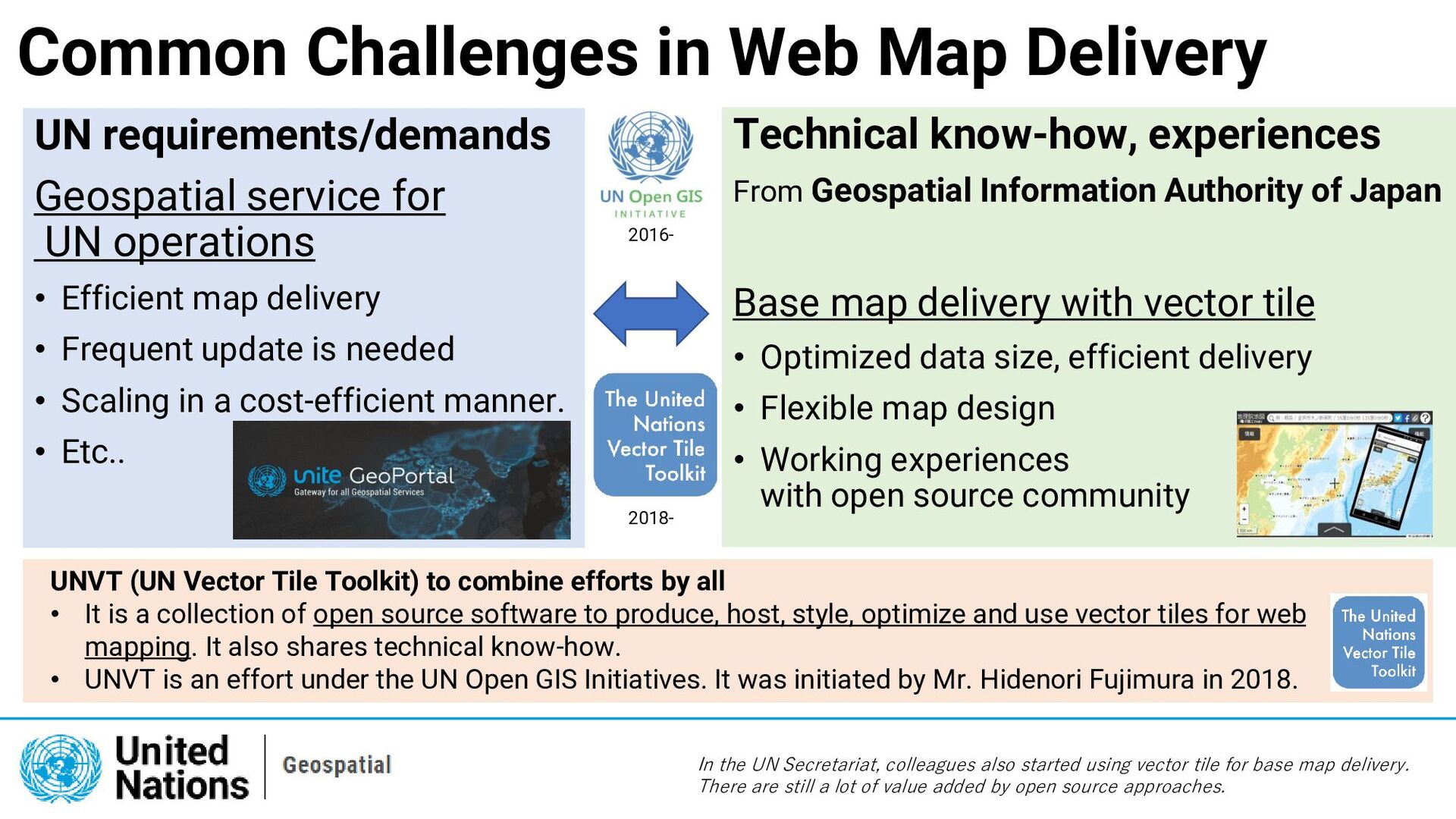
expert (seconded from Japanese govt), I have been working for the various activities under the UN Open GIS Initiative such as: • Web Mapping (Vector Tile) • Drone and 3D(OpenDroneMap) • Open source Geoportal (GeoNode/GeoServer) • Story Map pilot, etc. Today, I will talk about one of my main work items: Vector tile deployment I have worked to deploy vector tiles for UN geospatial team using open source methods. We have deployed vector tile based on the UN Vector Tile Toolkit.
for UN operations • Efficient map delivery • Frequent update is needed • Scaling in a cost-efficient manner. • Etc.. Technical know-how, experiences From Geospatial Information Authority of Japan Base map delivery with vector tile • Optimized data size, efficient delivery • Flexible map design • Working experiences with open source community In the UN Secretariat, colleagues also started using vector tile for base map delivery. There are still a lot of value added by open source approaches. 2016- 2018- UNVT (UN Vector Tile Toolkit) to combine efforts by all • It is a collection of open source software to produce, host, style, optimize and use vector tiles for web mapping. It also shares technical know-how. • UNVT is an effort under the UN Open GIS Initiatives. It was initiated by Mr. Hidenori Fujimura in 2018.
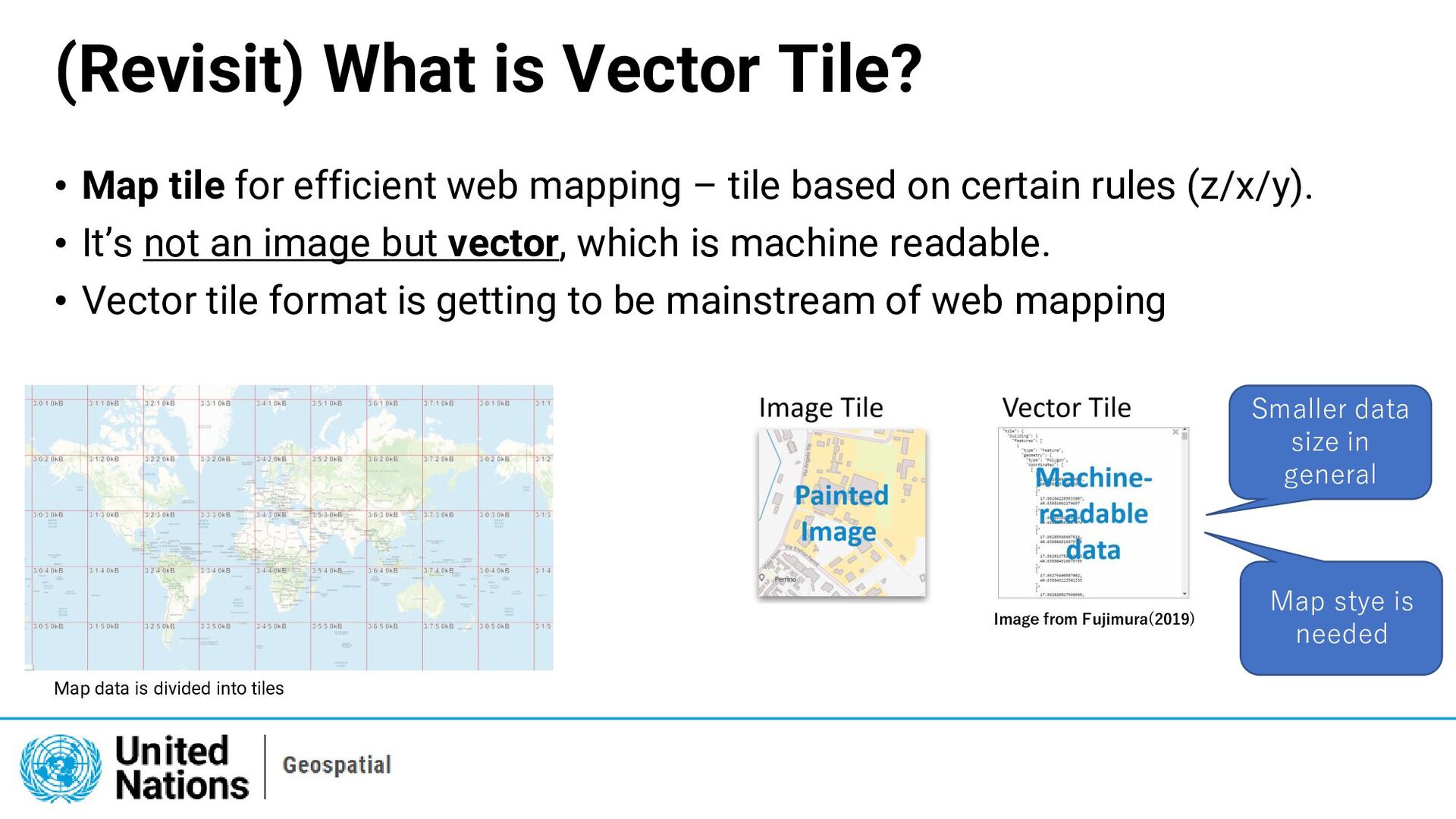
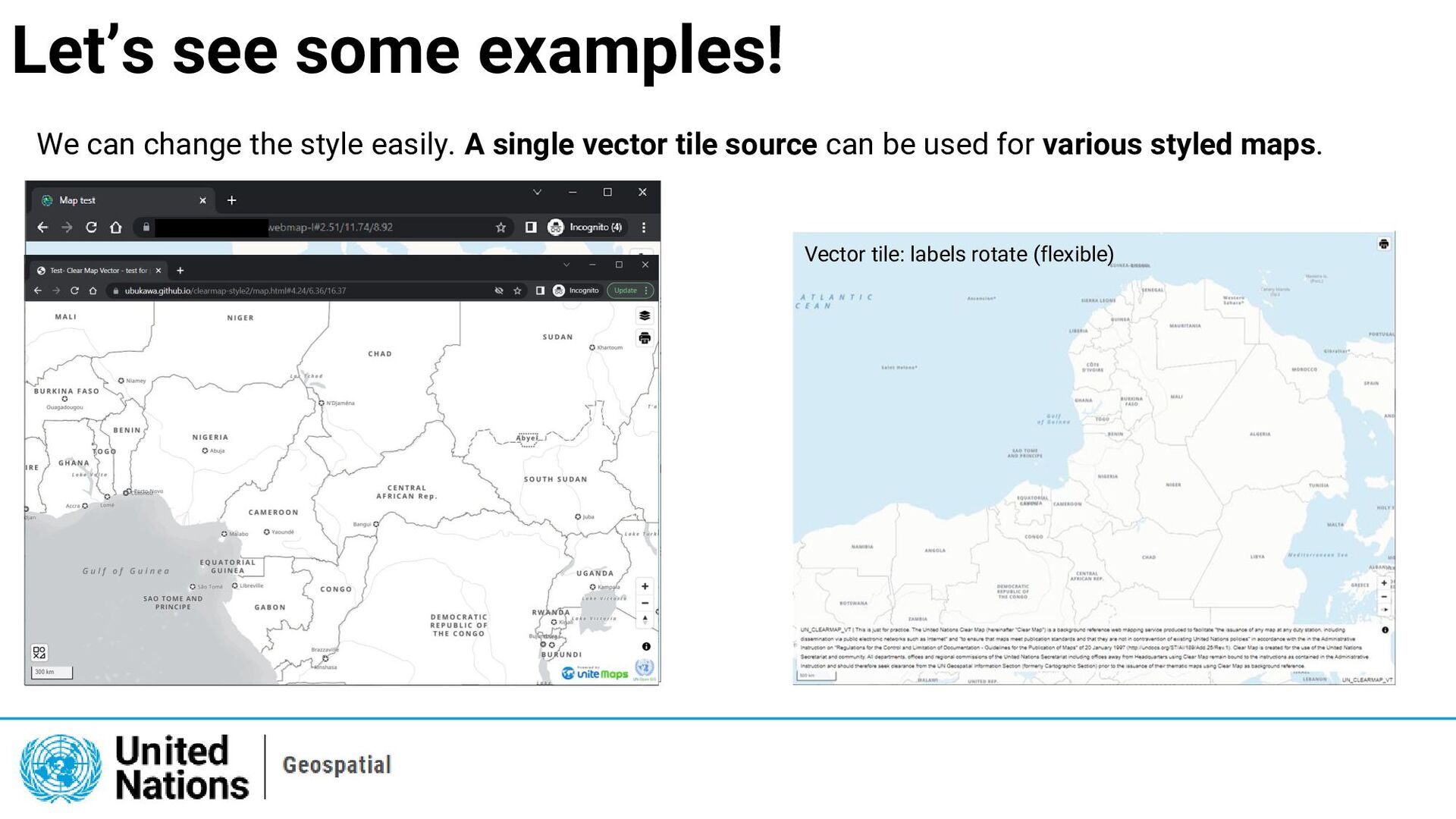
web mapping – tile based on certain rules (z/x/y). • It’s not an image but vector, which is machine readable. • Vector tile format is getting to be mainstream of web mapping Map data is divided into tiles Image from Fujimura(2019) Smaller data size in general Map stye is needed
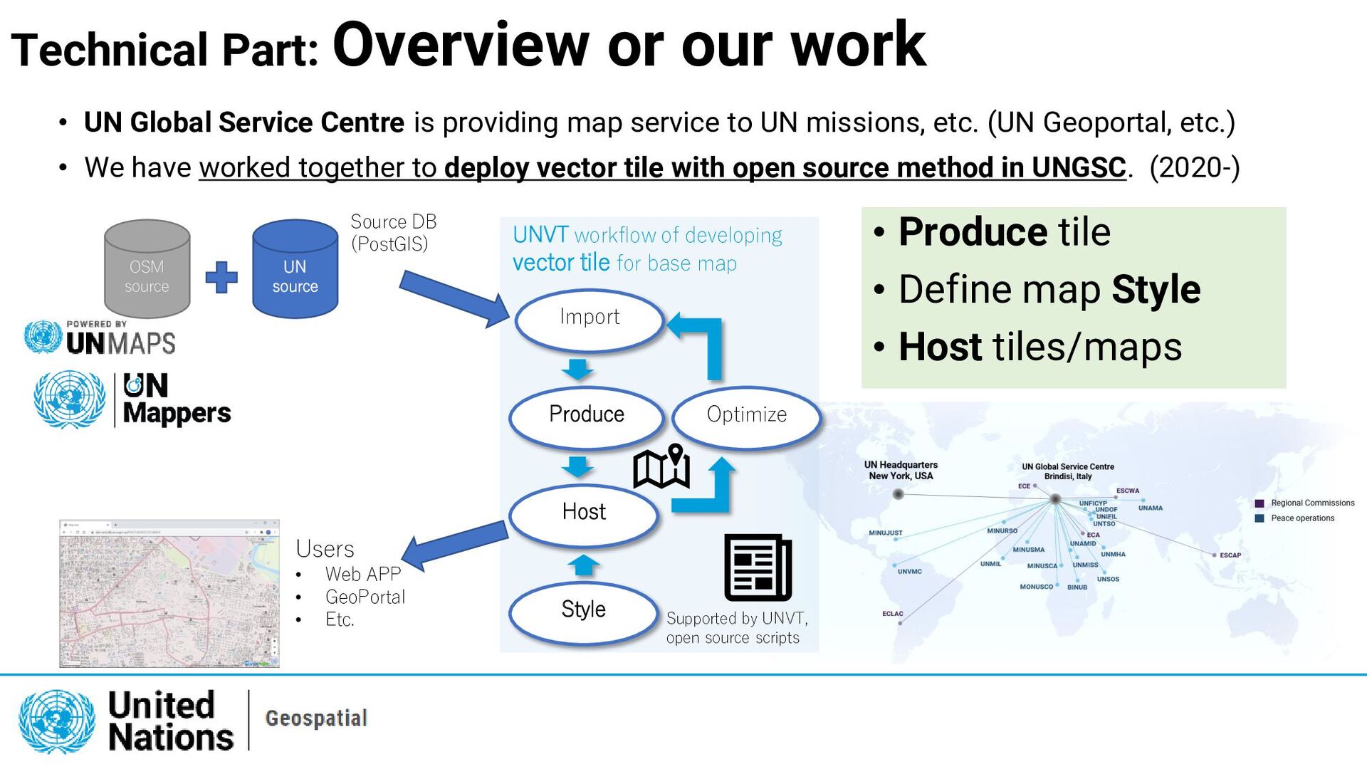
Produce Host Style Optimize Import UNVT workflow of developing vector tile for base map Supported by UNVT, open source scripts Source DB (PostGIS) Users • Web APP • GeoPortal • Etc. • UN Global Service Centre is providing map service to UN missions, etc. (UN Geoportal, etc.) • We have worked together to deploy vector tile with open source method in UNGSC. (2020-) • Produce tile • Define map Style • Host tiles/maps
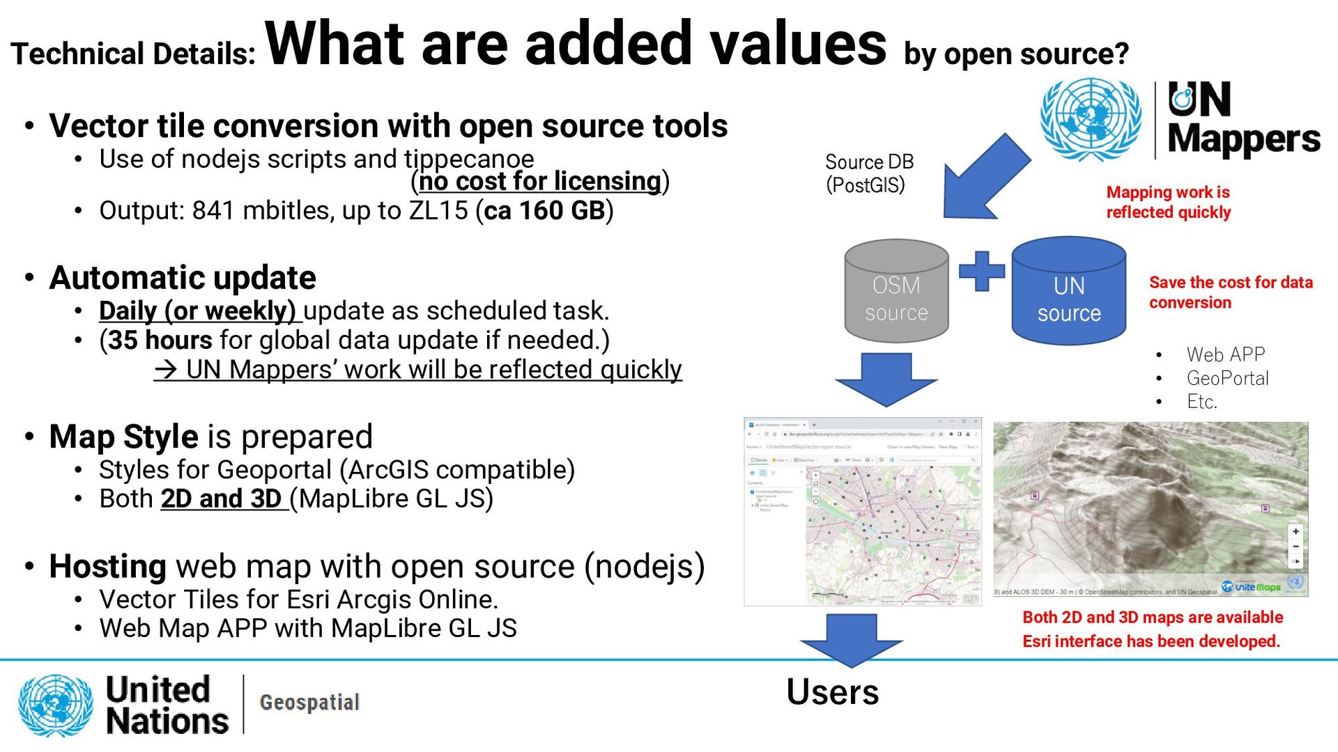
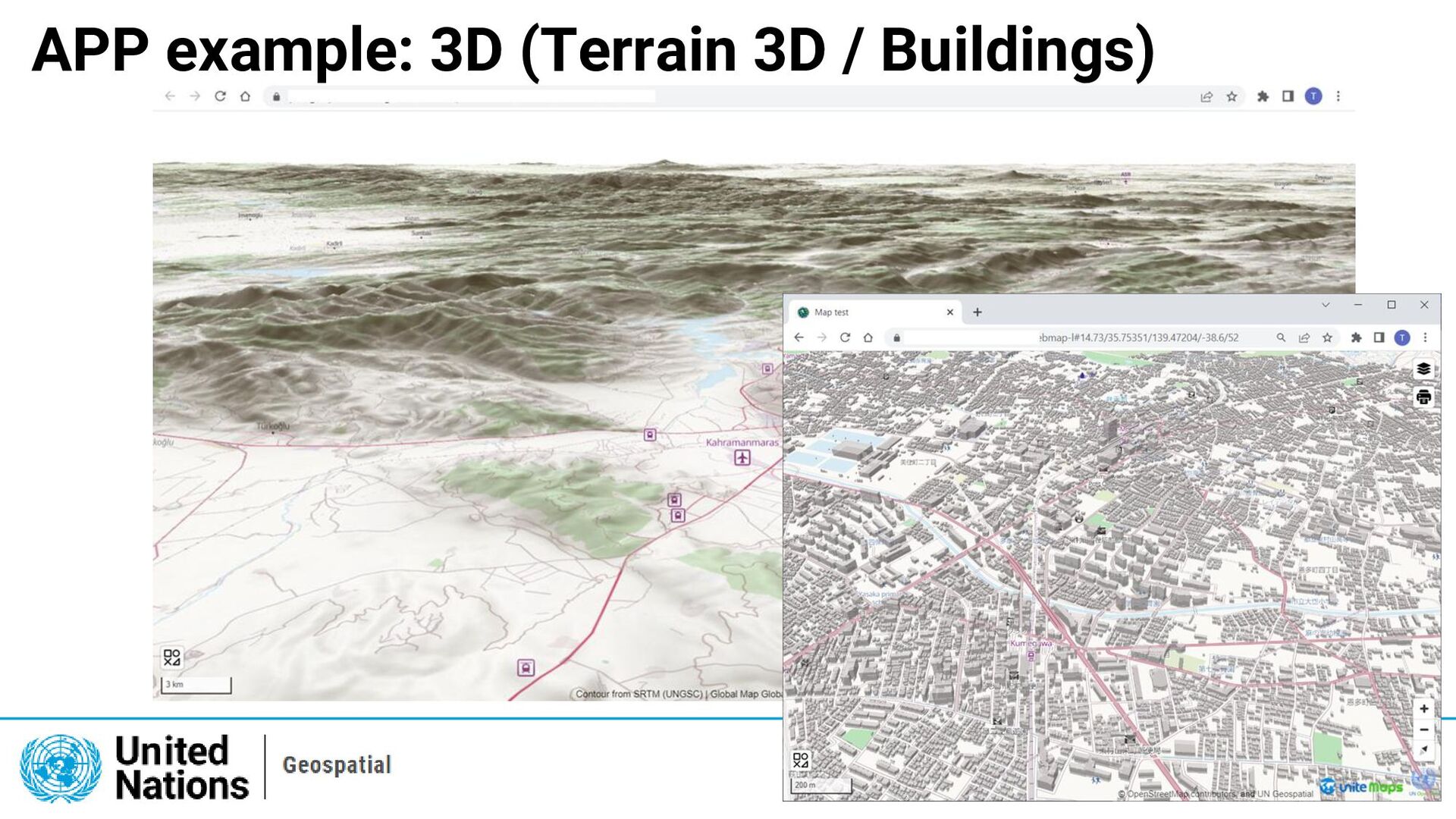
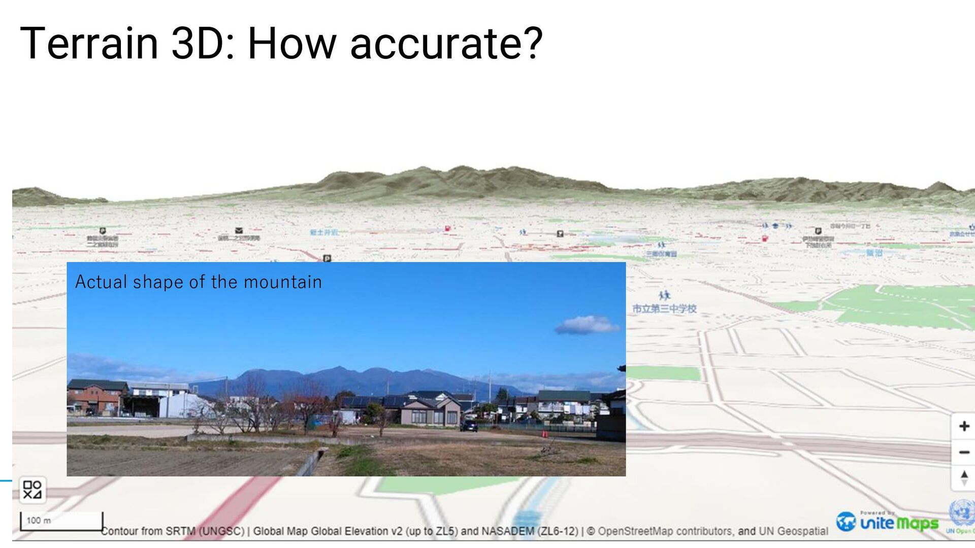
of nodejs scripts and tippecanoe (no cost for licensing) • Output: 841 mbitles, up to ZL15 (ca 160 GB) • Automatic update • Daily (or weekly) update as scheduled task. • (35 hours for global data update if needed.) → UN Mappers’ work will be reflected quickly • Map Style is prepared • Styles for Geoportal (ArcGIS compatible) • Both 2D and 3D (MapLibre GL JS) • Hosting web map with open source (nodejs) • Vector Tiles for Esri Arcgis Online. • Web Map APP with MapLibre GL JS OSM source UN source Source DB (PostGIS) • Web APP • GeoPortal • Etc. Technical Details: What are added values by open source? Users Mapping work is reflected quickly Save the cost for data conversion Both 2D and 3D maps are available Esri interface has been developed.
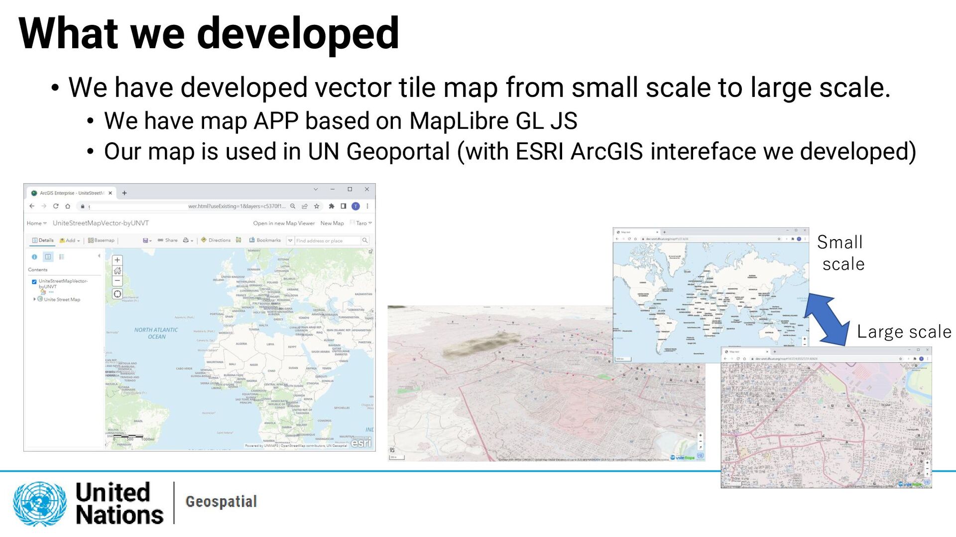
from small scale to large scale. • We have map APP based on MapLibre GL JS • Our map is used in UN Geoportal (with ESRI ArcGIS intereface we developed) Small scale Large scale
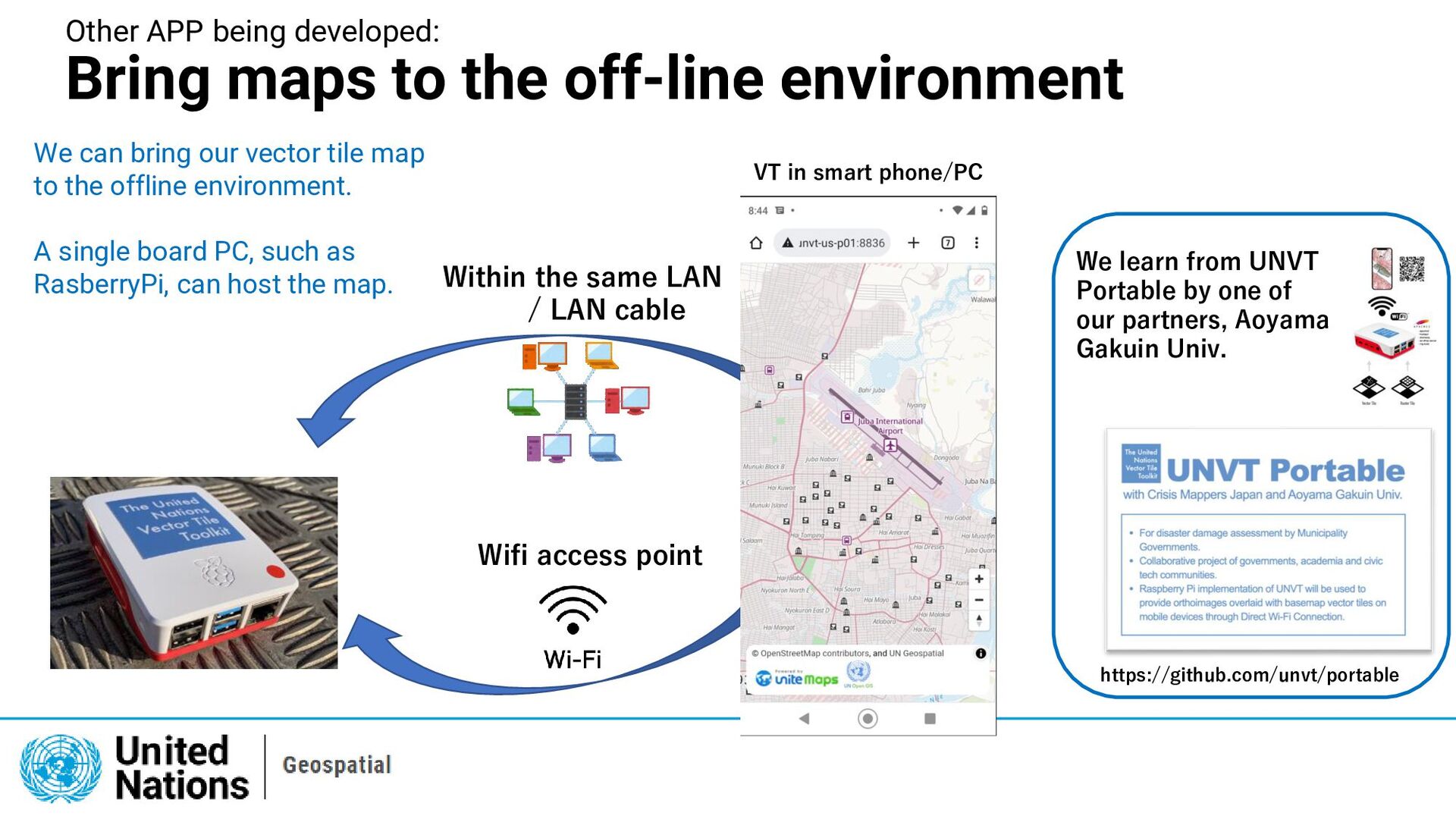
VT in smart phone/PC Wifi access point Within the same LAN / LAN cable We can bring our vector tile map to the offline environment. A single board PC, such as RasberryPi, can host the map. We learn from UNVT Portable by one of our partners, Aoyama Gakuin Univ. https://github.com/unvt/portable
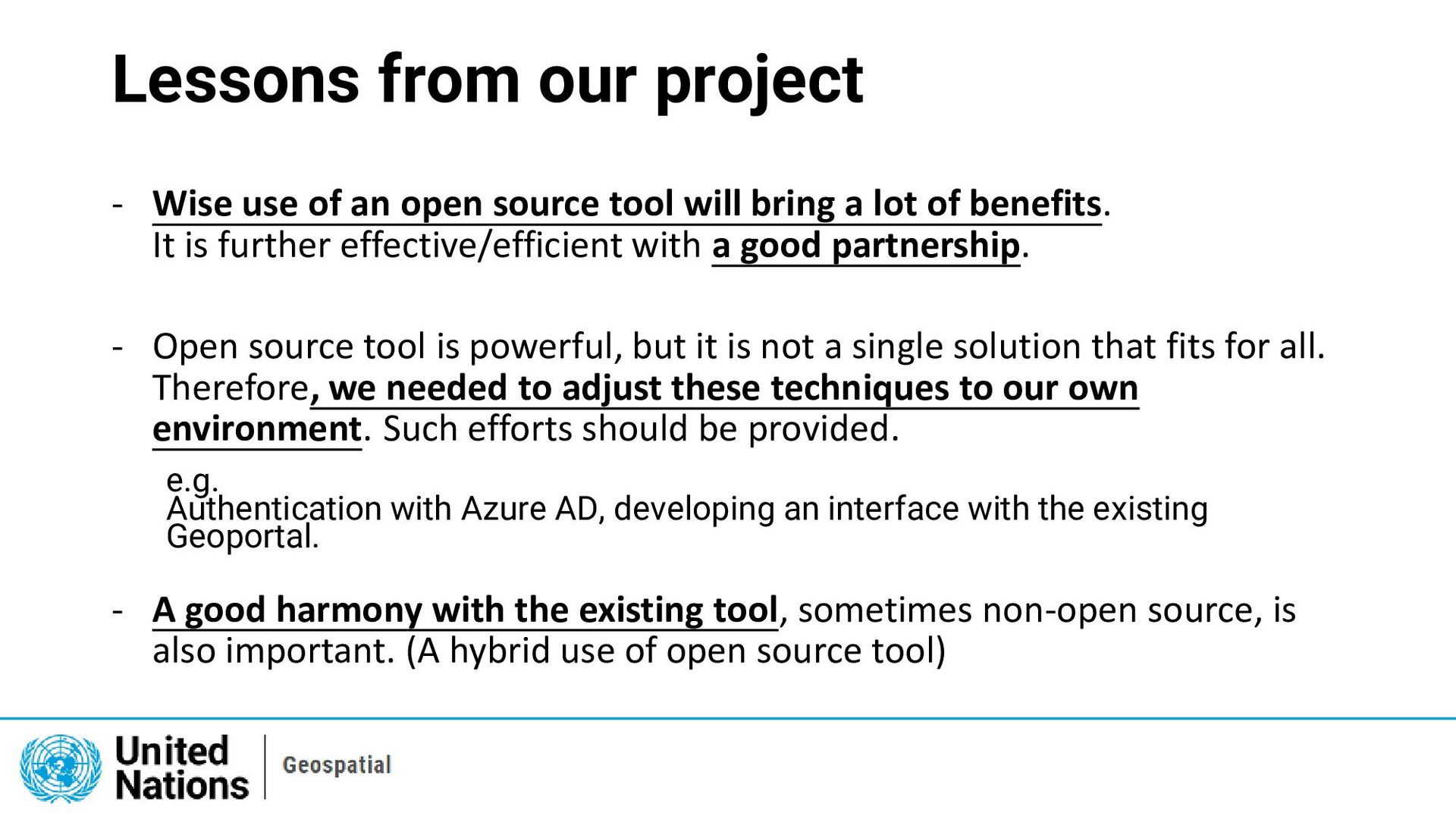
source tool will bring a lot of benefits. It is further effective/efficient with a good partnership. - Open source tool is powerful, but it is not a single solution that fits for all. Therefore, we needed to adjust these techniques to our own environment. Such efforts should be provided. e.g. Authentication with Azure AD, developing an interface with the existing Geoportal. - A good harmony with the existing tool, sometimes non-open source, is also important. (A hybrid use of open source tool)
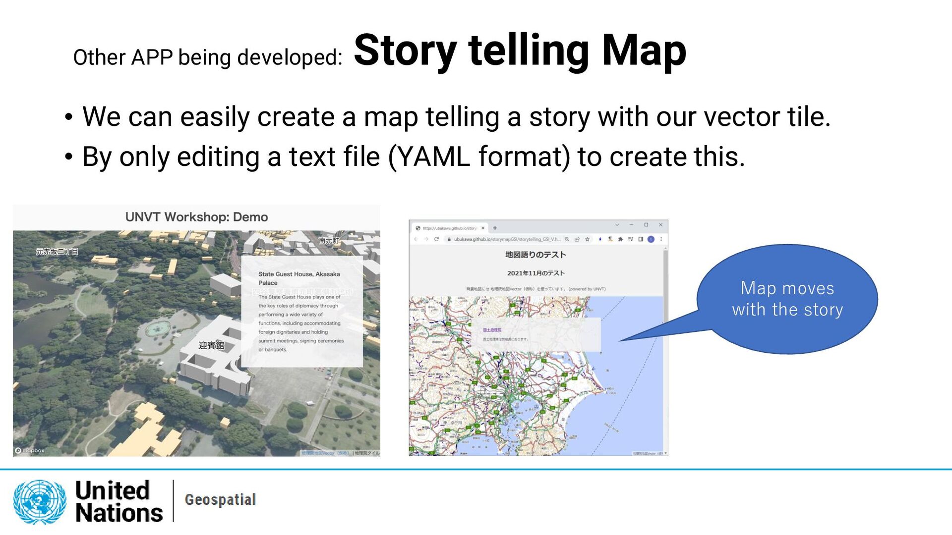
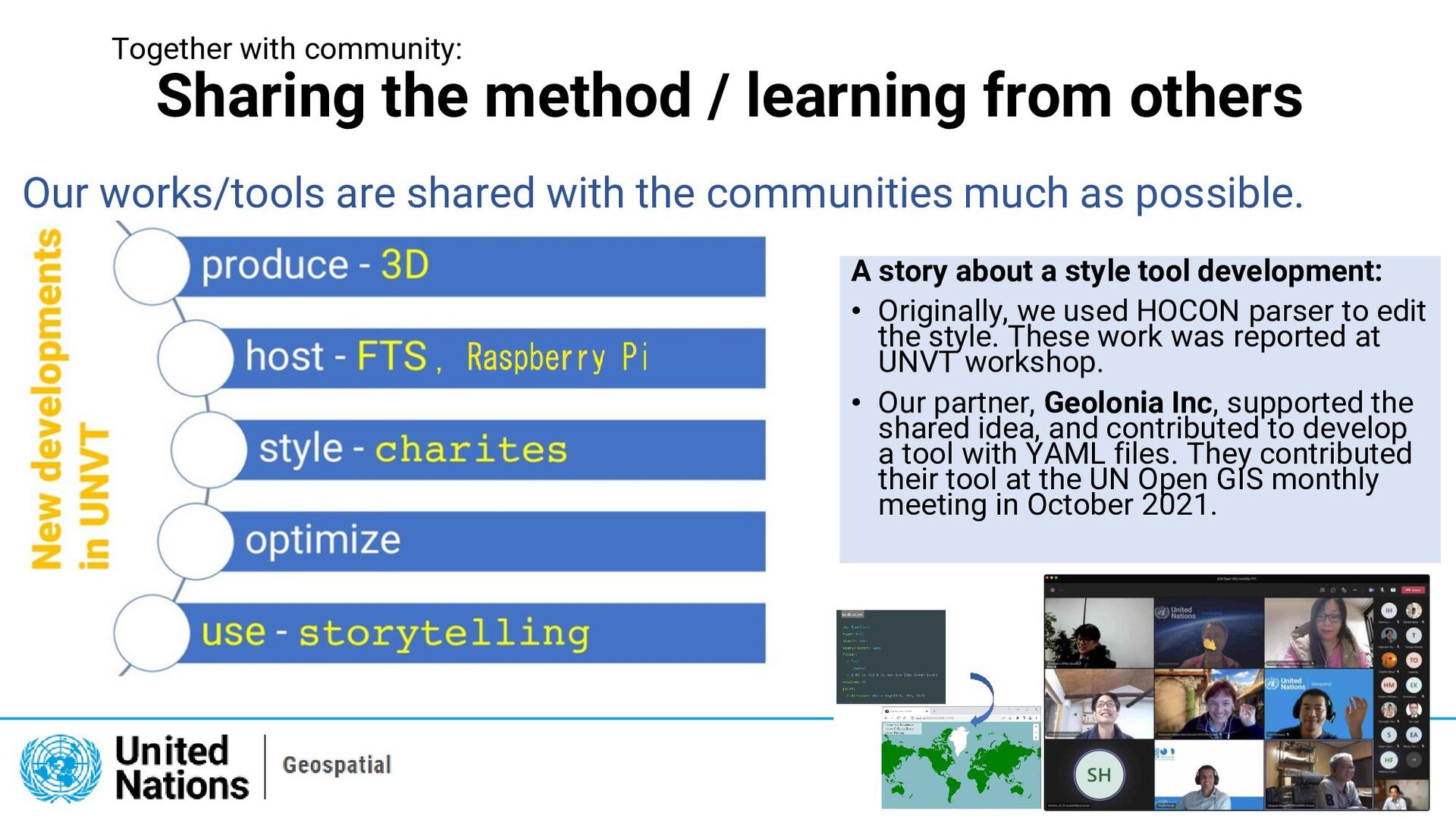
Our works/tools are shared with the communities much as possible. A story about a style tool development: • Originally, we used HOCON parser to edit the style. These work was reported at UNVT workshop. • Our partner, Geolonia Inc, supported the shared idea, and contributed to develop a tool with YAML files. They contributed their tool at the UN Open GIS monthly meeting in October 2021.
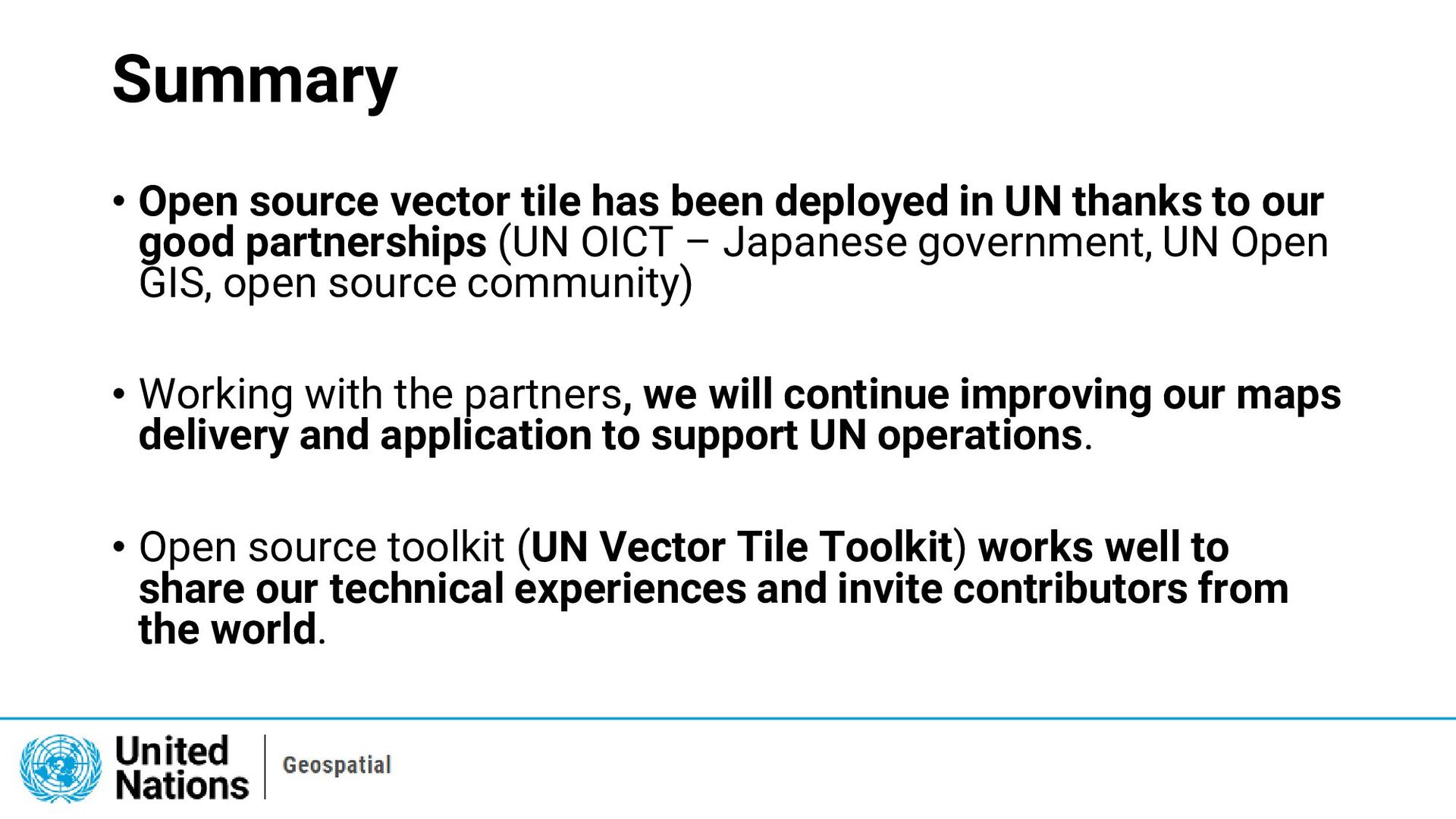
UN thanks to our good partnerships (UN OICT – Japanese government, UN Open GIS, open source community) • Working with the partners, we will continue improving our maps delivery and application to support UN operations. • Open source toolkit (UN Vector Tile Toolkit) works well to share our technical experiences and invite contributors from the world.
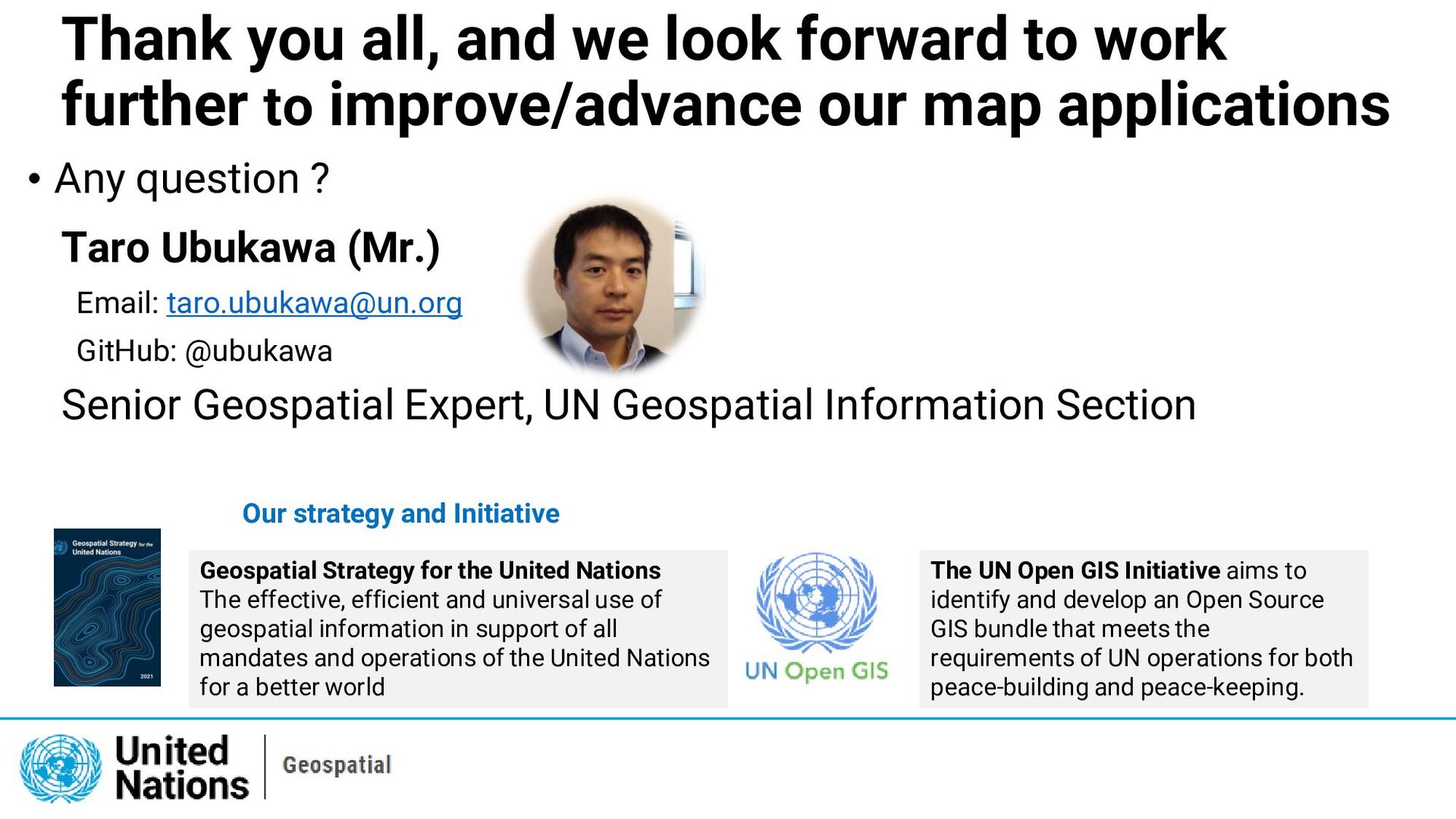
to improve/advance our map applications • Any question ? Taro Ubukawa (Mr.) Email: [email protected] GitHub: @ubukawa Senior Geospatial Expert, UN Geospatial Information Section The UN Open GIS Initiative aims to identify and develop an Open Source GIS bundle that meets the requirements of UN operations for both peace-building and peace-keeping. Geospatial Strategy for the United Nations The effective, efficient and universal use of geospatial information in support of all mandates and operations of the United Nations for a better world Our strategy and Initiative