64-bit:Pro, Enterprise, or Education For detail: https://docs.docker.com/docker-for-windows/install/ • I used Docker Desktop for Windows (Hyper-V backend and windows containers). For the user of Windows 10 Home, WSL 2 backend would be used. (but I have not confirmed if this works.) This practice is specially for windows users because Mac users may be able to use Terminal. Windows (powershell or cmd) cannot directly use some tool, so we use docker.
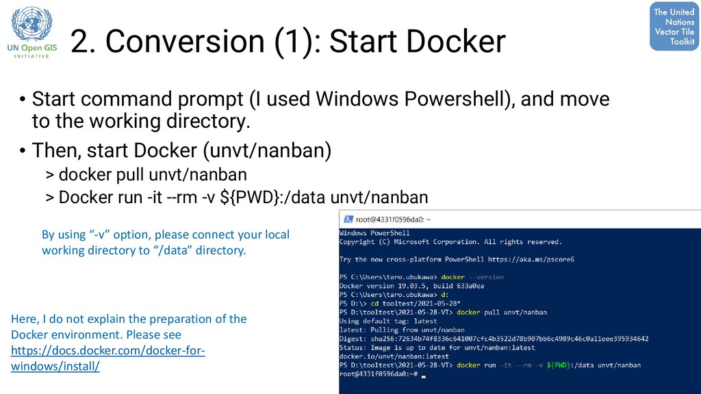
used Windows Powershell), and move to the working directory. • Then, start Docker (unvt/nanban) > docker pull unvt/nanban > Docker run -it --rm -v ${PWD}:/data unvt/nanban By using “-v” option, please connect your local working directory to “/data” directory. Here, I do not explain the preparation of the Docker environment. Please see https://docs.docker.com/docker-for- windows/install/
Dockerfile. Developed by Mr. Fujimura in July 2020. I think this tool helps windows users to easily use UNVT. • Features: • based on Ubuntu/Intel → This is the base of the various tools • Tippecanoe is contained. → It can be used for vector tile data conversion. • gdal is contained → It can be used for basic GIS data processing. • HOCON Parse is also available → It can be used for style editing. • The name nanban is from Tamil language. It means friend. You can find detailed information at https://github.com/unvt/nanban
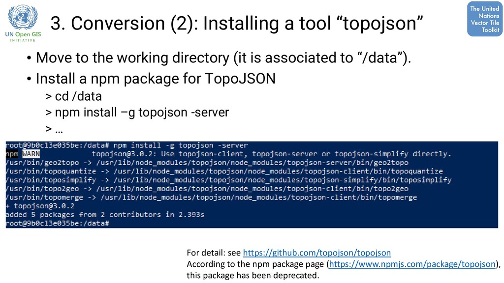
the working directory (it is associated to “/data”). • Install a npm package for TopoJSON > cd /data > npm install –g topojson -server > … For detail: see https://github.com/topojson/topojson According to the npm package page (https://www.npmjs.com/package/topojson), this package has been deprecated.
find several online conversion tools. I have not tried them, but we could possibly use them as well. • MyGeodata Converter https://mygeodata.cloud/converter/shp-to-topojson • mapshaper https://mapshaper.org/ • etc…