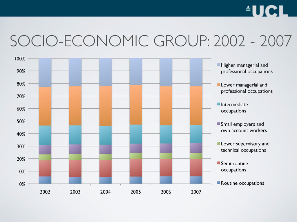
100% 2002 2003 2004 2005 2006 2007 Higher managerial and professional occupations Lower managerial and professional occupations Intermediate occupations Small employers and own account workers Lower supervisory and technical occupations Semi-routine occupations Routine occupations SOCIO-ECONOMIC GROUP: 2002 - 2007
Standard fees - ~£1500 • Topup fees - Up to a cap of ~£3000 • Can only be charged if university signs “access agreement” - States how the money will be used to “widen participation” • University performance indicators (State School Students, NS-SEC, Neighbourhood) • WP Funding - POLAR
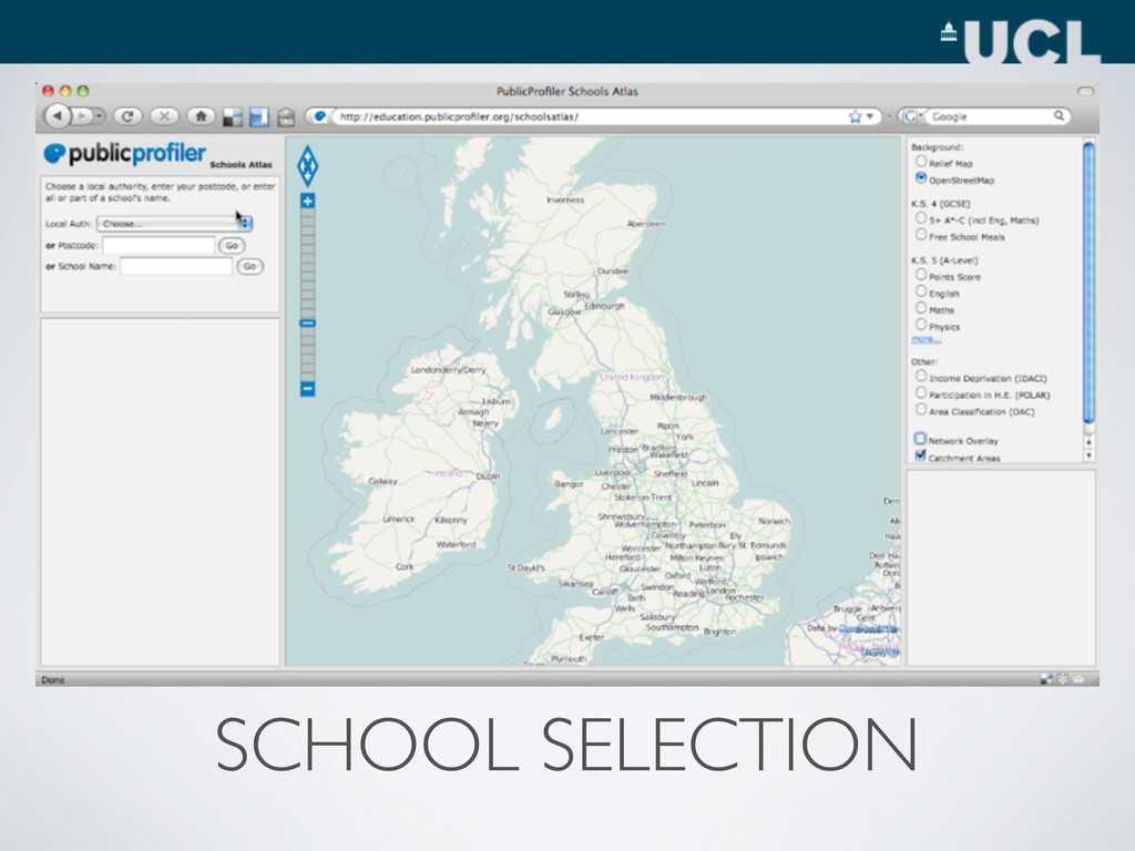
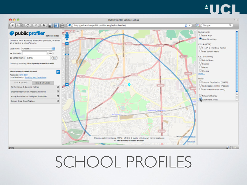
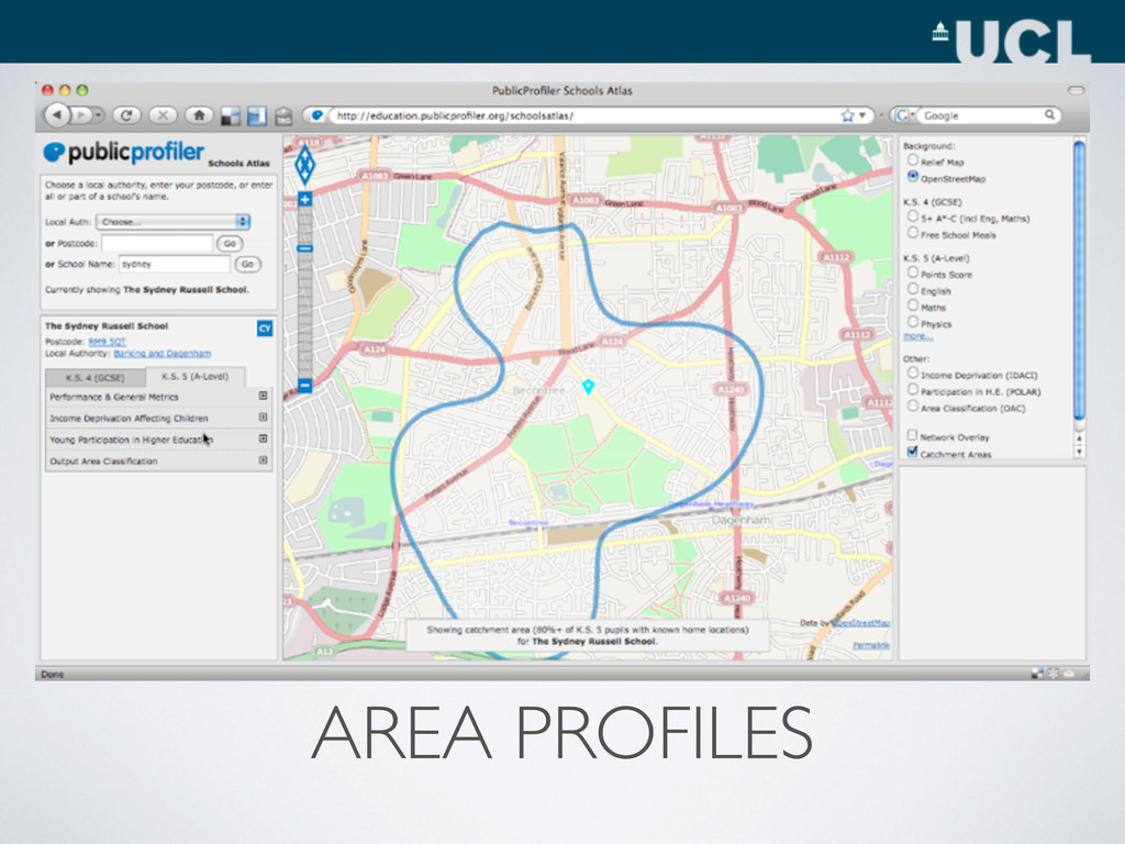
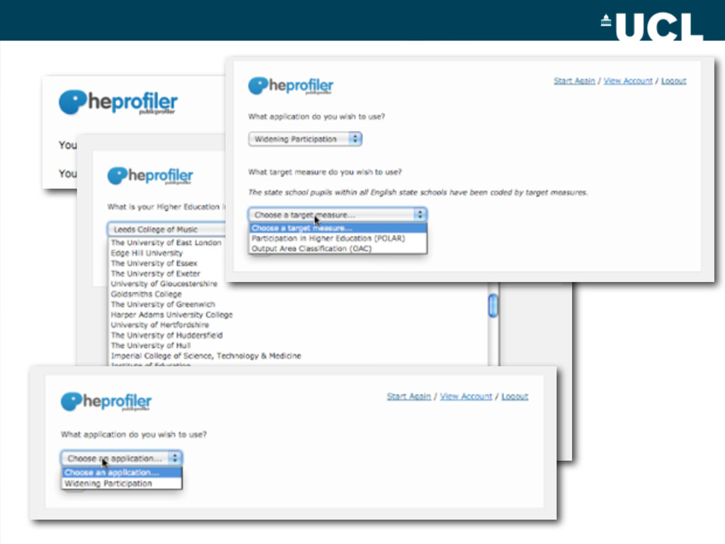
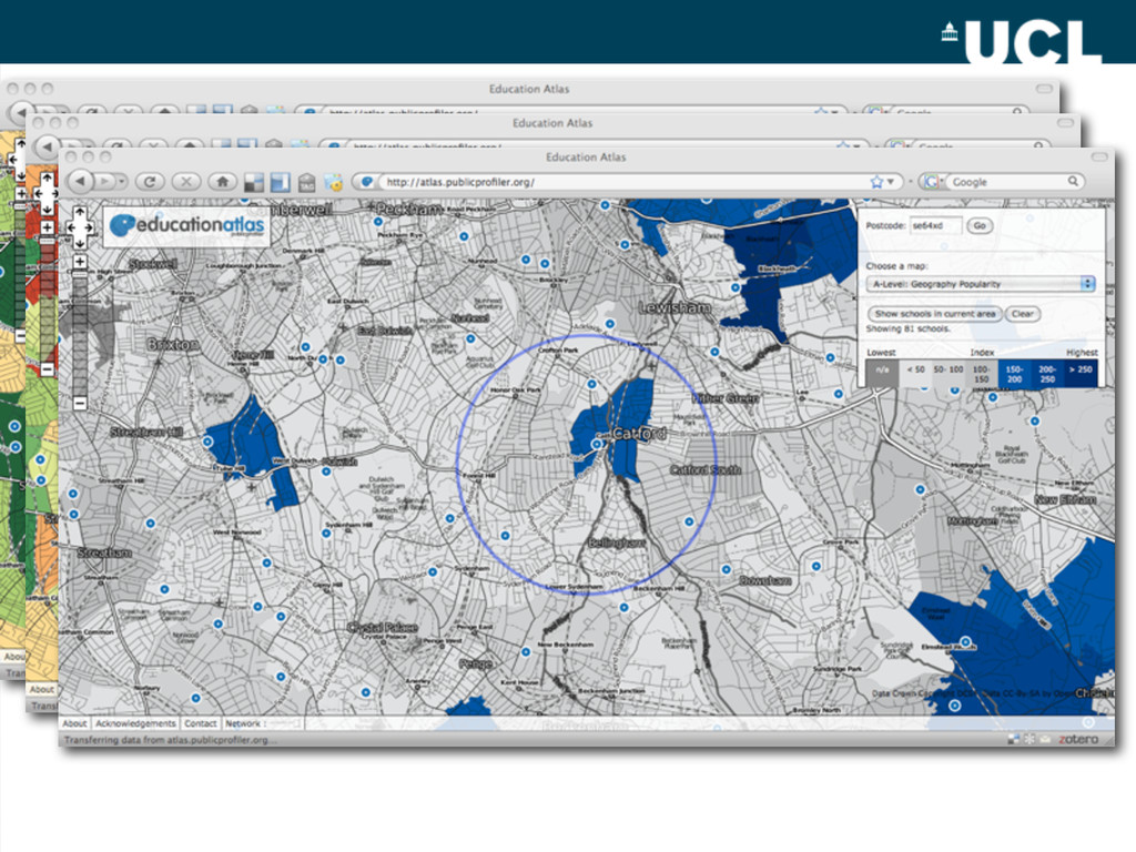
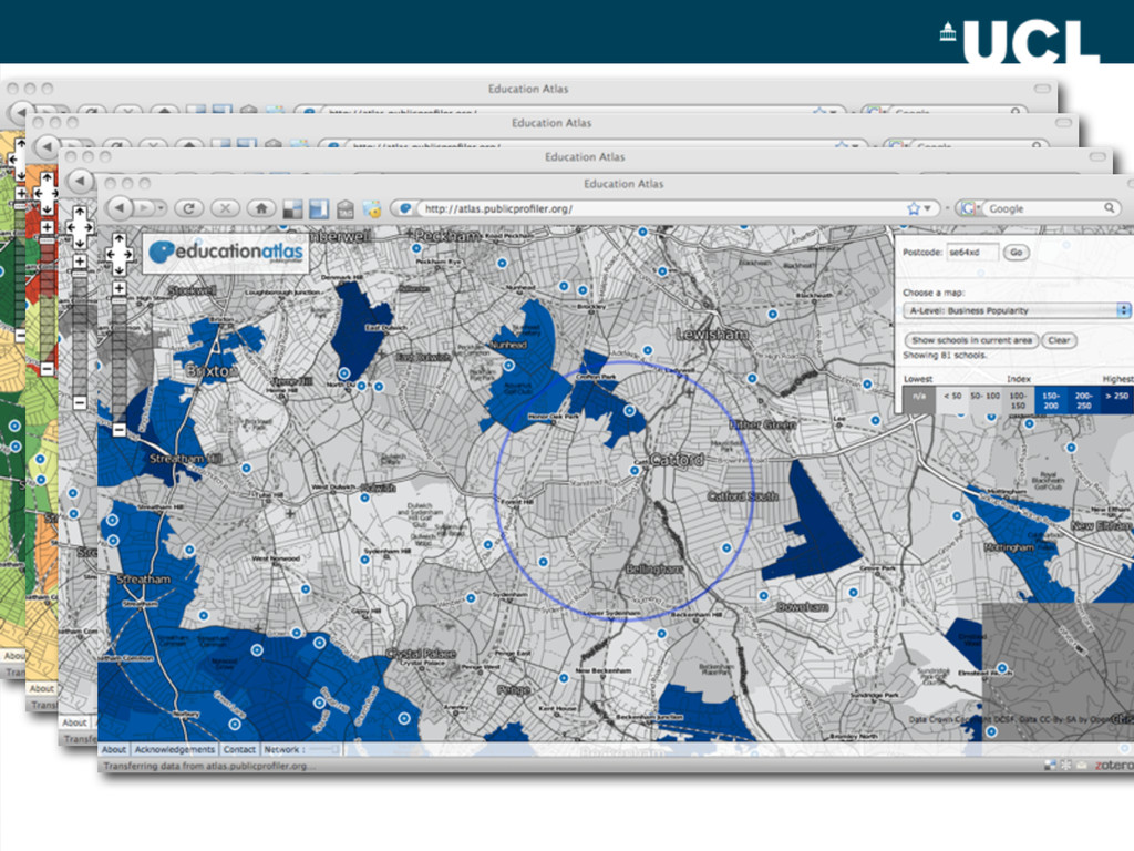
• Simple to use • Simple to use • Simple to use • Simple to use • Simple to use! • Data • Record for every state school pupils in England • Spatial reference • Attainment / demographic attributes
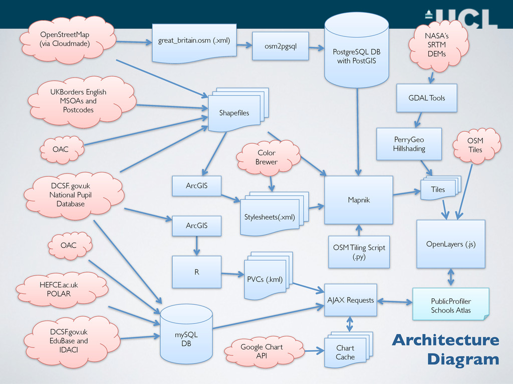
NASA’s SRTM DEMs GDAL Tools UKBorders English MSOAs and Postcodes DCSF. gov.uk National Pupil Database mySQL DB PublicProfiler Schools Atlas DCSF.gov.uk EduBase and IDACI OpenLayers (.js) HEFCE.ac.uk POLAR OAC Mapnik Shapefiles OSM Tiling Script (.py) Stylesheets(.xml) ArcGIS Color Brewer PerryGeo Hillshading AJAX Requests OSM Tiles PVCs (.kml) OAC R ArcGIS Google Chart API Tiles Chart Cache Architecture Diagram
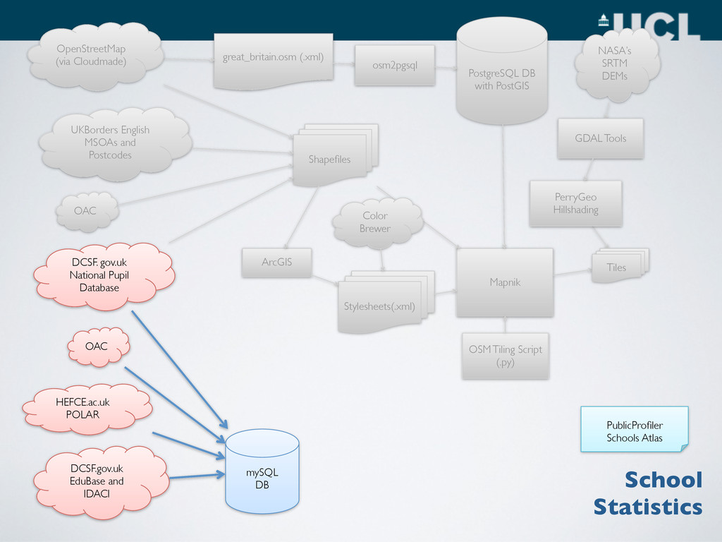
GDAL Tools UKBorders English MSOAs and Postcodes DCSF. gov.uk National Pupil Database mySQL DB DCSF.gov.uk EduBase and IDACI HEFCE.ac.uk POLAR OAC Mapnik Shapefiles OSM Tiling Script (.py) Stylesheets(.xml) ArcGIS Color Brewer PerryGeo Hillshading OAC School Statistics PublicProfiler Schools Atlas Tiles OpenStreetMap (via Cloudmade)
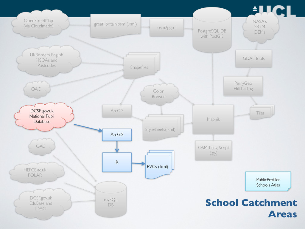
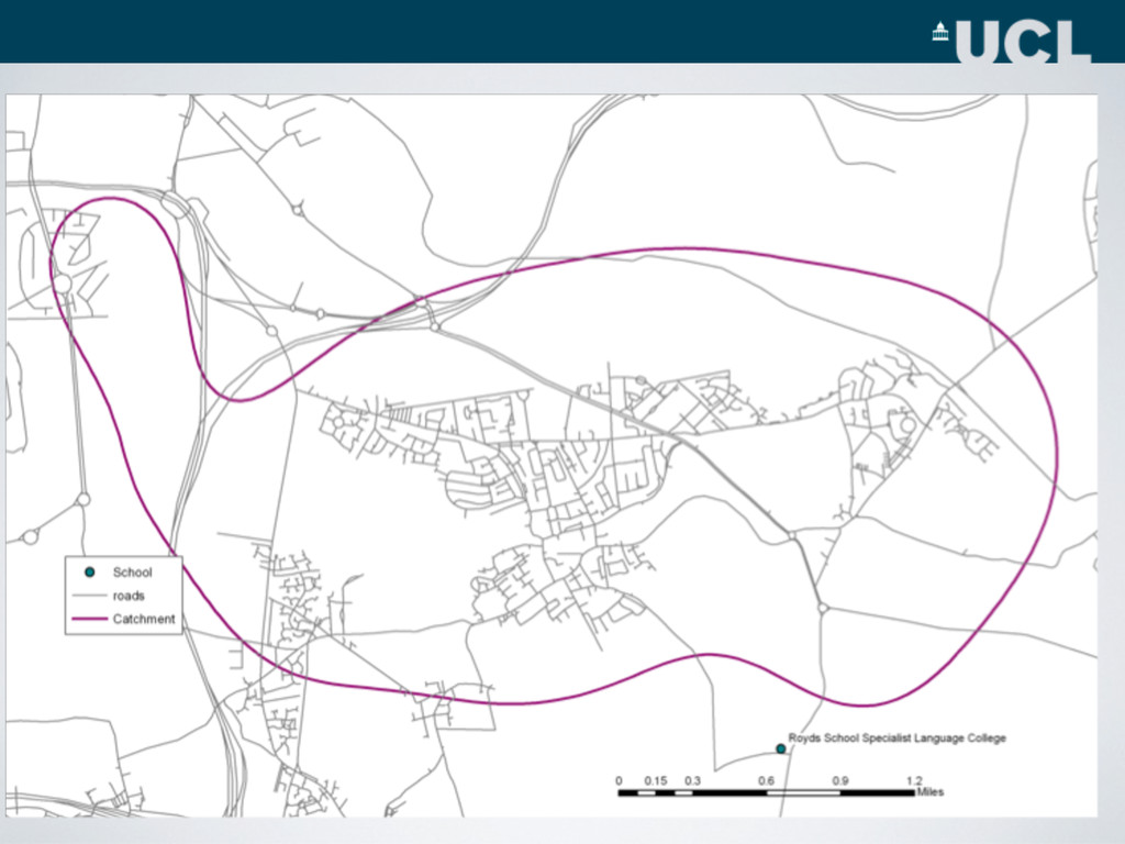
GDAL Tools UKBorders English MSOAs and Postcodes DCSF. gov.uk National Pupil Database mySQL DB DCSF.gov.uk EduBase and IDACI HEFCE.ac.uk POLAR OAC Mapnik Shapefiles OSM Tiling Script (.py) Stylesheets(.xml) ArcGIS Color Brewer PerryGeo Hillshading PVCs (.kml) OAC R ArcGIS School Catchment Areas PublicProfiler Schools Atlas Tiles OpenStreetMap (via Cloudmade)
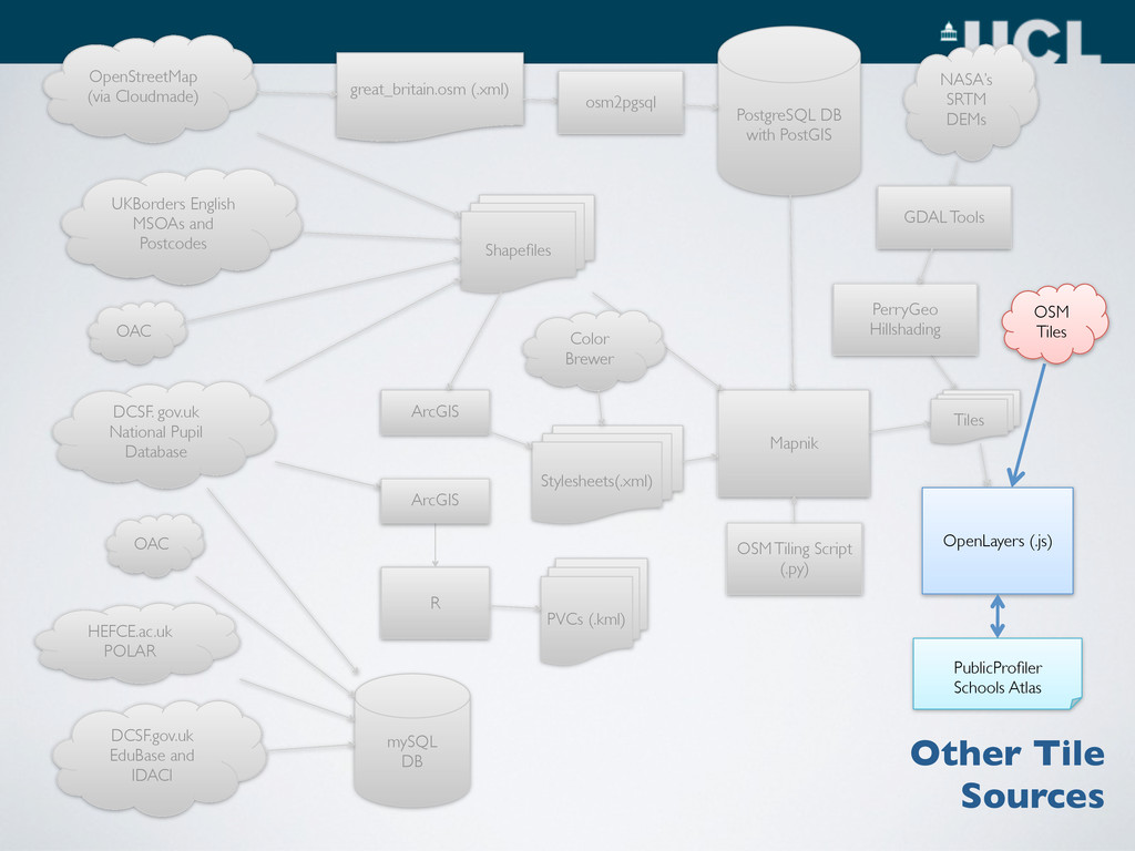
GDAL Tools UKBorders English MSOAs and Postcodes DCSF. gov.uk National Pupil Database mySQL DB DCSF.gov.uk EduBase and IDACI HEFCE.ac.uk POLAR OAC Mapnik Shapefiles OSM Tiling Script (.py) Stylesheets(.xml) ArcGIS Color Brewer PerryGeo Hillshading PVCs (.kml) OAC R ArcGIS Other Tile Sources PublicProfiler Schools Atlas Tiles OSM Tiles OpenLayers (.js) OpenStreetMap (via Cloudmade)
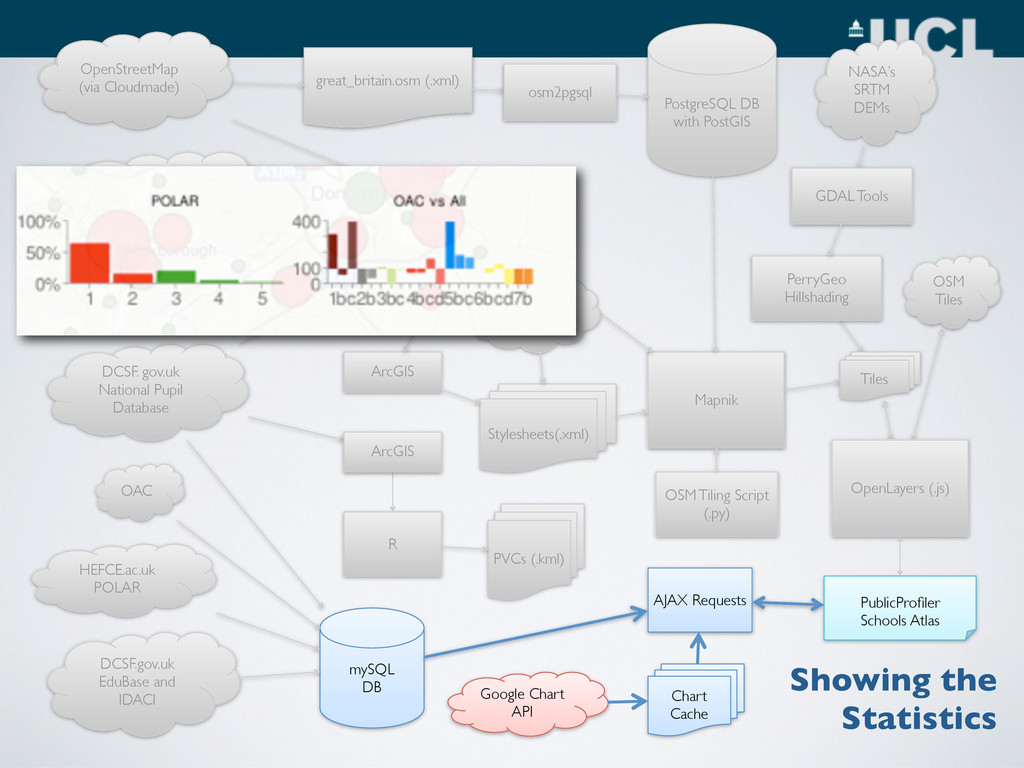
GDAL Tools UKBorders English MSOAs and Postcodes DCSF. gov.uk National Pupil Database mySQL DB DCSF.gov.uk EduBase and IDACI HEFCE.ac.uk POLAR OAC Mapnik Shapefiles OSM Tiling Script (.py) Stylesheets(.xml) ArcGIS Color Brewer PerryGeo Hillshading AJAX Requests PVCs (.kml) OAC R ArcGIS Google Chart API Chart Cache PublicProfiler Schools Atlas Tiles OSM Tiles OpenLayers (.js) Showing the Statistics OpenStreetMap (via Cloudmade)
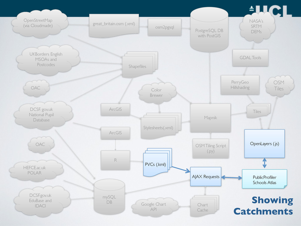
GDAL Tools UKBorders English MSOAs and Postcodes DCSF. gov.uk National Pupil Database mySQL DB DCSF.gov.uk EduBase and IDACI HEFCE.ac.uk POLAR OAC Mapnik Shapefiles OSM Tiling Script (.py) Stylesheets(.xml) ArcGIS Color Brewer PerryGeo Hillshading AJAX Requests PVCs (.kml) OAC R ArcGIS Google Chart API Chart Cache OSM Tiles Tiles OpenLayers (.js) PublicProfiler Schools Atlas Showing Catchments OpenStreetMap (via Cloudmade)