Upgrade to Pro — share decks privately, control downloads, hide ads and more …

Quantum GIS

Quantum GIS

Introduction to QGIS
Data Cleaning/Publishing workshop
Empowering Biodiversity Research

André Heughebaert

November 09, 2015
Tweet

More Decks by André Heughebaert

Other Decks in Research

Transcript

  1. QUANTUM GIS QUANTUM GIS Data cleaning/publishing Workshop 9th November 2015

    André Heughebaert Belgian Biodiversity Platform
  2. SUMMARY SUMMARY 1. 2. 3. 4. 5. 6. Georeferencing Locations

    and Coordinates Visualising Cleaning Demo Hands-on
  3. GEOREFERENCING GEOREFERENCING To georeference means to associate something with locations

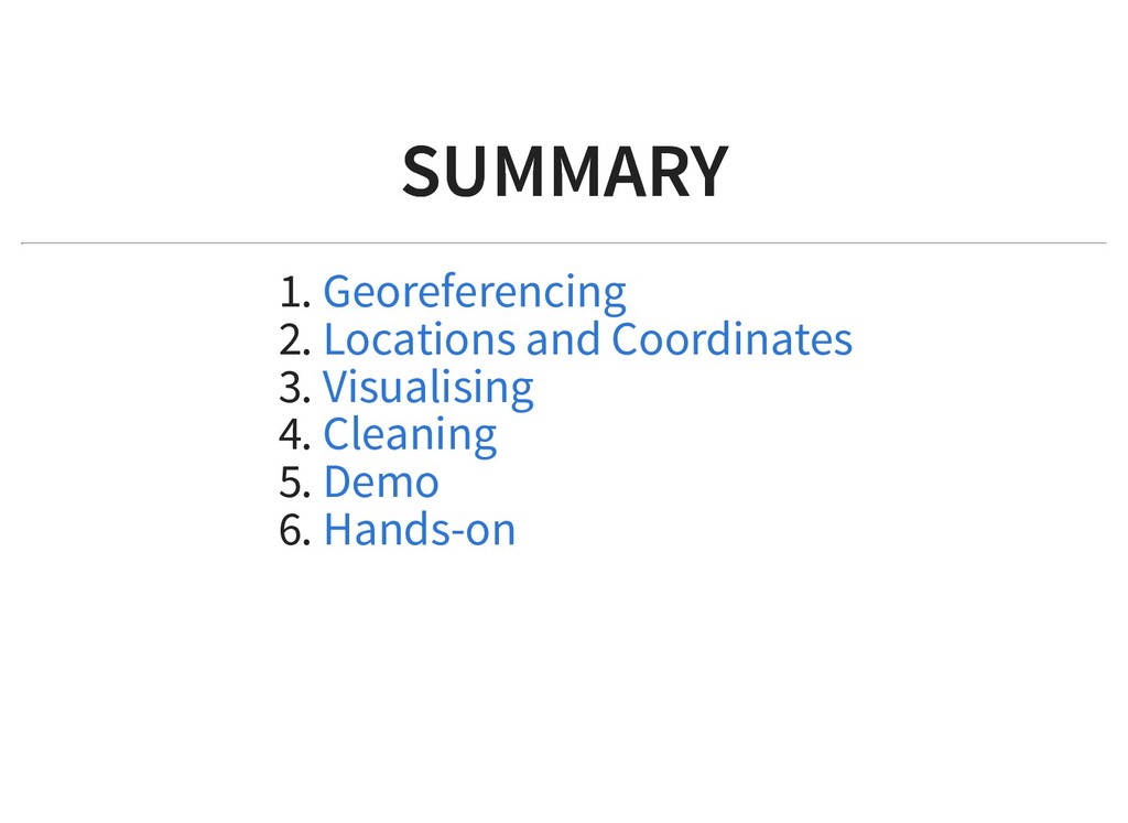
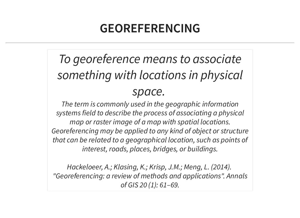
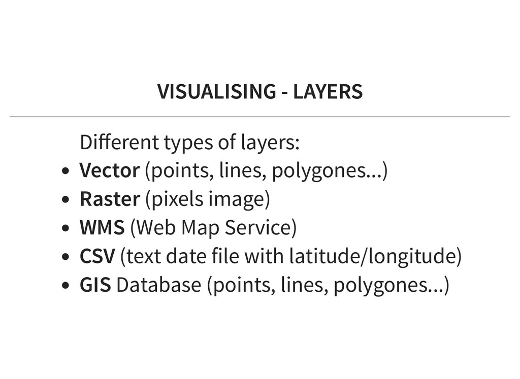
    in physical space. The term is commonly used in the geographic information systems field to describe the process of associating a physical map or raster image of a map with spatial locations. Georeferencing may be applied to any kind of object or structure that can be related to a geographical location, such as points of interest, roads, places, bridges, or buildings. Hackeloeer, A.; Klasing, K.; Krisp, J.M.; Meng, L. (2014). "Georeferencing: a review of methods and applications". Annals of GIS 20 (1): 61–69.
  4. LOCATIONS LOCATIONS COORDINATES COORDINATES Guinée équatoriale (Rio Muni), parc national

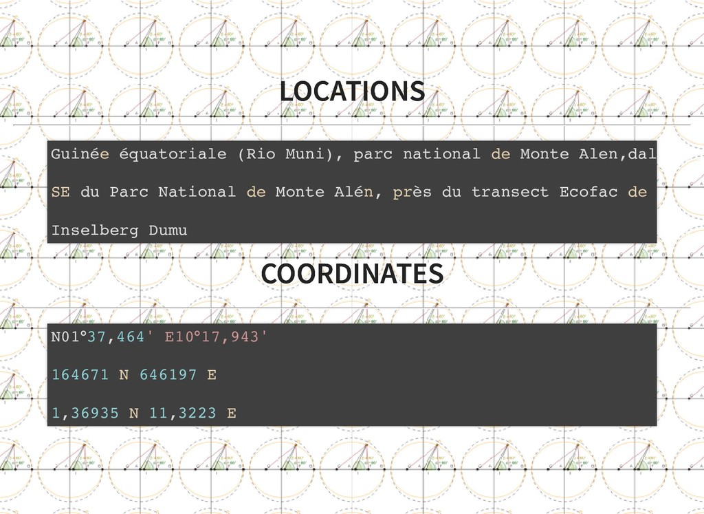
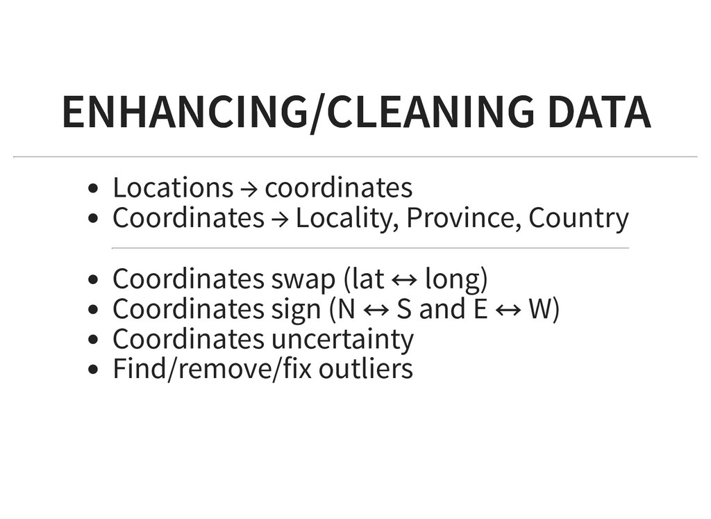
    de Monte Alen,dal SE du Parc National de Monte Alén, près du transect Ecofac de Inselberg Dumu N01°37,464' E10°17,943' 164671 N 646197 E 1,36935 N 11,3223 E
  5. GEODETIC DATUM/ COORDINATE SYSTEM GEODETIC DATUM/ COORDINATE SYSTEM WGS 84

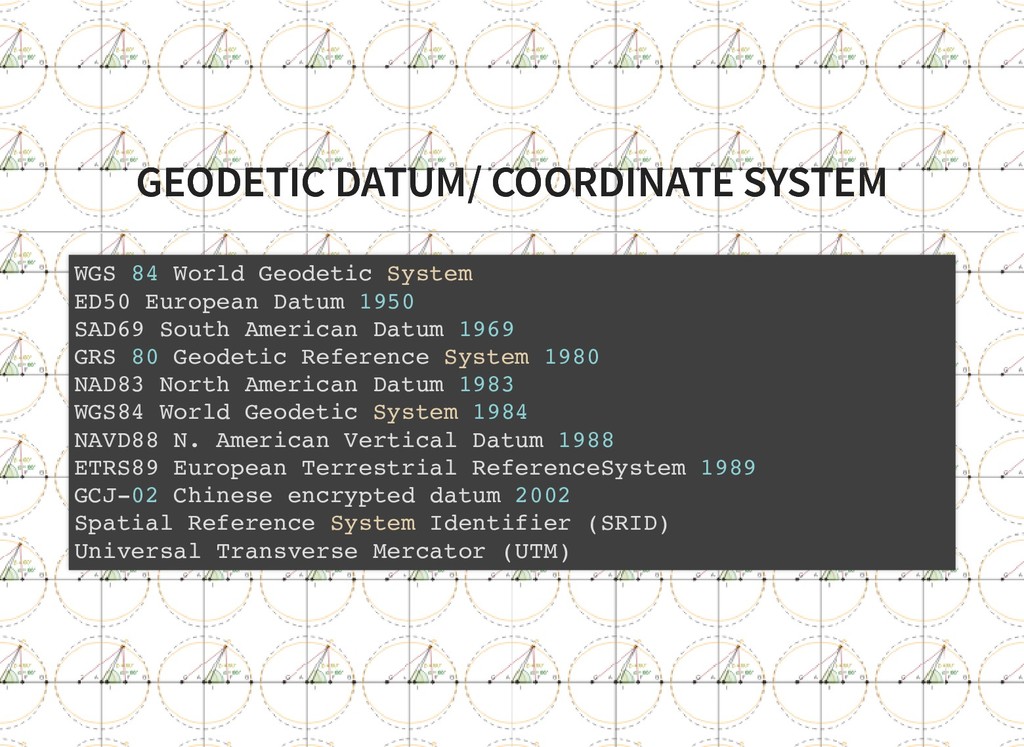
    World Geodetic System ED50 European Datum 1950 SAD69 South American Datum 1969 GRS 80 Geodetic Reference System 1980 NAD83 North American Datum 1983 WGS84 World Geodetic System 1984 NAVD88 N. American Vertical Datum 1988 ETRS89 European Terrestrial ReferenceSystem 1989 GCJ-02 Chinese encrypted datum 2002 Spatial Reference System Identifier (SRID) Universal Transverse Mercator (UTM)
  6. GAZETTEERS GAZETTEERS “Gazetteer is a geographical dictionary that helps you

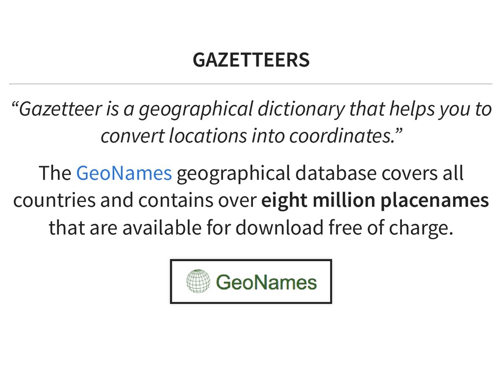
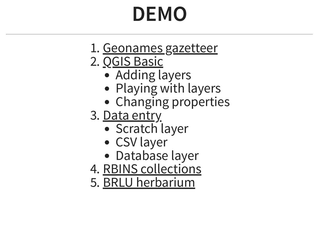
    to convert locations into coordinates.” The geographical database covers all countries and contains over eight million placenames that are available for download free of charge. GeoNames
  7. VISUALISING - LAYERS VISUALISING - LAYERS Different types of layers:

    Vector (points, lines, polygones...) Raster (pixels image) WMS (Web Map Service) CSV (text date file with latitude/longitude) GIS Database (points, lines, polygones...)
  8. ENHANCING/CLEANING DATA ENHANCING/CLEANING DATA Locations → coordinates Coordinates → Locality,

    Province, Country Coordinates swap (lat ↔ long) Coordinates sign (N ↔ S and E ↔ W) Coordinates uncertainty Find/remove/fix outliers
  9. DEMO DEMO 1. Geonames gazetteer 2. QGIS Basic Adding layers

    Playing with layers Changing properties 3. Data entry Scratch layer CSV layer Database layer 4. RBINS collections 5. BRLU herbarium