Center for Atmospheric Research, which is a major facility sponsored by the National Science Foundation under Cooperative Agreement No. 1852977. Anissa Zacharias | March 4, 2024 How to write new, old code Implementing legacy NCL routines in the python ecosystem
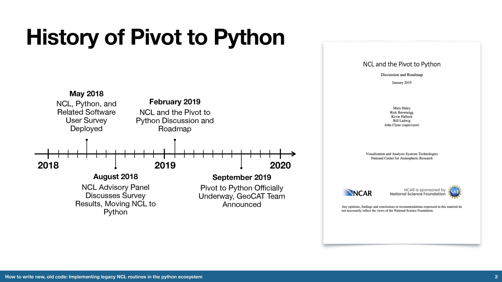
old code: Implementing legacy NCL routines in the python ecosystem NCL, Python, and Related Software User Survey Deployed May 2018 NCL Advisory Panel Discusses Survey Results, Moving NCL to Python August 2018 NCL and the Pivot to Python Discussion and Roadmap February 2019 2018 2019 2020 Pivot to Python O ff i cially Underway, GeoCAT Team Announced September 2019
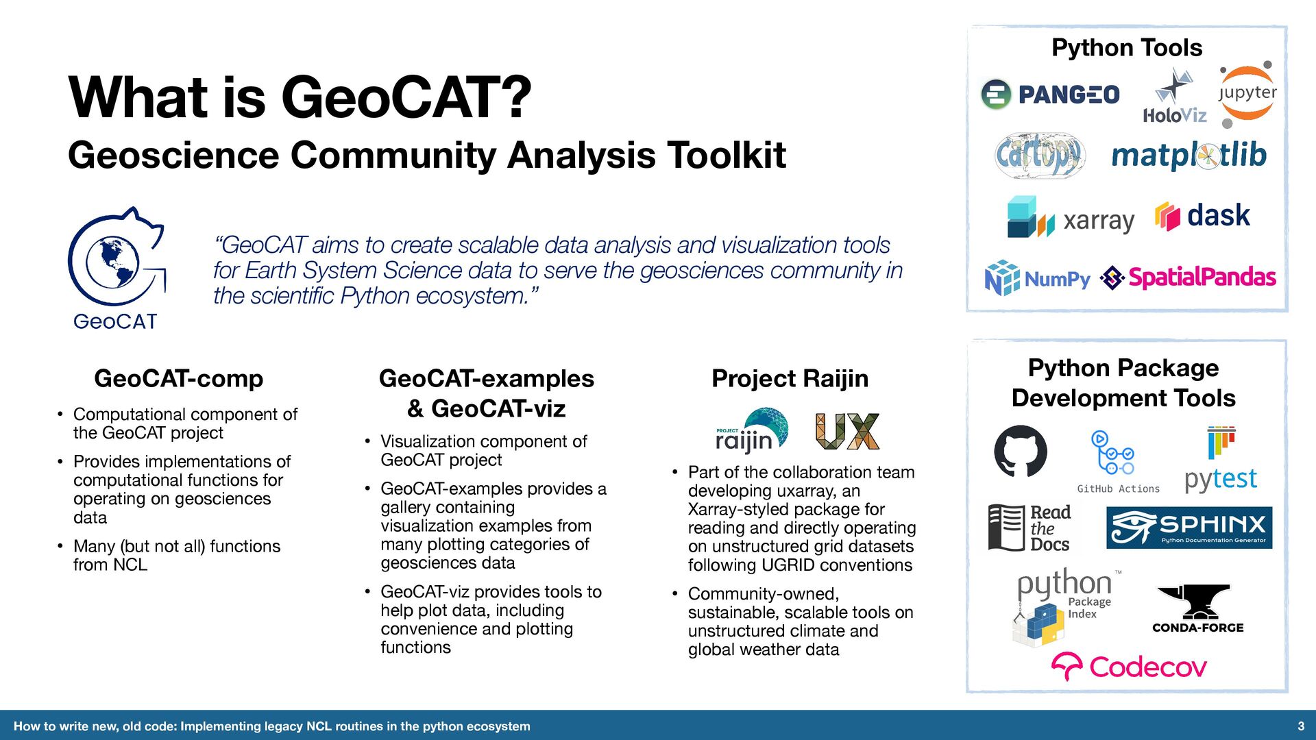
write new, old code: Implementing legacy NCL routines in the python ecosystem “GeoCAT aims to create scalable data analysis and visualization tools for Earth System Science data to serve the geosciences community in the scientific Python ecosystem.” Python Package Development Tools GeoCAT-comp • Computational component of the GeoCAT project • Provides implementations of computational functions for operating on geosciences data • Many (but not all) functions from NCL GeoCAT-examples & GeoCAT-viz • Visualization component of GeoCAT project • GeoCAT-examples provides a gallery containing visualization examples from many plotting categories of geosciences data • GeoCAT-viz provides tools to help plot data, including convenience and plotting functions Project Raijin • Part of the collaboration team developing uxarray, an Xarray-styled package for reading and directly operating on unstructured grid datasets following UGRID conventions • Community-owned, sustainable, scalable tools on unstructured climate and global weather data Python Tools
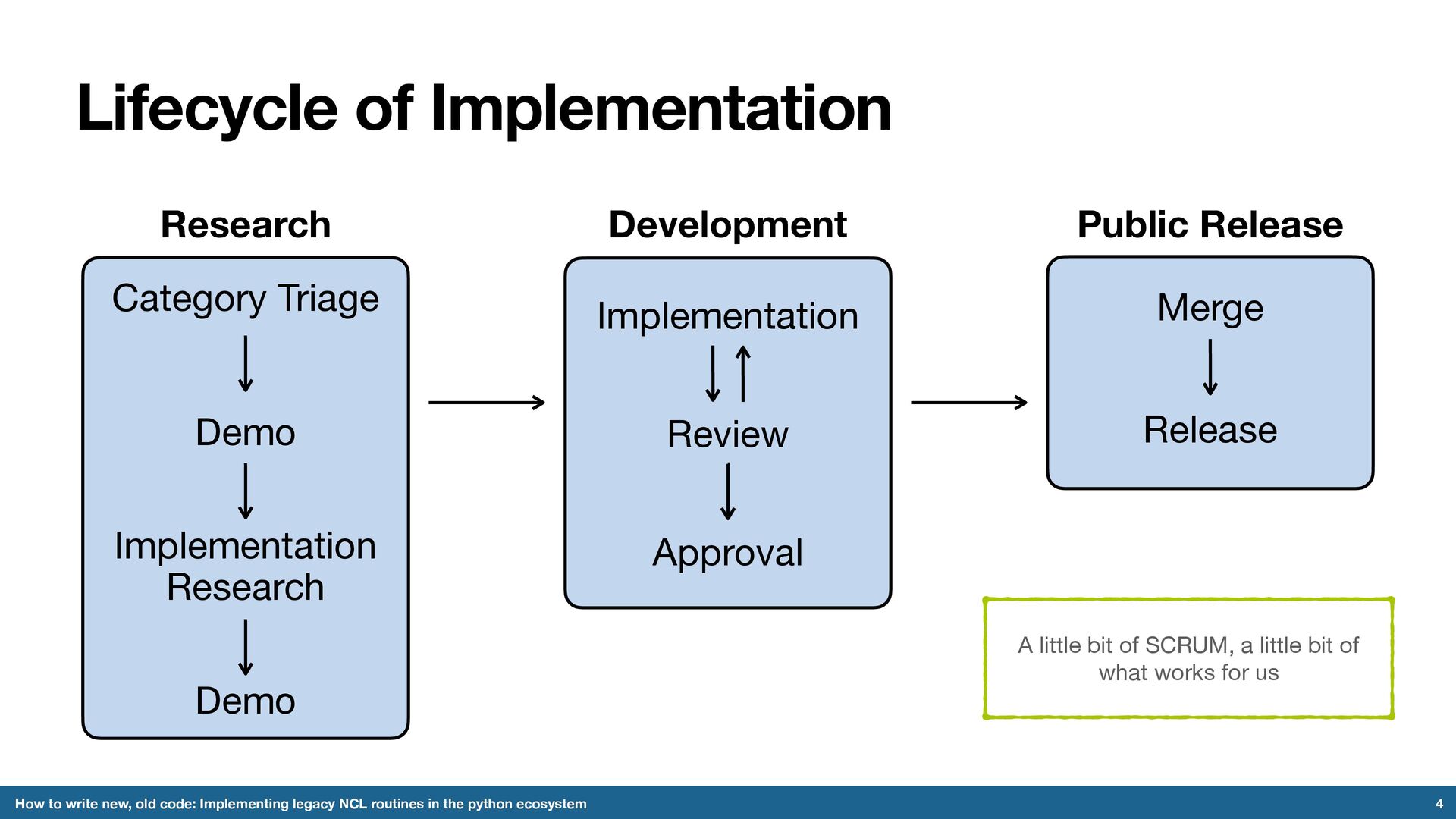
Implementing legacy NCL routines in the python ecosystem Category Triage Implementation Research Demo Demo Research Implementation Review Approval Development Merge Release Public Release A little bit of SCRUM, a little bit of what works for us
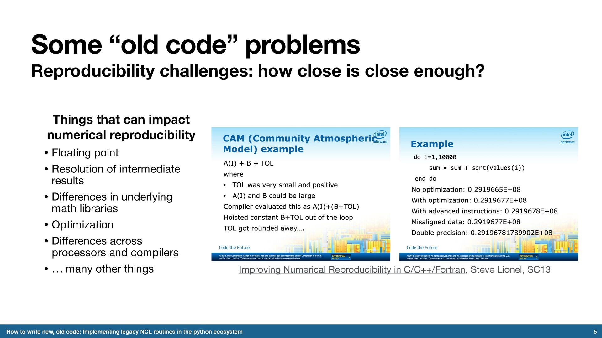
enough? 5 How to write new, old code: Implementing legacy NCL routines in the python ecosystem Things that can impact numerical reproducibility • Floating point • Resolution of intermediate results • Di ff erences in underlying math libraries • Optimization • Di ff erences across processors and compilers • … many other things Improving Numerical Reproducibility in C/C++/Fortran, Steve Lionel, SC13
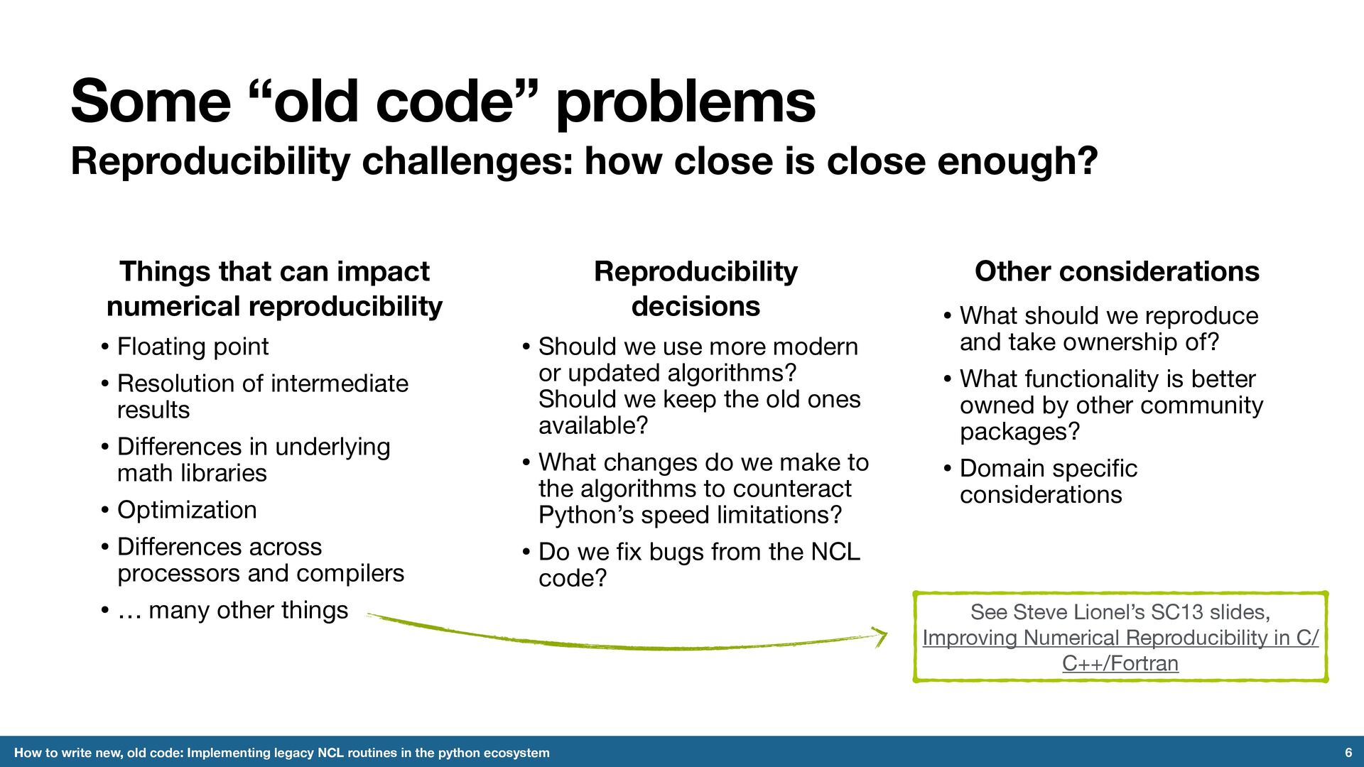
enough? 6 How to write new, old code: Implementing legacy NCL routines in the python ecosystem Things that can impact numerical reproducibility • Floating point • Resolution of intermediate results • Di ff erences in underlying math libraries • Optimization • Di ff erences across processors and compilers • … many other things Reproducibility decisions • Should we use more modern or updated algorithms? Should we keep the old ones available? • What changes do we make to the algorithms to counteract Python’s speed limitations? • Do we fi x bugs from the NCL code? See Steve Lionel’s SC13 slides, Improving Numerical Reproducibility in C/ C++/Fortran Other considerations • What should we reproduce and take ownership of? • What functionality is better owned by other community packages? • Domain speci fi c considerations
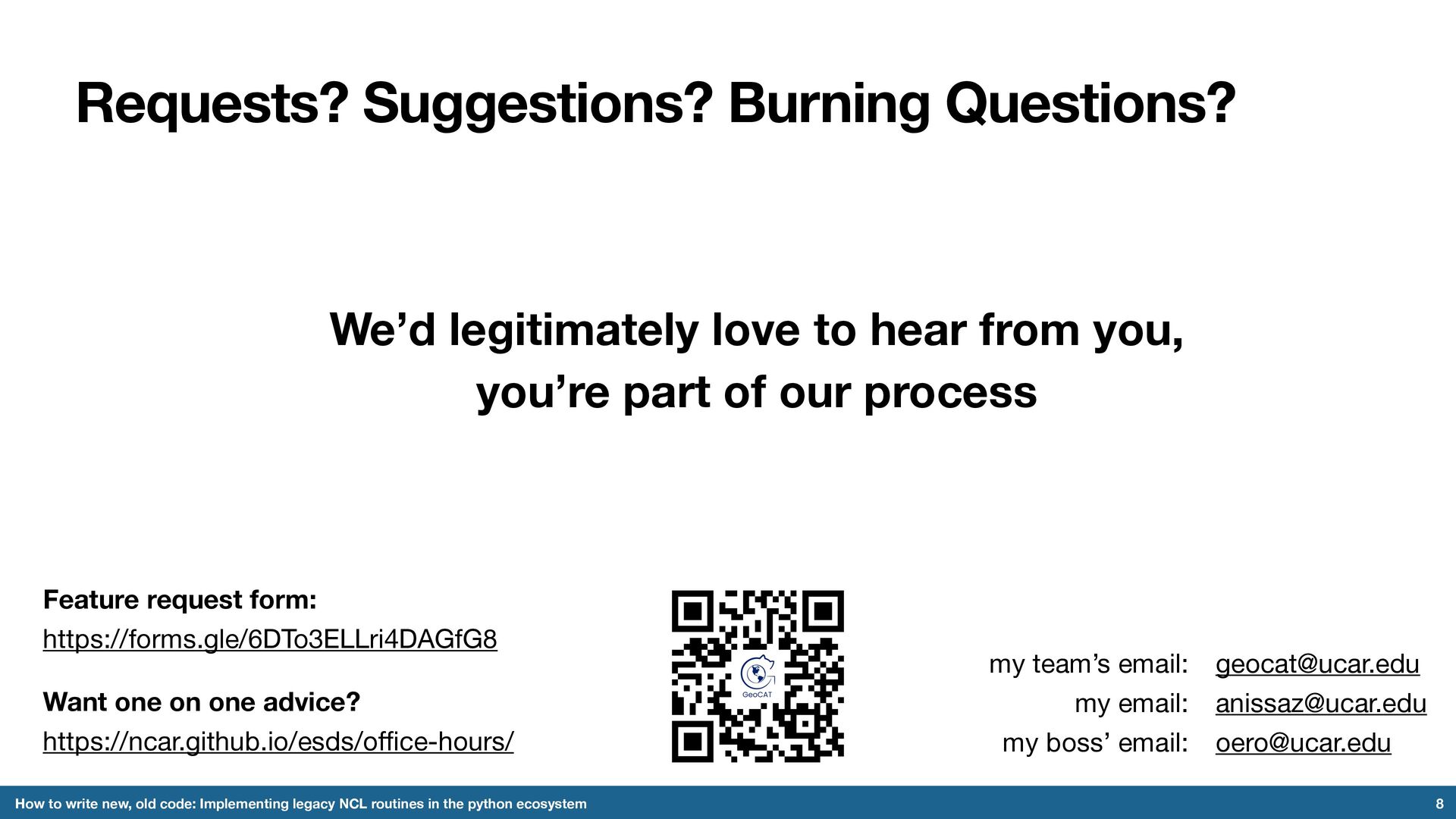
code: Implementing legacy NCL routines in the python ecosystem [email protected][email protected][email protected] my team’s email: my email: my boss’ email: We’d legitimately love to hear from you, you’re part of our process Want one on one advice? https://ncar.github.io/esds/o ffi ce-hours/ Feature request form: https://forms.gle/6DTo3ELLri4DAGfG8