Upgrade to Pro — share decks privately, control downloads, hide ads and more …

Visualising Mobile Network Data with Google Big Query and Google Maps

Dale Humby
November 12, 2014

Visualising Mobile Network Data with Google Big Query and Google Maps

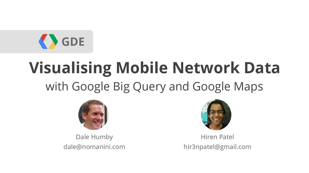
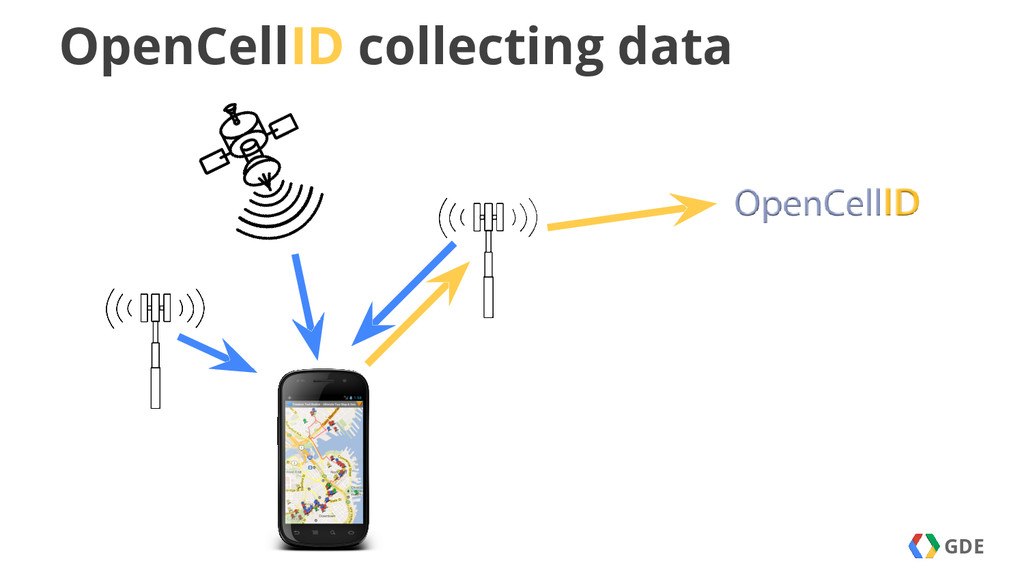
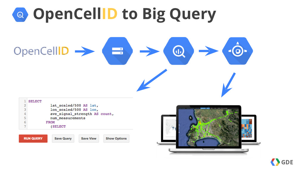
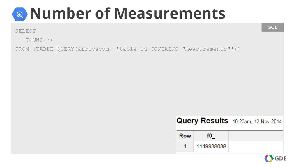
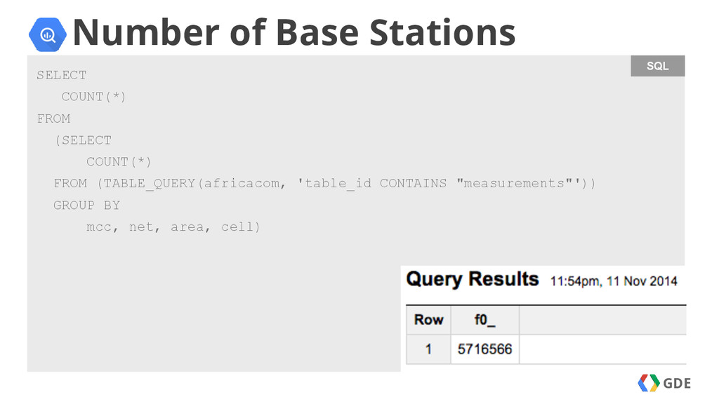
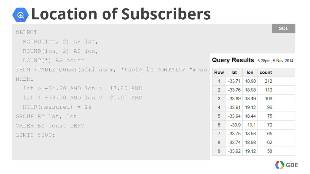
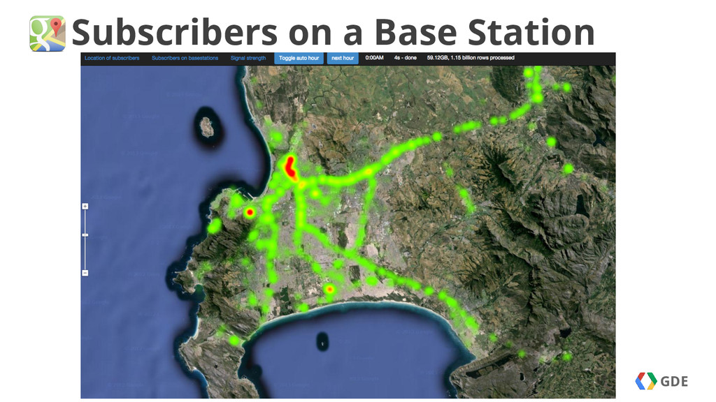
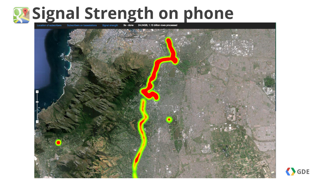
My talk at AfricaCom about using Google Big Query to mine OpenCellID data across 1.2 billion rows, and using Google Maps to visualise the data.

Dale Humby

November 12, 2014
Tweet

More Decks by Dale Humby

Other Decks in Technology

Transcript

  1. GDE

  2. GDE

  3. SQL GDE Number of Base Stations SELECT COUNT(*) FROM (SELECT

    COUNT(*) FROM (TABLE_QUERY(africacom, 'table_id CONTAINS "measurements"')) GROUP BY mcc, net, area, cell)
  4. SQL GDE Location of Subscribers SELECT ROUND(lat, 2) AS lat,

    ROUND(lon, 2) AS lon, COUNT(*) AS count FROM (TABLE_QUERY(africacom, 'table_id CONTAINS "measurements"')) WHERE lat > -34.60 AND lon > 17.80 AND lat < -33.00 AND lon < 20.00 AND HOUR(measured) = 14 GROUP BY lat, lon ORDER BY count DESC LIMIT 8000;
  5. GDE What could a MNO use it for: Stream CDR’s

    to Big Query Bulk loaded in Cloud Store KPI perf monitoring and business trends Engineering, planning and data exploration tool
  6. GDE When to use Big Query Adhoc queries on large

    data Data analysis Streaming inserts keep data live Fast enough for dashboards
  7. GDE Thank You App: Data: Code: GDG: Dale Humby [email protected]

    plus.google.com/+DaleHumby Hiren Patel [email protected] plus.google.com/+HirenPatel dale-humby.appspot.com bigquery.cloud.google.com/queries/dale-humby github.com/GDGCapeTown/bigquery-demo developers.google.com/groups