and teaching with urban and spatial data Dimitris C. Papadopoulos Ph.D NEH CARES Instructional Technologist [email protected] https://commons.gc.cuny.edu/members/dcpapadopoulos/
Working with multimodal content Session #3: mapping and teaching with urban and spatial data Session #4: digital humanities tools for crisis response, mobilization, and support
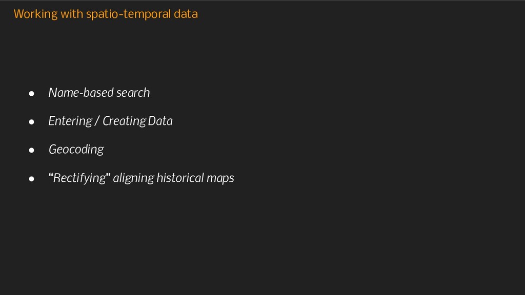
maps and geo-spatial data in your classes? • In what format? • What are some of the requirements or conditions that would make it easier for you to integrate geo-spatial/urban data and digital maps in your classes?
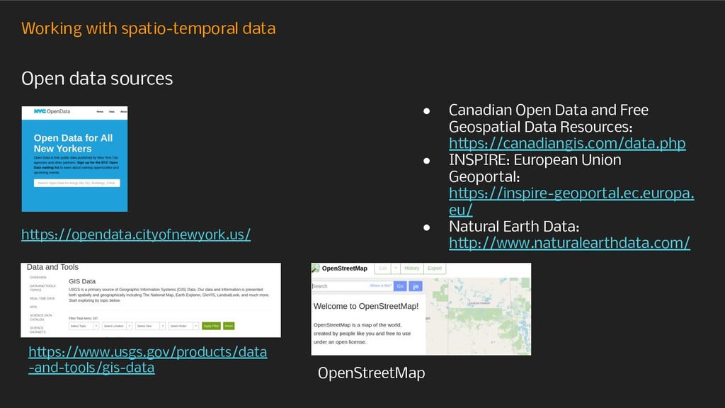
• Canadian Open Data and Free Geospatial Data Resources: https://canadiangis.com/data.php • INSPIRE: European Union Geoportal: https://inspire-geoportal.ec.europa. eu/ • Natural Earth Data: http://www.naturalearthdata.com/ OpenStreetMap
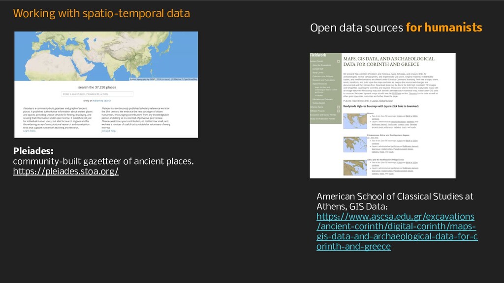
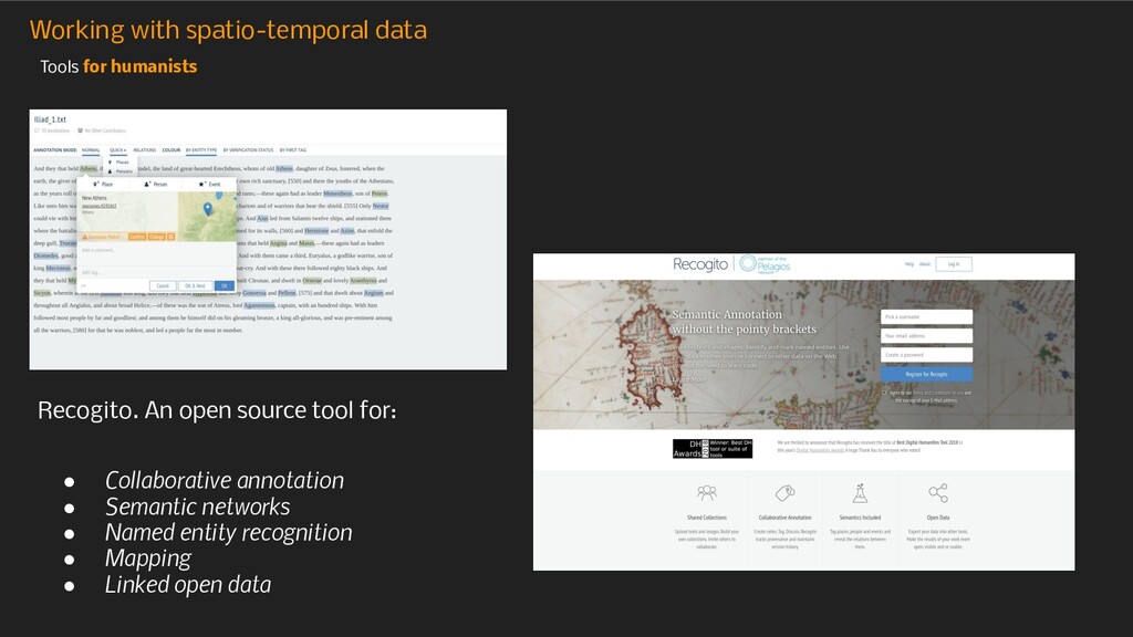
https://pleiades.stoa.org/ Open data sources for humanists American School of Classical Studies at Athens, GIS Data: https://www.ascsa.edu.gr/excavations /ancient-corinth/digital-corinth/maps- gis-data-and-archaeological-data-for-c orinth-and-greece
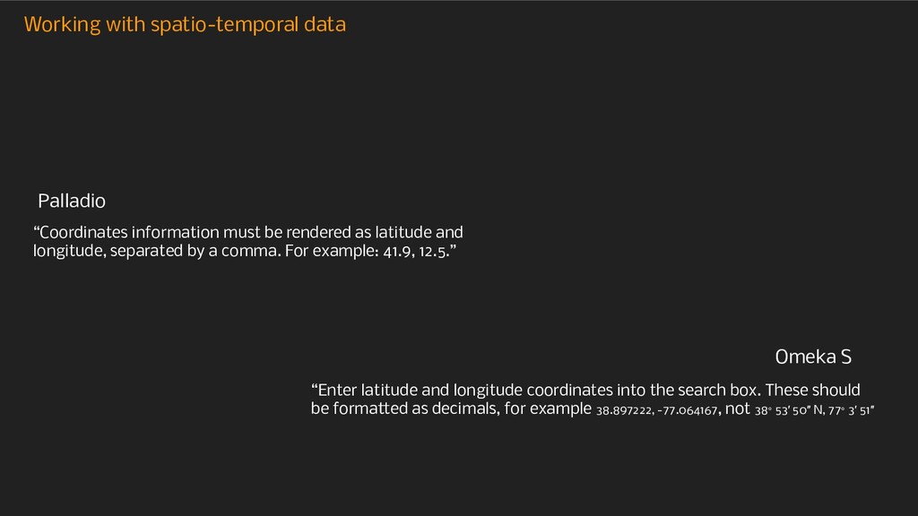
following format Year-Month-Day (2014-01-01). Years must always be rendered as four digit integers. Thus years between 0 CE and 1000 CE should still be rendered as 0001 or 0999. Negative dates should follow the same format, but preceded by a minus sign (ie. -200-01-01). If using Excel, be sure to specify that the column reads as “Text” rather than dates, so that Excel doesn’t change the dates into its own (non-Palladio friendly) format.” “To enter dates before the common era, just use a negative value for the year. Of course, you can also enter month and date if you need them.” Timeline.js • Timestamp, which can be as broad as year or as defined as the date and time; • Duration, for how long something lasted, with options for years down to seconds; • Interval, a date-based range with start and end dates in each instance of the property. Palladio Omeka S
latitude and longitude, separated by a comma. For example: 41.9, 12.5.” “Enter latitude and longitude coordinates into the search box. These should be formatted as decimals, for example 38.897222, -77.064167, not 38° 53′ 50″ N, 77° 3′ 51″ Palladio Omeka S
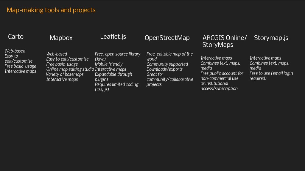
StoryMaps Storymap.js Web-based Easy to edit/customize Free basic usage Interactive maps Web-based Easy to edit/customize Free basic usage Online map editing studio Variety of basemaps Interactive maps Free, open source library (Java) Mobile friendly Interactive maps Expandable through plugins Requires limited coding (css, js) Free, editable map of the world Community supported Downloads/exports Great for community/collaborative projects Interactive maps Combines text, maps, media Free public account for non-commercial use or institutional access/subscription Interactive maps Combines text, maps, media Free to use (email login required)
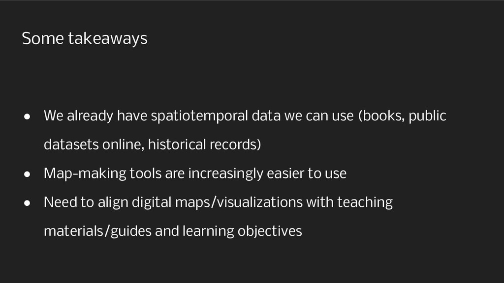
use (books, public datasets online, historical records) • Map-making tools are increasingly easier to use • Need to align digital maps/visualizations with teaching materials/guides and learning objectives