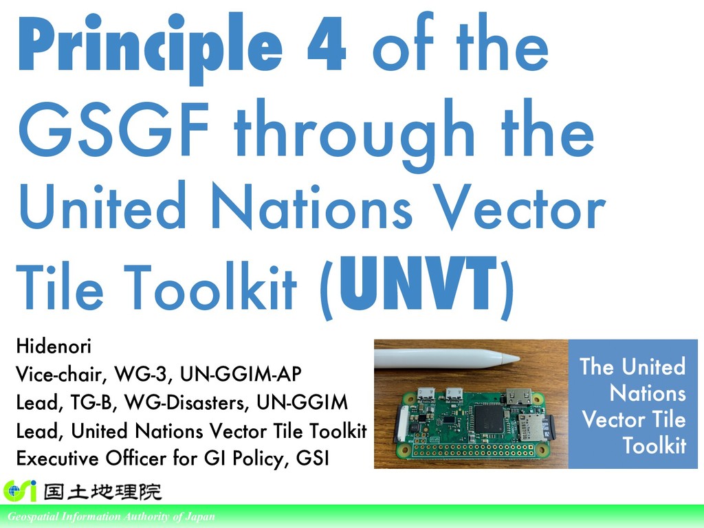
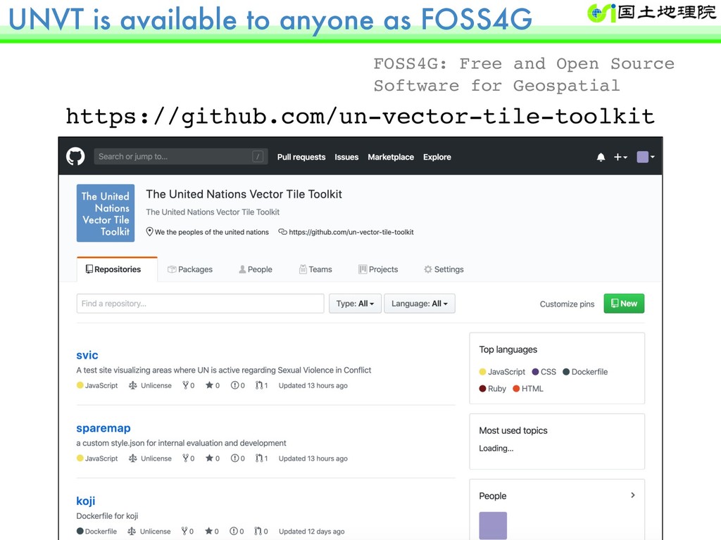
Principle 4 of the GSGF through the United Nations Vector Tile Toolkit (UNVT)
Regional Committee of United Nations Global Geospatial Information Management for Asia and the Pacific (UN-GGIM-AP) Working Group 3 "Integrating Geospatial Information and Statistics"
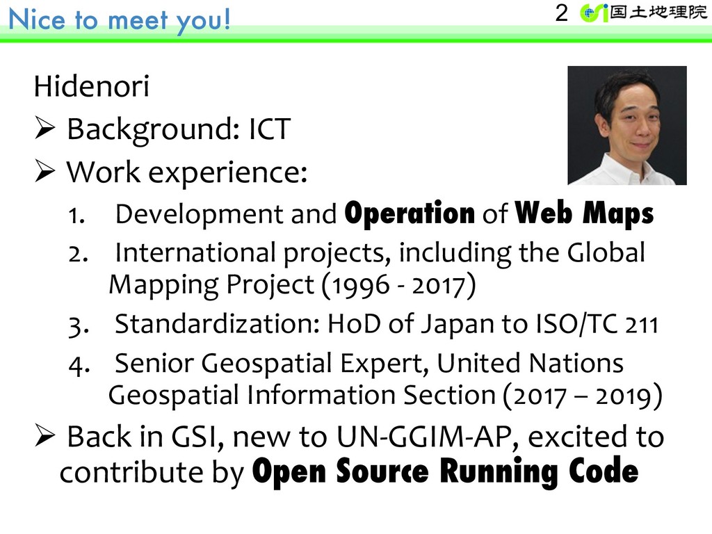
of Japan Principle 4 of the GSGF through the United Nations Vector Tile Toolkit (UNVT) Hidenori Vice-chair, WG-3, UN-GGIM-AP Lead, TG-B, WG-Disasters, UN-GGIM Lead, United Nations Vector Tile Toolkit Executive Officer for GI Policy, GSI
experience: 1. Development and Operation of Web Maps 2. International projects, including the Global Mapping Project (1996 - 2017) 3. Standardization: HoD of Japan to ISO/TC 211 4. Senior Geospatial Expert, United Nations Geospatial Information Section (2017 – 2019) Ø Back in GSI, new to UN-GGIM-AP, excited to contribute by Open Source Running Code 2
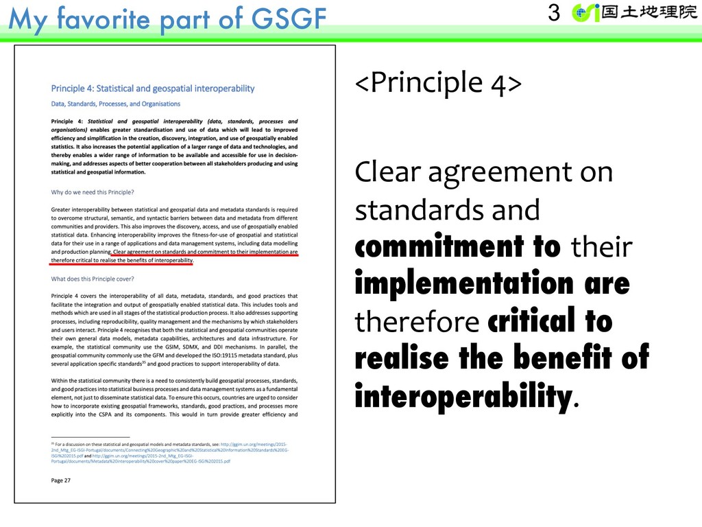
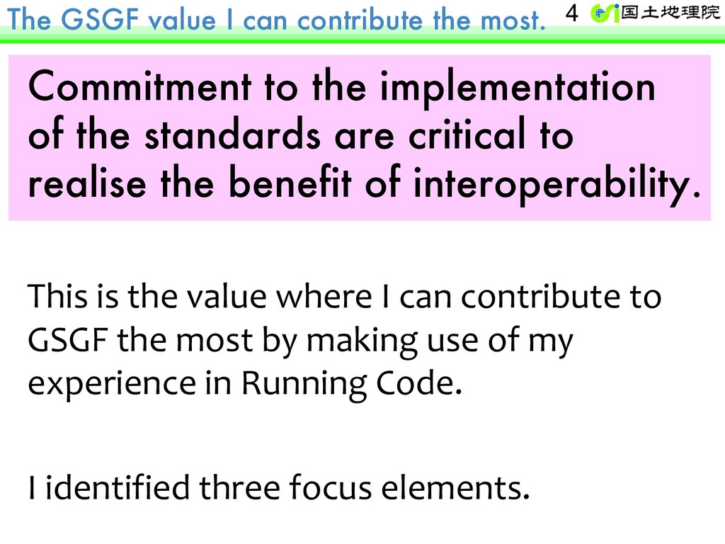
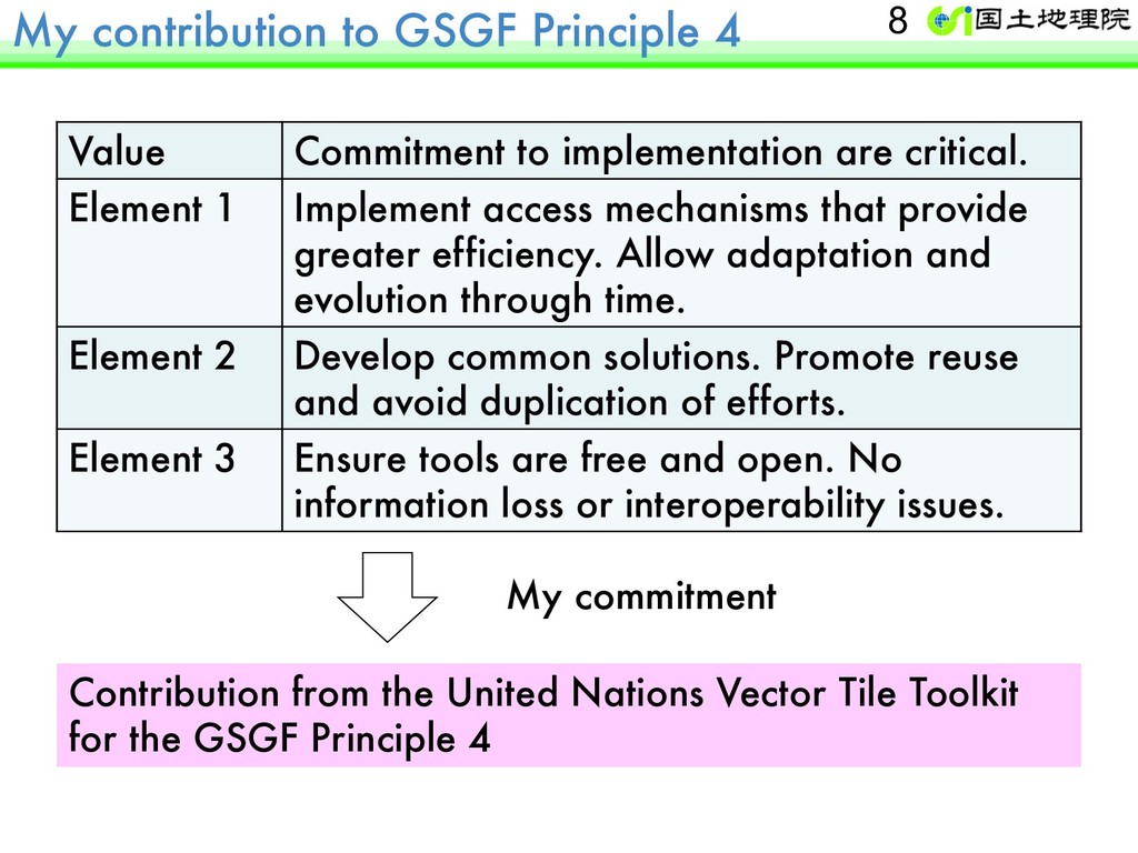
the implementation of the standards are critical to realise the benefit of interoperability. This is the value where I can contribute to GSGF the most by making use of my experience in Running Code. I identified three focus elements. 4
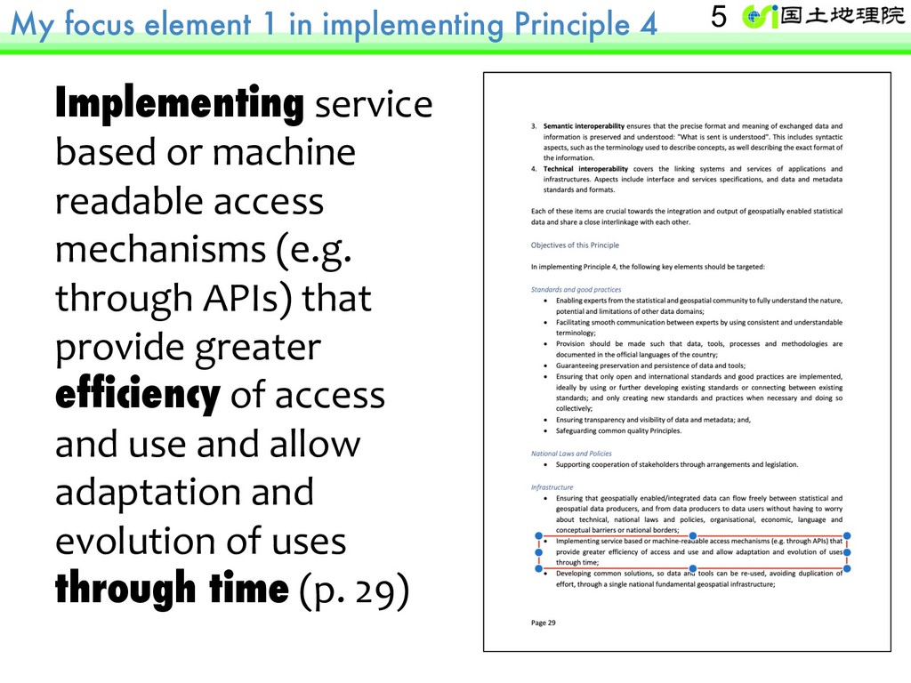
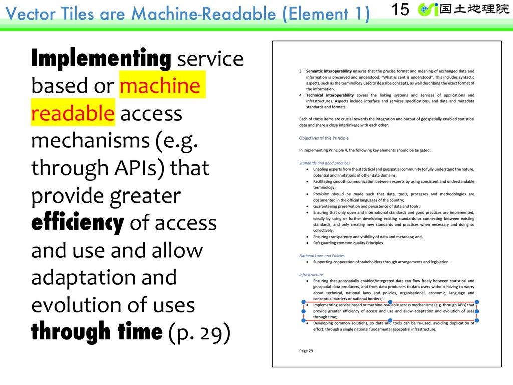
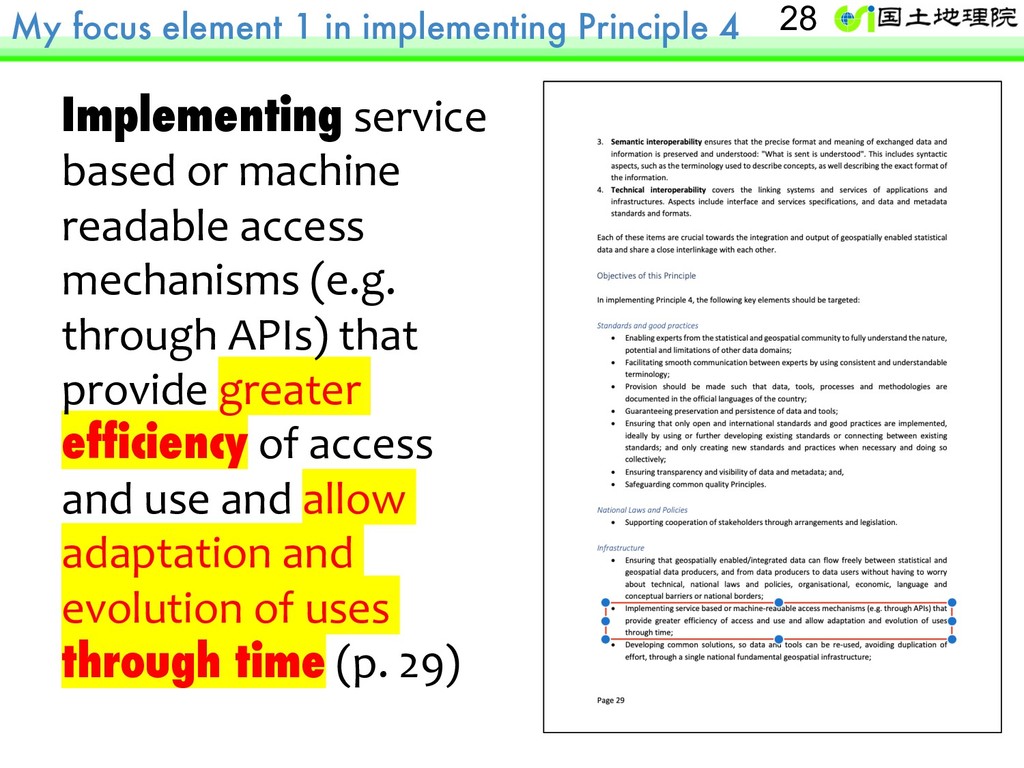
based or machine readable access mechanisms (e.g. through APIs) that provide greater efficiency of access and use and allow adaptation and evolution of uses through time (p. 29) 5
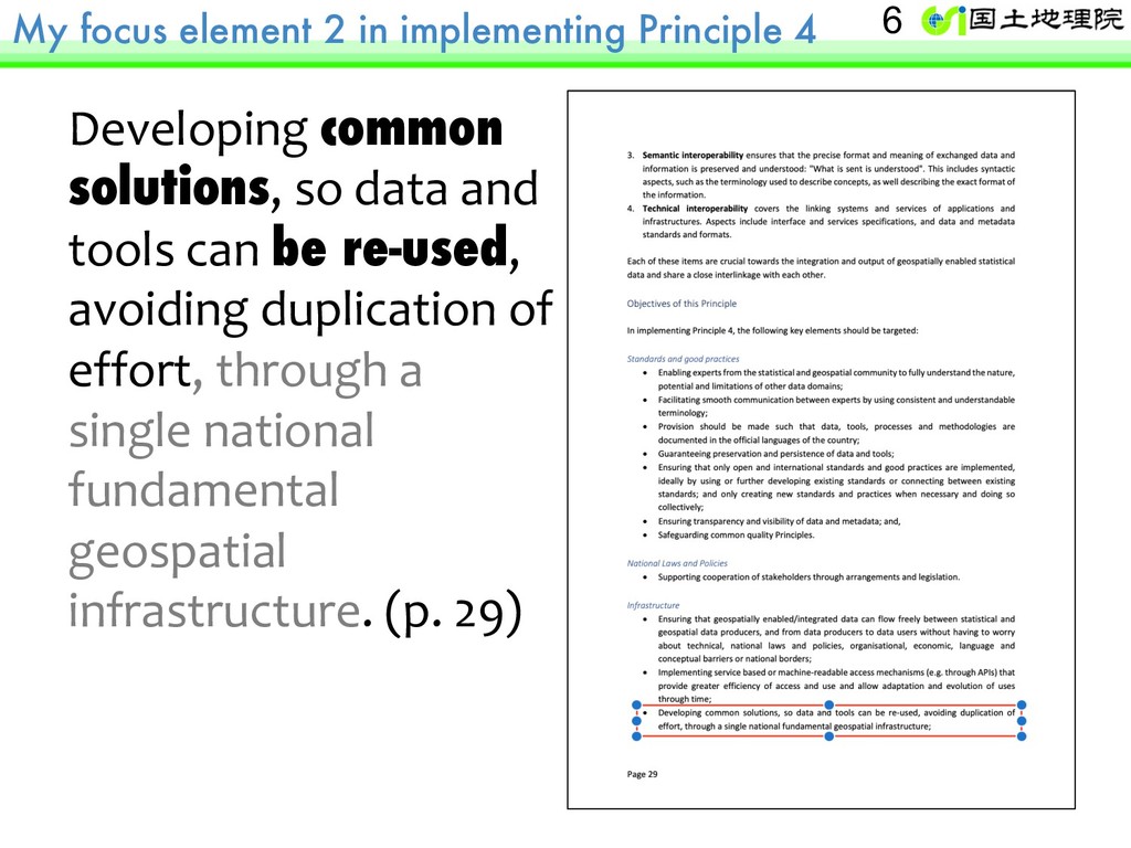
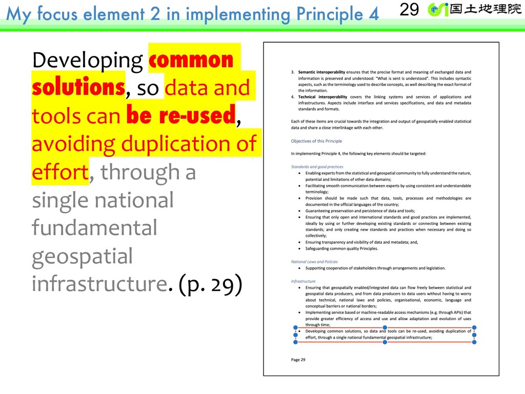
solutions, so data and tools can be re-used, avoiding duplication of effort, through a single national fundamental geospatial infrastructure. (p. 29) 6
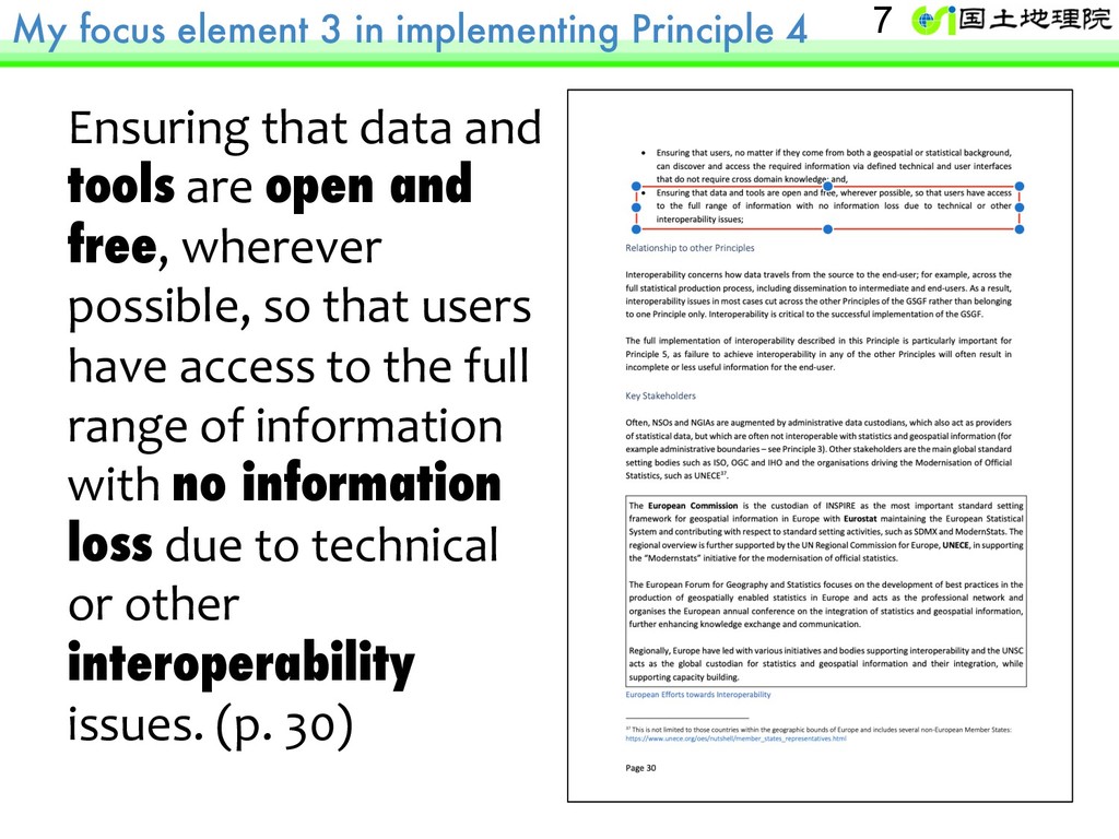
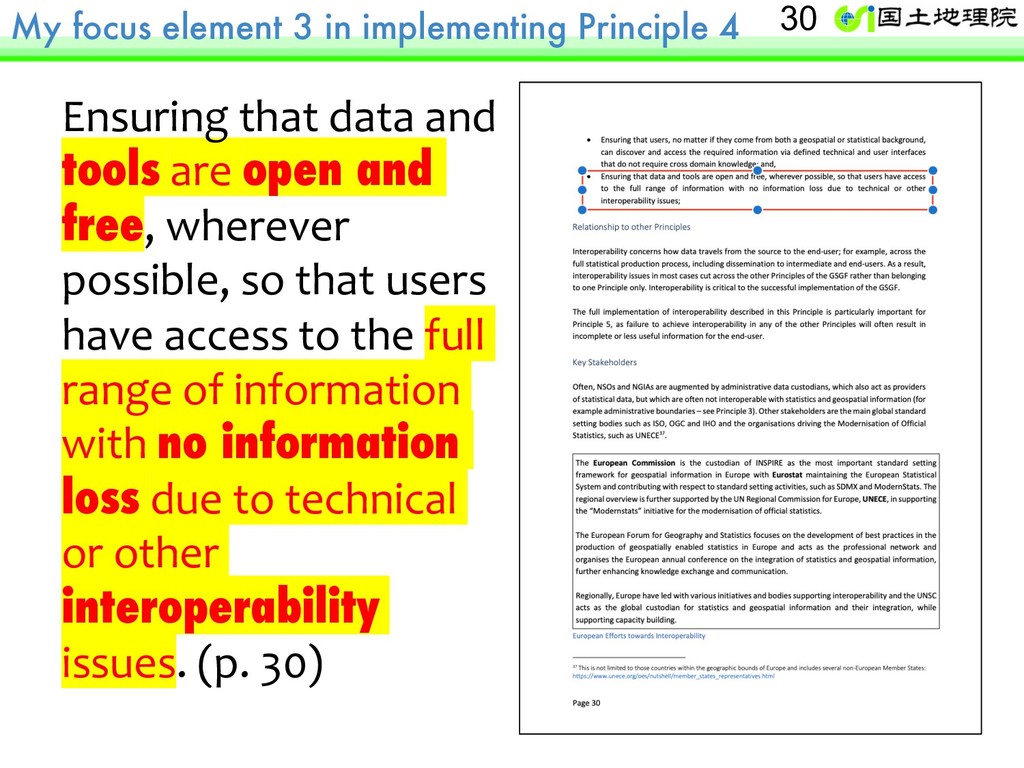
data and tools are open and free, wherever possible, so that users have access to the full range of information with no information loss due to technical or other interoperability issues. (p. 30) 7
are critical. Element 1 Implement access mechanisms that provide greater efficiency. Allow adaptation and evolution through time. Element 2 Develop common solutions. Promote reuse and avoid duplication of efforts. Element 3 Ensure tools are free and open. No information loss or interoperability issues. Contribution from the United Nations Vector Tile Toolkit for the GSGF Principle 4 My commitment 8
is the United Nations Vector Tile Toolkit (UNVT) ? 2. A short demo of the UNVT for statistical- geospatial integration. 3. Possible future work items by the UNVT, for the GSGF Principle 4. 4. Invitation to the UNVT, for the GSGF and many other UN-GGIM Frameworks. 9
is the United Nations Vector Tile Toolkit (UNVT) ? 2. A short demo of the UNVT for statistical- geospatial integration. 3. Possible future work items by the UNVT, for the GSGF Principle 4. 4. Invitation to the UNVT, for the GSGF and many other UN-GGIM Frameworks. 10
machine readable access mechanisms (e.g. through APIs) that provide greater efficiency of access and use and allow adaptation and evolution of uses through time (p. 29) 15
machine readable access mechanisms (e.g. through APIs) that provide greater efficiency of access and use and allow adaptation and evolution of uses through time (p. 29) 17
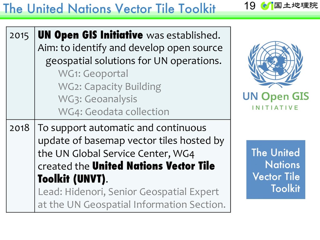
Initiative was established. Aim: to identify and develop open source geospatial solutions for UN operations. WG1: Geoportal WG2: Capacity Building WG3: Geoanalysis WG4: Geodata collection 2018 To support automatic and continuous update of basemap vector tiles hosted by the UN Global Service Center, WG4 created the United Nations Vector Tile Toolkit (UNVT). Lead: Hidenori, Senior Geospatial Expert at the UN Geospatial Information Section. 19
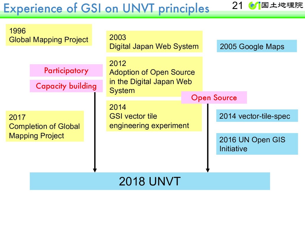
System 2005 Google Maps 2012 Adoption of Open Source in the Digital Japan Web System 1996 Global Mapping Project 2014 GSI vector tile engineering experiment 2014 vector-tile-spec Open Source Capacity building 2017 Completion of Global Mapping Project 2016 UN Open GIS Initiative 2018 UNVT Participatory 21
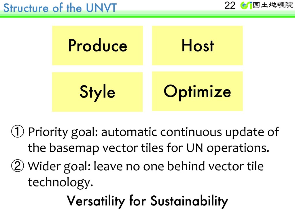
of the basemap vector tiles for UN operations. ② Wider goal: leave no one behind vector tile technology. Versatility for Sustainability Produce Host Style Optimize 22
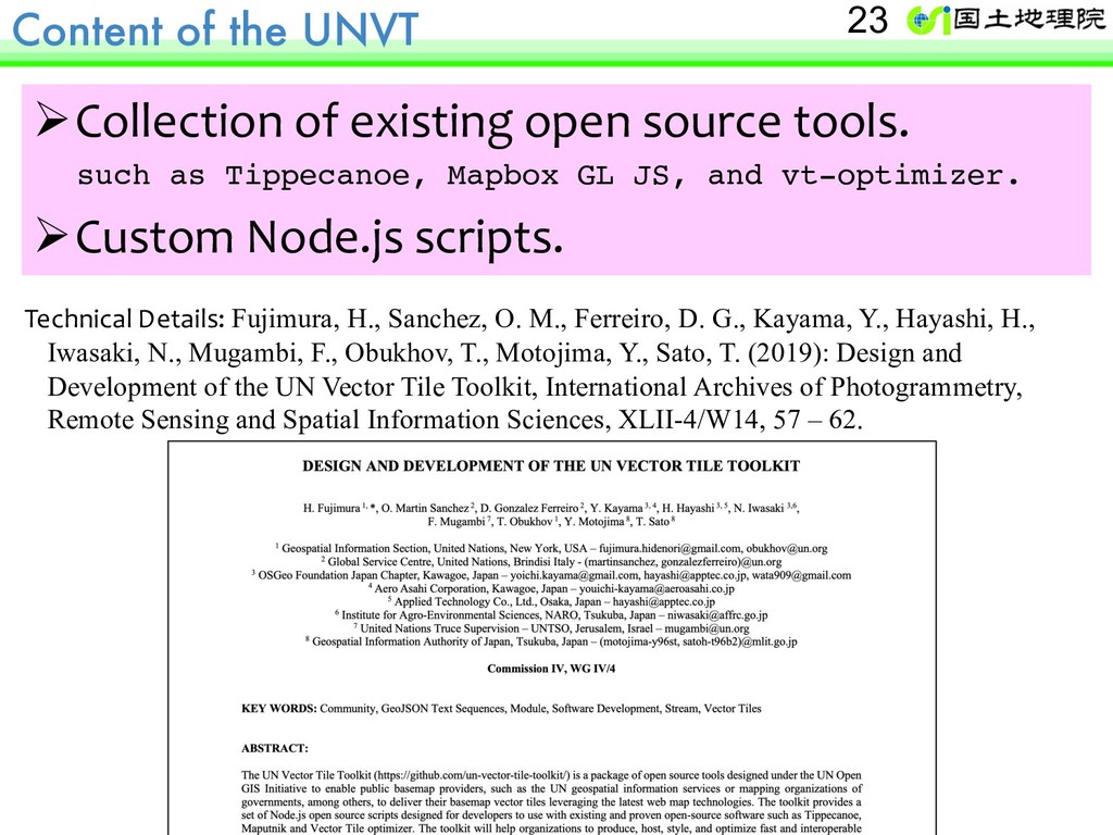
such as Tippecanoe, Mapbox GL JS, and vt-optimizer. ØCustom Node.js scripts. 23 Technical Details: Fujimura, H., Sanchez, O. M., Ferreiro, D. G., Kayama, Y., Hayashi, H., Iwasaki, N., Mugambi, F., Obukhov, T., Motojima, Y., Sato, T. (2019): Design and Development of the UN Vector Tile Toolkit, International Archives of Photogrammetry, Remote Sensing and Spatial Information Sciences, XLII-4/W14, 57 – 62.
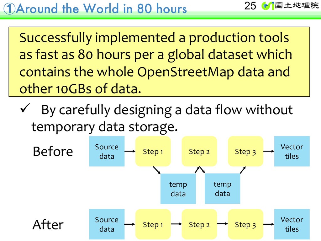
tools as fast as 80 hours per a global dataset which contains the whole OpenStreetMap data and other 10GBs of data. ü By carefully designing a data flow without temporary data storage. Source data Vector tiles Before After temp data Step 1 Step 2 Step 3 Source data Vector tiles Step 1 Step 2 Step 3 temp data 25
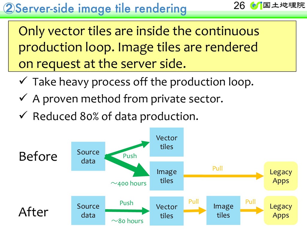
continuous production loop. Image tiles are rendered on request at the server side. ü Take heavy process off the production loop. ü A proven method from private sector. ü Reduced 80% of data production. Before After Source data Vector tiles Image tiles Source data Vector tiles Image tiles Legacy Apps Legacy Apps Push Push Pull Pull Pull 26 ~80 hours ~400 hours
based or machine readable access mechanisms (e.g. through APIs) that provide greater efficiency of access and use and allow adaptation and evolution of uses through time (p. 29) 28
solutions, so data and tools can be re-used, avoiding duplication of effort, through a single national fundamental geospatial infrastructure. (p. 29) 29
data and tools are open and free, wherever possible, so that users have access to the full range of information with no information loss due to technical or other interoperability issues. (p. 30) 30
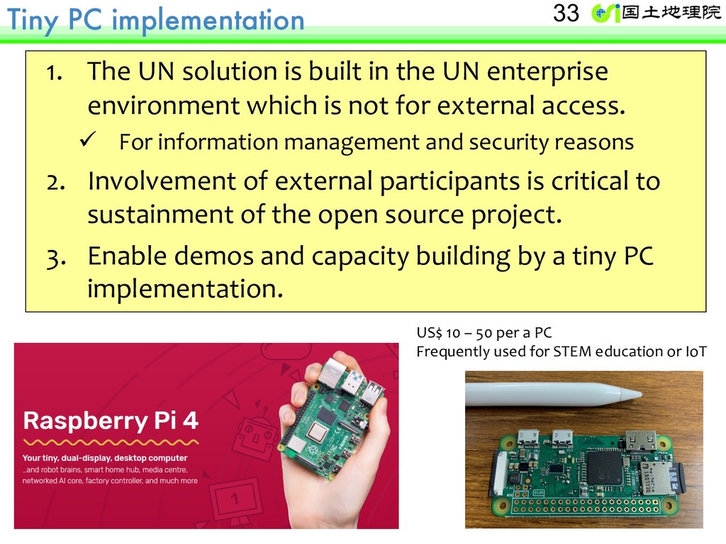
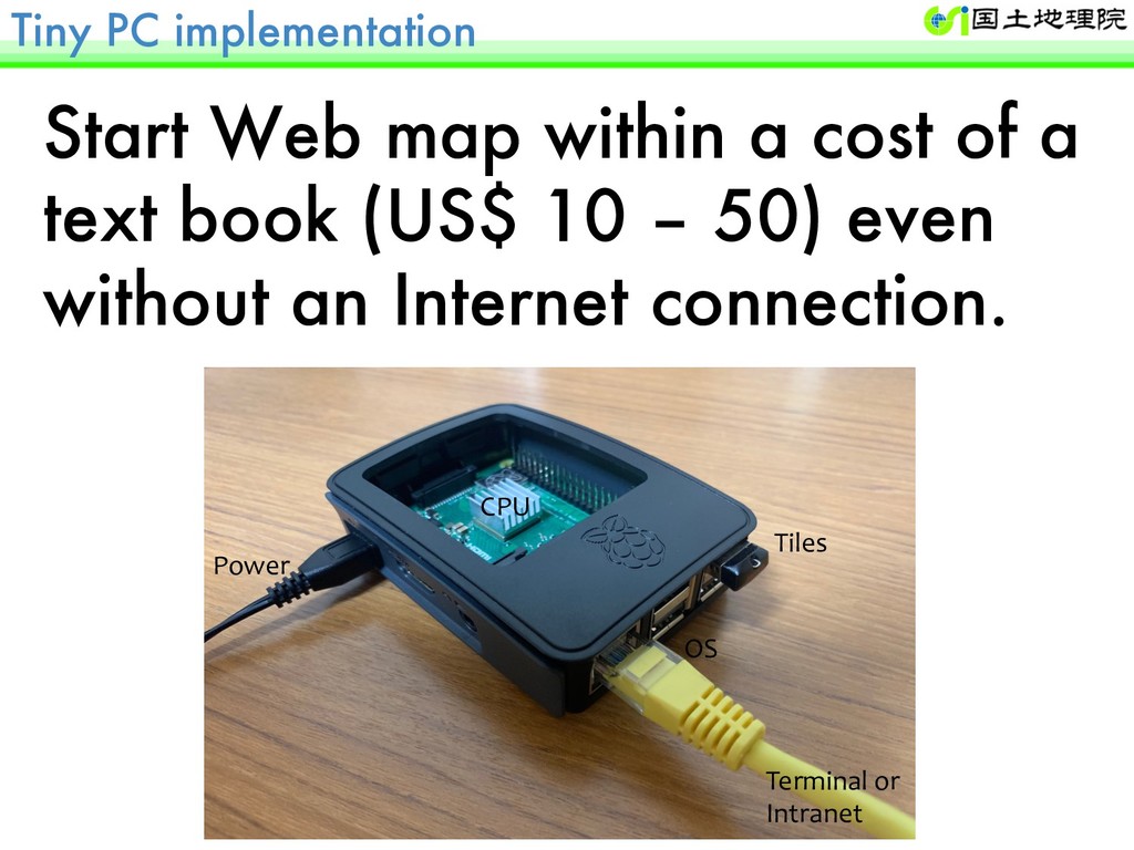
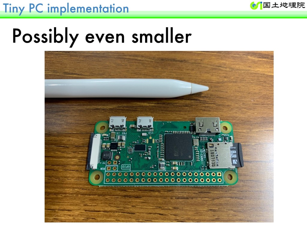
the UN enterprise environment which is not for external access. ü For information management and security reasons 2. Involvement of external participants is critical to sustainment of the open source project. 3. Enable demos and capacity building by a tiny PC implementation. US$ 10 – 50 per a PC Frequently used for STEM education or IoT 33
National Astronomical Observatory of Japan National Institute for Agro-Environmental Sciences Mapbox Mapple On OSGeo Japan Chapter UN Geospatial Information Section UN Global Service Centre UN Open GIS Initiative 36
We apply for the OSGeo incubation process 2. Contribute by the Running Code ü We contribute to UN-GGIM agendas 3. Lead as the advance team ü We deploy before you deploy 37
is the United Nations Vector Tile Toolkit (UNVT) ? 2. A short demo of the UNVT for statistical- geospatial integration. 3. Possible future work items by the UNVT, for the GSGF Principle 4. 4. Invitation to the UNVT, for the GSGF and many other UN-GGIM Frameworks. 38
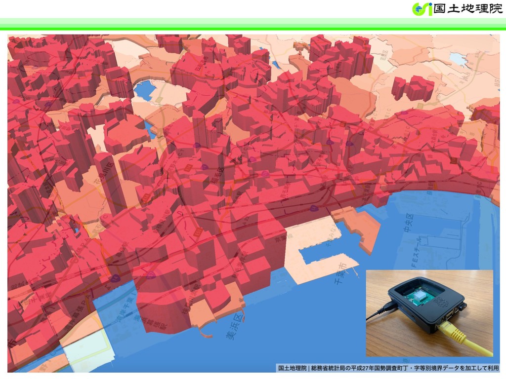
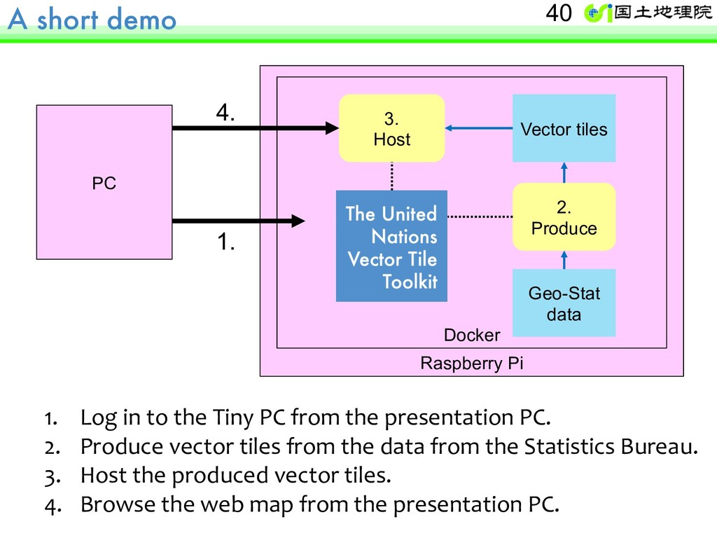
the Tiny PC from the presentation PC. 2. Produce vector tiles from the data from the Statistics Bureau. 3. Host the produced vector tiles. 4. Browse the web map from the presentation PC. 40 Docker Geo-Stat data Vector tiles 2. Produce 3. Host 1. 4.
is the United Nations Vector Tile Toolkit (UNVT) ? 2. A short demo of the UNVT for statistical- geospatial integration. 3. Possible future work items by the UNVT, for the GSGF Principle 4. 4. Invitation to the UNVT, for the GSGF and many other UN-GGIM Frameworks. 42
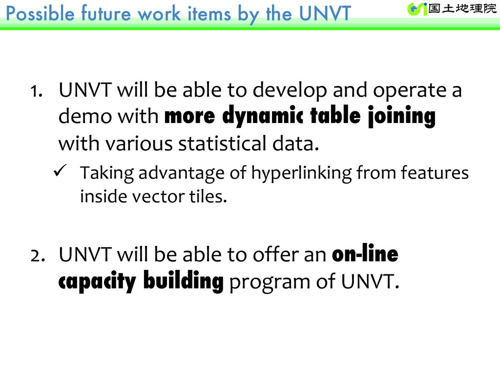
be able to develop and operate a demo with more dynamic table joining with various statistical data. ü Taking advantage of hyperlinking from features inside vector tiles. 2. UNVT will be able to offer an on-line capacity building program of UNVT.
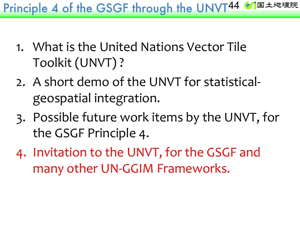
is the United Nations Vector Tile Toolkit (UNVT) ? 2. A short demo of the UNVT for statistical- geospatial integration. 3. Possible future work items by the UNVT, for the GSGF Principle 4. 4. Invitation to the UNVT, for the GSGF and many other UN-GGIM Frameworks. 44
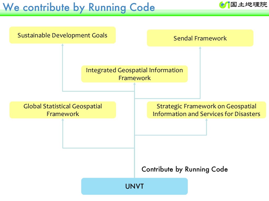
Framework Integrated Geospatial Information Framework Global Statistical Geospatial Framework Strategic Framework on Geospatial Information and Services for Disasters Contribute by Running Code
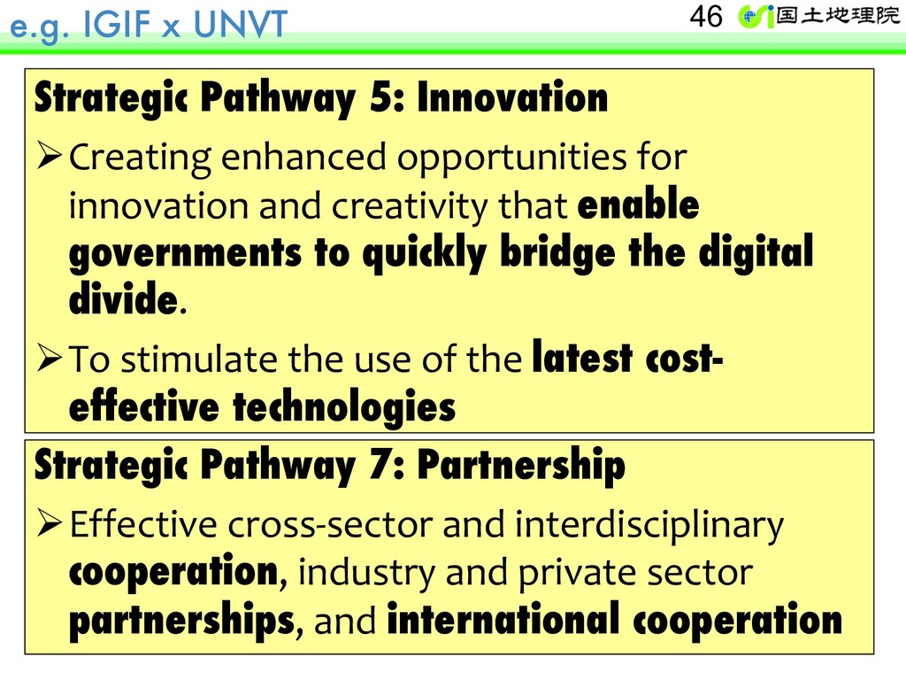
enhanced opportunities for innovation and creativity that enable governments to quickly bridge the digital divide. ØTo stimulate the use of the latest cost- effective technologies Strategic Pathway 7: Partnership ØEffective cross-sector and interdisciplinary cooperation, industry and private sector partnerships, and international cooperation
of Japan Principle 4 of the GSGF through the United Nations Vector Tile Toolkit (UNVT) Hidenori Vice-chair, WG-3, UN-GGIM-AP Lead, TG-B, WG-Disasters, UN-GGIM Lead, United Nations Vector Tile Toolkit Executive Officer for GI Policy, GSI
![A short demo ssh [email protected] docker run -ti --rm –p](https://files.speakerdeck.com/presentations/f90e0d2afbbb478083de808708ac3460/slide_40.jpg)