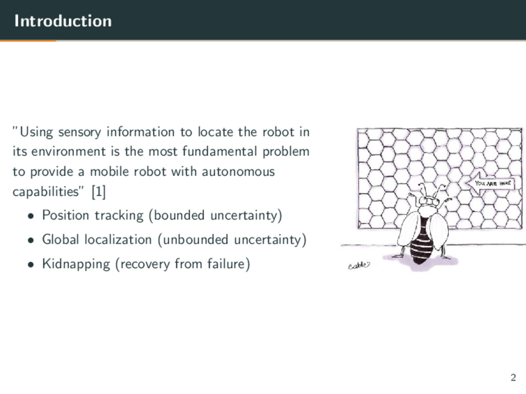
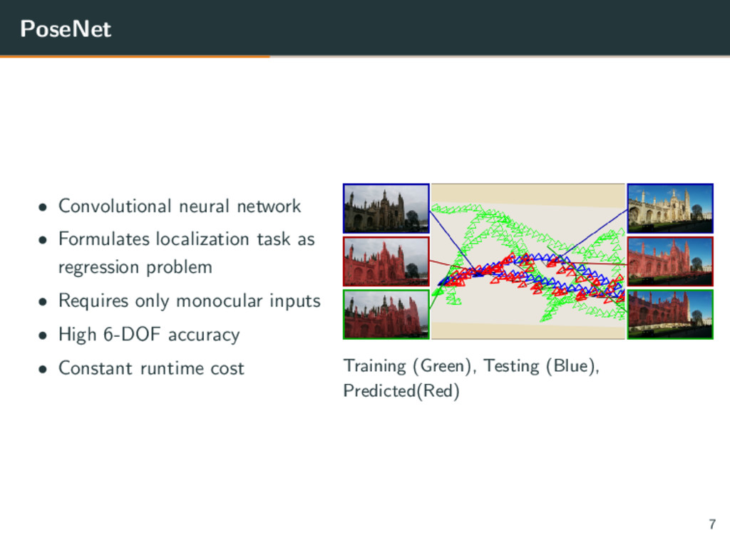
environment is the most fundamental problem to provide a mobile robot with autonomous capabilities” [1] • Position tracking (bounded uncertainty) • Global localization (unbounded uncertainty) • Kidnapping (recovery from failure) 2
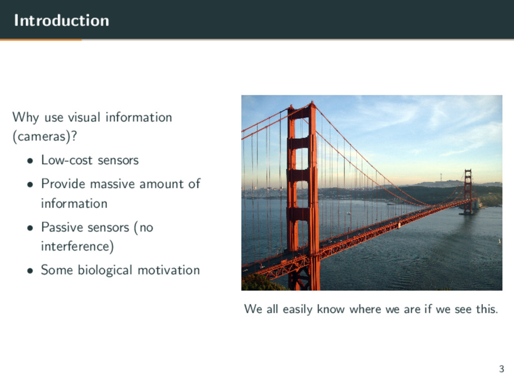
Provide massive amount of information • Passive sensors (no interference) • Some biological motivation We all easily know where we are if we see this. 3
problem rely heavily on hand-crafted image features [3, 4, 6–8] such as: • SIFT - Scale-Invarient Feature Transform • ORB - Oriented FAST and rotated BRIEF 4
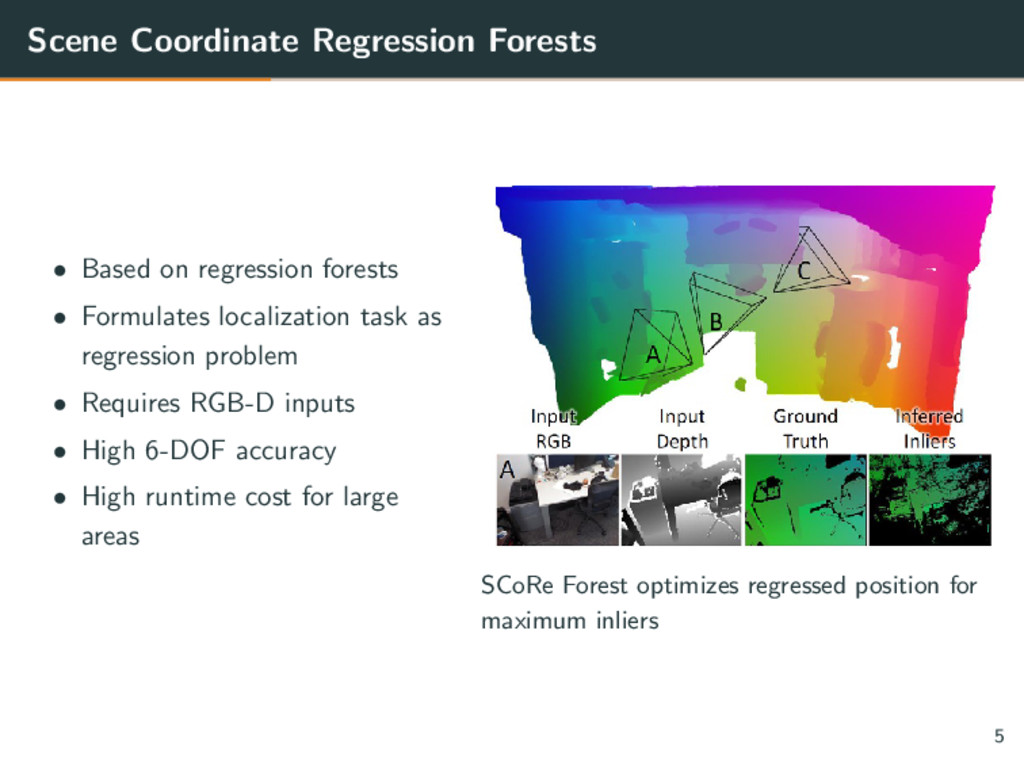
Formulates localization task as regression problem • Requires RGB-D inputs • High 6-DOF accuracy • High runtime cost for large areas SCoRe Forest optimizes regressed position for maximum inliers 5
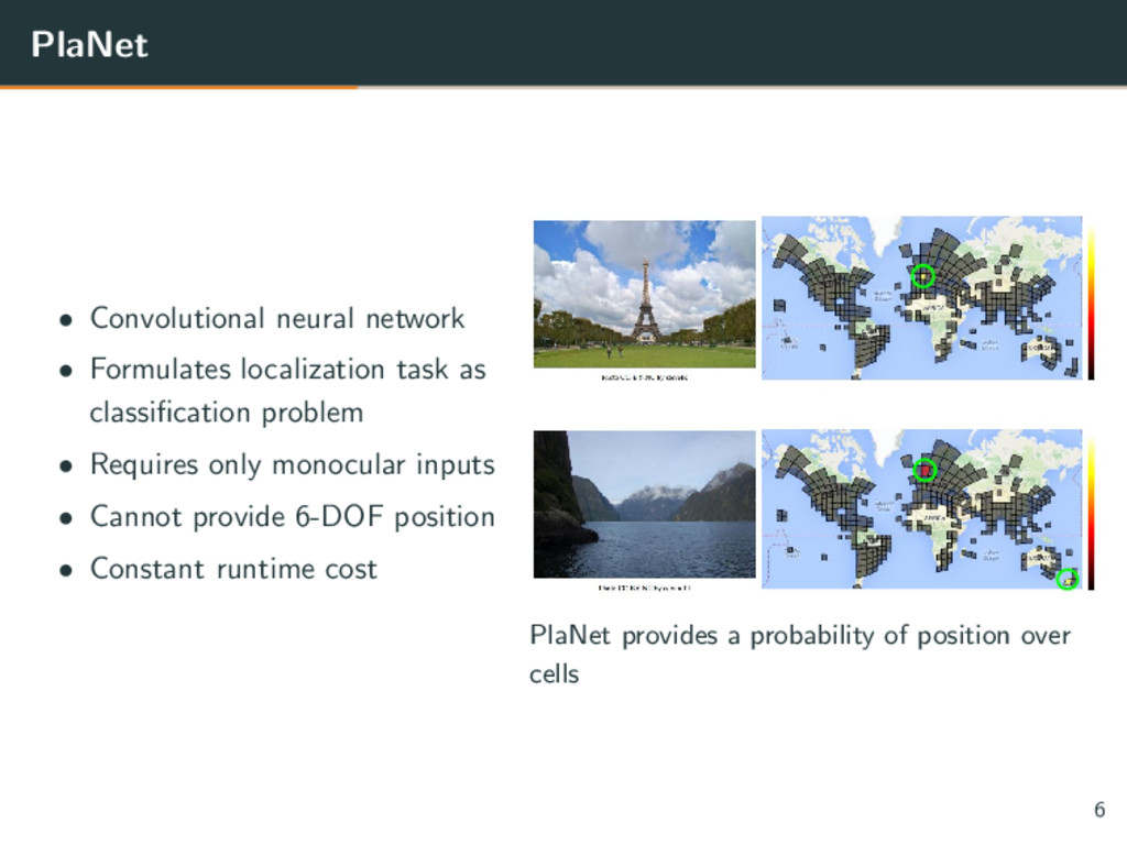
classification problem • Requires only monocular inputs • Cannot provide 6-DOF position • Constant runtime cost PlaNet provides a probability of position over cells 6
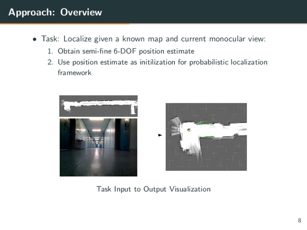
current monocular view: 1. Obtain semi-fine 6-DOF position estimate 2. Use position estimate as initilization for probabilistic localization framework Task Input to Output Visualization 8
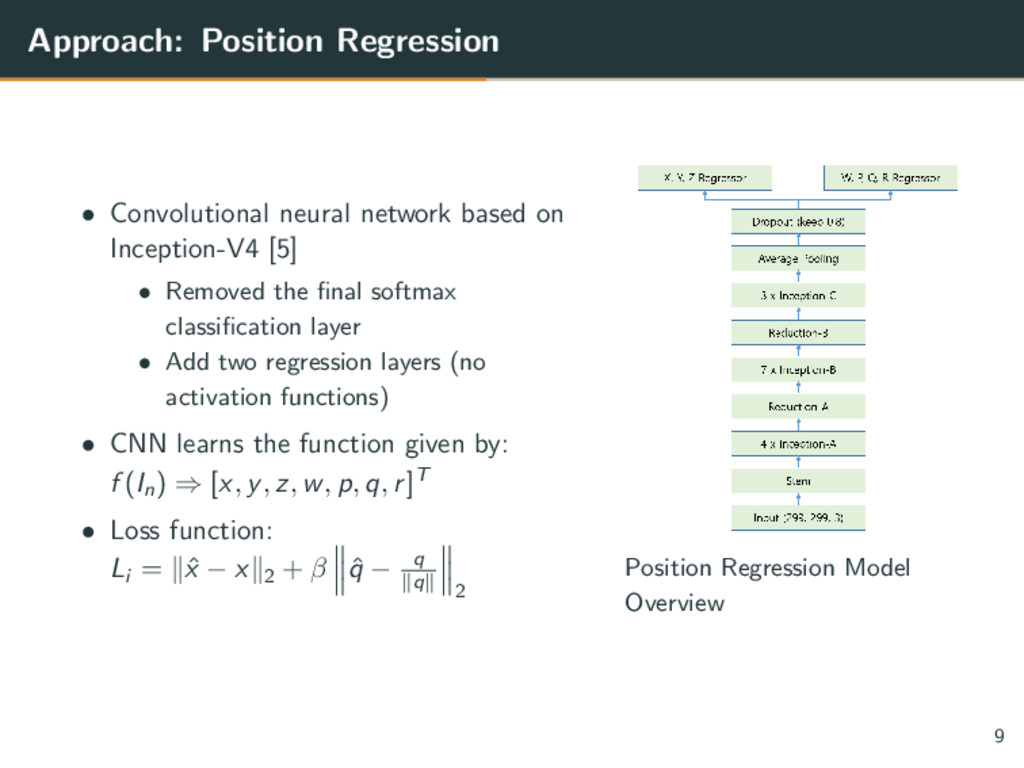
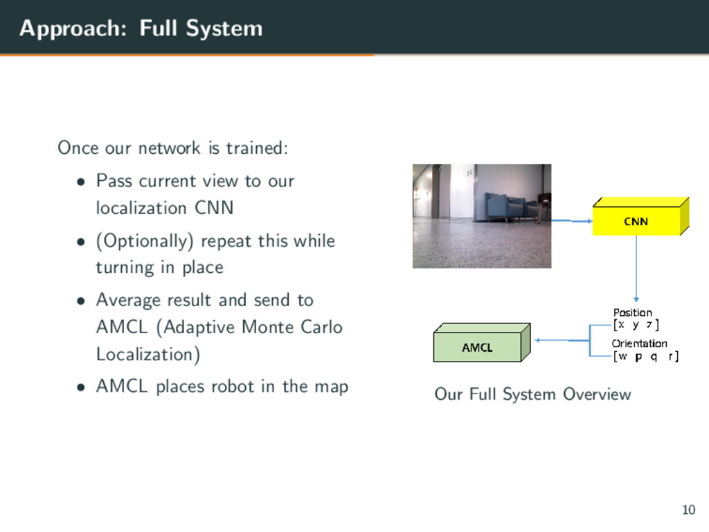
[5] • Removed the final softmax classification layer • Add two regression layers (no activation functions) • CNN learns the function given by: f (In ) ⇒ [x, y, z, w, p, q, r]T • Loss function: Li = ˆ x − x 2 + β ˆ q − q q 2 Position Regression Model Overview 9
current view to our localization CNN • (Optionally) repeat this while turning in place • Average result and send to AMCL (Adaptive Monte Carlo Localization) • AMCL places robot in the map Our Full System Overview 10
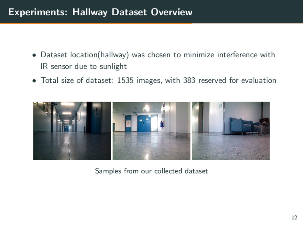
minimize interference with IR sensor due to sunlight • Total size of dataset: 1535 images, with 383 reserved for evaluation Samples from our collected dataset 12
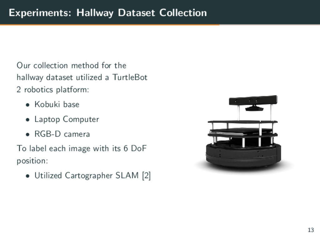
dataset utilized a TurtleBot 2 robotics platform: • Kobuki base • Laptop Computer • RGB-D camera To label each image with its 6 DoF position: • Utilized Cartographer SLAM [2] 13
ground truth accuracy of the dataset: • RGB-D depth map is often very noisy leading to difficulties with SLAM • Odometry accuracy suffered due to the slippery hallway surface during turns However: • Cartographer SLAM was still able to label images accurately enough • Our CNN position regression model was accurate enough to initialize AMCL successfuly 14
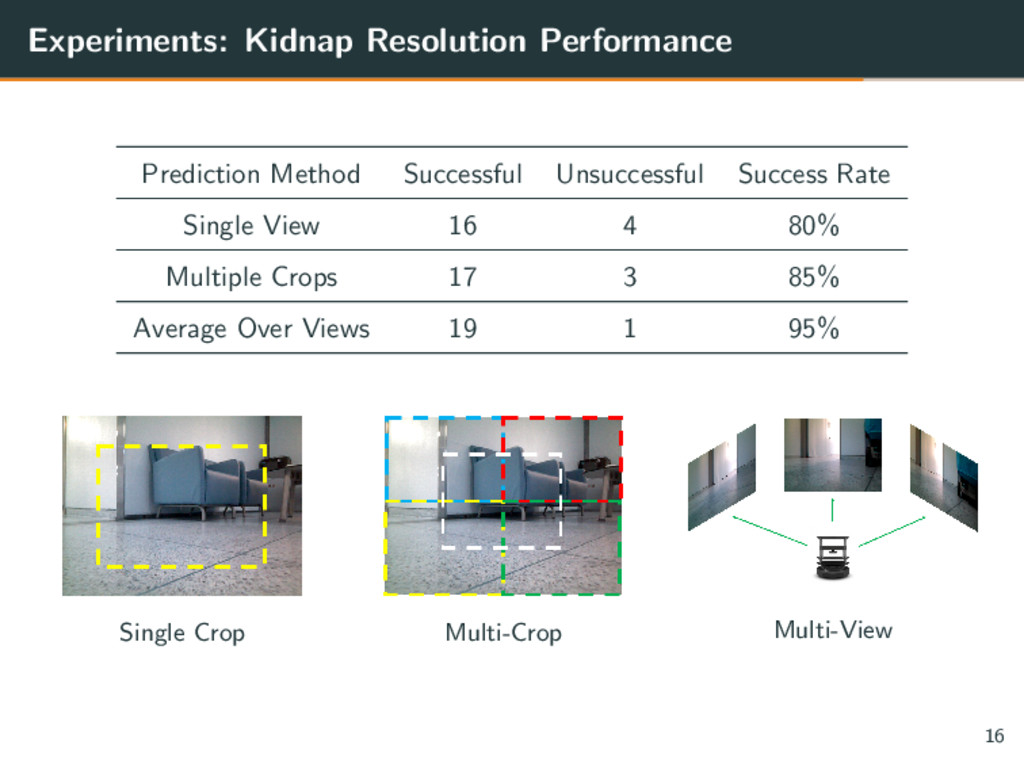
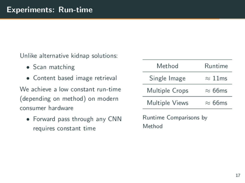
Content based image retrieval We achieve a low constant run-time (depending on method) on modern consumer hardware • Forward pass through any CNN requires constant time Method Runtime Single Image ≈ 11ms Multiple Crops ≈ 66ms Multiple Views ≈ 66ms Runtime Comparisons by Method 17
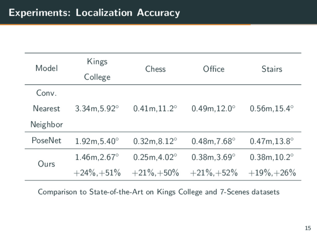
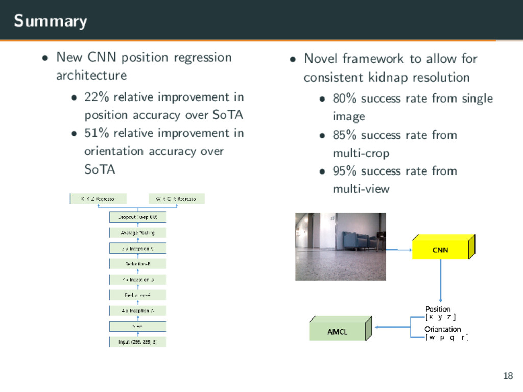
improvement in position accuracy over SoTA • 51% relative improvement in orientation accuracy over SoTA • Novel framework to allow for consistent kidnap resolution • 80% success rate from single image • 85% success rate from multi-crop • 95% success rate from multi-view 18
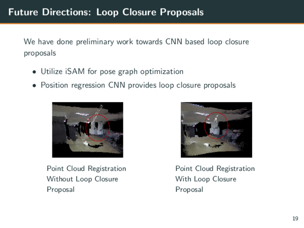
towards CNN based loop closure proposals • Utilize iSAM for pose graph optimization • Position regression CNN provides loop closure proposals Point Cloud Registration Without Loop Closure Proposal Point Cloud Registration With Loop Closure Proposal 19
guidance and navigation of an autonomous robot vehicle. IEEE Transactions on robotics and automation, 7(2):193–204, 1991. [2] W. Hess, D. Kohler, H. Rapp, and D. Andor. Real-time loop closure in 2d lidar slam. In Robotics and Automation (ICRA), 2016 IEEE International Conference on, pages 1271–1278. IEEE, 2016. [3] Y. Li, N. Snavely, D. P. Huttenlocher, and P. Fua. Worldwide pose estimation using 3d point clouds. In Large-Scale Visual Geo-Localization, pages 147–163. Springer, 2016.
Efficient & effective prioritized matching for large-scale image-based localization. IEEE Transactions on Pattern Analysis and Machine Intelligence, 2016. [5] C. Szegedy, S. Ioffe, V. Vanhoucke, and A. Alemi. Inception-v4, inception-resnet and the impact of residual connections on learning. arXiv preprint arXiv:1602.07261, 2016. [6] J. Wang, H. Zha, and R. Cipolla. Coarse-to-fine vision-based localization by indexing scale-invariant features. IEEE Transactions on Systems, Man, and Cybernetics, Part B (Cybernetics), 36(2):413–422, 2006. [7] B. Zeisl, T. Sattler, and M. Pollefeys. Camera pose voting for large-scale image-based localization. In Proceedings of the IEEE International Conference on Computer Vision, pages 2704–2712, 2015.


 yukiar
 institutdelelevage
 afroscript
 yumaichikawa
 hisaokatsumi
 polipoli
 satai
 hf149
 recsyslab
 chrisshort
 bryan
 malarkey
 aki_iinuma
 chrislema
 davidcarrasco
 bluesmoon
 iamctodd
 aleyda
 tmiket
 productmarketing
 morganepeng