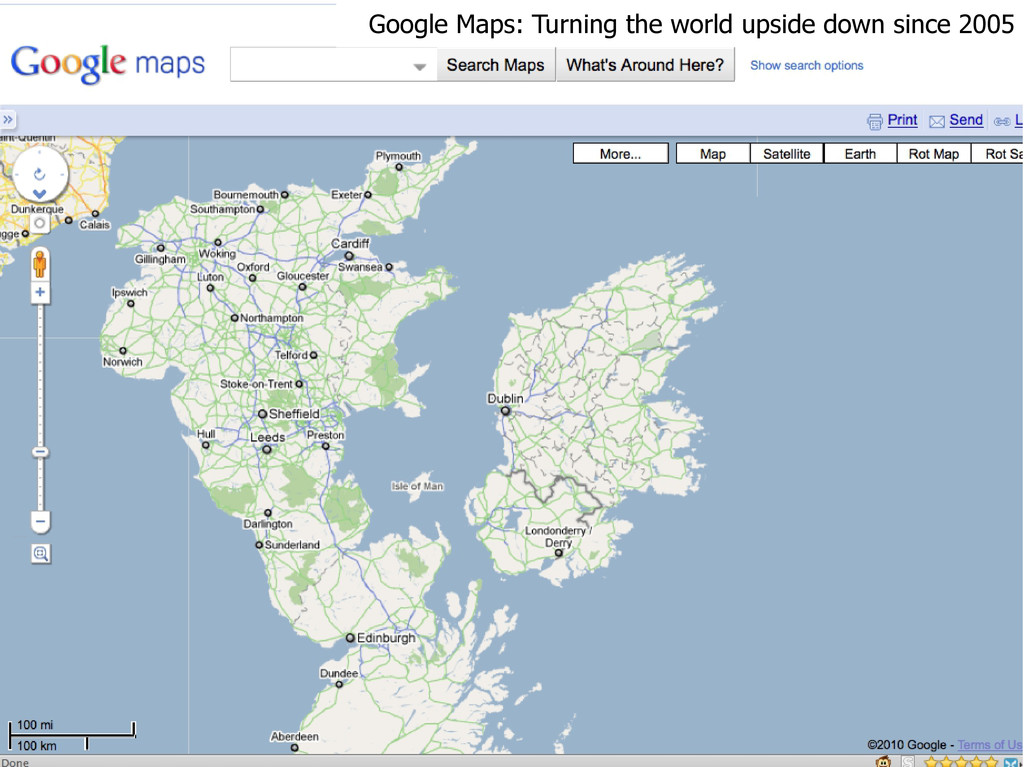
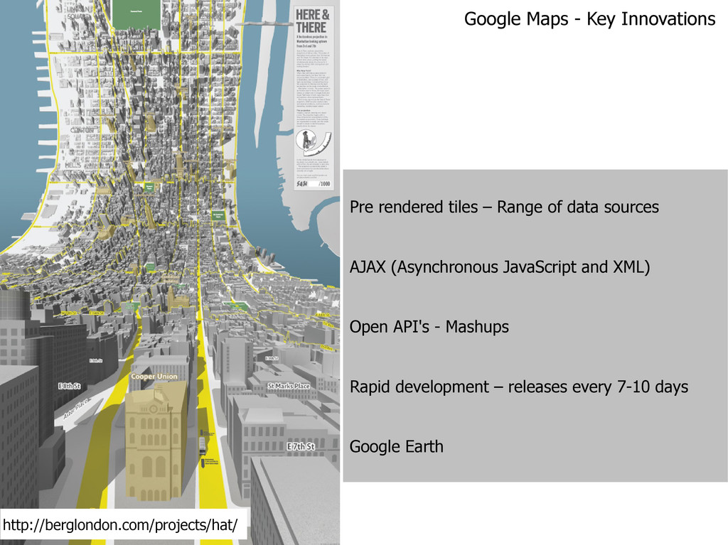
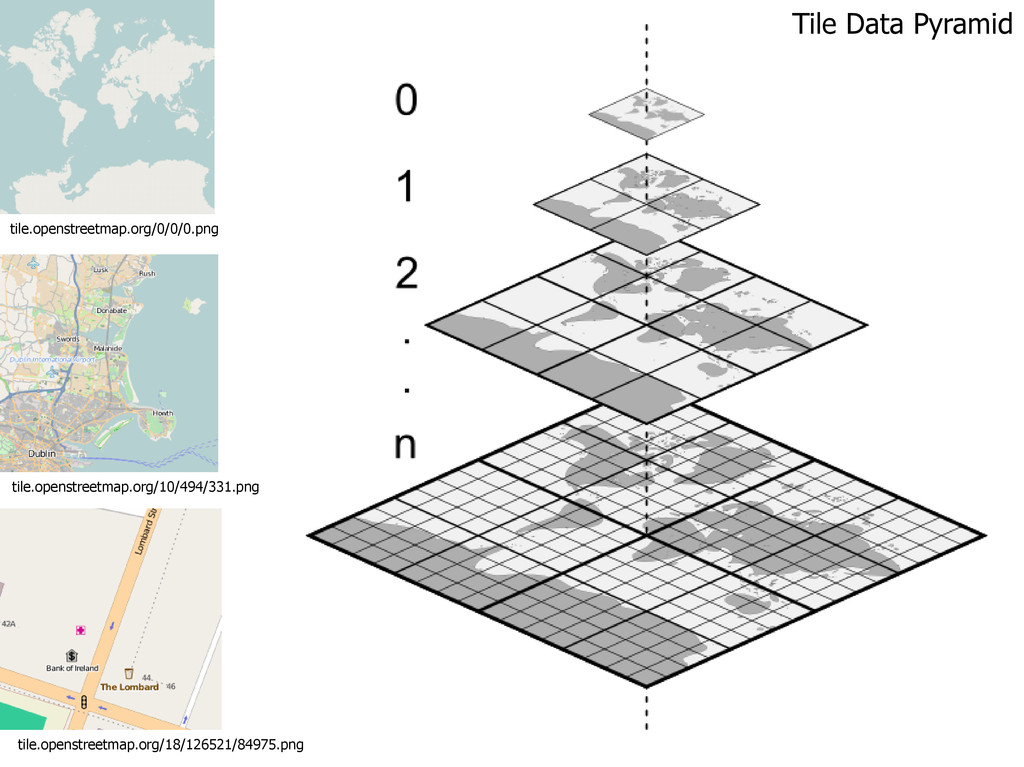
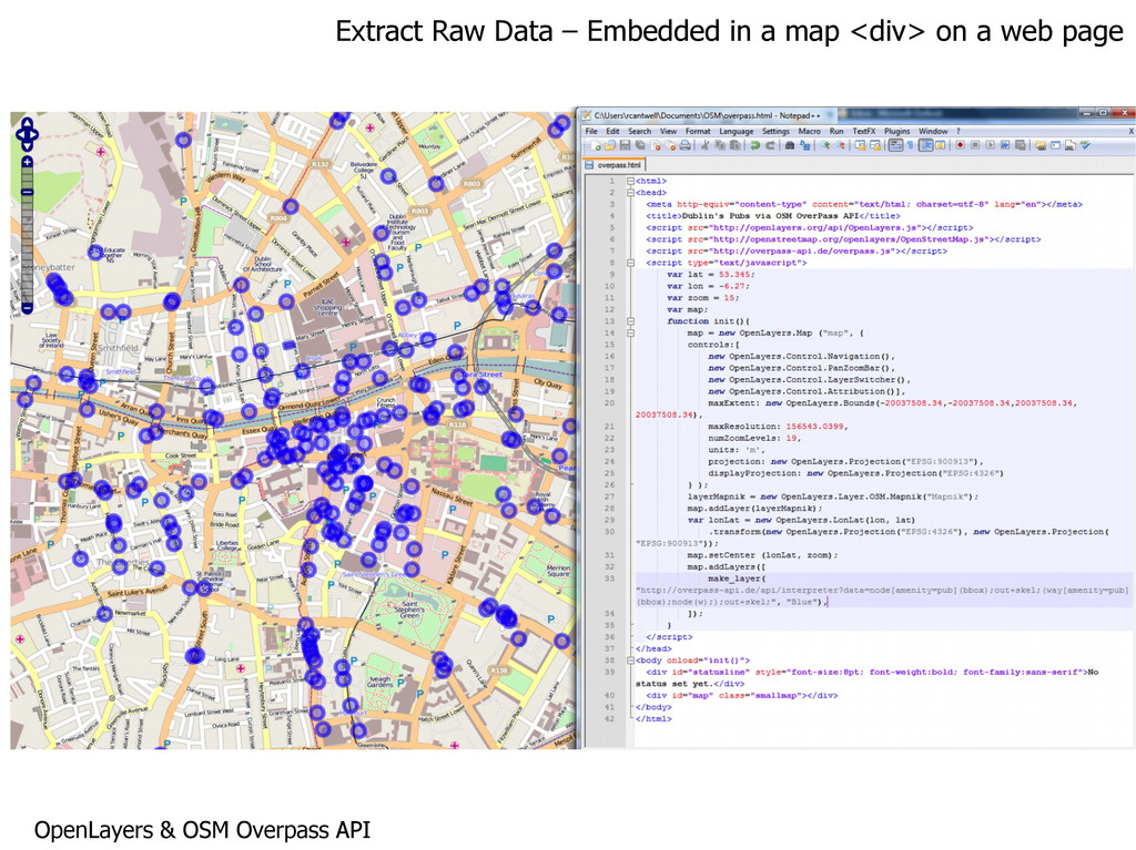
JavaScript and XML) Open API's - Mashups Rapid development – releases every 7-10 days Google Earth Google Maps - Key Innovations http://berglondon.com/projects/hat/
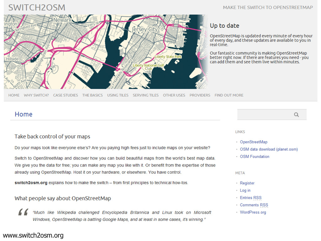
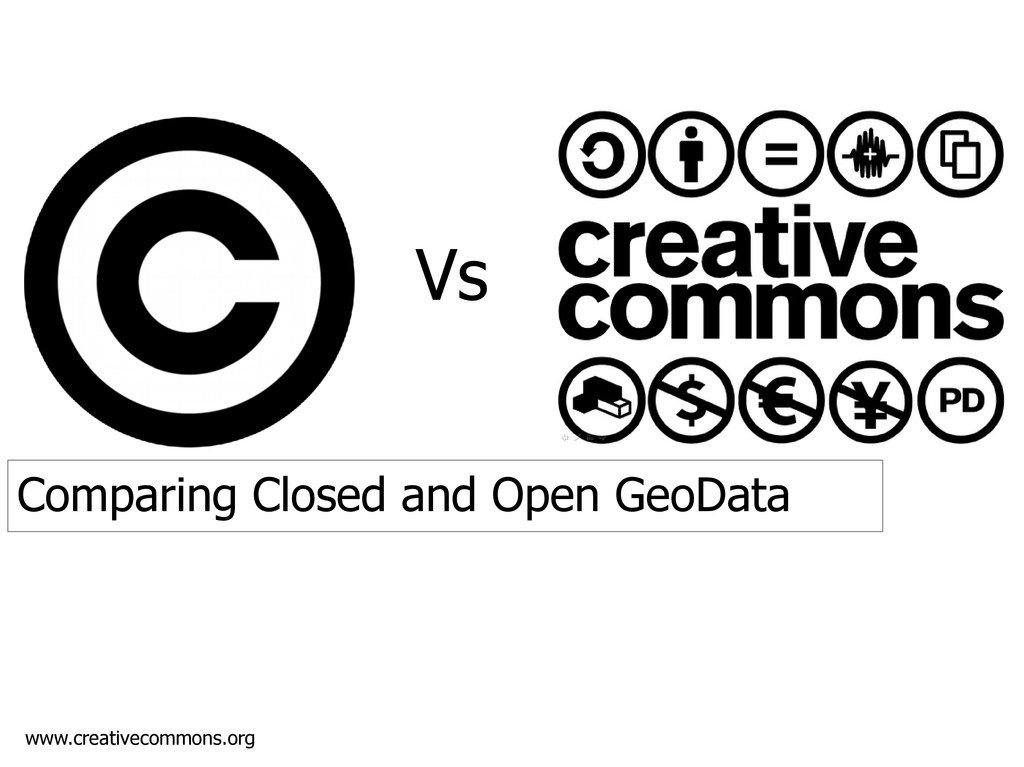
are free to use, reuse, and redistribute it - subject only, at most, to the requirement to attribute and share-alike.” www.opendefinition.org http://flic.kr/p/7Aqgs5
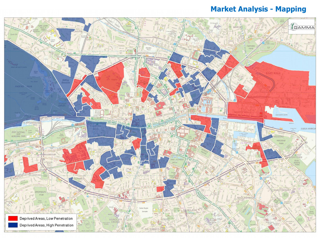
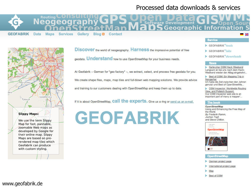
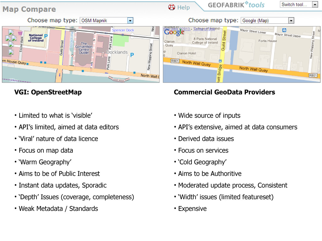
limited, aimed at data editors • ‘Viral’ nature of data licence • Focus on map data • ‘Warm Geography’ • Aims to be of Public Interest • Instant data updates, Sporadic • ‘Depth’ Issues (coverage, completeness) • Weak Metadata / Standards Commercial GeoData Providers • Wide source of inputs • API’s extensive, aimed at data consumers • Derived data issues • Focus on services • ‘Cold Geography’ • Aims to be Authoritive • Moderated update process, Consistent • ‘Width’ issues (limited featureset) • Expensive