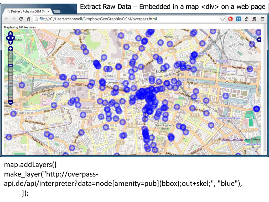
a web page map.addLayers([ make_layer("http://overpass-api.de/api/interpreter?data= node[amenity=pub](bbox);out+skel; (way[amenity=pub](bbox);node(w););out+skel;", “Blue") ]);
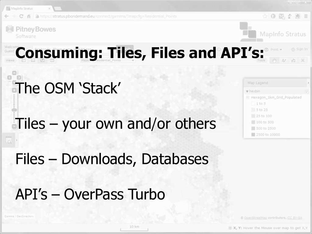
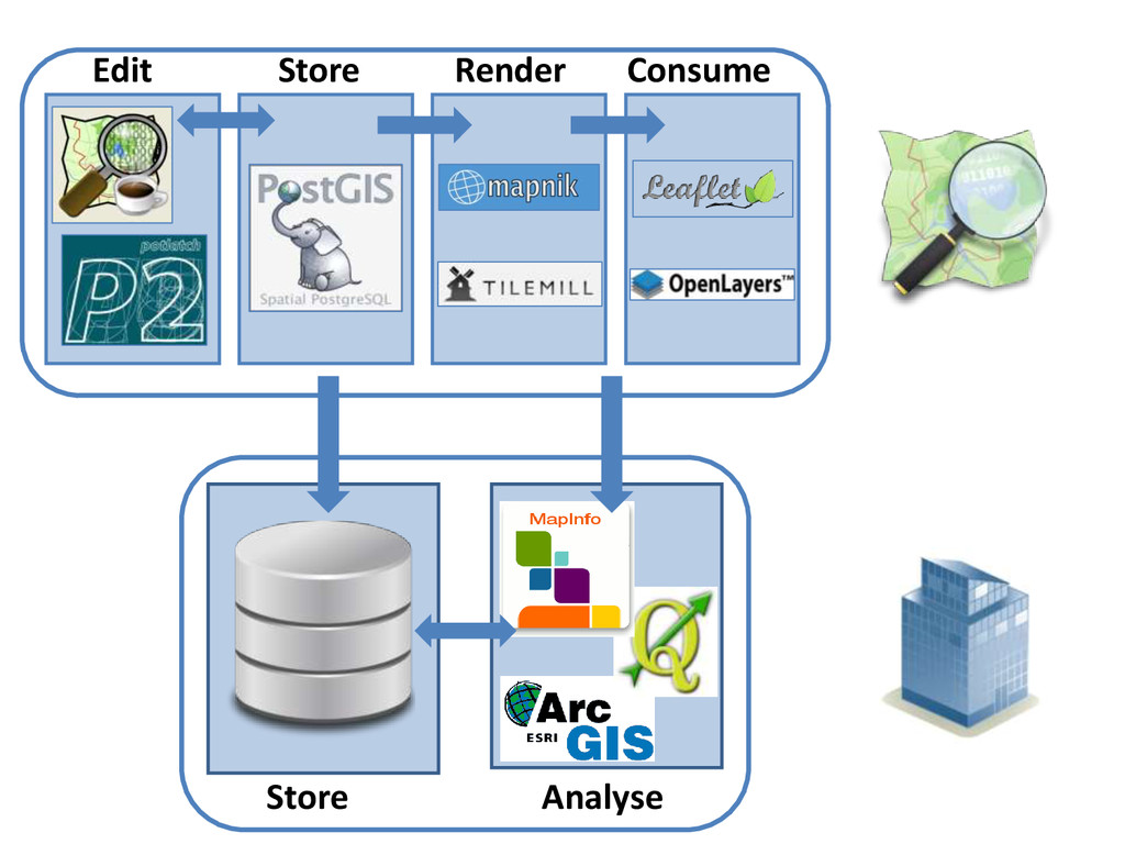
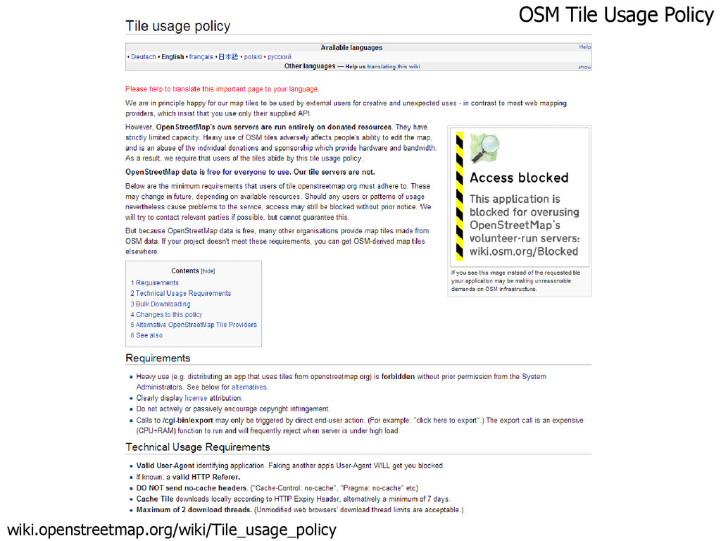
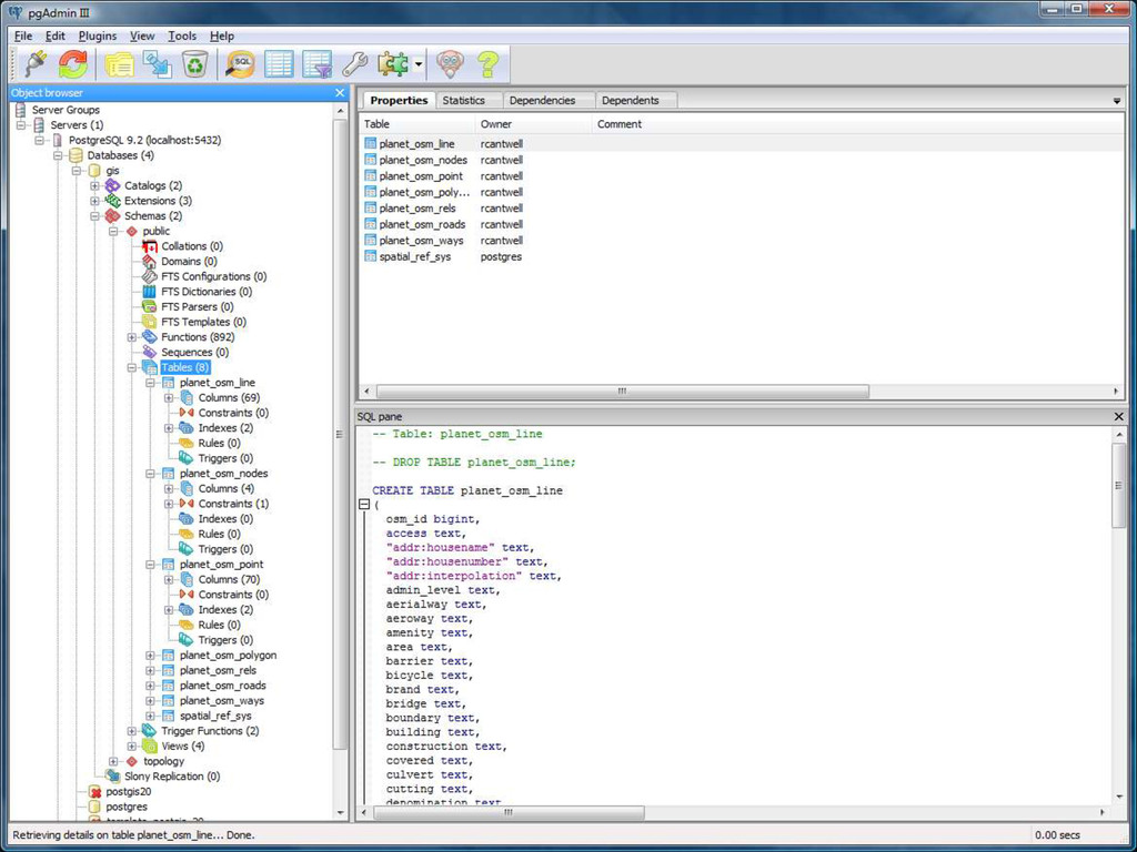
Area / Multipolygon handling is complex Usage Policies Desktop prob not an issue. Server, web different Build Your Own No apt-get install tileserver Yet Shapefiles Easy, not complete Postgis Starting point for many possibilities Data APIs Great for snapshots in geojson or POI webpages Data vs Services Is OSM commoditising data? Is that bad?
![An Introduction to OpenStreetMap for GIS Professionals [email protected] Local Authority](https://files.speakerdeck.com/presentations/2ee0aeb0875d013171475266eb92b936/slide_0.jpg)