Upgrade to Pro — share decks privately, control downloads, hide ads and more …

OpenStreetMap for GIS Pros - 2014

OpenStreetMap for GIS Pros - 2014

Workshop given in UCC, 29th Jan 2014.

Richard Cantwell

January 29, 2014
Tweet

More Decks by Richard Cantwell

Other Decks in Technology

Transcript

  1. An Introduction to
    OpenStreetMap for
    GIS Professionals
    Richard Cantwell
    @ManAboutCouch
    [email protected]
    UCC 29th January 2014

    View Slide

  2. Agenda:
    Introduction to OpenStreetMap:
    The origin of OSM
    Project Structure 
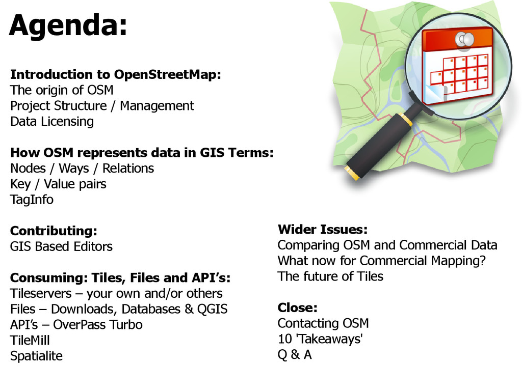
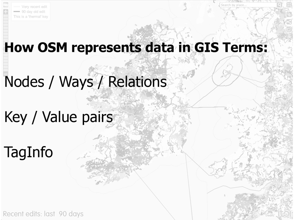
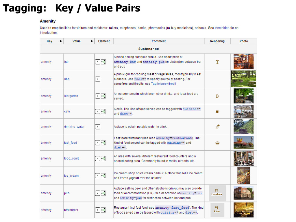
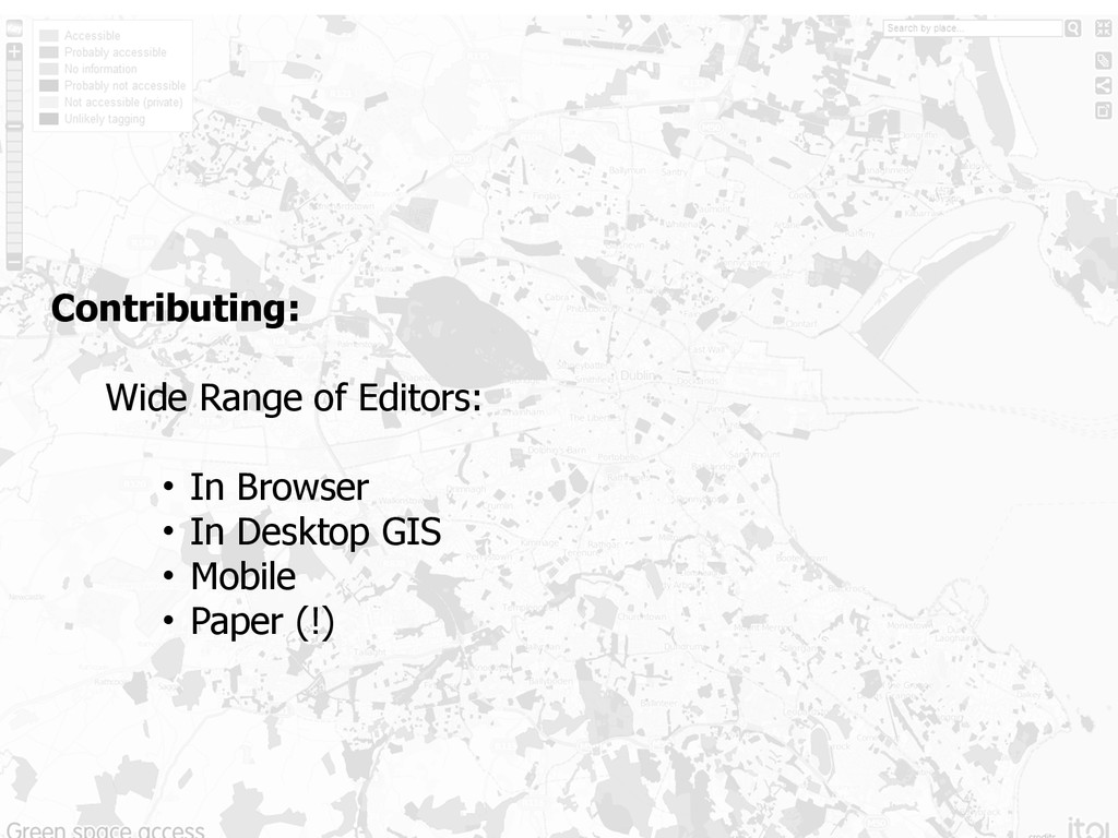
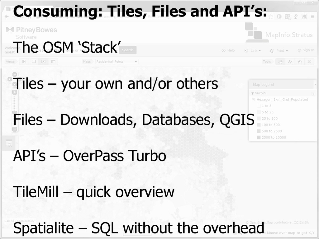
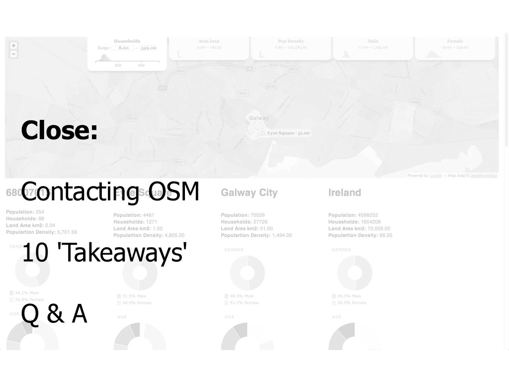
/ Management
    Data Licensing
    How OSM represents data in GIS Terms:
    Nodes / Ways / Relations
    Key / Value pairs
    TagInfo
    Contributing:
    GIS Based Editors
    Consuming: Tiles, Files and API’s:
    Tileservers – your own and/or others
    Files – Downloads, Databases & QGIS
    API’s – OverPass Turbo
    TileMill
    Spatialite
    Wider Issues:
    Comparing OSM and Commercial Data
    What now for Commercial Mapping?
    The future of Tiles
    Close:
    Contacting OSM
    10 'Takeaways'
    Q & A

    View Slide

  3. Introduction to OpenStreetMap:
    OSM in 2 minutes:
    The origin of OSM
    How OSM is organised
    Data Licensing

    View Slide

  4. View Slide

  5. View Slide

  6. Rapid and continuing growth
    wiki.openstreetmap.org/wiki/Stats

    View Slide

  7. Project Structure
    • “Rather Light”
    • “Do-ocracy” / “Meritocracy”
    • Somebody has to run the servers etc.:
    OSM Foundation (OSMF)
    • Contributors are a broad church

    View Slide

  8. www.openstreetmap.org/copyright

    View Slide

  9. opendatacommons.org/licenses/odbl/summary/

    View Slide

  10. How OSM represents data in GIS Terms:
    Nodes / Ways / Relations
    Key / Value pairs
    TagInfo

    View Slide

  11. Geographic Information is represented as:
    Nodes
    Point
    Ways
    Line Closed Line Area (Polygon)
    eg. Roundabouts
    Relations
    Multi (Point / Line / Polygon)
    eg. Bus Routes / Inner Rings

    View Slide

  12. Tagging: Key / Value Pairs

    View Slide

  13. Tagging: Key / Value Pairs

    View Slide

  14. Tagging: Oversight, not moderation

    View Slide

  15. Tagging: Oversight, not moderation

    View Slide

  16. Tagging: Oversight, not moderation

    View Slide

  17. Tagging: Oversight, not moderation

    View Slide

  18. Contributing:
    Wide Range of Editors:
    • In Browser
    • In Desktop GIS
    • Mobile
    • Paper (!)

    View Slide

  19. Contributing to OpenStreetMap
    Rule 1: Respect Copyright

    View Slide

  20. wiki.openstreetmap.org/wiki/Beginners%27_guide
    Contributing to
    OpenStreetMap

    View Slide

  21. ID Editor

    View Slide

  22. http://github.com/Esri/arcgis-osm-editor
    ArcGIS Editor

    View Slide

  23. QGIS OpenStreetMap Plugin – Currently Broken, replacement due in ‘months’

    View Slide

  24. fieldpapers.org
    GPS Mapping – on Paper

    View Slide

  25. fieldpapers.org
    GPS Mapping – on Paper

    View Slide

  26. Consuming: Tiles, Files and API’s:
    The OSM ‘Stack’
    Tiles – your own and/or others
    Files – Downloads, Databases, QGIS
    API’s – OverPass Turbo
    TileMill – quick overview
    Spatialite – SQL without the overhead

    View Slide

  27. Edit Store Render Consume
    Store Analyse

    View Slide

  28. Tile Data: .../{z}/{x}/{y}.png
    mike.teczno.com

    View Slide

  29. Tile Data Pyramid
    tile.openstreetmap.org/0/0/0.png
    tile.openstreetmap.org/10/494/331.png
    tile.openstreetmap.org/18/126521/84975.png

    View Slide

  30. OpenStreetMap – Tile Usage
    wiki.openstreetmap.org/wiki/Tile_Disk_Usage
    OSM does NOT pre-render every 
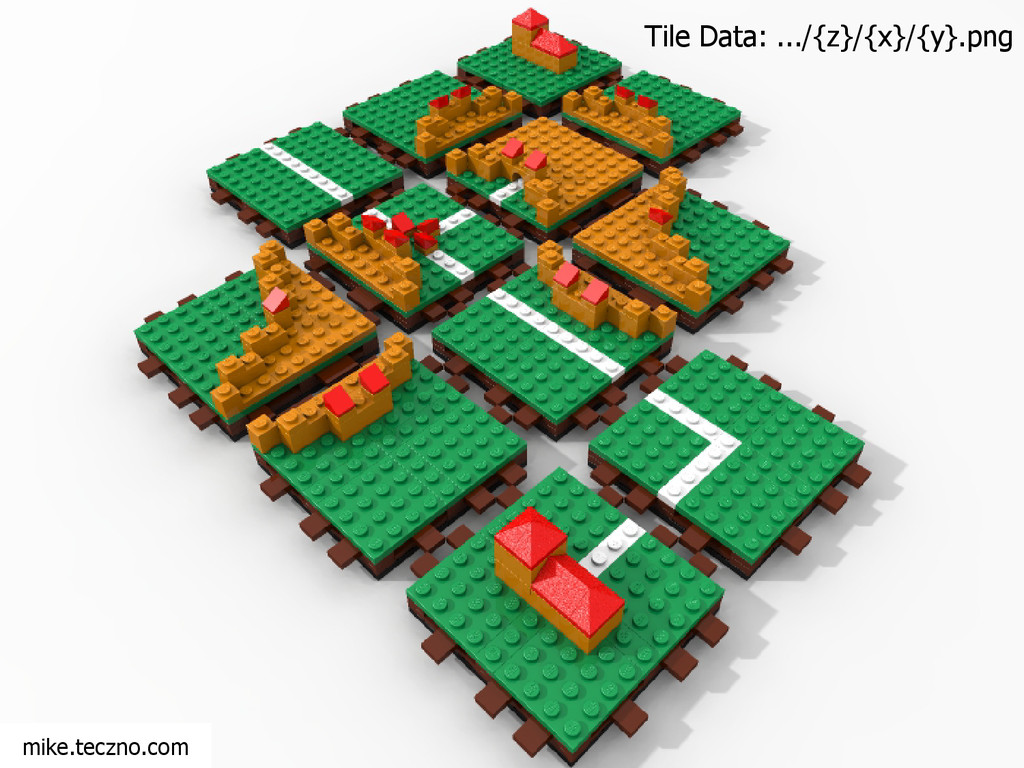
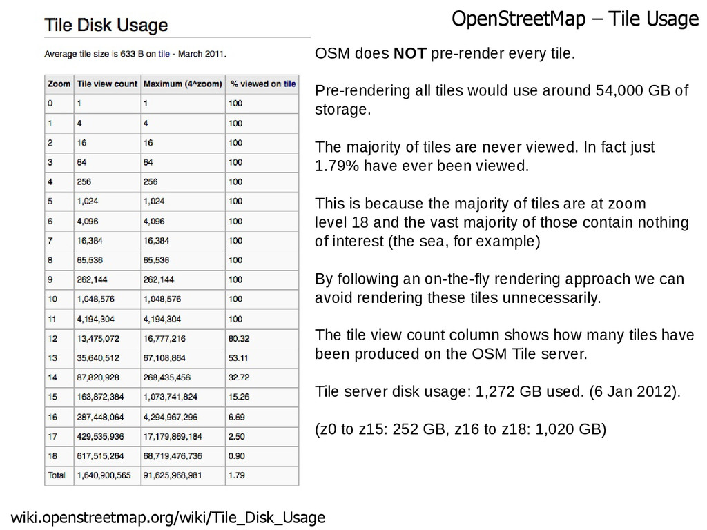
tile.
    Pre-rendering all tiles would use around 54,000 GB of
    storage.
    The majority of tiles are never viewed. In fact just
    1.79% have ever been viewed.
    This is because the majority of tiles are at zoom
    level 18 and the vast majority of those contain nothing
    of interest (the sea, for example)
    By following an on-the-fly rendering approach we can
    avoid rendering these tiles unnecessarily.
    The tile view count column shows how many tiles have
    been produced on the OSM Tile server.
    Tile server disk usage: 1,272 GB used. (6 Jan 2012).
    (z0 to z15: 252 GB, z16 to z18: 1,020 GB)

    View Slide

  31. wiki.openstreetmap.org/wiki/Tile_usage_policy
    OSM Tile Usage Policy

    View Slide

  32. QGIS – OpenLayers plugin

    View Slide

  33. maps.stamen.com/watercolor

    View Slide

  34. Using OSM data in GIS

    View Slide

  35. www.thunderforest.com

    View Slide

  36. MapInfo - .xml and .TAB files

    View Slide

  37. maps.cloudmade.com/editor

    View Slide

  38. Why make your own?
    Tile Usage Policy
    You’re in control: Design and Content
    Need tiles in EPSG:27700? 29903?
    Having OSM Data in a Database enables a lot of things
    You will learn a lot

    View Slide

  39. www.switch2osm.org

    View Slide

  40. www.switch2osm.org

    View Slide

  41. www.switch2osm.org
    Tileserver Software Stack
    • Software Stack:
    • mod_tile: apache 
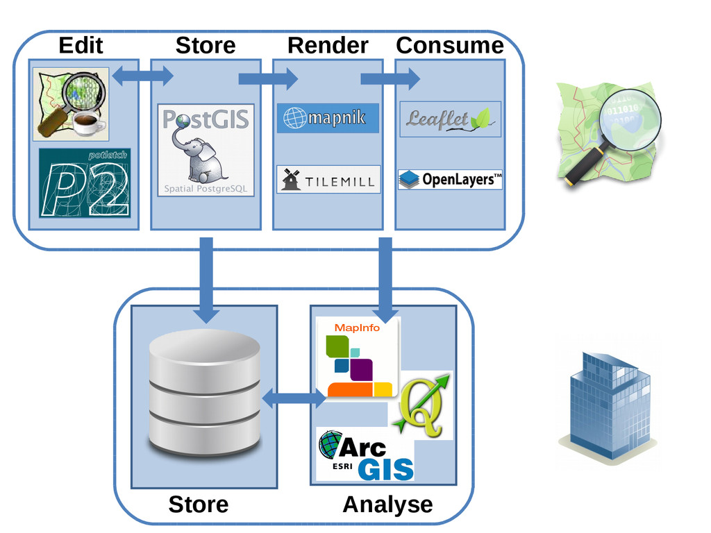
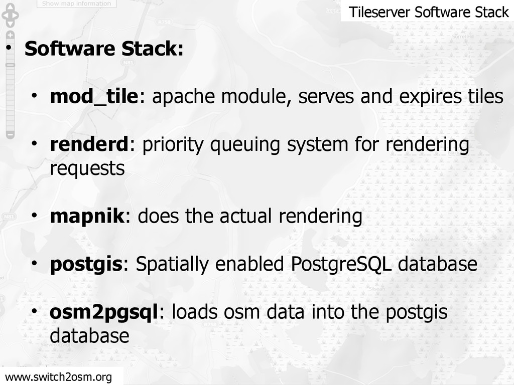
module, serves and expires tiles
    • renderd: priority queuing system for rendering
    requests
    • mapnik: does the actual rendering
    • postgis: Spatially enabled PostgreSQL database
    • osm2pgsql: loads osm data into the postgis
    database

    View Slide

  42. Steps for setting up your own Tileserver
    • Download and install libraries (apt-get)
    • Install PostgreSQL / Postgis
    • Install osm2pgsql and Mapnik (python)
    • Install mod_tile and renderd
    • Install & configure mapnik style-sheet
    • Configure renderd and mod_tile
    • Tune PostgreSQL
    • Download Planet and Coastline data
    • Import into Postgis
    • Start tileserver
    www.switch2osm.org

    View Slide

  43. Phew!
    Is there an easier way?
    • Postgis and Tilemill
    • maperitive.net – Reads .osm / .pbf, exports bitmaps & SVG
    • tiledrawer.com – Amazon EC2 based rendering / hosting

    View Slide

  44. www.mapbox.com

    View Slide

  45. www.mapbox.com/tilemill

    View Slide

  46. www.mapbox.com/tilemill

    View Slide

  47. www.mapbox.com/tilemill

    View Slide

  48. www.mapbox.com/blog/interactive-woodcut-map

    View Slide

  49. www.mapbox.com/blog/vector-tiles

    View Slide

  50. www.mapbox.com/blog/vector-tiles

    View Slide

  51. www.mapbox.com/blog/vector-tiles

    View Slide

  52. www.mapbox.com/blog/vector-tiles

    View Slide

  53. Entire Planet downloadable (~500GB uncompressed)
    planet.openstreetmap.org

    View Slide

  54. Processed data downloads & services
    www.geofabrik.de

    View Slide

  55. download.geofabrik.de
    Including pre-configured Shapefiles (reduced featureset)

    View Slide

  56. View Slide

  57. View Slide

  58. www.postgis.org

    View Slide

  59. osm2pgsql

    View Slide

  60. osm2pgsql
    Approx 70 Minutes for a small extract (Ireland .pbf = 69MB, Planet is 23GB)
    Would be faster on a machine with more RAM and SSD disks
    Whole Planet can take days
    osm2pgsql -s -U username -d gis -C 100
    /path/to/downloaded/osm/data
    -s = Slim mode
    -U = postgres username (owner of gis database)
    -d = database name (usually gis)
    -C = amount of memory in MB, usually 800, but my PC is a bit old

    View Slide

  61. View Slide

  62. View Slide

  63. View Slide

  64. View Slide

  65. Using the Data API
    “The Overpass API (or OSM3S) is 
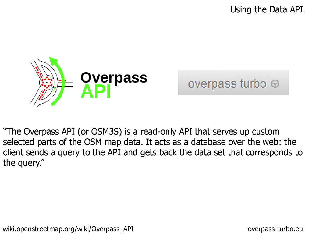
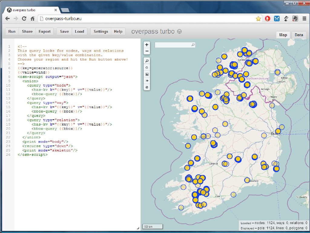
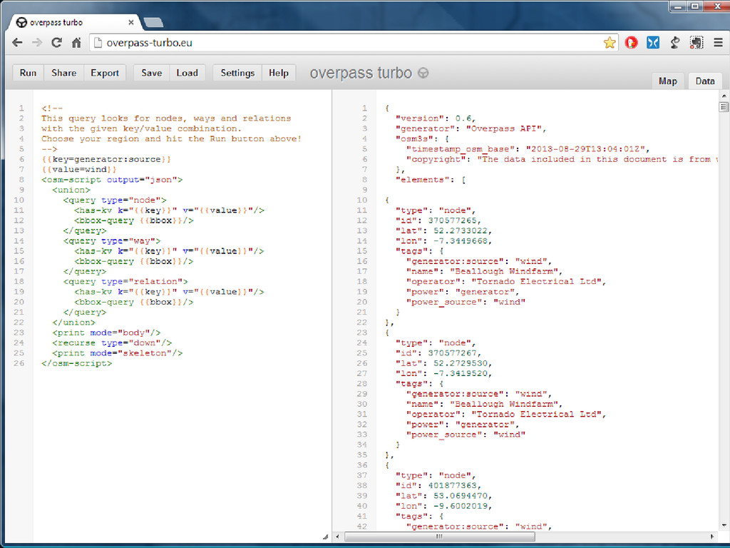
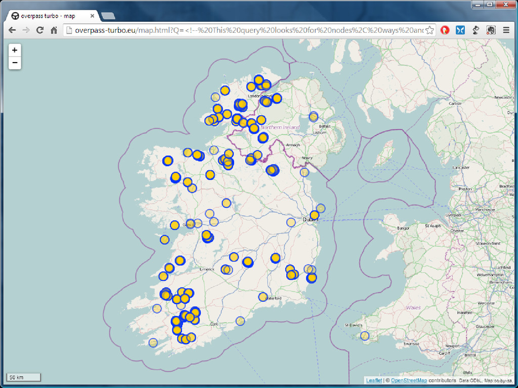
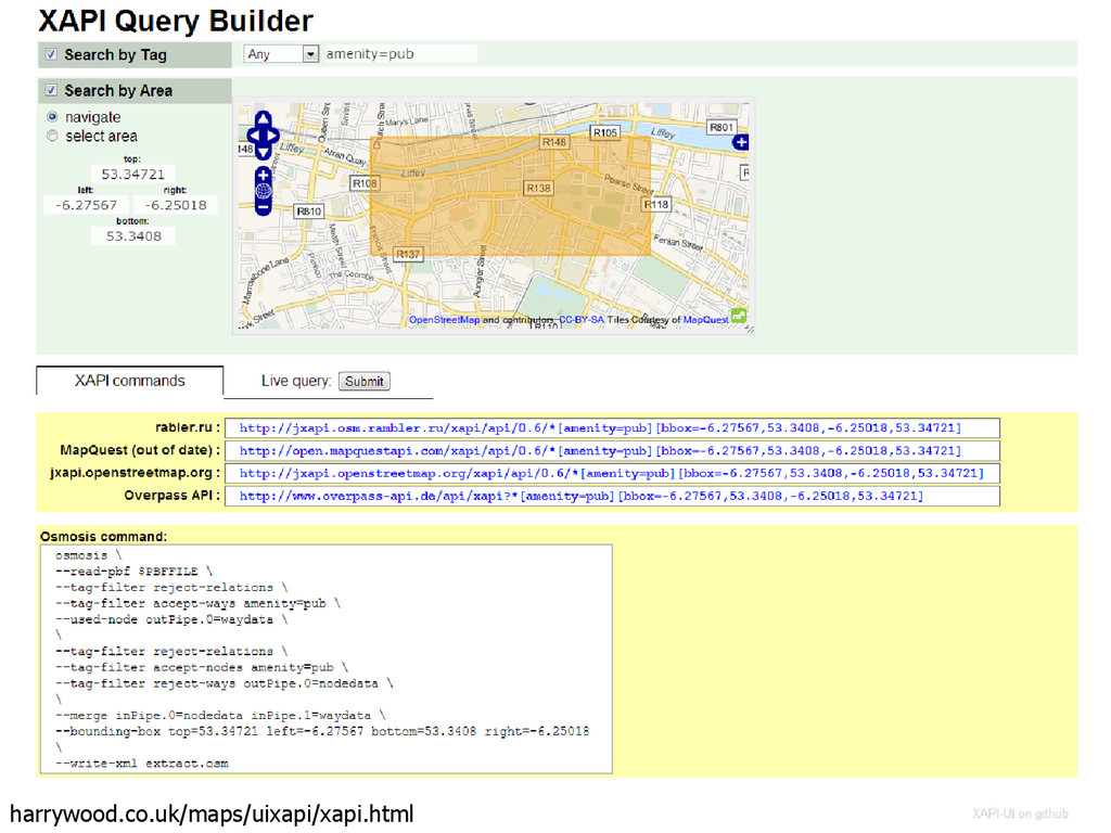
a read-only API that serves up custom
    selected parts of the OSM map data. It acts as a database over the web: the
    client sends a query to the API and gets back the data set that corresponds to
    the query.”
    wiki.openstreetmap.org/wiki/Overpass_API overpass-turbo.eu

    View Slide

  66. View Slide

  67. View Slide

  68. View Slide

  69. View Slide

  70. View Slide

  71. View Slide

  72. Extract Raw Data – Embedded in a map on 
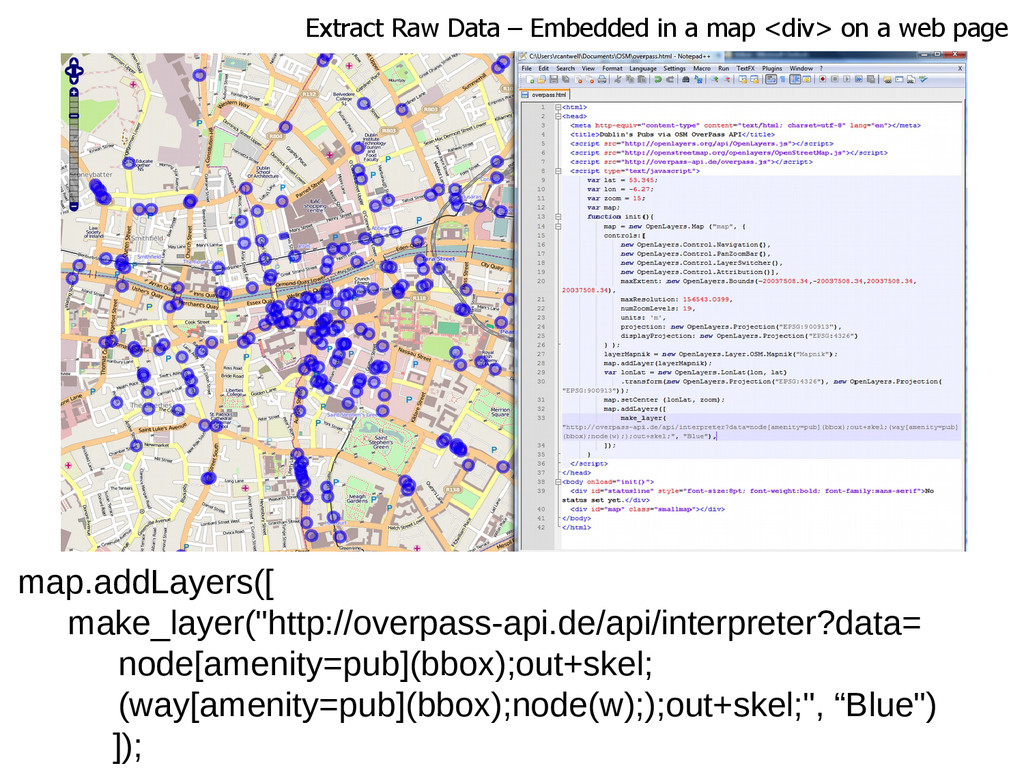
a web page
    map.addLayers([
    make_layer("http://overpass-api.de/api/interpreter?data=
    node[amenity=pub](bbox);out+skel;
    (way[amenity=pub](bbox);node(w););out+skel;", “Blue")
    ]);

    View Slide

  73. harrywood.co.uk/maps/uixapi/xapi.html

    View Slide

  74. osmosis – java based command line OSM data processing tool
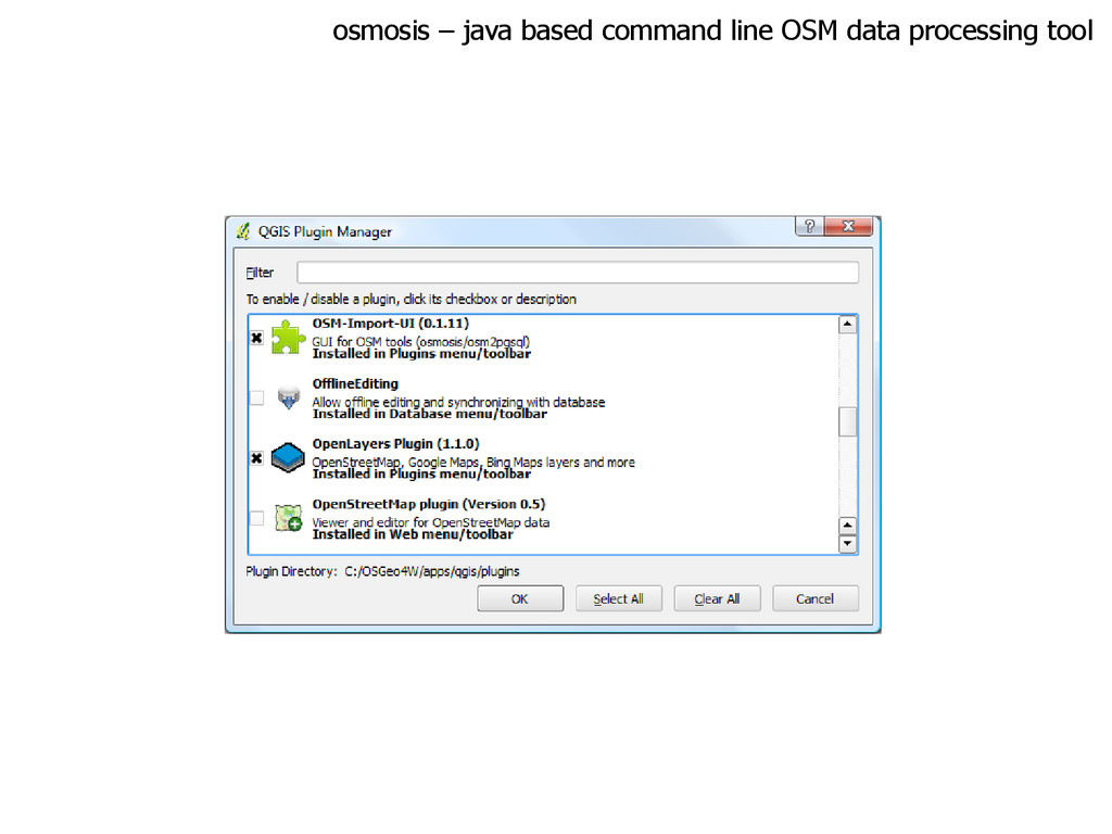
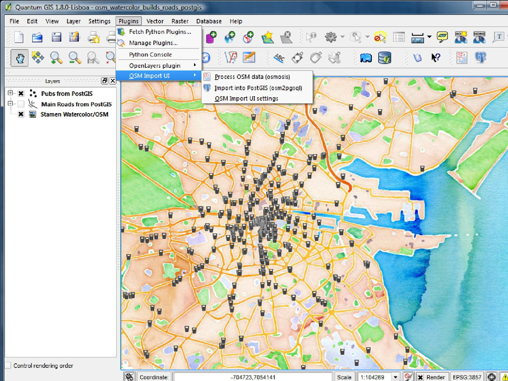
    Some examples of the things it can currently do are:
    • Generate planet dumps from a database
    • Load planet dumps into a database
    • Produce change sets using database history tables
    • Apply change sets to a local database
    • Compare two planet dump files and produce a change set
    • Re-sort the data contained in planet dump files
    • Extract data inside a bounding box or polygon
    wiki.openstreetmap.org/wiki/Osmosis

    View Slide

  75. osmosis – java based command line OSM data processing tool

    View Slide

  76. View Slide

  77. Spatialite – SQLite Spatial
    www.gaia-gis.it/gaia-sins/

    View Slide

  78. Spatialite – SQLite Spatial
    www.gaia-gis.it/fossil/spatialite_tools/index

    View Slide

  79. Spatialite – SQLite Spatial
    www.gaia-gis.it/fossil/spatialite_tools/index
    spatialite_osm_map – converts .osm to 
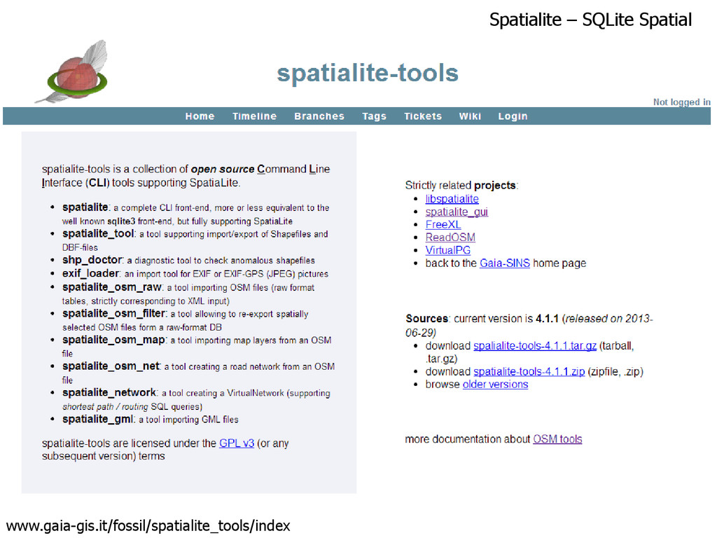
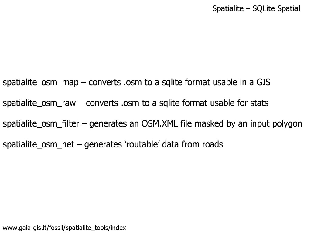
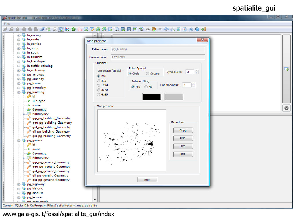
a sqlite format usable in a GIS
    spatialite_osm_raw – converts .osm to a sqlite format usable for stats
    spatialite_osm_filter – generates an OSM.XML file masked by an input polygon
    spatialite_osm_net – generates ‘routable’ data from roads

    View Slide

  80. spatialite_osm_map / raw – importing .pbf file
    www.gaia-gis.it/fossil/spatialite_tools/index
    spatialite_osm_map –o input.pbf –d output.sqlite
    Took about 30 mins (compared to 70 for osm2pgsql)
    Resulting .sqlite file was 300MB for the map, 1.5GB for raw

    View Slide

  81. Spatialite – SQLite Spatial
    www.gaia-gis.it/fossil/spatialite_gui/index

    View Slide

  82. spatialite_gui
    www.gaia-gis.it/fossil/spatialite_gui/index

    View Slide

  83. spatialite_gui
    www.gaia-gis.it/fossil/spatialite_gui/index

    View Slide

  84. Spatialite in QGIS – use ‘Add Vector Layer’

    View Slide

  85. Left as an exercise:
    Other services that you can run 
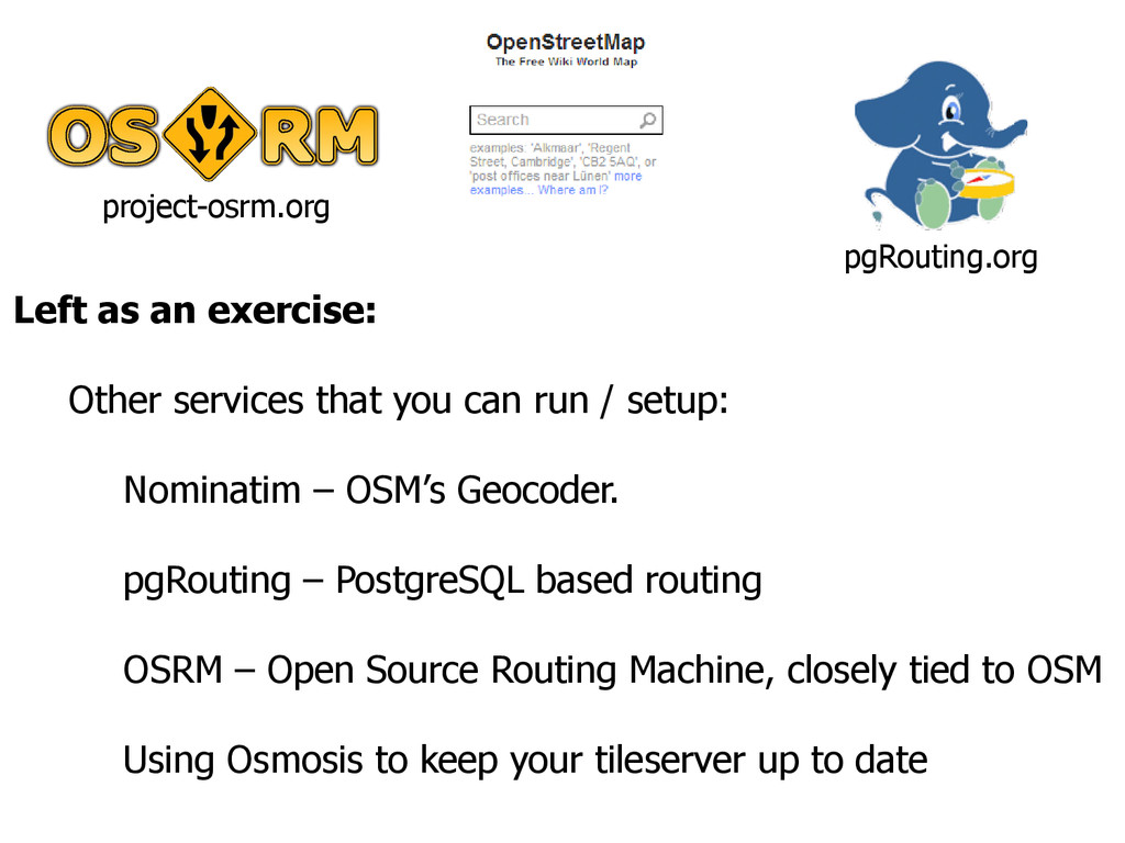
/ setup:
    Nominatim – OSM’s Geocoder.
    pgRouting – PostgreSQL based routing
    OSRM – Open Source Routing Machine, closely tied to OSM
    Using Osmosis to keep your tileserver up to date
    pgRouting.org
    project-osrm.org

    View Slide

  86. Wider Issues:
    Comparing OSM and Commercial Data
    What now for Commercial Mapping?
    Privacy & Data Protection
    The future of tiles

    View Slide

  87. Map contains data Copyright NavTeq
    Map contains data Copyright NavTeq

    View Slide

  88. Map contains data Copyright NavTeq
    Map contains data Copyright NavTeq

    View Slide

  89. Map contains data Copyright NavTeq
    Map contains data Copyright NavTeq

    View Slide

  90. But!
    © Stan

    View Slide

  91. View Slide

  92. 4,500 Done, 56,500 to go..

    View Slide

  93. Vs
    creativecommons.org

    View Slide

  94. VGI: OpenStreetMap
    • Limited to what is ‘visible’
    • API’s 
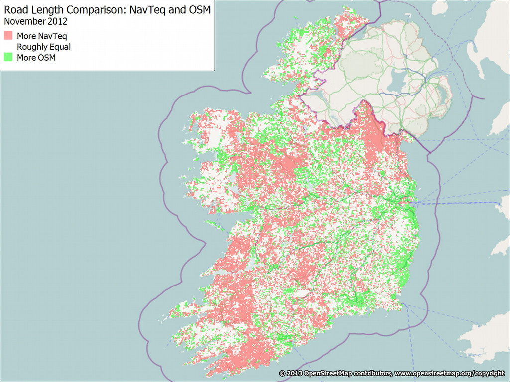
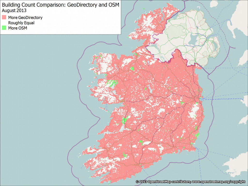
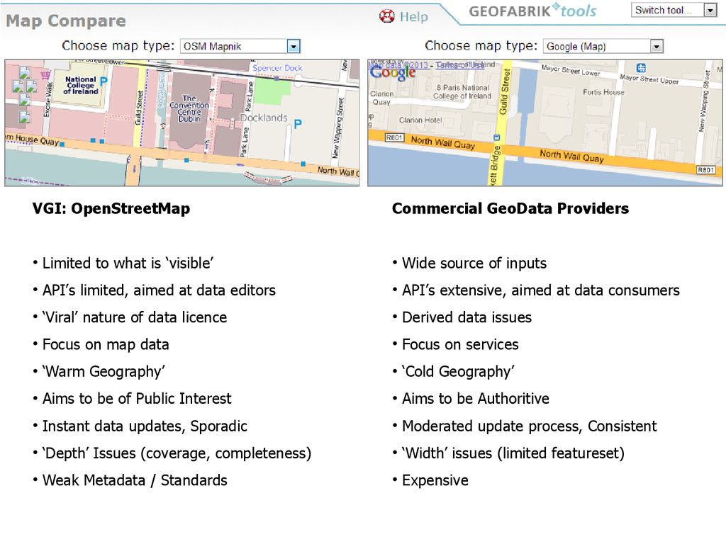
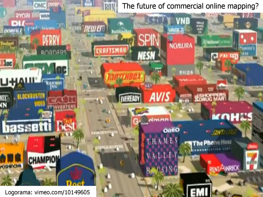
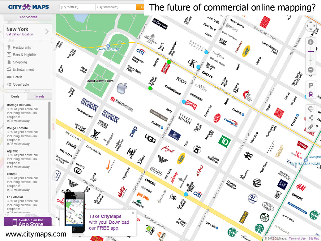
limited, aimed at data editors
    • ‘Viral’ nature of data licence
    • Focus on map data
    • ‘Warm Geography’
    • Aims to be of Public Interest
    • Instant data updates, Sporadic
    • ‘Depth’ Issues (coverage, completeness)
    • Weak Metadata / Standards
    Commercial GeoData Providers
    • Wide source of inputs
    • API’s extensive, aimed at data consumers
    • Derived data issues
    • Focus on services
    • ‘Cold Geography’
    • Aims to be Authoritive
    • Moderated update process, Consistent
    • ‘Width’ issues (limited featureset)
    • Expensive

    View Slide

  95. The future of commercial online mapping?
    Logorama: vimeo.com/10149605

    View Slide

  96. www.citymaps.com
    The future of commercial online mapping?

    View Slide

  97. maps.google.ie
    The future of commercial online mapping?

    View Slide

  98. www.jasondavies.com/maps/raster/
    Reprojected Raster Tiles

    View Slide

  99. www.mapbox.com/blog/vector-tiles wiki.openstreetmap.org/wiki/Vector_tiles
    Vector Tiles
    /{z}/{x}/{y}.png
    .geojson

    View Slide

  100. Close:
    Contacting OSM
    10 'Takeaways'
    Q & A

    View Slide

  101. OSM Wiki:
    wiki.openstreetmap.org
    OSM Help Forums:
    help.openstreetmap.org
    OSM-F Blog:
    blog.osmfoundation.org
    OpenGeoData Blog (OSM News):
    opengeodata.org
    IRC (Internet Relay Chat):
    irc://irc.oftc.net #osm
    Mailing Lists:
    lists.openstreetmap.org/listinfo
    Contacting OSM

    View Slide

  102. 10 'Takeaways'
    License Check obligations if mixing data
    Data Model 
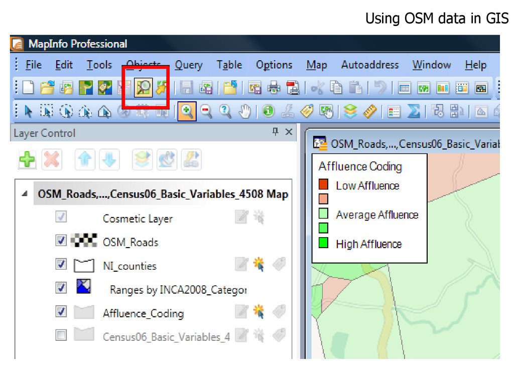
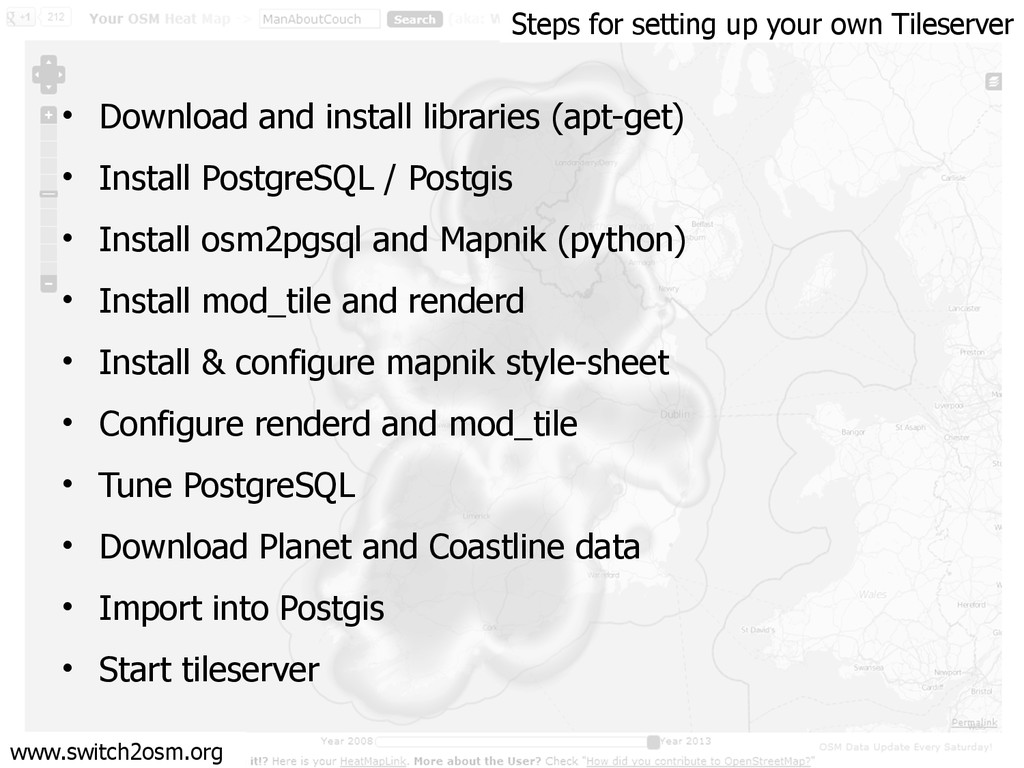
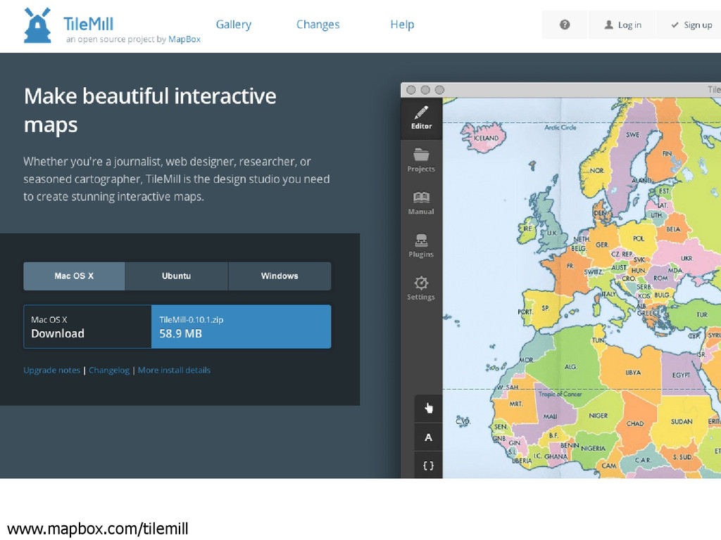
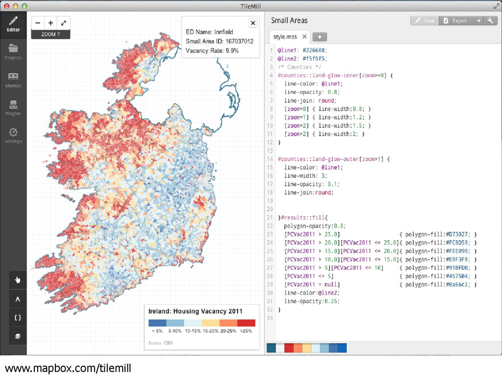
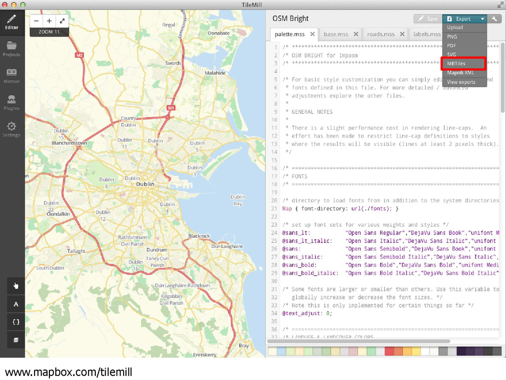
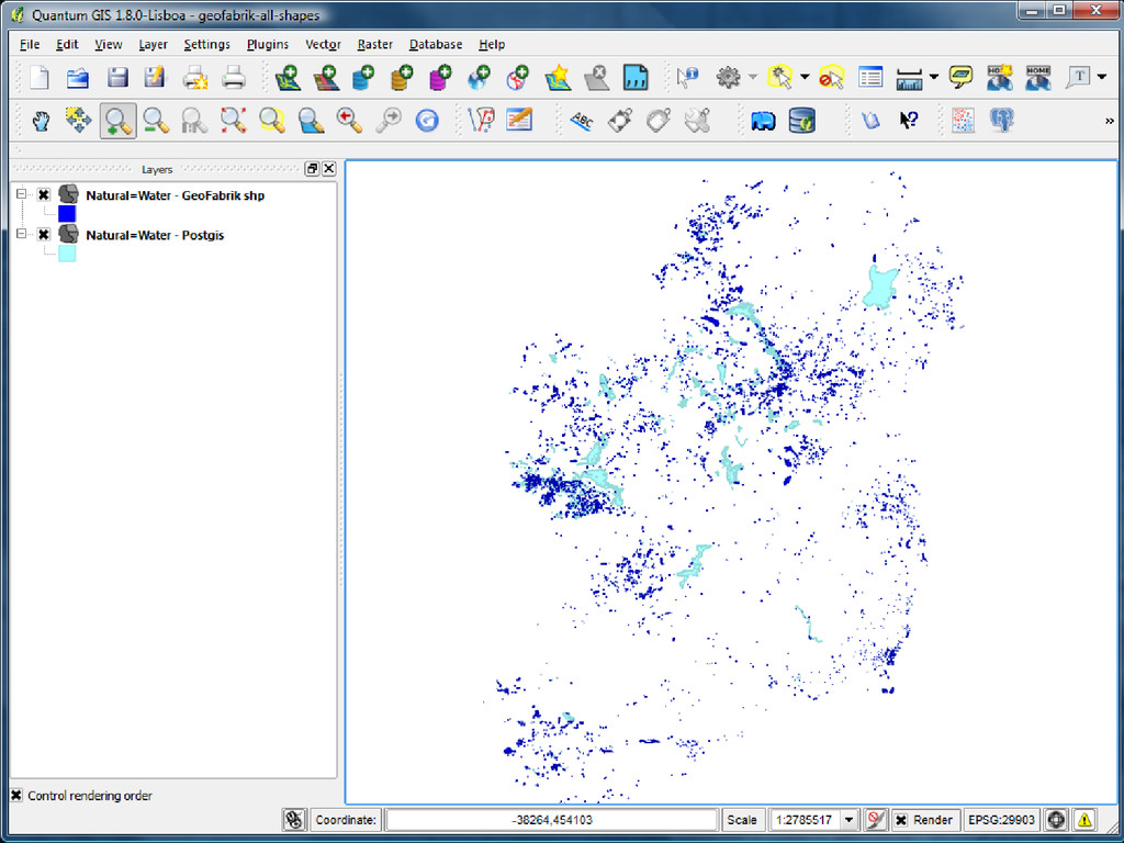
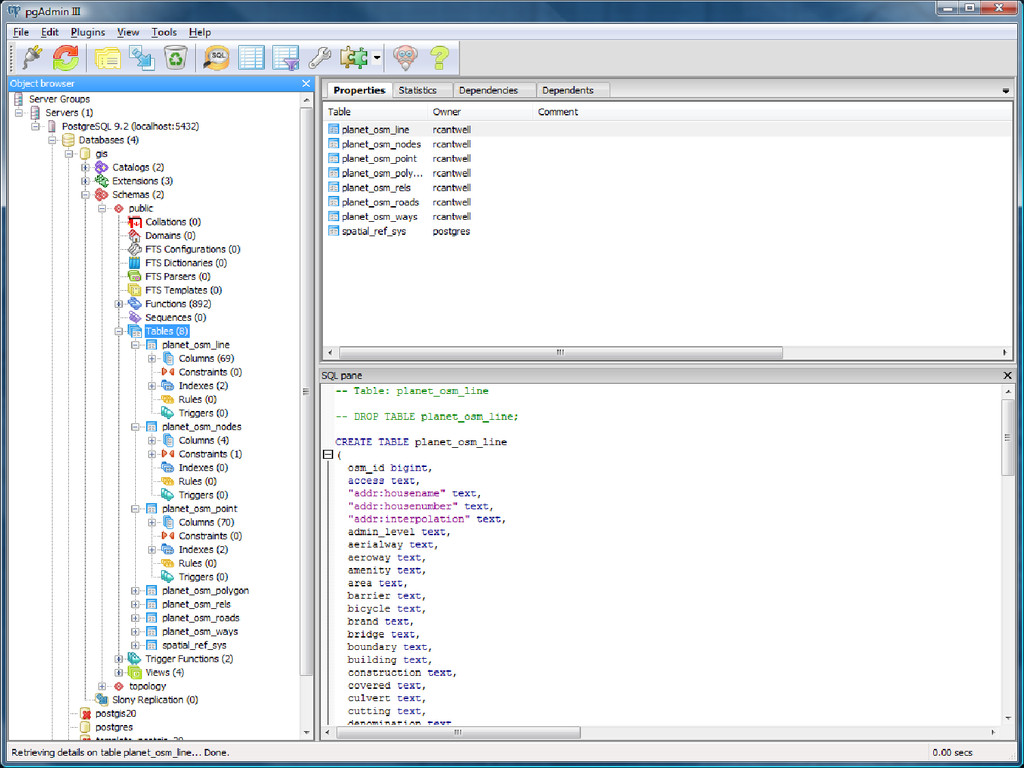
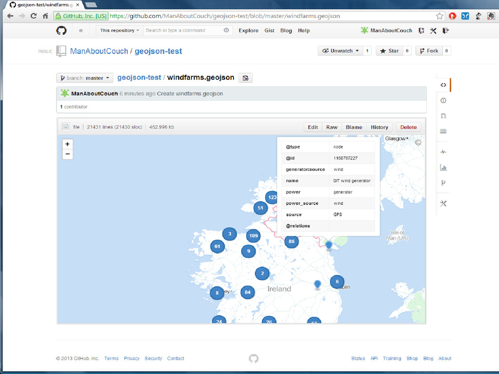
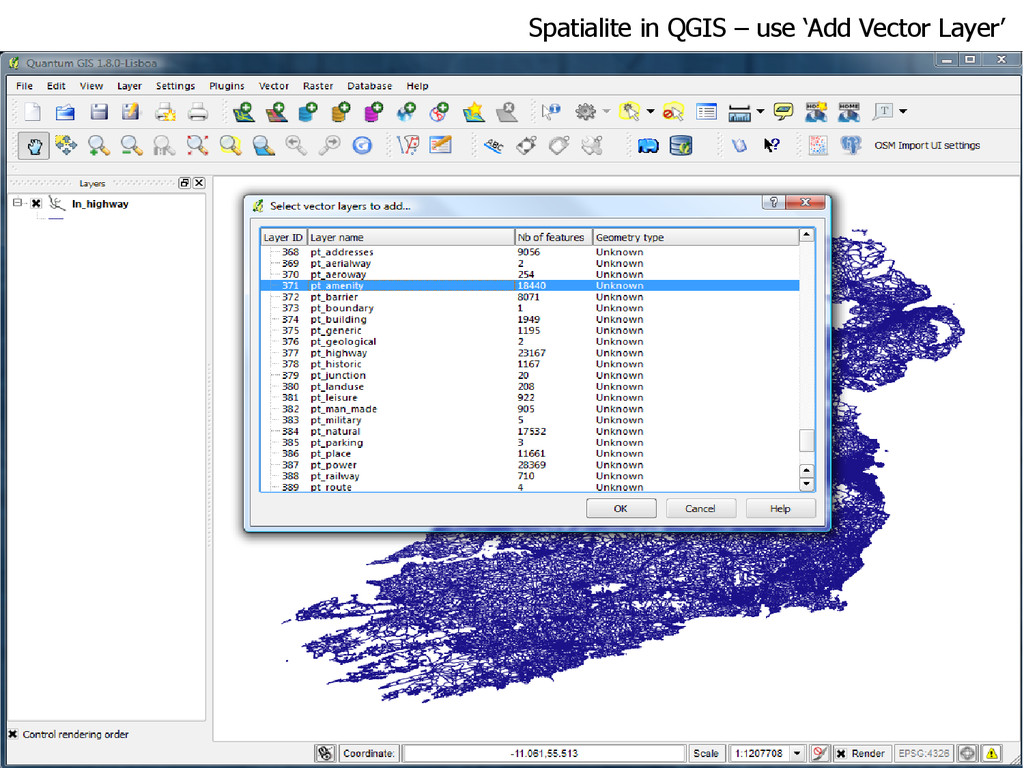
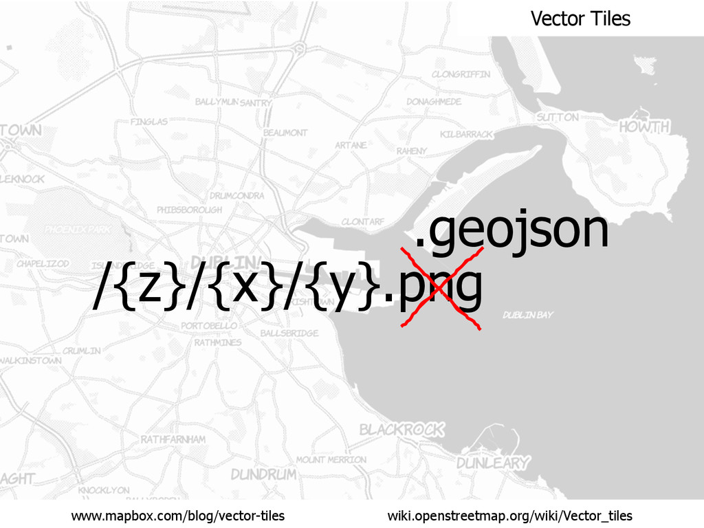
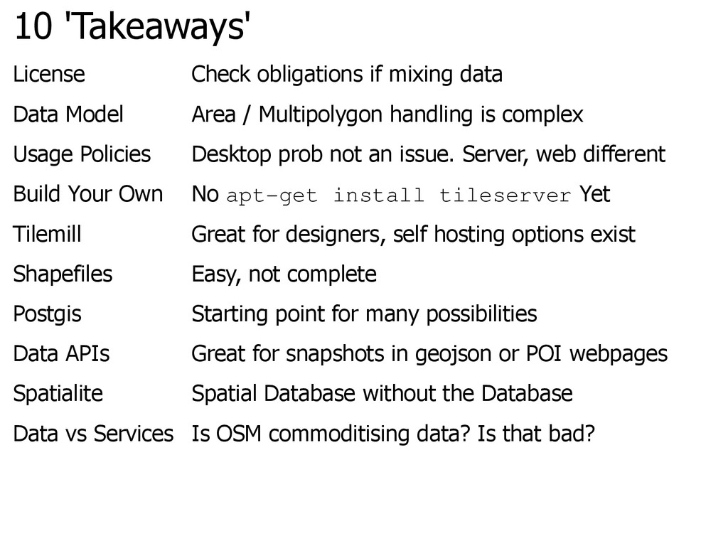
Area / Multipolygon handling is complex
    Usage Policies Desktop prob not an issue. Server, web different
    Build Your Own No apt-get install tileserver Yet
    Tilemill Great for designers, self hosting options exist
    Shapefiles Easy, not complete
    Postgis Starting point for many possibilities
    Data APIs Great for snapshots in geojson or POI webpages
    Spatialite Spatial Database without the Database
    Data vs Services Is OSM commoditising data? Is that bad?

    View Slide

  103. This slide deck is available at:
    speakerdeck.com/manaboutcouch
    Thank you.
    Any Questions?
    Richard Cantwell
    @ManAboutCouch [email protected]

    View Slide