Upgrade to Pro
— share decks privately, control downloads, hide ads and more …
Speaker Deck
Features
Speaker Deck
PRO
Sign in
Sign up for free
Search
Search
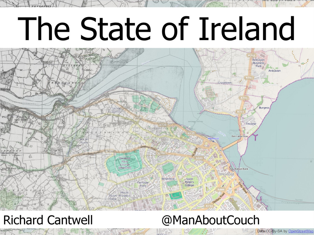
The State of Ireland
Search
Richard Cantwell
September 08, 2013
Education
570
0
Share
Embed
Copy iframe code
Copy JS code
Copy link
Start on current slide
The State of Ireland
Presentation for State of the Map, Birmingham, 2013
Richard Cantwell
September 08, 2013
More Decks by Richard Cantwell
See All by Richard Cantwell
nuim14
manaboutcouch
0
240
Where: Next
manaboutcouch
0
120
API Dublin - The OpenStreetMap Data API
manaboutcouch
0
260
OpenStreetMap for GIS Pros - Local Authority Edition
manaboutcouch
0
140
OpenStreetMap for GIS Pros - 2014
manaboutcouch
0
230
OpenStreetMap for GIS Pros
manaboutcouch
0
1.1k
An Introduction to Spatial Data: Sources & Methods
manaboutcouch
1
290
How Open Data is changing the Geo Landscape.
manaboutcouch
1
350
OpenGeoData: What, Where and Why?
manaboutcouch
1
220
Other Decks in Education
See All in Education
Portable & Reproducible Research Environments in the Age of AI Agents
denkiwakame
0
550
[2026前期火5] 論理学(京都大学文学部 前期 第11回)「ハーモニー:三層モデルと保存拡大」
yatabe
0
190
Πλουτοκρατία: Η Τυραννία του Μαμμωνά και η Μεταανθρώπινη Δουλεία
amethyst1
0
280
Implicit and Cross-Device Interaction - Lecture 10 - Next Generation User Interfaces (4018166FNR)
signer
PRO
2
2.3k
1人 × AI、1か月でここまで作れる ー 数年前の外注換算3.8〜7.4億円・241〜379人月分の作業を、AI費用 約10万円・31日で
frievea
0
100
Geografía y Fútbol: Chattanooga Geografía del Búnker de La Roja.
juanmartin2026
1
11k
Data Management and Analytics Specialisation
signer
PRO
0
1.9k
自己紹介 / who-am-i
yasulab
6
7.1k
[2026前期火5] 論理学(京都大学文学部 前期 第14回)「計算は、証明ではない——ハルシネーションを三層ハーモニーで診る」
yatabe
0
140
【セーフィー】テクニカルライティング&コミュニケーション実践講座(26新卒エンジニア向け研修資料)
ymzaki_m4
0
280
Lectura 2 (PIT : Python Basico)
robintux
0
390
[2026前期火5] 論理学(京都大学文学部 前期 第9回)「正規化の停止性——ヒドラゲームによる証明」
yatabe
0
210
Featured
See All Featured
What the history of the web can teach us about the future of AI
inesmontani
PRO
1
650
SERP Conf. Vienna - Web Accessibility: Optimizing for Inclusivity and SEO
sarafernandez
2
1.5k
StorybookのUI Testing Handbookを読んだ
zakiyama
31
6.9k
What Being in a Rock Band Can Teach Us About Real World SEO
427marketing
0
1.1k
CoffeeScript is Beautiful & I Never Want to Write Plain JavaScript Again
sstephenson
162
16k
Sharpening the Axe: The Primacy of Toolmaking
bcantrill
46
2.9k
Art, The Web, and Tiny UX
lynnandtonic
304
22k
Visual Storytelling: How to be a Superhuman Communicator
reverentgeek
2
600
Building a A Zero-Code AI SEO Workflow
portentint
PRO
0
650
世界の人気アプリ100個を分析して見えたペイウォール設計の心得
akihiro_kokubo
PRO
72
41k
We Are The Robots
honzajavorek
0
290
Testing 201, or: Great Expectations
jmmastey
46
8.2k
Transcript
The State of Ireland Richard Cantwell @ManAboutCouch
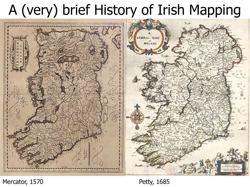
Mercator, 1570 Petty, 1685 A (very) brief History of Irish
Mapping
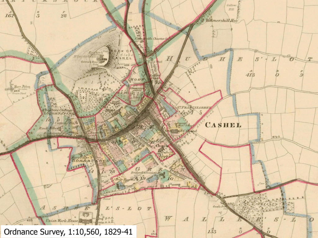
Ordnance Survey, 1:10,560, 1829-41
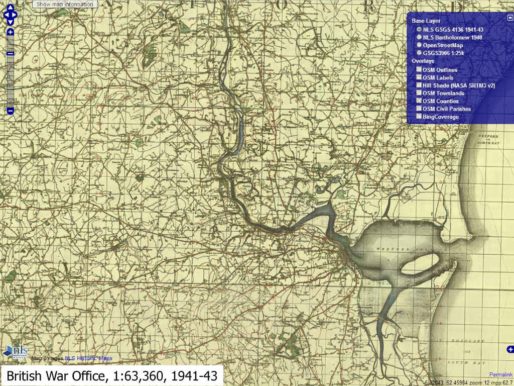
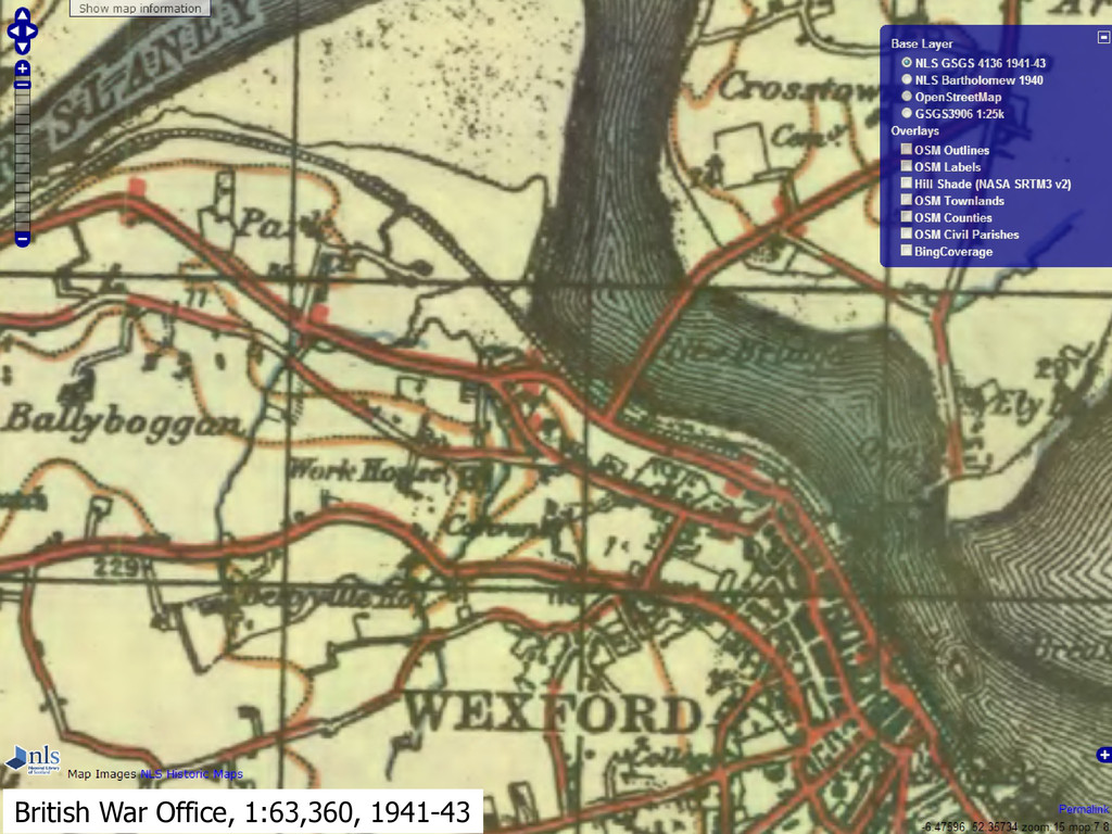
British War Office, 1:63,360, 1941-43
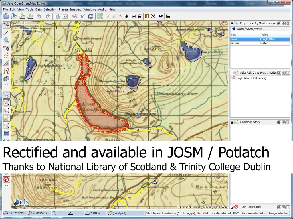
Rectified and available in JOSM / Potlatch Thanks to National
Library of Scotland & Trinity College Dublin
British War Office, 1:63,360, 1941-43
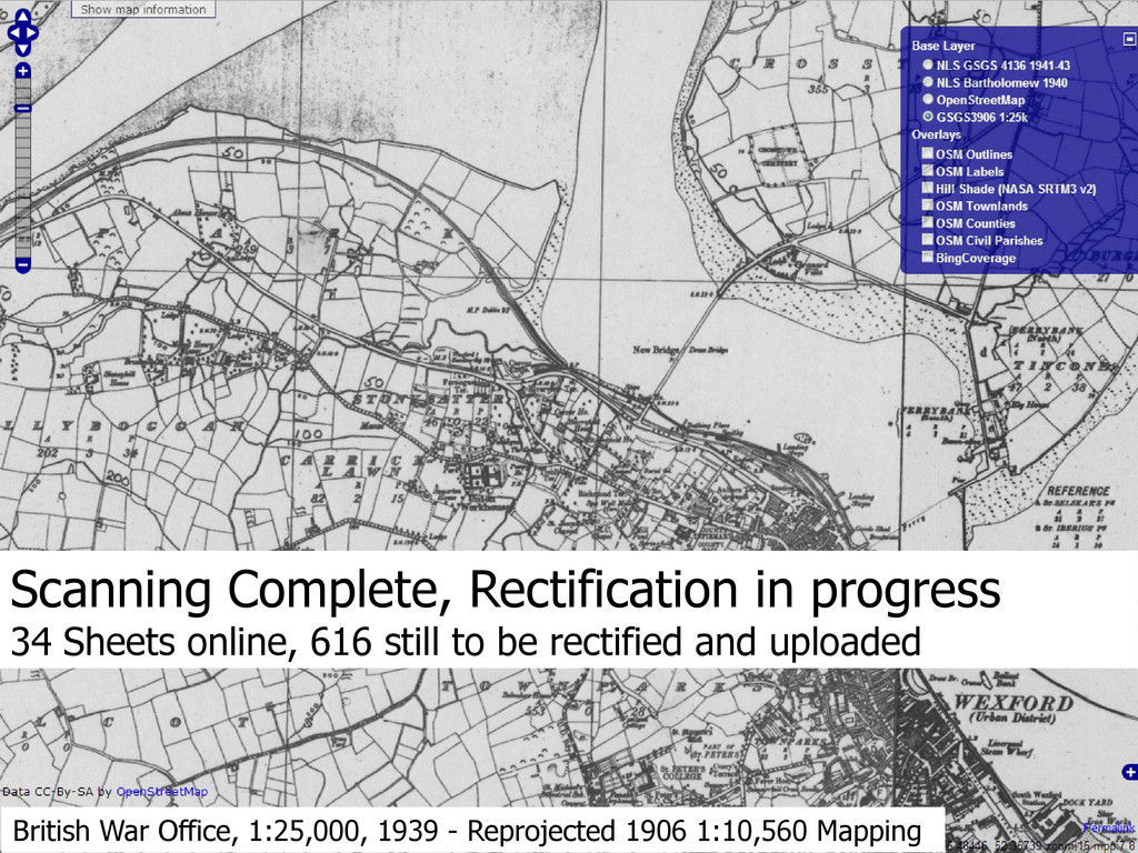
British War Office, 1:25,000, 1939 - Reprojected 1906 1:10,560 Mapping
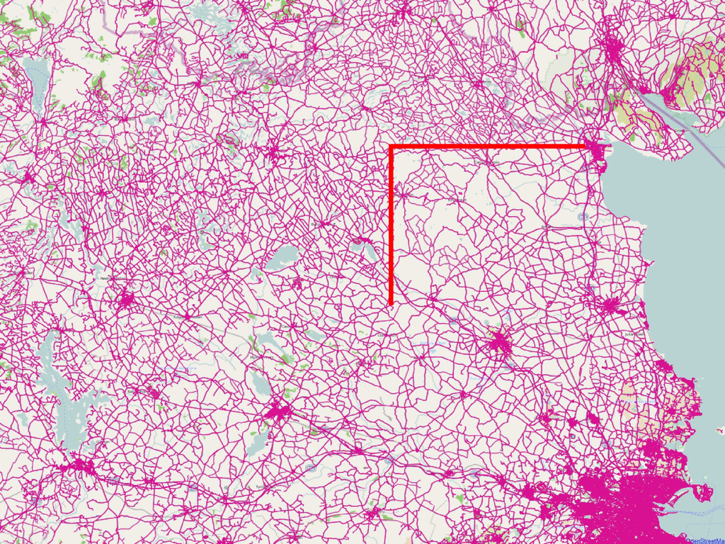
Scanning Complete, Rectification in progress 34 Sheets online, 616 still to be rectified and uploaded
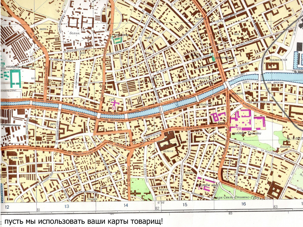
пусть мы использовать ваши карты товарищ!
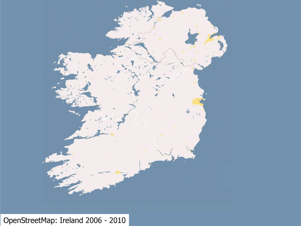
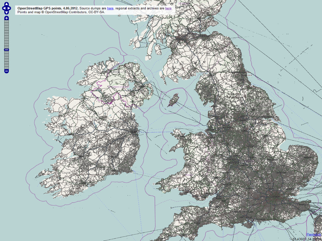
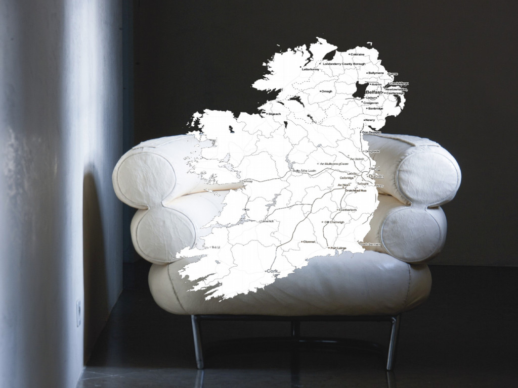
OpenStreetMap: Ireland 2006 - 2010
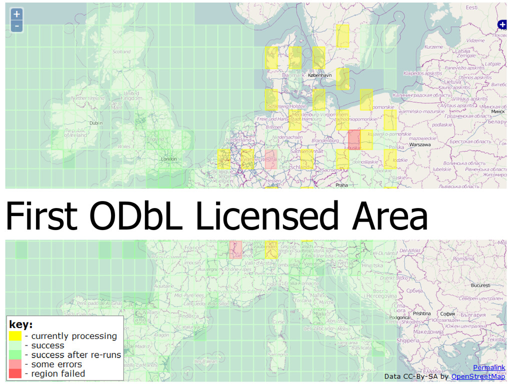
First ODbL Licensed Area
None
None
None
None
None
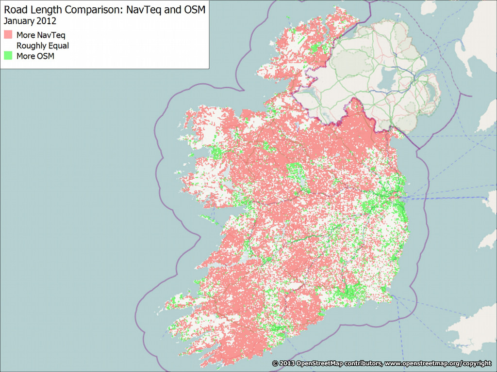
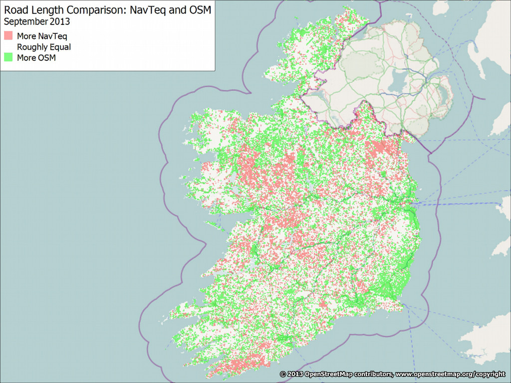
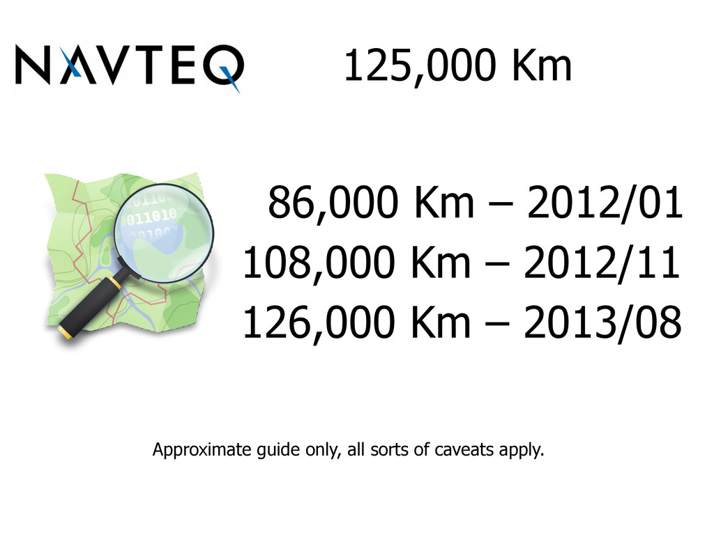
125,000 Km 86,000 Km – 2012/01 108,000 Km – 2012/11
126,000 Km – 2013/08 Approximate guide only, all sorts of caveats apply.
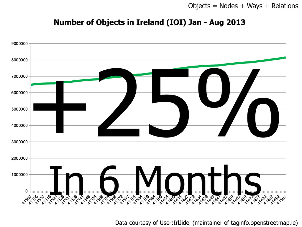
0 1000000 2000000 3000000 4000000 5000000 6000000 7000000 8000000 9000000
Number of Objects in Ireland (IOI) Jan - Aug 2013 +25% In 6 Months Objects = Nodes + Ways + Relations Data courtesy of User:IrlJidel (maintainer of taginfo.openstreetmap.ie)
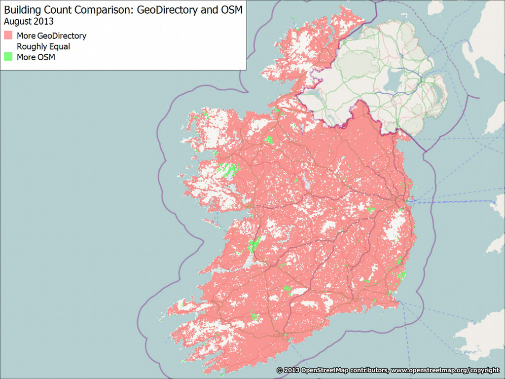
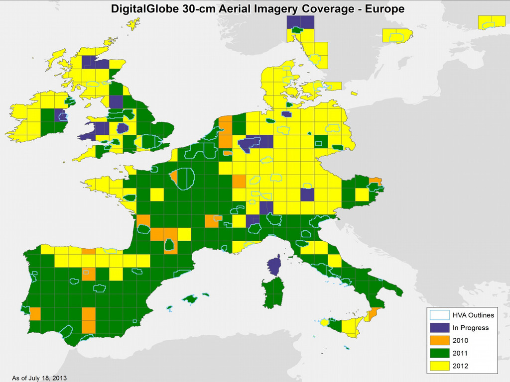
But! © Stan Openshaw
None
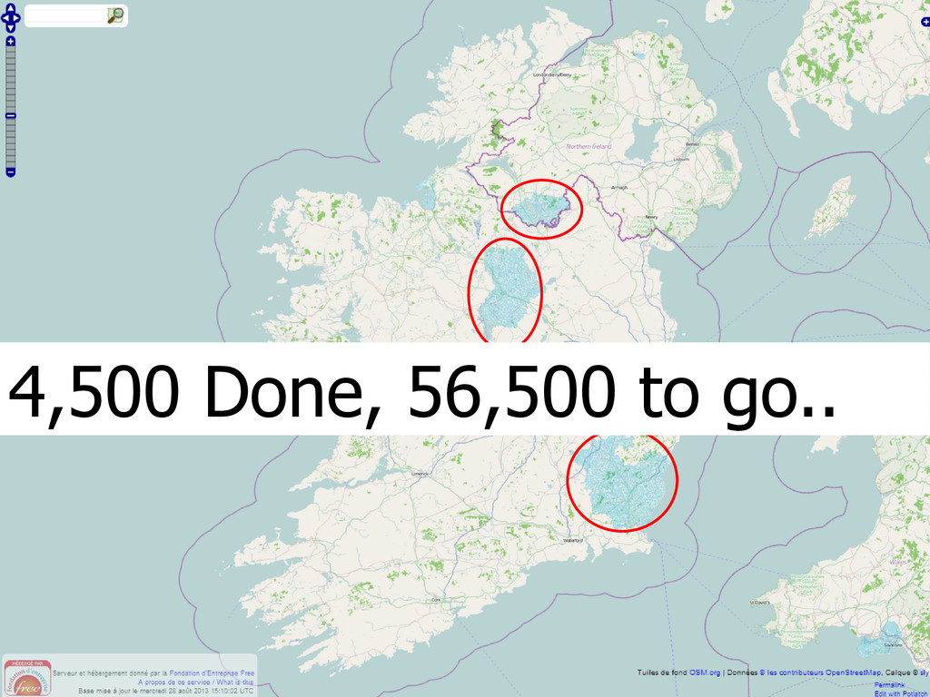
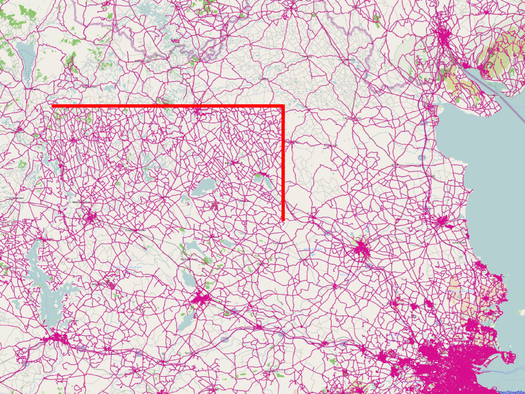
4,500 Done, 56,500 to go..
None
None
None
None
None
None
None
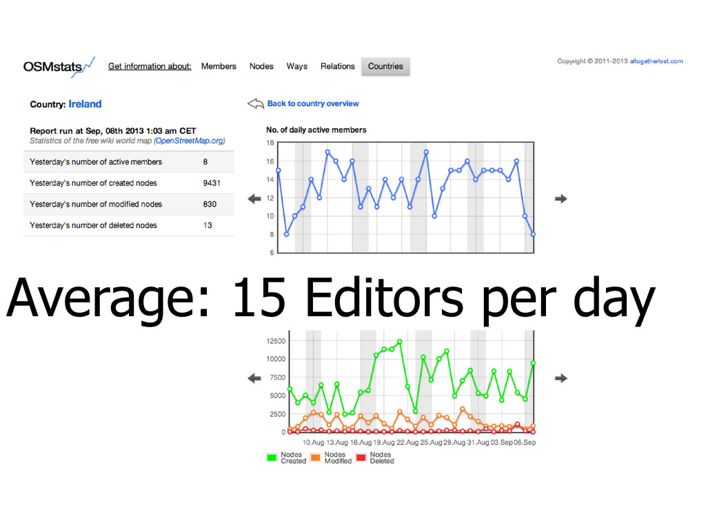
Average: 15 Editors per day
None
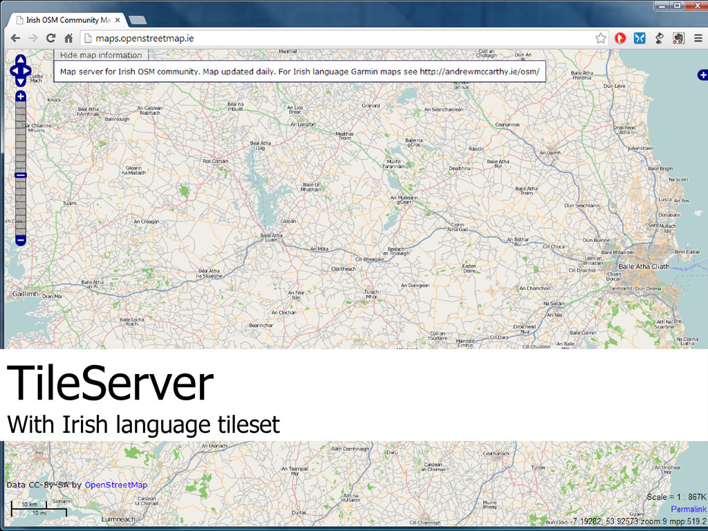
TileServer With Irish language tileset
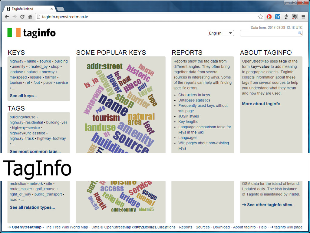
TagInfo
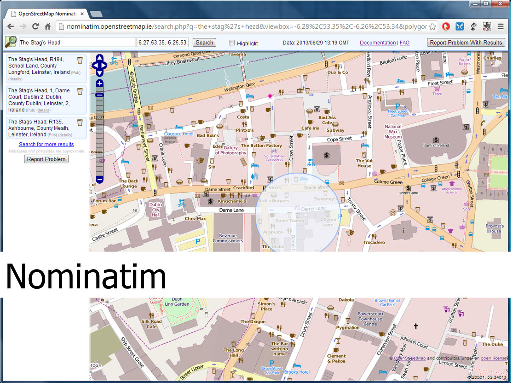
Nominatim
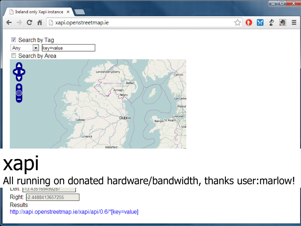
xapi All running on donated hardware/bandwidth, thanks user:marlow!
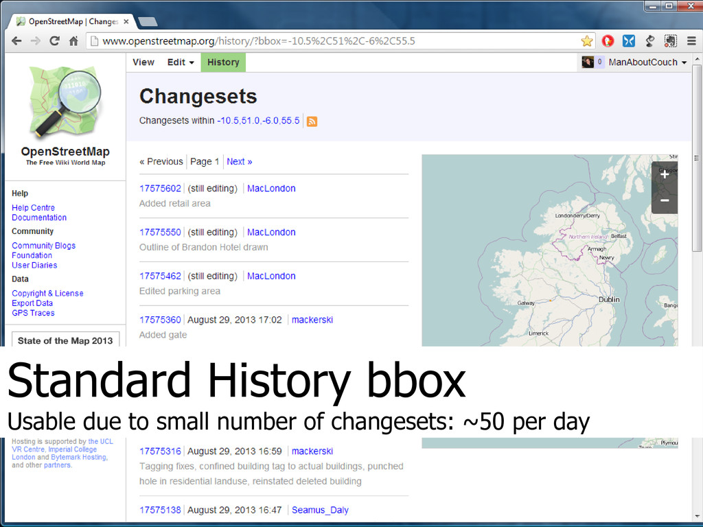
Standard History bbox Usable due to small number of changesets:
~50 per day
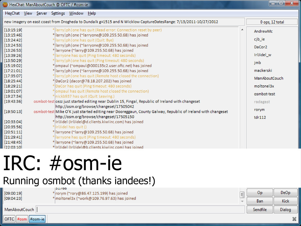
IRC: #osm-ie Running osmbot (thanks iandees!)
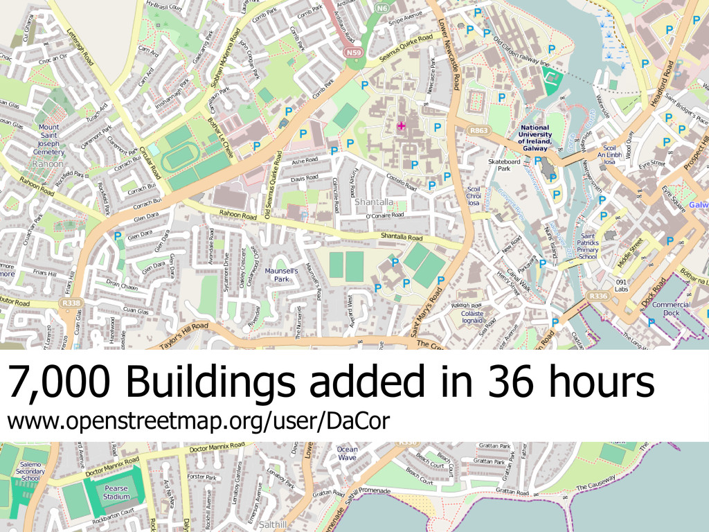
7,000 Buildings added in 36 hours www.openstreetmap.org/user/DaCor
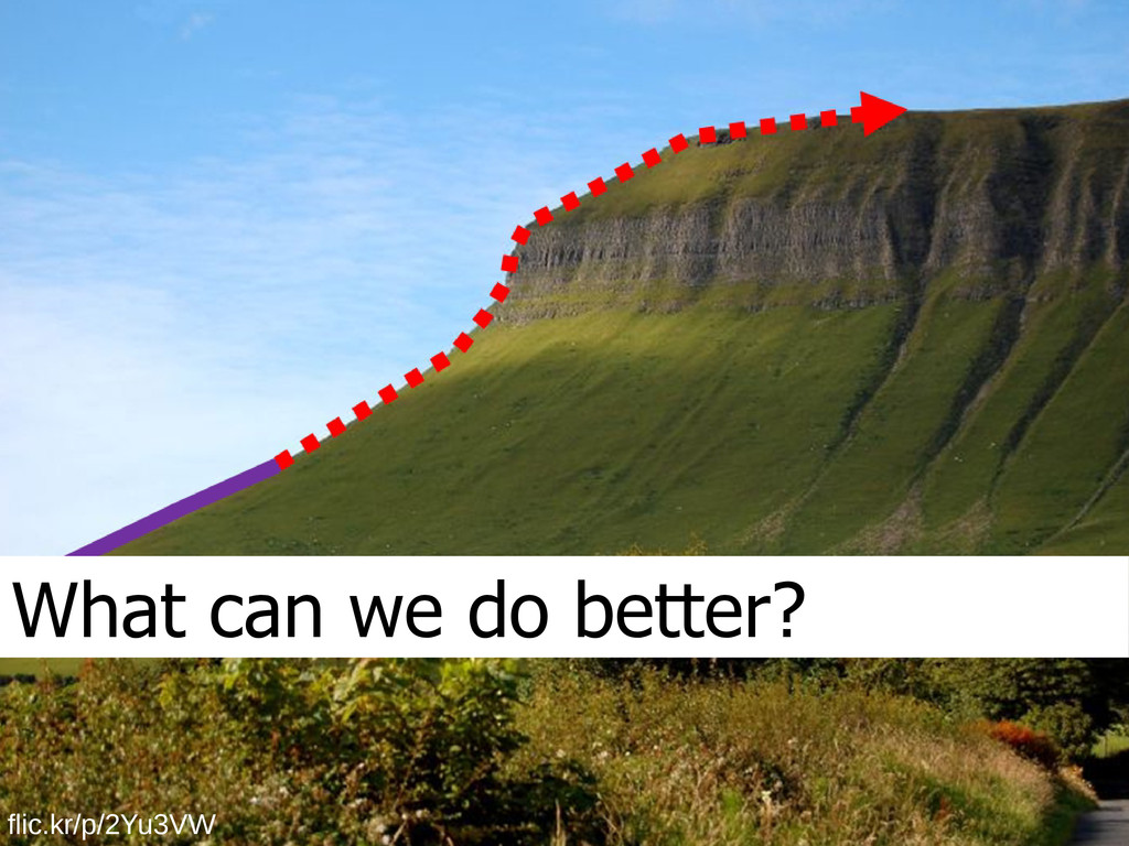
What can we do better? flic.kr/p/2Yu3VW
The State of Ireland Richard Cantwell @ManAboutCouch