Upgrade to Pro
— share decks privately, control downloads, hide ads and more …
Speaker Deck
Features
Speaker Deck
PRO
Sign in
Sign up for free
Search
Search
nuim14
Search
Richard Cantwell
April 15, 2014
Education
240
0
Share
Embed
Copy iframe code
Copy JS code
Copy link
Start on current slide
nuim14
An extended look at the future of GIS. Presented to NUIM Geography MSc class, 15th April 2014
Richard Cantwell
April 15, 2014
More Decks by Richard Cantwell
See All by Richard Cantwell
Where: Next
manaboutcouch
0
120
API Dublin - The OpenStreetMap Data API
manaboutcouch
0
260
OpenStreetMap for GIS Pros - Local Authority Edition
manaboutcouch
0
140
OpenStreetMap for GIS Pros - 2014
manaboutcouch
0
230
The State of Ireland
manaboutcouch
0
570
OpenStreetMap for GIS Pros
manaboutcouch
0
1.1k
An Introduction to Spatial Data: Sources & Methods
manaboutcouch
1
290
How Open Data is changing the Geo Landscape.
manaboutcouch
1
350
OpenGeoData: What, Where and Why?
manaboutcouch
1
220
Other Decks in Education
See All in Education
Where Data Meets Storytelling
georgesinnott
0
140
Catecismo 26 #1 - Aula inaugural
cm_manaus
0
220
子どものためのプログラミング道場『CoderDojo』〜法人提携例〜 / Partnership with CoderDojo Japan
coderdojojapan
PRO
4
19k
sepm-training-sample
levii
0
110
BITCOIN : Les fondamentaux !
rlifchitz
0
200
Geografía y fútbol. Atlanta. la megalópolis del fútbol
juanmartin2026
1
11k
!コスパよくインターンに受かる方法!
ruribou
1
310
Throw Yourself In! - How I've learned English and What I'm Facing
georgeorge
1
210
0526
cbtlibrary
0
200
生成AI時代のエンジニア育成について考えてみた
akasan
0
190
Visionary Initiative: Future Intelligence — Laying the foundations for the future of science, intelligence, and society | Science Tokyo
sciencetokyo
PRO
0
180
Info Session MSc Computer Science & MSc Applied Informatics
signer
PRO
0
300
Featured
See All Featured
HU Berlin: Industrial-Strength Natural Language Processing with spaCy and Prodigy
inesmontani
PRO
0
590
How to optimise 3,500 product descriptions for ecommerce in one day using ChatGPT
katarinadahlin
PRO
1
3.7k
Understanding Cognitive Biases in Performance Measurement
bluesmoon
32
3k
Have SEOs Ruined the Internet? - User Awareness of SEO in 2025
akashhashmi
0
400
The World Runs on Bad Software
bkeepers
PRO
72
12k
The Anti-SEO Checklist Checklist. Pubcon Cyber Week
ryanjones
0
190
GraphQLとの向き合い方2022年版
quramy
50
15k
The Psychology of Web Performance [Beyond Tellerrand 2023]
tammyeverts
49
3.5k
The Cult of Friendly URLs
andyhume
79
7k
How GitHub (no longer) Works
holman
316
150k
SEO for Brand Visibility & Recognition
aleyda
0
4.6k
Prompt Engineering for Job Search
mfonobong
0
390
Transcript
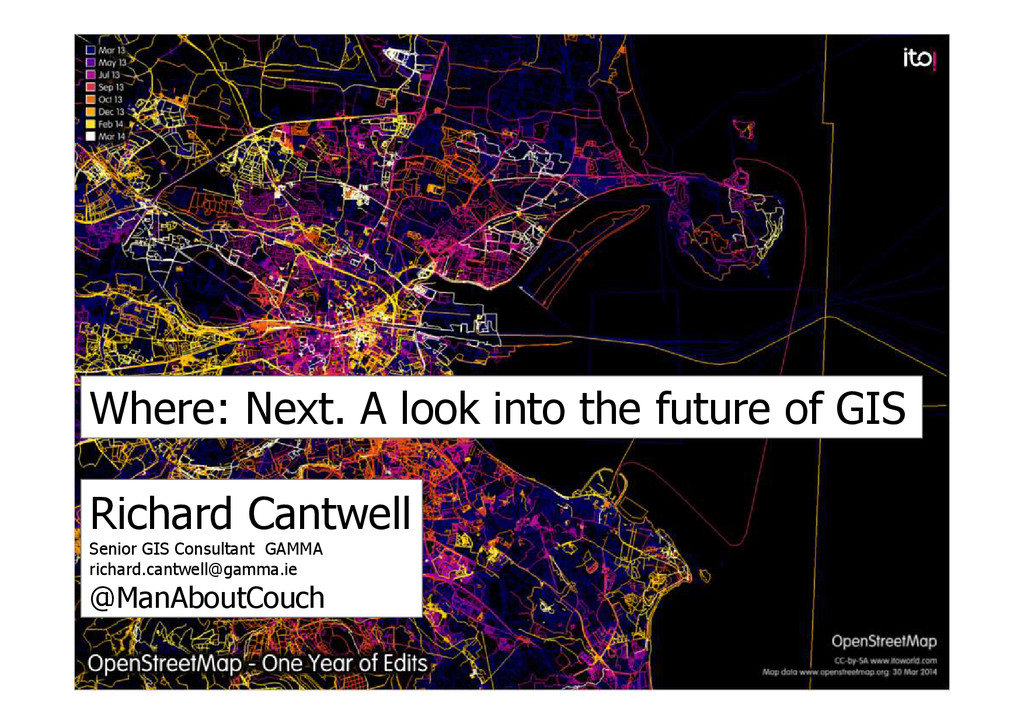
Where: Next. A look into the future of GIS Richard
Cantwell Senior GIS Consultant GAMMA
[email protected]
@ManAboutCouch
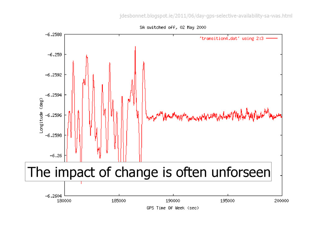
The impact of change is often unforseen jdesbonnet.blogspot.ie/2011/06/day-gps-selective-availability-sa-was.html
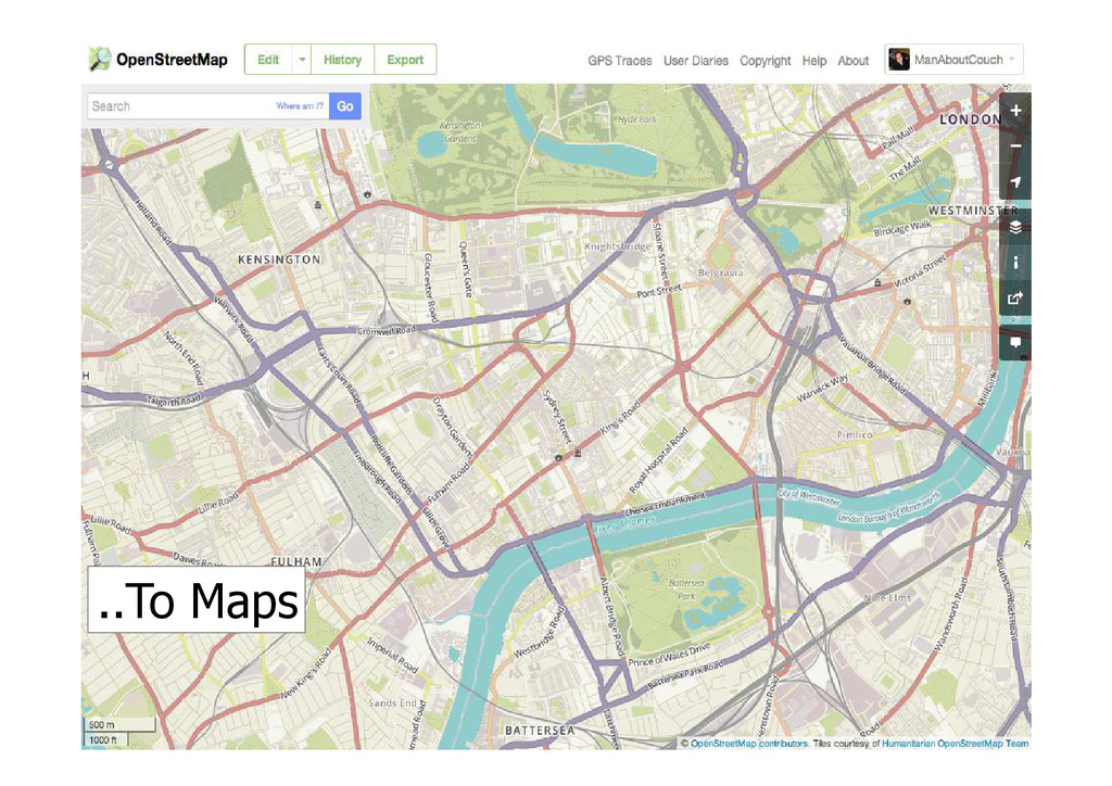
From GPS tracks..
..To Maps
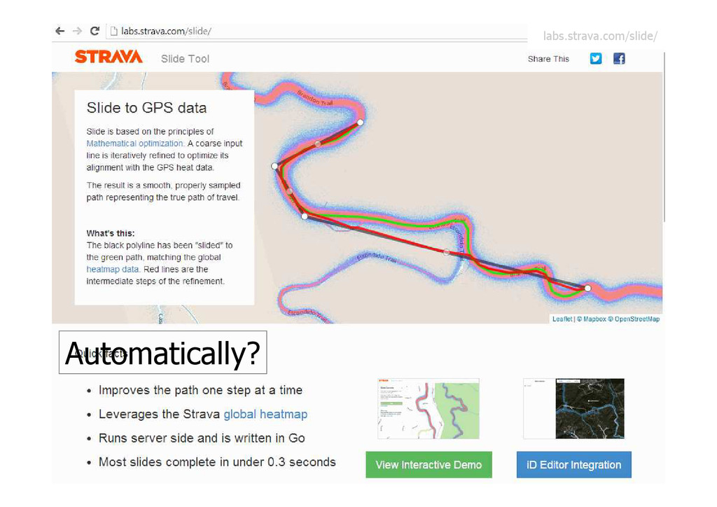
Automatically? labs.strava.com/slide/
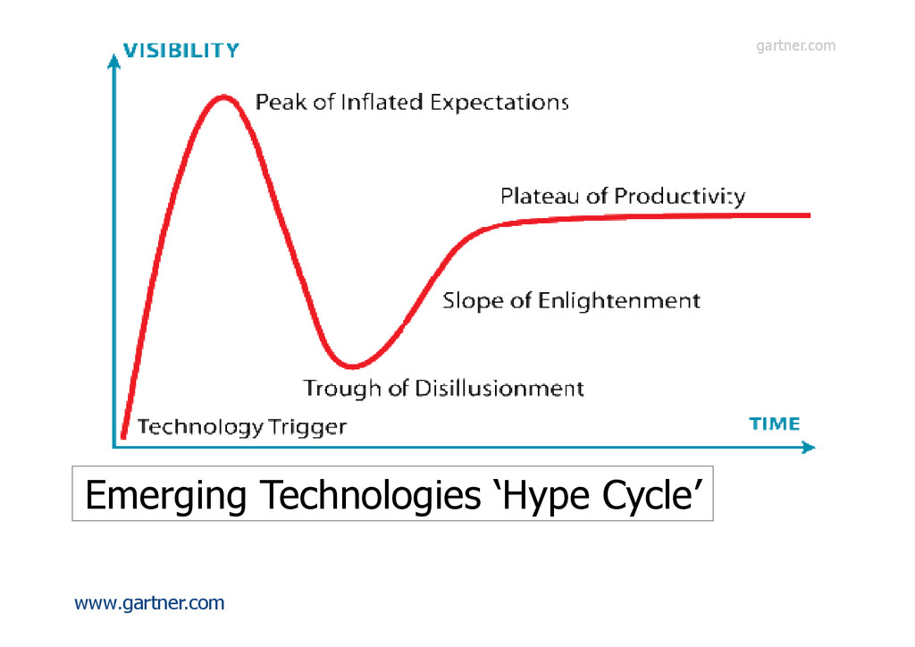
www.gartner.com Emerging Technologies ‘Hype Cycle’ gartner.com
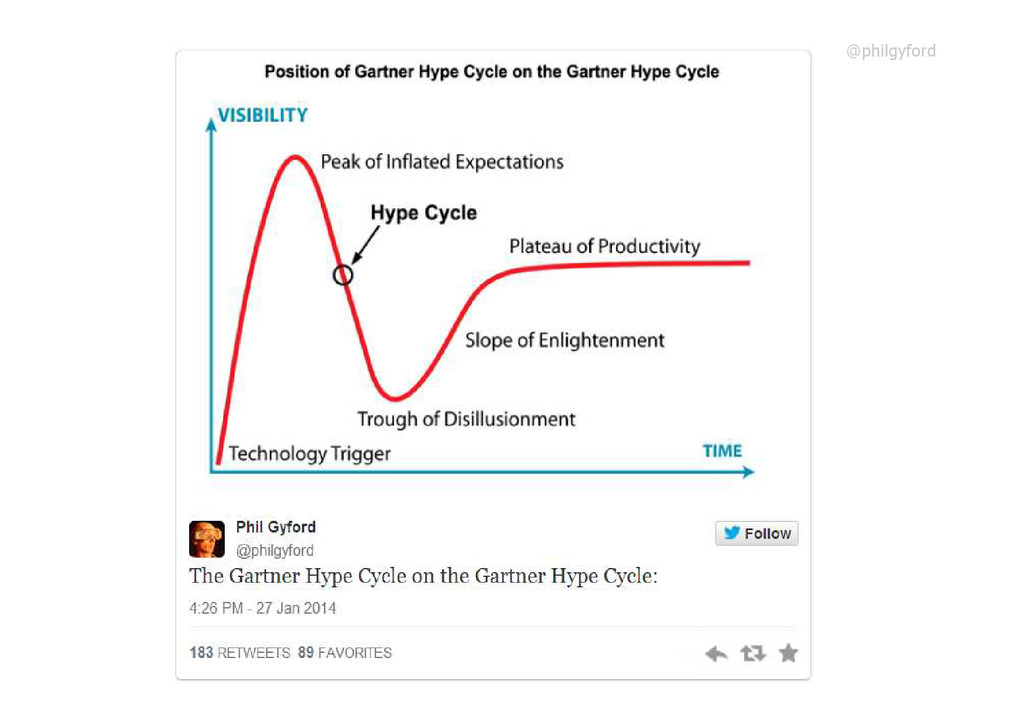
@philgyford
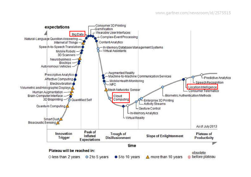
www.gartner.com/newsroom/id/2575515
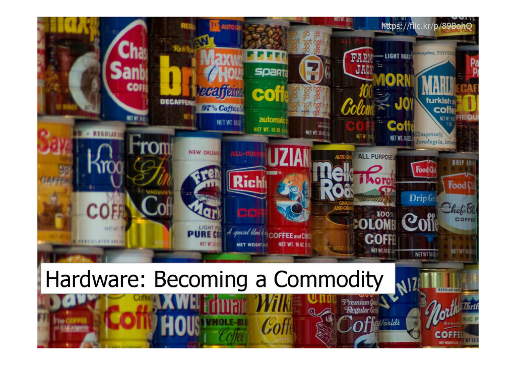
Hardware, Software, Data & People https://flic.kr/p/b7stL4
Hardware: Becoming a Commodity https://flic.kr/p/89BohQ
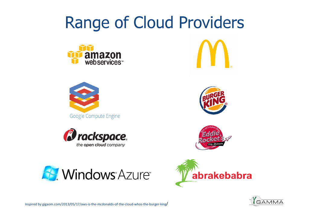
Range of Cloud Providers Inspired by gigaom.com/2013/05/17/aws-is-the-mcdonalds-of-the-cloud-whos-the-burger-king/
IaaS PaaS SaaS Transitioning to Services
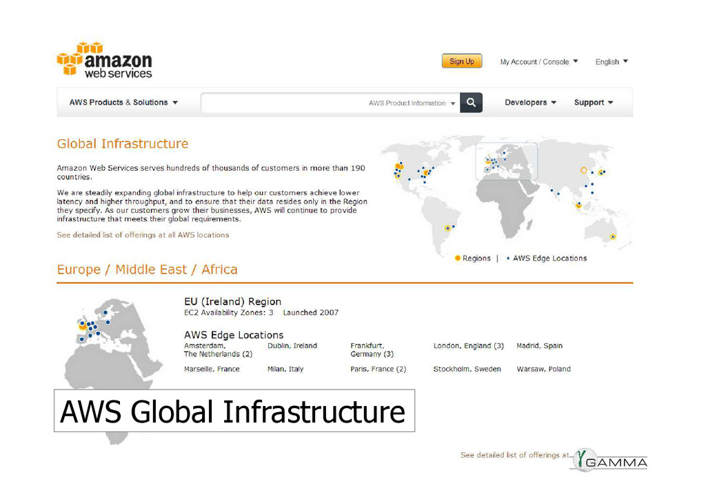
AWS Global Infrastructure
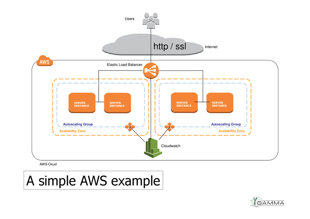
Availability Zone Availability Zone SERVER INSTANCE SERVER INSTANCE http /
ssl AWS Cloud SERVER INSTANCE SERVER INSTANCE Autoscaling Group Autoscaling Group Cloudwatch Elastic Load Balancer Users Internet A simple AWS example
Internet NAT Server Amazon RDS SQL Server VPN ELB ELB
Mapping ASG Spectrum ASG DynamoDB Amazon S3 ELB Amazon SQS Batch Spot ASG Low/Hi ASG Complex Configuration. Hybrid Approaches Amazon S3 DynamoDB ELB ELB ELB Reverse Proxy Routing ASG App ASG Spatial ASG Oracle 10g Postgres MDM Spatial Geocode
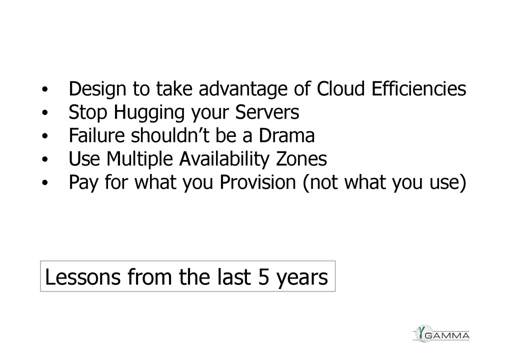
• Design to take advantage of Cloud Efficiencies • Stop
Hugging your Servers • Failure shouldn’t be a Drama • Use Multiple Availability Zones • Pay for what you Provision (not what you use) Lessons from the last 5 years
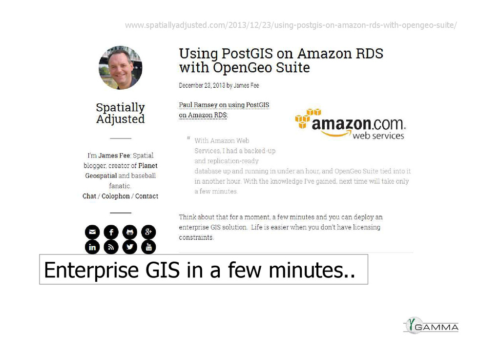
Enterprise GIS in a few minutes.. www.spatiallyadjusted.com/2013/12/23/using-postgis-on-amazon-rds-with-opengeo-suite/
Location: Ubiquitous for $1.50
Sensor Web becoming a reality? CityWatch.ie
Software: In Transition
The future of desktop GIS? @billdollins
Vendors iterating Desktop
Vendors embedding GIS into platforms
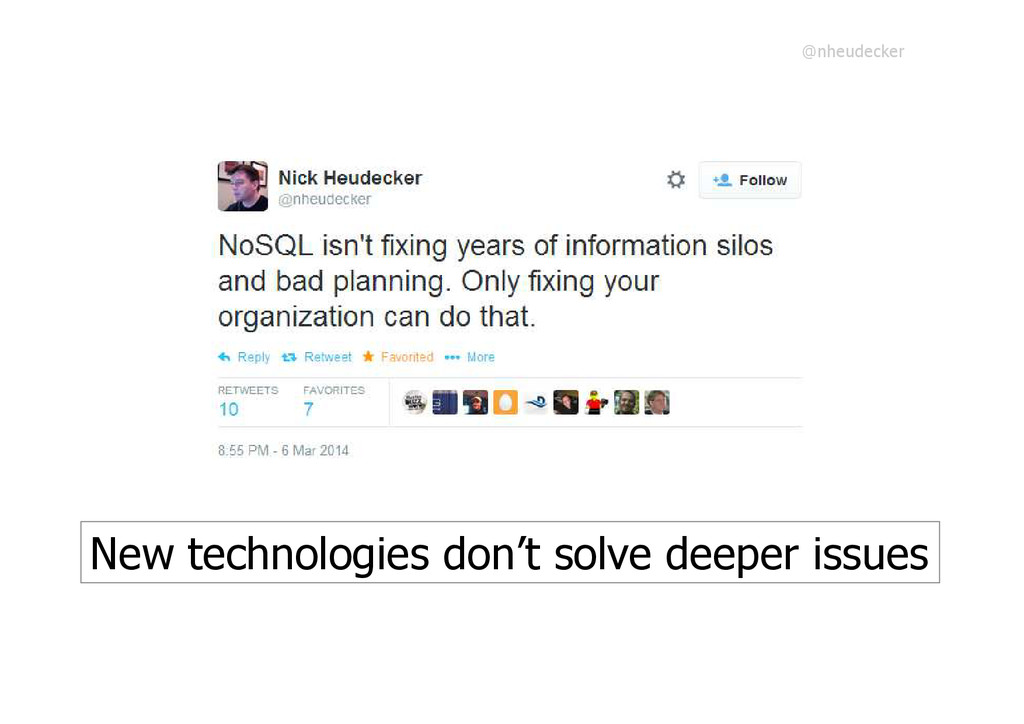
New technologies don’t solve deeper issues @nheudecker
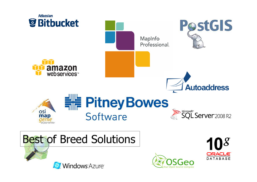
Best of Breed Solutions
Browsers: Becoming more capable
..mostly.
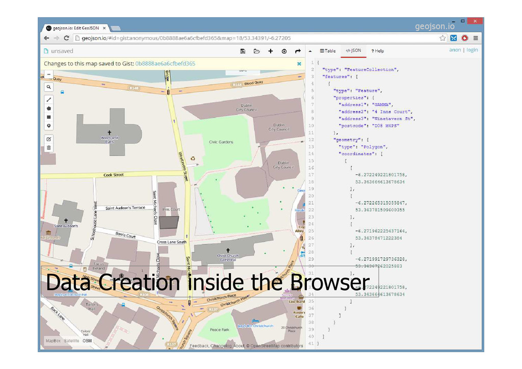
Data Creation inside the Browser geojson.io
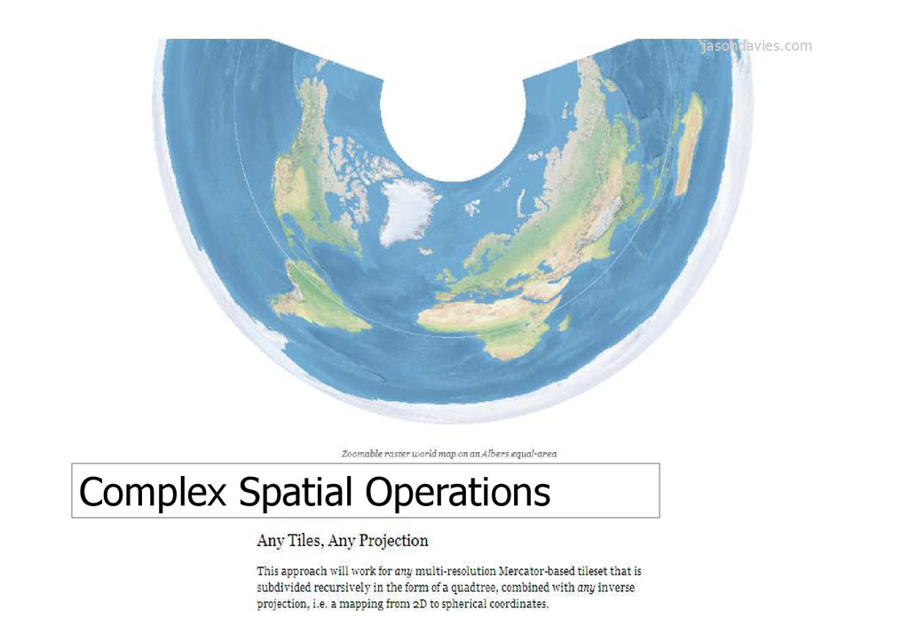
Complex Spatial Operations jasondavies.com
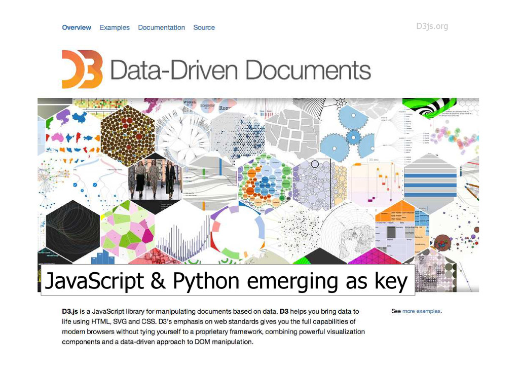
JavaScript & Python emerging as key D3js.org
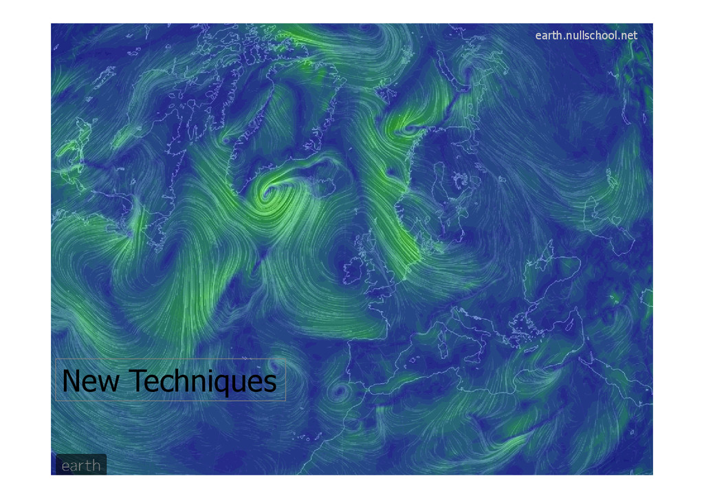
New Techniques earth.nullschool.net
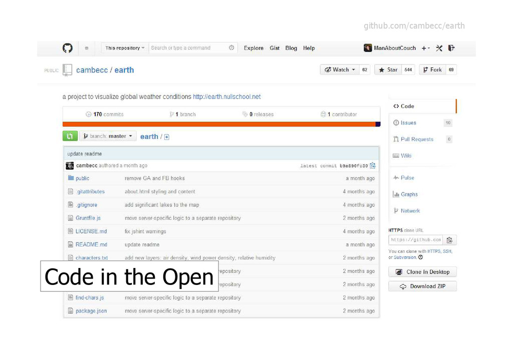
Code in the Open github.com/cambecc/earth
GitHub: Distributed versioning and collaboration
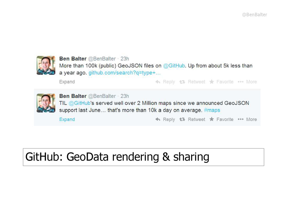
GitHub: GeoData rendering & sharing @BenBalter
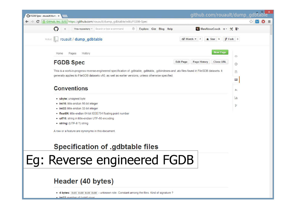
Eg: Reverse engineered FGDB github.com/rouault/dump_gdbtable
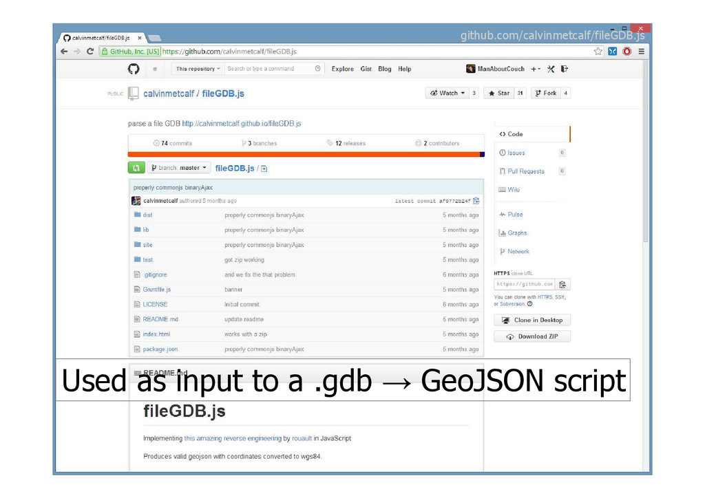
Used as input to a .gdb → GeoJSON script github.com/calvinmetcalf/fileGDB.js
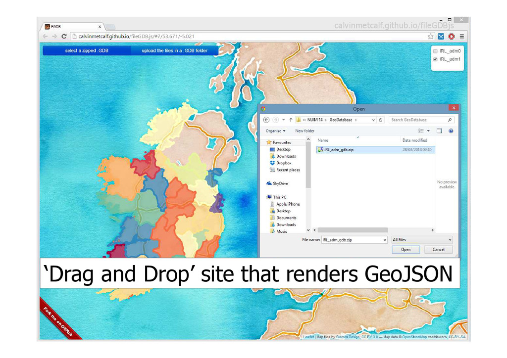
‘Drag and Drop’ site that renders GeoJSON calvinmetcalf.github.io/fileGDBjs
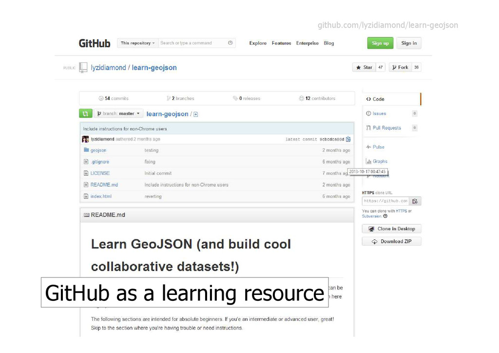
GitHub as a learning resource github.com/lyzidiamond/learn-geojson
Smart Tools: Dumb Formats flic.kr/p/4YMxp7
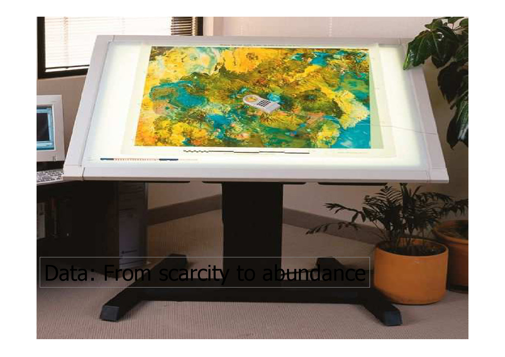
Data: From scarcity to abundance
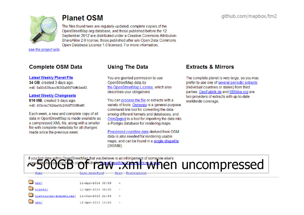
~500GB of raw .xml when uncompressed github.com/mapbox/tm2
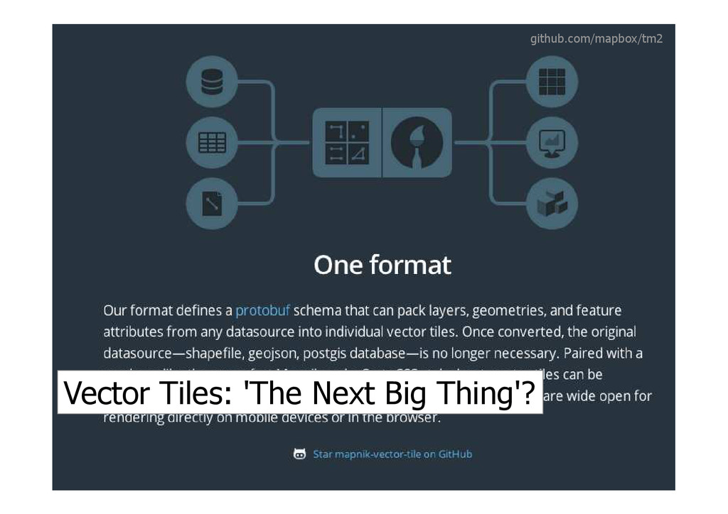
Vector Tiles: 'The Next Big Thing'? github.com/mapbox/tm2
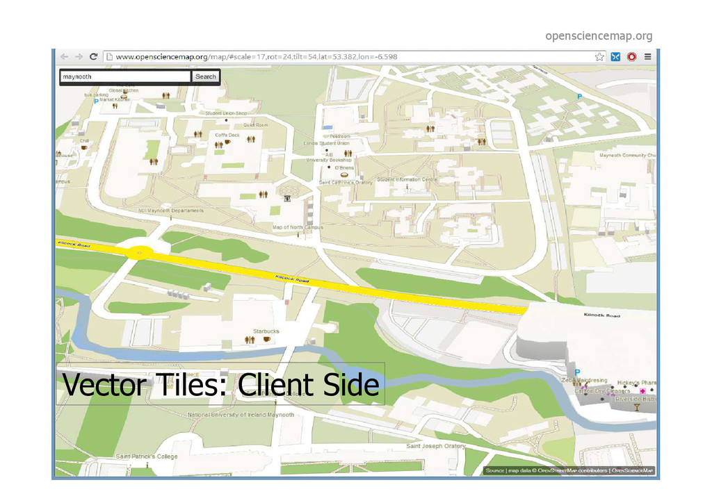
Vector Tiles: Client Side opensciencemap.org
Cartography: A new Golden Age?
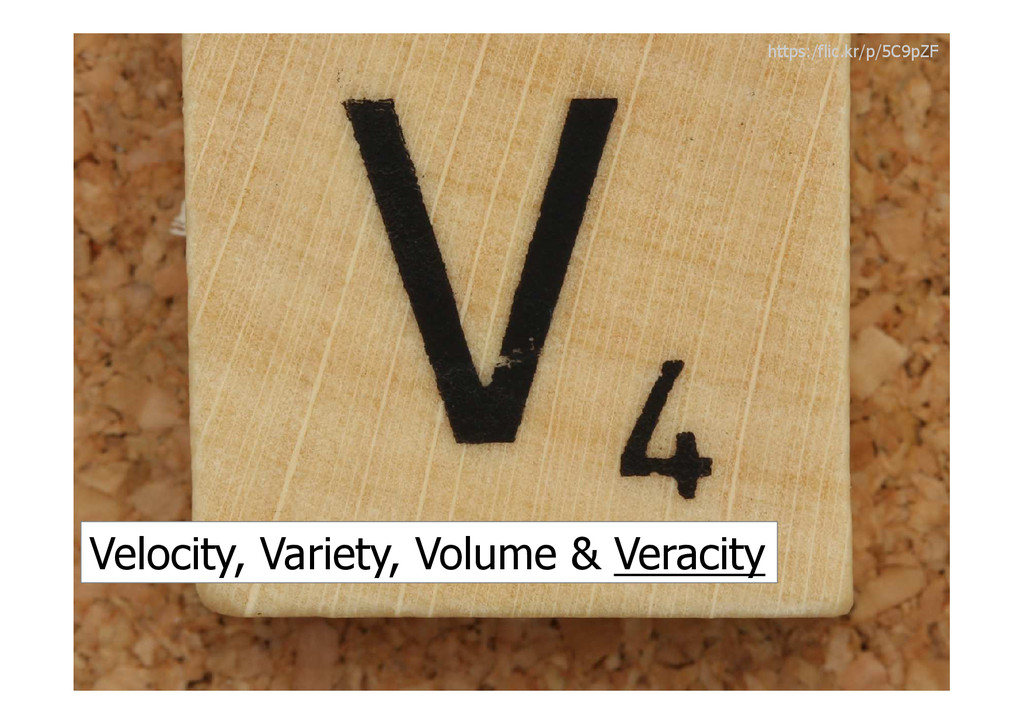
Velocity, Variety, Volume & Veracity https:/flic.kr/p/5C9pZF
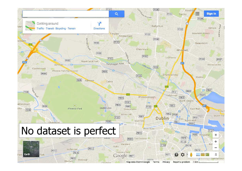
No dataset is perfect
Mapping isn't as easy as some thought
Domain Knowledge still key @Thierry_G
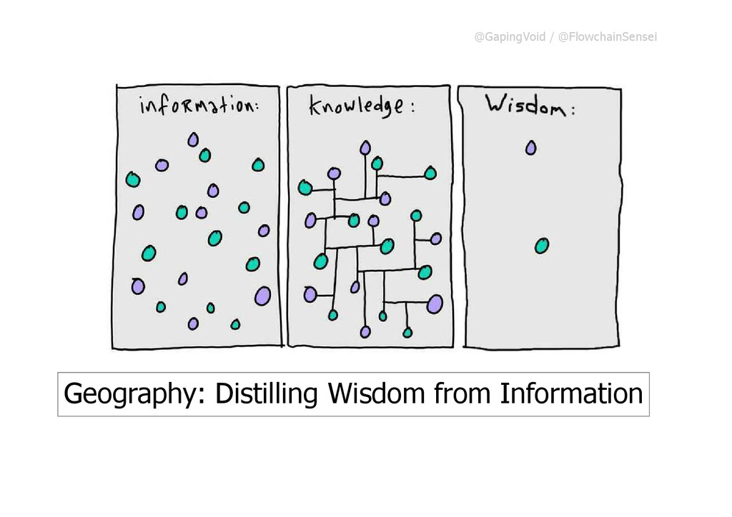
@GapingVoid / @FlowchainSensei Geography: Distilling Wisdom from Information Geography: Distilling
Wisdom from Information
(Some) Data becoming a commodity Vs
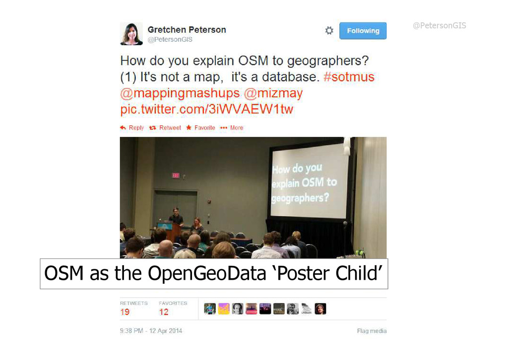
OSM as the OpenGeoData ‘Poster Child’ @PetersonGIS
https://flic.kr/p/N9J81F Spatial Data moving to the Main Datastore
Opportunities: Postcodes
Challenges: Move up the Value Chain flic.kr/p/4wUhRb
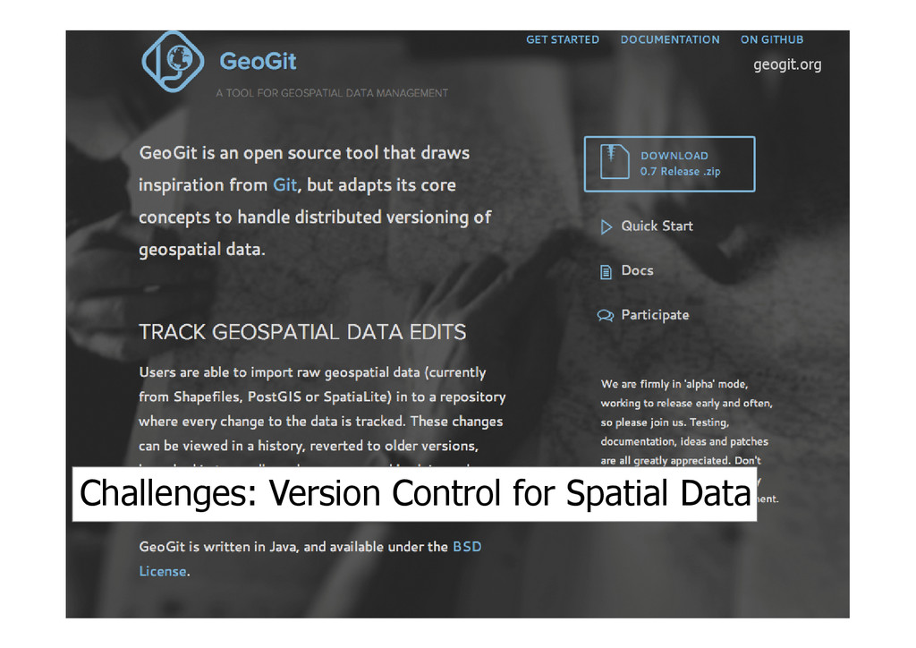
geogit.org Challenges: Version Control for Spatial Data
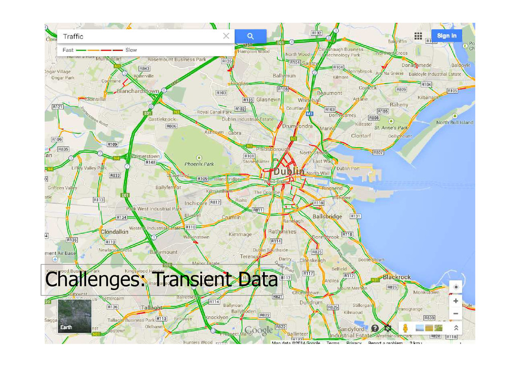
Challenges: Transient Data
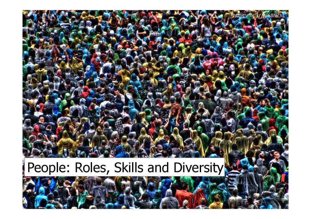
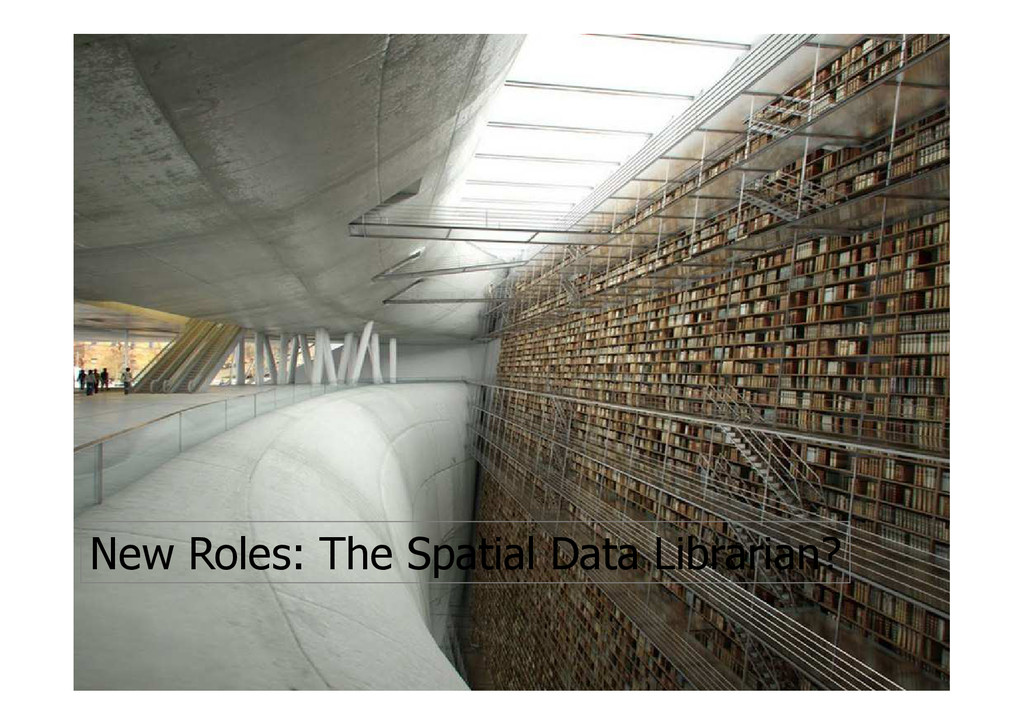
https:/flic.kr/p/68NZhL People: Roles, Skills and Diversity
New Roles: The Spatial Data Librarian?
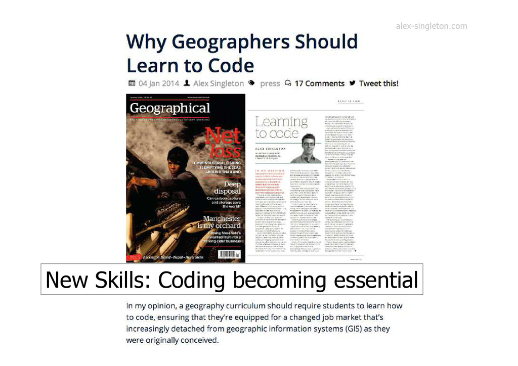
New Skills: Coding becoming essential alex-singleton.com
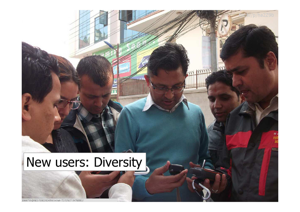
New users: Diversity flic.kr/p/ha2Z9b
New bad maps @NBCNews
“Everything flows, nothing stands still” en.wikipedia.org/wiki/Heraclitus
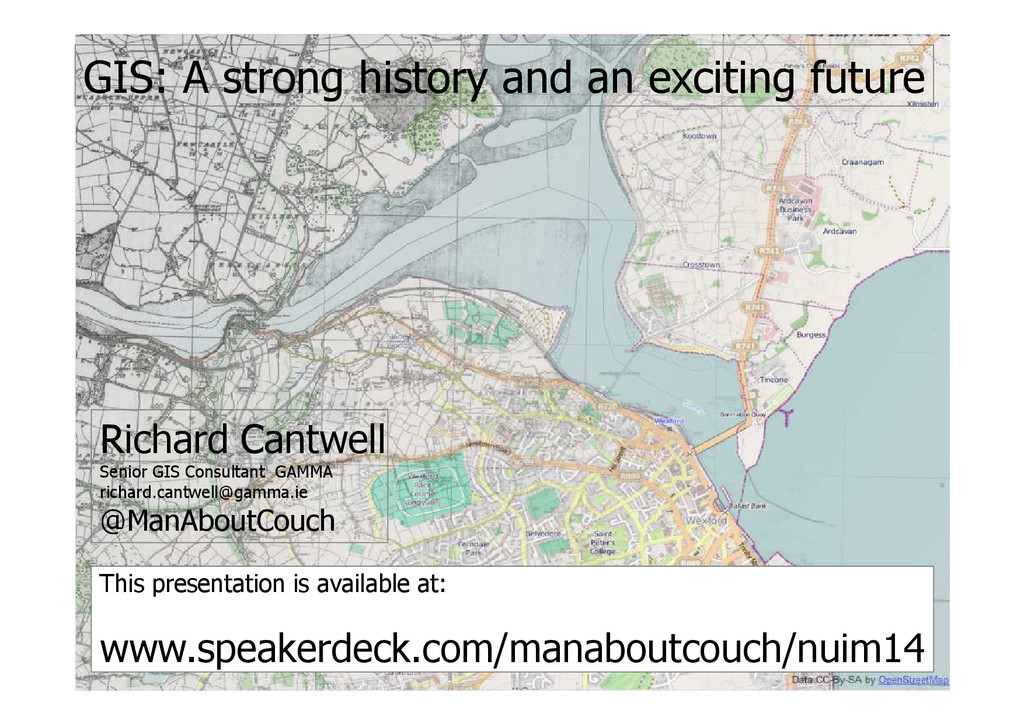
GIS: A strong history and an exciting future Richard Cantwell
Senior GIS Consultant GAMMA
[email protected]
@ManAboutCouch This presentation is available at: www.speakerdeck.com/manaboutcouch/nuim14