Decision Planning Sittichai Choosumrong, Venkatesh Raghavan, Daisuke Yoshida & Poliyapram Vinayaraj Graduate School for Creative Cities Osaka City University
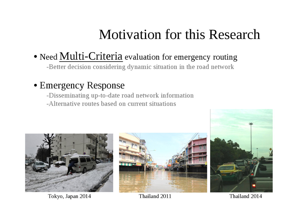
this Research • Need Multi-Criteria evaluation for emergency routing -Better decision considering dynamic situation in the road network • Emergency Response -Disseminating up-to-date road network information -Alternative routes based on current situations
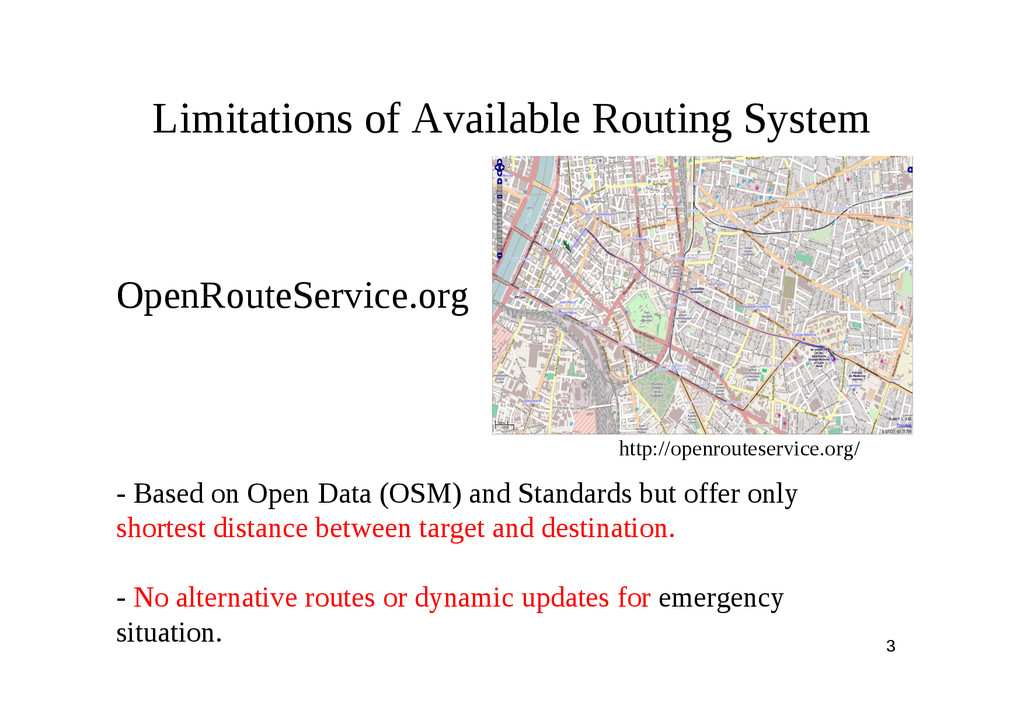
offer only shortest distance between target and destination. - No alternative routes or dynamic updates for emergency situation. http://openrouteservice.org/ OpenRouteService.org Limitations of Available Routing System
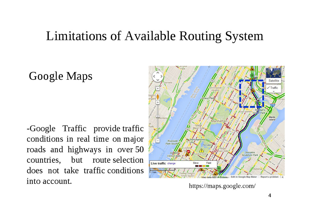
real time on major roads and highways in over 50 countries, but route selection does not take traffic conditions into account. Limitations of Available Routing System
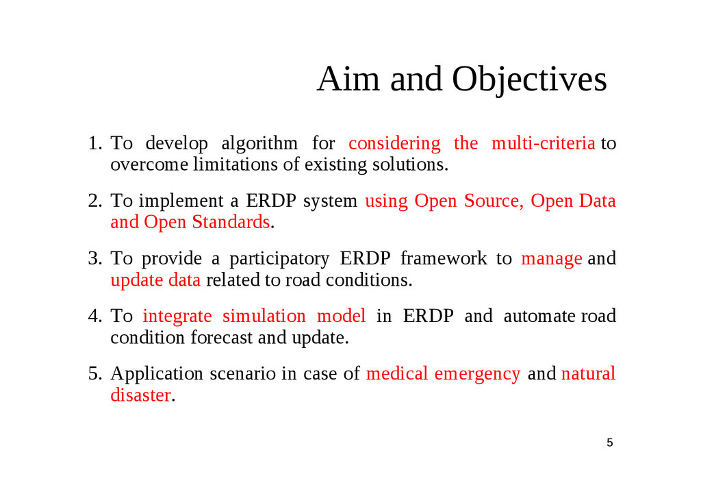
overcome limitations of existing solutions. 2. To implement a ERDP system using Open Source, Open Data and Open Standards. 3. To provide a participatory ERDP framework to manage and update data related to road conditions. 4. To integrate simulation model in ERDP and automate road condition forecast and update. 5. Application scenario in case of medical emergency and natural disaster. Aim and Objectives
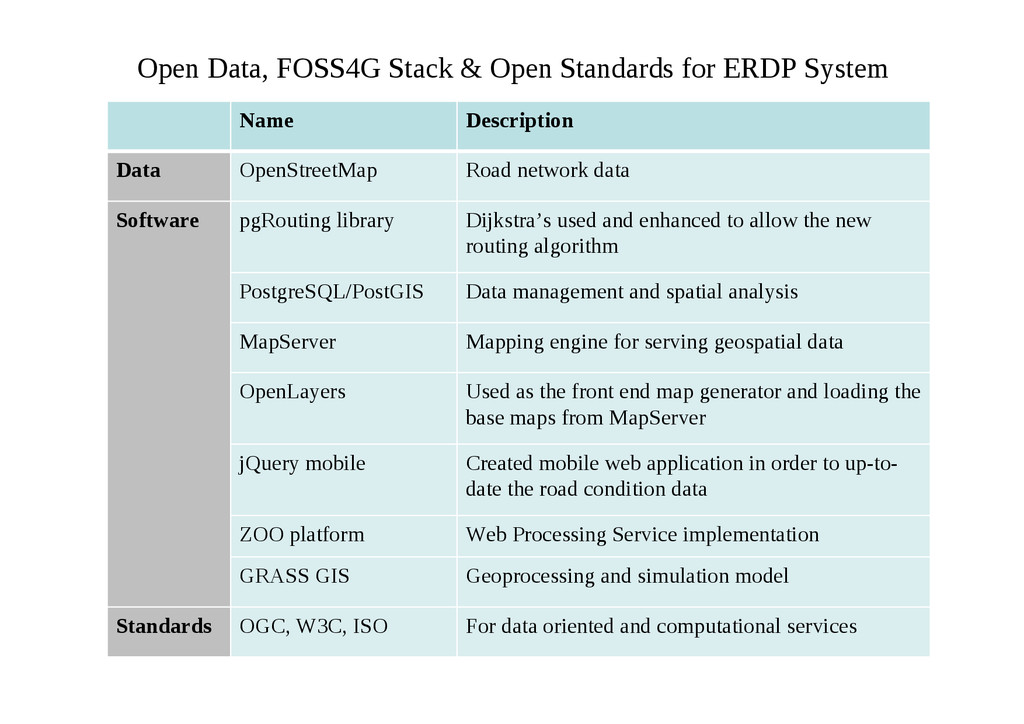
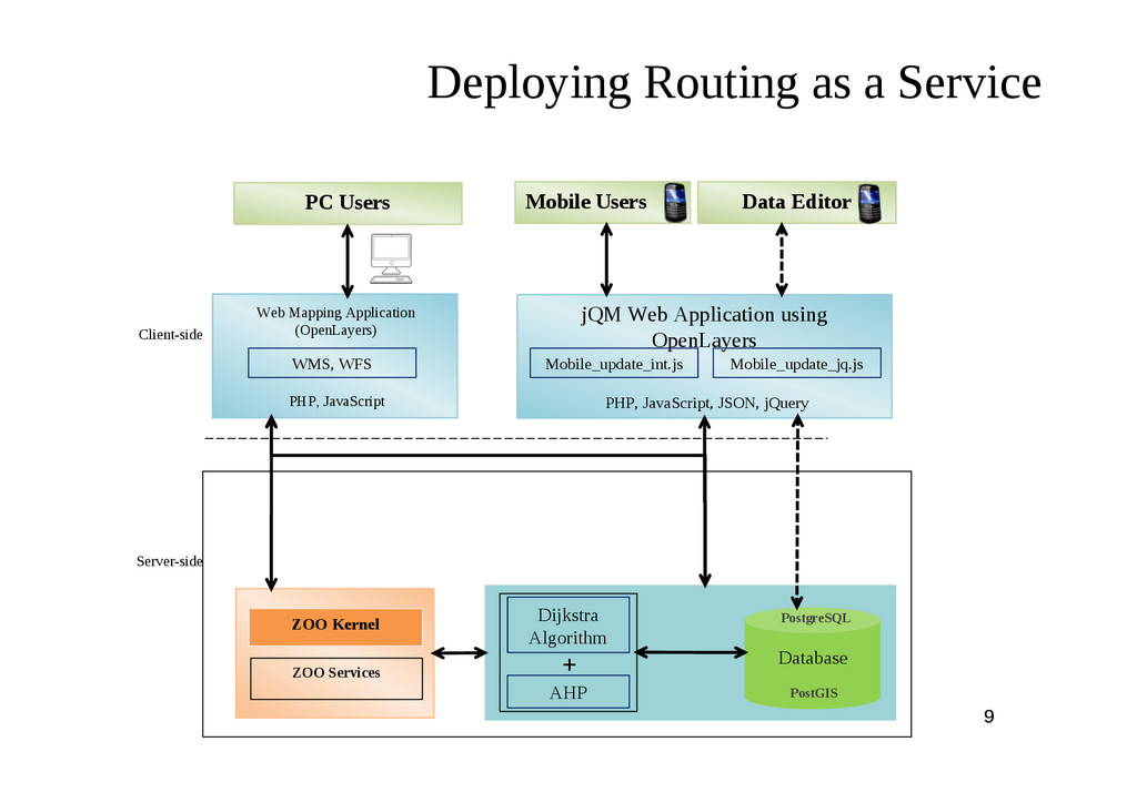
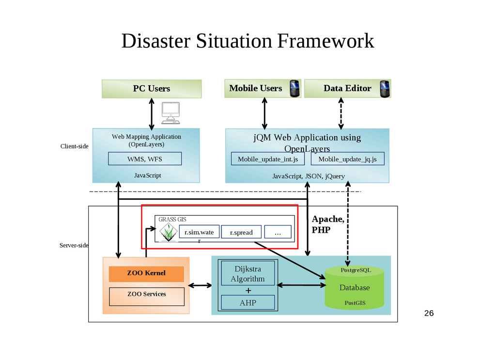
System Name Description Data OpenStreetMap Road network data Software pgRouting library Dijkstra’s used and enhanced to allow the new routing algorithm PostgreSQL/PostGIS Data management and spatial analysis MapServer Mapping engine for serving geospatial data OpenLayers Used as the front end map generator and loading the base maps from MapServer jQuery mobile Created mobile web application in order to up-to- date the road condition data ZOO platform Web Processing Service implementation GRASS GIS Geoprocessing and simulation model Standards OGC, W3C, ISO For data oriented and computational services
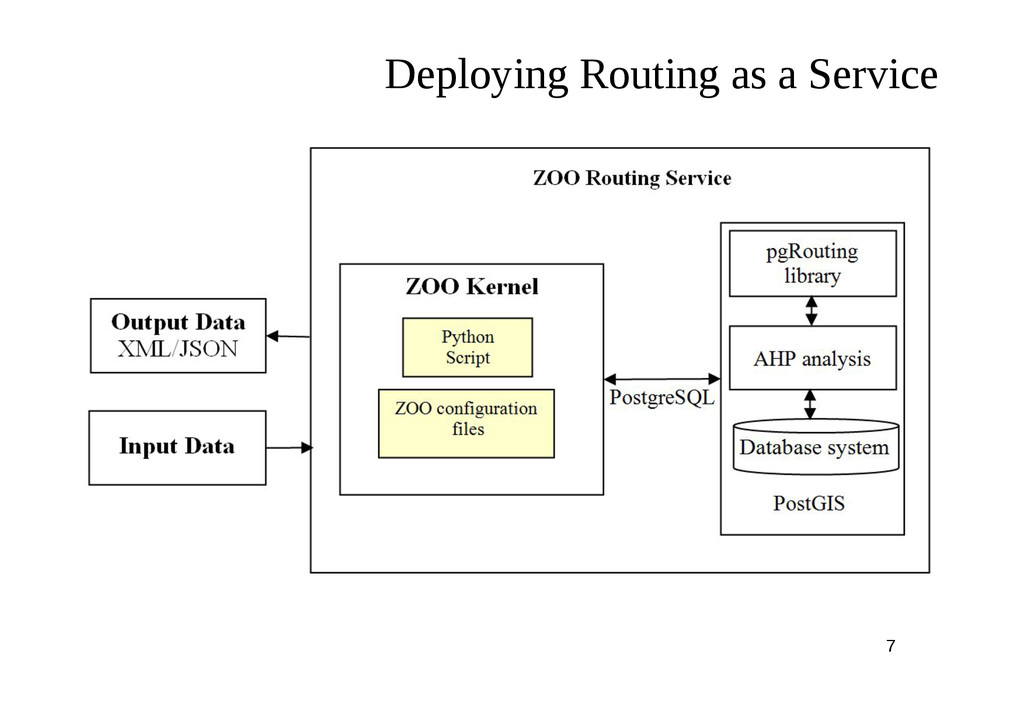
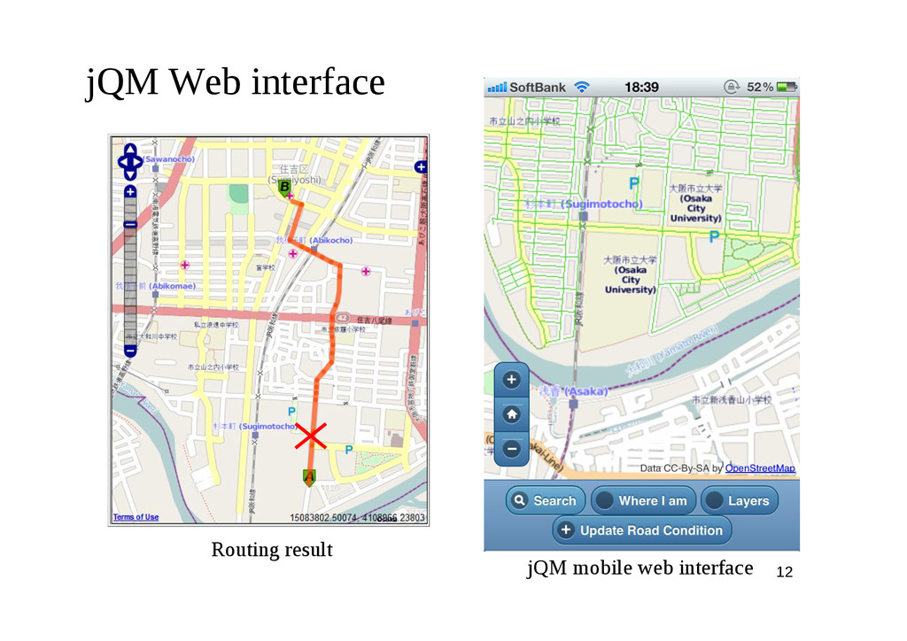
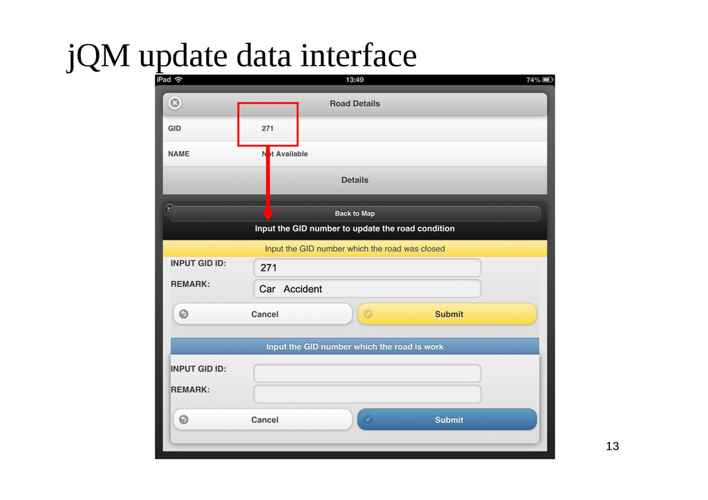
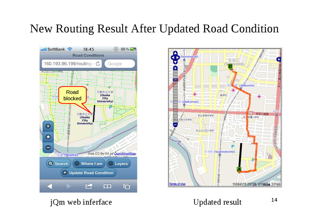
as a Service jQM Web Application using OpenLayers PHP, JavaScript, JSON, jQuery Mobile Users Data Editor Server-side PC Users Web Mapping Application (OpenLayers) PHP, JavaScript Client-side ZOO Kernel ZOO Services Mobile_update_jq.js Mobile_update_int.js WMS, WFS
and Dijkstra ’ s algorithm for routing decision planning in neurosurgical medical emergencies • But the system proposed by Ohta et al. (2007) does not address many issue related to dynamic routing, system implementation and data management. • ERDP computes routes with optimal travel time to hospital in proximity of accident site considering Multi-Criteria such as dynamic conditions of road network, the patient’s state and availability of medical facilities and expertise in the target hospital.
Available Beds Serious state Normal state Yes No Main Criteria: Sub- Criteria: Alternatives: Patient’s State Length Junction delay Speed limit Route1 Route2 …… Route n
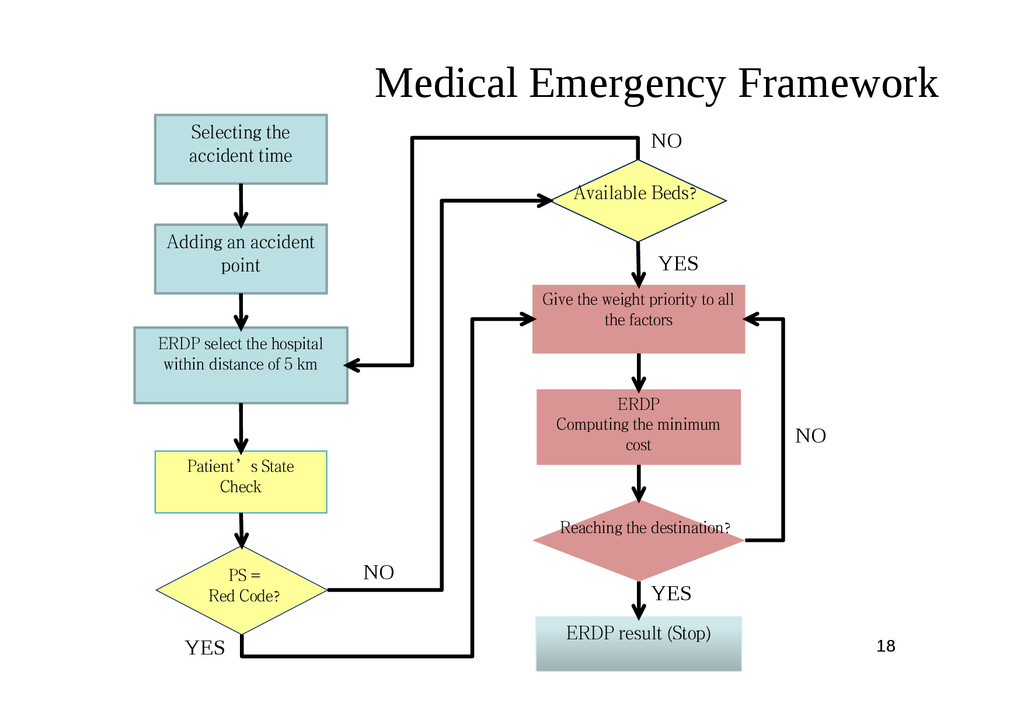
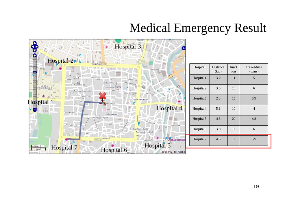
to all the factors ERDP Computing the minimum cost ERDP result (Stop) Reaching the destination? Selecting the accident time PS = Red Code? Adding an accident point ERDP select the hospital within distance of 5 km Patient’s State Check NO NO YES YES NO YES
part of this researches is; • more comprehensive and robust • addresses several limitations of above research • automatic update of road conditions based on flood forecast model • Open SOA Some existing research on enhancing the routing system in case of natural disaster (Albert et al., 2008 and Wang, 2012). Yang and Li (2010) and Mali et al., (2012), are also introduced combination of AHP and Dijkstra algorithm for emergency routing.
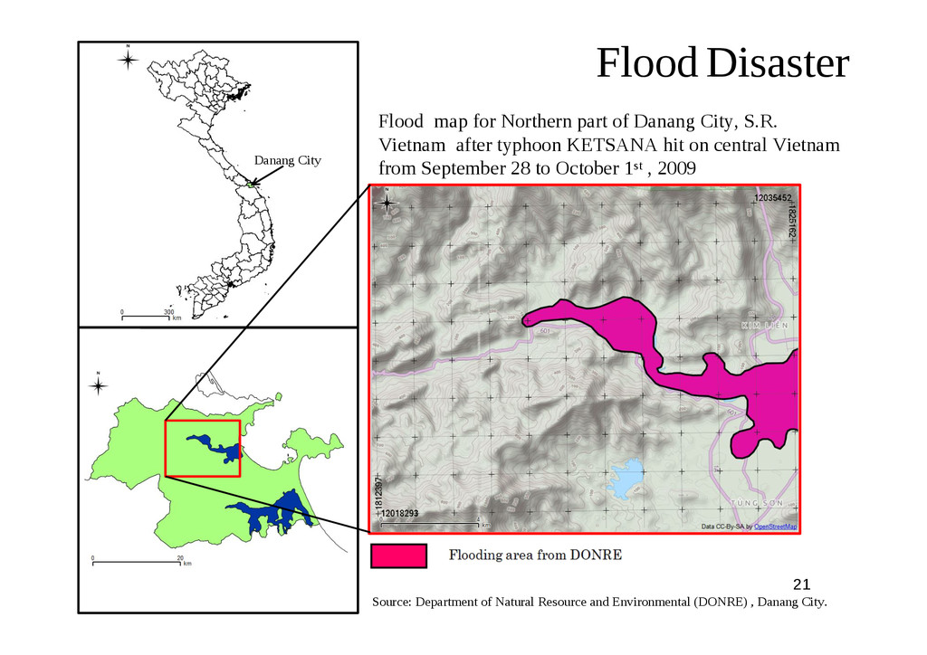
City, S.R. Vietnam after typhoon KETSANA hit on central Vietnam from September 28 to October 1st , 2009 Source: Department of Natural Resource and Environmental (DONRE) , Danang City. Danang City
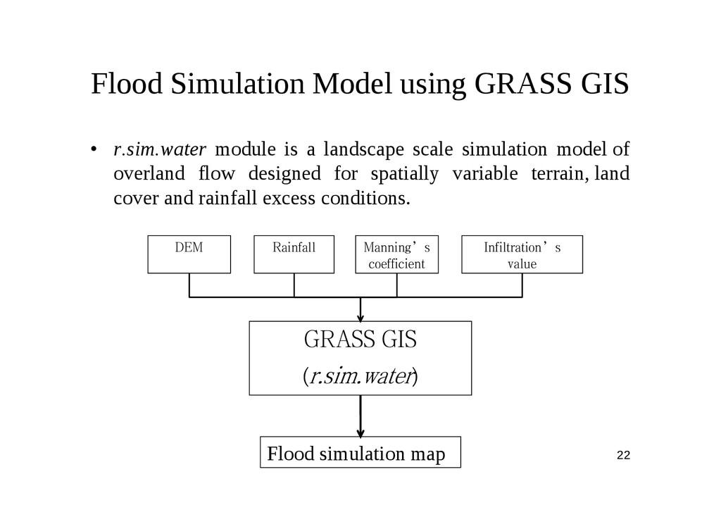
is a landscape scale simulation model of overland flow designed for spatially variable terrain, land cover and rainfall excess conditions. GRASS GIS (r.sim.water) DEM Rainfall Manning’s coefficient Infiltration’s value Flood simulation map
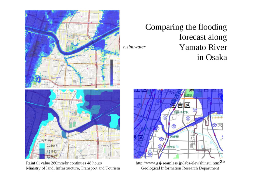
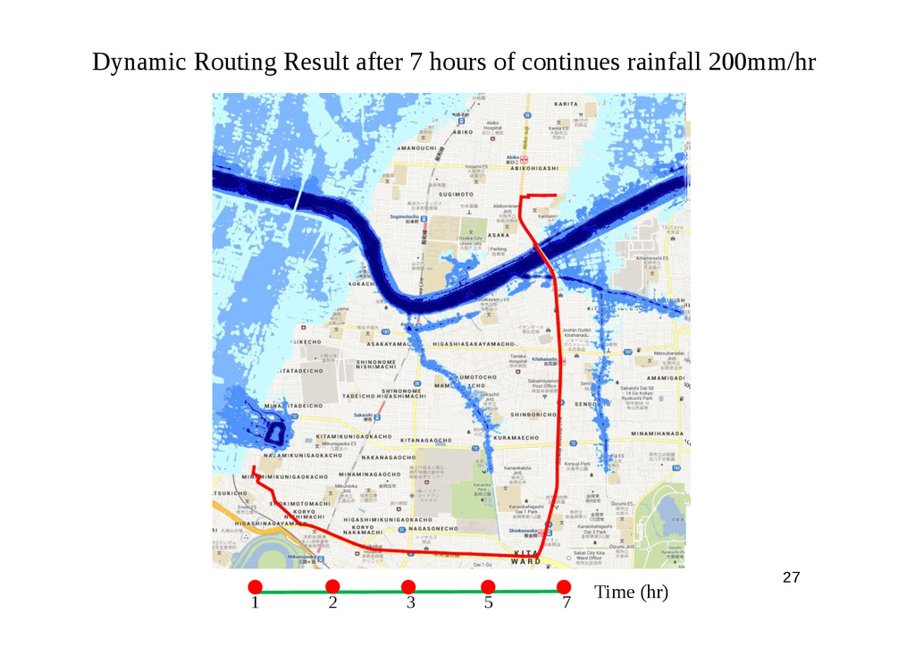
Rainfall value 280mm/hr continues 48 hours http://www.gsj-seamless.jp/labs/elev/shinsui.html Ministry of land, Infrastructure, Transport and Tourism Geological Information Research Department r.sim.water
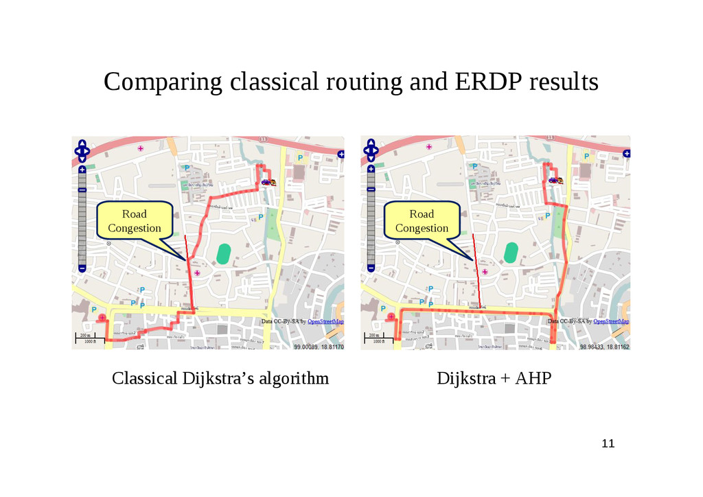
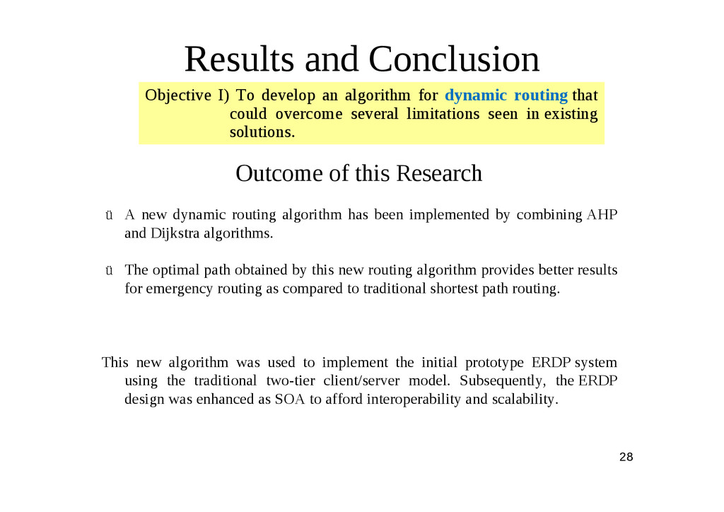
new dynamic routing algorithm has been implemented by combining AHP and Dijkstra algorithms. ü The optimal path obtained by this new routing algorithm provides better results for emergency routing as compared to traditional shortest path routing. This new algorithm was used to implement the initial prototype ERDP system using the traditional two-tier client/server model. Subsequently, the ERDP design was enhanced as SOA to afford interoperability and scalability. Objective I) To develop an algorithm for dynamic routing that could overcome several limitations seen in existing solutions.
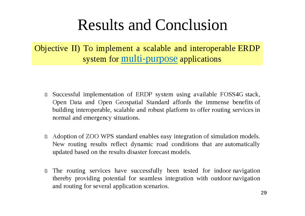
using available FOSS4G stack, Open Data and Open Geospatial Standard affords the immense benefits of building interoperable, scalable and robust platform to offer routing services in normal and emergency situations. ü Adoption of ZOO WPS standard enables easy integration of simulation models. New routing results reflect dynamic road conditions that are automatically updated based on the results disaster forecast models. ü The routing services have successfully been tested for indoor navigation thereby providing potential for seamless integration with outdoor navigation and routing for several application scenarios. Objective II) To implement a scalable and interoperable ERDP system for multi-purpose applications
application capable to query and update road network from mobile devices. ü The ERDP system can be deployed at very low cost ü amenable to easy customization, localization and further enhancements ü particularly useful for Asian mega-cities with increasingly complex and heavily used road network, rise in frequency of disaster events and high penetration of mobile devices with internet connectivity. Objective III) Cost effective, flexible & Participatory ERDP framework.
considering additional impedance factors such traffic volume, mass density, slope, snow etc. • Incorporation of other simulation and forecast model for fire spread, debris flow, tsunami and other natural disaster. Several models pertaining to such disaster are available in GRASS GIS and can be easily integrated into the ERDP as demonstrated in the present research. • Support for OGC Sensor Web Enablement (SWE) standards, wherein data such as CCTV cameras, weather stations etc. that could automatically be received from field and provide routing reflecting such data inputs. • Implementation of Web Service chaining framework from service discovery to execution, allowing the user to find-bind-publish geospatial information for ERDP.