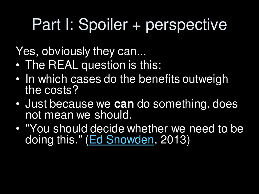
The REAL question is this: • In which cases do the benefits outweigh the costs? • Just because we can do something, does not mean we should. • "You should decide whether we need to be doing this." (Ed Snowden, 2013)
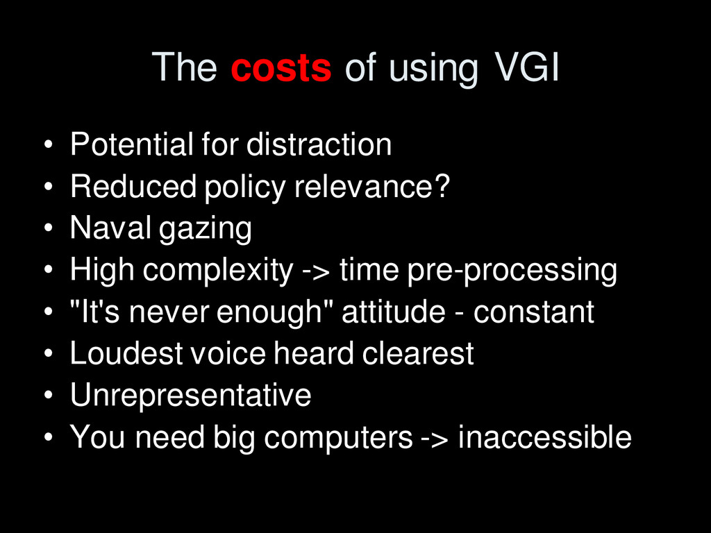
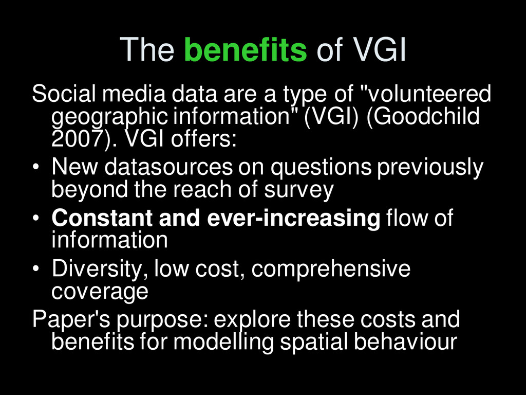
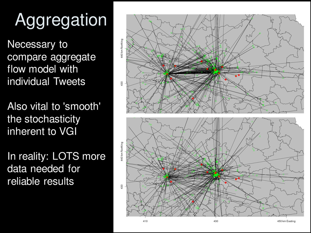
of "volunteered geographic information" (VGI) (Goodchild 2007). VGI offers: • New datasources on questions previously beyond the reach of survey • Constant and ever-increasing flow of information • Diversity, low cost, comprehensive coverage Paper's purpose: explore these costs and benefits for modelling spatial behaviour
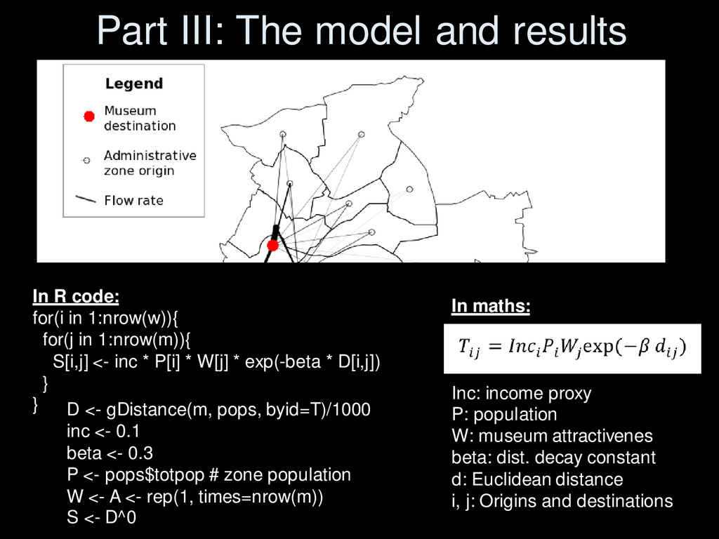
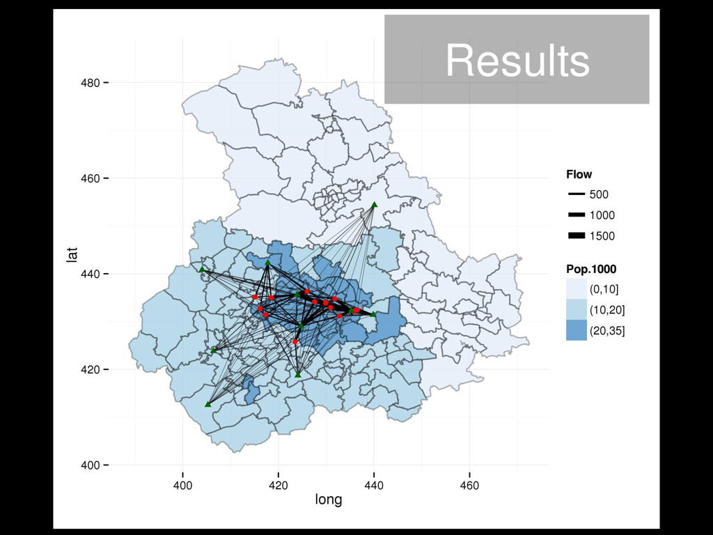
in 1:nrow(w)){ for(j in 1:nrow(m)){ S[i,j] <- inc * P[i] * W[j] * exp(-beta * D[i,j]) } } In maths: Inc: income proxy P: population W: museum attractivenes beta: dist. decay constant d: Euclidean distance i, j: Origins and destinations D <- gDistance(m, pops, byid=T)/1000 inc <- 0.1 beta <- 0.3 P <- pops$totpop # zone population W <- A <- rep(1, times=nrow(m)) S <- D^0
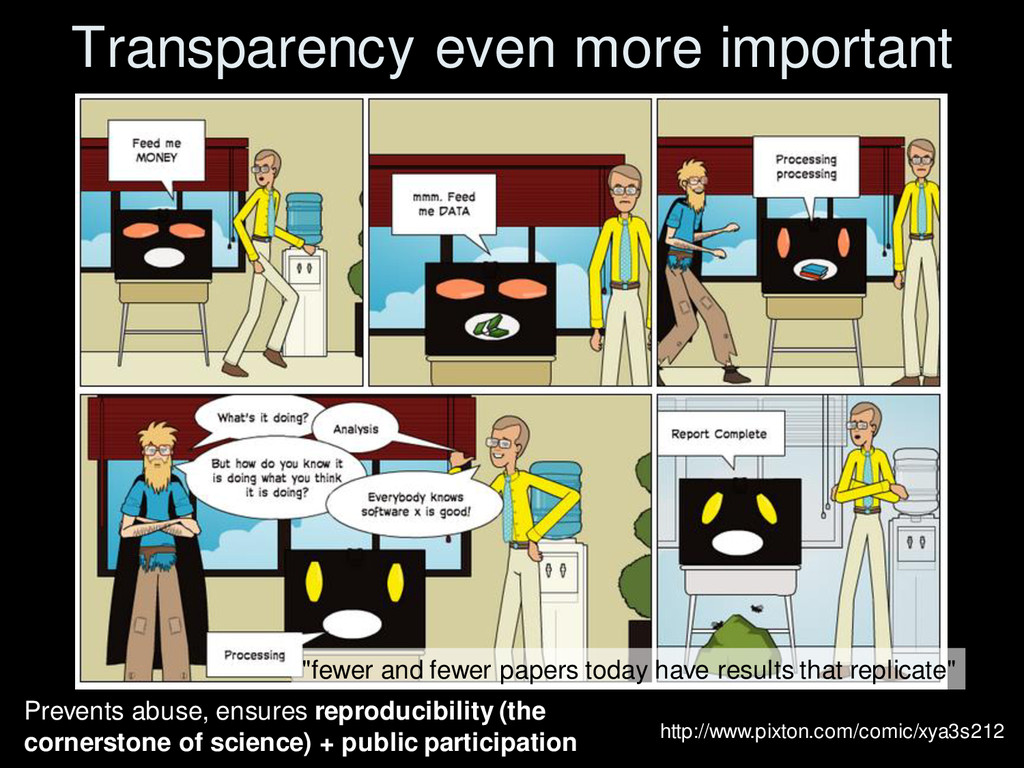
• Large methodological implications – New ways to corroborate theoretical models – Some reproducible code for using geo Tweets • Ethical issues raised – Who created the dataset? Who owns it? Who will benefit from it? – Payment of public $$$ to private companies for the public's data? (CDRC Leeds) http://www.pixton.com/comic/xya3s212
version of cherry-picking that destroys the entire spirit of research and makes the abundance of data extremely harmful to knowledge." (Taleb 2012, 416)
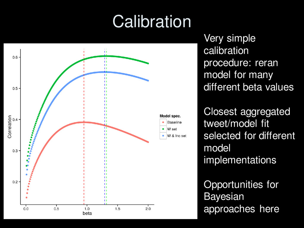
Geo-spatial information science (Preprint on arXiv.org) • Discussion paper on broader issues – Suggestions of where to publish? • Working paper on spatial interaction models in R building on Dennet (2012)
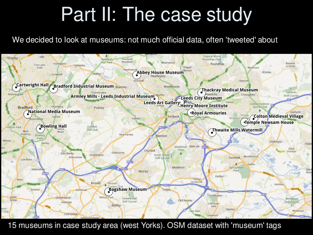
• Where little/no official data but verification possible VGI from Social Media is useful – Phenomena that are ephemeral, so not conducive to standard surveys • Situations where people actually have time to Tweet • Subjects that can be 'geovalidated' – Eg: road safety perceptions, visits to cinemas, geo- behavioural demographics • Where application is clearly for public benefit • Use social media data for public engagement
paper • Check Snowden, E. (2013). Interview with Glen Greenwald - Full Transcript. • Reproducible code available on rpubs.com/robinlovelace • See how to set up your very own 'Twitter Listener' • Check out the 'big data backlash' (Taleb 2012 on Wired.com) • Slides available from robinlovelace.net
locations:’get me started in'spatial interaction modelling. UCL Working Papers Series, 44(0), 0–24. • Taleb, N. N. (2012). Antifragile: things that gain from disorder. Random House LLC. • Lovelace, R., Malleson, N., Harland, K., & Birkin, M. (2014). Geotagged tweets to inform a spatial interaction model: a case study of museums. arXiv preprint arXiv:1403.5118.
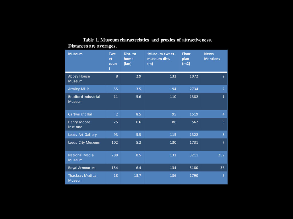
averages. Museum Twe et coun t Dist. to home (km) ‘Museum tweet- museum dist. (m) Floor plan (m2) News Mentions Abbey House Museum 8 2.9 132 1072 2 Armley Mills 55 3.5 194 2734 2 Bradford Industrial Museum 11 5.6 110 1382 1 Cartwright Hall 2 8.5 95 1519 4 Henry Moore Institute 25 6.6 86 562 5 Leeds Art Gallery 93 5.5 115 1322 8 Leeds City Museum 102 5.2 130 1731 7 National Media Museum 288 8.5 131 3211 252 Royal Armouries 154 6.4 134 5180 36 Thackray Medical Museum 18 13.7 136 1790 5
![The impact of "too much" data [Big data is] "a](https://files.speakerdeck.com/presentations/6db3cca0a7d90131f453524187cb86b1/slide_13.jpg)