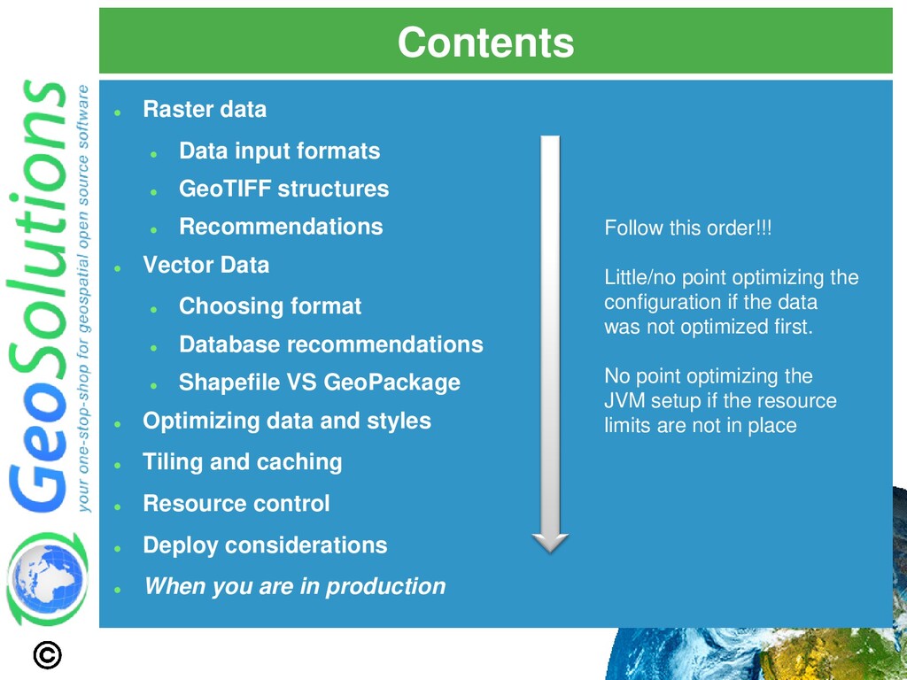
structures ⚫ Recommendations ⚫ Vector Data ⚫ Choosing format ⚫ Database recommendations ⚫ Shapefile VS GeoPackage ⚫ Optimizing data and styles ⚫ Tiling and caching ⚫ Resource control ⚫ Deploy considerations ⚫ When you are in production Follow this order!!! Little/no point optimizing the configuration if the data was not optimized first. No point optimizing the JVM setup if the resource limits are not in place
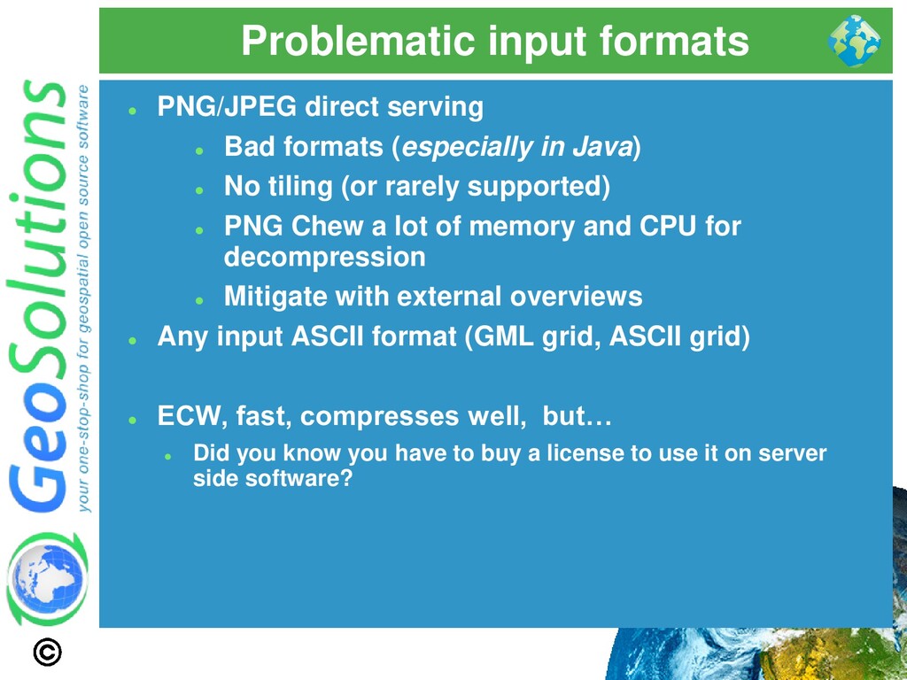
(especially in Java) ⚫ No tiling (or rarely supported) ⚫ PNG Chew a lot of memory and CPU for decompression ⚫ Mitigate with external overviews ⚫ Any input ASCII format (GML grid, ASCII grid) ⚫ ECW, fast, compresses well, but… ⚫ Did you know you have to buy a license to use it on server side software?
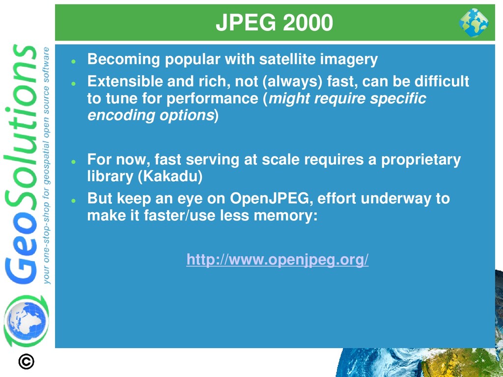
and rich, not (always) fast, can be difficult to tune for performance (might require specific encoding options) ⚫ For now, fast serving at scale requires a proprietary library (Kakadu) ⚫ But keep an eye on OpenJPEG, effort underway to make it faster/use less memory: http://www.openjpeg.org/
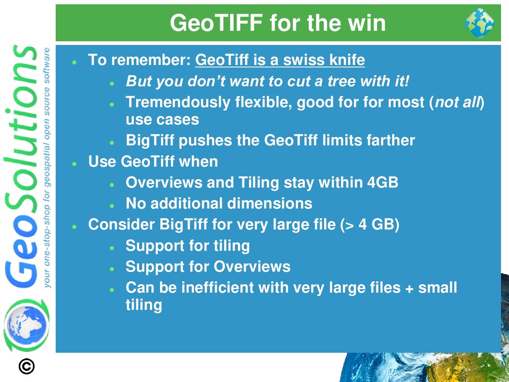
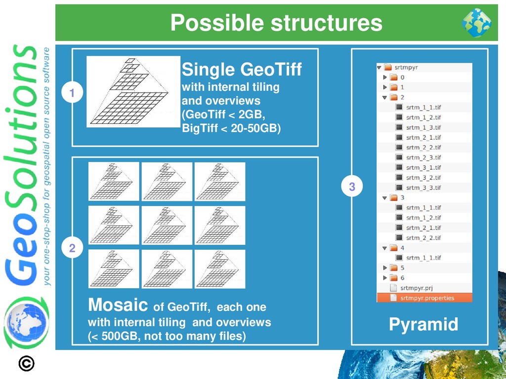
swiss knife ⚫ But you don’t want to cut a tree with it! ⚫ Tremendously flexible, good for for most (not all) use cases ⚫ BigTiff pushes the GeoTiff limits farther ⚫ Use GeoTiff when ⚫ Overviews and Tiling stay within 4GB ⚫ No additional dimensions ⚫ Consider BigTiff for very large file (> 4 GB) ⚫ Support for tiling ⚫ Support for Overviews ⚫ Can be inefficient with very large files + small tiling
GeoTiff is generally a good fit ⚫ Use ImageMosaic when: ⚫ A single file gets too big (inefficient seeks, too much metadata to read, etc..) ⚫ Multiple Dimensions (time, elevation, others..) ⚫ Avoid mosaics made of many very small files ⚫ Single granules can be large ⚫ Use Tiling + Overviews + Compression on granules ⚫ Use ImagePyramid when: ⚫ Tremendously large dataset ⚫ Too many files / too large files ⚫ Need to serve at all scales ⚫ Especially low resolution
reproject) ⚫ Compress (eventually) ⚫ Retile, add overviews ⚫ Get all the details in our training material: http://geoserver.geo-solutions.it/edu/en/raster_data/index.html
generate even if you're not using S3 storage ⚫ GeoServer (gt-s3-geotiff ) supports Amazon S3 storage of single GeoTIFFs. ⚫ Need to go mosaic? On Linux, mount S3 bucket using FUSE ⚫ Work under-way to improve support for native COG support and mosaics of COGs https://www.cogeo.org/
the best query planner for spatial and plans every query based on the query parameter (GIS makes for wildly different optimal plans depending on the bbox you queried) ⚫ Rich support for complex native filters ⚫ Use connection pooling ⚫ Validate connections (with proper pooling) ⚫ Table Clustering ⚫ Spatial and Alphanumeric Indexing ⚫ Spatial and Alphanumeric Indexing ⚫ Spatial and Alphanumeric Indexing ⚫ … ⚫ Did we mention indexes?
to the number of concurrent requests you want to serve (obvious no?) ⚫ Activate connection validation ⚫ Mind networking tools that might cut connections sitting idle (yes, your server is not always busy), they might cut the connection in “bad” ways (10 minutes timeout before the pool realizes the TCP connection attempt gives up) ⚫ Read more ⚫ Advanced Database Connection Pooling Configuration ⚫ DBMS Connections Params Explained
if you are not filtering on attributes, but just on the bounding box ⚫ Especially, much faster if by any reason you want to display millions of features in a single shot, like this road network of Texas (3 million roads in a tiny map):
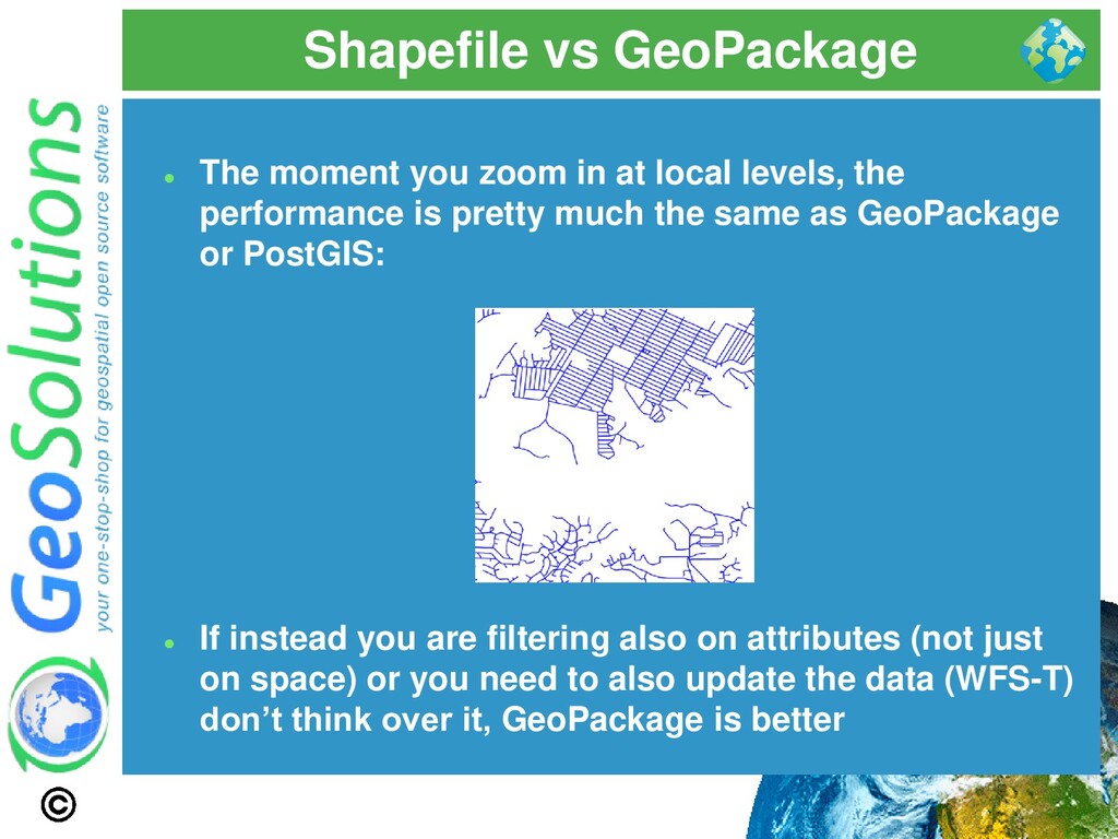
local levels, the performance is pretty much the same as GeoPackage or PostGIS: ⚫ If instead you are filtering also on attributes (not just on space) or you need to also update the data (WFS-T) don’t think over it, GeoPackage is better
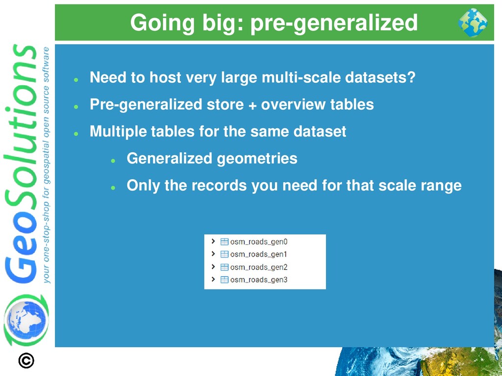
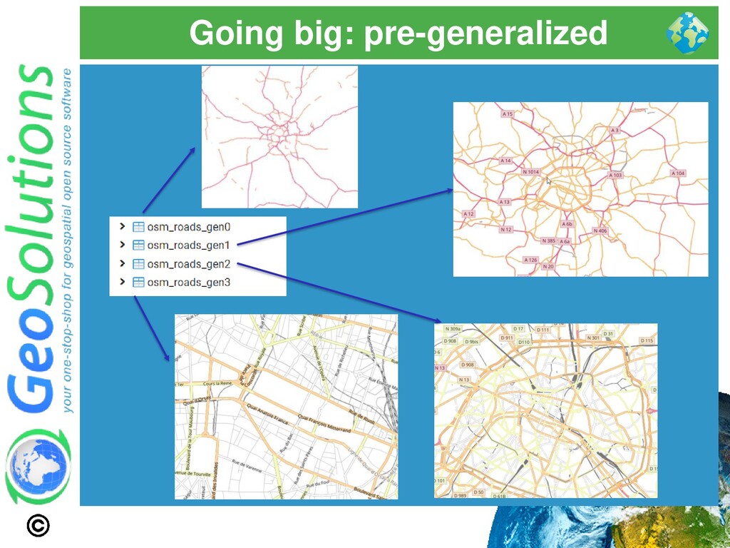
datasets? ⚫ Pre-generalized store + overview tables ⚫ Multiple tables for the same dataset ⚫ Generalized geometries ⚫ Only the records you need for that scale range
and type in ('motorway', 'trunk') tolerance: 900.0 roads_gen1: source: roads_gen2 sql_filter: (class = 'highway' and type IN ('motorway', 'trunk', 'primary')) OR (class = 'railway' and type IN ('funicular','light_rail','narrow_gauge')) tolerance: 450.0 roads_gen2: source: roads_gen3 sql_filter: (class = 'highway' and type IN ('motorway', 'motorway_link', 'trunk', 'trunk_link', 'primary', 'primary_link', 'secondary', 'secondary_link')) OR (class = 'railway' and type IN ('funicular','light_rail','narrow_gauge')) tolerance: 300.0 roads_gen3:… ⚫ Generalized geometries ⚫ Only the records you need for that scale range
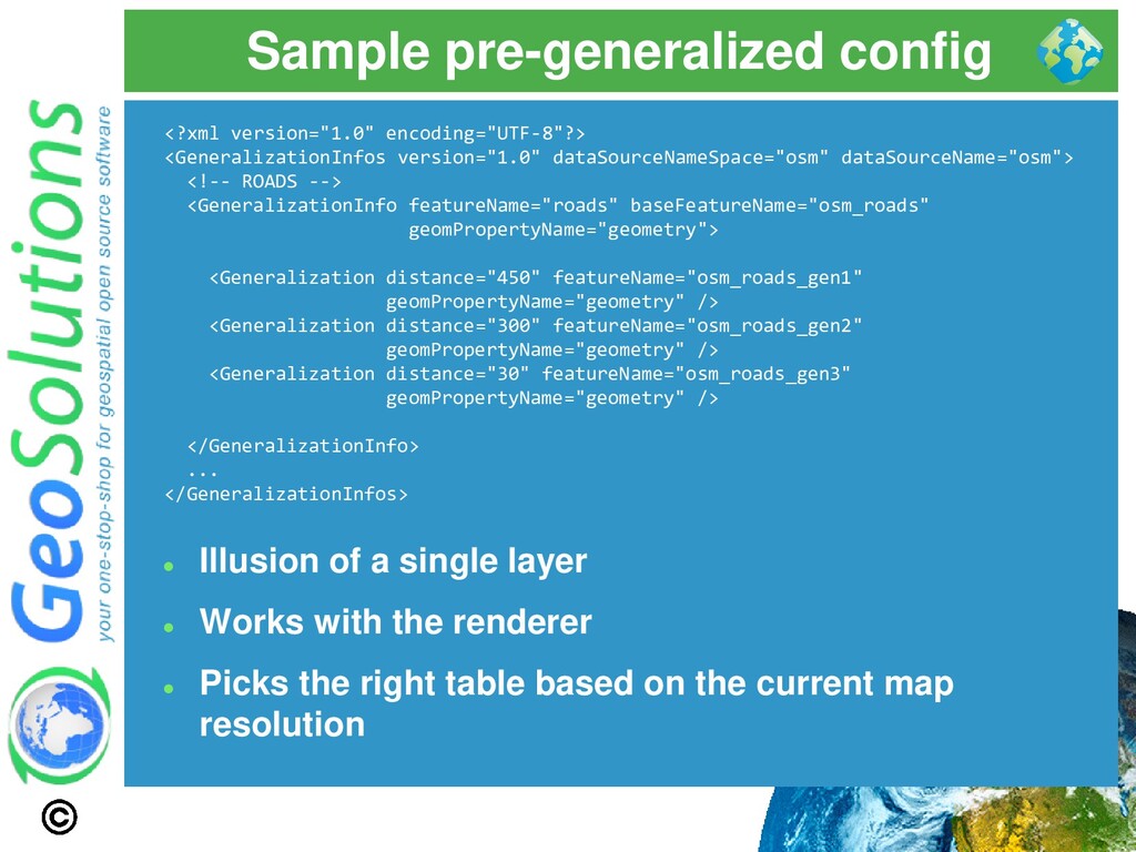
<!-- ROADS --> <GeneralizationInfo featureName="roads" baseFeatureName="osm_roads" geomPropertyName="geometry"> <Generalization distance="450" featureName="osm_roads_gen1" geomPropertyName="geometry" /> <Generalization distance="300" featureName="osm_roads_gen2" geomPropertyName="geometry" /> <Generalization distance="30" featureName="osm_roads_gen3" geomPropertyName="geometry" /> </GeneralizationInfo> ... </GeneralizationInfos> ⚫ Illusion of a single layer ⚫ Works with the renderer ⚫ Picks the right table based on the current map resolution
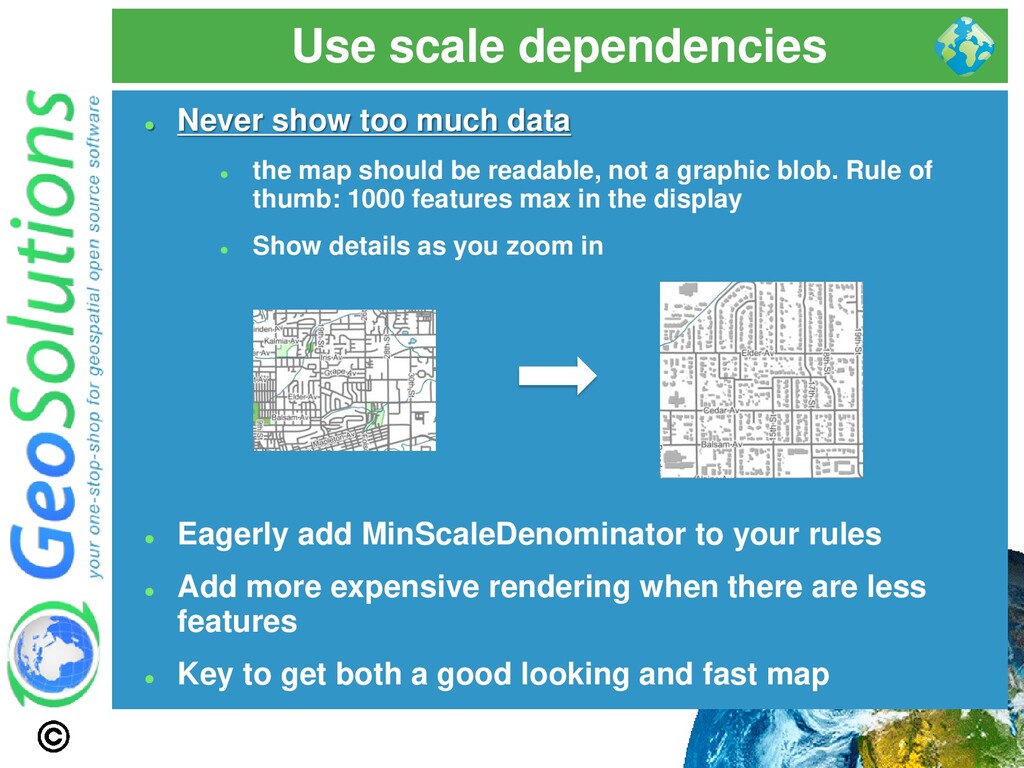
the map should be readable, not a graphic blob. Rule of thumb: 1000 features max in the display ⚫ Show details as you zoom in ⚫ Eagerly add MinScaleDenominator to your rules ⚫ Add more expensive rendering when there are less features ⚫ Key to get both a good looking and fast map
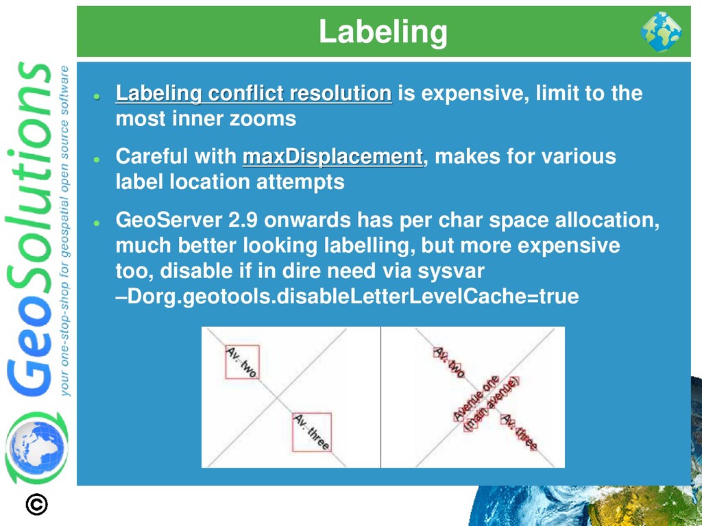
most inner zooms ⚫ Careful with maxDisplacement, makes for various label location attempts ⚫ GeoServer 2.9 onwards has per char space allocation, much better looking labelling, but more expensive too, disable if in dire need via sysvar –Dorg.geotools.disableLetterLevelCache=true
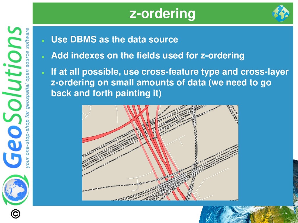
indexes on the fields used for z-ordering ⚫ If at all possible, use cross-feature type and cross-layer z-ordering on small amounts of data (we need to go back and forth painting it)
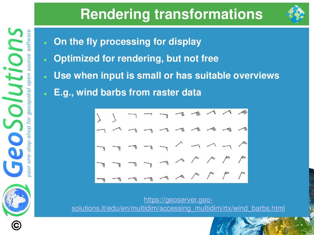
Optimized for rendering, but not free ⚫ Use when input is small or has suitable overviews ⚫ E.g., wind barbs from raster data https://geoserver.geo- solutions.it/edu/en/multidim/accessing_multidim/rtx/wind_barbs.html
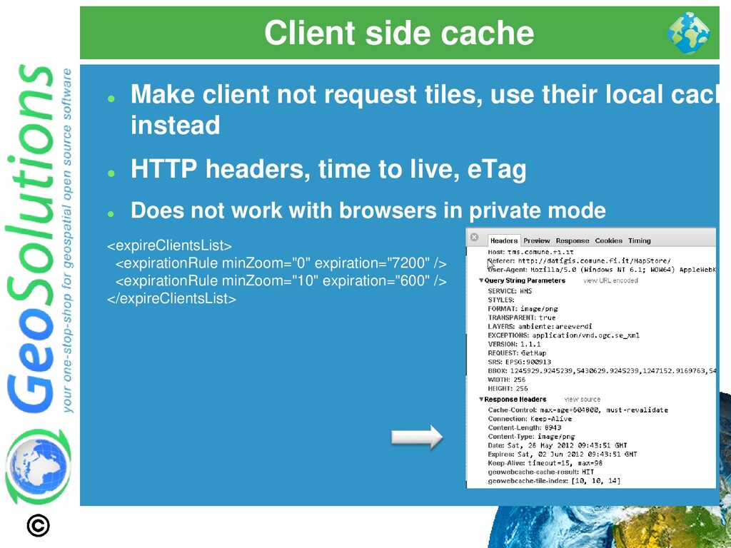
their local cache instead ⚫ HTTP headers, time to live, eTag ⚫ Does not work with browsers in private mode <expireClientsList> <expirationRule minZoom="0" expiration="7200" /> <expirationRule minZoom="10" expiration="600" /> </expireClientsList>
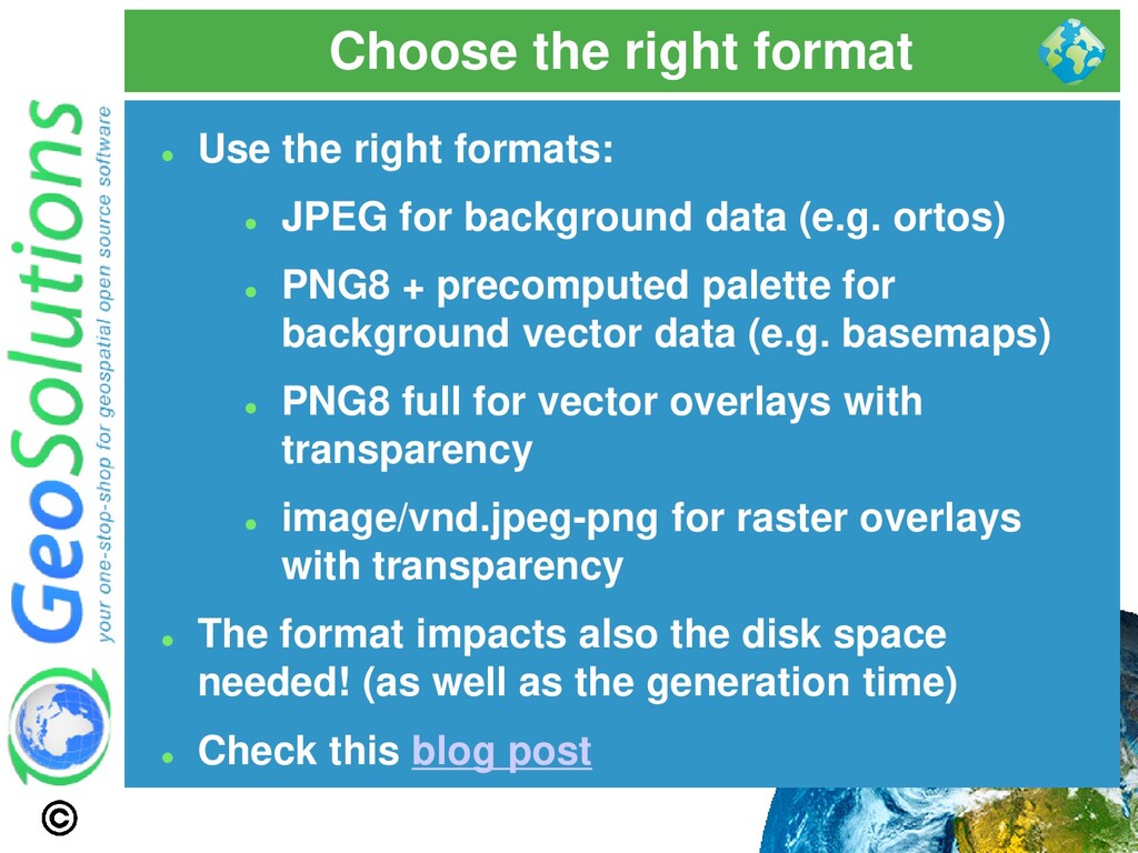
JPEG for background data (e.g. ortos) ⚫ PNG8 + precomputed palette for background vector data (e.g. basemaps) ⚫ PNG8 full for vector overlays with transparency ⚫ image/vnd.jpeg-png for raster overlays with transparency ⚫ The format impacts also the disk space needed! (as well as the generation time) ⚫ Check this blog post
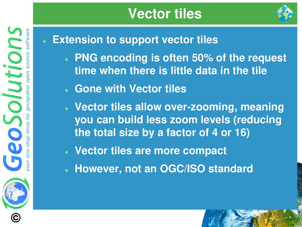
encoding is often 50% of the request time when there is little data in the tile ⚫ Gone with Vector tiles ⚫ Vector tiles allow over-zooming, meaning you can build less zoom levels (reducing the total size by a factor of 4 or 16) ⚫ Vector tiles are more compact ⚫ However, not an OGC/ISO standard
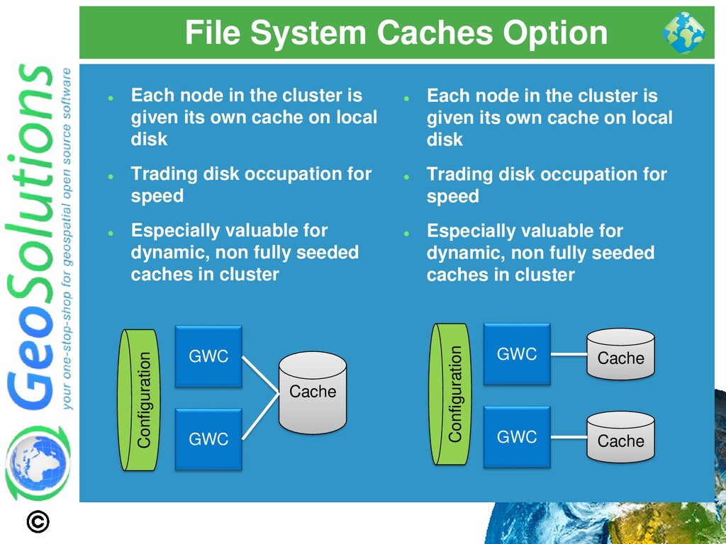
is given its own cache on local disk ⚫ Trading disk occupation for speed ⚫ Especially valuable for dynamic, non fully seeded caches in cluster GWC Cache GWC Cache GWC GWC Cache Configuration Configuration ⚫ Each node in the cluster is given its own cache on local disk ⚫ Trading disk occupation for speed ⚫ Especially valuable for dynamic, non fully seeded caches in cluster
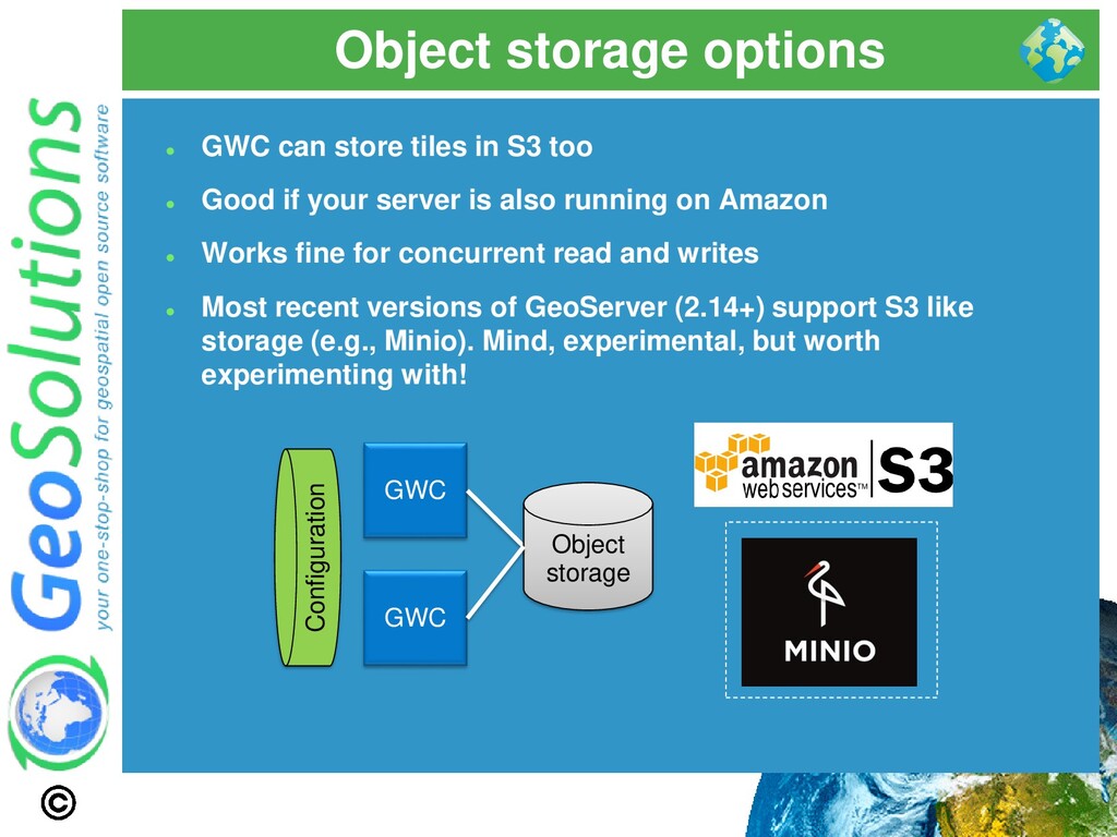
can store tiles in S3 too ⚫ Good if your server is also running on Amazon ⚫ Works fine for concurrent read and writes ⚫ Most recent versions of GeoServer (2.14+) support S3 like storage (e.g., Minio). Mind, experimental, but worth experimenting with!
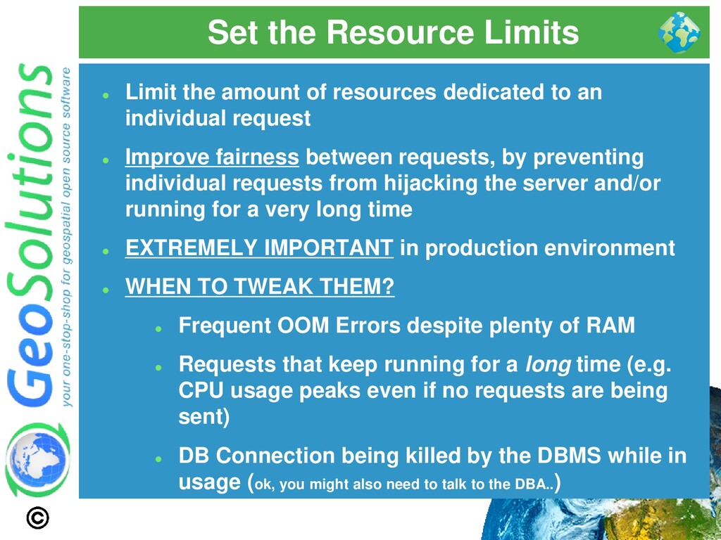
dedicated to an individual request ⚫ Improve fairness between requests, by preventing individual requests from hijacking the server and/or running for a very long time ⚫ EXTREMELY IMPORTANT in production environment ⚫ WHEN TO TWEAK THEM? ⚫ Frequent OOM Errors despite plenty of RAM ⚫ Requests that keep running for a long time (e.g. CPU usage peaks even if no requests are being sent) ⚫ DB Connection being killed by the DBMS while in usage (ok, you might also need to talk to the DBA..)
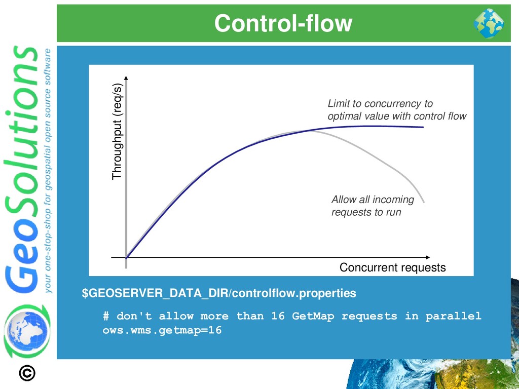
in parallel ows.wms.getmap=16 Throughput (req/s) Concurrent requests Allow all incoming requests to run Limit to concurrency to optimal value with control flow
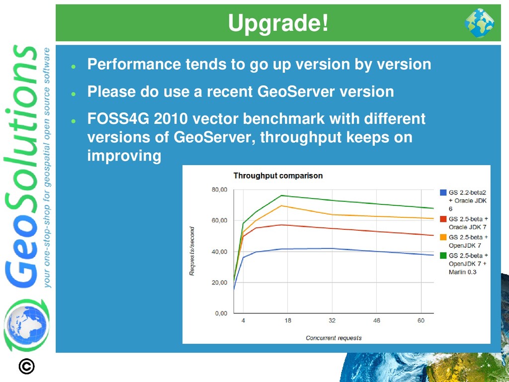
no “GO FAST!” option in the Java Virtual Machine ⚫ The options discussed here are not going to help if you did not prepare the data and the styles ⚫ They are finishing touches that can get performance up once the major data bottlenecks have been dealt with ⚫ Check “Running in production” instructions here
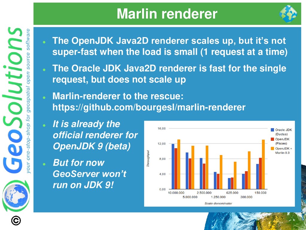
it’s not super-fast when the load is small (1 request at a time) ⚫ The Oracle JDK Java2D renderer is fast for the single request, but does not scale up ⚫ Marlin-renderer to the rescue: https://github.com/bourgesl/marlin-renderer ⚫ It is already the official renderer for OpenJDK 9 (beta) ⚫ But for now GeoServer won’t run on JDK 9!
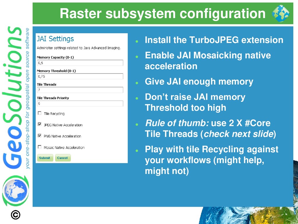
JAI Mosaicking native acceleration ⚫ Give JAI enough memory ⚫ Don’t raise JAI memory Threshold too high ⚫ Rule of thumb: use 2 X #Core Tile Threads (check next slide) ⚫ Play with tile Recycling against your workflows (might help, might not)
tough get going! ⚫ Performance suboptimal ⚫ OOM ⚫ Occasional Deadlocks and Stalls ⚫ Hang tight before reading next line… ⚫ That is normal! ⚫ Don’t have any of these problems that means nobody uses your services ⚫ Reaching PROD does not mean the work has ended!* * hello beloved client, did you read that?
boat ⚫ Thanks, but what can I do? ⚫ Here some key concepts ⚫ Logging ⚫ Monitoring ⚫ Metering ⚫ You want to be able to know what happens before it actually happens*! ⚫ or better before someone call you on the phone screaming and shouting!
ask you how you feel, right? ⚫ We should do the same with GeoServer ⚫ Logs of a network exposed service are usually full of errors and exceptions ⚫ Unless nobody uses that service ☺ ⚫ Logging levels are your friend ⚫ Look for known errors first
understand and monitor every bit involved ⚫ DBMS, Disks ⚫ CPU, Memory , Network ⚫ Other Software ⚫ Proactivity ⚫ Alerting → low RAM, high cpu, low disk space ⚫ Actions → service dead/stuck then restart
Time ⚫ Throughput ⚫ Interesting questions can be asked ⚫ What is the slowest layer? ⚫ Which kind of requests are slow? ⚫ Who is sending the slowest requests? ⚫ Who is actually using my service?
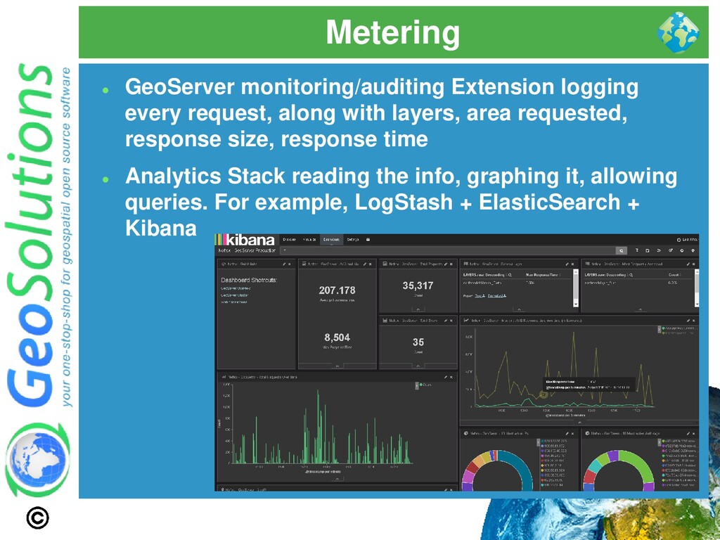
layers, area requested, response size, response time ⚫ Analytics Stack reading the info, graphing it, allowing queries. For example, LogStash + ElasticSearch + Kibana
Check the logs ⚫ Monitor every bit ⚫ Use alerts and actions to be proactive ⚫ Keep calm and take snapshots before taking actions ⚫ Check the actual traffic and learn about most used/slowest layers, fix accordingly
![That’s all folks! Questions? [email protected]](https://files.speakerdeck.com/presentations/622642adb11f4249b148a5c1dd736db9/slide_45.jpg)