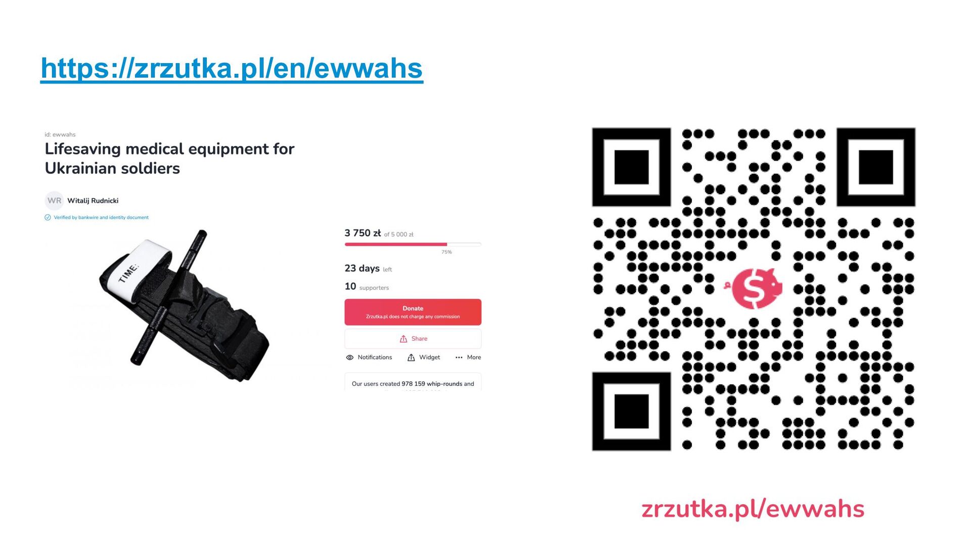
company. All rights reserved. ǀ Let me introduce myself - Vitaliy Rudnytskiy (aka Віталій Рудницький) @Sygyzmundovych - SAP’s Developers Center (developers.sap.com) Data, Analytics… and ML - Devtoberfest and SAP TechEd - Based in Wrocław, Poland 51°04'40.3"N 16°57'48.8"E (WGS84)
company. All rights reserved. ǀ I am glad to be back to Riga 🇱🇻 2015: SAP CodeJam IoT 2023: SAP Inside Track 202?: SAP CodeJam “Getting Started with Machine Learning using SAP HANA Cloud and Python”
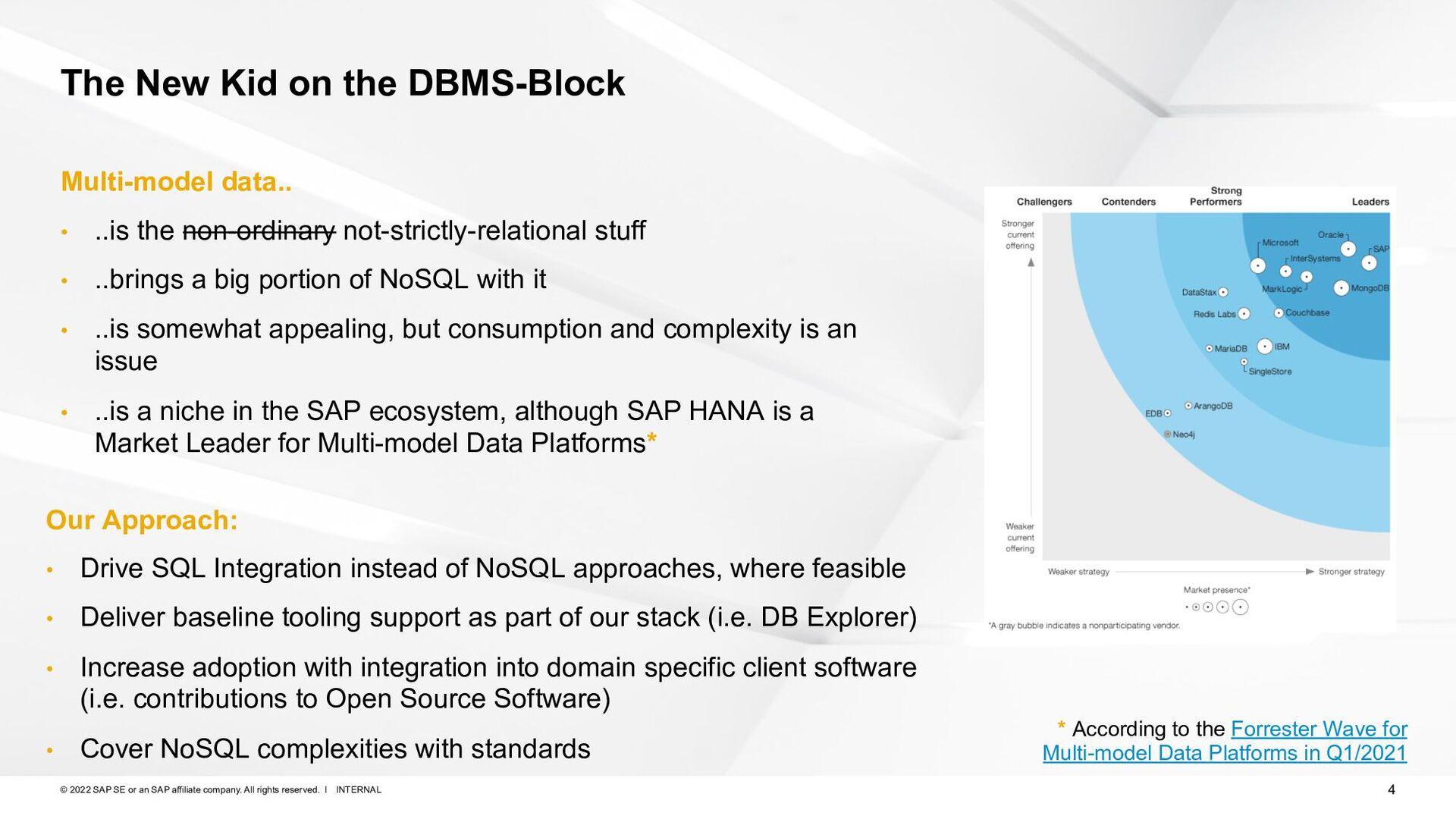
company. All rights reserved. ǀ The New Kid on the DBMS-Block Multi-model data.. • ..is the non-ordinary not-strictly-relational stuff • ..brings a big portion of NoSQL with it • ..is somewhat appealing, but consumption and complexity is an issue • ..is a niche in the SAP ecosystem, although SAP HANA is a Market Leader for Multi-model Data Platforms* * According to the Forrester Wave for Multi-model Data Platforms in Q1/2021 Our Approach: • Drive SQL Integration instead of NoSQL approaches, where feasible • Deliver baseline tooling support as part of our stack (i.e. DB Explorer) • Increase adoption with integration into domain specific client software (i.e. contributions to Open Source Software) • Cover NoSQL complexities with standards
company. All rights reserved. ǀ SAP HANA Database Explorer Web-based Swiss Army Knife for managing data in SAP HANA Cloud Community Content: • https://developers.sap.com/tutorials/hana-dbx-multi-model.html • https://blogs.sap.com/2022/06/21/visualize-your-spatial-data-in- sap-hana-database-explorer/ When to use: • Managing (Multi-model) Data in SAP HANA Cloud • Visualizations for Graph, Spatial and JSON • Import/Export of data • First choice for developers & administrators. Mostly not suitable for Domain Experts
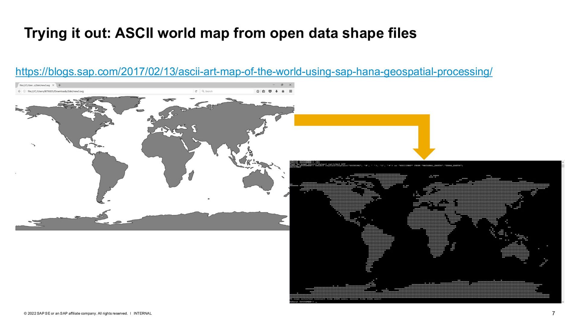
company. All rights reserved. ǀ Trying it out: ASCII world map from open data shape files https://blogs.sap.com/2017/02/13/ascii-art-map-of-the-world-using-sap-hana-geospatial-processing/
company. All rights reserved. ǀ A poster by Jacques Goldstyn for Carto-Québec 1983 conference https://www.mapthematics.com/forums/viewtopic.php?f=8&t=233
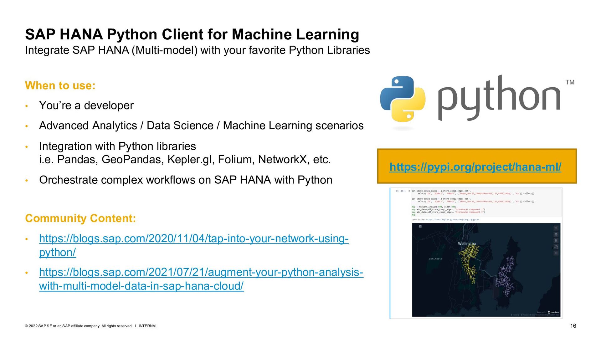
company. All rights reserved. ǀ SAP HANA Python Client for Machine Learning Integrate SAP HANA (Multi-model) with your favorite Python Libraries Community Content: • https://blogs.sap.com/2020/11/04/tap-into-your-network-using- python/ • https://blogs.sap.com/2021/07/21/augment-your-python-analysis- with-multi-model-data-in-sap-hana-cloud/ https://pypi.org/project/hana-ml/ When to use: • You’re a developer • Advanced Analytics / Data Science / Machine Learning scenarios • Integration with Python libraries i.e. Pandas, GeoPandas, Kepler.gl, Folium, NetworkX, etc. • Orchestrate complex workflows on SAP HANA with Python
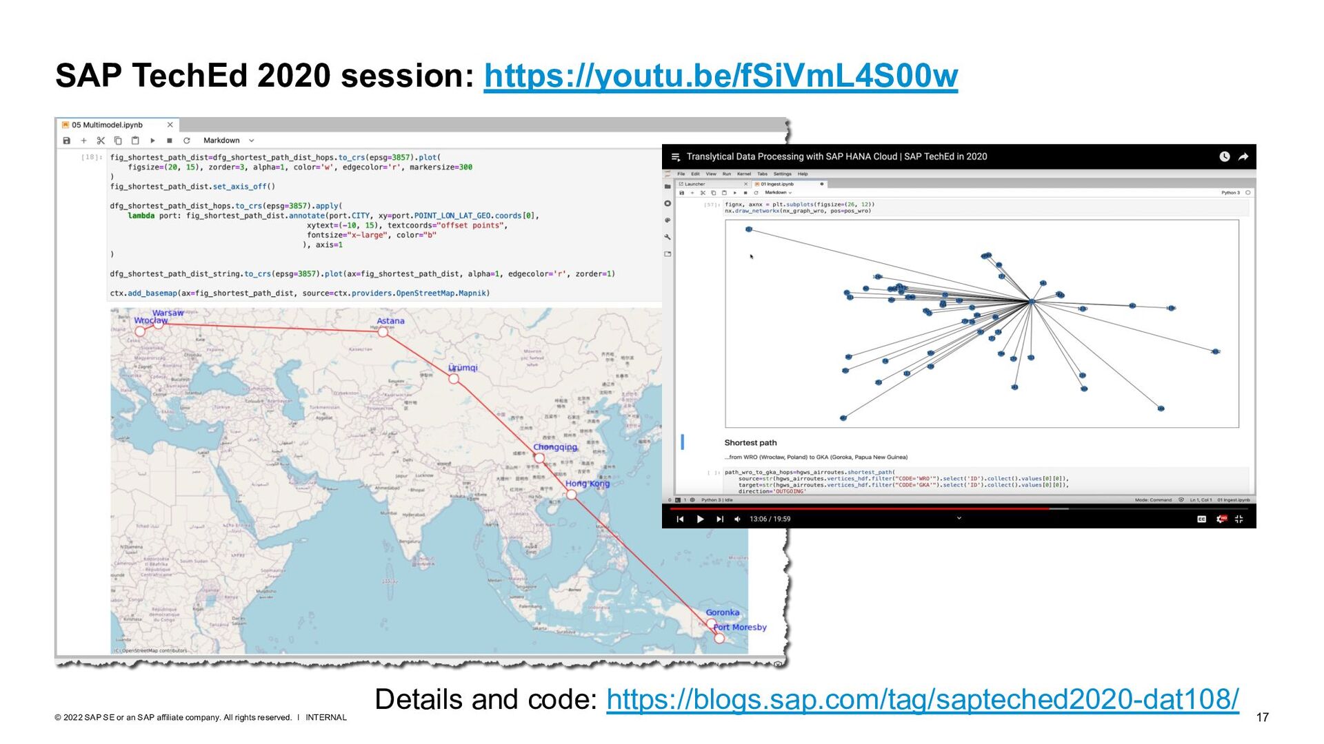
company. All rights reserved. ǀ SAP TechEd 2020 session: https://youtu.be/fSiVmL4S00w Details and code: https://blogs.sap.com/tag/sapteched2020-dat108/
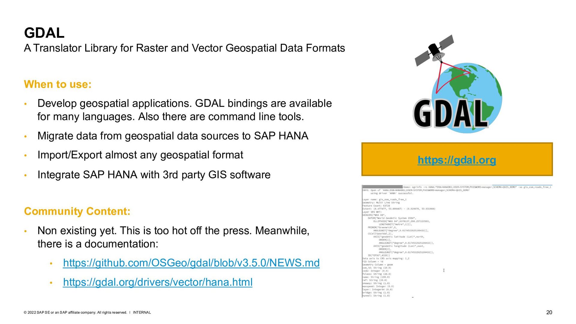
company. All rights reserved. ǀ GDAL A Translator Library for Raster and Vector Geospatial Data Formats https://gdal.org When to use: • Develop geospatial applications. GDAL bindings are available for many languages. Also there are command line tools. • Migrate data from geospatial data sources to SAP HANA • Import/Export almost any geospatial format • Integrate SAP HANA with 3rd party GIS software Community Content: • Non existing yet. This is too hot off the press. Meanwhile, there is a documentation: • https://github.com/OSGeo/gdal/blob/v3.5.0/NEWS.md • https://gdal.org/drivers/vector/hana.html
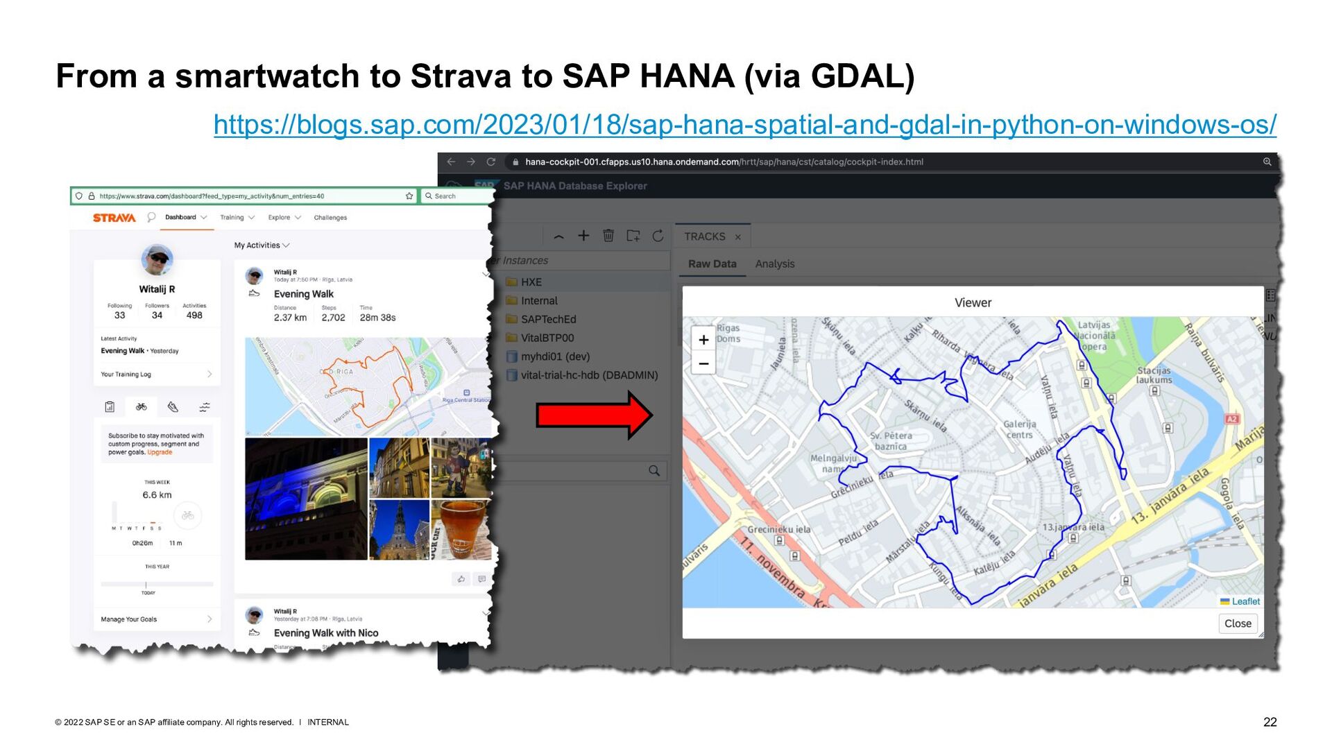
company. All rights reserved. ǀ From a smartwatch to Strava to SAP HANA (via GDAL) https://blogs.sap.com/2023/01/18/sap-hana-spatial-and-gdal-in-python-on-windows-os/
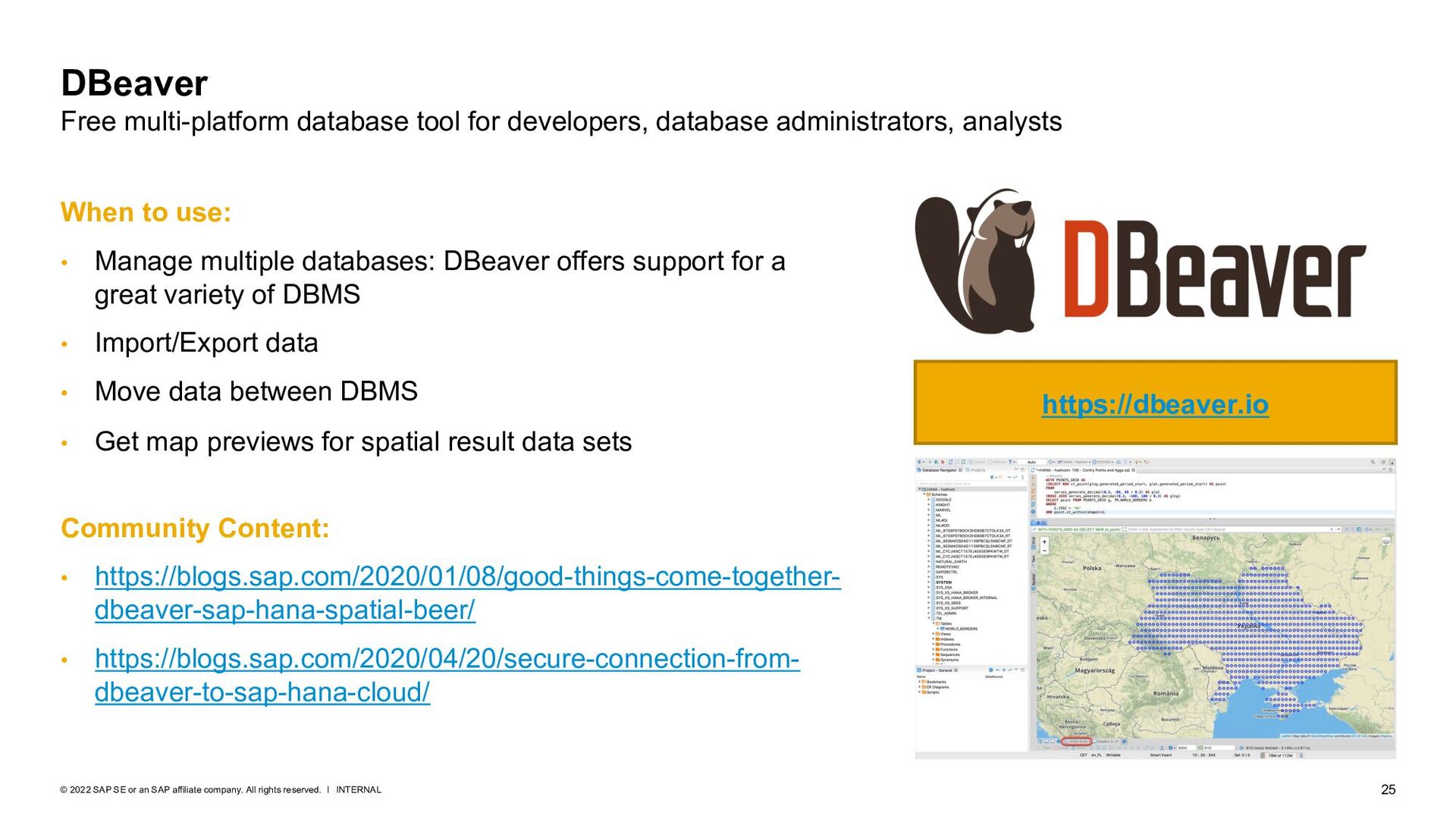
company. All rights reserved. ǀ DBeaver Free multi-platform database tool for developers, database administrators, analysts https://dbeaver.io Community Content: • https://blogs.sap.com/2020/01/08/good-things-come-together- dbeaver-sap-hana-spatial-beer/ • https://blogs.sap.com/2020/04/20/secure-connection-from- dbeaver-to-sap-hana-cloud/ When to use: • Manage multiple databases: DBeaver offers support for a great variety of DBMS • Import/Export data • Move data between DBMS • Get map previews for spatial result data sets
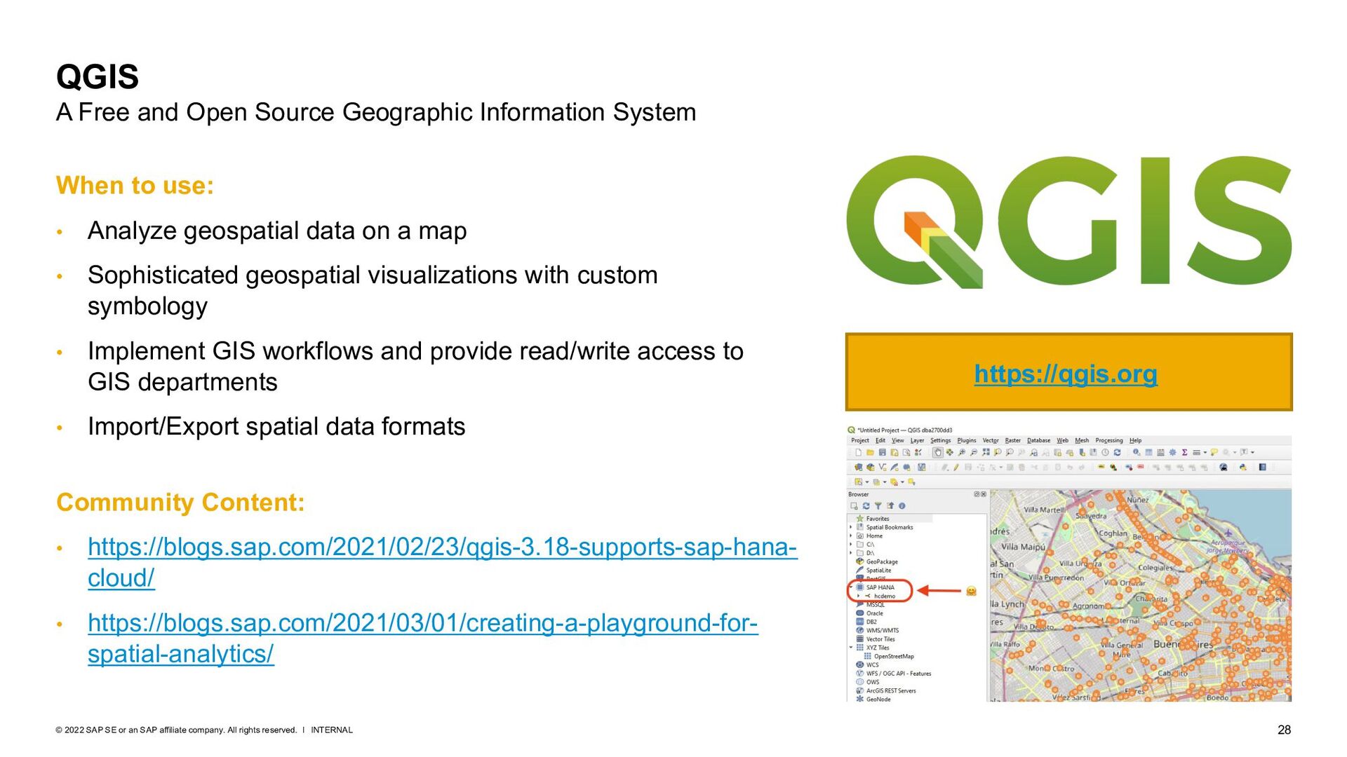
company. All rights reserved. ǀ QGIS A Free and Open Source Geographic Information System Community Content: • https://blogs.sap.com/2021/02/23/qgis-3.18-supports-sap-hana- cloud/ • https://blogs.sap.com/2021/03/01/creating-a-playground-for- spatial-analytics/ https://qgis.org When to use: • Analyze geospatial data on a map • Sophisticated geospatial visualizations with custom symbology • Implement GIS workflows and provide read/write access to GIS departments • Import/Export spatial data formats
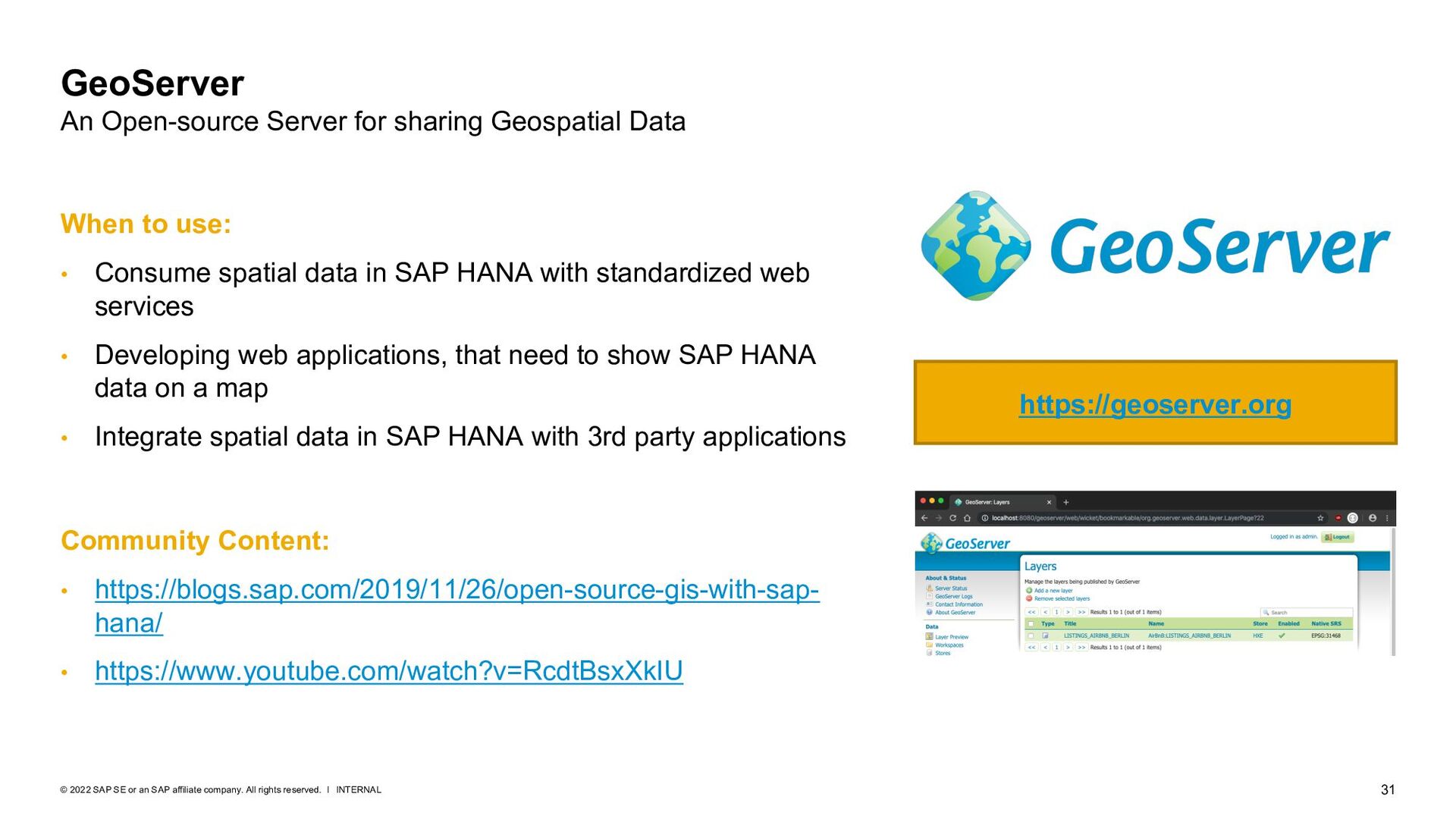
company. All rights reserved. ǀ GeoServer An Open-source Server for sharing Geospatial Data Community Content: • https://blogs.sap.com/2019/11/26/open-source-gis-with-sap- hana/ • https://www.youtube.com/watch?v=RcdtBsxXkIU https://geoserver.org When to use: • Consume spatial data in SAP HANA with standardized web services • Developing web applications, that need to show SAP HANA data on a map • Integrate spatial data in SAP HANA with 3rd party applications
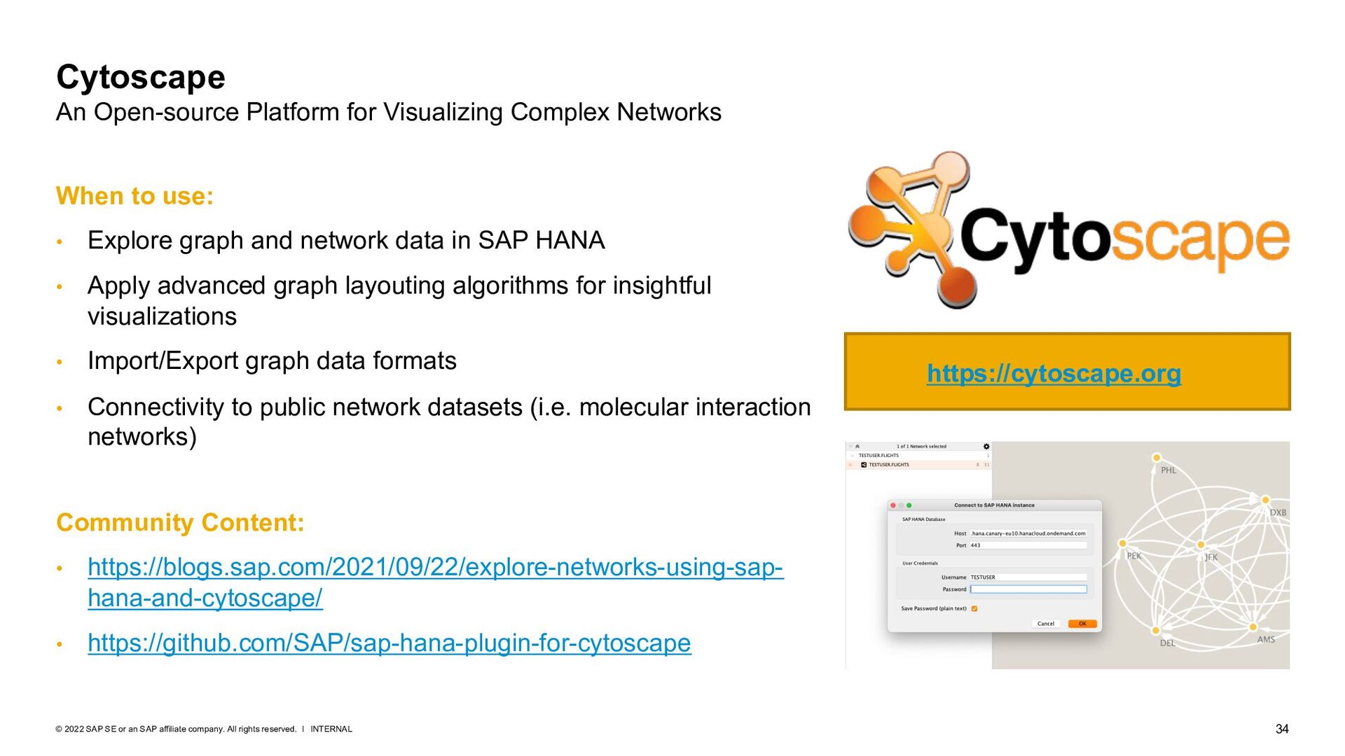
company. All rights reserved. ǀ Cytoscape An Open-source Platform for Visualizing Complex Networks Community Content: • https://blogs.sap.com/2021/09/22/explore-networks-using-sap- hana-and-cytoscape/ • https://github.com/SAP/sap-hana-plugin-for-cytoscape https://cytoscape.org When to use: • Explore graph and network data in SAP HANA • Apply advanced graph layouting algorithms for insightful visualizations • Import/Export graph data formats • Connectivity to public network datasets (i.e. molecular interaction networks)
rights reserved. No part of this publication may be reproduced or transmitted in any form or for any purpose without the express permission of SAP SE or an SAP affiliate company. The information contained herein may be changed without prior notice. Some software products marketed by SAP SE and its distributors contain proprietary software components of other software vendors. National product specifications may vary. These materials are provided by SAP SE or an SAP affiliate company for informational purposes only, without representation or warranty of any kind, and SAP or its affiliated companies shall not be liable for errors or omissions with respect to the materials. The only warranties for SAP or SAP affiliate company products and services are those that are set forth in the express warranty statements accompanying such products and services, if any. Nothing herein should be construed as constituting an additional warranty. In particular, SAP SE or its affiliated companies have no obligation to pursue any course of business outlined in this document or any related presentation, or to develop or release any functionality mentioned therein. This document, or any related presentation, and SAP SE’s or its affiliated companies’ strategy and possible future developments, products, and/or platforms, directions, and functionality are all subject to change and may be changed by SAP SE or its affiliated companies at any time for any reason without notice. The information in this document is not a commitment, promise, or legal obligation to deliver any material, code, or functionality. All forward-looking statements are subject to various risks and uncertainties that could cause actual results to differ materially from expectations. Readers are cautioned not to place undue reliance on these forward-looking statements, and they should not be relied upon in making purchasing decisions. SAP and other SAP products and services mentioned herein as well as their respective logos are trademarks or registered trademarks of SAP SE (or an SAP affiliate company) in Germany and other countries. All other product and service names mentioned are the trademarks of their respective companies. See www.sap.com/trademark for additional trademark information and notices. www.sap.com/contactsap Follow us