Upgrade to Pro — share decks privately, control downloads, hide ads and more …

The role of GIS in Emergency Response for Texas

The role of GIS in Emergency Response for Texas

David Allen - Texas Emergency GIS Response Team

More Decks by Texas Natural Resources Information System

Other Decks in Technology

Transcript

  1. www.TexasEGRT.org

    View Slide

  2. ¨  Organize into a deployable resource that can be
    called up in an emergency
    ¨  Train GIS professionals to perform emergency
    response mapping
    ¨  Enhance the mapping capabilities of
    emergency responders across our region

    View Slide

  3. ¨  Founded in 2006 after the Space Shuttle
    Columbia Incident
    ¨  Operating area was 14 cities in Northeast
    Tarrant County
    ¨  Worked in conjunction with the NEFDA group
    ¨  Utilized NEFDA Mobile Command Post

    View Slide

  4. ¨  Developed the initial training for NEFDA
    ¨  Compiled GIS 
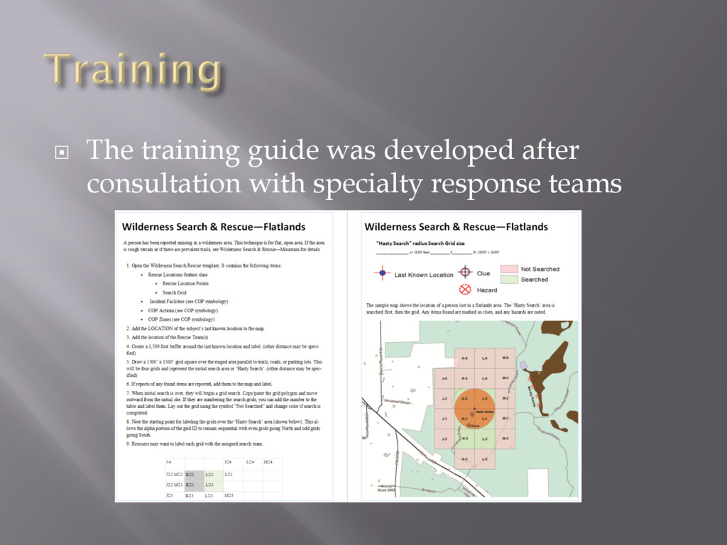
Datasets
    ¨  Developed SOG and Response Templates
    ¨  Require FEMA ICS Training
    ¨  Conduct On-site training classes
    ¡  How to respond to an event
    ¡  How to use the Tx EGRT Templates
    ¡  How to work with EMC’s to provide critical
    mapping

    View Slide

  5. •  The training required for EGRT includes several
    FEMA online independent study courses on the
    Incident Command Structure (ICS)
    ¨  IS-100.b: Introduction to Incident Command System
    ¨  IS-700.a: National Incident Management System
    (NIMS) – An Introduction
    ¨  IS-103: GIS Specialist
    ¨  Tx EGRT Specific classes (online and classroom)
    ¨  Participate in Local or Regional Exercises
    ¨  IS-922: Applications of GIS for Emergency
    Management (optional)

    View Slide

  6. ¨  The training guide was developed after
    consultation with specialty response teams

    View Slide

  7. ¨  We’re building the organization at the
    grassroots level

    View Slide

  8. ¨  National Alliance for Public Safety GIS
    Foundation (NAPSG)
    ¡  We’ve partnered with them to use their SOG for state
    and local GIS support
    ¡  They’ve developed scenario based training for basic
    GIS response, coastal storms / oil spills, wildfires,
    tornadoes
    ¡  Developed Standard emergency response symbology

    View Slide

  9. ¨  As NEFDA
    ¡  Flooding
    ¡  Straight Line Wind events
    ¡  Traffic Control for apartment fires
    ¡  Remote assistance with Hurricane Ike
    ¡  Remote assistance with Possum Kingdom Wildfires
    ¨  As Tx EGRT
    ¡  Red Oak Full-scale Exercise
    ¡  Hood County Full-scale Exercise
    ¡  Dallas Ebola response – Disaster District 4 Garland EOC
    ¡  Rowlett / Garland Tornadoes - Rowlett EOC / DDC 4
    Garland
    ¡  Multiple Flood Events – DDC 4 Garland / DDC 4 Hurst
    ¡  Visit of Pope to Juarez, Mexico

    View Slide

  10. View Slide

  11. ¨  Texas EGRT responds to any government
    agency that requests GIS support
    ¨  Call the toll free number
    ¡  1-844-Tex-EGRT or 1-844-839-3478

    View Slide

  12. ¨  The job will be to provide the three basic 
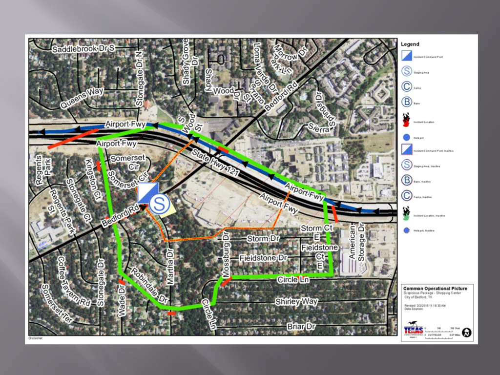
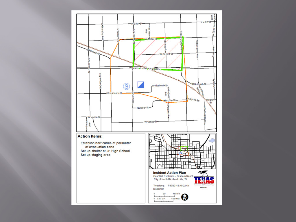
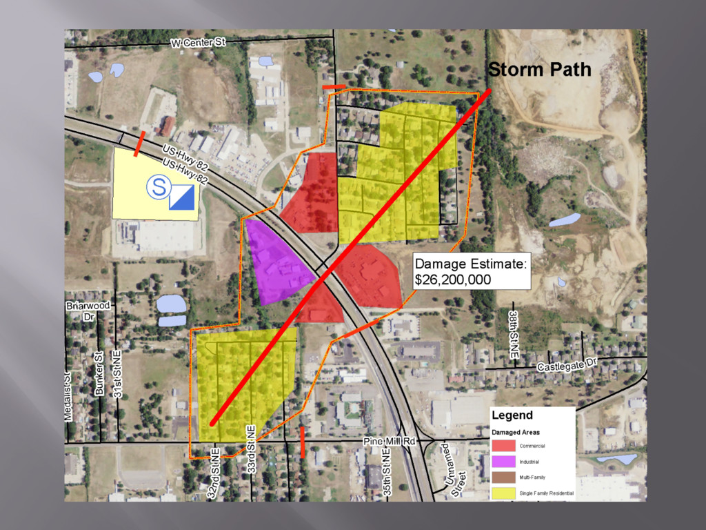
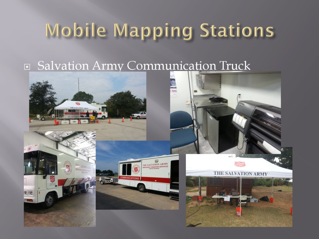
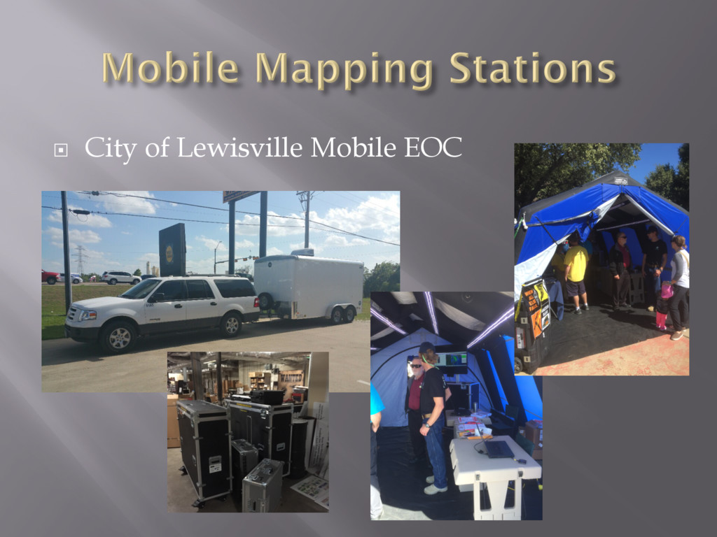
maps:
    ¡  Common Operational Picture
    ¡  Incident Action Plan
    ¡  Initial Damage Assessment / Detailed Damage Assessment
    ¨  In addition, there may be specialty maps required:
    ¡  Bomb Evacuation Plan
    ¡  Chemical Spill / Plume Model
    ¡  Swift Water Rescue
    ¡  Search and Rescue
    ¡  Etc…
    ¨  We carry all the data necessary for this type of
    mapping without the Internet
    ¨  AND … we’re adding web based map applications

    View Slide

  13. View Slide

  14. View Slide

  15. View Slide

  16. ¨  Uses Tx EGRT’s AGOL account
    ¨  Collector for ArcGIS
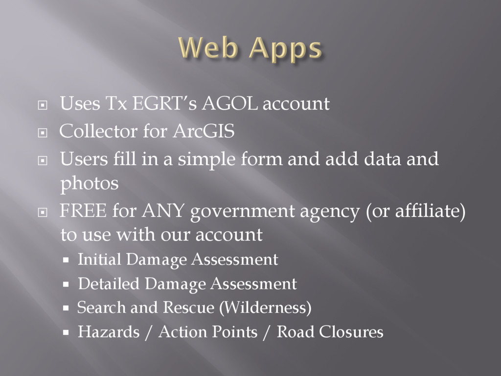
    ¨  Users fill in a simple form and add data and
    photos
    ¨  FREE for ANY government agency (or affiliate)
    to use with our account
    ¡  Initial Damage Assessment
    ¡  Detailed Damage Assessment
    ¡  Search and Rescue (Wilderness)
    ¡  Hazards / Action Points / Road Closures

    View Slide

  17. ¨  The Disaster District 4 Garland EOC

    View Slide

  18. ¨  Salvation Army Communication Truck

    View Slide

  19. ¨  City of Lewisville Mobile EOC

    View Slide

  20. ¨  We are working with ESRI to develop more
    phone apps and a new Emergency Response
    data schema
    ¨  We are looking at funding for more Deployable
    Mapping Stations
    ¨  We are actively training members in Austin,
    San Antonio, and Houston. Watch the website
    for training locations – we need all the people we
    can get!

    View Slide

  21. We are breaking new ground with this grassroots
    concept of GIS for emergency response.

    View Slide

  22. www.TexasEGRT.org
    1-844-TexEGRT
    David Allen
    [email protected]
    817-371-9167

    View Slide