of Federal and national geospatial programs; b) The development of the National Spatial Data Infrastructure (NSDI); and c) Implementation of the Act; 2) Review and comment on geospatial policy and management issues; and 3) Ensure the views of representatives of non-Federal interested parties involved in national geospatial activities are conveyed to the FGDC. More info at https://www.fgdc.gov/ngac National Geospatial Advisory Committee Duties
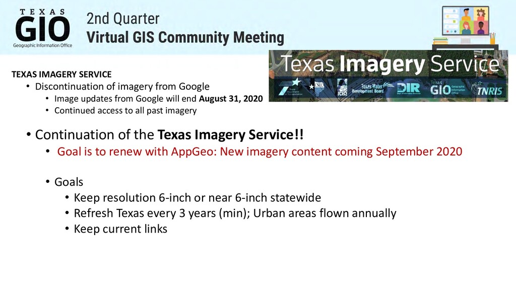
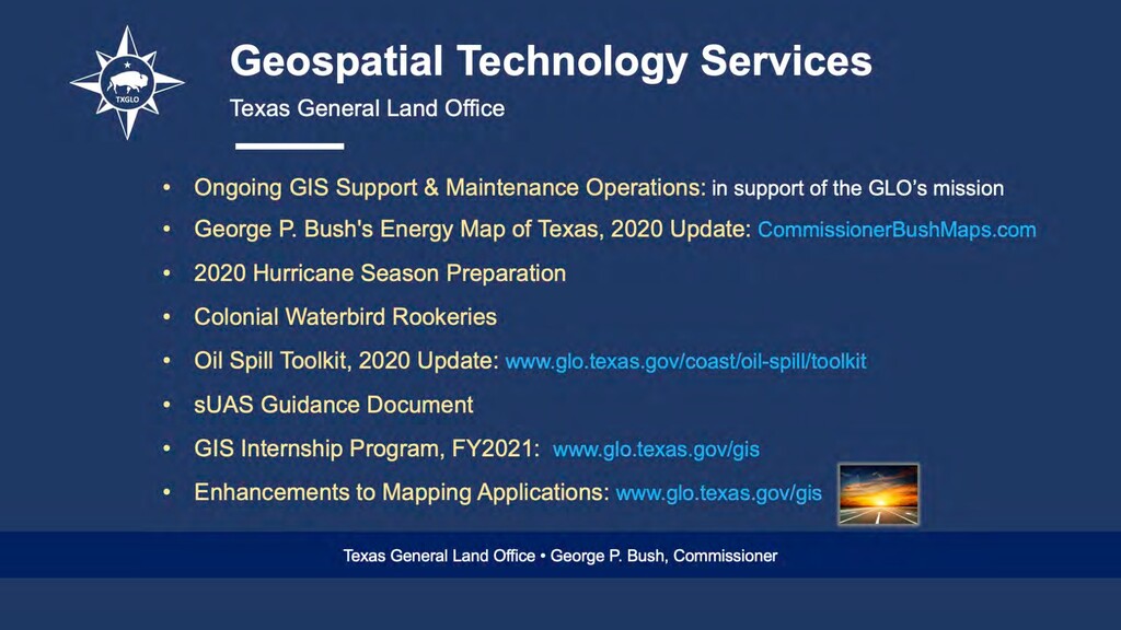
Image updates from Google will end August 31, 2020 • Continued access to all past imagery • Continuation of the Texas Imagery Service!! • Goal is to renew with AppGeo: New imagery content coming September 2020 • Goals • Keep resolution 6-inch or near 6-inch statewide • Refresh Texas every 3 years (min); Urban areas flown annually • Keep current links
• Statewide availability of lidar is estimated for Fall 2020- Summer 2021 depending on release of the datasets by the USGS. • TNRIS/StratMap has acquired three Lidar collections this leaf-off season.
recapture lidar where data is older than 8 years or obtain higher density data where needed. • Over 6,500 square miles of updated lidar data in North, Central, and West Texas. • Partnerships with Texas Parks and Wildlife(TPWD), Texas Commission on Environmental Quality(TCEQ), and the City of Marble Falls. • Data will be released for these projects Fall 2020-Spring 2021 4 Points Per Square Meter 8 Points Per Square Meter
Lidar and Orthoimagery • Local and regional partners are interested is pursuing ortho and lidar for large portions of the central Texas regions. • TNRIS is considering proposing a dual capture project for these areas which would provide a single timestamp of lidar and orthoimagery for complete watersheds where both are acquired. • Some partners have expressed interest in pursing inland bathymetric datasets within the proposed areas of interest Additional partnerships are needed to proceed with the project and ensure capture of the entire proposed areas.
Federal Lidar Projects. Ø RFI has been completed and a Statement of work is being developed for release in the coming months • High Quality Bathymetric Data for Rivers and Reservoirs Ø Ongoing efforts to coordinate and define a state specifications • Elevation Derived Hydrography (Ele-Hydro) Ø Ideally will be coordinated to occur with or post inland bathymetry data collection • Continuing efforts to Digitize the TNRIS Historical Imagery Archive Ø Statement of work currently in development
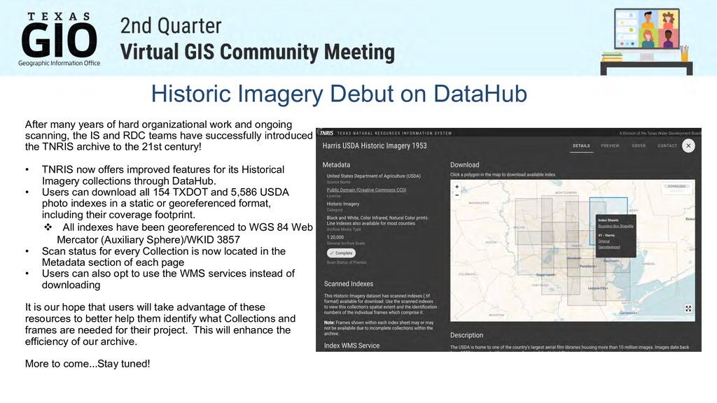
organizational work and ongoing scanning, the IS and RDC teams have successfully introduced the TNRIS archive to the 21st century! • TNRIS now offers improved features for its Historical Imagery collections through DataHub. • Users can download all 154 TXDOT and 5,586 USDA photo indexes in a static or georeferenced format, including their coverage footprint. v All indexes have been georeferenced to WGS 84 Web Mercator (Auxiliary Sphere)/WKID 3857 • Scan status for every Collection is now located in the Metadata section of each page • Users can also opt to use the WMS services instead of downloading It is our hope that users will take advantage of these resources to better help them identify what Collections and frames are needed for their project. This will enhance the efficiency of our archive. More to come...Stay tuned!
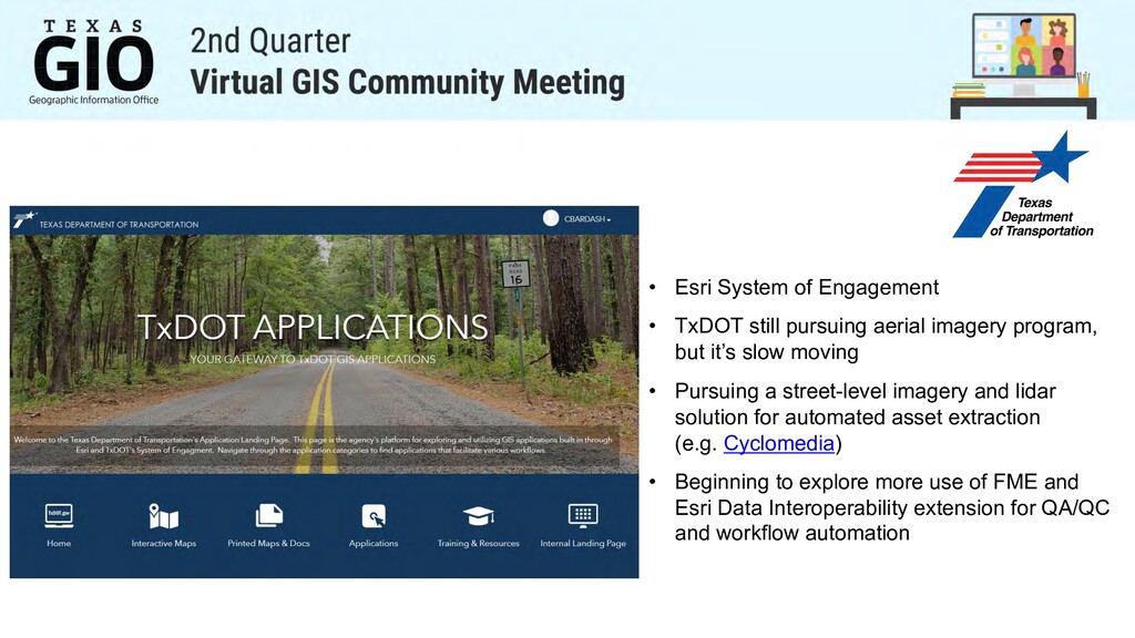
imagery program, but it’s slow moving • Pursuing a street-level imagery and lidar solution for automated asset extraction (e.g. Cyclomedia) • Beginning to explore more use of FME and Esri Data Interoperability extension for QA/QC and workflow automation
through reuse. Integration of data across the enterprise. Automate the process of conformance-checking against business rules to find and report on data issues. Provide certification required for proof of data quality (SLA’s, legislation, etc.) Data Enhancement Automate cleaning tasks. Create new data. Construct repeatable, non-subjective corrective actions.
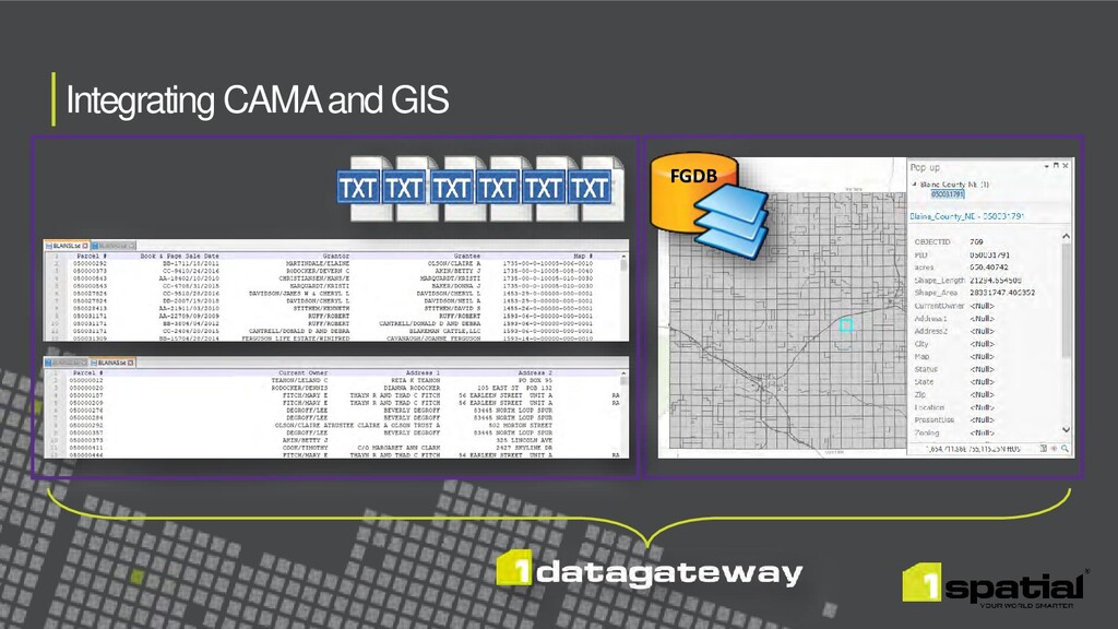
Schema Address_E Centerlines_E County Parcels Buildings Site Structure Address Points Road Centerlines County Validation & Conflation Essential Geometry Checks Address Point Checks Road Checks Parcel Checks 911 Validation Additional Geometry Checks Street Name & Address Nos. Address Range Values Address Range Direction Microsoft Open Source Data