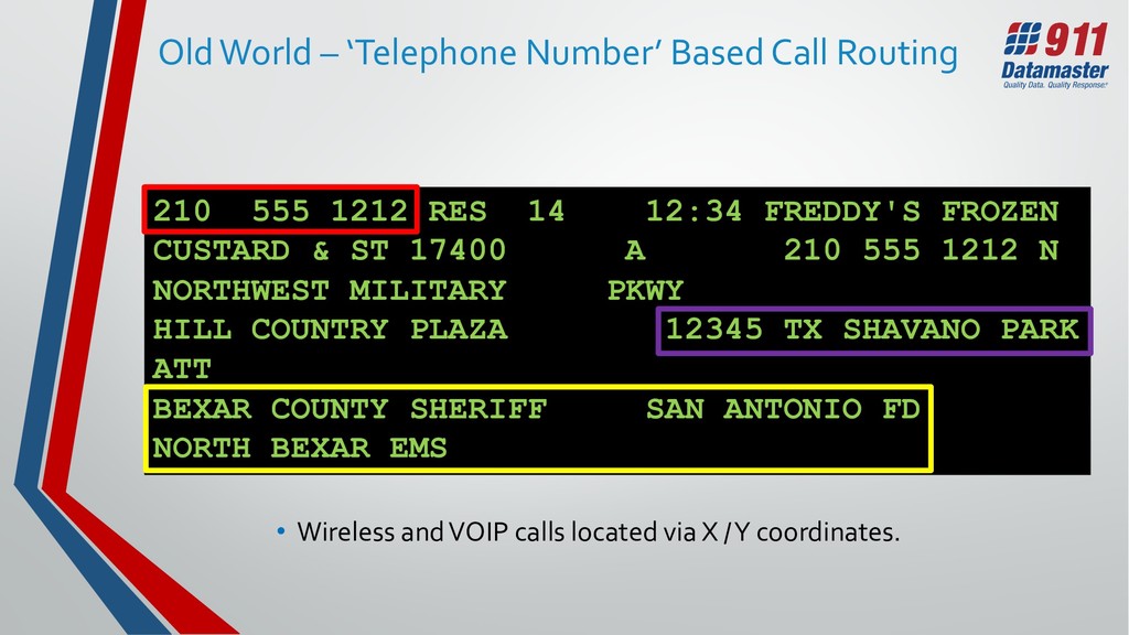
1212 RES 14 12:34 FREDDY'S FROZEN CUSTARD & ST 17400 A 210 555 1212 N NORTHWEST MILITARY PKWY HILL COUNTRY PLAZA 12345 TX SHAVANO PARK ATT BEXAR COUNTY SHERIFF SAN ANTONIO FD NORTH BEXAR EMS • Wireless and VOIP calls located via X / Y coordinates.
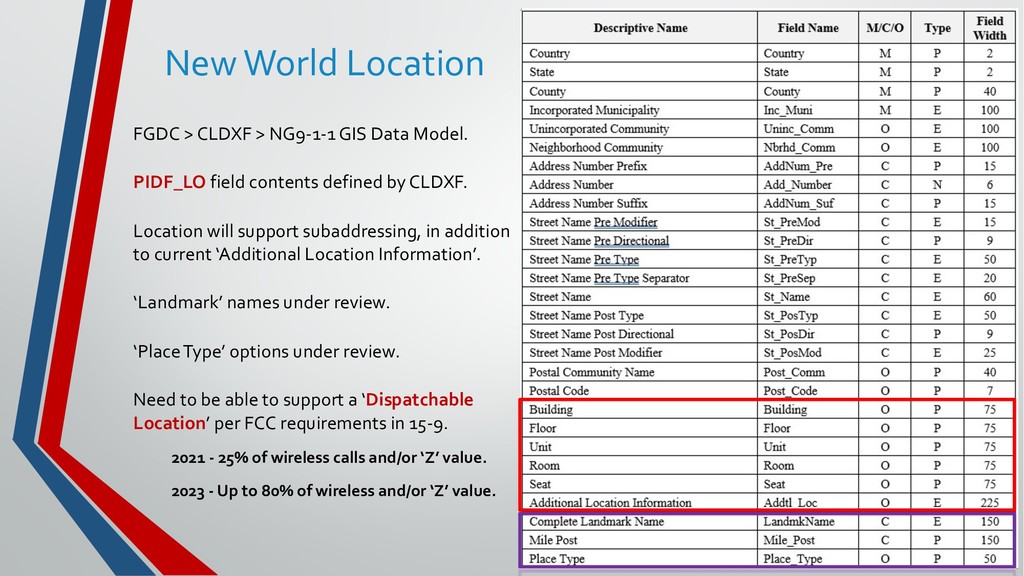
Model. PIDF_LO field contents defined by CLDXF. Location will support subaddressing, in addition to current ‘Additional Location Information’. ‘Landmark’ names under review. ‘Place Type’ options under review. Need to be able to support a ‘Dispatchable Location’ per FCC requirements in 15-9. 2021 - 25% of wireless calls and/or ‘Z’ value. 2023 - Up to 80% of wireless and/or ‘Z’ value.
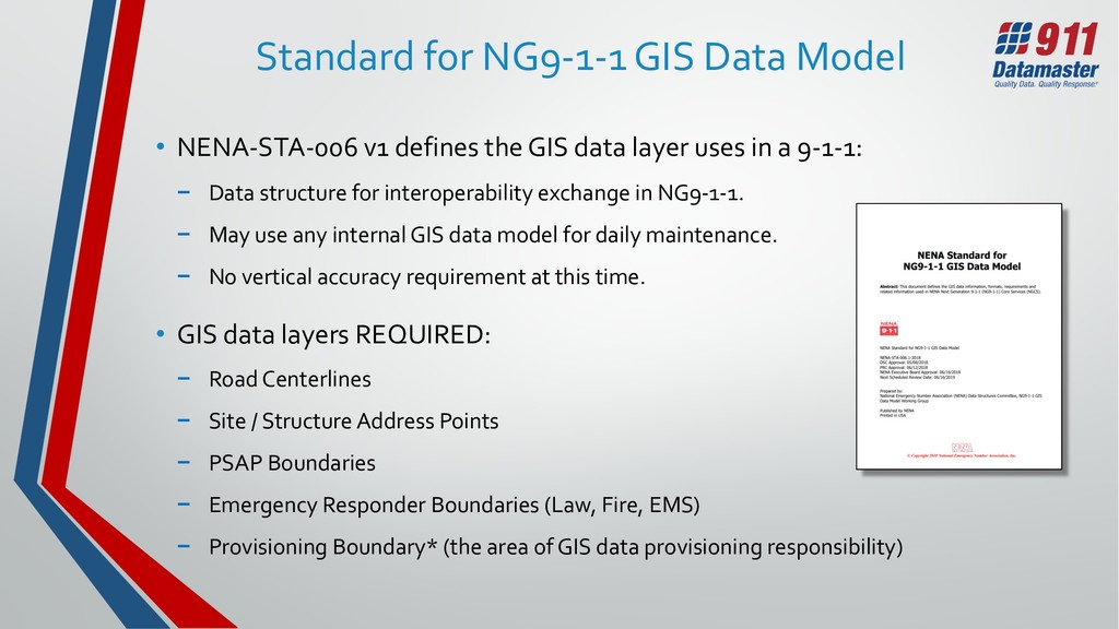
the GIS data layer uses in a 9-1-1: − Data structure for interoperability exchange in NG9-1-1. − May use any internal GIS data model for daily maintenance. − No vertical accuracy requirement at this time. • GIS data layers REQUIRED: − Road Centerlines − Site / Structure Address Points − PSAP Boundaries − Emergency Responder Boundaries (Law, Fire, EMS) − Provisioning Boundary* (the area of GIS data provisioning responsibility)
(UUID) must be included for all required GIS data elements in NG 9-1-1. (Standard for NG9-1-1 GIS Data Model - NENA 71-003, Section 3.4) • Format recommended in the GIS Data Model: − Data provisioning entities maintain local Unique ID numbers for all features in their GIS. − Each data provisioning entity would follow a unique identifier for its domain (ex…@MYCOUNTY.TX.US). − A Universal Unique ID can be generated by taking local Unique ID numbers and concatenating to the end of each the providers domain. Example: 9025719 + @MYCOUNTY.TX.US = [email protected]
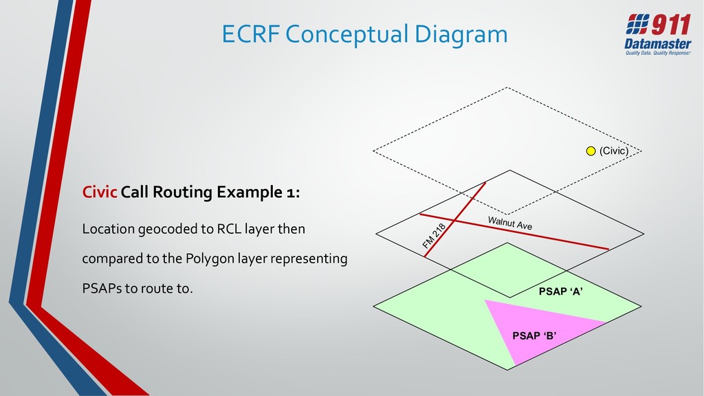
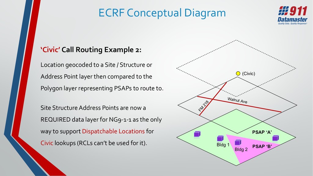
Example 2: Location geocoded to a Site / Structure or Address Point layer then compared to the Polygon layer representing PSAPs to route to. Site Structure Address Points are now a REQUIRED data layer for NG9-1-1 as the only way to support Dispatchable Locations for Civic lookups (RCLs can’t be used for it). Walnut Ave FM 218 (Civic) Bldg 1 Bldg 2
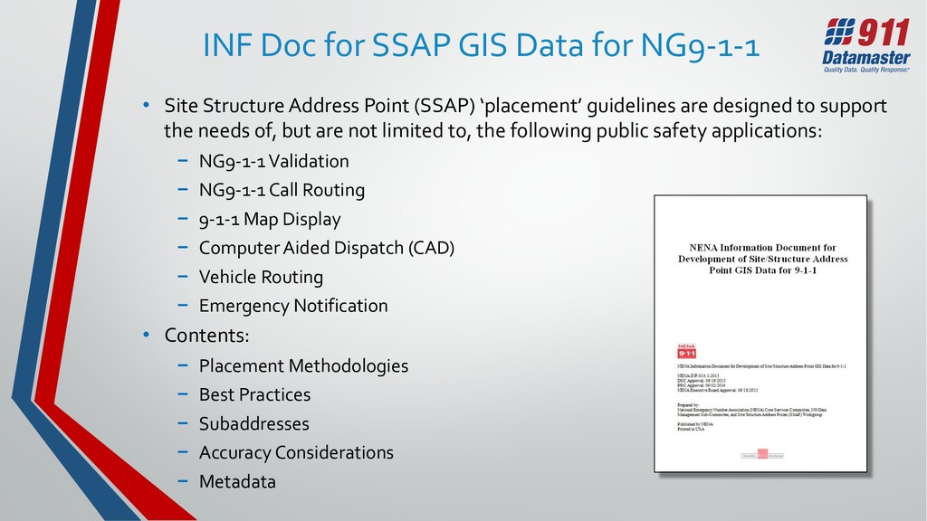
Structure Address Point (SSAP) ‘placement’ guidelines are designed to support the needs of, but are not limited to, the following public safety applications: − NG9-1-1 Validation − NG9-1-1 Call Routing − 9-1-1 Map Display − Computer Aided Dispatch (CAD) − Vehicle Routing − Emergency Notification • Contents: − Placement Methodologies − Best Practices − Subaddresses − Accuracy Considerations − Metadata
is Issued • Address Point Placement Guidelines – Placement Methodologies: − Placement of an Address Point Based on a Parcel − Placement of an Address Point Based on Property Access − Placement of an Address Point Based on a Structure − Placement of an Address Point Based on a Group of Structures − Placement of an Address Point Based on an Exterior Structure Entry − Placement of an Address Point Based on Interior Locations Within a Structure − Geocoding Addresses off of Road Centerlines • Future work is needed on – ‘Multipoints’, ‘Elevation’ and ‘Related Tables’.
(NAD) Goals • Establish a national database for complete address points coverage nationwide, with latitude/longitude and sub-units included for each one. • Data format aligned with FGDC and National Emergency Number Association (NENA) address standards. • Derived from authoritative local/tribal government address data sources. • To be consumable from the USDoT in a stable data schema as a REST service (ex. WMS/WFS), or downloadable file. • Updated as often as feasible with established workflows, aggregated from locals/tribes by state governments, which in turn updates the NAD.
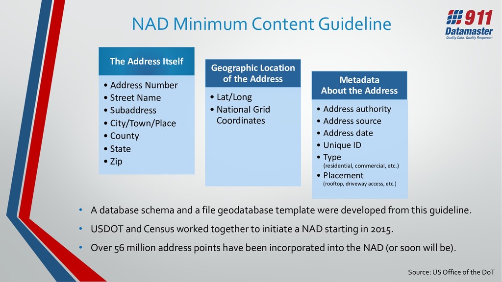
• Street Name • Subaddress • City/Town/Place • County • State • Zip Geographic Location of the Address • Lat/Long • National Grid Coordinates Metadata About the Address • Address authority • Address source • Address date • Unique ID • Type (residential, commercial, etc.) • Placement (rooftop, driveway access, etc.) • A database schema and a file geodatabase template were developed from this guideline. • USDOT and Census worked together to initiate a NAD starting in 2015. • Over 56 million address points have been incorporated into the NAD (or soon will be). Source: US Office of the DoT
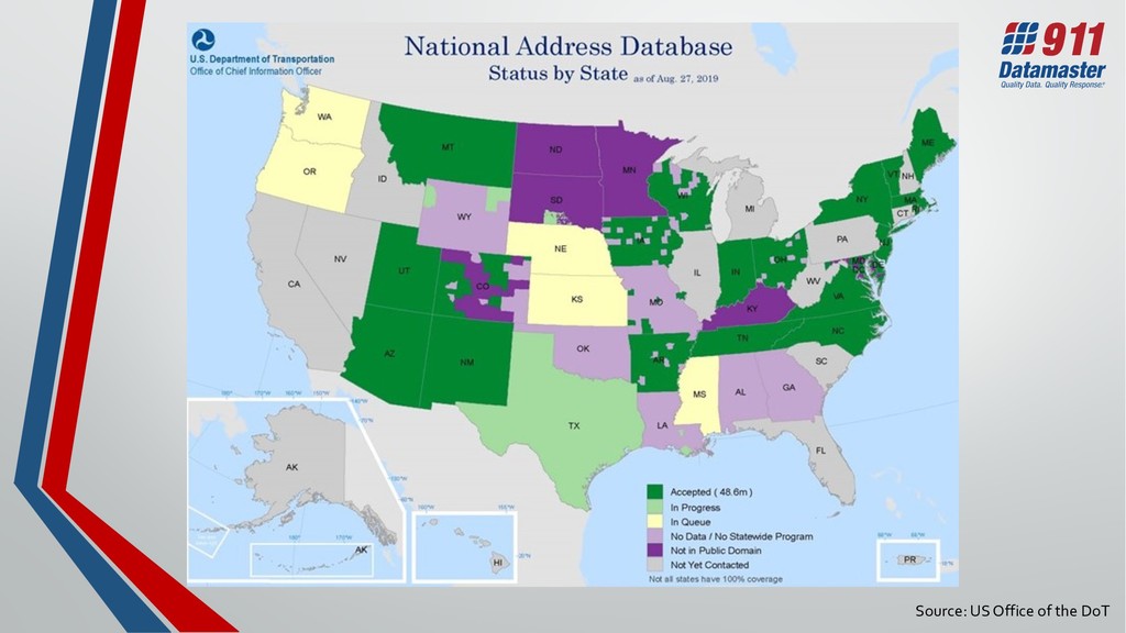
− Required and supported NAD data variables - count and percentage populated • ‘Data Quality’ Assessment. − Duplicate records − Missing required data variables − Missing required metadata − Invalid geometry • ‘Attribute Domain Quality’ Assessment. − Invalid values − Non-documented values, proposed expansion of domain • Based on these assessments, reports are generated and provided to each partner state (data provisioner). Source: US Office of the DoT