Upgrade to Pro — share decks privately, control downloads, hide ads and more …

2020 1st Quarter GIS Community Meeting

2020 1st Quarter GIS Community Meeting

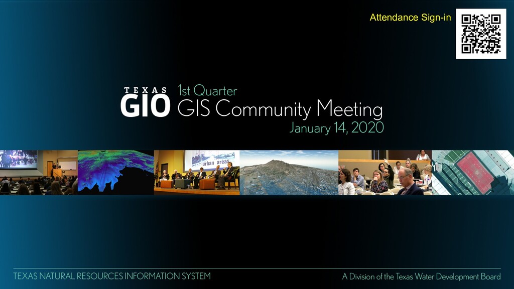
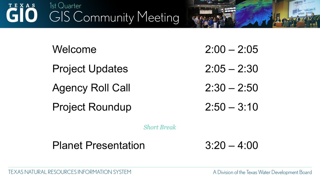
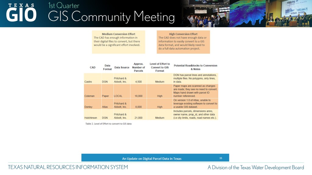
The 1st quarter GIS Community meeting took place on January 14, 2020 at the Texas Parks and Wildlife Headquarters in Austin, TX. Roughly 40+ attendees were present, and the guest speaker was Dan Rodriguez from RazorTek. Mr. Rodriguez presented on imagery products available from Planet.

More Decks by Texas Natural Resources Information System

Transcript

  1. Attendance Sign-in

    View Slide

  2. Welcome
    Project Updates
    Agency Roll Call
    Project Roundup
    Planet Presentation
    2:00 – 2:05
    2:05 – 2:30
    2:30 – 2:50
    2:50 – 3:10
    3:20 – 4:00
    Short Break

    View Slide

  3. Since we last met….
    üCensus 2020
    üSPCS 2022
    ü2019 GMA
    üHistorical Imagery Archive
    üGeoRodeo

    View Slide

  4. STRATMAP CONTRACTS RE-BID OF VENDOR POOL
    Schedule
    • Request for Offer opened Dec. 20, 2019
    • Vendor submissions due Feb. 3, 2020
    • New vendor pool Summer 2020
    Geospatial Data, Services & Software

    View Slide

  5. STRATMAP FUNDING PLAN

    View Slide

  6. TEXAS IMAGERY SERVICE
    • Discontinuation of imagery from Google
    • Image updates from Google will end August 31, 2020
    • Continued access to all past imagery
    • Continuation of the Texas Imagery Service!!
    • Plan 1: SOW to DIR to bid new vendor for Imagery as a Service
    • Plan 2: Research state owned aircraft, sensor and data processing
    • Goals
    • Keep resolution 6-inch or near 6-inch statewide
    • Refresh Texas every 3 years (min); Urban areas flown annually
    • Keep current links

    View Slide

  7. TEXAS IMAGERY SERVICE
    Cost Model
    • Remain for FY2021
    • Plan budgets for FY2021 same as current

    View Slide

  8. NATIONAL AGRICULTURE IMAGERY PROGRAM
    • 100% flights complete Apr 2019
    • NAIP acquisition for TX in 2020: Undetermined
    Specs
    • 60-cm (2-foot)
    • 4-band
    • DOQQs; No CCMs
    • Status: Complete
    • Available: Now!
    • Download on TNRIS DataHub
    • Consume online mapping service
    • Link on TNRIS DataHub
    NAIP
    TX 2018

    View Slide

  9. 2020 CAPITAL AREA / McLENNAN CO
    • 3-inch / 6-inch / 1-foot
    • 4-band
    • DO4Qs (.jp2)
    • Status: Acquisition
    • Available: Fall 2020

    View Slide

  10. Texas Lidar Coverage 2020
    Statewide Lidar Coverage Update for Texas
    • Statewide availability of lidar is estimated for Fall 2020-
    Summer 2021 depending on release of the datasets by
    the USGS.
    • TNRIS/StratMap is acquiring three Lidar collections this
    leaf-off season.

    View Slide

  11. Winter 2019-2020 Lidar Projects
    • StratMap 2020 Acquisitions aim to recapture lidar where data is
    older than 8 years or obtain higher density data where needed.
    • Over 6,500 square miles of updated lidar data in North, Central,
    and West Texas.
    • Partnerships with Texas Parks and Wildlife(TPWD), Texas
    Commission on Environmental Quality(TCEQ), and the City of
    Marble Falls.
    4 Points Per Square Meter 8 Points Per Square Meter

    View Slide

  12. StratMap Data Initiatives on the Horizon
    • Full Classification of Federal Lidar Projects
    • High Quality Bathymetric Data for Rivers
    and Reservoirs
    • Elevation Derived Hydrography (Ele-Hydro)
    • Continuing efforts to Digitize the TNRIS
    Historical Imagery Archive

    View Slide

  13. View Slide

  14. View Slide

  15. View Slide

  16. View Slide

  17. Customers include any Texas state agency, unit of local government, or
    institution of higher education as defined in Texas Government Code, Section 2054.003;
    the Electric Reliability Council of Texas, the Lower Colorado River Authority, a private
    school, as defined by Section 5.001, Education Code, a private or independent institution
    of higher education, as defined by Section 61.003, Education Code, a volunteer fire
    department, as defined by Section 152.001, Tax Code, or a public safety entity, as defined
    by 47 U.S.C. Section 1401, or a county hospital, public hospital, or hospital district; those
    state agencies purchasing from a DIR contract through an Interagency Agreement, as
    authorized by Texas Government Code, Chapter 771; any local government as authorized
    through Texas Government Code, Chapter 791; the Interlocal Cooperation Act; the state
    agencies and political subdivisions of other states as authorized by Texas Government
    Code, Section 2054.0565; and for non-telecommunications IT Commodity products and
    services, “assistance organizations” defined in Texas Government Code, Section
    2175.001.
    Texas Governmental Entity

    View Slide

  18. View Slide

  19. 7/17/17

    View Slide

  20. 7/17/17
    Project Roundup
    The purpose of this exercise is to determine if partnerships or
    resource connections can be made to assist with decision
    making, recommendations, or cost share.

    View Slide

  21. Short Break
    10 Minutes

    View Slide

  22. Planet Imagery Presentation
    Dan Rodriguez, RazorTek, Inc.

    View Slide

  23. Next Meeting
    April 21, 2020
    2:00 – 4:00 p.m.
    Department of State Health Services
    1100 West 49th Street
    Bernstein Bldg., K100
    Austin, TX 78756

    View Slide