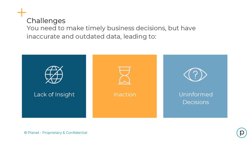
Field-Level Crop Information VEGETATION HEALTH COMMERCIAL FORESTRY Estimate tree count, assess post- harvestment, and identify tree stress and disease. Detect crop anomalies and trends using vegetation indices that leverage near-infrared spectral band Corn Understand how land is being used, how it changes over time, and what is being grown LAND COVER CHANGE
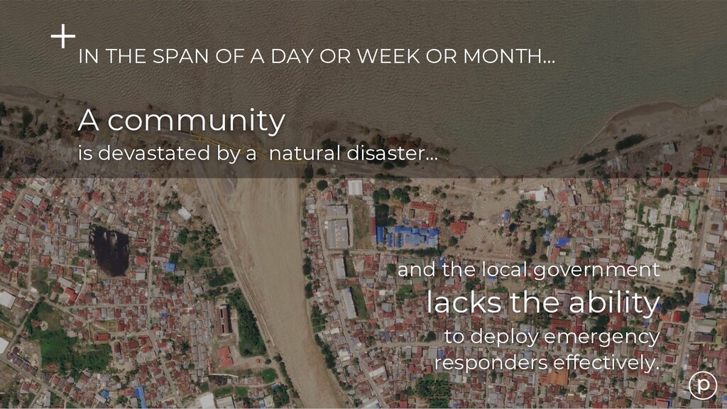
data delivery provide transparency into situational events as change occurs Rapid revisit allows you to see change over time, and increases the likelihood of securing imagery of strategically important assets High temporal cadence coupled with global coverage makes remote sensing valuable for any government Use Cases in Defense & Intelligence Gain Situational Awareness of Daily, Global Change A Chinese road is constructed across the line of control at the northern Arunachal Pradesh border. CHINA INDIA
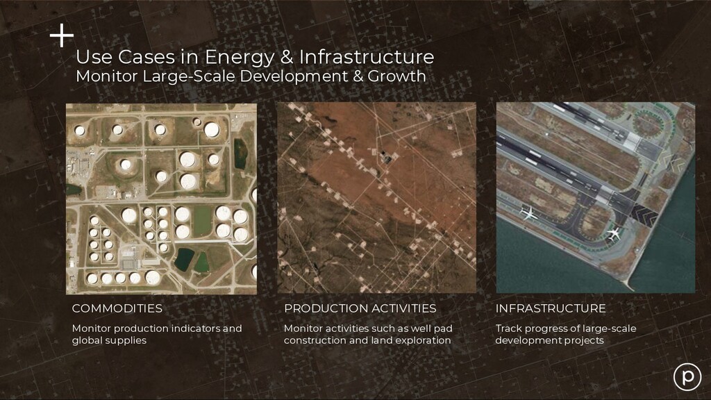
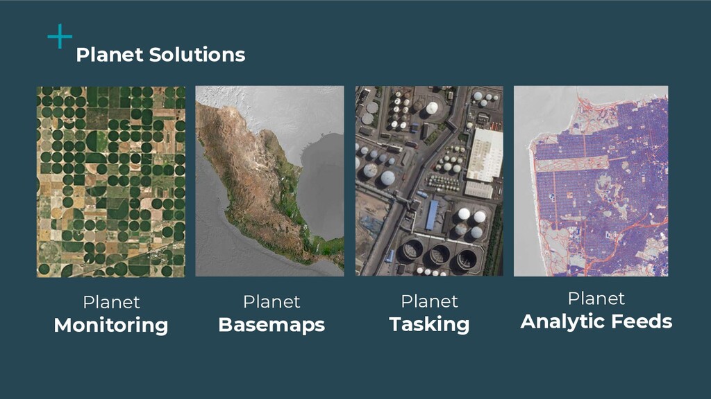
Monitor activities such as well pad construction and land exploration Track progress of large-scale development projects Use Cases in Energy & Infrastructure Monitor Large-Scale Development & Growth
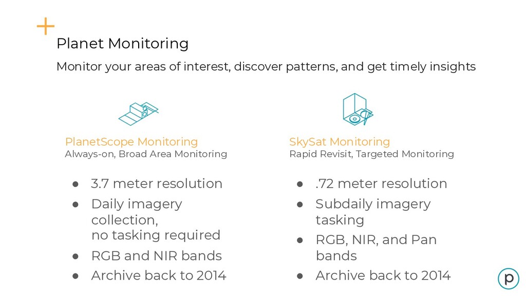
• Daily imagery collection, no tasking required • RGB and NIR bands • Archive back to 2014 Planet Monitoring Monitor your areas of interest, discover patterns, and get timely insights SkySat Monitoring Rapid Revisit, Targeted Monitoring • .72 meter resolution • Subdaily imagery tasking • RGB, NIR, and Pan bands • Archive back to 2014
get historical context, and understand what’s happening on the ground with daily imagery of your areas of interest. • Quick and easy access. Pre-processed, analysis- ready imagery that can easily integrate into your existing workflows and tools • Customizable. Choose a subscription that fits your scope and requirements. High frequency, global coverage Planet Monitoring
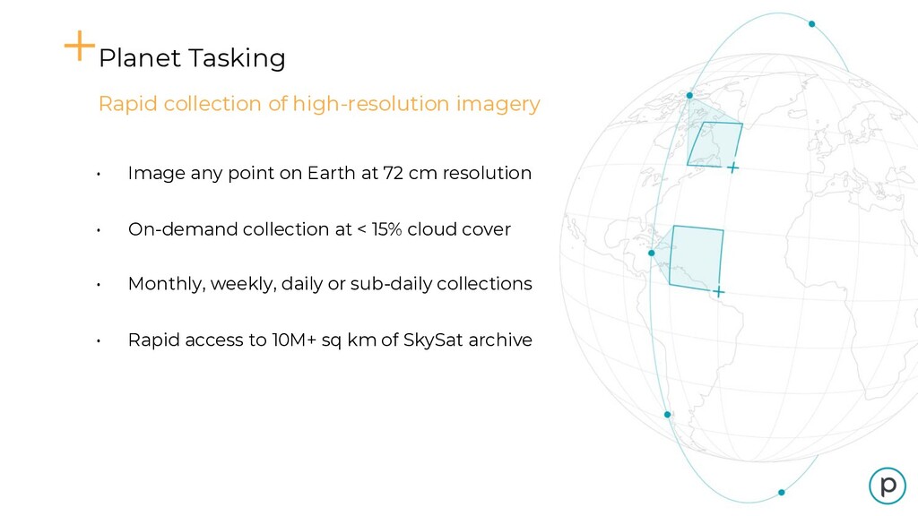
point on Earth at 72 cm resolution • On-demand collection at < 15% cloud cover • Monthly, weekly, daily or sub-daily collections • Rapid access to 10M+ sq km of SkySat archive
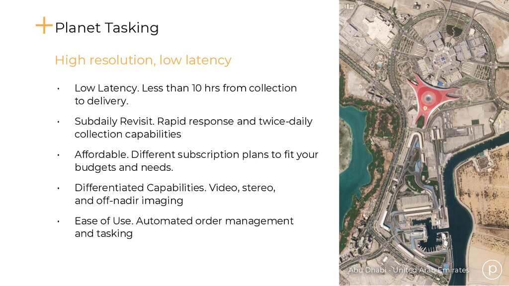
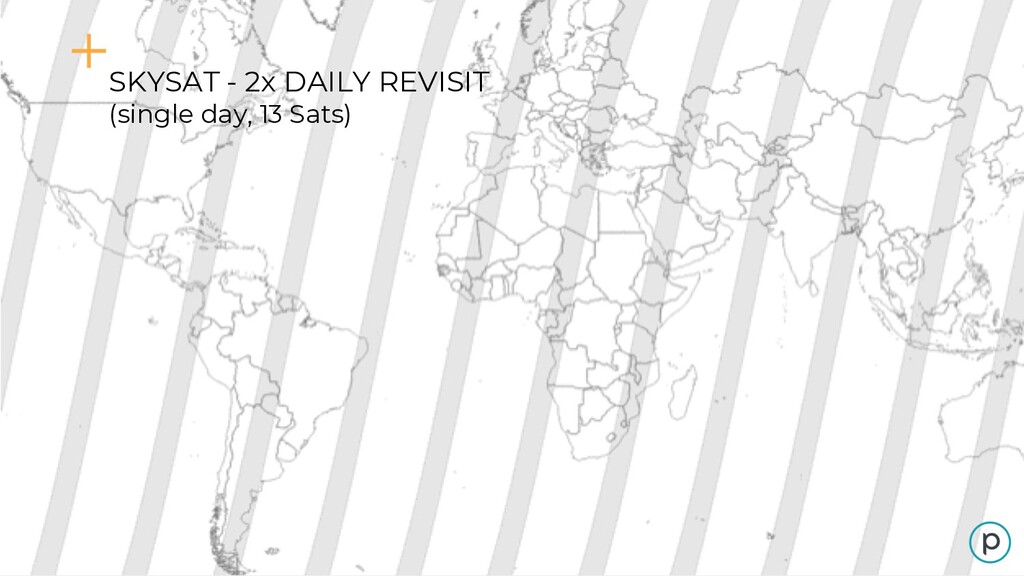
than 10 hrs from collection to delivery. • Subdaily Revisit. Rapid response and twice-daily collection capabilities • Affordable. Different subscription plans to fit your budgets and needs. • Differentiated Capabilities. Video, stereo, and off-nadir imaging • Ease of Use. Automated order management and tasking High resolution, low latency Planet Tasking
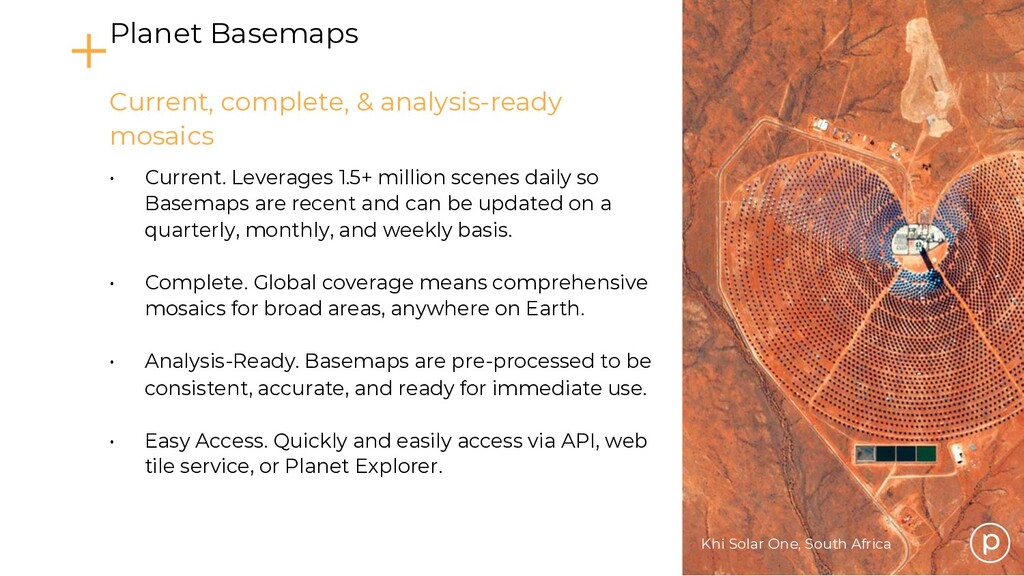
scenes daily so Basemaps are recent and can be updated on a quarterly, monthly, and weekly basis. • Complete. Global coverage means comprehensive mosaics for broad areas, anywhere on Earth. • Analysis-Ready. Basemaps are pre-processed to be consistent, accurate, and ready for immediate use. • Easy Access. Quickly and easily access via API, web tile service, or Planet Explorer. Current, complete, & analysis-ready mosaics Planet Basemaps
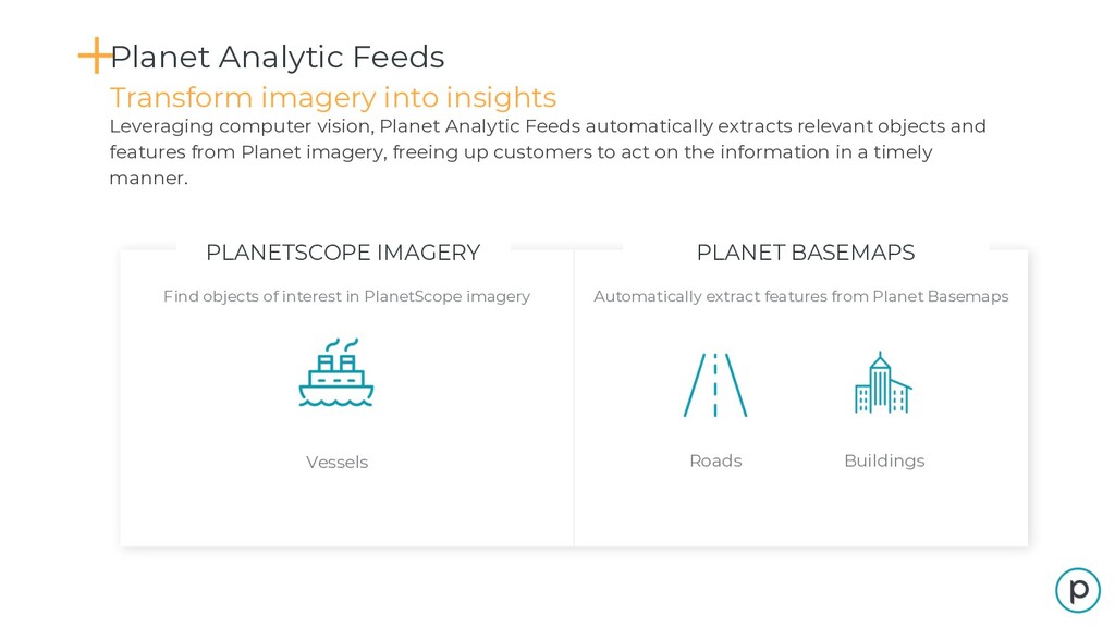
imagery Automatically extract features from Planet Basemaps Vessels Roads Buildings Transform imagery into insights Planet Analytic Feeds Leveraging computer vision, Planet Analytic Feeds automatically extracts relevant objects and features from Planet imagery, freeing up customers to act on the information in a timely manner.
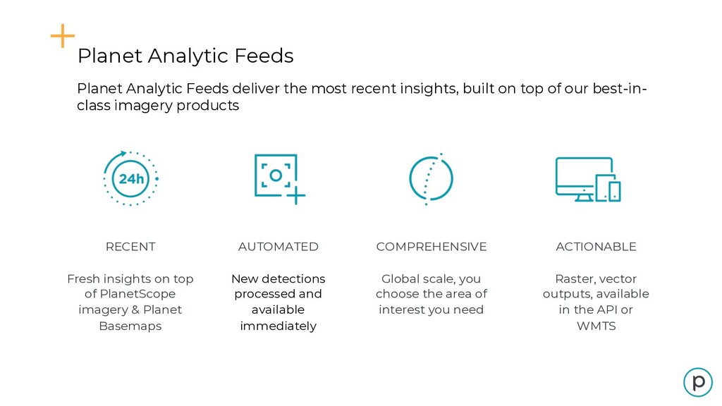
top of our best-in- class imagery products Planet Analytic Feeds RECENT Fresh insights on top of PlanetScope imagery & Planet Basemaps COMPREHENSIVE Global scale, you choose the area of interest you need ACTIONABLE Raster, vector outputs, available in the API or WMTS AUTOMATED New detections processed and available immediately
images available for any given location on Earth Deep historical context on your areas of interest and deep imagery stacks for analytics and app development Train machine learning and computer vision algorithms Detect change and assess trends globally Access to PlanetScope, RapidEye, SkySat, Landsat, and Sentinel archives
with imagery corrected for a variety of factors and analysis-ready, without costly post-processing or manual intervention. • Cloud-based access, speed, and scale. Built to be fast and intuitive, enabling you to run analytics and extract information at scale. • API-first integration and download. Programmatically search and download from our 6+ petabyte catalog with Planet’s API, built on accepted REST, JSON, and HTTP standards Planet Platform Automated, scalable, API-first
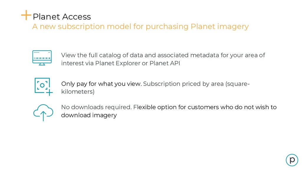
View the full catalog of data and associated metadata for your area of interest via Planet Explorer or Planet API Only pay for what you view. Subscription priced by area (square- kilometers) No downloads required. Flexible option for customers who do not wish to download imagery
+ Download A new subscription model for purchasing Planet imagery View the catalog of newly acquired data and associated metadata in Planet Explorer or Planet API. See everything, only download what you absolutely need Features include: • Clipping to your AOI • Cloud integrations • More to come! Pay for what you view and download. Priced by download area (square- kilometers)
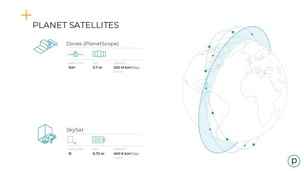
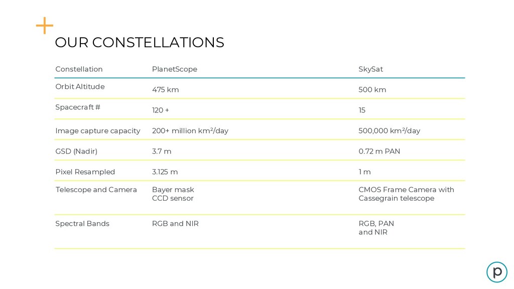
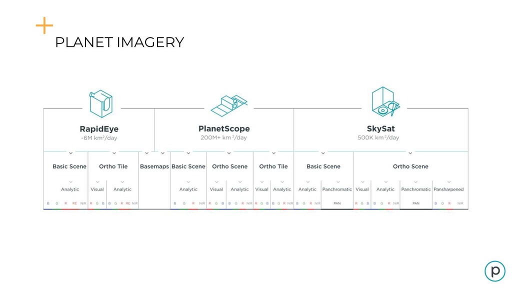
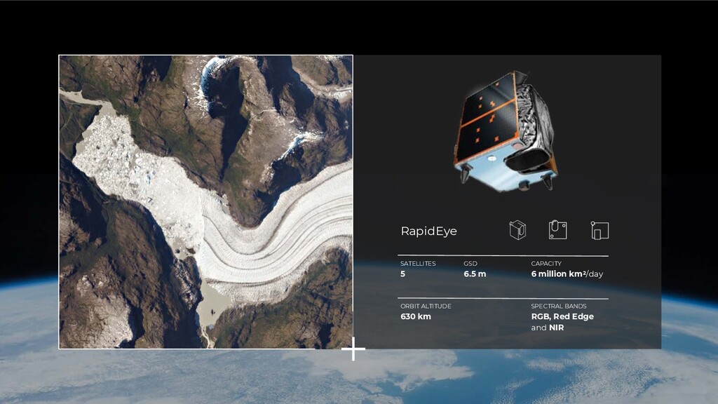
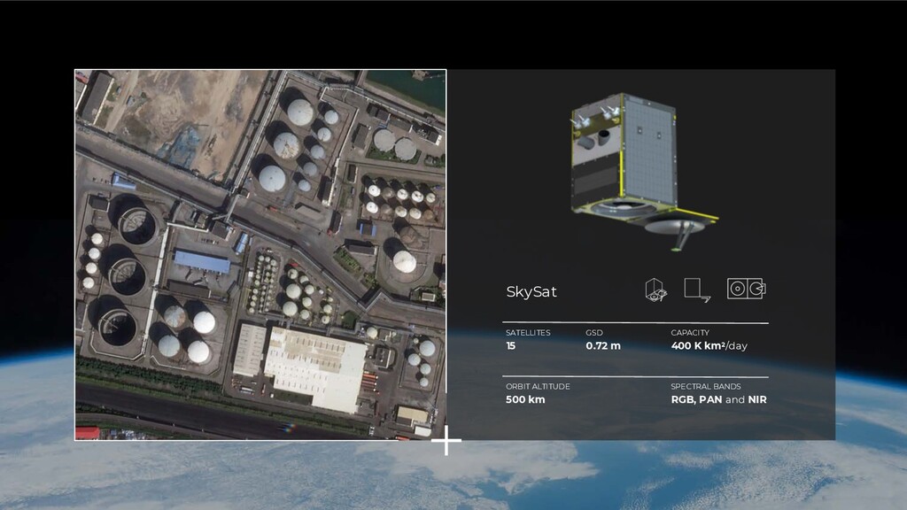
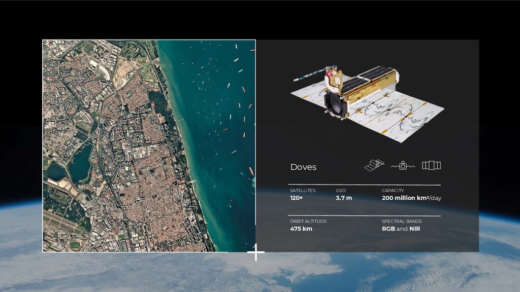
km Spacecraft # 120 + 15 Image capture capacity 200+ million km²/day 500,000 km²/day GSD (Nadir) 3.7 m 0.72 m PAN Pixel Resampled 3.125 m 1 m Telescope and Camera Bayer mask CCD sensor CMOS Frame Camera with Cassegrain telescope Spectral Bands RGB and NIR RGB, PAN and NIR
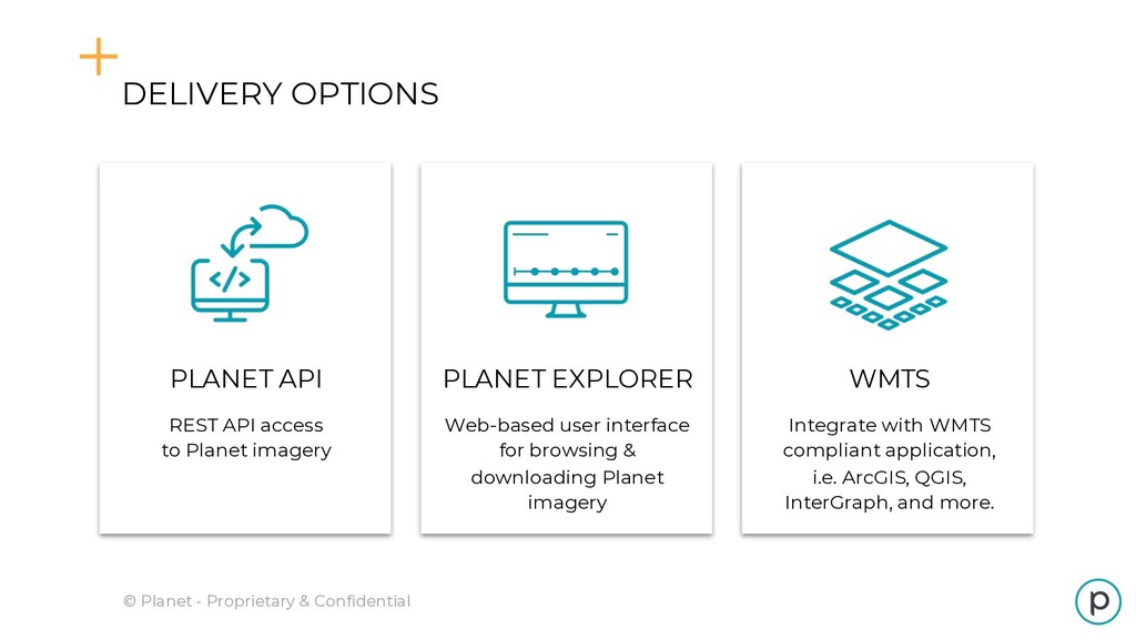
with WMTS compliant application, i.e. ArcGIS, QGIS, InterGraph, and more. PLANET EXPLORER Web-based user interface for browsing & downloading Planet imagery PLANET API REST API access to Planet imagery
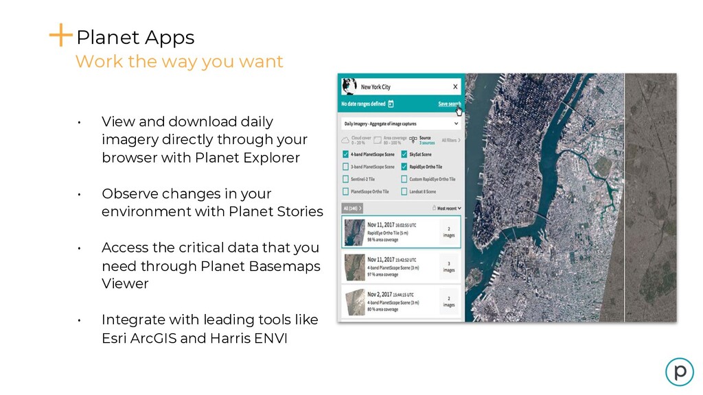
with Planet Explorer • Observe changes in your environment with Planet Stories • Access the critical data that you need through Planet Basemaps Viewer • Integrate with leading tools like Esri ArcGIS and Harris ENVI Planet Apps Work the way you want
![[Macro trends slide] Democratization of Satellite Imagery Cloud-based Platforms Agile](https://files.speakerdeck.com/presentations/0be53f5307fa4248b93ac35cb548e89b/slide_6.jpg)
![Email [email protected] for Planet Labs information and pricing options](https://files.speakerdeck.com/presentations/0be53f5307fa4248b93ac35cb548e89b/slide_49.jpg)