A pitch at the Code Naija on our solution Parrot which is focused on aggregating reports on lacking amenities and providing a base platform for contractors to look up places for action.
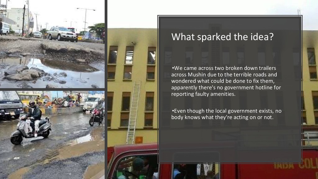
trailers across Mushin due to the terrible roads and wondered what could be done to fix them, apparently there's no government hotline for reporting faulty amenities. •Even though the local government exists, no body knows what they're acting on or not.
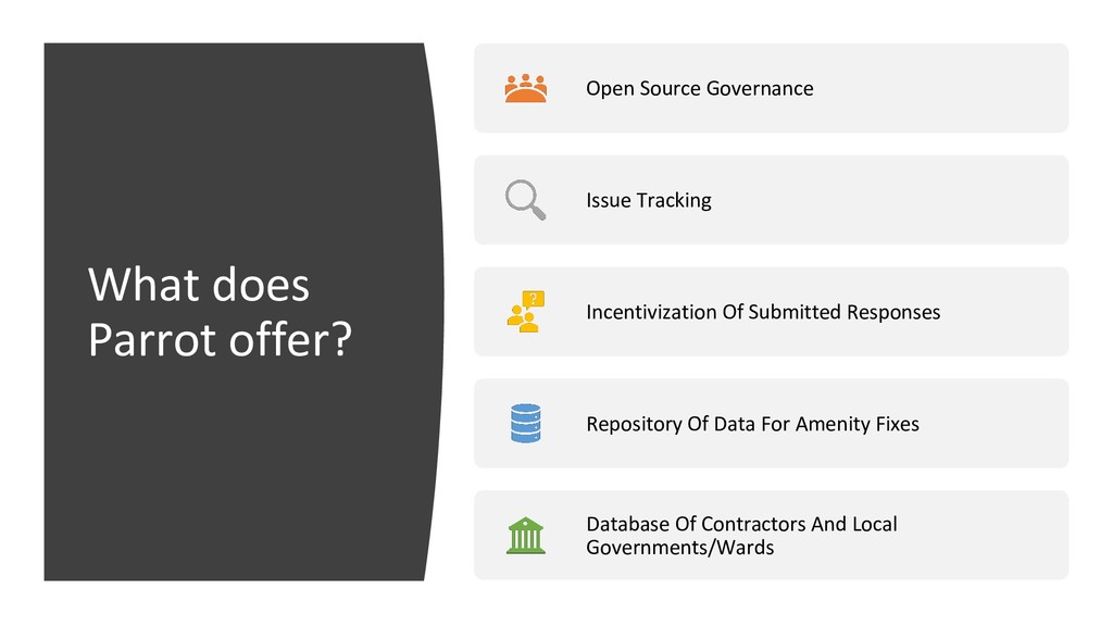
amenities requiring repairs alongside government attention and open-sourcing governance, holding all parties publicly accountable in the process. There are lacking mediums in managing requests for fixing amenities, corruption due to manual operation logistics in government offices and inability of contractors to get visibility on fixing such problems so we make that accessible.
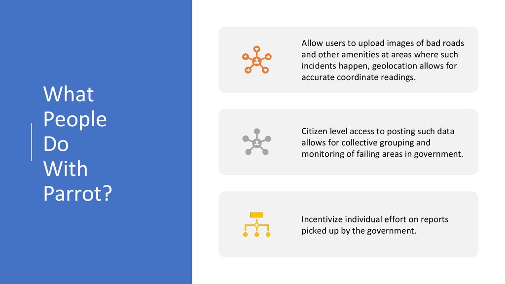
of bad roads and other amenities at areas where such incidents happen, geolocation allows for accurate coordinate readings. Citizen level access to posting such data allows for collective grouping and monitoring of failing areas in government. Incentivize individual effort on reports picked up by the government.
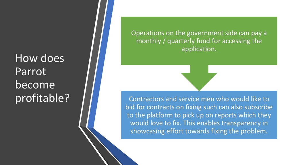
would like to bid for contracts on fixing such can also subscribe to the platform to pick up on reports which they would love to fix. This enables transparency in showcasing effort towards fixing the problem. Operations on the government side can pay a monthly / quarterly fund for accessing the application.
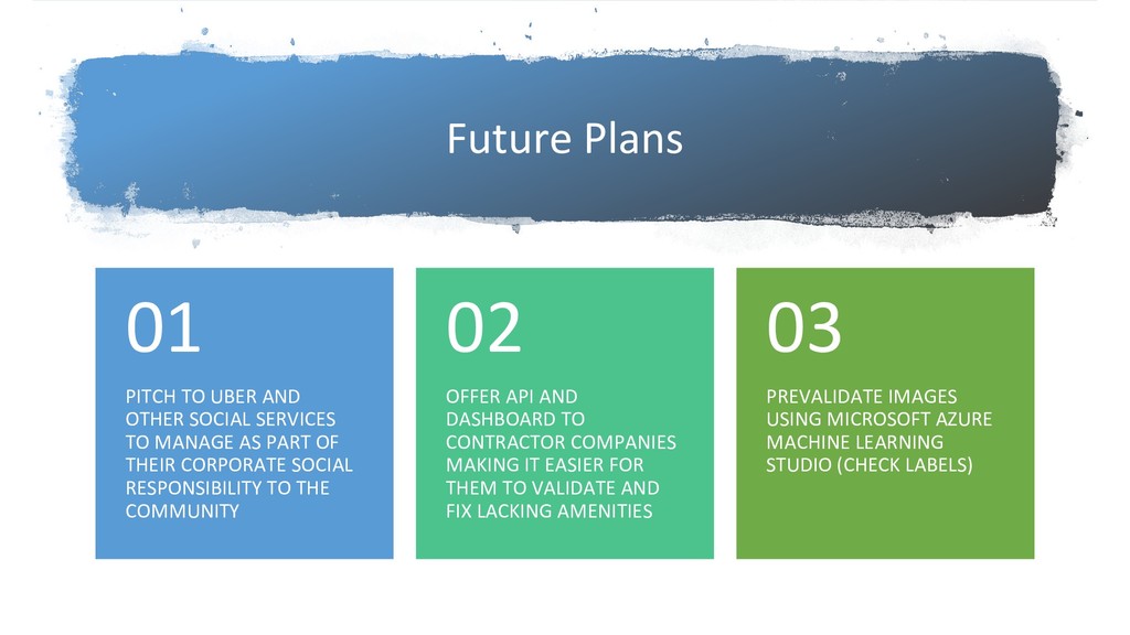
MANAGE AS PART OF THEIR CORPORATE SOCIAL RESPONSIBILITY TO THE COMMUNITY 01 OFFER API AND DASHBOARD TO CONTRACTOR COMPANIES MAKING IT EASIER FOR THEM TO VALIDATE AND FIX LACKING AMENITIES 02 PREVALIDATE IMAGES USING MICROSOFT AZURE MACHINE LEARNING STUDIO (CHECK LABELS) 03
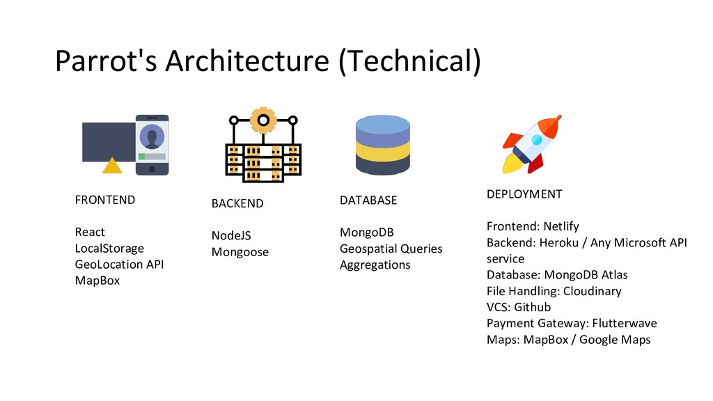
source the data uploaded using public repositories dumps on GITHUB using a CRON process, it's readily available for data visualization and historical studies on how governments have paved repairs over the years.