Upgrade to Pro — share decks privately, control downloads, hide ads and more …

GSCC2016_UrbanInformaticsSeminar

 GSCC2016_UrbanInformaticsSeminar

Toshikazu SETO

June 28, 2016
Tweet

More Decks by Toshikazu SETO

Other Decks in Education

Transcript

  1. 2016/06/28 Urban  Informatics  Seminar  @  GSCC 2 Overview  My  Research

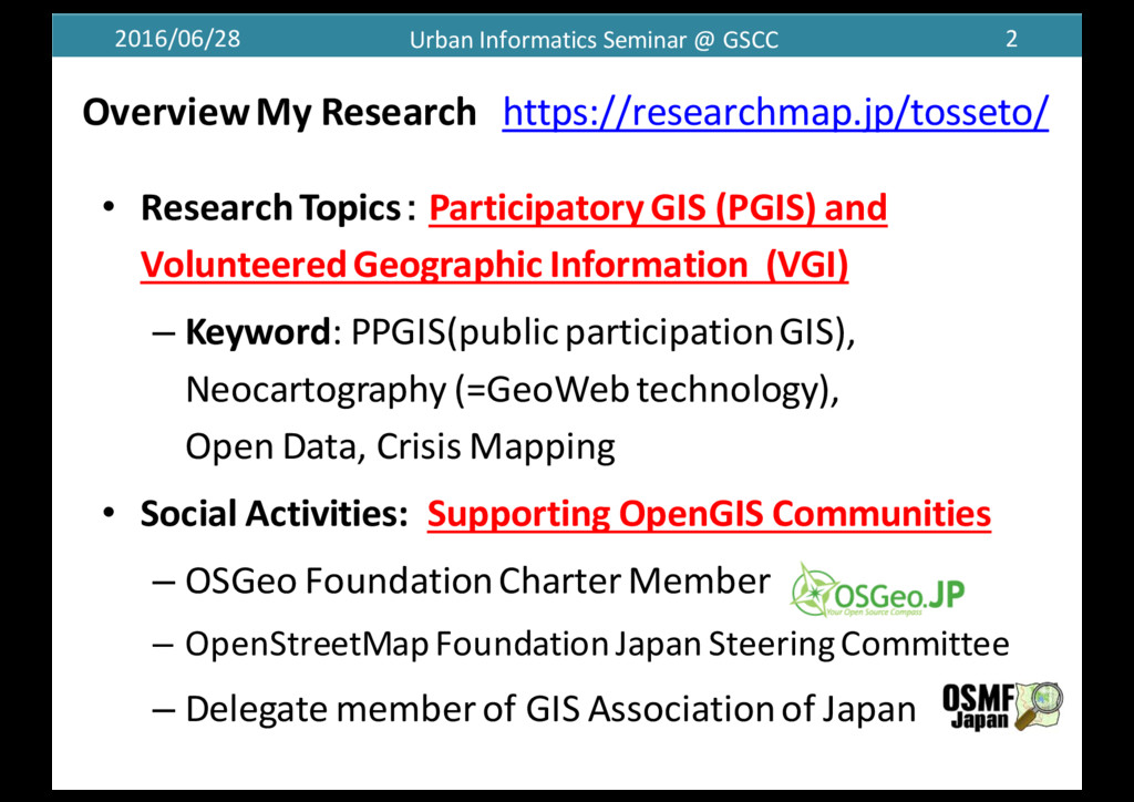
    https://researchmap.jp/tosseto/ • Research  Topics: Participatory  GIS  (PGIS)  and   Volunteered  Geographic  Information (VGI) – Keyword:  PPGIS(public  participation  GIS),   Neocartography (=GeoWebtechnology), Open  Data,  Crisis  Mapping   • Social  Activities:   Supporting  OpenGIS Communities – OSGeo Foundation  CharterMember – OpenStreetMap Foundation  Japan  SteeringCommittee – Delegate  member  of  GIS  Association  of  Japan
  2. 2016/06/28 Urban  Informatics  Seminar  @  GSCC 3 Center  for  Spatial

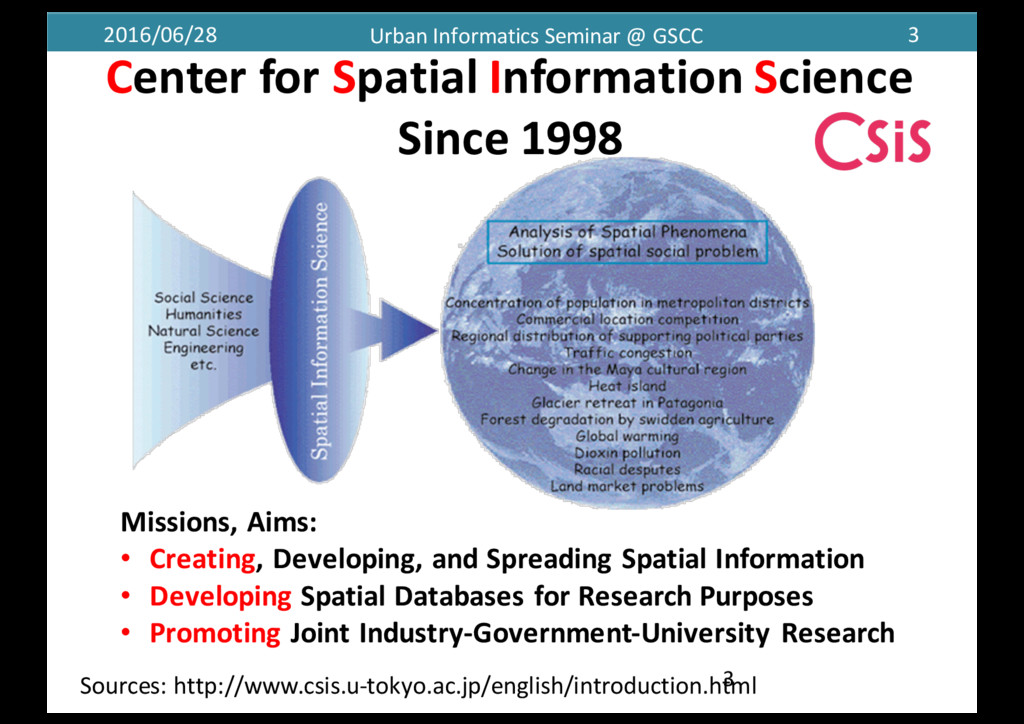
     Information  Science Since  1998 3 Missions,  Aims: • Creating,  Developing,  and  Spreading  Spatial  Information • Developing Spatial  Databases  for  Research  Purposes • Promoting Joint  Industry-­‐Government-­‐University  Research Sources:  http://www.csis.u-­‐tokyo.ac.jp/english/introduction.html
  3. 2016/06/28 Urban  Informatics  Seminar  @  GSCC 4 Recent  Activities Humanitarian

     Information  Response  x  GeoWeb for  Kumamoto  Earthquake
  4. 2016/06/28 Urban  Informatics  Seminar  @  GSCC 5 The  Estimation  for

     Human  Congestion   on  The  2016  Kumamoto  Earthquake  (4.15-­‐17  Ave./Daily  Ave.) •:ZDC社提供「全国避難所データベース」(2015年3月) ★:Youth  Action  for  Kumamoto避難所データ(2016年4月28日版) メッシュ図:「混雑統計®」©ZENRIN  DataComCO.,  LTD. 背景図:  ©OpenStreetMapcontributors Ratio  (%) Source:  http://bit.ly/28ZGE7a
  5. 2016/06/28 Urban  Informatics  Seminar  @  GSCC 6 ←Daily: 380  peoples

    4/15: 350  peoples 4/16: 2360 peoples 4/17: 1420  peoples ←Daily:310 peoples 4/15:600  peoples 4/16:820  peoples 4/17:1420peoples •:ZDC社提供「全国避難所データベース」(2015年3月) ★:Youth  Action  for  Kumamoto避難所データ(2016年4月28日版) 背景写真:国土地理院・平成28年熊本地震・熊本地区 正射画像(2016年4月16日撮影) メッシュ図:「混雑統計®」©ZENRIN  DataComCO.,  LTD. The  Estimation  for  Human  Congestion   on  The  2016  Kumamoto  Earthquake  @  Mashiki Town
  6. 2016/06/28 Urban  Informatics  Seminar  @  GSCC 7 0 500 1000

    1500 2000 2500 3000 3500 13_00 13_02 13_04 13_06 13_08 13_10 13_12 13_14 13_16 13_18 13_20 13_22 14_00 14_02 14_04 14_06 14_08 14_10 14_12 14_14 14_16 14_18 14_20 14_22 15_00 15_02 15_04 15_06 15_08 15_10 15_12 15_14 15_16 15_18 15_20 15_22 16_00 16_02 16_04 16_06 16_08 16_10 16_12 16_14 16_16 16_18 16_20 16_22 17_00 17_02 17_04 17_06 17_08 17_10 17_12 17_14 17_16 17_18 17_20 17_22 0 500 1000 1500 2000 2500 3000 3500 13_00 13_02 13_04 13_06 13_08 13_10 13_12 13_14 13_16 13_18 13_20 13_22 14_00 14_02 14_04 14_06 14_08 14_10 14_12 14_14 14_16 14_18 14_20 14_22 15_00 15_02 15_04 15_06 15_08 15_10 15_12 15_14 15_16 15_18 15_20 15_22 16_00 16_02 16_04 16_06 16_08 16_10 16_12 16_14 16_16 16_18 16_20 16_22 17_00 17_02 17_04 17_06 17_08 17_10 17_12 17_14 17_16 17_18 17_20 17_22 The  Transition  of  Human  Congestion  (per  1  hour) 4/14  21:26 M6.5 4/16  01:25 M7.3 Grandmesse Kumamoto 4/14  21:26 M6.5 4/16  01:25 M7.3 Hiroyasu  Elementary  School グラフ:「混雑統計®」©ZENRIN  DataComCO.,  LTD.
  7. 2016/06/28 Urban  Informatics  Seminar  @  GSCC 8 Contents • Research

     Background • The  Concepts  of – Open  Data – Open  Government – Civic  Tech • Open  Data  and  Civic  Tech  Situation  in  Japan • Conclusions
  8. 2016/06/28 Urban  Informatics  Seminar  @  GSCC 10 (Craig  et  al.,

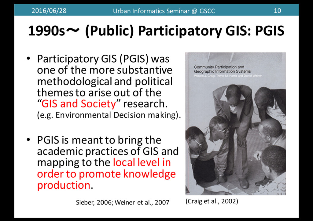
     2002) • Participatory  GIS  (PGIS)  was   one  of  the  more  substantive   methodological  and  political   themes  to  arise  out  of  the   “GIS  and  Society”  research. (e.g.  Environmental  Decision  making). • PGIS  is  meant  to  bring  the   academic  practices  of  GIS  and   mapping  to  the  local  level  in   order  to  promote  knowledge   production.   1990s〜 (Public)  Participatory  GIS:  PGIS Sieber,  2006;  Weiner  et  al.,  2007
  9. 2016/06/28 Urban  Informatics  Seminar  @  GSCC 11 GIS  and  Society

     (2011) • 1.  Foundations  of  GIS  and   Society  Research • 2.  GIS  and  Modern  Life • 3.  Alternative  Representations  in   GIS  and  Society • 4.  GIS  in  Organizations  and   Institutions • 5.  GIS  in  Public  Participation  and   Community  Development • 6.  Value,  Fairness  and  Privacy  in   a  GIS  Context
  10. 2016/06/28 Urban  Informatics  Seminar  @  GSCC 12 • Neogeography combines

     the   complex  techniques  of   cartography  and  GIS  and  places   them  within  reach  of  users  and   developers. • Neogeography is  about  sharing   location  informationwith  friends   and  visitors,  helping  to  shape   contexts,  and  conveying  an   understanding  through  the   knowledge  of  place. • Andrew  Turner  (2006):   『Introduction  to  Neogeography』 Neogeography
  11. 2016/06/28 Urban  Informatics  Seminar  @  GSCC 13 Volunteered  Geographic  Information

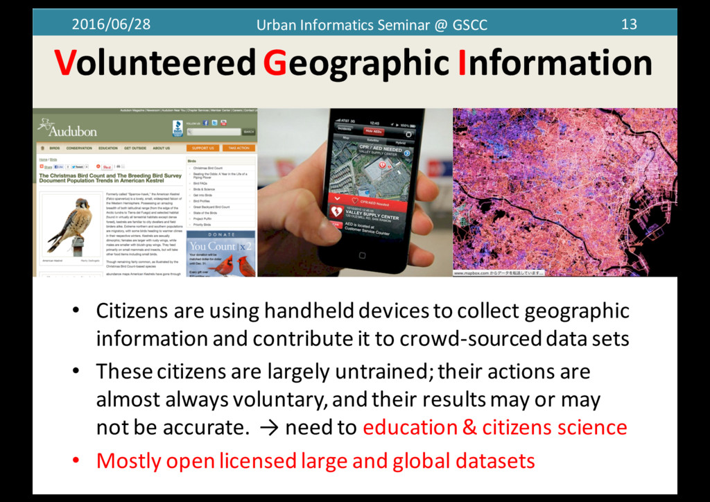
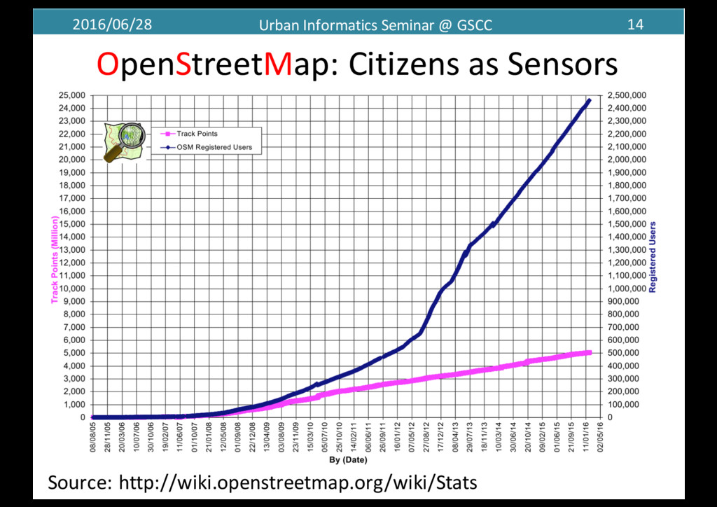
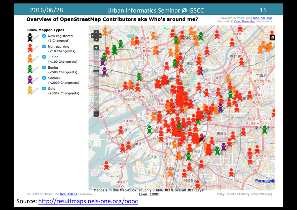
    • Citizens  are  using  handheld  devices  to  collect  geographic   information  and  contribute  it  to  crowd-­‐sourced  data  sets • These  citizens  are  largely  untrained;  their  actions  are   almost  always  voluntary,  and  their  results  may  or  may   not  be  accurate.    → need  to  education  &  citizens  science • Mostly  open  licensed  large  and  global  datasets
  12. 2016/06/28 Urban  Informatics  Seminar  @  GSCC 14 OpenStreetMap:  Citizens  as

     Sensors 14 Source: http://wiki.openstreetmap.org/wiki/Stats
  13. 2016/06/28 Urban  Informatics  Seminar  @  GSCC 16 • Citizen  science

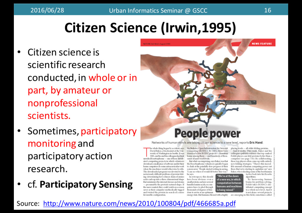
     is   scientific  research   conducted,  in  whole  or  in   part,  by  amateur  or   nonprofessional   scientists. • Sometimes,  participatory   monitoring  and   participatory  action   research. • cf.  Participatory  Sensing Source:    http://www.nature.com/news/2010/100804/pdf/466685a.pdf Citizen  Science  (Irwin,1995)
  14. 2016/06/28 Urban  Informatics  Seminar  @  GSCC 18 Concepts  of  Open

     Data,  Open   Government  and  Civic  Tech  
  15. 2016/06/28 Urban  Informatics  Seminar  @  GSCC 19 19/21 “Open  means

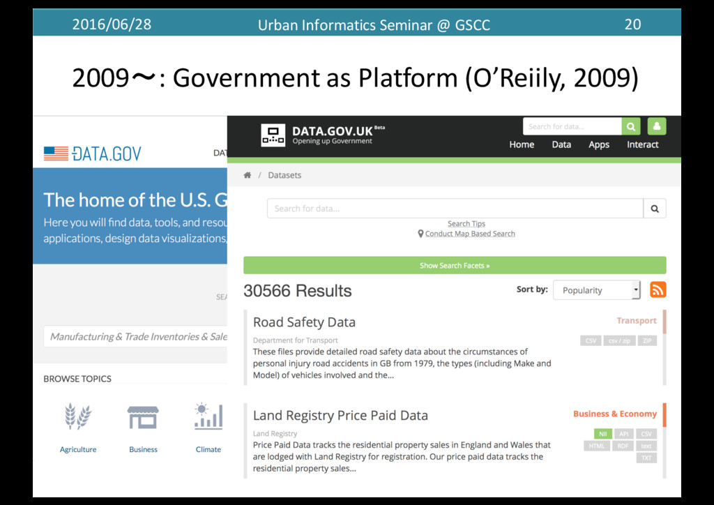
     anyone can  freely  access,  use,  modify,  and   share for  any  purpose (subject,  at  most,  to  requirements  that   preserve  provenance  and  openness).”   by  opendefinition.org ▪Open  government  → Open  Inovation ! Government  as  a  Platform プラットフォームとしての政府 (O'Reilly,  2009)
  16. 2016/06/28 Urban  Informatics  Seminar  @  GSCC 22 G8 Open Data

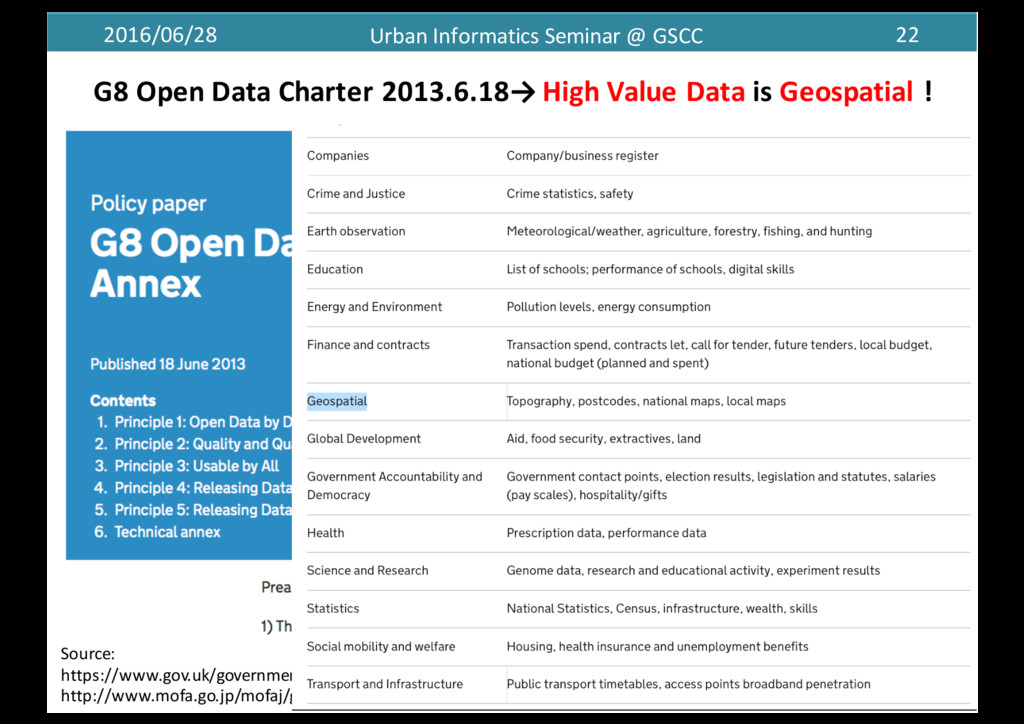
    Charter 2013.6.18→ High Value Data is Geospatial ! Source: https://www.gov.uk/government/publications/open-­‐data-­‐charter/g8-­‐open-­‐data-­‐charter-­‐and-­‐technical-­‐annex http://www.mofa.go.jp/mofaj/gaiko/page4_000099.html 22/21
  17. 2016/06/28 Urban  Informatics  Seminar  @  GSCC 23 Global  Open  Data

     Index  2015 http://2015.index.okfn.org/place/ This  census  data  is  available  to use  public  domain.
  18. 2016/06/28 Urban  Informatics  Seminar  @  GSCC 24 Evaluation  Score 15

     Key  Datasets  Availability  and    9  Methods • statistics National  Statistics • budget Government  Budget • legislation Legislation • procurement Procurement  tenders   • elections Election  Results • map National  Map • weather Weather  forecast • emissions Pollutant  Emissions • companies Company  Register • postcodes Location  datasets • water Water  Quality • land Land  Ownership • spending Government  Spending • timetables Transport  Timetables • health Health  performance ×
  19. 2016/06/28 Urban  Informatics  Seminar  @  GSCC 29 Taiwan:Data  Portal  &

     Provide  API(M2M) cf.  Real-­‐estate  transaction Source:  http://data.gov.tw/
  20. 2016/06/28 Urban  Informatics  Seminar  @  GSCC 33 Concepts  of  Open

     Data,  Open   Government  and  Civic  Tech  
  21. 2016/06/28 Urban  Informatics  Seminar  @  GSCC 34 ࢢຽͷ࣏ࣗͱ ΦʔϓϯͳςΫϊϩδʔɾσʔλΛ௨ͯ͡ ஍Ҭ՝୊΍ࣾձ՝୊ͷղܾΛ໨ࢦ͢

    Knight  Foundation  (2013):  The  Emergence  of  Civic  Tech:  Investments  in  a  Growing  Field
  22. 2016/06/28 Urban  Informatics  Seminar  @  GSCC 37 Civic  Tech(nology):  civic

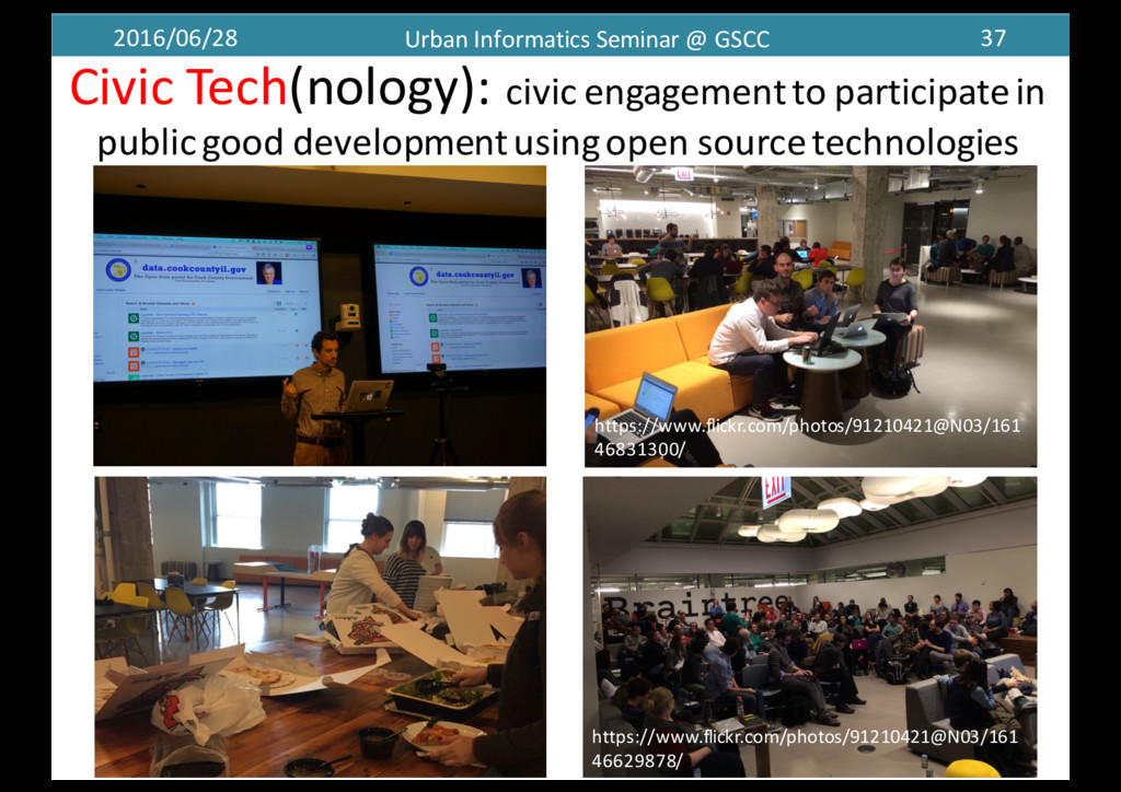
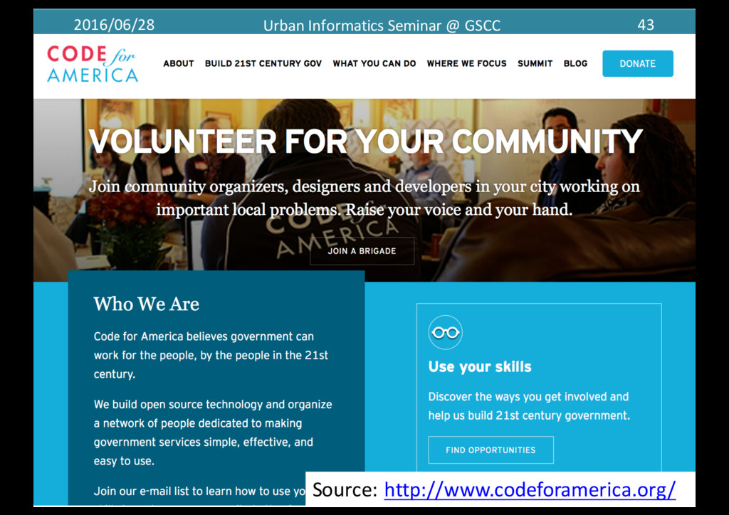
     engagement  to  participate  in   public  good  development  using  open  source  technologies   37 https://www.flickr.com/photos/91210421@N03/161 46831300/ https://www.flickr.com/photos/91210421@N03/161 46629878/
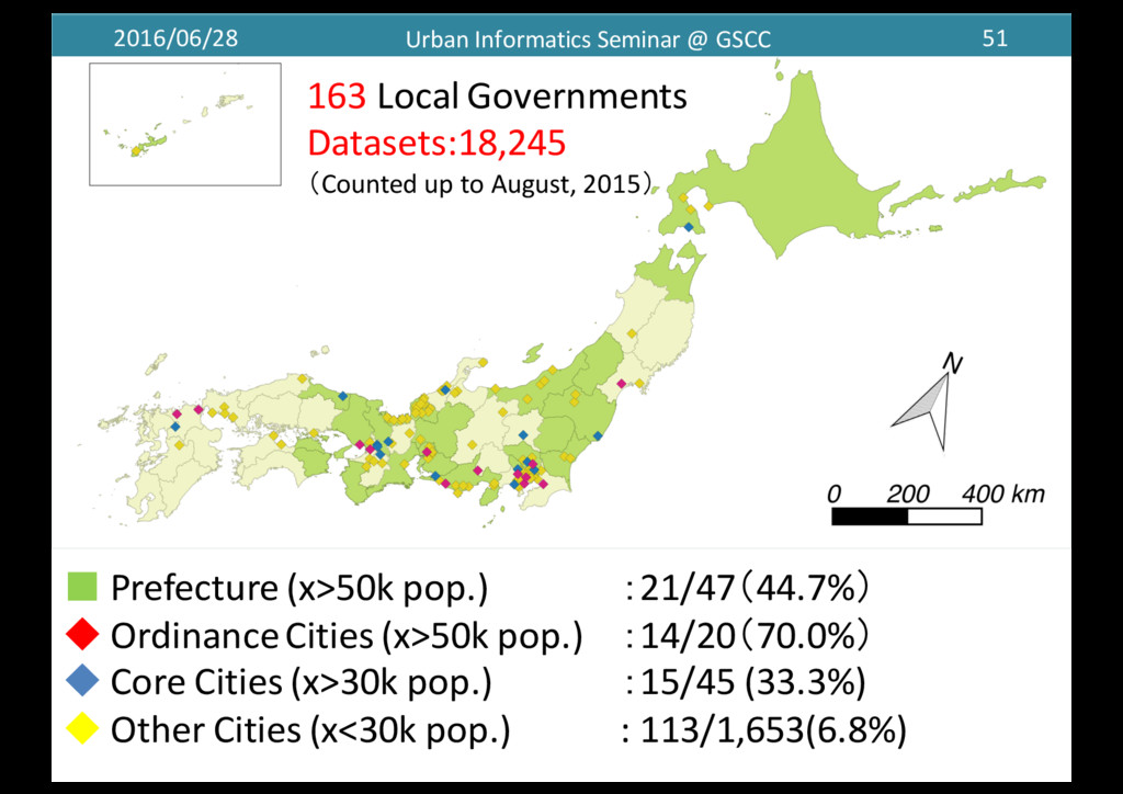
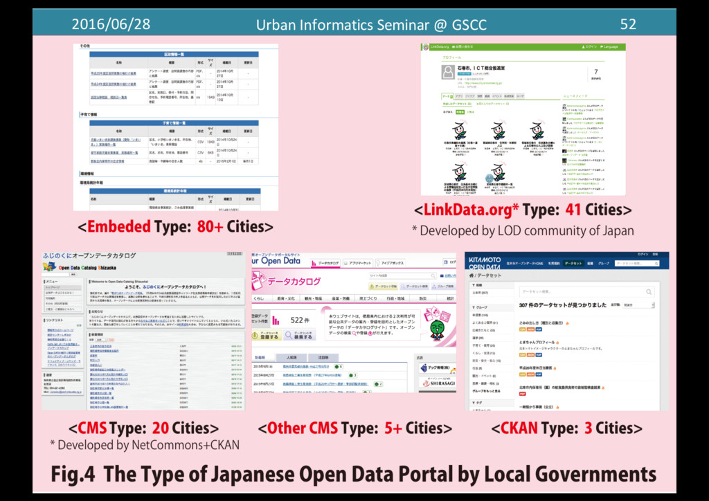
  23. 2016/06/28 Urban  Informatics  Seminar  @  GSCC 38 Chicago  (Open)  Data

     Portal(Since  2010.06) 38 Source:  https://data.cityofchicago.org/
  24. 2016/06/28 Urban  Informatics  Seminar  @  GSCC 39 Download  Datasets  more

     than  5,000  times 39 144301 82150 36131 34265 29117 27576 26986 25420 24336 24320 18887 16981 15714 15556 15083 13012 12885 12309 12303 11948 10331 10121 9436 8955 8360 8232 7153 6636 6592 6509 5761 5542 5345 5335 5274 5161 5093 0 20000 40000 60000 80000 100000 120000 140000 160000 Crimes12 20011to1present Business1Licenses Current1 Employee1Names,1Salaries,1and1Position1 Titles Crimes12 One1year1prior1 to1present FOIA1Request1Log12 Business1Affairs1&1Consumer1 Protection FOIA1Request1Log12 Police Boundaries1 2 Neighborhoods CDPH1Storage1Tanks 3111Service1Requests12 Graffiti1 Removal 3111Service1Requests12 Sanitation1 Code1Complaints Public1 Chauffeurs Business1Licenses12 Current1 Active CDPH1Environmental1 Complaints Towed1Vehicles Boundaries1 2 City12 Outdated1Format Boundaries1 2 Community1Areas1(current) Major1Streets CDPH1Asbestos1and1Demolition1 Notification FOIA1Request1Log12 Procurement1 Services Crime  and  traffic   accident  are most  important   local  issues
  25. 2016/06/28 Urban  Informatics  Seminar  @  GSCC 45 0 20 40

    60 80 100 120 140 0 20 40 60 80 100 120 140 160 180 200 adopt,a,hydrant codeforamerica.org click_that_hood ohana,api honolulu_answers codeofconduct brigade bizfriendly,web ohana,web,search annual citygram CutePets cfapi streetmix beyondtransparency recordtrac cityvoice opencounter follow,all trailsy srtracker adopt,a,siren city,analytics,dashboard public_art_finder CutePetsDenver balance cfa_coder_sounds textizen councilmatic howto congress open311dashboard promptly oakland_answers brigade,alpha civic,tech,patterns naics,api cfawp2012 blightstatus Transit,Map,in,TileMill trailsyserver somerville,teacher,tool office,screen OpenReferral transpochoices open311 straymapper OpenTrails wheresmyschoolbus prepared.ly three civic,issue,finder skillshares denver,schedules US,Census,Area,API hello,dog cfa,orgchart Forks Issues CfA Provide  CivicTech Applications:Total  575  Applications
  26. 2016/06/28 Urban  Informatics  Seminar  @  GSCC 49 Transitmix →Launched  Venture

     Company   Source:  http://getremix.com/#platform https://www.codeforamerica.org/blog/2014/07/07/transitmix-­‐design-­‐your-­‐perfect-­‐bus-­‐system/
  27. 2016/06/28 Urban  Informatics  Seminar  @  GSCC 51 ▪ Prefecture  (x>50k

     pop.) :21/47(44.7%) ◆ Ordinance  Cities  (x>50k  pop.) :14/20(70.0%) ◆ Core  Cities  (x>30k  pop.)   :15/45 (33.3%) ◆ Other  Cities  (x<30k  pop.)   :  113/1,653(6.8%) 163 Local  Governments Datasets:18,245 (Counted  up  to  August,  2015)
  28. 2016/06/28 Urban  Informatics  Seminar  @  GSCC 53 Launched  Data.go.jp The

     Strategy  Plan For  e-­‐goverenment G8  OpenDataCharter Sabae Shizuoka  Pref. Kanazawa Yokohama Chiba Shizuoka  City Datasets:18,245 (Counted  up  to  August,  2015) Prefecture Ordnance  Cities Core  Cities Other  Cities Borough
  29. 2016/06/28 Urban  Informatics  Seminar  @  GSCC 54 City  type Org.

    Open Geo   Data Size(KB) Open Data Size(KB) Total Prefecture 21 1,825 (10.0%) 309.5 3,097 (17.0%) 397.8 4,922 Ordnance  Cities 14 836 (4.6%) 36,514.5 4,516 (24.8%) 415.5 5,352 Core  Cities 15 705 (3.9%) 194.6 644 (3.5%) 874.8 1,349 Other  Cities 87 1,576 (8.6%) 8615.1 4,718 (25.9%) 244.3 6,294 Borough 26 96 (0.5%) 64.5 232 (1.3%) 4872.5 328 Total 163 5,038 (27.6%) 9975.5 13,207 453.9 18,245
  30. 2016/06/28 Urban  Informatics  Seminar  @  GSCC 55 Category Prefecture Ordnance

    Cities Core Cities Other  Cities Borough Total Open   Geo  Data (%) Statistics 305 2,776 66 2,299 0 5,446 109 2.0% Population 713 1,071 585 838 16 3,223 532 16.5% Education 333 222 85 592 34 1,266 463 36.6% Tourism 707 272 31 115 11 1,136 766 67.4% Industry 857 54 40 72 0 1,023 101 9.9% Administration 245 223 49 461 8 986 710 72.0% Public  Health 316 86 95 430 6 933 488 52.3% Disaster 284 128 61 398 8 879 378 43.0% Environment 277 82 106 152 3 620 227 36.6% Public  Facilities 98 87 75 152 10 422 382 90.5% Budget 258 34 16 89 0 397 59 14.9% The  Primary   Industry 299 0 31 63 0 393 95 24.2% Transportation 42 179 29 123 3 376 350 93.1% Publicity 3 32 31 64 227 357 28 7.8% Election 70 3 19 236 0 328 54 16.5% Infrastructure 90 67 21 103 0 281 209 74.4% Crime 21 24 4 61 1 111 19 17.1% AED 4 12 5 46 1 68 68 100% Total 4,922 5,352 1,349 6,294 328 18,245 5,038 27.6%
  31. 2016/06/28 Urban  Informatics  Seminar  @  GSCC 56 Photoed by  Fumihiko

    Kato Source:  https://www.slideshare.net/codeforjapan Code  for  Japan  CC-­‐BY-­‐SA-­‐4.0 2016.02
  32. 2016/06/28 Urban  Informatics  Seminar  @  GSCC 58 Source:  http://5374.jp/ Code

     for  Kanazawa:  5374.jp Mozilla  Public  License,  v.  2.0  →  More  than 50 Cities
  33. 2016/06/28 Urban  Informatics  Seminar  @  GSCC 59 Code  for  Sapporo:

      Interactive  Preschool  Map The  MIT  License  (MIT) →  More  than  10  Cities Source:  http://papamama.codeforsapporo.org/
  34. 2016/06/28 Urban  Informatics  Seminar  @  GSCC 60 Seseki:  Statistical  Web

     Viewer  for  Hokkaido CC-­‐BY  2.1  JP →  Started  Another  Analysis   Source:  http://labo.colspan.net/seseki_udc2015/
  35. 2016/06/28 Urban  Informatics  Seminar  @  GSCC 62 Nagoya&Shizuoka:  Night  Street

     Advisor Sources:  http://www.meti.go.jp/committee/kenkyukai/shoujo/ it_yugo_forum_data_wg/pdf/h25_02_07_00.pdf
  36. 2016/06/28 Urban  Informatics  Seminar  @  GSCC 63 The  Benefits  of

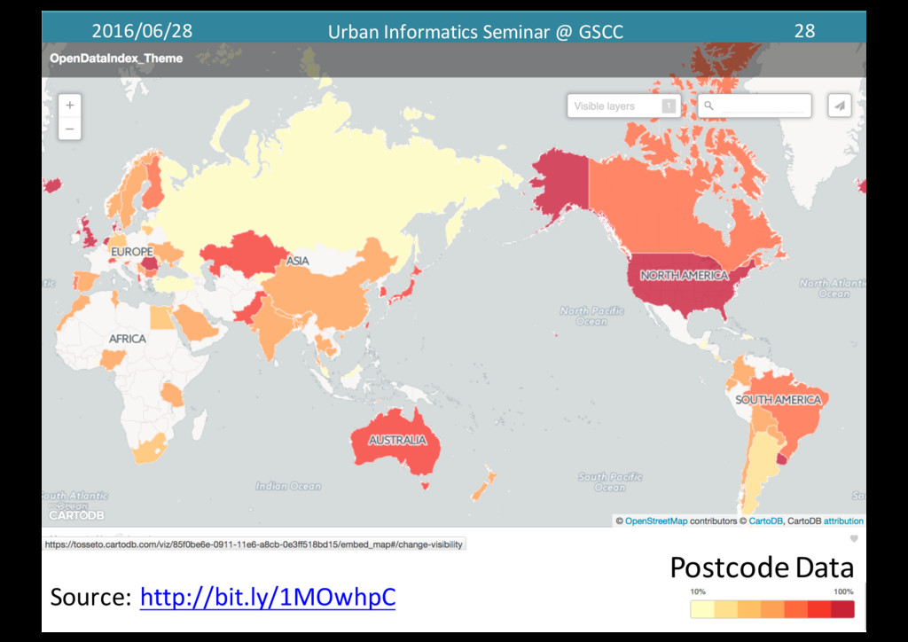
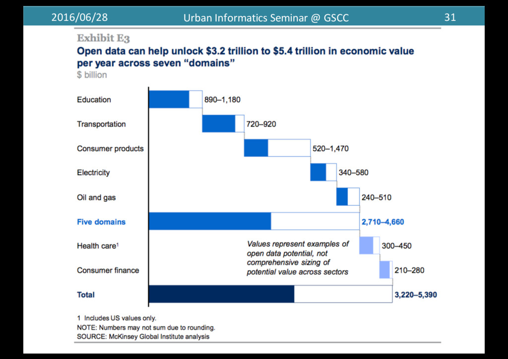
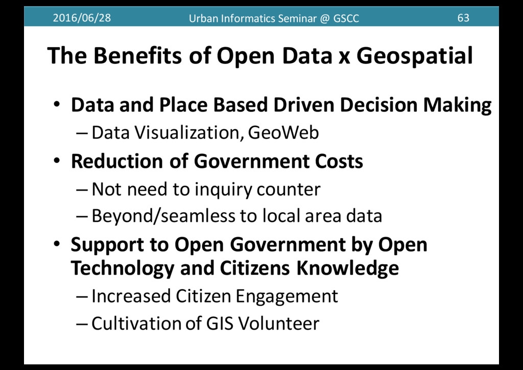
     Open  Data  x  Geospatial • Data  and  Place  Based  Driven  Decision  Making – Data  Visualization,  GeoWeb • Reduction  of  Government  Costs   – Not  need  to  inquiry  counter – Beyond/seamless  to  local  area  data • Support  to  Open  Government  by  Open   Technology  and  Citizens  Knowledge – Increased  Citizen  Engagement – Cultivation  of  GIS  Volunteer
  37. 2016/06/28 Urban  Informatics  Seminar  @  GSCC 64 Future  Research –

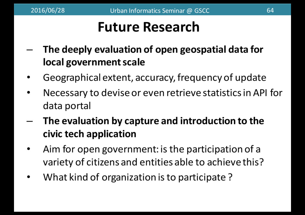
    The  deeply  evaluation  of  open  geospatial  data  for   local  government  scale • Geographical  extent,  accuracy,  frequency  of  update • Necessary  to  devise  or  even  retrieve  statistics  in  API  for   data  portal – The  evaluation  by  capture  and  introduction  to  the   civic  tech  application • Aim  for  open  government:  is  the  participation  of  a   variety  of  citizens  and  entities  able  to  achieve  this? • What  kind  of  organization  is  to  participate  ?
  38. 2016/06/28 Urban  Informatics  Seminar  @  GSCC 65 “GIS  and  Society”

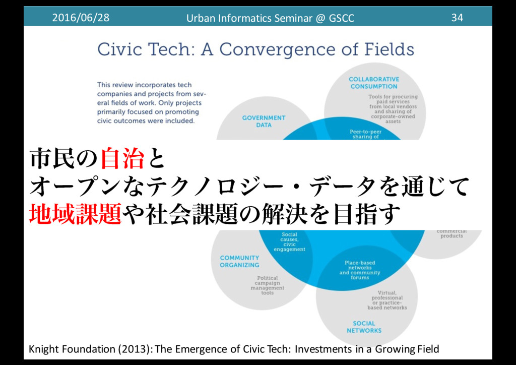
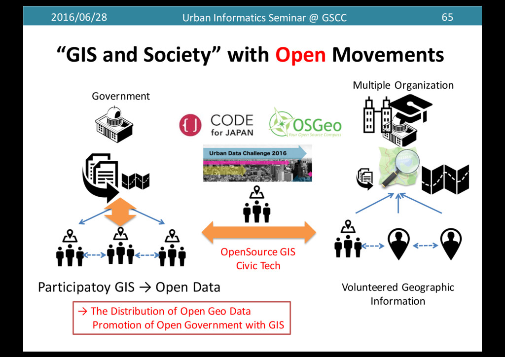
     with  Open Movements Participatoy GIS  →  Open Data Government →  The  Distribution  of  Open  Geo  Data Promotion  of  Open  Government  with  GIS OpenSource GIS Civic  Tech Volunteered  Geographic   Information Multiple  Organization  
  39. 2016/06/28 Urban  Informatics  Seminar  @  GSCC 66 Thank  you  &

    Questions ? [email protected]­‐tokyo.ac.jp http://researchmap.jp/tosseto