Upgrade to Pro — share decks privately, control downloads, hide ads and more …

UNC WIHS Geocoding Presentation

UNC WIHS
December 18, 2013

UNC WIHS Geocoding Presentation

UNC WIHS

December 18, 2013
Tweet

Other Decks in Education

Transcript

  1. Geocoding  Training   The  Affordable  Care  Act,  Socioeconomic   Context,

     Spa9al  Mapping,  and  the  WIHS   19  December  2013    
  2. Concept  background   How  do  these  factors  interact  for  WIHS

     women?   Will  access  to  health  insurance  mi9gate  some  of   the  effects  of  poverty?   Will  the  individuals  now  insured  aLer   implementa9on  of  the  Affordable  Care  Act  have   beMer  health  outcomes?   Individual  poverty   Neighborhood  poverty   Income  inequality   Access  to  health  insurance   health  (e.g.,  blood   pressure  control,   viral  load   suppression)   →
  3. Data  sources   Health   outcomes   *exist  in  WIHS

      ACA   Implementa9on   Demographic  data   *exist  in  WIHS   Context     *census  data  
  4. Overview  of  protocol   1.  Geocode  all  par9cipant’s  addresses  in

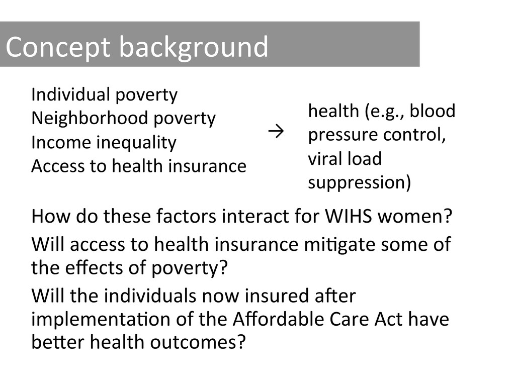
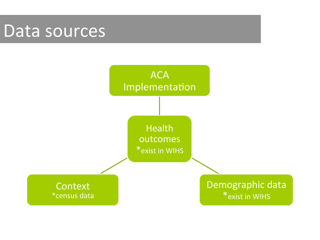
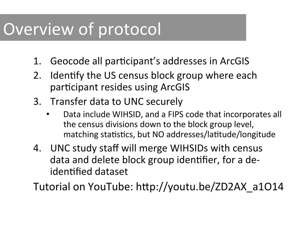
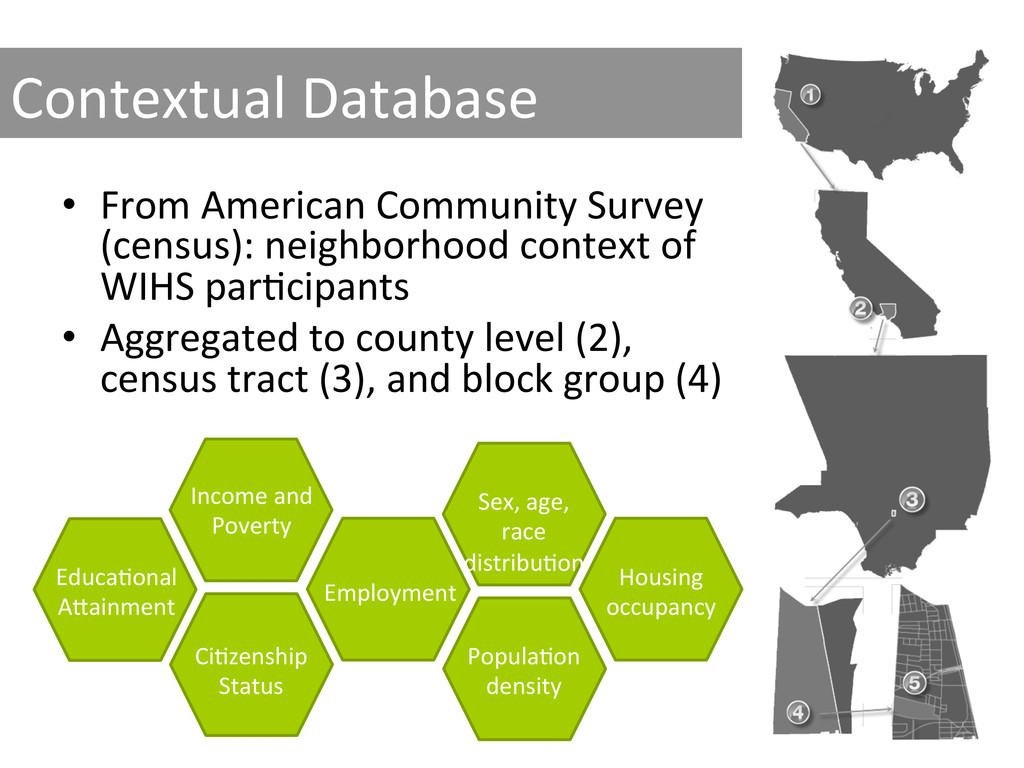
     ArcGIS   2.  Iden9fy  the  US  census  block  group  where  each   par9cipant  resides  using  ArcGIS   3.  Transfer  data  to  UNC  securely   •  Data  include  WIHSID,  and  a  FIPS  code  that  incorporates  all   the  census  divisions  down  to  the  block  group  level,   matching  sta9s9cs,  but  NO  addresses/la9tude/longitude   4.  UNC  study  staff  will  merge  WIHSIDs  with  census   data  and  delete  block  group  iden9fier,  for  a  de-­‐ iden9fied  dataset   Tutorial  on  YouTube:  hMp://youtu.be/ZD2AX_a1O14  
  5. Summary  of  data  flow   Site   UNC   Dataset

      WIHSID   CBG     Address   WIHSID   CBG   Census  data   WIHSID     Census  data   CBG  =  Census  block  group  
  6. Contextual  Database   •  From  American  Community  Survey   (census):

     neighborhood  context  of   WIHS  par9cipants   •  Aggregated  to  county  level  (2),   census  tract  (3),  and  block  group  (4)   Income  and   Poverty   Educa9onal   AMainment   Ci9zenship   Status   Employment   Sex,  age,   race   distribu9on   Popula9on   density   Housing   occupancy  
  7. Collec9ng  addresses  at  WIHS  visit   •  Collect:   – Address

     (primary  residence,  no  PO  boxes)   – Alternate  names  by  which  their  street  is  known   – Nearest  major  intersec9on  to  their  house  (this   informa9on  will  only  be  used  when  ArcGIS  is   having  difficulty  finding  a  match)   •  Show  the  par9cipant  the  address  and   intersec9on  and  ask  if  they  are  correct  
  8. What  you  need  to   get  started   •  ArcGIS

     (if  your  site  does  not  have  ArcGIS,  UNC   can  provide  access  to  a  license)   •  MicrosoL  Excel  document  with  par9cipant’s   addresses   •  Internet  Access    
  9. What  can  we  do  for  you?   •  Provide  help

     with  IRB  applica9on/approval   •  Obtain  ArcGIS  soLware  and  license  for  you   •  Training  video  on  YouTube   •  Individual  (phone  or  in  person)  training  for   protocol   Ques9ons?     Chris9na  Ludema   [email protected]   (919)  597-­‐1422   Catalina  Ramirez   [email protected]   (919)  966-­‐0082