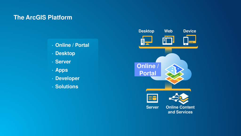
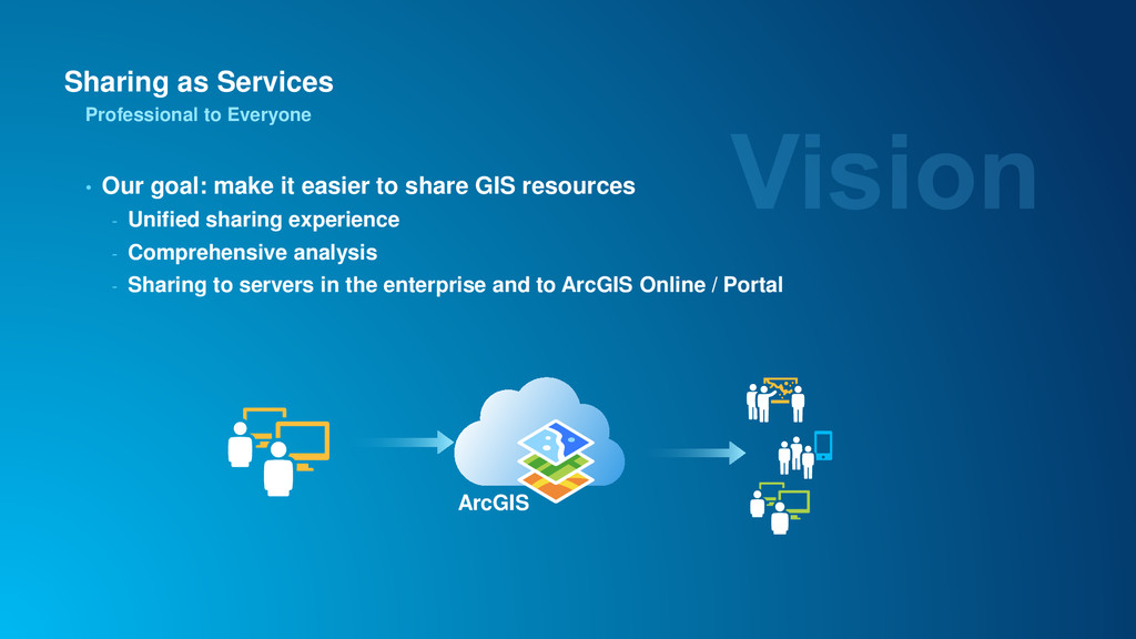
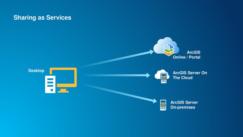
share GIS resources - Unified sharing experience - Comprehensive analysis - Sharing to servers in the enterprise and to ArcGIS Online / Portal Professional to Everyone ArcGIS
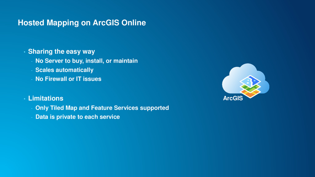
- No Server to buy, install, or maintain - Scales automatically - No Firewall or IT issues • Limitations - Only Tiled Map and Feature Services supported - Data is private to each service ArcGIS
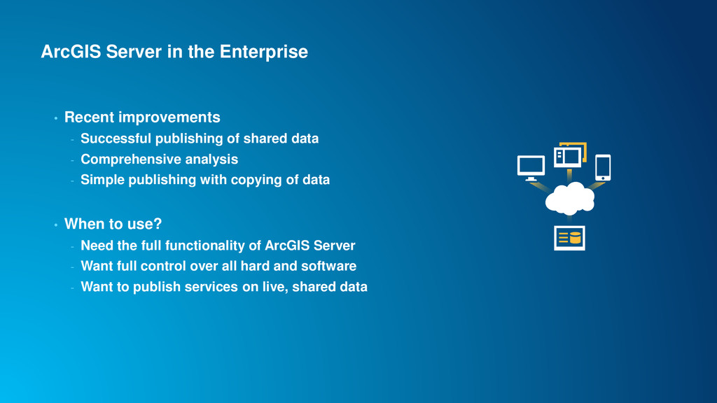
publishing of shared data - Comprehensive analysis - Simple publishing with copying of data • When to use? - Need the full functionality of ArcGIS Server - Want full control over all hard and software - Want to publish services on live, shared data
registered Data Stores • Data Store is of type - Enterprise Geodatabase - Folder - Tip: register top-most folder level possible for maximal benefit • Access to the Data Store is validated during registration - On all machines in the site • Replicated data stores for separate data instances - Tip: Read Help Topic About registering your data with the server Data Stores are a key concept for publishing to ArcGIS Server
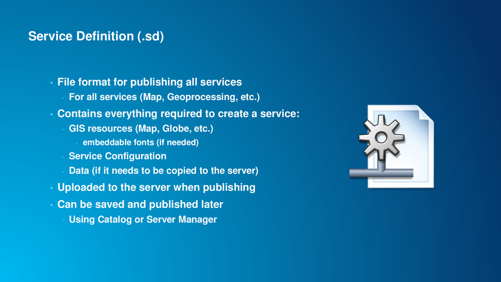
- For all services (Map, Geoprocessing, etc.) • Contains everything required to create a service: - GIS resources (Map, Globe, etc.) - embeddable fonts (if needed) - Service Configuration - Data (if it needs to be copied to the server) • Uploaded to the server when publishing • Can be saved and published later - Using Catalog or Server Manager
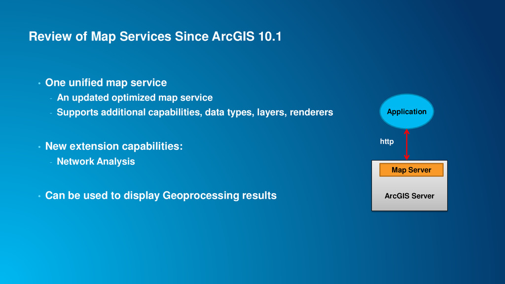
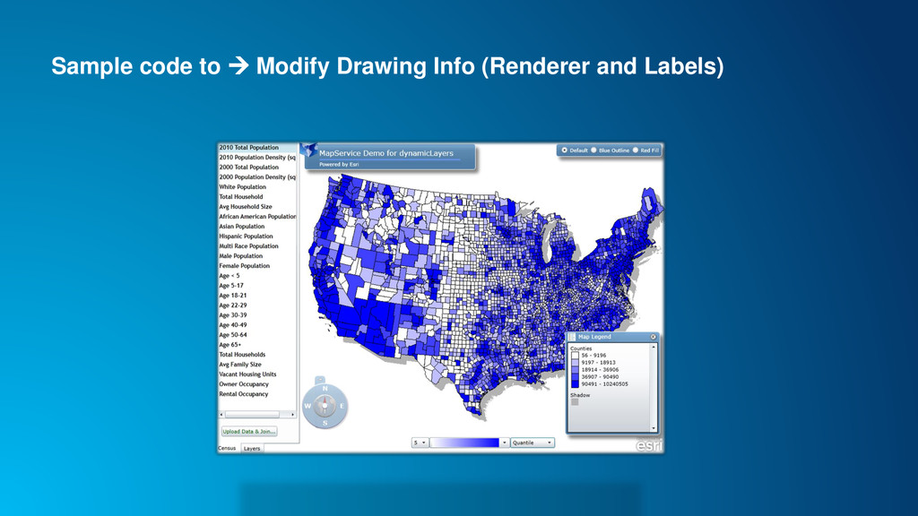
map service - An updated optimized map service - Supports additional capabilities, data types, layers, renderers • New extension capabilities: - Network Analysis • Can be used to display Geoprocessing results Application ArcGIS Server Map Server http
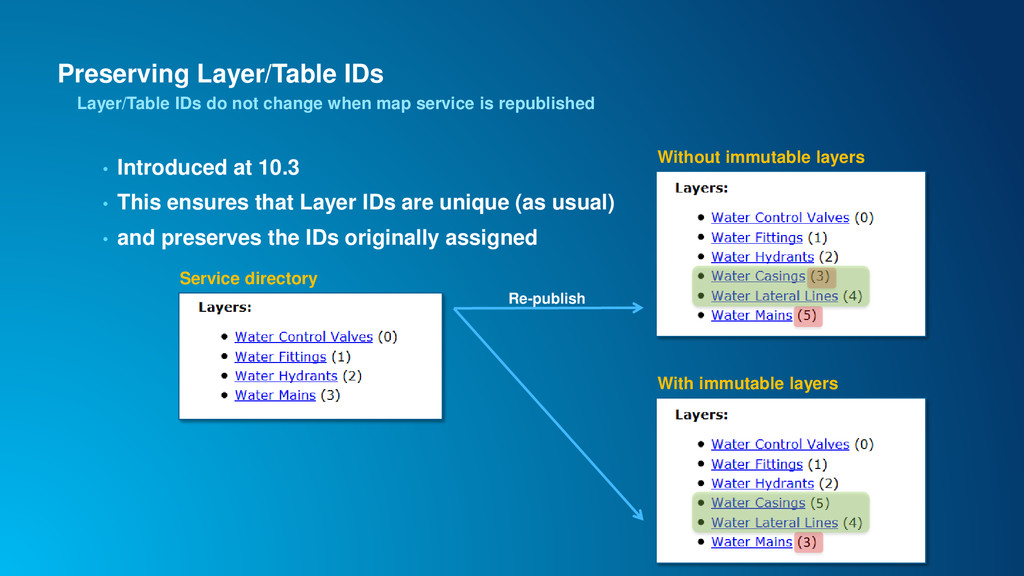
service is republished Service directory 3 5 With immutable layers Without immutable layers Re-publish • Introduced at 10.3 • This ensures that Layer IDs are unique (as usual) • and preserves the IDs originally assigned
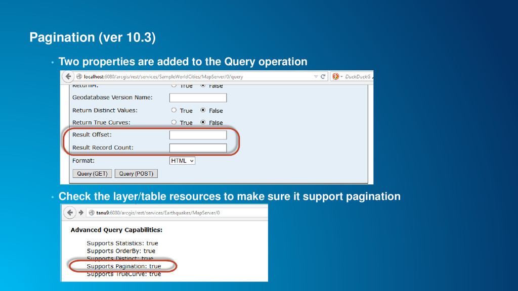
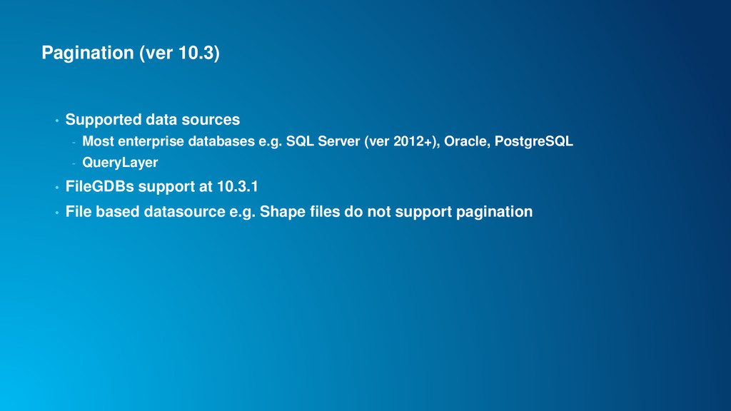
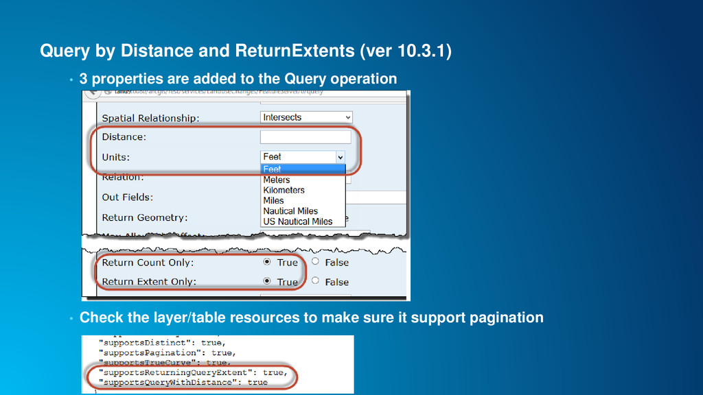
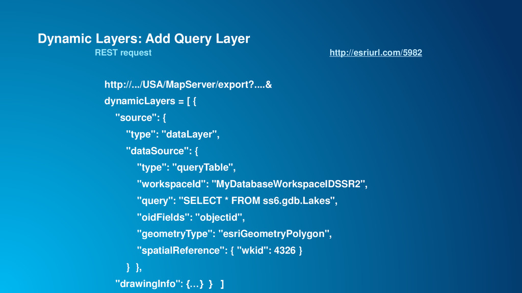
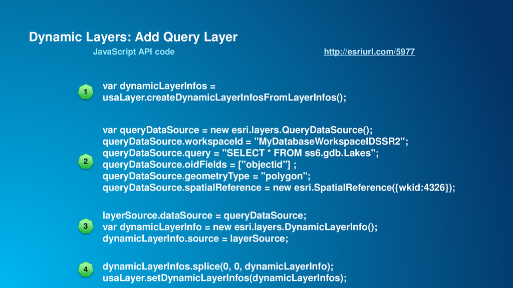
Server (ver 2012+), Oracle, PostgreSQL - QueryLayer • FileGDBs support at 10.3.1 • File based datasource e.g. Shape files do not support pagination Pagination (ver 10.3)
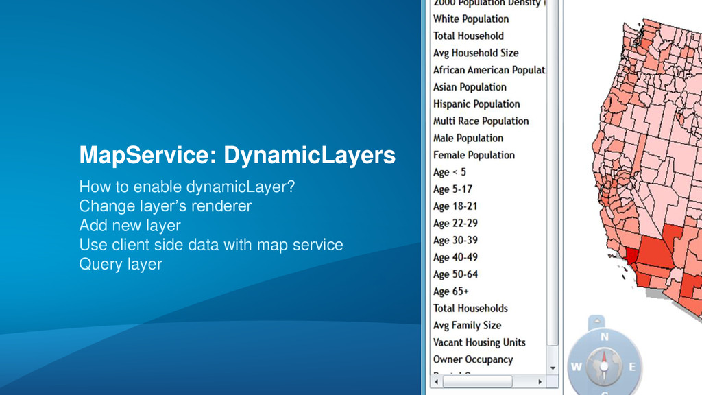
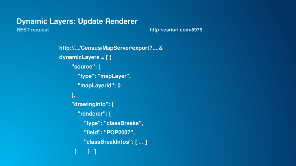
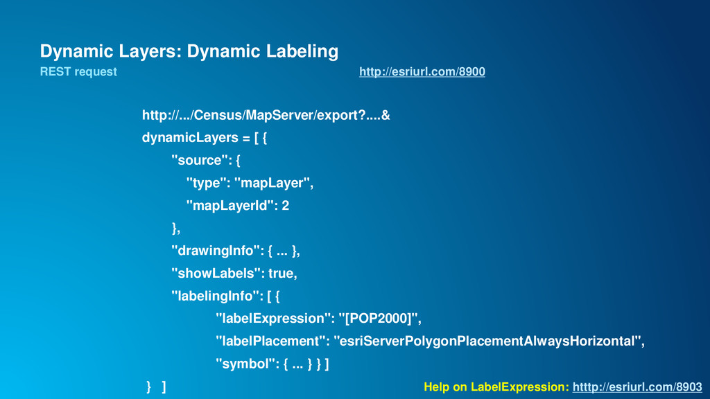
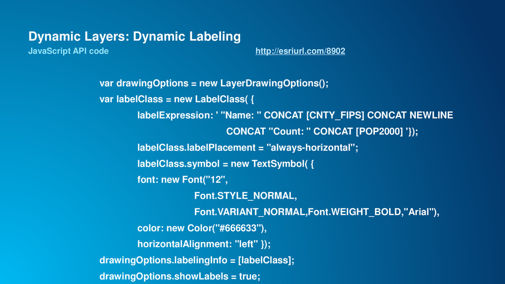
that allows for per-request changes to the map - Optional capability of map services • Allows for: - Updating renderers and symbols - Removing and reordering layers - Changing layer data sources - Adding new layers from registered data sources
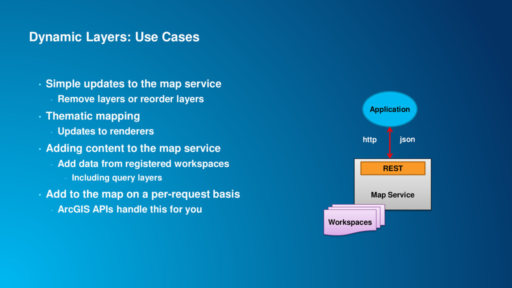
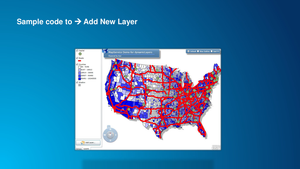
service - Remove layers or reorder layers • Thematic mapping - Updates to renderers • Adding content to the map service - Add data from registered workspaces - Including query layers • Add to the map on a per-request basis - ArcGIS APIs handle this for you Application Map Service REST Workspaces http json
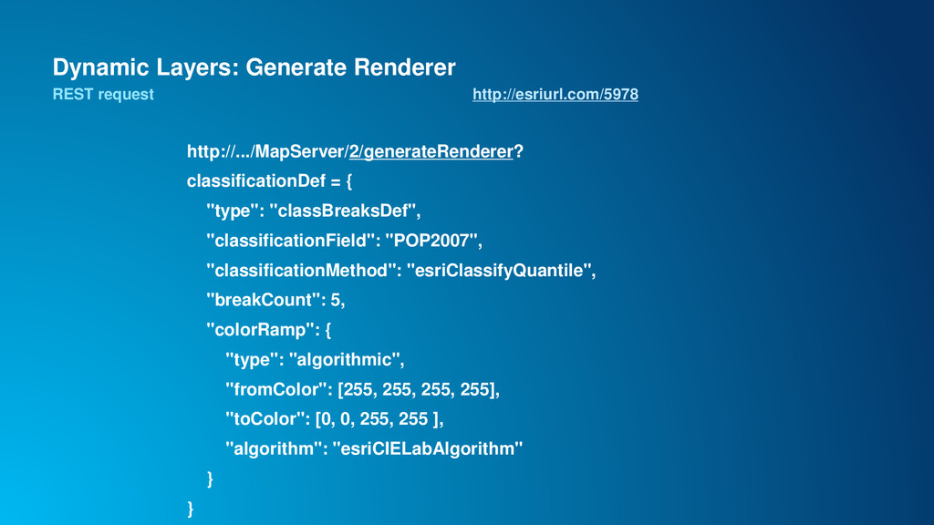
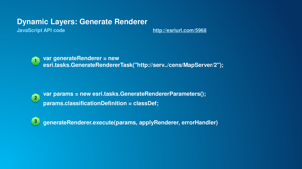
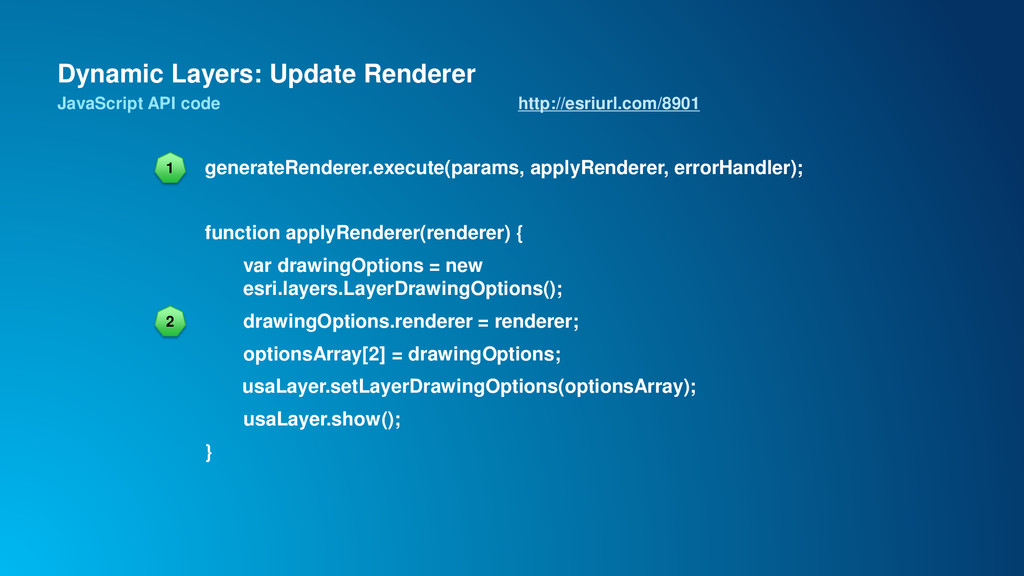
- Ability to change renderer - Ability to change data sources – including joins - Map service API for constructing renderer classes • Generate renderer operation - Supports class breaks and unique value class generation - Popular classification types from ArcGIS for Desktop
of feature layers on the client for thematic mapping? - large number of features - complex geometries that cannot be generalized - when it provides a performance advantage • Each approach has tradeoffs - e.g. Client side features scale better and provide more interactive behavior - Generate renderer can be used with both approaches When to use?
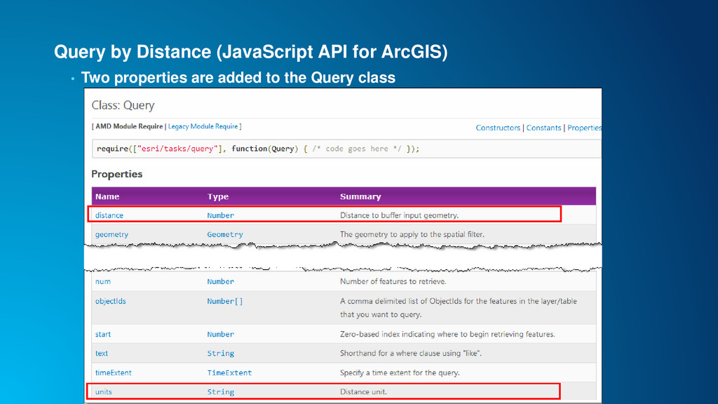
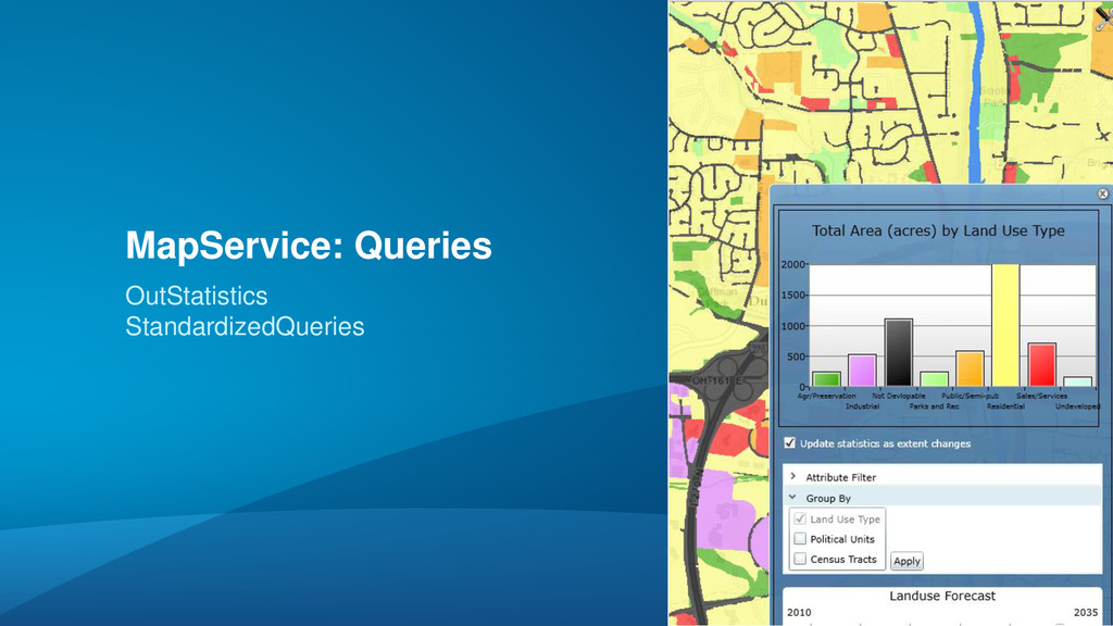
• Support for order by, output statistics, and group by statistics was added for both layers / tables - count | sum | min | max | avg | std dev | var • Additional query capabilities - Optional ability to return M and Z values for features - Can query a specific geodatabase version - Query response contains a flag when maxRecordCount was reached by the query
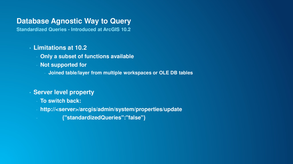
against all databases! - e.g. one date query syntax --- YEAH! - incident_time = date '3/16/2000 3:45:47 PM‘ - upper(name) = ‘JOHN EDWARD’ • Based on SQL92 query syntax and functions - Does not accept any DB vendor specific queries - http://resources.arcgis.com/en/help/main/10.2/index.html#/Supported_SQL_functions_ in_ArcGIS_Server/015400000686000000/ • StandardizedQuery is turned on by default Standardized Queries - Introduced at ArcGIS 10.2
Only a subset of functions available - Not supported for - Joined table/layer from multiple workspaces or OLE DB tables • Server level property - To switch back: - http://<server>/arcgis/admin/system/properties/update - {"standardizedQueries":"false"} Standardized Queries - Introduced at ArcGIS 10.2
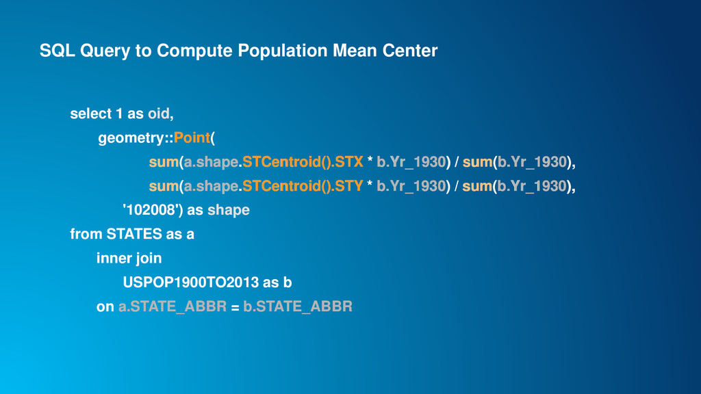
oid, geometry::Point( sum(a.shape.STCentroid().STX * b.Yr_1930) / sum(b.Yr_1930), sum(a.shape.STCentroid().STY * b.Yr_1930) / sum(b.Yr_1930), '102008') as shape from STATES as a inner join USPOP1900TO2013 as b on a.STATE_ABBR = b.STATE_ABBR select 1 as oid, geometry::Point( sum(a.shape.STCentroid().STX * b.Yr_1930) / sum(b.Yr_1930), sum(a.shape.STCentroid().STY * b.Yr_1930) / sum(b.Yr_1930), '102008') as shape from STATES as a inner join USPOP1900TO2013 as b on a.STATE_ABBR = b.STATE_ABBR