Upgrade to Pro — share decks privately, control downloads, hide ads and more …

Make great symbols in ArcGIS Pro

Make great symbols in ArcGIS Pro

Craig Williams | Edie Punt

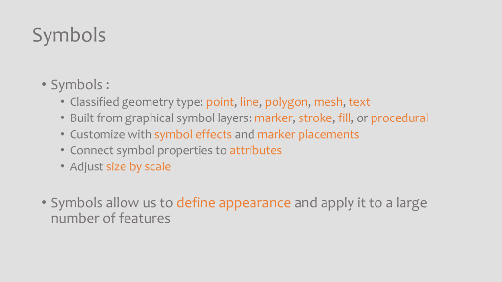
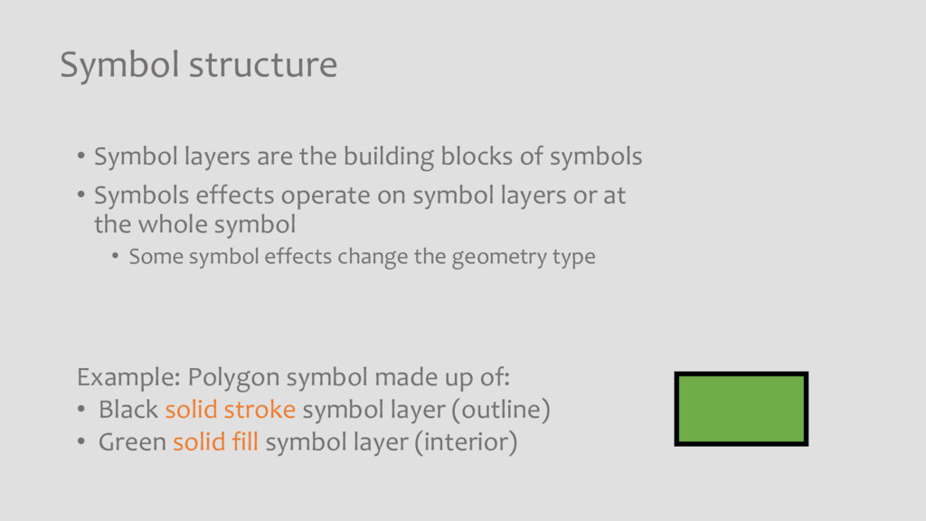
Learn how to make and manage your own symbols in ArcGIS Pro. You'll see how to find and modify existing symbols, including representation rules. We'll cover simple steps to create custom symbols from existing artwork ”no artistic skill required." You'll get tips for working with color, color schemes, and transparency. Finally, you'll learn how to leverage styles to organize symbols and streamline your map authoring workflows.

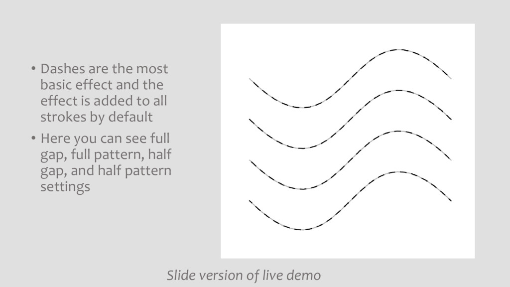
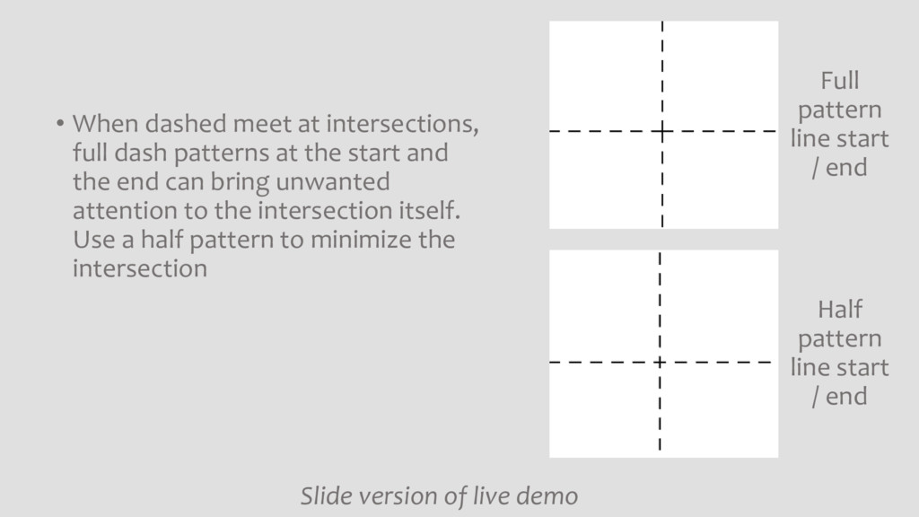
Slides contain slide versions of the live demo.

Craig Williams

October 10, 2017
Tweet

More Decks by Craig Williams

Other Decks in Technology

Transcript

  1. Make great symbols in ArcGIS Pro Craig Williams @williamscraigm Edie

    Punt @epunt Slides can be found at https://speakerdeck.com/williamscraigm/
  2. Symbols • Symbols : • Classified geometry type: point, line,

    polygon, mesh, text • Built from graphical symbol layers: marker, stroke, fill, or procedural • Customize with symbol effects and marker placements • Connect symbol properties to attributes • Adjust size by scale • Symbols allow us to define appearance and apply it to a large number of features
  3. Symbol structure • Symbol layers are the building blocks of

    symbols • Symbols effects operate on symbol layers or at the whole symbol • Some symbol effects change the geometry type Example: Polygon symbol made up of: • Black solid stroke symbol layer (outline) • Green solid fill symbol layer (interior)
  4. • Dashes are the most basic effect and the effect

    is added to all strokes by default • Here you can see full gap, full pattern, half gap, and half pattern settings Slide version of live demo
  5. • When dashed meet at intersections, full dash patterns at

    the start and the end can bring unwanted attention to the intersection itself. Use a half pattern to minimize the intersection Slide version of live demo Full pattern line start / end Half pattern line start / end
  6. • Marker placements specify how markers are placed on strokes.

    There are numerous options but basic properties like aligning or not aligning the markers with the line are the most common Slide version of live demo Markers aligned with the line Markers remain upright
  7. • You can use marker, stroke, and fill symbol layers

    together and this is common for polygons. Slide version of live demo One symbol with a marker placed at the center, a stroke, and a fill
  8. • Effects can change geometry types. In this example, a

    line is tapered using the Tapered Polygon Effect which takes line input and creates a polygon which can then be filled Slide version of live demo
  9. • SVG can be imported into point symbols for brining

    in existing artwork. In this case, the logo of the Montréal– Pierre Elliott Trudeau International Airport was imported for a map showing ranges of aircraft from Montréal Slide version of live demo
  10. Organize map authoring with styles • Styles are collections of

    graphical assets • The galleries you see when you author maps and layouts are filled with style items • symbols • colors • color schemes • label placements • layout items • Use styles for efficiency and to promote consistency and standardization
  11. Styles: Tips and Tricks • In Gallery, search All Styles

    to access all system styles • Add styles to the project directly from the gallery
  12. Styles: Tips and Tricks • Use Catalog view to manage

    styles • Copy symbols from read-only system styles to modify
  13. Styles: Tips and Tricks • Import ArcMap styles (*.style) to

    ArcGIS Pro (*.stylx) • Convert representations to symbols by saving them to an ArcMap style
  14. Types of Styles • System styles: • Esri styles included

    with ArcGIS Pro download. • Add to project, not shared, read-only • Favorites style: • linked to your profile, not the project, • always available, not shared • Custom styles: • any style that is not a system style or your Favorites style, • usually writeable • Solution styles: • usually Esri-authored, intended for a specific industry or solution, • found on ArcGIS Online • Mobile styles: • paired down style schema that can be used in mobile applications • Project styles: • any style of any type referenced by the project