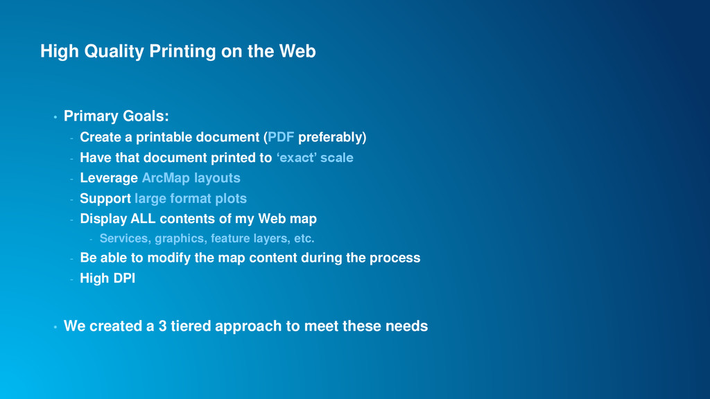
Create a printable document (PDF preferably) - Have that document printed to ‘exact’ scale - Leverage ArcMap layouts - Support large format plots - Display ALL contents of my Web map - Services, graphics, feature layers, etc. - Be able to modify the map content during the process - High DPI • We created a 3 tiered approach to meet these needs
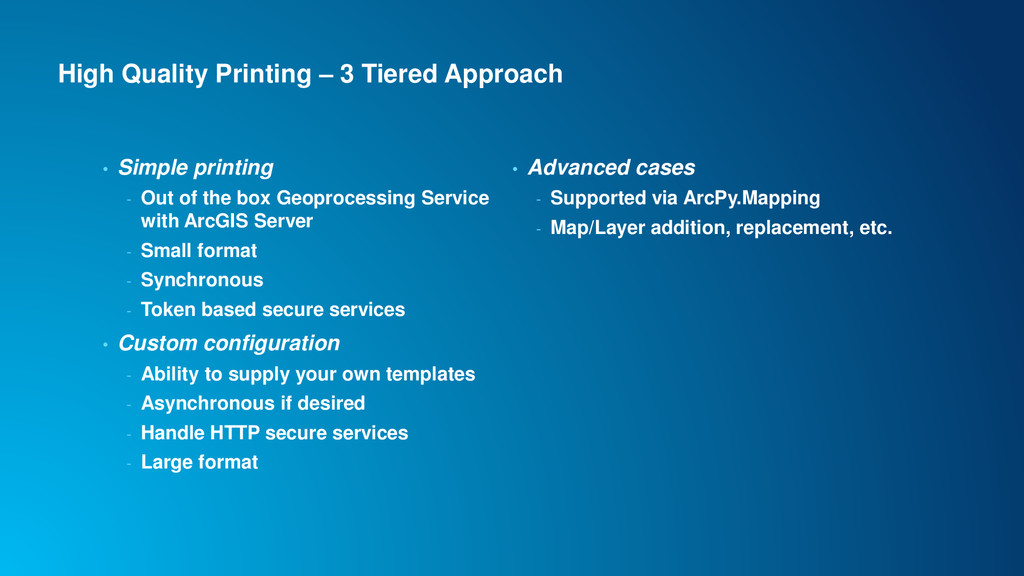
- Out of the box Geoprocessing Service with ArcGIS Server - Small format - Synchronous - Token based secure services • Custom configuration - Ability to supply your own templates - Asynchronous if desired - Handle HTTP secure services - Large format • Advanced cases - Supported via ArcPy.Mapping - Map/Layer addition, replacement, etc.
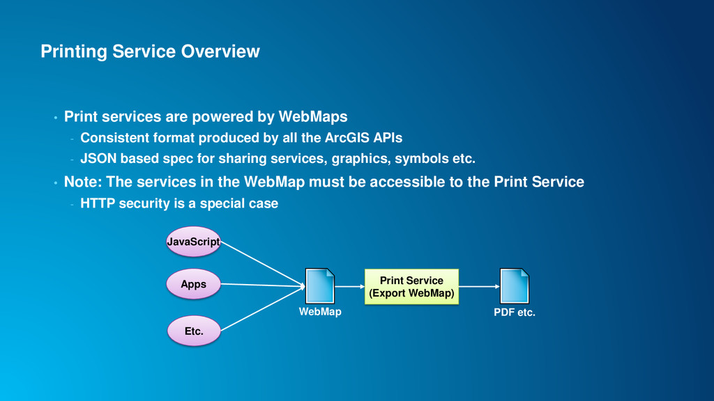
- Consistent format produced by all the ArcGIS APIs - JSON based spec for sharing services, graphics, symbols etc. • Note: The services in the WebMap must be accessible to the Print Service - HTTP security is a special case Apps Etc. JavaScript WebMap Print Service (Export WebMap) PDF etc.
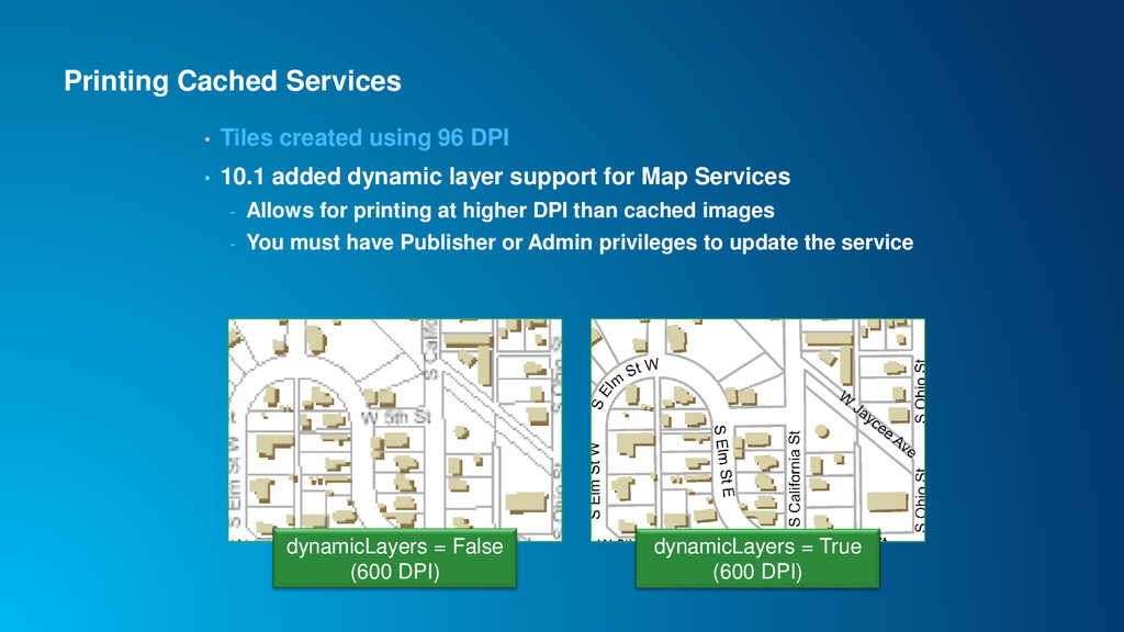
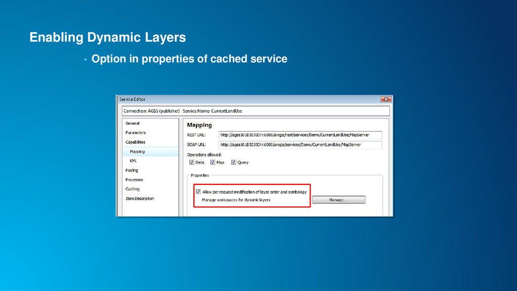
10.1 added dynamic layer support for Map Services - Allows for printing at higher DPI than cached images - You must have Publisher or Admin privileges to update the service dynamicLayers = False (600 DPI) dynamicLayers = True (600 DPI)
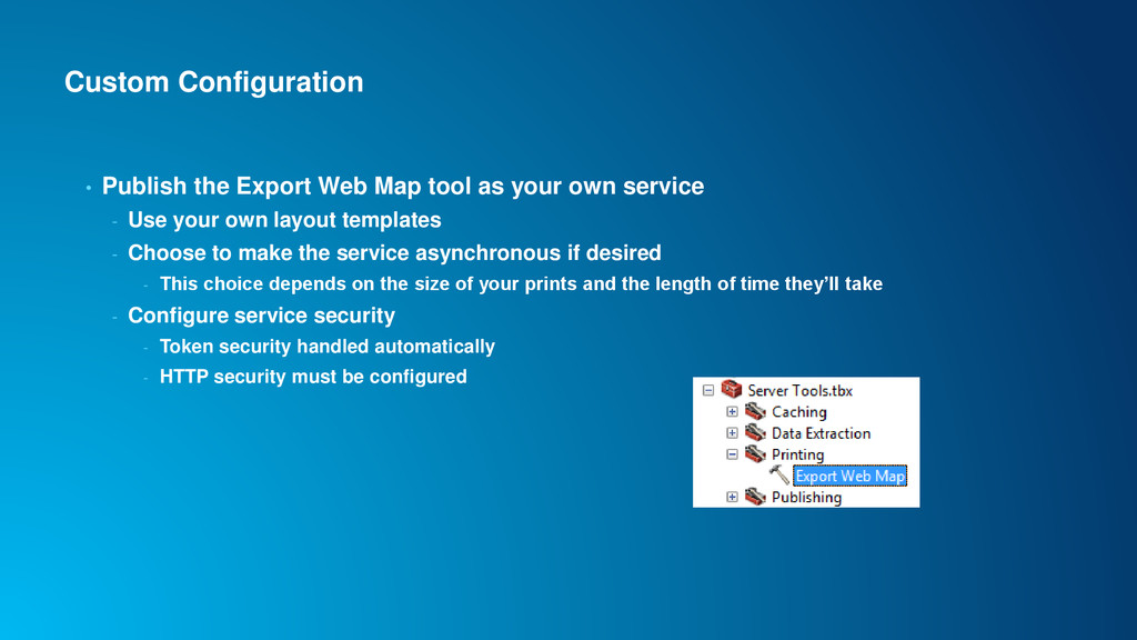
your own service - Use your own layout templates - Choose to make the service asynchronous if desired - This choice depends on the size of your prints and the length of time they’ll take - Configure service security - Token security handled automatically - HTTP security must be configured
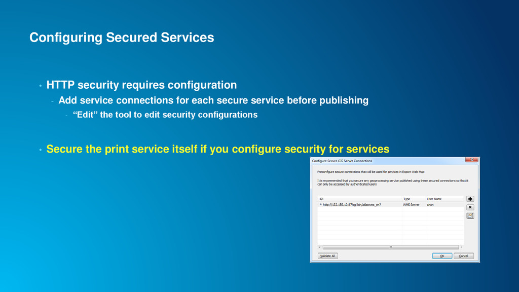
service connections for each secure service before publishing - “Edit” the tool to edit security configurations • Secure the print service itself if you configure security for services
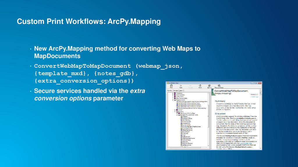
Web Maps to MapDocuments • ConvertWebMapToMapDocument (webmap_json, {template_mxd}, {notes_gdb}, {extra_conversion_options}) • Secure services handled via the extra conversion options parameter
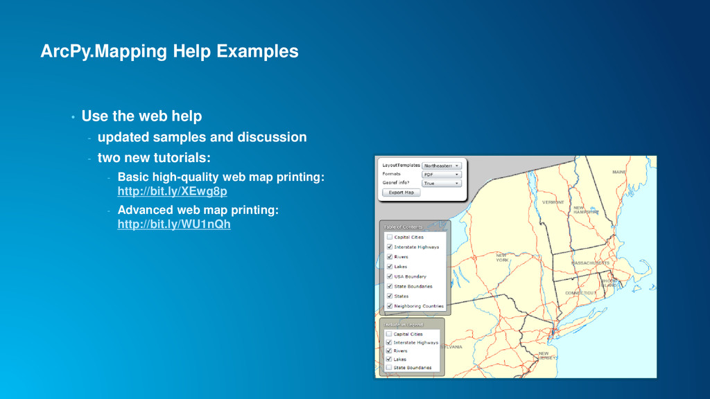
map document - Full capabilities of ArcPy.Mapping on the document - Modify content - Add content - Export using custom options - etc. • See the ArcPy.Mapping help for examples…
samples and discussion - two new tutorials: - Basic high-quality web map printing: http://bit.ly/XEwg8p - Advanced web map printing: http://bit.ly/WU1nQh
• If you wish to send the output to a physical printer automatically - Use the ArcPy.Mapping workflow - Local printers – xcopy to local share on some printers - Cloud printing workflows (e.g. Google Cloud Print) - Driverless printing - Simple APIs that can be called from Python Wait! You didn’t actually print anything
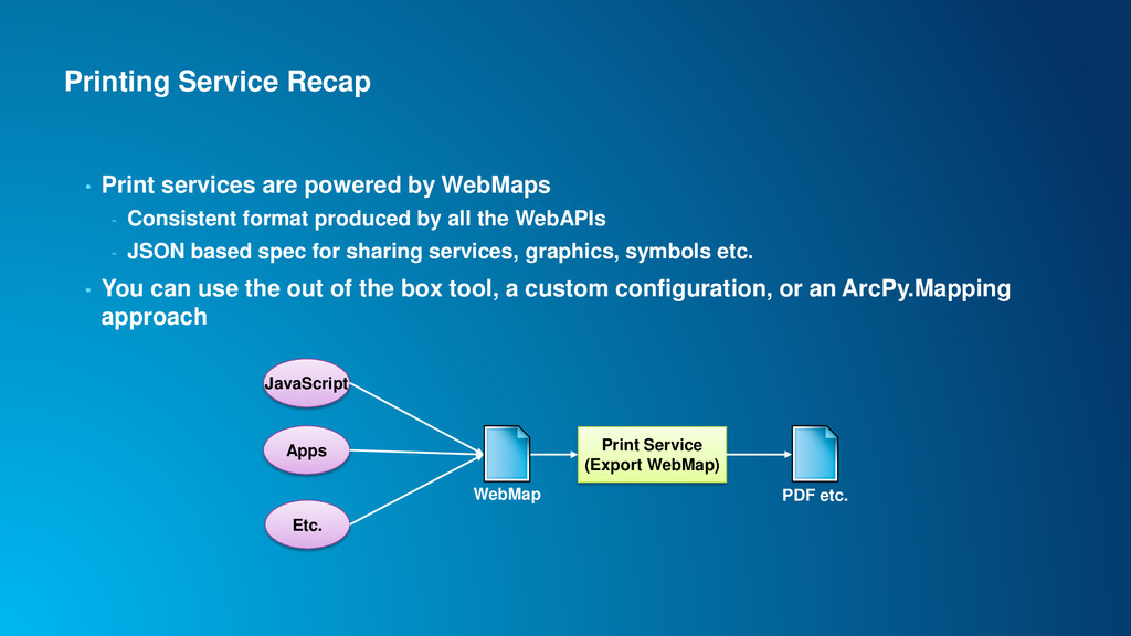
- Consistent format produced by all the WebAPIs - JSON based spec for sharing services, graphics, symbols etc. • You can use the out of the box tool, a custom configuration, or an ArcPy.Mapping approach Apps Etc. JavaScript WebMap Print Service (Export WebMap) PDF etc.