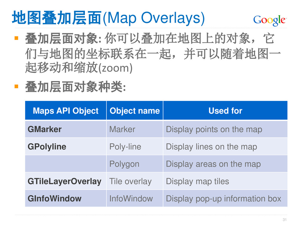
Maps API Object Object name Used for GMarker Marker Display points on the map GPolyline Poly-line Display lines on the map Polygon Display areas on the map GTileLayerOverlay Tile overlay Display map tiles GInfoWindow InfoWindow Display pop-up information box
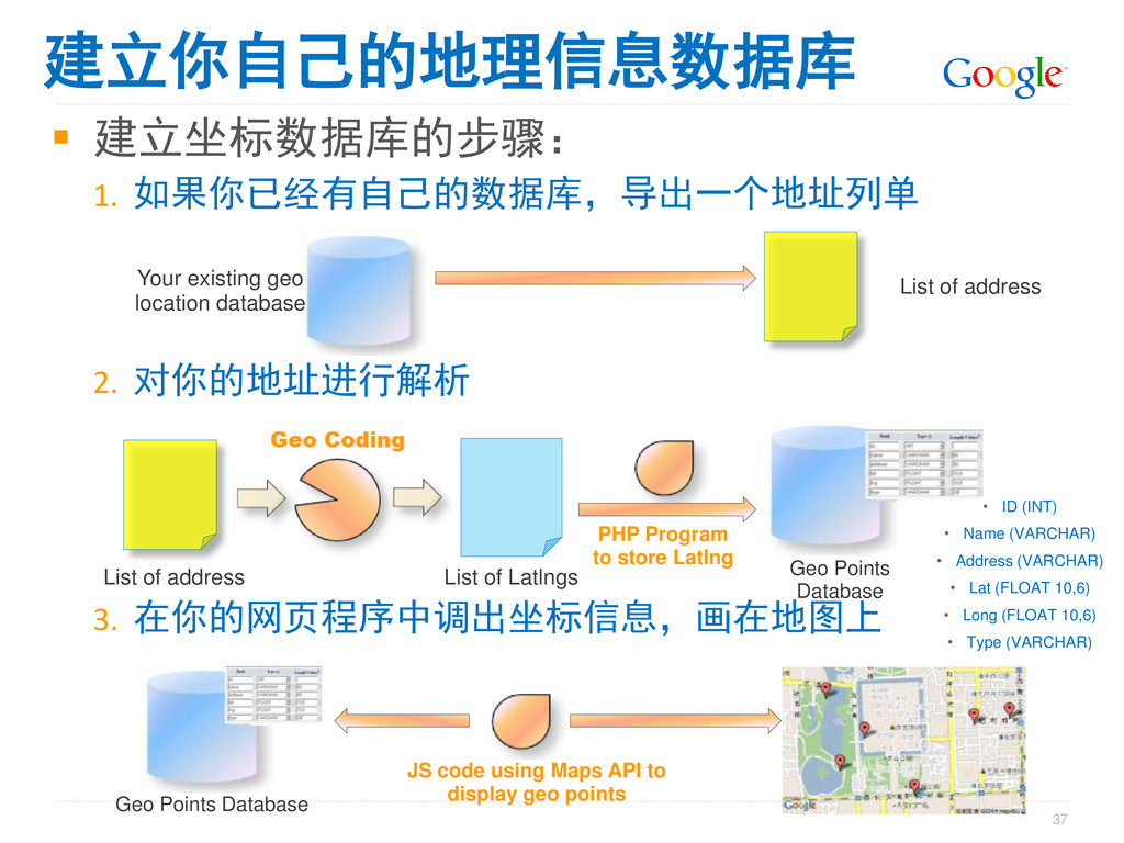
existing geo location database List of address List of address List of Latlngs Geo Points Database PHP Program to store Latlng • ID (INT) • Name (VARCHAR) • Address (VARCHAR) • Lat (FLOAT 10,6) • Long (FLOAT 10,6) • Type (VARCHAR) Geo Points Database JS code using Maps API to display geo points 建立你自己的地理信息数据库
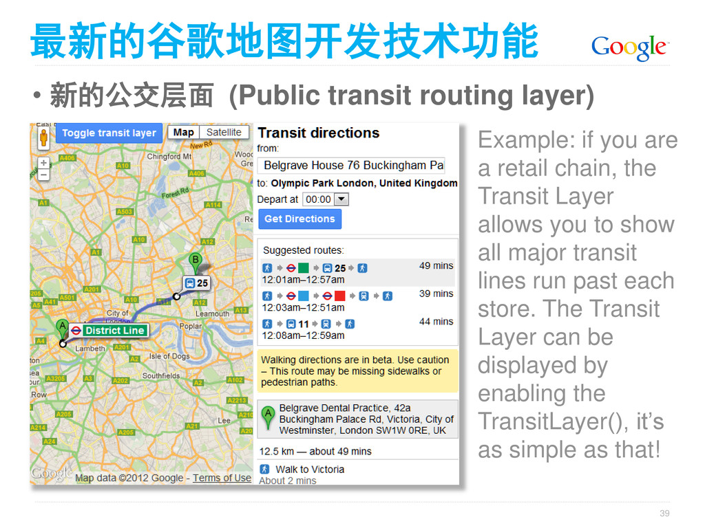
are a retail chain, the Transit Layer allows you to show all major transit lines run past each store. The Transit Layer can be displayed by enabling the TransitLayer(), it’s as simple as that! 最新的谷歌地图开发技术功能
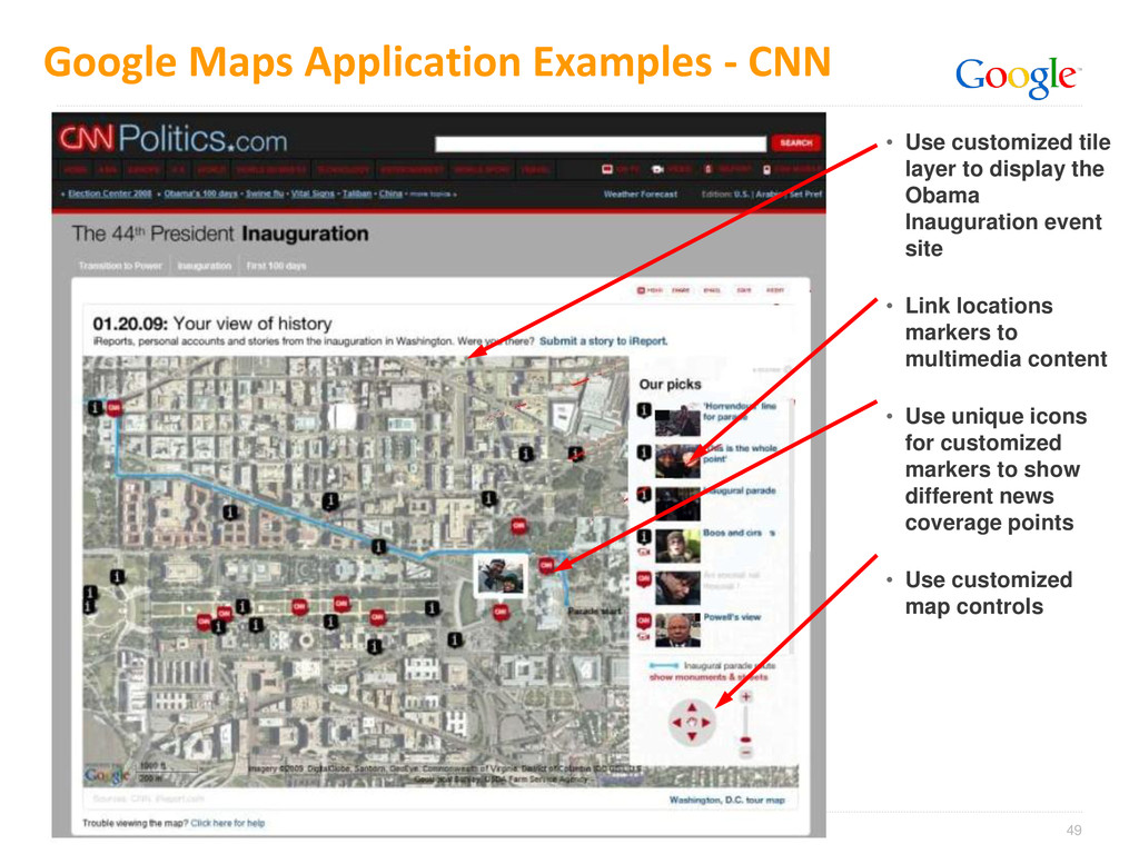
tile layer to display the Obama Inauguration event site • Link locations markers to multimedia content • Use unique icons for customized markers to show different news coverage points • Use customized map controls