Upgrade to Pro
— share decks privately, control downloads, hide ads and more …
Speaker Deck
Features
Speaker Deck
PRO
Sign in
Sign up for free
Search
Search
Recherche GFOSS Werkzeuge
Search
Sponsored
·
Your Podcast. Everywhere. Effortlessly.
Share. Educate. Inspire. Entertain. You do you. We'll handle the rest.
→
almereyda
February 25, 2014
Research
55
0
Share
Embed
Copy iframe code
Copy JS code
Copy link
Start on current slide
Recherche GFOSS Werkzeuge
extensive Stichwortsammlung zum Feld Geospatial Free and Open Source Software
almereyda
February 25, 2014
More Decks by almereyda
See All by almereyda
Berliner Gartenkarte
almereyda
2
2k
Dokumentation Web mapping
almereyda
0
70
Other Decks in Research
See All in Research
論文紹介:HalluCitation Matters
wasyro
0
130
人間中心の意思決定支援AI
yukinobaba
PRO
7
3.4k
SLAMはどこまで解決されたのか?
tomonom
0
820
言語モデルから言語について語る際に押さえておきたいこと
eumesy
PRO
6
2.5k
LINEヤフー データサイエンス Meetup「三井物産コモディティ予測チャレンジ」の舞台裏-AlpacaTechパート
gamella
1
610
RS-Agent: Automating Remote Sensing Tasks through Intelligent Agent
satai
3
380
データサイエンティストの就労意識~2015 → 2026 一般(個人)会員アンケートより
datascientistsociety
PRO
0
220
長時間動画QAにおけるマルチエージェント推論 ・SVAgent: Storyline-Guided Long Video Understanding via Cross-Modal Multi-Agent Collaboration
murakawatakuya
1
160
COFFEE-Japan PROJECT Impact Report(Uminomukou Coffee)
ontheslope
0
240
Model Discovery and Graph Simulation: A Lightweight Gateway to Chaos Engineering
anatolykr
0
220
Claude Code × autoresearch 実践
mathbullet
0
210
SoftMatcha 2: 1兆語規模コーパスの超高速かつ柔らかい検索
e869120_sub
7
3.6k
Featured
See All Featured
How to build an LLM SEO readiness audit: a practical framework
nmsamuel
1
810
The Success of Rails: Ensuring Growth for the Next 100 Years
eileencodes
47
8.2k
Paper Plane
katiecoart
PRO
2
52k
Building Better People: How to give real-time feedback that sticks.
wjessup
370
20k
Let's Do A Bunch of Simple Stuff to Make Websites Faster
chriscoyier
508
140k
Future Trends and Review - Lecture 12 - Web Technologies (1019888BNR)
signer
PRO
0
3.6k
How to Talk to Developers About Accessibility
jct
2
390
Neural Spatial Audio Processing for Sound Field Analysis and Control
skoyamalab
0
370
A Modern Web Designer's Workflow
chriscoyier
698
190k
A better future with KSS
kneath
240
18k
I Don’t Have Time: Getting Over the Fear to Launch Your Podcast
jcasabona
34
2.8k
16th Malabo Montpellier Forum Presentation
akademiya2063
PRO
0
240
Transcript
[ http://goo.gl/7Isio ] GFOSS Werkzeuge Recherche zu Geospatial Free and
Open Source Software Gestalter Max Godt, Lennart Wiesiolek, Jon Richter
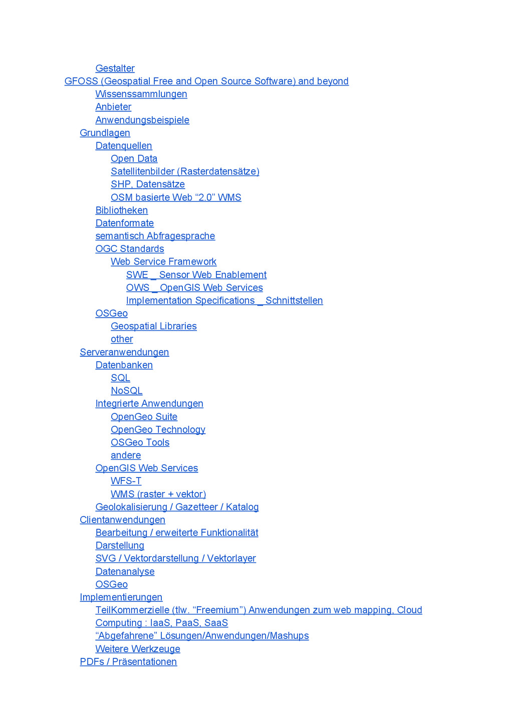
Gestalter GFOSS (Geospatial Free and Open Source Software) and beyond
Wissenssammlungen Anbieter Anwendungsbeispiele Grundlagen Datenquellen Open Data Satellitenbilder (Rasterdatensätze) SHP, Datensätze OSM basierte Web “2.0” WMS Bibliotheken Datenformate semantisch Abfragesprache OGC Standards Web Service Framework SWE _ Sensor Web Enablement OWS _ OpenGIS Web Services Implementation Specifications _ Schnittstellen OSGeo Geospatial Libraries other Serveranwendungen Datenbanken SQL NoSQL Integrierte Anwendungen OpenGeo Suite OpenGeo Technology OSGeo Tools andere OpenGIS Web Services WFST WMS (raster + vektor) Geolokalisierung / Gazetteer / Katalog Clientanwendungen Bearbeitung / erweiterte Funktionalität Darstellung SVG / Vektordarstellung / Vektorlayer Datenanalyse OSGeo Implementierungen TeilKommerzielle (tlw. “Freemium”) Anwendungen zum web mapping, Cloud Computing : IaaS, PaaS, SaaS “Abgefahrene” Lösungen/Anwendungen/Mashups Weitere Werkzeuge PDFs / Präsentationen
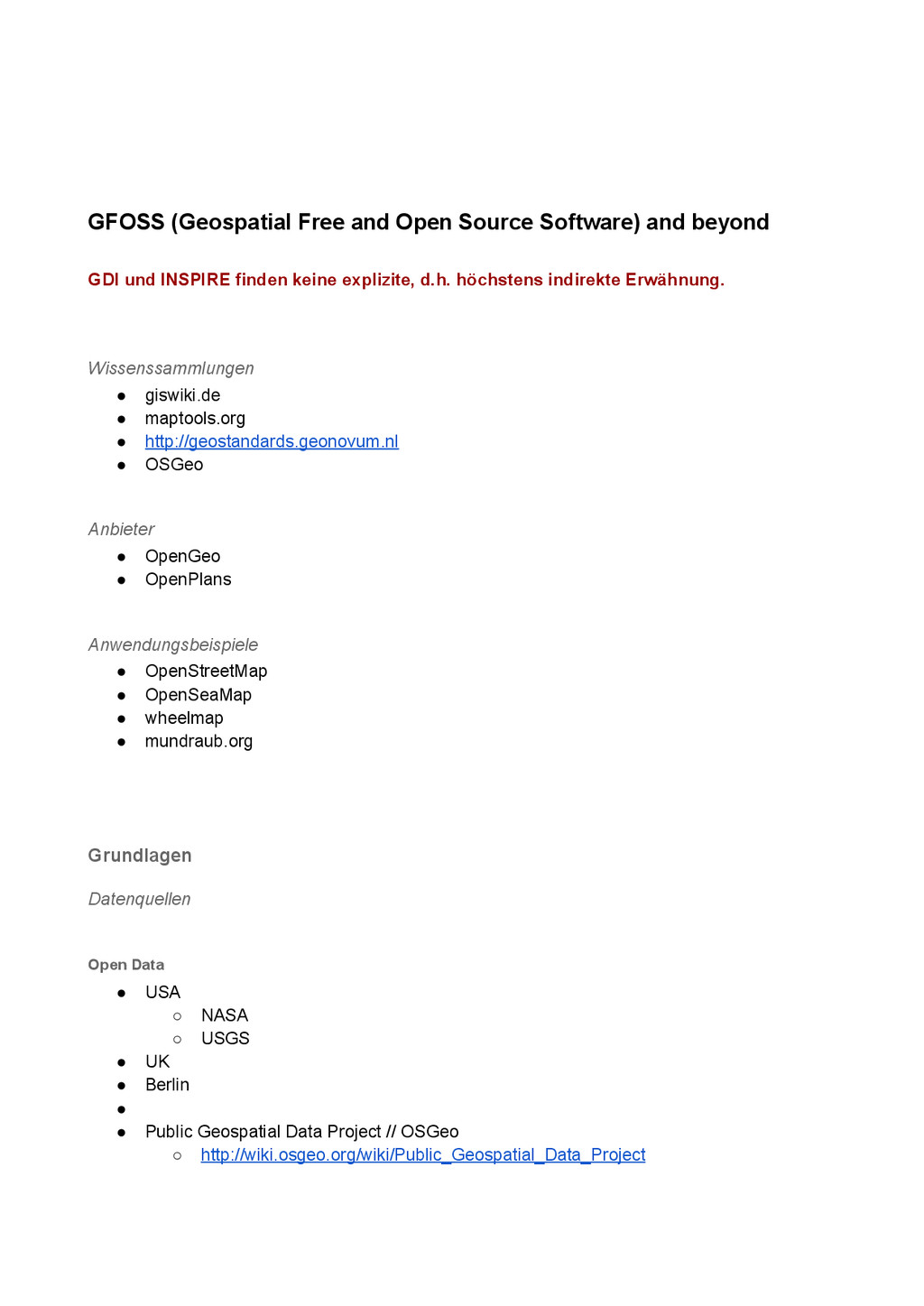
GFOSS (Geospatial Free and Open Source Software) and beyond GDI
und INSPIRE finden keine explizite, d.h. höchstens indirekte Erwähnung. Wissenssammlungen • giswiki.de • maptools.org • http://geostandards.geonovum.nl • OSGeo Anbieter • OpenGeo • OpenPlans Anwendungsbeispiele • OpenStreetMap • OpenSeaMap • wheelmap • mundraub.org Grundlagen Datenquellen Open Data • USA ◦ NASA ◦ USGS • UK • Berlin • • Public Geospatial Data Project // OSGeo ◦ http://wiki.osgeo.org/wiki/Public_Geospatial_Data_Project
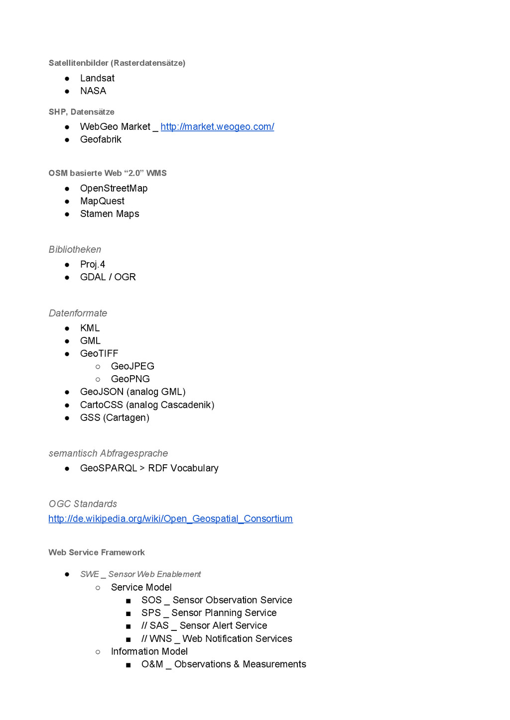
Satellitenbilder (Rasterdatensätze) • Landsat • NASA SHP, Datensätze • WebGeo
Market _ http://market.weogeo.com/ • Geofabrik OSM basierte Web “2.0” WMS • OpenStreetMap • MapQuest • Stamen Maps Bibliotheken • Proj.4 • GDAL / OGR Datenformate • KML • GML • GeoTIFF ◦ GeoJPEG ◦ GeoPNG • GeoJSON (analog GML) • CartoCSS (analog Cascadenik) • GSS (Cartagen) semantisch Abfragesprache • GeoSPARQL > RDF Vocabulary OGC Standards http://de.wikipedia.org/wiki/Open_Geospatial_Consortium Web Service Framework • SWE _ Sensor Web Enablement ◦ Service Model ▪ SOS _ Sensor Observation Service ▪ SPS _ Sensor Planning Service ▪ // SAS _ Sensor Alert Service ▪ // WNS _ Web Notification Services ◦ Information Model ▪ O&M _ Observations & Measurements
▪ SensorML _ Sensor Model Language ▪ // TML _
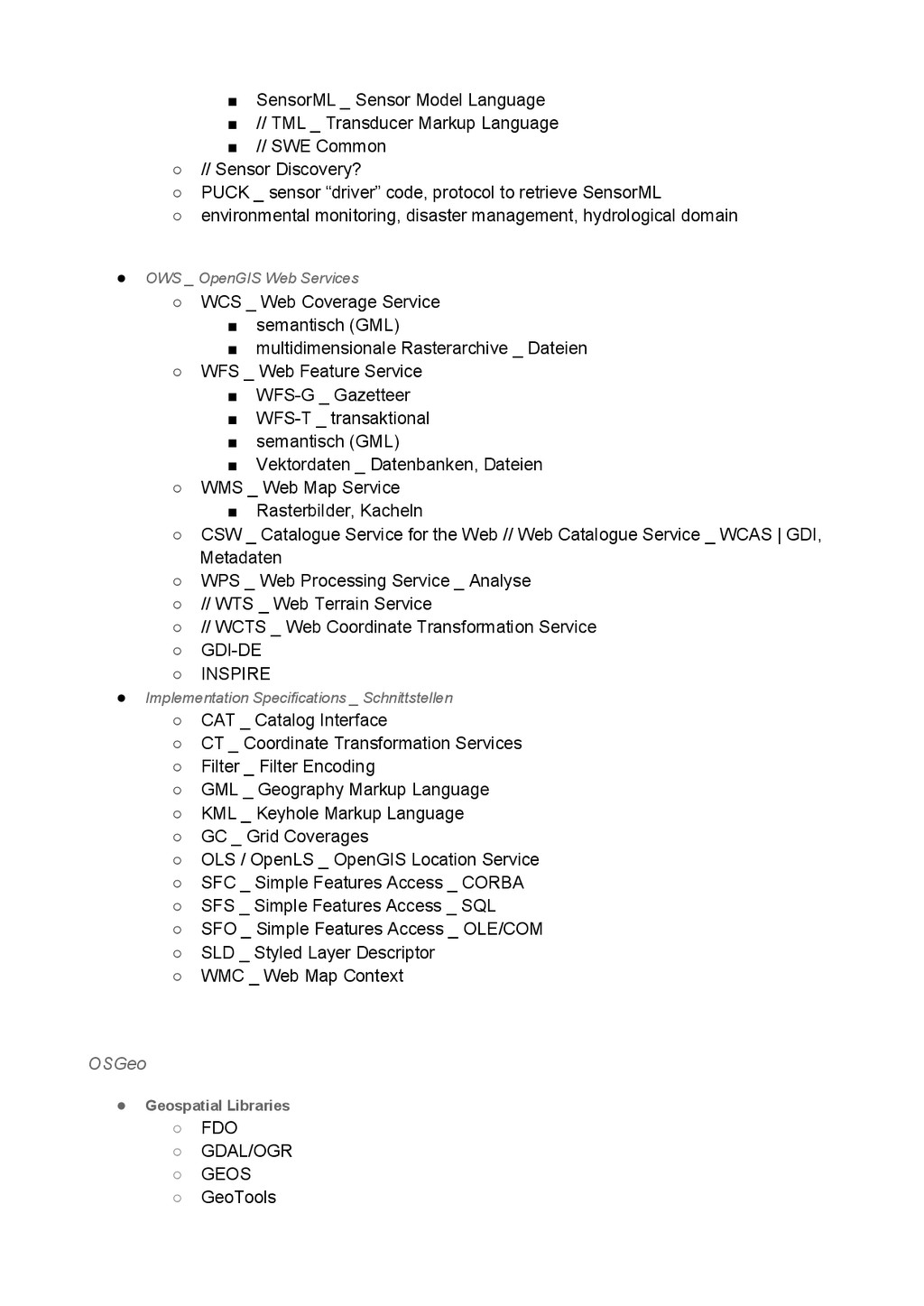
Transducer Markup Language ▪ // SWE Common ◦ // Sensor Discovery? ◦ PUCK _ sensor “driver” code, protocol to retrieve SensorML ◦ environmental monitoring, disaster management, hydrological domain • OWS _ OpenGIS Web Services ◦ WCS _ Web Coverage Service ▪ semantisch (GML) ▪ multidimensionale Rasterarchive _ Dateien ◦ WFS _ Web Feature Service ▪ WFSG _ Gazetteer ▪ WFST _ transaktional ▪ semantisch (GML) ▪ Vektordaten _ Datenbanken, Dateien ◦ WMS _ Web Map Service ▪ Rasterbilder, Kacheln ◦ CSW _ Catalogue Service for the Web // Web Catalogue Service _ WCAS | GDI, Metadaten ◦ WPS _ Web Processing Service _ Analyse ◦ // WTS _ Web Terrain Service ◦ // WCTS _ Web Coordinate Transformation Service ◦ GDIDE ◦ INSPIRE • Implementation Specifications _ Schnittstellen ◦ CAT _ Catalog Interface ◦ CT _ Coordinate Transformation Services ◦ Filter _ Filter Encoding ◦ GML _ Geography Markup Language ◦ KML _ Keyhole Markup Language ◦ GC _ Grid Coverages ◦ OLS / OpenLS _ OpenGIS Location Service ◦ SFC _ Simple Features Access _ CORBA ◦ SFS _ Simple Features Access _ SQL ◦ SFO _ Simple Features Access _ OLE/COM ◦ SLD _ Styled Layer Descriptor ◦ WMC _ Web Map Context OSGeo • Geospatial Libraries ◦ FDO ◦ GDAL/OGR ◦ GEOS ◦ GeoTools
◦ METAcrs ◦ OSSIM ◦ PostGIS ◦ rasdaman • other
◦ public geospatial data ◦ education and curriculum Serveranwendungen Datenbanken https://gist.github.com/994992 SQL • PostgreSQL + PostGIS • SQLite + Spatialite NoSQL • CouchDB : GeoCouch • MongoDB • Redis Integrierte Anwendungen OpenGeo Suite • Geoserver • GeoExt • PostGIS • GeoWebCache • OpenLayers // Client OpenGeo Technology • GeoNode // portal, py • GeoExplorer // GIS OSGeo Tools ◦ web mapping ▪ degree // WMS, WFS, CSW, WPS ▪ geomajas ▪ geomoose ▪ geoserver ... WMS ... ▪ mapbender // php, GDIVerwaltung
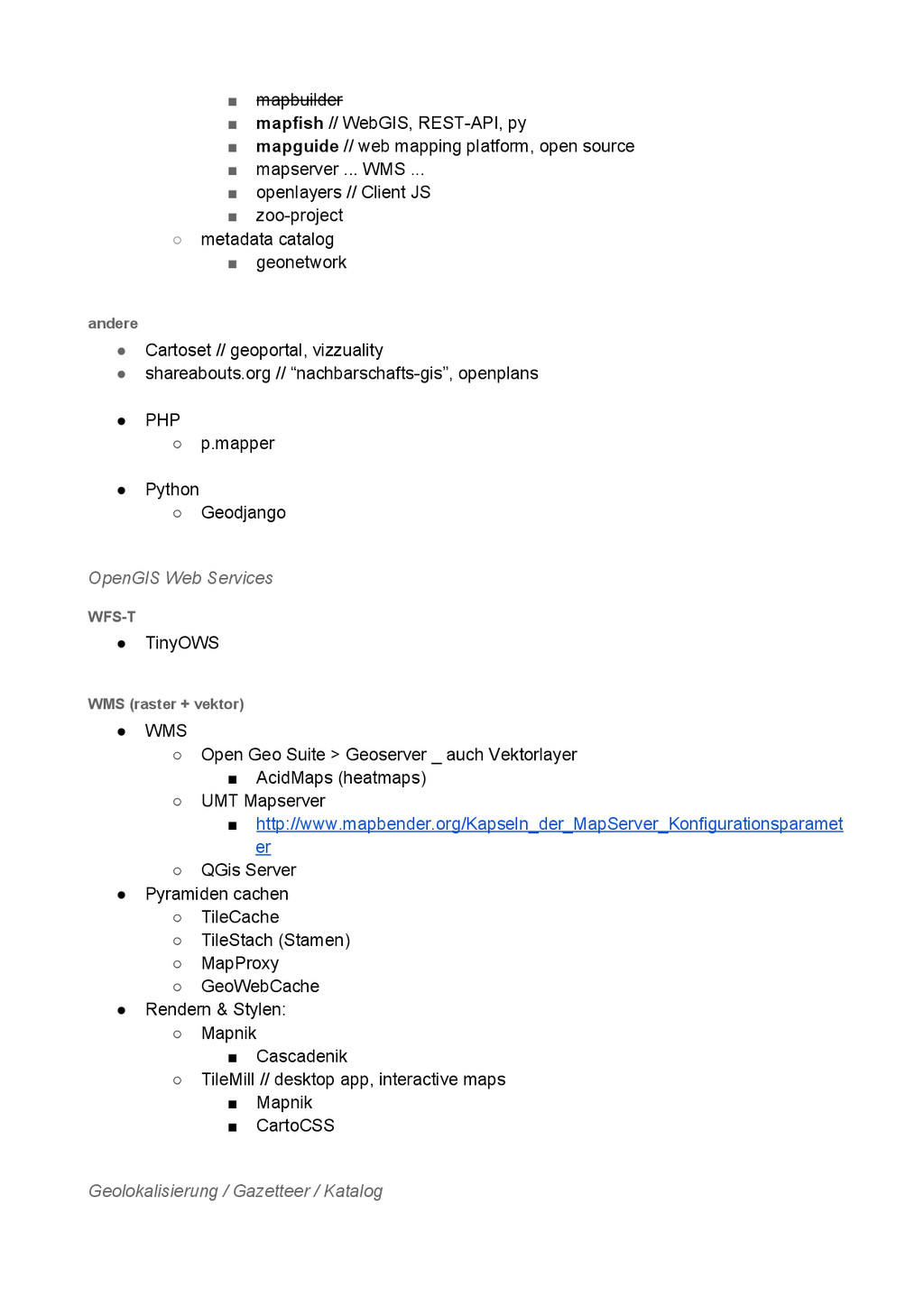
▪ mapbuilder ▪ mapfish // WebGIS, RESTAPI, py ▪ mapguide
// web mapping platform, open source ▪ mapserver ... WMS ... ▪ openlayers // Client JS ▪ zooproject ◦ metadata catalog ▪ geonetwork andere • Cartoset // geoportal, vizzuality • shareabouts.org // “nachbarschaftsgis”, openplans • PHP ◦ p.mapper • Python ◦ Geodjango OpenGIS Web Services WFST • TinyOWS WMS (raster + vektor) • WMS ◦ Open Geo Suite > Geoserver _ auch Vektorlayer ▪ AcidMaps (heatmaps) ◦ UMT Mapserver ▪ http://www.mapbender.org/Kapseln_der_MapServer_Konfigurationsparamet er ◦ QGis Server • Pyramiden cachen ◦ TileCache ◦ TileStach (Stamen) ◦ MapProxy ◦ GeoWebCache • Rendern & Stylen: ◦ Mapnik ▪ Cascadenik ◦ TileMill // desktop app, interactive maps ▪ Mapnik ▪ CartoCSS Geolokalisierung / Gazetteer / Katalog
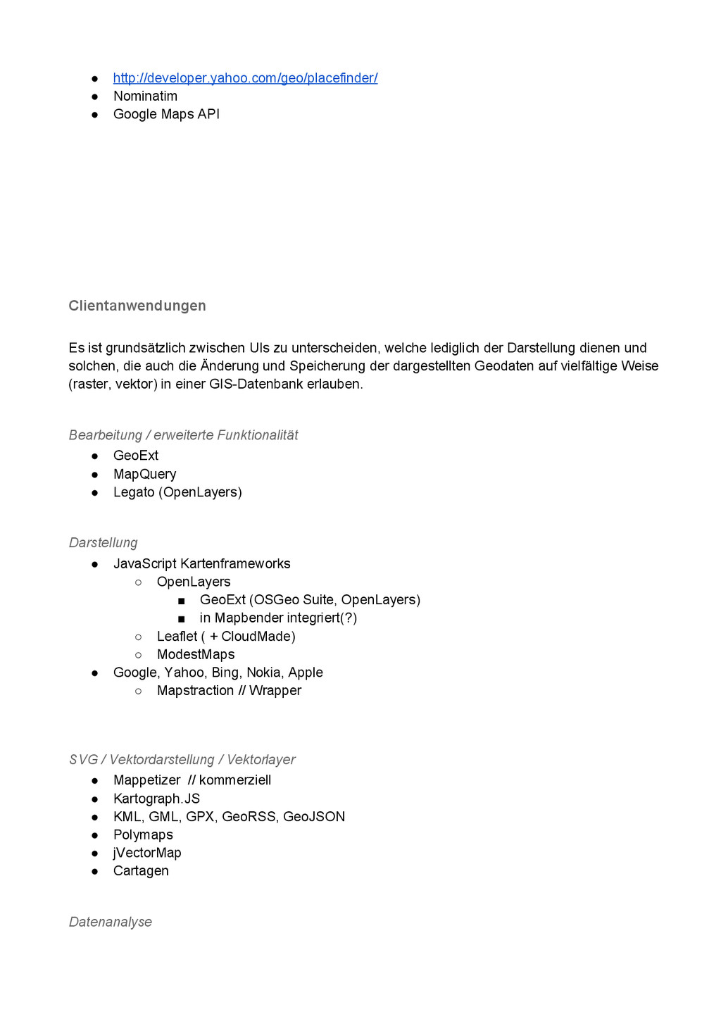
• http://developer.yahoo.com/geo/placefinder/ • Nominatim • Google Maps API Clientanwendungen Es
ist grundsätzlich zwischen UIs zu unterscheiden, welche lediglich der Darstellung dienen und solchen, die auch die Änderung und Speicherung der dargestellten Geodaten auf vielfältige Weise (raster, vektor) in einer GISDatenbank erlauben. Bearbeitung / erweiterte Funktionalität • GeoExt • MapQuery • Legato (OpenLayers) Darstellung • JavaScript Kartenframeworks ◦ OpenLayers ▪ GeoExt (OSGeo Suite, OpenLayers) ▪ in Mapbender integriert(?) ◦ Leaflet ( + CloudMade) ◦ ModestMaps • Google, Yahoo, Bing, Nokia, Apple ◦ Mapstraction // Wrapper SVG / Vektordarstellung / Vektorlayer • Mappetizer // kommerziell • Kartograph.JS • KML, GML, GPX, GeoRSS, GeoJSON • Polymaps • jVectorMap • Cartagen Datenanalyse
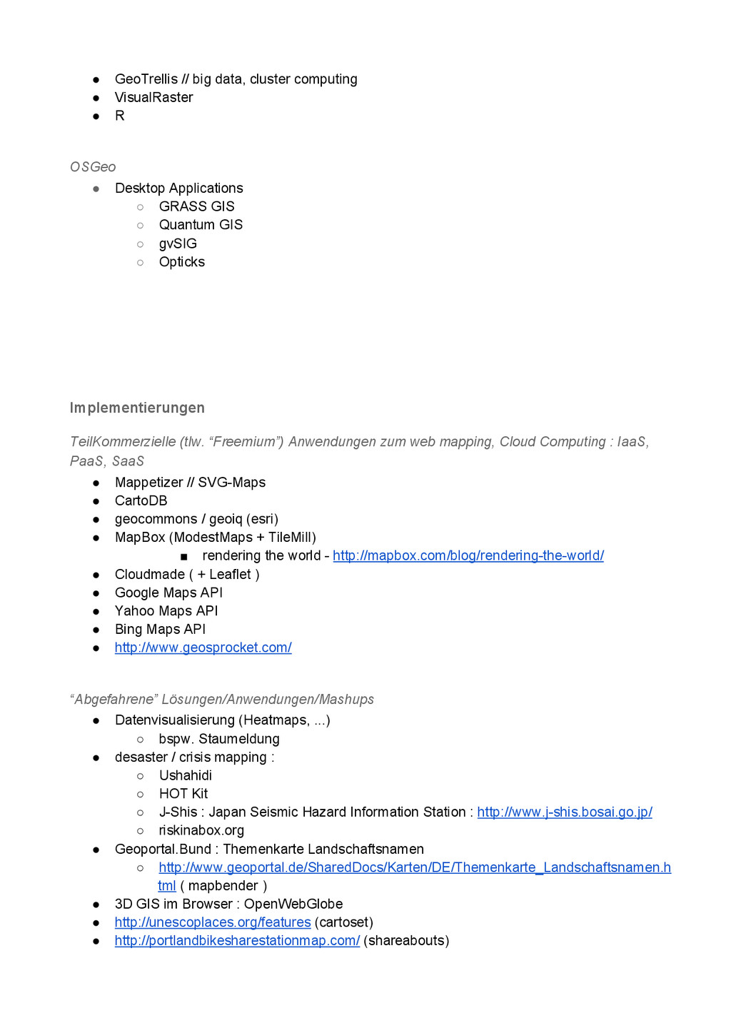
• GeoTrellis // big data, cluster computing • VisualRaster •
R OSGeo • Desktop Applications ◦ GRASS GIS ◦ Quantum GIS ◦ gvSIG ◦ Opticks Implementierungen TeilKommerzielle (tlw. “Freemium”) Anwendungen zum web mapping, Cloud Computing : IaaS, PaaS, SaaS • Mappetizer // SVGMaps • CartoDB • geocommons / geoiq (esri) • MapBox (ModestMaps + TileMill) ▪ rendering the world http://mapbox.com/blog/renderingtheworld/ • Cloudmade ( + Leaflet ) • Google Maps API • Yahoo Maps API • Bing Maps API • http://www.geosprocket.com/ “Abgefahrene” Lösungen/Anwendungen/Mashups • Datenvisualisierung (Heatmaps, ...) ◦ bspw. Staumeldung • desaster / crisis mapping : ◦ Ushahidi ◦ HOT Kit ◦ JShis : Japan Seismic Hazard Information Station : http://www.jshis.bosai.go.jp/ ◦ riskinabox.org • Geoportal.Bund : Themenkarte Landschaftsnamen ◦ http://www.geoportal.de/SharedDocs/Karten/DE/Themenkarte_Landschaftsnamen.h tml ( mapbender ) • 3D GIS im Browser : OpenWebGlobe • http://unescoplaces.org/features (cartoset) • http://portlandbikesharestationmap.com/ (shareabouts)
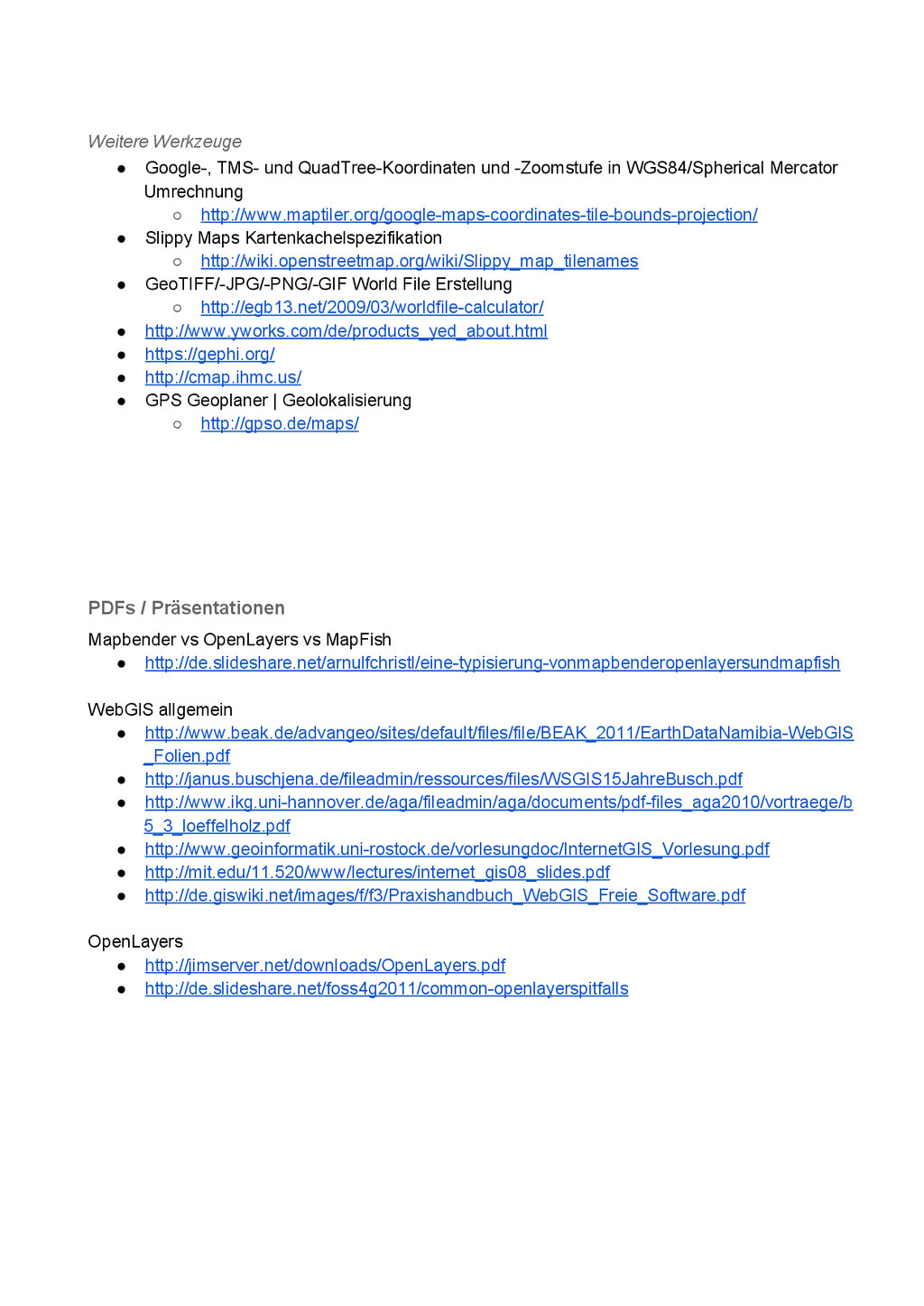
Weitere Werkzeuge • Google, TMS und QuadTreeKoordinaten und Zoomstufe in
WGS84/Spherical Mercator Umrechnung ◦ http://www.maptiler.org/googlemapscoordinatestileboundsprojection/ • Slippy Maps Kartenkachelspezifikation ◦ http://wiki.openstreetmap.org/wiki/Slippy_map_tilenames • GeoTIFF/JPG/PNG/GIF World File Erstellung ◦ http://egb13.net/2009/03/worldfilecalculator/ • http://www.yworks.com/de/products_yed_about.html • https://gephi.org/ • http://cmap.ihmc.us/ • GPS Geoplaner | Geolokalisierung ◦ http://gpso.de/maps/ PDFs / Präsentationen Mapbender vs OpenLayers vs MapFish • http://de.slideshare.net/arnulfchristl/einetypisierungvonmapbenderopenlayersundmapfish WebGIS allgemein • http://www.beak.de/advangeo/sites/default/files/file/BEAK_2011/EarthDataNamibiaWebGIS _Folien.pdf • http://janus.buschjena.de/fileadmin/ressources/files/WSGIS15JahreBusch.pdf • http://www.ikg.unihannover.de/aga/fileadmin/aga/documents/pdffiles_aga2010/vortraege/b 5_3_loeffelholz.pdf • http://www.geoinformatik.unirostock.de/vorlesungdoc/InternetGIS_Vorlesung.pdf • http://mit.edu/11.520/www/lectures/internet_gis08_slides.pdf • http://de.giswiki.net/images/f/f3/Praxishandbuch_WebGIS_Freie_Software.pdf OpenLayers • http://jimserver.net/downloads/OpenLayers.pdf • http://de.slideshare.net/foss4g2011/commonopenlayerspitfalls
![[ http://goo.gl/7Isio ] GFOSS Werkzeuge Recherche zu Geospatial Free and](https://files.speakerdeck.com/presentations/9c0eac50851e0131b8c766a463623da4/slide_0.jpg)