Upgrade to Pro
— share decks privately, control downloads, hide ads and more …
Speaker Deck
Features
Speaker Deck
PRO
Sign in
Sign up for free
Search
Search
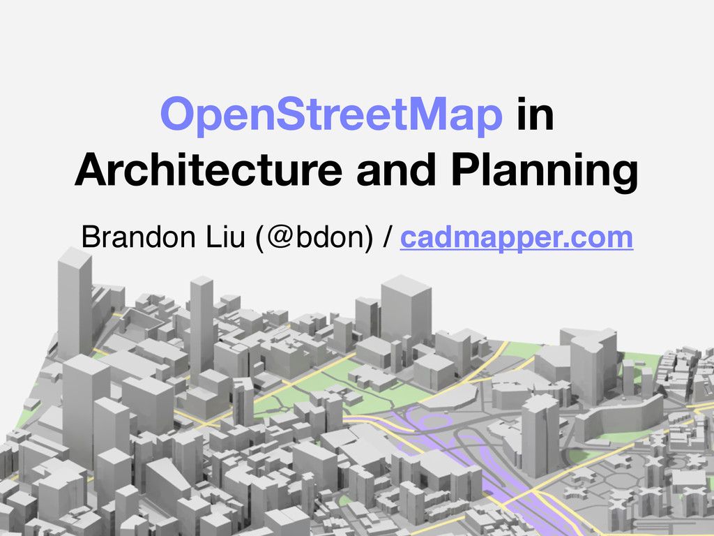
OpenStreetMap in Architecture and Planning
Search
Sponsored
·
SiteGround - Reliable hosting with speed, security, and support you can count on.
→
brandon liu
June 07, 2015
Technology
0
870
OpenStreetMap in Architecture and Planning
State of the Map US, June 6-8 2015
brandon liu
June 07, 2015
Tweet
Share
More Decks by brandon liu
See All by brandon liu
Predicting YouBike
bdon
0
100
Other Decks in Technology
See All in Technology
CloudFrontのHost Header転送設定でパケットの中身はどう変わるのか?
nagisa53
1
200
AIエージェント×GitHubで実現するQAナレッジの資産化と業務活用 / QA Knowledge as Assets with AI Agents & GitHub
tknw_hitsuji
0
250
CREがSLOを握ると 何が変わるのか
nekomaho
0
130
OpenClawでPM業務を自動化
knishioka
1
220
AIエージェント勉強会第3回 エージェンティックAIの時代がやってきた
ymiya55
0
130
「捨てる」を設計する
kubell_hr
0
380
Embeddings : Symfony AI en pratique
lyrixx
0
350
脳が溶けた話 / Melted Brain
keisuke69
1
1.1k
スピンアウト講座02_ファイル管理
overflowinc
0
1.4k
SaaSに宿る21g
kanyamaguc
2
170
Blue/Green Deployment を用いた PostgreSQL のメジャーバージョンアップ
kkato1
0
150
開発チームとQAエンジニアの新しい協業モデル -年末調整開発チームで実践する【QAリード施策】-
kaomi_wombat
0
250
Featured
See All Featured
Sharpening the Axe: The Primacy of Toolmaking
bcantrill
46
2.7k
The Cost Of JavaScript in 2023
addyosmani
55
9.8k
How Software Deployment tools have changed in the past 20 years
geshan
0
33k
Pawsitive SEO: Lessons from My Dog (and Many Mistakes) on Thriving as a Consultant in the Age of AI
davidcarrasco
0
93
No one is an island. Learnings from fostering a developers community.
thoeni
21
3.6k
How to Grow Your eCommerce with AI & Automation
katarinadahlin
PRO
1
160
Designing for Timeless Needs
cassininazir
0
170
Writing Fast Ruby
sferik
630
63k
New Earth Scene 8
popppiees
1
1.8k
Rebuilding a faster, lazier Slack
samanthasiow
85
9.4k
DevOps and Value Stream Thinking: Enabling flow, efficiency and business value
helenjbeal
1
150
HU Berlin: Industrial-Strength Natural Language Processing with spaCy and Prodigy
inesmontani
PRO
0
290
Transcript
OpenStreetMap in Architecture and Planning Brandon Liu (@bdon) / cadmapper.com
What do people need OSM data for?
None
None
None
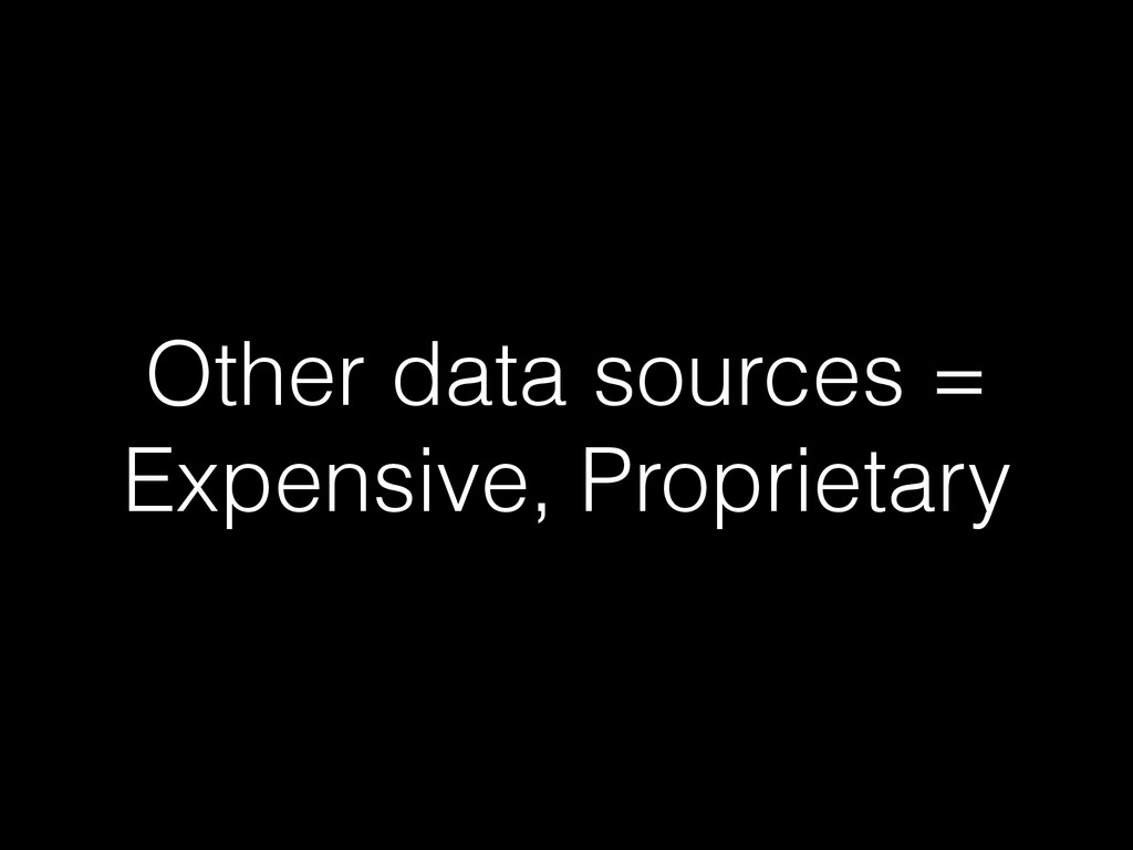
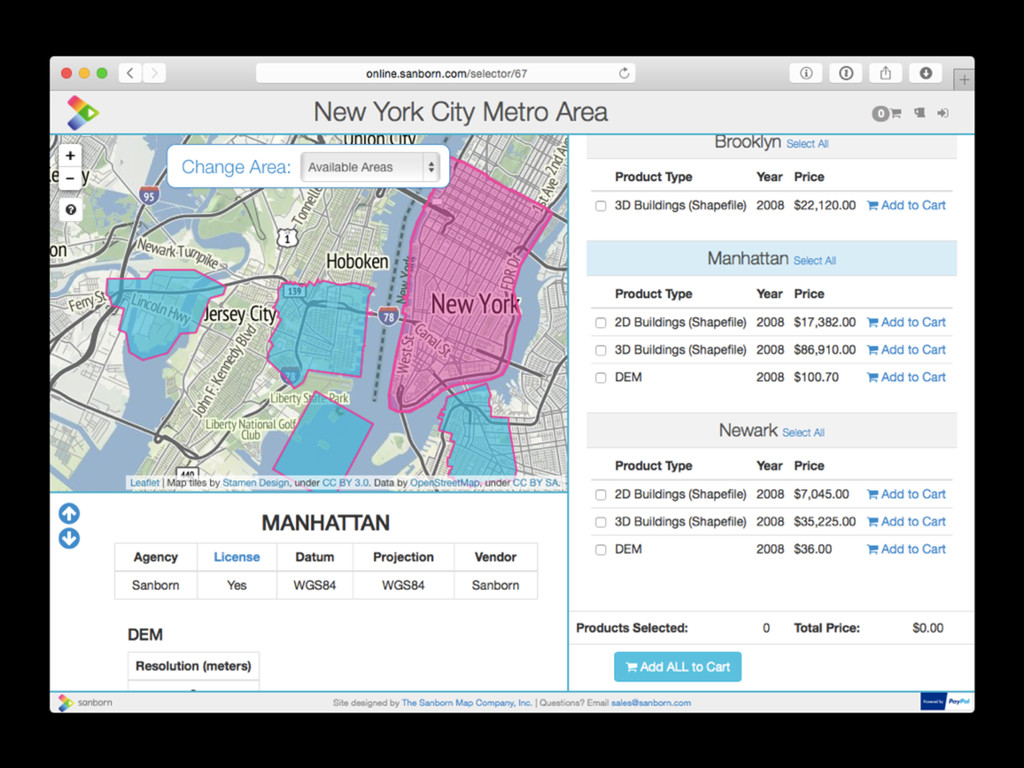
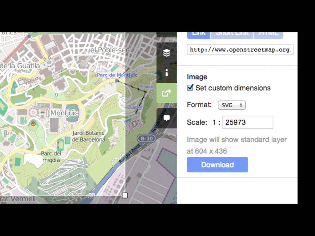
Other data sources = Expensive, Proprietary
None
None
None
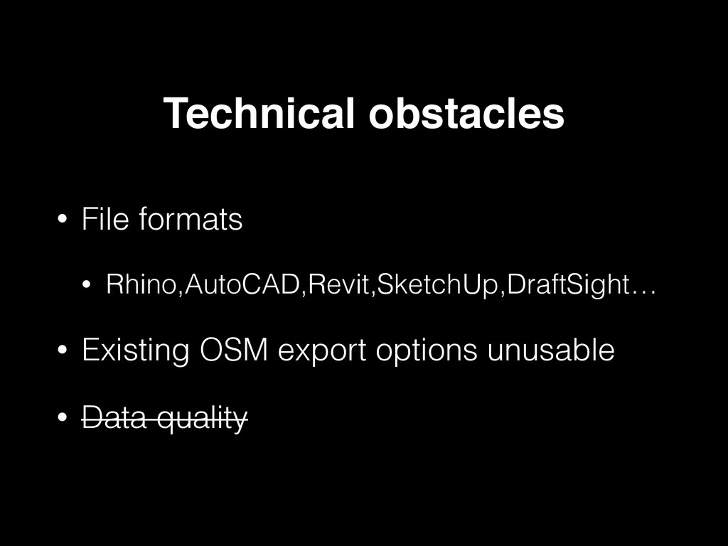
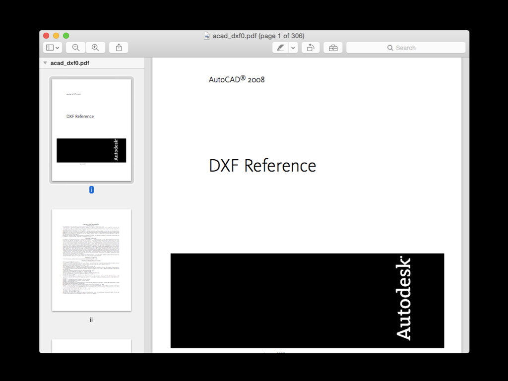
• File formats • Rhino,AutoCAD,Revit,SketchUp,DraftSight… • Existing OSM export options
unusable • Data quality Technical obstacles
None
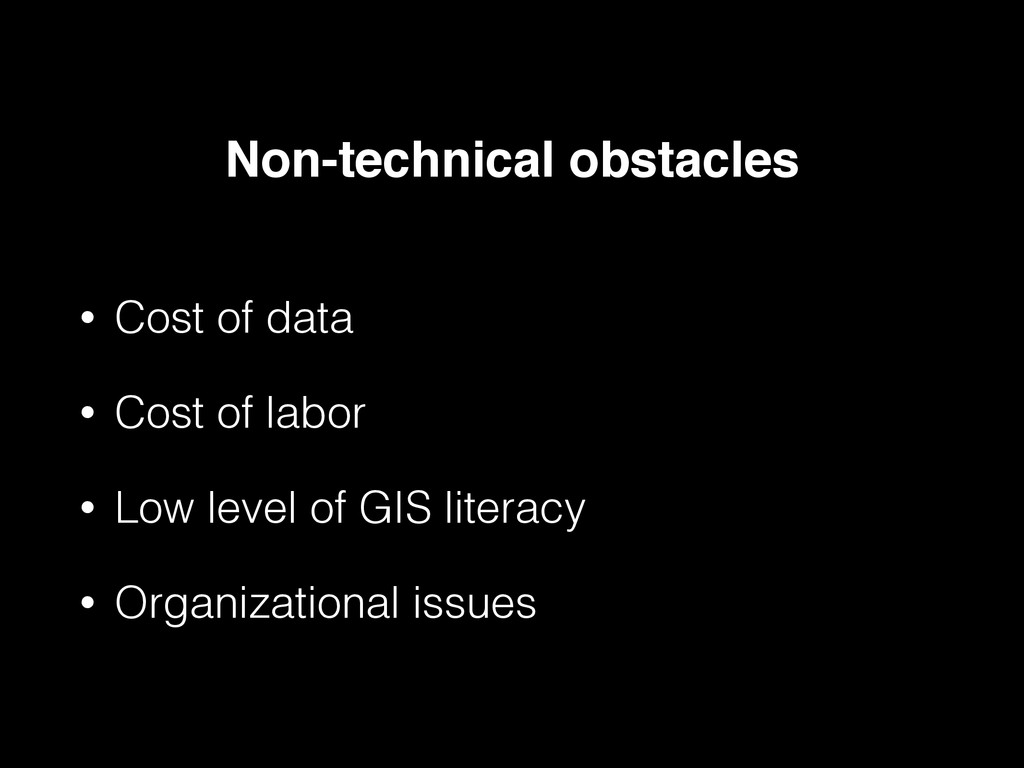
• Cost of data • Cost of labor • Low
level of GIS literacy • Organizational issues Non-technical obstacles
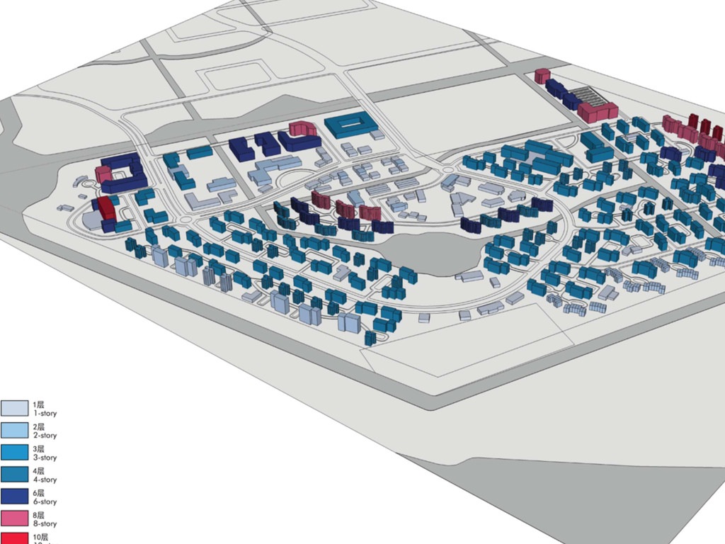
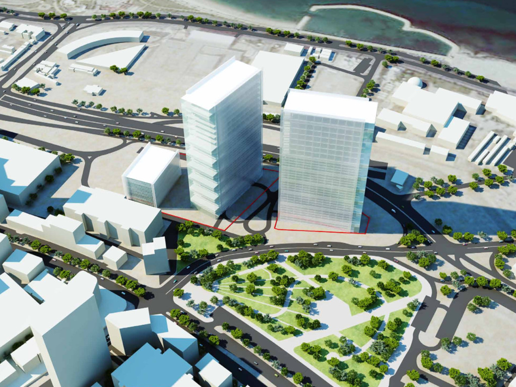
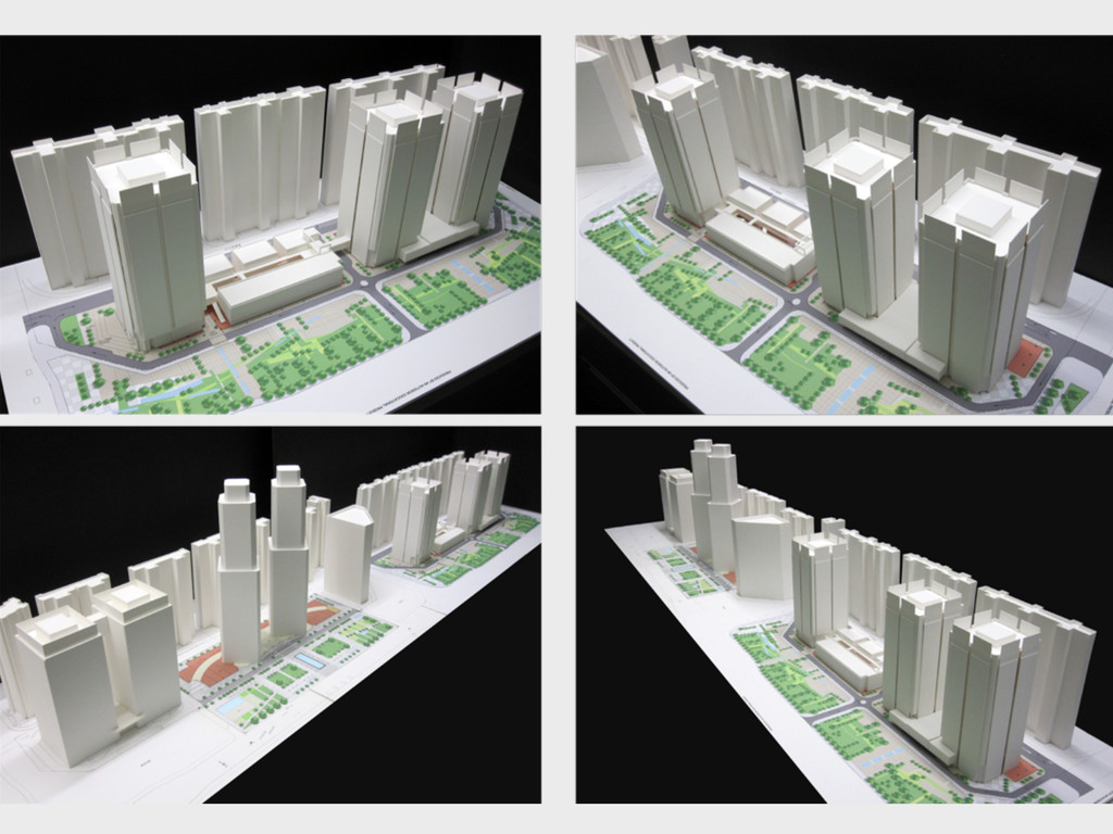
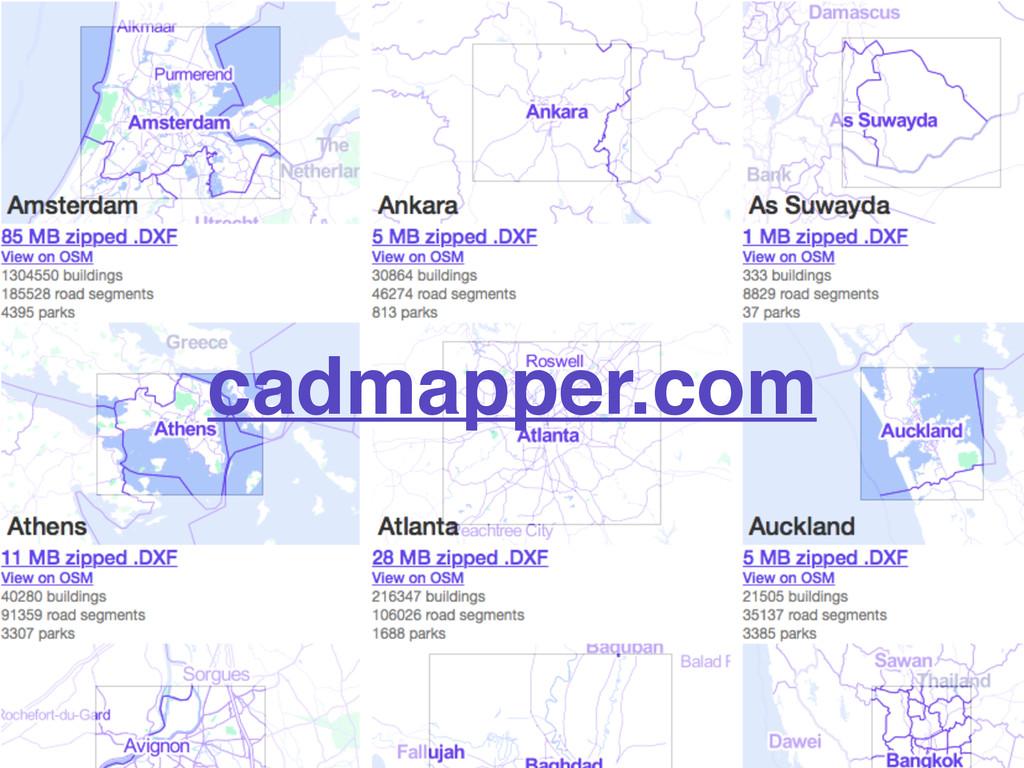
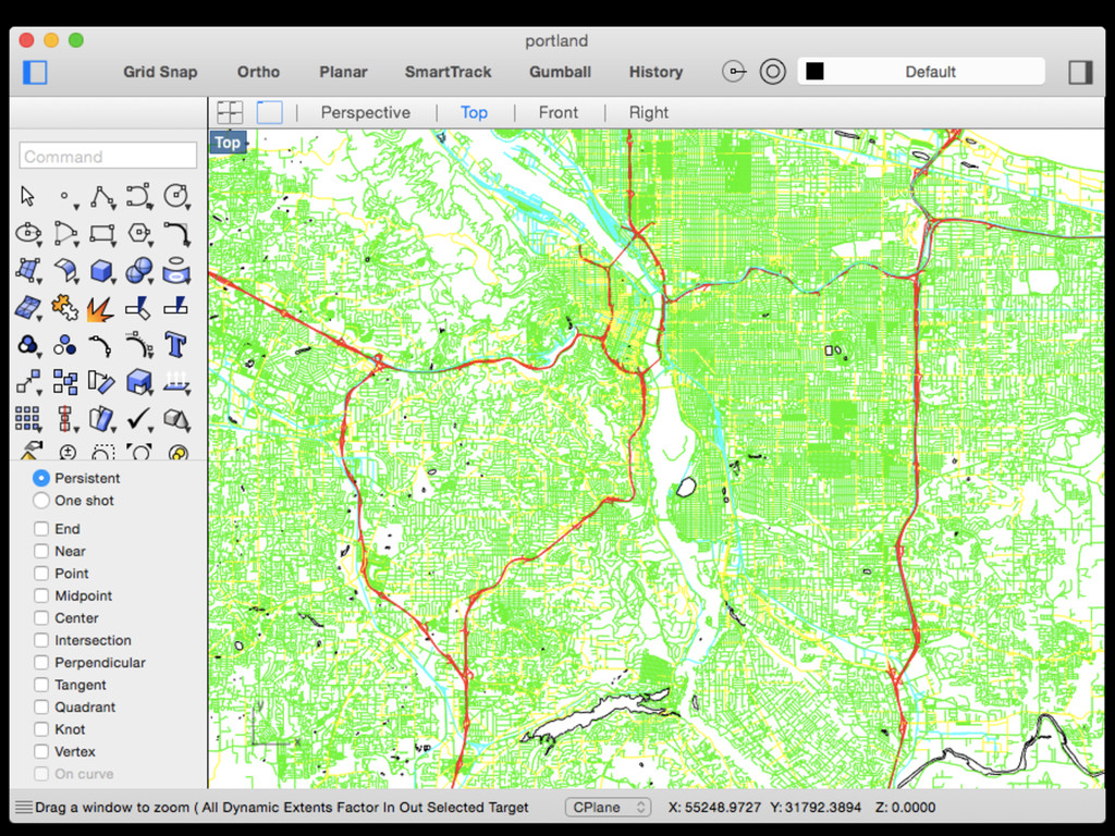
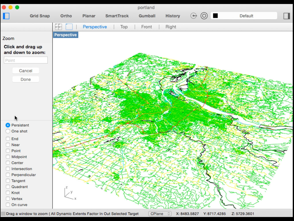
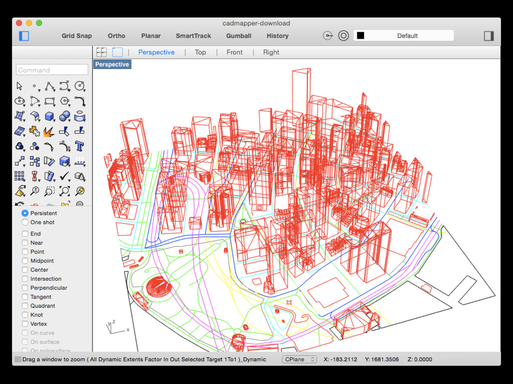
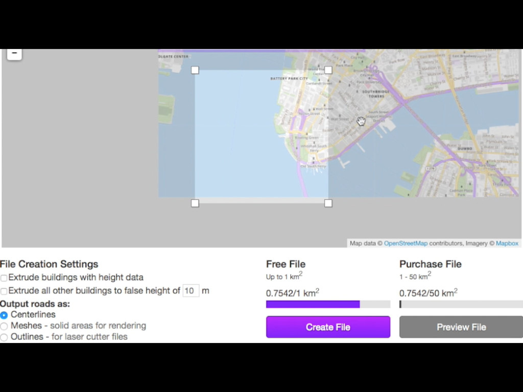
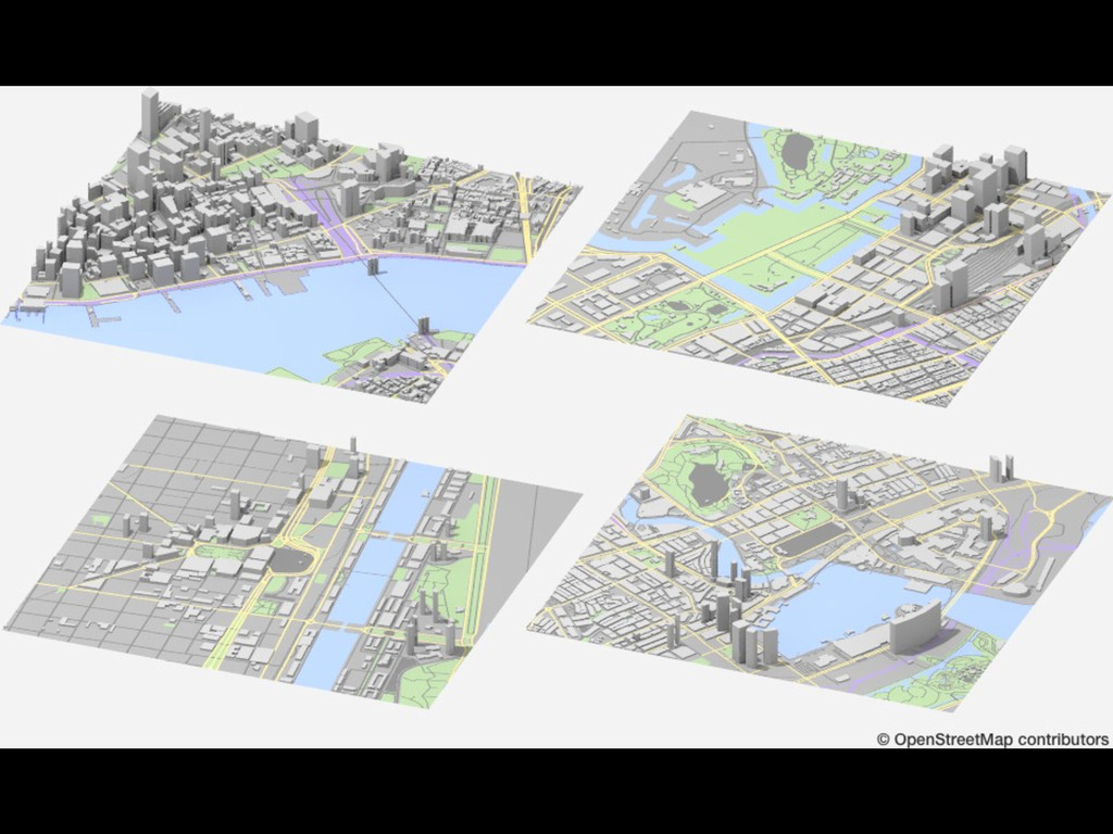
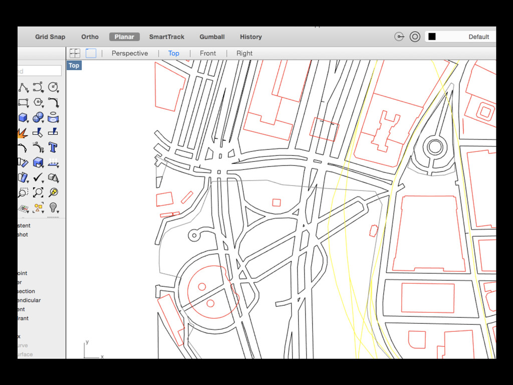
cadmapper.com
None
None
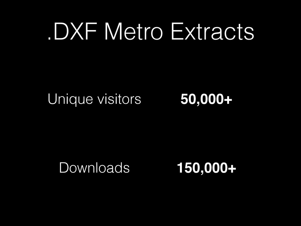
.DXF Metro Extracts Unique visitors 50,000+ Downloads 150,000+
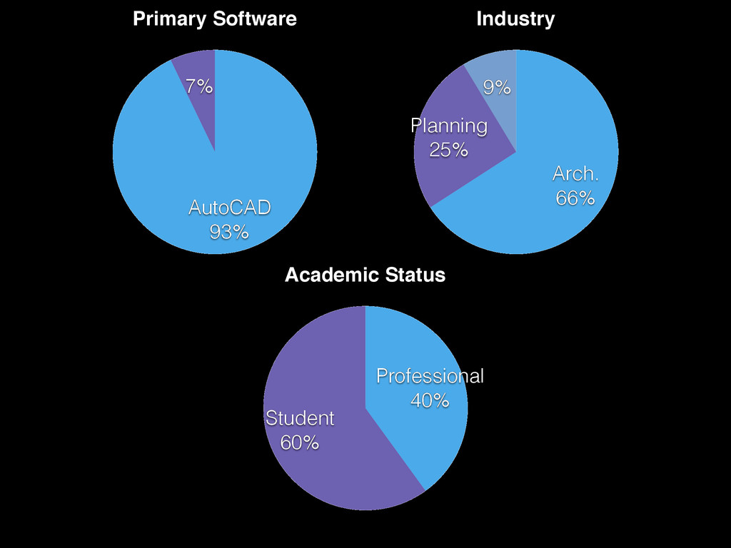
Industry 9% Planning 25% Arch. 66% Primary Software 7% AutoCAD
93% Academic Status Student 60% Professional 40%
None
None
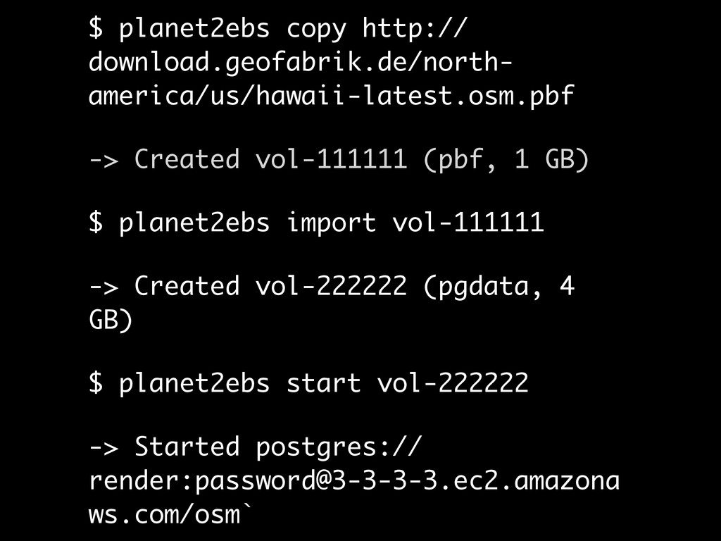
github.com/bdon/planet2ebs
$ planet2ebs copy http:// download.geofabrik.de/north- america/us/hawaii-latest.osm.pbf -> Created vol-111111 (pbf,
1 GB) $ planet2ebs import vol-111111 -> Created vol-222222 (pgdata, 4 GB) $ planet2ebs start vol-222222 -> Started postgres:// render:
[email protected]
ws.com/osm`
None
None
None
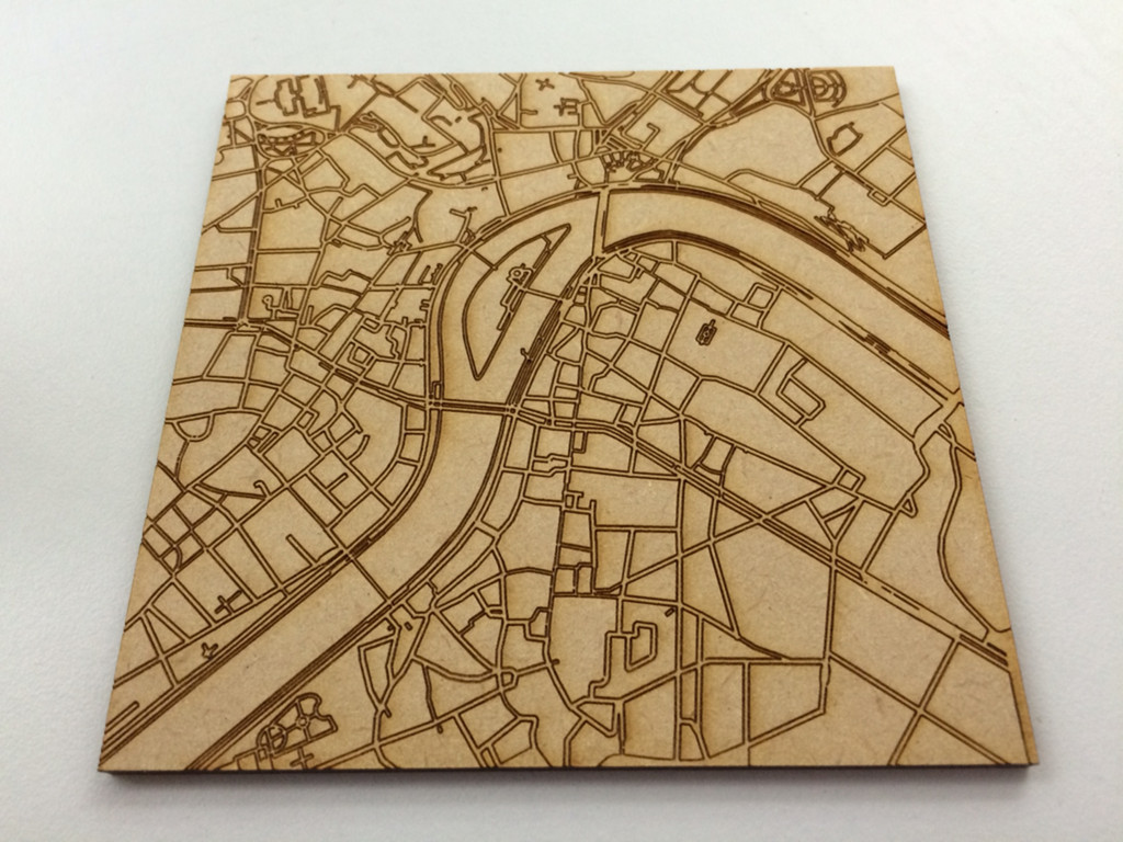
OSM + Laser cutters
None
None
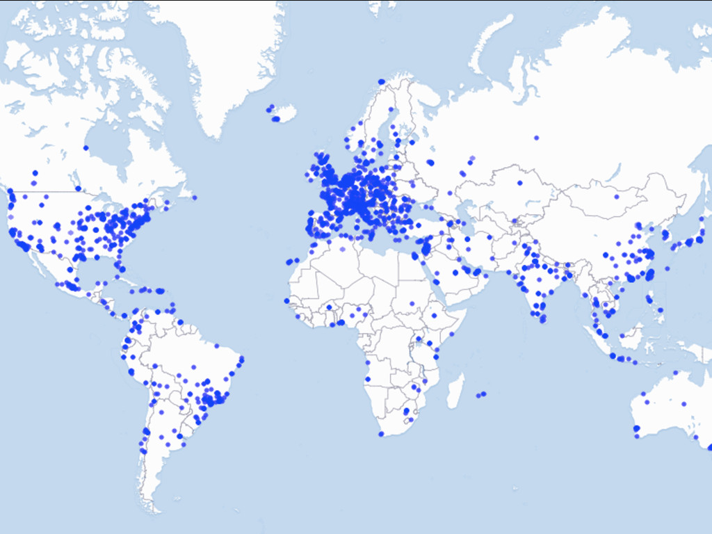
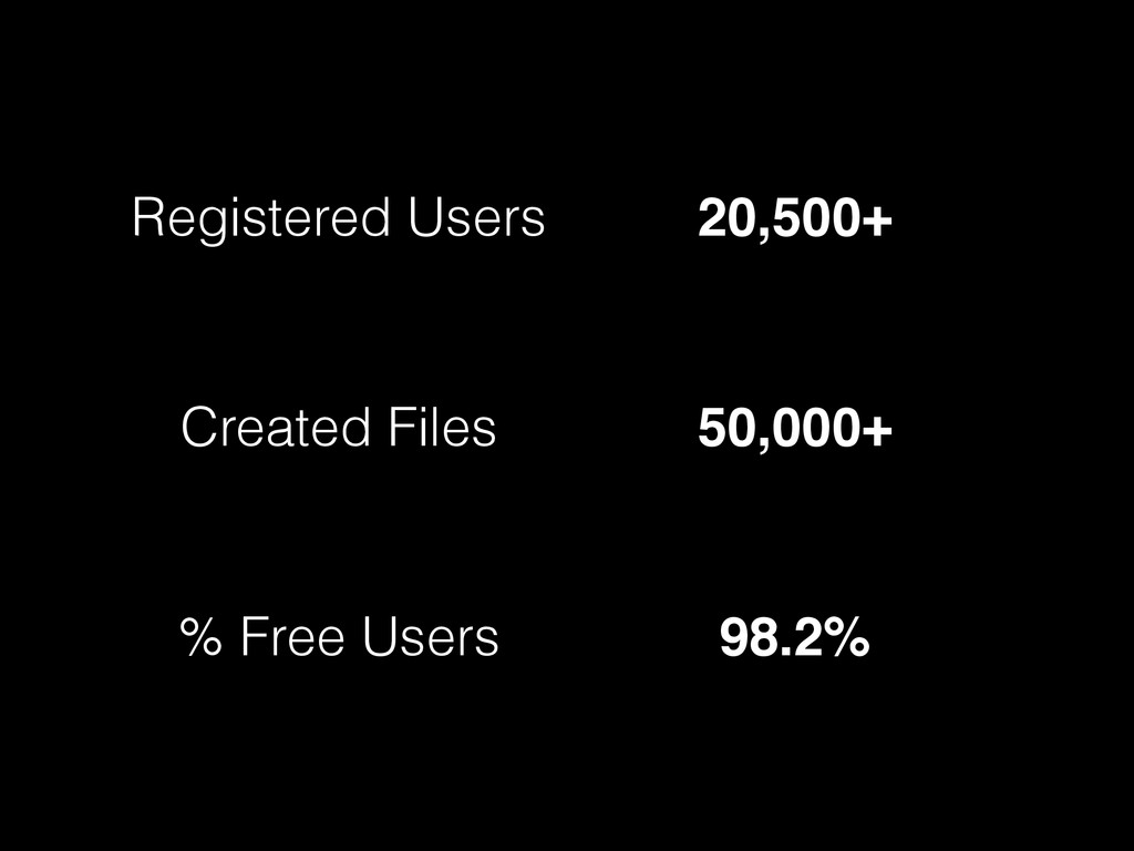
Registered Users 20,500+ Created Files 50,000+ % Free Users 98.2%
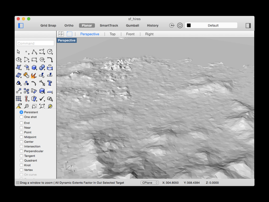
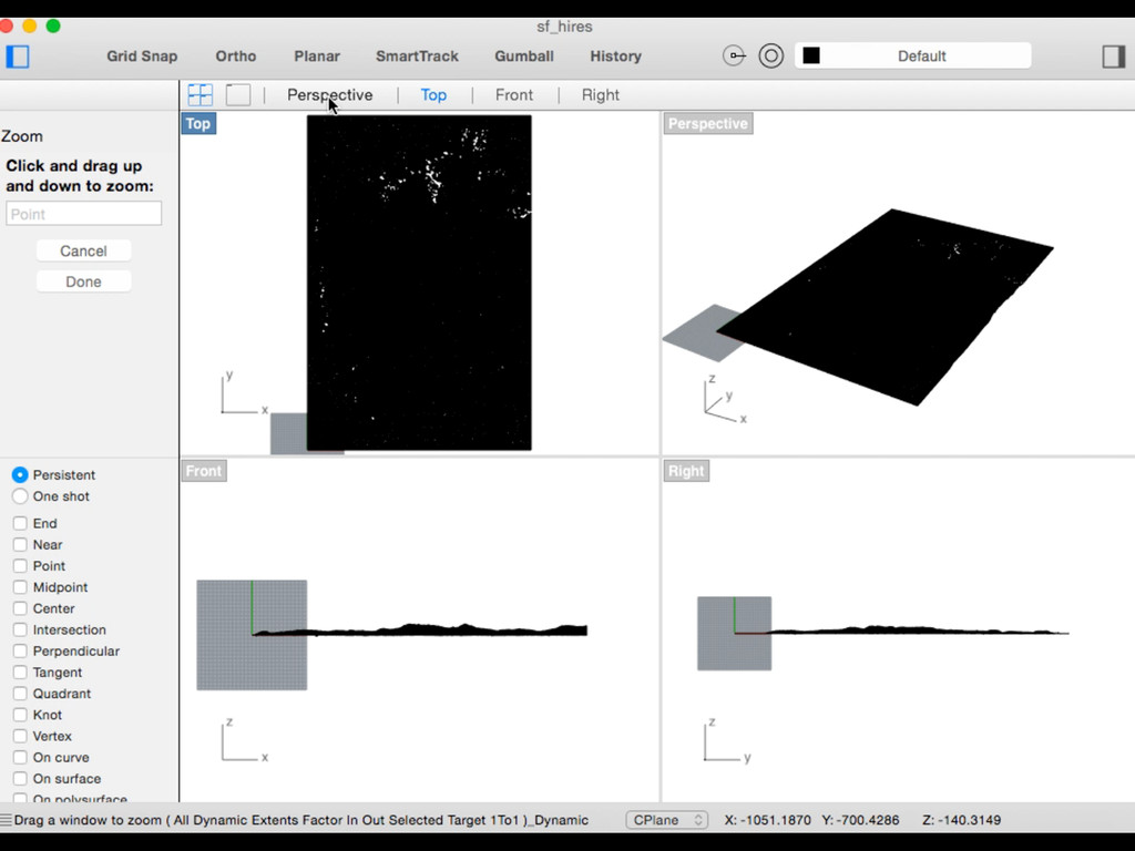
SRTM terrain data
None
None
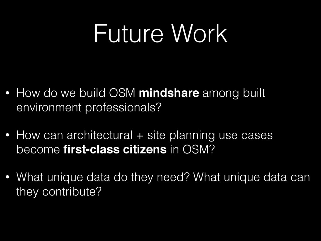
Future Work • How do we build OSM mindshare among
built environment professionals? • How can architectural + site planning use cases become first-class citizens in OSM? • What unique data do they need? What unique data can they contribute?
Contact me:
[email protected]
@bdon
![Contact me: [email protected] @bdon](https://files.speakerdeck.com/presentations/671fdf50f2af4f66bd482462cb260969/slide_32.jpg)