Upgrade to Pro — share decks privately, control downloads, hide ads and more …

Mapping and analyzing maize and wheat and other scientific stuff

CGIAR-CSI
September 23, 2014
19

Mapping and analyzing maize and wheat and other scientific stuff

CGIAR-CSI

September 23, 2014
Tweet

Transcript

  1. Mapping and analyzing maize and wheat and other scientific stuff

    ! Kai Sonder, Kindie Tesfaye GIS UNIT CIMMYT and many many others CGIAR CSI annual meeting ITC University of Twente Enschede 22-24 September 2014
  2. Drought targeting work DTMA DSI (DROUGHT SEVERITY INDEX) ! RS

    (MODIS) based Global Data 2000-2011 available ! Annual values Monthly values 8 Day values ! Mu et al 2013.
  3. Remote sensing in breeding and conservation agriculture • High throughput

    phenotyping • Fertilizer recommendations • Crop area estimations • Field variability
  4. Airborne Remote Sensing Platform for High 
 Throughput Phenotyping •

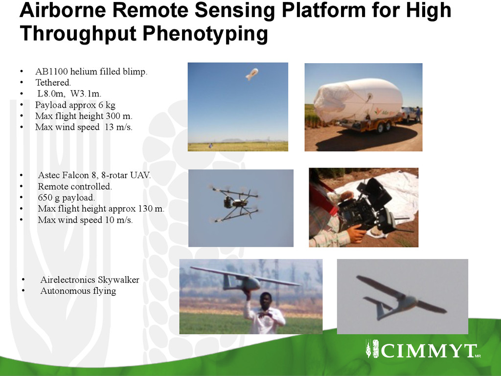
    AB1100 helium filled blimp. • Tethered. • L8.0m, W3.1m. • Payload approx 6 kg • Max flight height 300 m. • Max wind speed 13 m/s. ! • Astec Falcon 8, 8-rotar UAV. • Remote controlled. • 650 g payload. • Max flight height approx 130 m. • Max wind speed 10 m/s. • Airelectronics Skywalker • Autonomous flying
  5. Multispectral Imagery NIR Red Green 2 m plot size, 100

    m height 3-band false colour image 0.5 m plot size, 60 m height
  6. • Area of interest: 400 ha • Flight time: 90

    min • Total amount of images: 970 • Area /image: 208mx165m • Transversal overlap: 40% • Longitudinal overlap: 40% • Resolution 16 cm Multi-spectral camera Example 2 flight at 300m above ground 2030 m 1990 m 17500 pixels 24600 pixels
  7. Raw data RAW Calibration and correction Mosaic* Multi-spectral camera ▪

    Storage and processing steps Amount 970 RAW 970 TIF 1 TIF Total size 14.2GB 13.2GB 9.6GB Example 2 flight at 300m above ground Data capture Processing Total 37GB *Also possible georeferenced mosaic and unit conversion Data on atmospheric conditions (TXT)
  8. Training on GIS ! • In house • NARS partners

    and others Open source or ESRI?