Upgrade to Pro — share decks privately, control downloads, hide ads and more …

Spatial data management and distribution ICRAF's GeoScience Lab

CGIAR-CSI
September 23, 2014
25

Spatial data management and distribution ICRAF's GeoScience Lab

CGIAR-CSI

September 23, 2014
Tweet

Transcript

  1. Data Management ICRAF GSL RMG KM Spatial Data Vector Raster

    Non-spatial Data Methods Publications
  2. Data (archived) Data Documentation Generate Metadata Upload (Data & metadata)

    metadata Possibility of metadata Hold Data audits Yes Yes No No
  3. Visualization (maps) • Easy maps – Public data sets (layers)

    • Blog about your map(s) – Users read stories Blog Layers Map GeoExp
  4. Map Styles  Web maps and styles  Create a

    style (default)  Edit styles
  5. Data Processing & Analysis Rainfall time series (1998-2012) Upcoming tools

    Phenology time series (growing seasons over a period of time) Comparison of datasets e.g. NDVIs. (at a location for better selection of data)
  6. • Total datasets 500 (an other 500 will be added

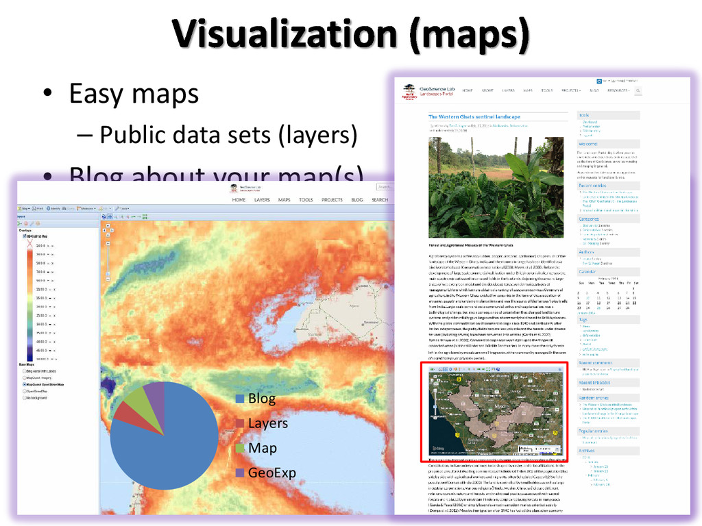
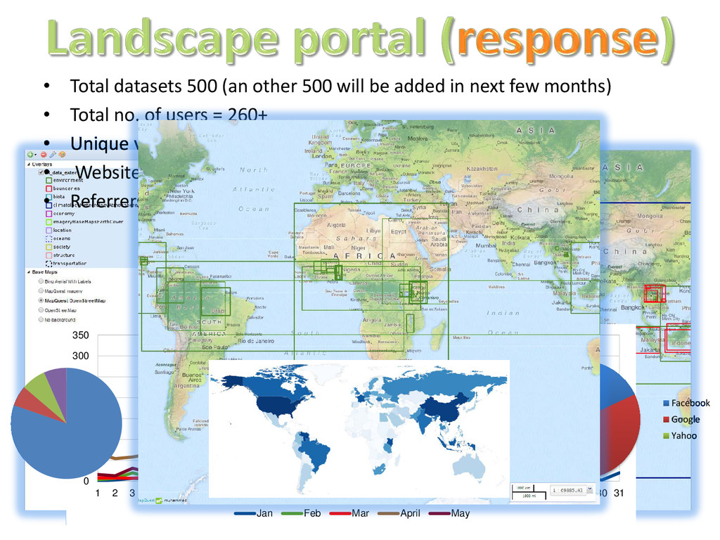
    in next few months) • Total no. of users = 260+ • Unique visitors = 4580 • Website visitors • Referrers 0 50 100 150 200 250 300 350 1 2 3 4 5 6 7 8 9 10 11 12 13 14 15 16 17 18 19 20 21 22 23 24 25 26 27 28 29 30 31 Jan Feb Mar April May Blog Layers Map GeoExp Facebook Google Yahoo